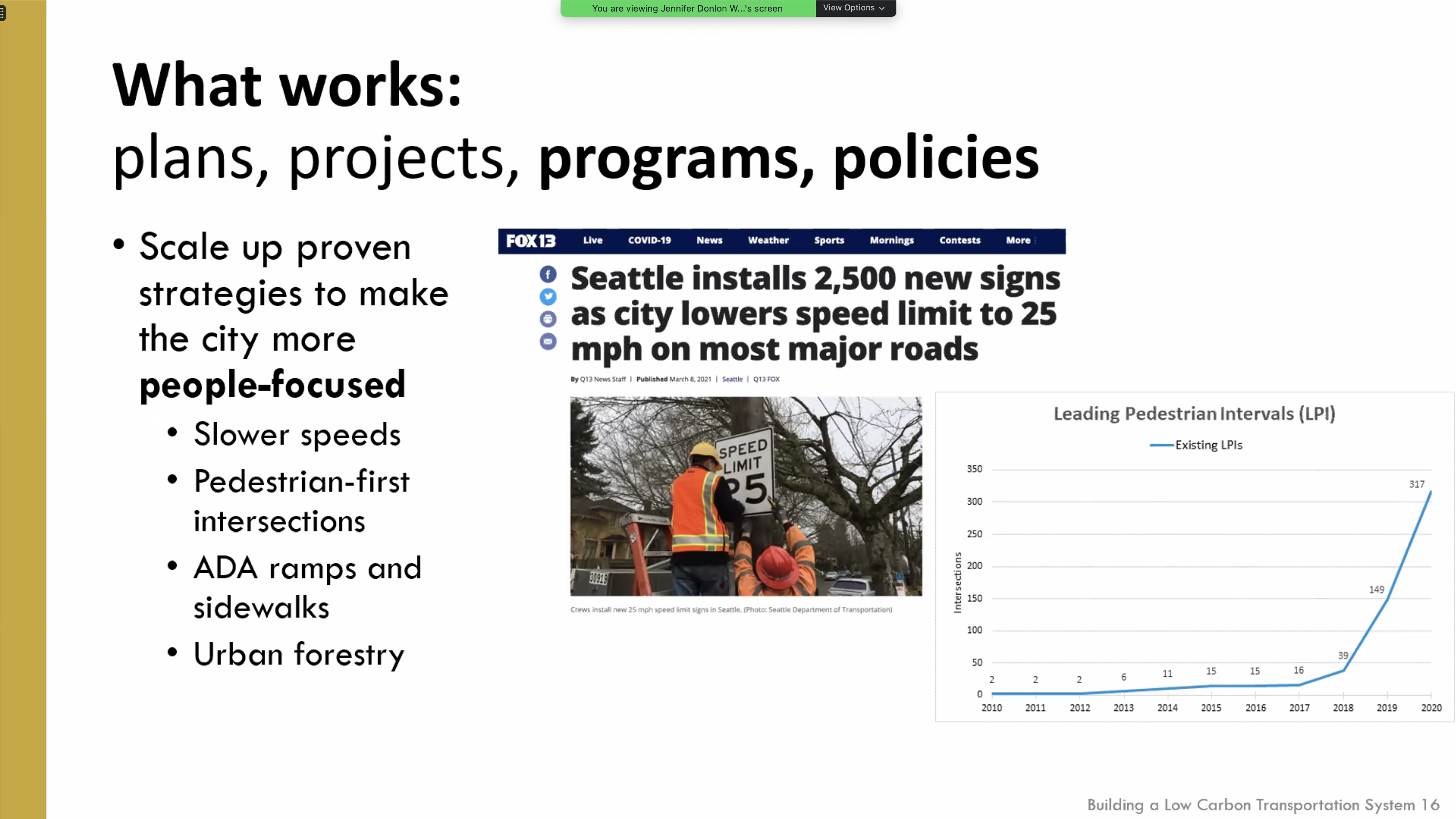
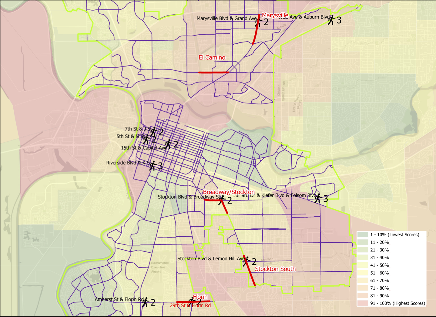
Reset for SacATC

The City of Sacramento Active Transportation Commission (SacATC) was established in 2018 as a replacement for the city/county Bicycle Advisory Committee (BAC). This was good, as the county’s unwillingness to consider innovative solutions, even when they were in the city, meant that very little ever happened there. There was a lot of hope in the bicycling and walking advocacy community that SacATC would turn a new page and accelerate necessary changes in the city. Unfortunately, that has not been the case. The commission has been reactive, not proactive. A number of people have resigned from the commission when they discovered that not much of importance was happening there.

Nothing here is meant to demean the contributions of city staff to seeking grant funding for critical projects. The city is paying much more attention to active transportation than it used to, but I and many other advocates believe that it is still paying too little attention, and certainly too little funding.

So, I believe it is time for a reset.

  1. SacATC is advisory to the city council. It should therefore be communicating with council on a fairly regular basis. That does not mean that it does not collaborate with staff, but it does not take direction from them.
  2. The primary job of the commission should be to review and to create policy. Reviewing projects is a secondary focus. That means at least half of every meeting should be spent talking about policy, not about projects.
  3. SacATC should be setting its own agenda, not letting staff set it. If staff wants to bring something to the commission, they would contact the commission chair to request that it be on the agenda. The chair should solicit agenda ideas from commissioners at the end of each meeting, and again, in advance of the next meeting to meet whatever deadline the city sets for its agenda posting.
  4. The purview of SacATC should be all city activities, when they may affect active transportation, not just Public Works. This would include, for example, construction traffic control plan permitting, city utility work in the streets, waste collection (trash cans in bike lanes), repaving plans, law enforcement, and parking enforcement.
  5. SacATC supported sidewalks where they are part of complete streets projects, but has not addressed sidewalk infill, closing gaps in this critical transportation infrastructure. I believe this should be a major focus of the commission this year, developing policy to recommend to the council that makes consistent and rapid progress towards a continuous sidewalk network, properly designed ADA ramps at every corner, and frequent safe crossings.

The next meeting of SacATC is Thursday, February 18. The agenda and eComment link will be available a few days beforehand at http://sacramento.granicus.com/ViewPublisher.php?view_id=21.

The commission is established under city code: http://www.qcode.us/codes/sacramento/view.php?topic=2-2_100&showAll=1&frames=on.

red light cameras

The City of Sacramento has 11 red light camera locations: Red Light Running Program. Of these, some are at high-injury intersections, but most are not. These locations are cross-referenced with high injury intersections shown in the post Sac Vision Zero new intersections map.

LocationTop allTop pedTop bike
Mack Rd & La Mancha Way/Valley Hi Drnonono
El Camino Ave & Evergreen Stnonono
Howe Ave & Fair Oaks Blvdnonono
Mack Rd & Center Parkwaynonono
Exposition Blvd & Ethan Waynonono
Broadway & 21st Stnonono
Folsom Blvd & Howe Ave/Power Inn Rdnonono
Arden Way & Challenge Waynonono
5th St & I Stnonono
16th St & W Stnonono
Alhambra Blvd & J Stnonono

My first thought is that the city was putting these cameras in the wrong location. But then I thought, what if the presence of red light cameras is making these locations safer and therefore dropping them out of the highest injury intersection list. I don’t have the information to answer that question, which would take analysis of crashes at the intersections, and before/after data.

What I do know is that many more red light cameras are needed to counteract the pandemic of red light running: pandemic of red light running. I spend time around the edges of Fremont Park, close to where I live, which includes the intersection of arterial streets P, Q, 15th, and 16th, and one of the things I do is watch traffic in the intersections. It has now become rare for a signal cycle for 16th St northbound at P St to not see an incidence of red light running. The other intersections are not quite as bad, but the pattern is there. And this is happening everywhere in Sacramento that I go; these are not likely to even be the worst intersections.

I believe that most of the red light running is by egregious violators, people who routinely and continuously violate traffic law for their own convenience or thrill seeking. This is true of most traffic violations, but red light running is the one most likely to result in fatality and serious injury, for people in all modes of travel. So having a more widespread set of red light cameras would serve to catch these red light violators. Of course the follow-up is necessary, to revoke the licenses and confiscate the vehicles of these repeat offenders. The longer the city looks the other way on this issue, the more people will come to see it as normal behavior, and the less safe our streets will be.

The standard response by cars-first entitled drivers is that tickets are just a money-making scheme by the government. The purpose of red light cameras is to make streets safer, and if that results in some income, so be it. I’m more than happy to have these sociopathic drivers hit in the pocketbook, and the money can be used to make our streets safer, such as by installing more red light cameras. Red light tickets, with photos, are part of the documentation needed to revoke licenses and confiscate vehicles.

Stockton Blvd Corridor Plan review

I have finally gotten to reviewing the Stockton Blvd Corridor Plan, following my post noticing the draft plan: Stockton Blvd draft available.

Overall, the plan is great, and when someday implemented, will result in a much safer and livable Stockton Blvd. The plan addresses major concerns raised by the community, including safer and more frequent crossings, better lighting, more trees, more effective transit service, and others. However…

  • The plan is still too oriented to the throughput of motor vehicle traffic. Better, but not as good as it could be. Maintaining the five lane configuration for significant parts of the corridor is unnecessary.
  • The plan does not even mention speed limits. When any street is reconfigured/reallocated, it removes any obligation to the unsafe and outmoded 85% rule, so the city should have considered speed limit changes for the corridor.
  • The plan recommends two-way cycle tracks in some locations. These are great for traveling along, but the problem comes in transitioning into and out of them at the beginning and end. Unless very clear guidance and priority is provided, these transitions can be very unsafe, particularly for less experienced bicyclists. In most cases, a bicycle signal head with exclusive bicyclist phase is required at beginning and end.
  • The plan acknowledges the challenging intersection of Stockton Blvd/34th Street/R Street as a “unique challenge” (page 13), but doesn’t even suggest solutions. I believe that the only way to make this intersection safe is to either restrict R Street or 34th Street, or to construct a flyover for light rail, similar to that for 19th Street, Watt Ave, and Sunrise Blvd. Yes, the expense of any of these might be beyond the scope of this plan, but eliminating this issue from the plan makes it difficult to compare the relative cost and benefit of other solutions.
  • On page 36, a diagram shows a bike lane eastbound on T Street to the right of a dedicated right hand turn lane. Bike lanes should never be to the right of dedicated turn lanes unless there is a bicycle signal head to create an exclusive bicyclist phase, which the plan does not propose. This must be fixed.
  • Shared bus and bike lanes will be a new concept for the city, and region. I support the implementation of these, and have used them in several other cities where transit frequency is not high. But they should be considered a pilot. If they don’t work out for bicyclists, and bus drivers, in this region, how do we fix it?
  • The flared intersection at Stockton Blvd and Fruitridge Road is preserved in the plan, but this is completely inappropriate. Flared intersections are always more dangerous for people crossing the street. The roadway width at the intersection, shown on page 41, is 90 feet. Crossings of this length cannot be safe, no matter what the length of the pedestrian cycle, without a pedestrian refuge median (with push buttons unless the pedestrian crossing is already on auto-recall). Double left hand turn lanes are dangerous for drivers and everyone else, as driver attention is focused on the vehicle beside, and not the roadway ahead, so these should be reduced to single left turn lanes. The right hand turns lanes should probably be eliminated, unless a traffic study shows conclusively that traffic would not clear during a signal cycle without them. The upshot is that this intersection should be completely reconfigured, not just tinkered with.
  • The plan does not indicate which intersection signals and signalized pedestrian crossings will be on auto-recall, or not. There is probably no justification for pedestrians activation buttons at any location on the corridor (pedestrian crossings should have auto-detection), but if there is, these should be called out clearly in the plan.
  • The plan shows most intersections as having skipped (dotted) green bike lanes striped through the intersection, but a few do not. They should be used everywhere. For the protected legs of partially protected intersections, the striping should be continuous rather than skipped (dotted). MUTCD frowns on this, but it has been installed many places with positive safety outcomes.
  • Added item: No right turn on red prohibitions should never be used without leading pedestrian intervals (LPI). Otherwise, drivers turning will immediately come into conflict with walkers in the crosswalk. I don’t think this is being proposed in this plan, but just want to make sure.

The City of Sacramento Active Transportation Commission will consider the plan this evening (2021-03-18). I apologize for not posting this in time for you to consider my suggestions, and relay them to the commission, if you agree.

Stockton Blvd & Fruitridge Road intersection

Added info: There was a discussion about the prioritization of different travel modes during the SacATC meeting this evening. It reminded me of one of my favorite graphics about transportation modes, from Chicago Department of Transportation. I think this is the right answer for Stockton Blvd, and for nearly every other roadway.

Stockton Blvd draft available

The Stockton Blvd Corridor Study draft is now available for review. It and some display boards reflecting the report can be downloaded at https://www.cityofsacramento.org/Public-Works/Transportation/Planning-Projects/Stockton-Blvd-Corridor-Study. The city is asking for feedback through email rather than another round of workshops.

I have not reviewed the report, but if I have comments to share, I’ll post them on the blog. My take on the earlier ideas are here: Stockton Blvd Corridor Study and Stockton Blvd needs trees.

Sac Vision Zero new intersections map

Thinking about the intersections maps and what they show (Sac Vision Zero top intersections all modes, Sac Vision Zero top ped intersections, Sac Vision Zero Top 5 Corridors and top intersections), I thought it might be interesting to present the data in a different way. The two maps below show all of the top intersections identified in the all-modes, pedestrian, and bicycle data. They are divided into a north section and a south section so that the intersections and their labels are visible. The maps are available as pdfs (north, south).

legend for intersections on maps below
Sacramento top collision intersections, north section
Sacramento top collision intersections, south section

The intersection data is in the table below.

What’s next? I’ll take a closer look at some of these intersections. For people who follow traffic engineering, it will probably be immediately obvious why these intersections are dangerous. A detailed analysis requires looking at each collision record individually, which I don’t have time to do. The city did make use of incident reports, which contain more information than the data in SWITRS, in developing the Vision Zero Plan.

Sac Vision Zero top ped intersections

As promised, a follow-on to my post on the top bicycle collision intersections in Sacramento (Sac Vision Zero Top 5 Corridors and top intersections), here is the same sort of analysis for pedestrian collisions. I used a somewhat different data set, this time only killed and severe injury crashes (KSI), for the years 2009-2017. This mirrors the data the city used in the Vision Zero Top 5 Corridors document, and so is not directly comparable to the different criteria I used on the bicycle post.

Pedestrian (walker) collisions are more dispersed that bicycle collisions, fewer occurring at intersections and more in between. Of the 408 collisions, 70 were at intersections, 17%, compared to 69% for bicycle collisions. Of these 408 collisions, twelve intersections stood out: Amherst St & Florin Rd, Marysville Blvd & Grand Ave, and Watt Ave & Auburn Blvd, each with three; and 15th St & Capitol Mall, 29th St & Florin Rd, 5th St & N St, 7th St & J St, Stockton Blvd & Broadway, Stockton Blvd & Lemon Hill Ave, Riverside Dr & X St, and Julliard Dr & Kiefer Blvd & Folsom Blvd, each with two. Of these 12 intersections, 4 are on Top Five corridors: Marysville Blvd & Grand Ave on the Marysville corridor, Stockton Blvd & Broadway on the Stockton-Broadway corridor, Stockton Blvd & Lemon Hill Ave on the South Stockton corridor, and 29th St & Florin Rd on the Florin corridor.

The map belows shows the city corridors and the twelve intersections, with the number of collisions and intersection name labeled. There is also a pdf available.

map Vision Zero top pedestrian intersections
Sacramento pedestrian collision top intersections, with Vision Zero corridors

There is a better alignment between the five designated corridors and pedestrian collision intersections than was true for bicycle collisions.

I will point out that the Julliard Dr & Kiefer Blvd & Folsom Blvd intersection is the site of three pedestrian collisions and four bicycle collisions, which is higher than any other intersection in the city. It should really be a focus for the city.

Addition 2021-03-02: Someone asked how the pedestrian collision locations relate to disadvantaged communities. Below, a map with CalEnviroScreen 3 2018-06 (CES) layer, with red end being higher pollution, green being lower, and weighted with income. CES is not the only measure of disadvantage, but it is one commonly used.

13th & J intersection

I want to acknowledge Enzo of Streets Are Better for reminding me of this intersection and provoking me to write now in more detail. Two previous posts change the signal at J St and 13th St and J & 13th needs a pedestrian scramble were briefer and did not cover all the issues.

The intersection of 13th Street and J Street in downtown Sacramento is a mess for walkers and bicyclists, largely due to poor decisions that the city has made. The setting is below, with a historical view selected for no leaves on the deciduous trees. On the southeast corner is the convention center, which is under construction now, and the southeast corner is fenced off. On the southwest corner is the Sheraton Grand Hotel. On the northwest corner is a major downtown parking garage, managed by Ace Parking. On the northeast corner is another parking garage managed by Parking.com.

intersection of 13th Street & J Street, downtown Sacramento

In the days before construction on the convention center started and the Sheraton shut down due to the pandemic, this was one of the busiest pedestrian intersections in the central city. The crossing of 7th Street at K Street/DOCO Center, L Street at 11th Street and 10th Street when the legislature is in session, Capitol Mall at Tower Bridge, and a few others are up there, but this one is certainly in the top 10. The city rarely collects pedestrian data, so I do not know what the ranking or volume is.

When the convention center is completed and open, and the Sheraton opens at full scale, this will again become a very busy pedestrian intersection. So you would think that the city would design this intersection and signals to prioritize people walking, but you’d be wrong.

The crossing of J Street on the west leg of the intersection requires pushing the ped button. There are a number of pedestrian signals in the central city that do not require pushing the button, and these are called auto-recall, meaning they automatically change on a cycle. Not this one! I just observed a number of walkers crossing here, and only about 5% of them initially realized they had to push the button. When I mentioned that the signal would never change unless they pushed it, they were surprised, and not happy. When the ped head signal does come on, it has a white hand of 5 seconds, and a countdown of 9 seconds for a total of 14 seconds. There are three lanes of motor vehicle traffic here, lanes about 12 feet wide, for 36 feet. The MUTCD recommended crossing speed is 3.5 feet/second, so 36 feet should be a minimum of 10 seconds, but this assumes that people can leave the curb immediately, not true when the activation button is set well back, and there is pedestrian congestion. In that case, the crossing speed should be 3.0 feet/second. If you want to read about the contortions traffic engineers go through to make walk cycles as short as possible, read pedestrian crossing questions and answers.

The traffic signal for J Street will remain green unless there is a vehicle waiting on 13th Street or someone pushes the ped button to cross. The ped signal to cross 13th Street goes through a white hand, countdown, brief pause, and then back to the next cycle. Without a cross-traffic vehicle or button push, the traffic signal will never cycle. Ever.

crosswalk over J Street at 13th Street

An additional problem is that sometimes the signal controller will just skip the crossing J Street part of the cycle, even when the button is pushed. Since I’m mostly on my bicycle rather than on foot here, I haven’t quite pinned down the behavior. I don’t know if it depends on time of day, or traffic volume, or is just random, but I can affirm that it happens, and not infrequently. So even after the walker presses the button, they may have to wait through another full cycle before they get the walk.

On the southeast corner, the convention center construction has closed the corner and sidewalks. In this situation, there should be a barricade and warning signs on the opposite corner, so J Street south side eastbound and 13th Street east side southbound. A fully sighted person can of course see the barrier and fence across the street, but the point of ADA requirements is to communicate to everyone, not just the sighted. Below is what is looks like, followed by what it should look like. Remember, this is a city project, not a private development, but the city apparently holds itself to lower standards than it holds private developers.

closed crosswalk over 13th Street at J Street
proper barricade and signing for a closed crosswalk, O Street at 8th Street

The east leg crosswalk also suffers from traffic flow design. The walk sign for this crosswalk comes on at the same time as the southbound green signal comes on, bringing drivers into immediate conflict with walkers in the crosswalk. There is no leading pedestrian interval (LPI) to let the walkers get a head start. At this time the crosswalk is closed, but as soon as it is reopened, the conflicts will be immediate, as they have been for years.

Solutions?

  1. Immediately institute auto-recall on the crossing of J Street, and remove the buttons. These are not modern audible buttons, they are antiques.
  2. Immediately institute a leading pedestrian interval on the crossing of J Street, to increase protection from left and right turning drivers.
  3. Immediately lengthen the pedestrian phase for the crossing of J Street to a minimum of 20 seconds.
  4. When then southeast corner of the intersection is re-opened, with completion of the convention center construction, implement an exclusive pedestrian phase for this intersection, in which there is no movement by motor vehicles during the walk cycle, and walkers can cross in any direction including diagonally. If any intersection in Sacramento deserves this treatment, this is it.
  5. Traffic calm J Street to reduce speeds. The most important step is to reduce general purpose lanes to two, and create some sort of bicycle facility. I’m not sure of the best design, as the valet/unloading/loading are for Sheraton Grand may make this challenging.
  6. Get rid of any City of Sacramento Public Works employee who believes the purpose of central city streets is to favor suburban commuters (the J Street traffic) over walkers, bicyclist, and local residents.

I have made at least seven 311 reports on the signal problems at this intersection, asking that it be changed. The only change that I’ve been able to notice is that they lengthened the pedestrian phase for crossing 13th Street, and shortened it for crossing J Street. I just gave up after a while.

Bicyclists

That covers most of the pedestrian problems at this intersection. How about bicyclists? 13th Street is a major bicycle route in downtown, being the only north-south street that crosses through Capitol Park and is not an arterial street, often with heavy traffic and higher speeds. There are bike lanes on much though not all of 13th Street to the south J Street, and there are bike lanes on most blocks to the north, except the half block approaching this intersection. Here, the bike lane has been sacrificed to create a turn lane. There is a required left turn lane and an optional turn lane, but no bike lane. So at this busiest of all intersections on the route, there is no bike lane. There is a clear message here from the city: we will accommodate bicyclists only if it does not reduce motor vehicle capacity. Otherwise, tough luck.

The loop detectors on 13th Street only sometimes detect bicycles. I often see bicyclists during off-times, when there are fewer motor vehicles to trigger the cycle, proceeding through the intersection on red, when it is safe to do so (and occasionally when it is not). They have the right to do so, since by definition a signal that does not detect vehicles (devices) is a non-functional signal, but it is not the best solution.

When the pedestrian button is pushed to cross J Street on the west leg, but no southbound motor vehicles are present, the vehicle signal remains red, so doesn’t allow for undetected bicyclists. This doesn’t protect any walkers, so it makes not sense.

Solutions?

  1. Continue the bike lane on southbound 13th Street to and through (with green skip paint) the intersection with J Street, and remove the left turn lane which prevents the bike lane from continuing. That might mean lengthening the green light for motor vehicles in order to clear the queue.
  2. Install video detection on this intersection that will detect bicyclists on 13th Street so that they don’t have to wait for motor vehicle traffic to arrive and trigger the signal cycle.
  3. Change the traffic signal for southbound to go green at the same time as the pedestrian walk sign. This allows bicyclists to proceed without confusion.

more LPIs

I wrote some while ago about leading pedestrian indicator (LPI) signals, which give the pedestrian a head start of a few seconds before the parallel traffic light turns green. So far as I know, Sacramento has not added any locations to the list of eleven.

But the city should. In fact, I’d argue that any traffic signal where there are a significant number of walkers, and a significant number of turning drivers, should have an LPI. Drivers often fail to yield to people in the crosswalk when turning, or cut in right behind them, and the more chance the walker has to get out into the crosswalk and visible, the better. Of course nothing about the LPI prevents the driver from turning on red, unless turns on red are prohibited. Prohibiting turns on red has been much discussed lately, but I don’t think that treatment is the most important that can happen at intersections.

I live a few blocks from Fremont Park, which is the block between 15th Street and 16th Street, and P Street and Q Street. In fact, many of the parks in the central city are located between pairs of one-way streets, called couplets. 16th is one of the busiest streets in the central city, and the other two are moderately busy, and these four intersections see a lot of turning vehicles. Since I walk nearly every day to and around the park, I get plenty of chance to see how drivers interact with walkers in the crosswalk. I’ve never seen anybody hit, but I often see conflicts, the driver trying to intimidate the walker, trying to beat them to the crosswalk, stopping just short of hitting them, or cutting in close behind them.

P Street and Q Street are two-lane arterials, while 15th Street and 16th Street are three-lane arterials, with higher traffic volumes and vehicle speeds. 16th was a state highway.

So, I’m asking the city to install LPI signals for the south crosswalk at 15th & P, the east crosswalk at 15th & Q, the north crosswalk at 16th & Q, and the west crosswalk at 16th & P. The photos below show the intersection of 15th & P from pedestrian level, and overhead. The video shows two pedestrians crossing, and mostly through the crosswalk before the driver encroaches. This was a low traffic time with only one turning vehicle. When I have a chance to capture a heavier traffic time with pedestrians, I’ll replace it.

P Street westbound, showing crosswalk over 15th St ahead
15th Street & P Street, south crosswalk
crosswalk over 15th Street at P Street

I often write about the Sacramento central city because that is where I live, and I have ample opportunity to observe transportation infrastructure and driver, walker and bicyclist behavior. However, I’d like to state that I DO NOT think that central city issues should be solved first. These issues occur in many places in Sacramento, where the traffic is higher speed, facilities are poorer, and neighborhoods have been disinvested. Drivers in the central city are just as bad as drivers elsewhere, in fact most of them are from elsewhere, the suburbs, but they have grown somewhat accustomed to seeing walkers and bicyclists, and are more careful around them.

Next: LPIs and bicyclists

Sac Vision Zero Top 5 Corridors and top intersections

As promised in my previous post, Sac Vision Zero flaws, here is a limited analysis of high injury network intersections in Sacramento. I used bicycle crashes for 2014 through 2018 from the SWITRS crash database, and matched these to intersections of arterials and collectors in the city. It is known that most crashes occur at or near intersections, not in between. Of the 1112 crashes in this time period, 763 occurred at intersections, or 69% (for all crash types, the city said it is 78%). I selected eight intersections to highlight, which had 4, 5, or 7 crashes at the intersection or within 120 feet of the intersection, meaning on the approach or departure from the intersection. The other 590 intersections had 3, 2, 1, or no crashes. I did not analyze the crashes for fatality or serious injury, but that would be a useful.

The map below shows the Sacramento Vision Zero Top 5 Corridors, in red, and the top eight crash intersections with a bicycle symbol. The number to the right is crashes, and the location is labeled with cross streets. This is also available as a pdf.

Of the eight intersections, one is part of the Florin corridor, at 24th Street and Florin Road. The other seven are not.

I ask that the city revise its Vision Zero program to include high injury intersections. The number might be as many as 10, and selection should include the same equity criteria used to select the corridors. That means that the three central city locations might not be selected, or might be lower on the priority list, and that is good. The challenge of the Stockton Blvd & Fruitridge Road intersection is that it is on the city/county boundary, so complete treatment of the intersection would require some cooperation with the county. But with seven bicycle crashes in the time period, it is a very important intersection.

A strong advantage to giving high injury intersections recognition and attention is that they could receive near-term safety improvements that require only reallocation of roadway width and new paint. Full safety improvements probably would require redesign of the intersection.

Again, I fully support the city’s Vision Zero efforts, and want to see them be the best they can be. That means including high injury intersections.

Addition 2021-03-02: Someone asked how the bicycle collision locations relate to disadvantaged communities. Below, a map with CalEnviroScreen 3 2018-06 (CES) layer, with red end being higher pollution, green being lower, and weighted with income. CES is not the only measure of disadvantage, but it is one commonly used.

Stockton Blvd needs trees

This is a follow-on the the Stockton Blvd Corridor Study post.

Trees

Following the online virtual open house, I realized I could not picture the situation on some segments of Stockton. Though I’ve traveled Stockton many times, I had not in a while, so I went back. I had commented during the open house, as well as after, that I didn’t think the cross-sections presented gave enough information on or weight to trees, so that was part of my agenda, to see the tree situation better. The day I went, last Sunday, was one of the cooler days in a while, high of 80 degrees Fahrenheit, but on the street the lack of shade and heat was noticeable. Add 20 degrees, and it would be intolerable for walking and unpleasant for bicycling.

The tree situation is not good. There are some sections with healthy trees, and some places where trees on commercial properties are healthy and shade the sidewalks, but on the whole, trees are lacking. The first photo below, taken looking south, to the south of Broadway, shows a long section with no trees at all, no buffer, no shade. The sidewalk is wide enough, but who would want to walk here?

Stockton Blvd south of Broadway

The next photo is of the section adjacent to UC Davis Medical Center where trees are present in a slightly too narrow buffer. The trees are relatively young, but when mature, will provide necessary shade and probably also crowd the buffer.

Stockton Blvd near UC Davis Medical Center

The next photo is of a very narrow strip where trees were present but were all cut down, and the following photo, a Google streetview capture of the trees. The trees were obviously planted in a strip far too narrow for them, and some of them were unhealthy as a result, so I’m not presenting this as a model, but as a warning that commercial properties cannot be relied upon to provide trees. Even the small trees in this narrow strip provided some shade and feeling of place to the street. In addition to this instance, there are many commercial properties and some residential properties along Stockton where the trees are dying, dead, or have been removed. And conversely, some where the trees on commercial properties are in good condition, so thank you to these properties. Trees, if they are to serve as a long-term amenity, as I believe they should, must be provided in the public right of way and maintained by the city.

Stockton Blvd, removed trees, near Jansen
Stockton Blvd, trees before removal, near Jansen

A small archive of photos from Stockton Blvd are available in the Flickr album at the end of this post, and those who live along or do business along can provide more detail.

So what is the solution? The first part of the solution is that the city must modify its cross-section renderings and pages so that it highlights the tree situation. Will there be a sidewalk buffer? How wide? What numbers and kinds of trees? To what degree will the project rely on trees on private property, versus trees in the public right-of-way? I find the options presented as unacceptable because they don’t really address this issue. On a few of the pages, trees are mentioned, but never in enough detail.

I would propose for community along Stockton Blvd that there should be continuous sidewalk buffers planted with trees, all the way from Alhambra to 47th Ave/Elder Creek Rd. Where buffers are present with trees, great, make sure they are preserved and cared for. Where buffers are present but the trees are absent or unhealthy, plant new trees and care for them. Where there are no buffers, create them, and plant trees and care for them. Where there is a healthy tree line on private property, this can serve for now, but the buffer should still be provided for the protection of walkers and as a bulwark against possible abandonment of the private trees. I envision Stockton Blvd being a tree-lined community asset, where walking is a pleasure and traffic speeds and volumes are low.

For new buffers, the minimum width of the buffer should be eight feet, as anything narrower does not allow for full development of the trees, and leads to excessive root heaving of the sidewalk. The heaving is to some degree an inevitable consequence of having trees, but wider buffers and correct watering regimes reduce the problem considerably. Where the existing buffers are at least six feet and the trees are healthy, the buffer can be widened or left as is, depending on the situation. Where the buffer is narrower than six feet, the buffer must be expanded.

Where commercial businesses are present and buildings meet the sidewalk, the trees should still be present, but the spacing and species can be adjusted in consultation with the property or business owners so that they don’t block off visibility of local businesses. In most cases the buffer would be paved, with tree wells for the trees, and street furniture or other amenities in the buffer, but the buffer would still be a minimum of eight feet.

Intersections

Another issues that the city diagrams and information do not address is intersections and crossings. The existing conditions report acknowledges that there are long distances between safe crossings on the south end, but doesn’t provide much detail about intersections.

The intersections as they exist actively discourage pedestrian activity. The midblock crossings, of which there are a few, do not have any additional protection. At a minimum, these locations need user-activated RRFBs (Rectangular Rapid Flashing Beacons). At many of the signalized intersections with minor streets, there is a pedestrian prohibition on either the north or south leg. These prohibitions exist solely to speed the signal cycle and encourage traffic flow; they do not exist for safety reasons. They must be removed. The photos below shows just one of the many such prohibitions. A person walking on the south side of Jansen, wanting to go south on Stockton, would have to use two crosswalks, waiting for the signal, and then walk through an overly wide commercial driveway. There is no reason for this.

Stockton Blvd at Jansen Dr, pedestrian prohibition

At the major intersections, where crosswalks are present on all legs, the crossing distances are long. Though not as bad as many other locations in Sacramento, intersections are often flared out to add turn lanes, both left and, often, right turn lanes. This increases crossing distance. This issue can be solved in two ways: removing the unnecessary turn lanes, or adding pedestrian refuge islands in the middle, so that slower walkers can make the crossing in two stages. The medians must be six feet wide, to meet standards, and must have a pedestrian button so that people don’t become stranded. (Note: I’m not in favor of pedestrian buttons at all, except when they: 1) trigger audible information, or 2) lengthen the crossing time; however, this is one situation in which they make sense)

The project information does not really address intersections at all. City staff said that these details would be worked out later, but I find this unacceptable. Intersection design must be part of the options presented. Intersections are where most conflicts occur between pedestrians and vehicle drivers, and bicyclists and drivers as well, so they are a critical element of any effort to improve Stockton.

Driveways

Some of the sections of Stockton are littered with driveways. Each commercial property has one to several. Part of improving Stockton must be to reduce the number of driveways. Each commercial property should have one driveway, or less. One of (the only) advantages of the parking moats that front the street (what I mean by parking moat is that the commercial buildings are set back away from the street, and parking lots face the street; these parking moats contribute significantly to the feeling of Stockton Blvd being a car-dominated place). In several cases, these parking moats can be combined for several properties in order to reduce the frequency of driveways. The issue with driveways is that they not only make a place feel busy and unwelcoming to walkers and bicyclists, but they are safety hazards for walkers and bicyclists very nearly as bad as the hazard of an intersection.

Stockton Blvd, north of Elder Creek, excessive driveways

Built Form

There is a section of ‘old’ Stockton Blvd where the buildings come to the sidewalk, and parking, if any is to the side or back. This traditional pattern (traditional before suburban sprawl) is the best built environment, the one that feels most welcoming to people outside cars. It increases customers, it makes the street feel smaller and the sidewalk feel larger.

The ‘new’ sections of Stockton Blvd where buildings are set back behind a moat of parking have exactly the opposite effect, producing an environment that feels unwelcoming to walkers, makes the sidewalk feel like a part of the street rather than a part of the neighborhood. This built form is a widely recognized mistake, but the correction will take many, many years as these commercial properties evolve. But what can happen, now, is that all new commercial buildings can be required to front the sidewalk. There are a lot of empty or abandoned parcels on Stockton, which everyone hopes will see new development. That development should be the traditional pattern that gives the street a neighborhood feel rather than a traffic sewer feel.

Stockton Blvd, buildings fronting the sidewalk

Speed Limits

Another issue that the study pays scant attention to is speed limits. Whether or not the street design option work depends on design speed and posted speed. The default assumption in transportation planning is that speed limits cannot be lowered, due to California ‘law’. First, it is not a law, it is case law, established by judges, not the legislature, that says traffic tickets won’t be enforced unless speed limits are set to the level at which only 15% of drivers exceed. This will of course be changed, but the process is long, with powerful opponents, most specifically CHP whose lip service to safety is legend. But more important to this study is that streets that are reconfigured, with a change to lane width or number of lanes or mix of modes, can be set to any speed limit the city wishes. The road is new, and the past speed limit doesn’t apply.

So, in accordance with my desire to see a tree-lined neighborhood boulevard, I think that the speed limit for this entire length should be 30 mph. And of course the street must be designed to enforce that posted speed limit.

Highway 50 Interchange

The Hwy 50 and Stockton Blvd interchange is problematic for both walkers and bicyclists. There are no bike lanes through this section, at all, and walkers on the east side of Stockton face long crossing distances in a design that strongly favors high speed motor vehicle drivers. In the photo below, look at the long crossing distance on the north side of the freeway, of the exit and entrance ramps. It’s about 120 feet, with no protection from drivers, at all. I have both used and observed this crosswalk, and can confirm that very few drivers yield to walkers in the crosswalk. It is a guaranteed death trap for walkers.

The roadway striping does not delineate areas for motor vehicles and bicyclists, nor does it indicate where riders or drivers should be merging to reach their destination. It is just a wide-open area, and as with all wide-open areas, drivers will assume they have complete right-of-way. You can see by the tire tracks that the turns on and off the freeways are being taken at high speed.

Stockton Blvd – Hwy 50 interchange

This interchange must be completely reconfigured for the safety of walkers and bicyclists, and drivers for that matter. The entry and exit ramps must connect with the street at 90 degree angles, requiring drivers to make low speed turns. Bicycle lanes with green conflict markings must be installed throughout the interchange. Sidewalks must be improved and crossing distances shortened to no more than 22 feet.

It is disappointing that such a critical safety hazard was not addressed in the study.

Mode Share

The study, online survey, and open house never address the key issue for the entire corridor, which is: what should be the priority of travel modes in design of the street? Some of the options imply a higher priority for some modes than others, but the critical question is never asked of the public. I had said in my previous post that my priorities would be transit first, then walking, then bicycling, then private motor vehicle travel. However, having spent more time looking at and thinking about the corridor, I’m going to change that. The priorities should be walking first, strongly supported by the tree-lined boulevard configuration I’ve outlined and justified, then transit, then bicycling, then private motor vehicles.

What is is important here, though, it not my preference, but that the public, and in particular the residents and customers along the corridor were never asked this question.

What Now?

I’ve laid out what I consider some major flaws in the study. I am not against the particular options that were presented, and from that limited perspective, the study has done a good job. But the number of things NOT considered is glaring. I know the city hopes to address these issues later, but I don’t find later to be acceptable. The public needs a full set in information now, so that it can comment on the study from a perspective of understanding how the street will feel after the changes, not just design diagrams, but how each traveler will get along and across the corridor, and whether it supports their desires for mobility and livability.

I think the city should pause the study process and add in the elements not addressed, then go back out to key stakeholders, and re-do the engagement process including the survey and open house.

Photos on Flickr: https://www.flickr.com/photos/allisondan/albums/72157714923753216