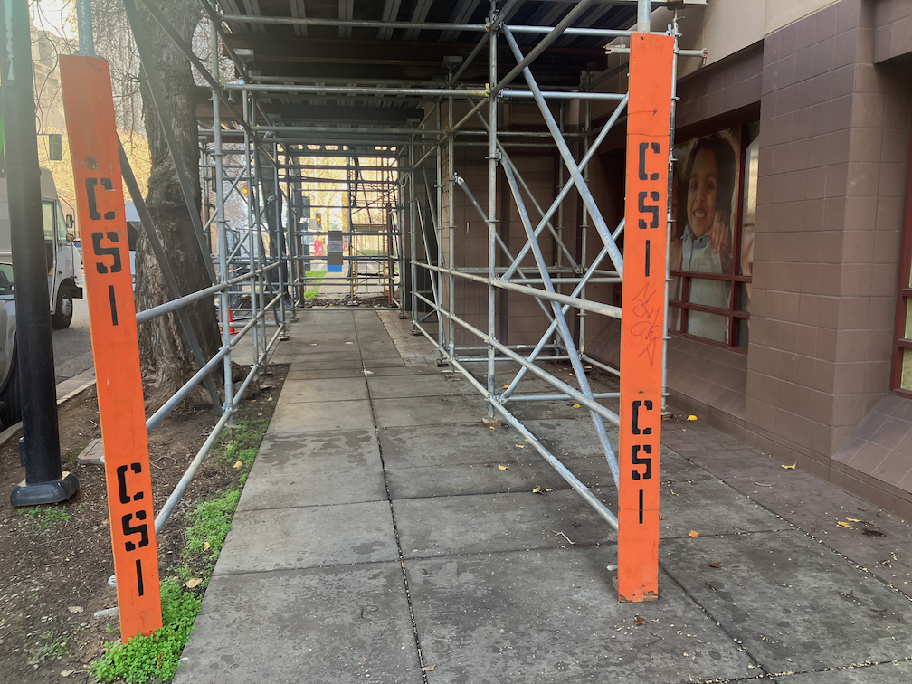
You may be getting tired of these posts on construction zone failures to accommodate walkers and bicyclists, to to comply with ADA regulations. Well, I’m getting tired of the City of Sacramento Public Works Department completely failing at its responsibility to protect people walking and bicycling. I wonder why it falls to the public to report these issues, rather than to city employees whose job it is to take care of these things. Maybe they should not have their jobs.
This most recently noticed problem is on the east side of 6th Street between I Street and Improv Alley. The building is Riverview Plaza Apartments, a Sacramento Housing and Redevelopment Agency (SHRA) housing, and the project is apparently Riverview Plaza Rehabilitation Project. This construction is not on the city’s AgencyCounter website, perhaps because SHRA is a city/county partnership and assumes it does not need to inform the public.
The sidewalk on the east side of 6th Street is completely blocked by construction. At I Street, there is no advance warning of the sidewalk being closed ahead. At the closure, southbound, there is a chainlink fence, which is not a detectable barrier, and no sidewalk closed sign. The construction extends to the curb, including the sidewalk buffer. From the south, there is no advance warning of the sidewalk being closed ahead, either at Improv Alley or at J Street. At the closure, there is a scaffolding, which is not a detectable barrier, and a small paper sidewalk closed sign, not compliant with CA-MUTCD or PROWAG. At the time I walked past, there were two delivery vehicles double-parked on the street, so even if a person wanted to walk around the closure, they would be forced out into traffic on 6th Street. This situation is a complete failure on the part of the construction company, and the city.
SHRA construction on 6th St, no advance warning, no sign on chainlink fenceSHRA construction on 6th St, scaffolding as barrier
SHRA construction on 6th St, scaffolding as barrier, non-compliant paper sidewalk closed sign
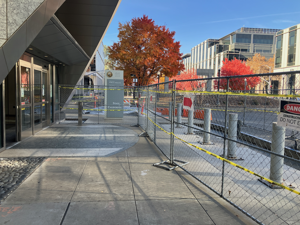
On the northwest corner of 9th Street and Capitol Mall, the construction project on the east side, Jesse Unruh State Office Building Renovation, has closed the sidewalk on the northeast corner, and therefore the crosswalk over 9th Street north side. In general, the construction project has done a good job of signing and barriers to comply with ADA. State projects, though not perfect, are more likely to be compliant with ADA than any of the city or private projects.
9th St & Capitol Mall NW difficult corner
There should be a barrier across the crosswalk at this location, to indicate that the crosswalk is closed and the opposite side inaccessible. There is a barrier, and the correct sign, but the barrier is not blocking the crosswalk. But it can’t! If the barrier were placed to block this crosswalk, it would also block the crosswalk over Capitol Mall, which is not a closed crosswalk. That is just one of the things wrong with diagonal ramps. They make it impossible to correctly place barriers and signing for closed crosswalks and sidewalks.
Two actions could make this better. One, cover the pedestrian countdown signal so that it is not visible, and therefore subject to misunderstanding by limited vision walkers. But this would only be safe if, two, the crosswalk were completely blocked by barriers, and a temporary ramp to the Capitol Mall crosswalk placed, to the right of the barriers.
Diagonal ramps are now illegal everywhere via PROWAG, but of course existing diagonal ramps do not need to be corrected unless the corner is subject to modification for other reasons. The city has known for years that diagonal ramps are poor practice, but has continued to build them, or allow them to be built. And sadly, has even allowed illegal ramps to be built: serious concerns about Broadway.
Posts related to the work zone guidelines are linked via category ‘Work Zones‘ within City of Sacramento category. Posts about construction project issues, previous to and after the release of the draft guidelines, of which there are a huge number, are linked via tag ‘construction zone‘ within Active Transportation category.
Posts related to the work zone guidelines are linked via category ‘Work Zones‘ within City of Sacramento category. Posts about construction project issues, previous to and after the release of the draft guidelines, of which there are a huge number, are linked via tag ‘construction zone‘ within Active Transportation category.
I walked a long section of Broadway today, and came across two construction projects that close sidewalks without proper and safe signing and barricades.
‘Dental Clinic Remodel’
I put this one in quotes because it is a building that has been abandoned for years, but is apparently now under construction. Construction for this half-block building on the north side of Broadway between 23rd and 22nd Streets has closed sidewalks on both 23rd and 22nd. For 23rd, there is some signing, but also a non-detectable chainlink fence and trips hazard folding barricade. As with many other construction projects, a sign on hand, the bicycle/pedestrian detour sign (MUTCD M4-9a), was used though it is not required or appropriate. The sidewalk closed ahead cross here (MUTCD R9-11) is a valid sign, but the wrong location. The sidewalk is closed HERE, not ahead, so the correct sign is sidewalk closed cross here (MUTCD R9-11a).
work zone violation at Broadway and 23rd St, wrong sign, non-detectable barricade
At the corner of Broadway and 22nd Street, there is no sign at all, and the same non-detectable chainlink fence used as a barricade.
work zone violation at Broadway and 22nd St, no sign, non-detectable barricade
I did not check on the north side of these sidewalk closures, but I would assume the signing and detectability is the same or worse.
There is a new development occurring on the southwest corner of 16th Street and E Street, 30 affordable apartments, apparently called Studio 30. This is something that I always support, more housing, more affordable housing.
apartment construction at 16th St & E St, southwest, called Studio 30Read More »
Posts related to the work zone guidelines are linked via category ‘Work Zones‘ within City of Sacramento category. Posts previous to the release of the draft guidelines, of which there are a considerable number, are linked via tag ‘construction zone‘ within Active Transportation category.
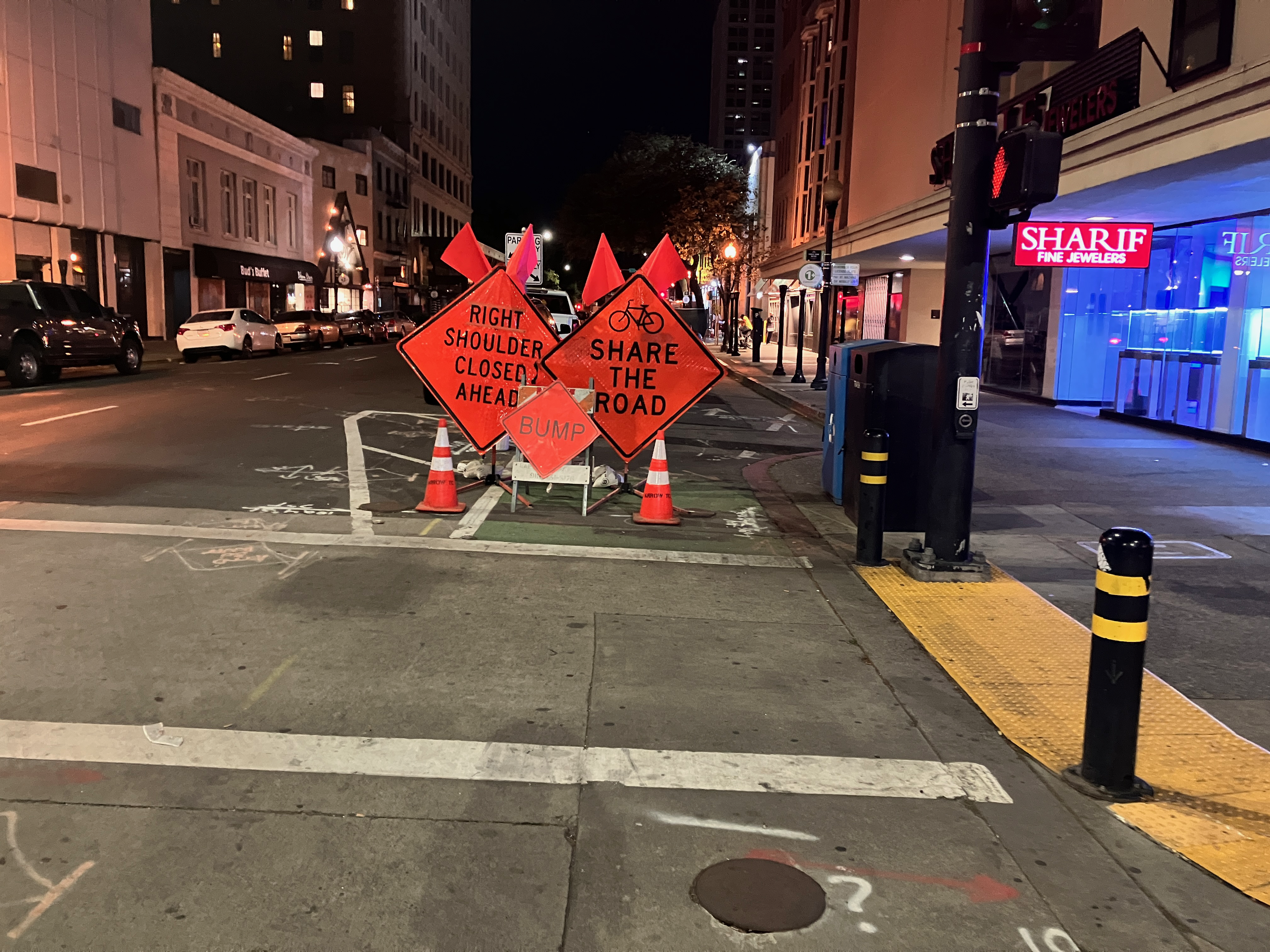
The problem with work zones at this time, before the adoption of a new Guidance to Accommodate Active Transportation in Work Zones and at Events policy (https://www.cityofsacramento.org/Public-Works/Transportation/Planning-Projects/Work-Zone-and-Event-Detours), is that the city accepts incomplete and non-compliant Temporary Traffic Control Plans, and then does not monitor them for compliance. The success and safety of construction zones should not have to rely on the public reporting non-compliant locations, it should be the job of city staff to monitor compliance.
Monitoring
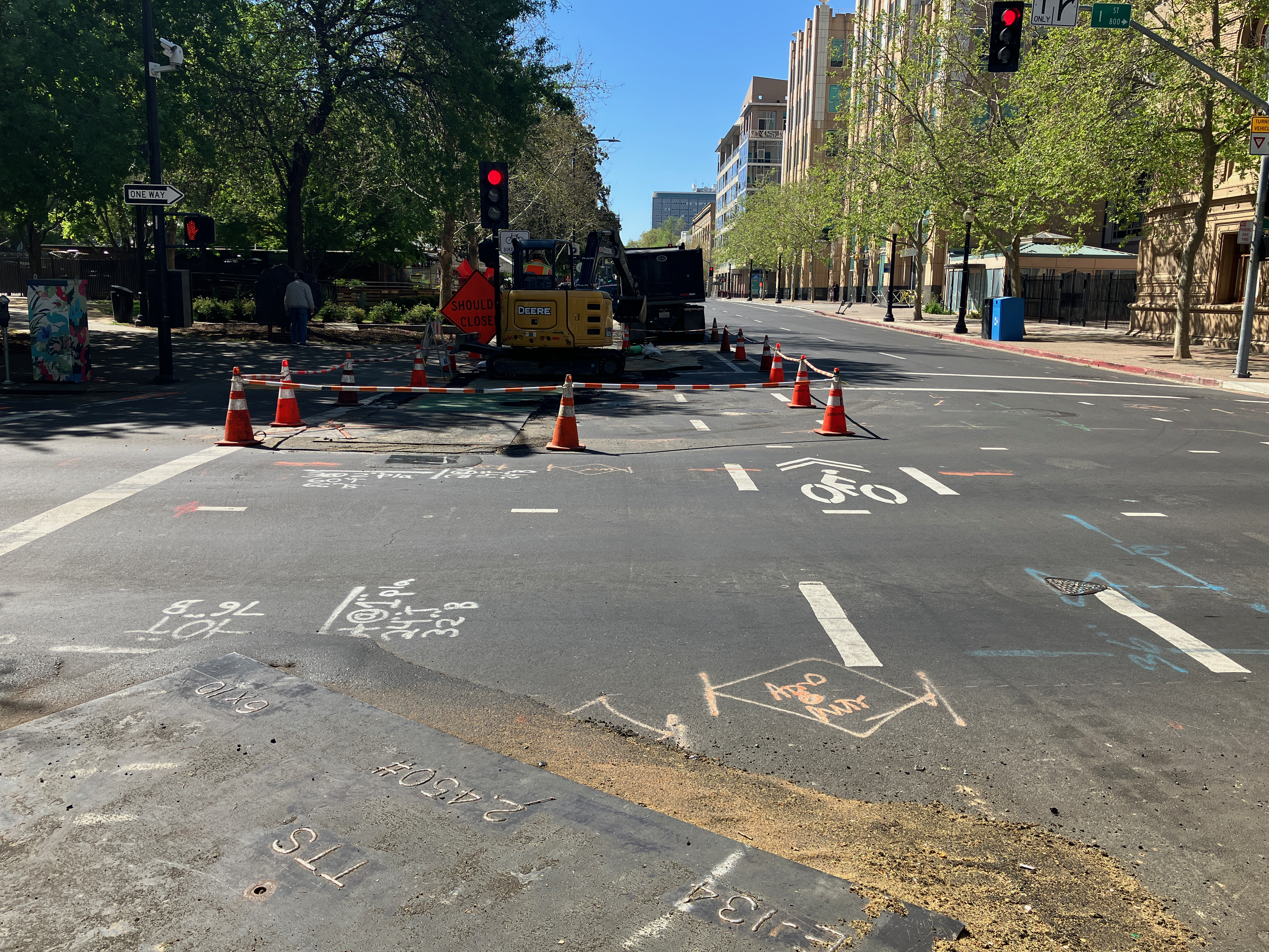
City staff should monitor construction zones at the beginning of the construction project when signs, barricades, and channelizing devices are installed, and at any point when there is a significant change to the locations closed or detoured sidewalks or bikeways. As an example, 9th Street between K Street and L Street changed dozens of times during the construction project, and in fact, the sidewalk at that location is still closed long after construction appears to be complete. Almost every change had one or more non-compliant aspects, though it did improve over time. At beginning of construction, the sidewalk and bikeway were closed without warning signs, and there was unrelated construction on the other side of the street which closed the sidewalk. This sort of issue should never have happened! It has long been a requirement to comply with MUTCD and ADA (even before PROWAG was finalized).
The draft guidelines define five work durations:
Long-term stationary is work that occupies a location for 5 days or more.
Intermediate-term stationary is work that occupies a location more than one daylight period up to 5 days, or nighttime work lasting more than 1 hour.
Short-term stationary is daytime work that occupies a location for more than 1 hour within a single daylight period.
Short duration is work that occupies a location up to 1 hour.
Mobile is work that moves intermittently or continuously.
I would not suggest that monitoring is necessary for durations C, D, and E, unless there is a citizen complaint about safety. For duration B, it should be inspected once, at the beginning. For duration A, it should be inspected at the beginning, and once per week thereafter. The additional monitoring would ensure that changes are captured and addressed, and that fallen signs, barricades or channelizing devices are corrected.
If there seems to be insufficient staff for monitoring, then the construction company must be charged more for the Temporary Traffic Control Plan and encroachment permit, sufficient to staff. The majority of construction is occurring in the central city, but there are locations throughout the city that must be monitored.
Enforcement
The draft guidelines do provide for administrative remedy, as follows. This will be sufficient, if Public Works staff follows through. However, in the past, staff has shown little concern for compliance, and has only responded to repeated citizen complaints.
Administrative Penalties Implementation of the requirements for accommodations within these criteria and guidance must be paid for by the construction sponsor and it must be the responsibility of the construction sponsor to comply with the requirements of these criteria and guidance. Should the construction sponsor fail to comply, the Public Works Director or their delegate has the authority to stop all work until compliance has been achieved (§12.20.020). Such work will not be resumed until the necessary modifications have been implemented (§12.20.020). The Public Works Director or their delegate may issue an order imposing an administrative penalty to any person violating any provision of Chapter 12.20 Closure of Primary Streets for Construction.
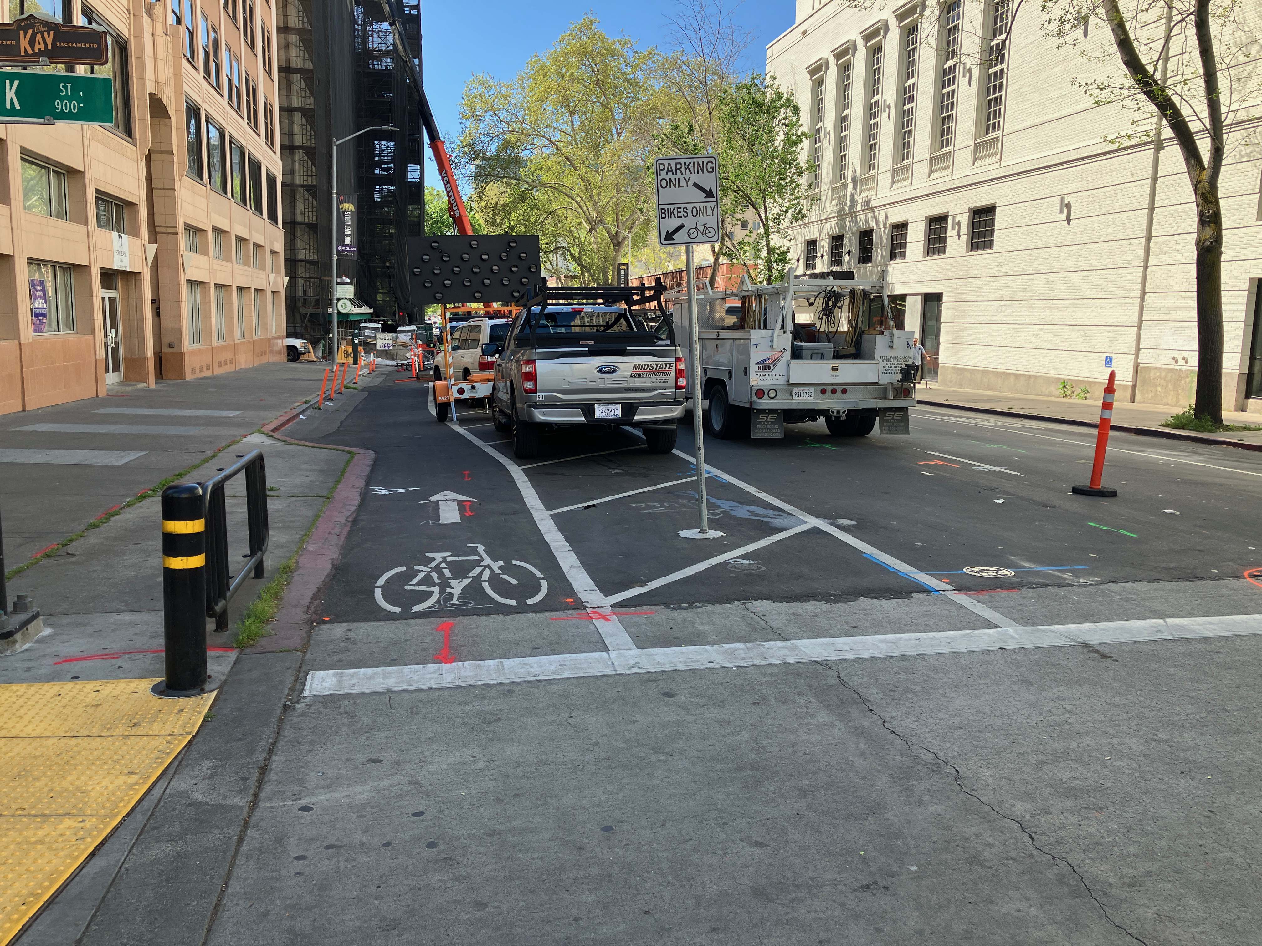
The parking-protected, separated bikeway on 9th Street between K Street and L Street is finally open again, 2-1/2 years after it was closed for construction conversion of the Capitol Park Hotel by Mercy Housing. Though the area was occasionally used for active construction, mostly it was used for long-term storage of construction materials.
Nothing has changed on 21st Street since the last post.
On 19th Street, some of the striping has been completed as far south at P Street. This is only white, long-line striping, none of the details have been painted. While riding 19th Street today, I was very nearly hit by a driver at O Street. The long-lines lead drivers to think that they have full width right of way, and to not expect bike riders to be coming out to pass the curb extensions at O Street. As I have said all along, I question putting extensions in locations with separated bikeways. It may be less dangerous once the detailed striping and green paint are installed, but it won’t be as safe as it could be if the city had simply not installed extensions on the east side of the 19th Street and O Street intersection.
A friend pointed out that the separated bikeway on 19th Street southbound is more than half in the gutter pan, and that the gutter pan is deteriorated in many locations. Therefore the effective width of the separated bikeway is not six feet, but about two feet. Smooth sailing for drivers, not for bicyclists!
19th St separated bikeway in the gutter pan
As is true of every street that has been repaved, or patched, so far, the lane tabs have indicated that the general purpose lanes are very wide, and there are no bike lanes. Bike riders are now exposed to higher speed traffic (because of the very wide lanes), with not even the slight protection of paint. Though this might be the fault of the project contractor, I doubt it. If the city had told the contractor to keep temporary bike lanes, they would have. I’m almost certain that the city did not say anything about accommodations for bicyclists to the contractor. The city is endangering bicyclists during this construction project, on purpose and with full knowledge. If someone is hurt or killed here, it will be on the city, and I hope they get sued for millions. The city philosophy, overall, for this project and every other construction project on streets and sidewalks, is that bicyclists and walkers don’t matter.
The city has claimed that they are now, finally, working on a construction accommodation policy. I suspect that it will come out very weak, because Public Works still believes strongly in cars-first. Traffic flow and ease for drivers controls all their decisions.
P Street has been repaved, but does not have any marking yet. Q Street has been patched, though I can’t tell if there is more to be done. A reader pointed out that there is some active work on 10th Street, but I haven’t gotten there yet.
A friend mentioned that traffic was a disaster when the city closed Q Street and 15th Street, with traffic backed up for many blocks. Though I did not observe this, I’ve had reports now from many people that the detour signage for this project does not provide drivers (or bicyclists) with any information about which way to go (the detour signs, I have observed, frequently point two directions, and the signage along the detours is incomplete. This could, possibly, be the fault of the contractor, but if the city was not out inspecting the detours and getting them corrected, the city was also failing. I have talked to a number of people on the street for whom this project has left a bad taste in their mouth. They have seen that the city has done a poor job of communicating with drivers, bicyclists and walkers, and there is a lot of doubt being expressed about whether the separated bikeways will actually be safer.
Lastly, I will note that there was no public outreach on this project. There are no plans available to the public. I am sure if there had been outreach, some of the design details would be different, some of the flaws would have been caught, communication would have been continuous and effective, and construction signing would have been done correctly. This was an internal Public Works project, and it was not done well.
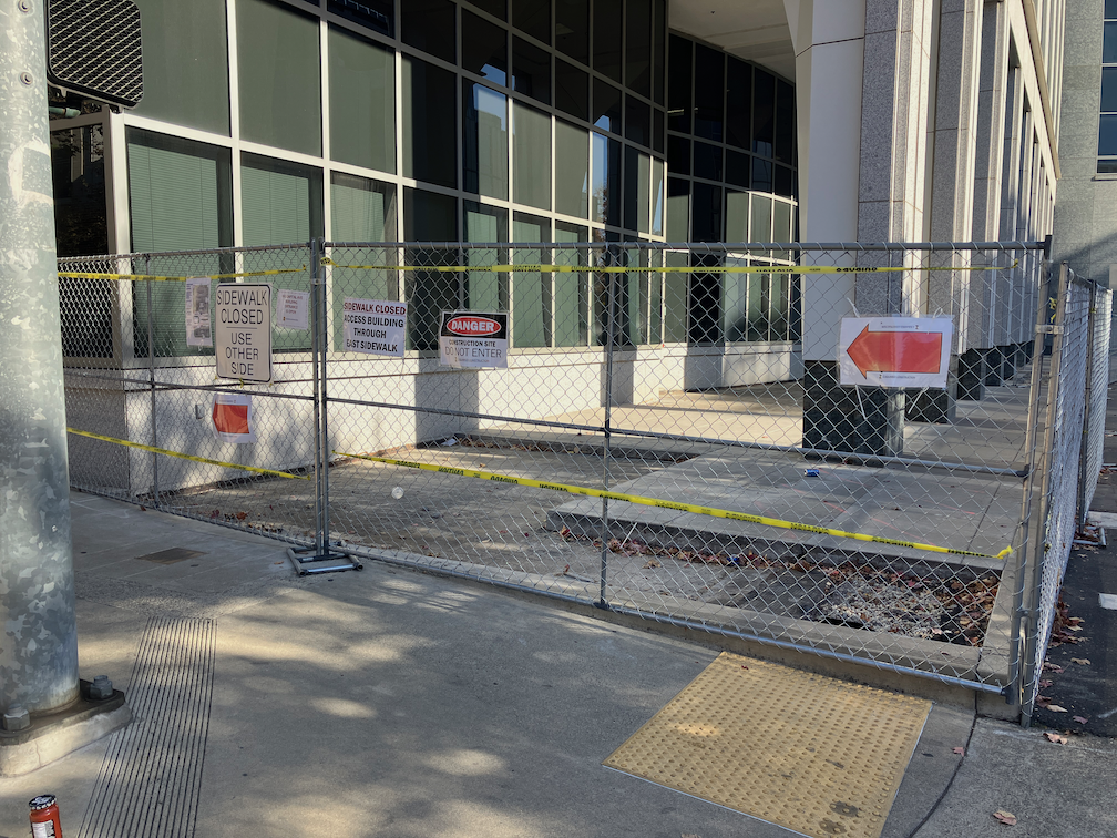
Let me say up front that there is a lot of competition for ‘the worst’, but I think the sidewalk and other construction on Capitol Ave between 16th St and 17th St is certainly in the running.
What are the issues?
No advance warning of sidewalk closure at the preceding corners on 17th St.
No ADA detectable barrier. The project is using chain link fencing with yellow caution tape strung through the fence.
Fence bases protrude into the sidewalk, presenting a tripping hazard for blind or low vision persons, or anyone at night.
No appropriate ‘sidewalk closed’ sign at the point of closure.
Both sides of Capitol Ave have closed sidewalks, so there is no choice between sides of street.
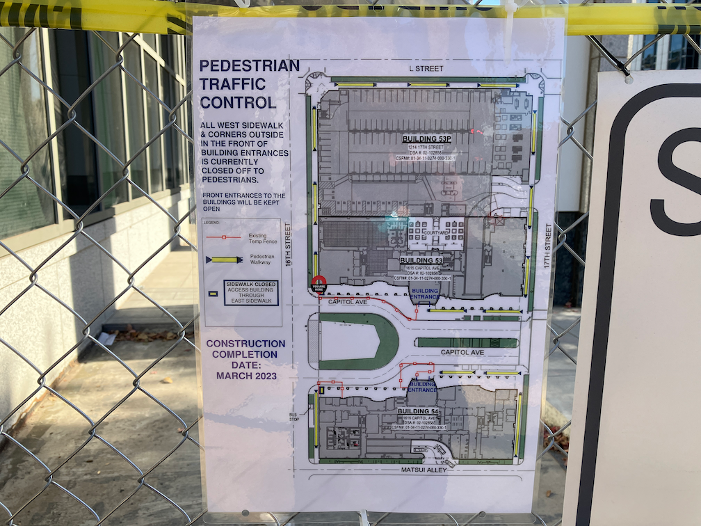
The small sign on the fences at 16th St indicate very long detours to reach the entrances of both 1616 Capitol Ave (south side) and 1615 Capitol Ave (north side). Photo below. This sign of course would be of absolutely no use for someone with impaired vision, or anyone on a dark day or early in the morning or late afternoon (at this time of year).
The bike lanes on both sides of Capitol are partially obstructed by fencing. No signing for bicyclists or drivers indicates this. Bicyclists have to merge away from the fencing into the general purpose lane, with no advance warning.
This is a California Department of General Services (DGS) project, and signing indicates that the construction contractor is Z Squared. I have reported these violations to both the City of Sacramento 311 (case 221130-1423348) and DGS Facilities Management Division.
It is worth noting that his current construction seems to be part of an ongoing construction project that was stalled for about a year. DGS removed the rocks from a sidewalk adjacent area meant to protect walkers from walking into the awkward building buttresses, then fenced these areas. About a year ago. Then, nothing.
There is also construction going on Capitol Ave between 15th and 16th, but I was so depressed by this one that I didn’t include it.
1616 Capitol Ave construction blocking sidewalk1615 Capitol Ave construction blocking sidewalkCapitol Ave at 16th St construction blocking sidewalk, northCapitol Ave at 16th St construction blocking sidewalk, southCapitol Ave detour signing for pedestrians
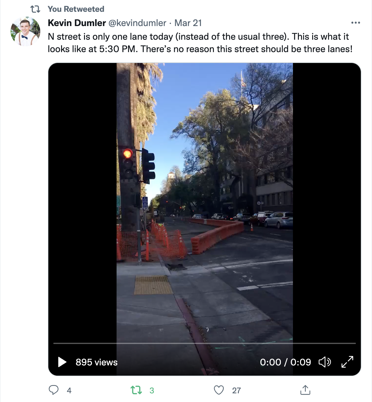
Kevin Dumler posted this to Twitter, and it caused me to pay more attention to all the utility and construction projects going on in the central city that have reduced general purpose travel lanes (car lanes). What follows are some photos of other locations.
10th St past P St, lane reduction two to oneI St past 10th St, lane reduction three to twoJ St past 10th St, lane reduction three to two, also parking and bike lane closure N St past 10th St, lane reduction from three to one (same location as Kevin tweeted)L St past 12th St, lane reduction from three to one
It is only in this last example, on J Street between 12th and 10th, where there was some congestion. However, no vehicles were being stuck at signals, nor failing to make it through the signal at 11th Street, so this is very minor congestion.
The point, well made by Kevin, is that we have excess capacity for motor vehicles on many of our roadways, particularly three lane roadways, that could better be used for other things, like bike facilities, wider sidewalks, planter strips or wider planter strips. Or even narrowing the street for housing!
There are active utility projects on 9th Street and 10th Street that have closed parts of the separated bikeways on those streets. Upon noticing this, I thought, no big deal, a few days of work and things will be back. But the closures have been continuing for three weeks now, with no end in sight. It is interesting that the utility work on J Street is moving fairly quickly, but on 9th and 10th, not so much. I am not sure what utilities are being worked on, and whether these are city-led projects with contractors working on city-owned utilities, or whether they are private utilities such as PG&E or communications.
When there is an extended closure of a separated bikeway, more than two days, an accommodation for bicyclists should be provided. I am aware that some bicyclists are willing to ride in the traffic lanes, but the entire point of a separated bikeway is that it needs to work for all bicyclists, including people who are not comfortable riding in traffic. To allow construction to close a bikeway, without any alternative, is a failure on the part of the city. The city is again expressing its favoritism for motor vehicle drivers over bicyclists.
10th Street
10th St at K St bikeway closure10th St bikeway construction plate
For 10th Street, general purpose lanes should be reduced from two to one, making the other lane a temporary bikeway. Or, remove parking from the left (west) side of the street so as to allow two general purpose lanes and one temporary bikeway.
9th Street, H Street to J Street
9th St at H St bikeway/bike lane closure9th St at I St bikeway/bike lane
The bike facility on 9th St is not technically a bikeway until it crosses J St, but since it is intended to provide a similar safe route of travel, I’m including it here. Utility work has closed off the bike lane between H St and J St. No alternative has been provided. The solution is to remove one general purpose travel lane and create a bikeway, or remove parking on the right (west) side of the street in order to maintain two general purpose lanes and one bikeway.
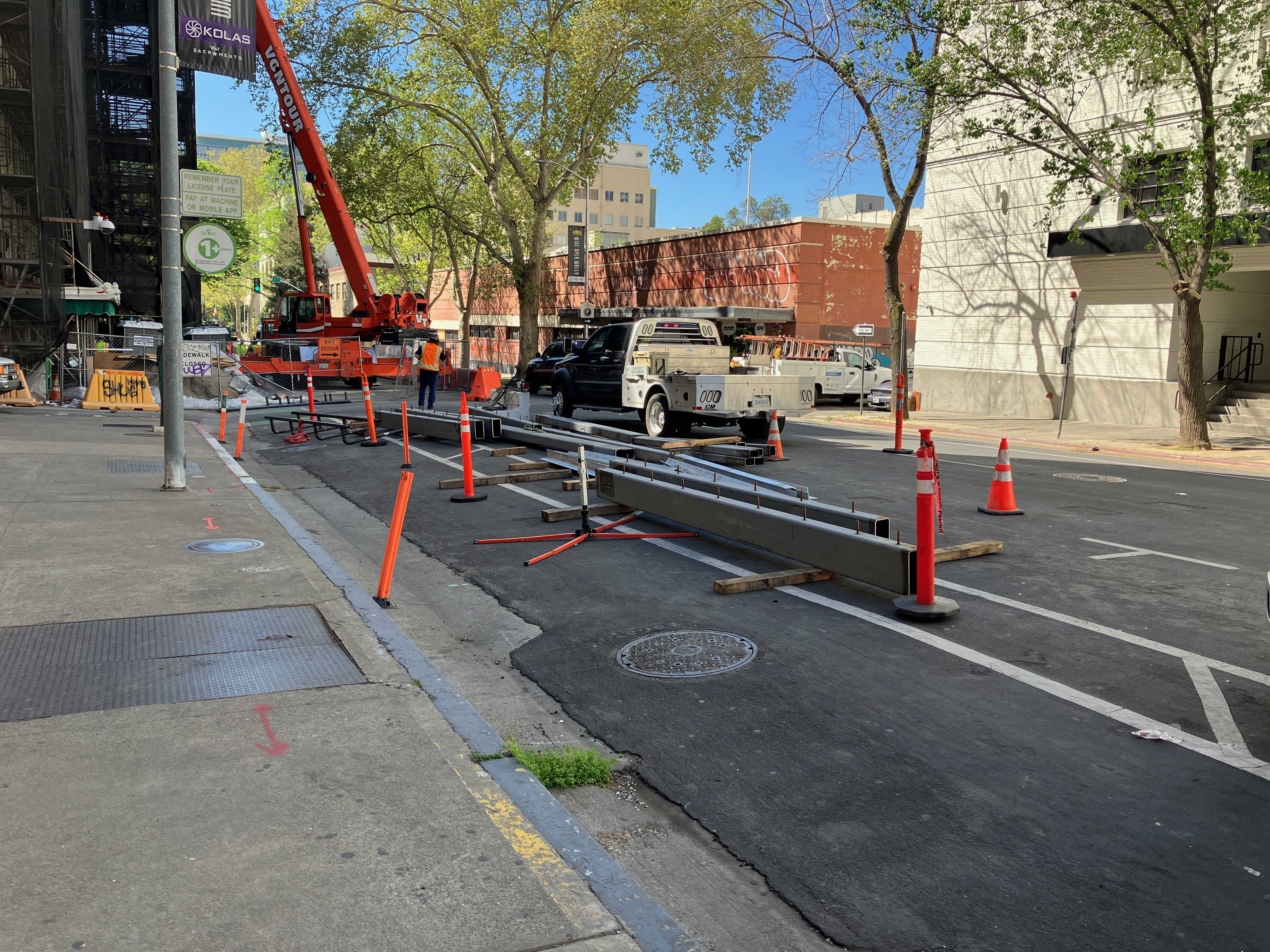
9th Street, K Street to L Street
9th St at K St, no signing for bikeway closure9th St construction materials stored in the bikeway (just south of previous photo) 9th St at Kayak Alley, walkway/bikeway gone
The reconstruction of Capitol Park Hotel, on the east side of 9th Street between Kayak Alley and L Street, has been going on for months. Every time I go by, something has changed about how the roadway is being handled. Today, the safe bikeway and walkway that was there is now gone. Construction has pushed the fence up against what were formerly the barriers that separated the bikeway/walkway from traffic. Today there was a crane filling the space, which may be necessary, but that doesn’t change the clear message that the entire area is now construction zone with stored construction materials.
The section between K St and Kayak Alley is now being used to store construction materials and worker vehicles. The closure of the separated bikeway is not signed in any way; there have been signs here in the past, but they are gone. If you rode the bikeway without realizing it was closed, you would crash into construction materials.
I am not sure whether there is enough space left in the roadway to provide both a separated bikeway and a travel lane. If so, it should be modified for that. If not, the travel lane should be closed until the construction footprint shrinks again to allow the original walkway/bikeway.
It should be noted that the city did not initially provide the walkway/bikeway on 9th Street, and it was only installed after considerably public outcry.
These locations are a fraction of the ones throughout the city where the city has decided that motor vehicle traffic must be accommodated, but walkers and bicyclists do not. The construction guidelines code that the public requested the city develop and implement have been back-burnered because the city has decided to use staff to apply for grants rather than solving current problems on the roadways. I get more frustrated by the city by the day. I don’t really think they care at all. The car-dominated city, which was created by city planners and engineers, is just fine with them.