I attended the SacATC 2026-06-18 meeting.
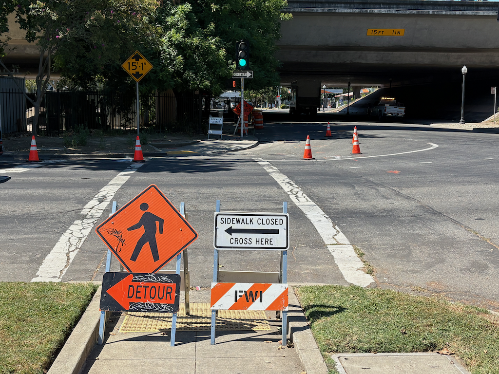
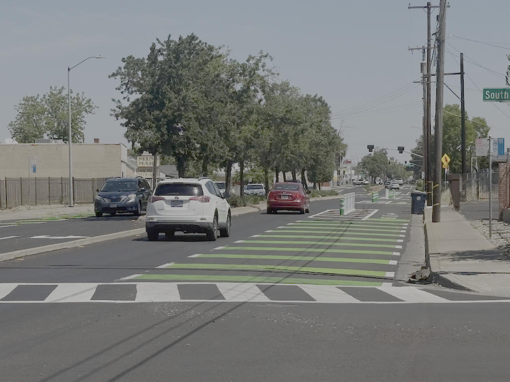
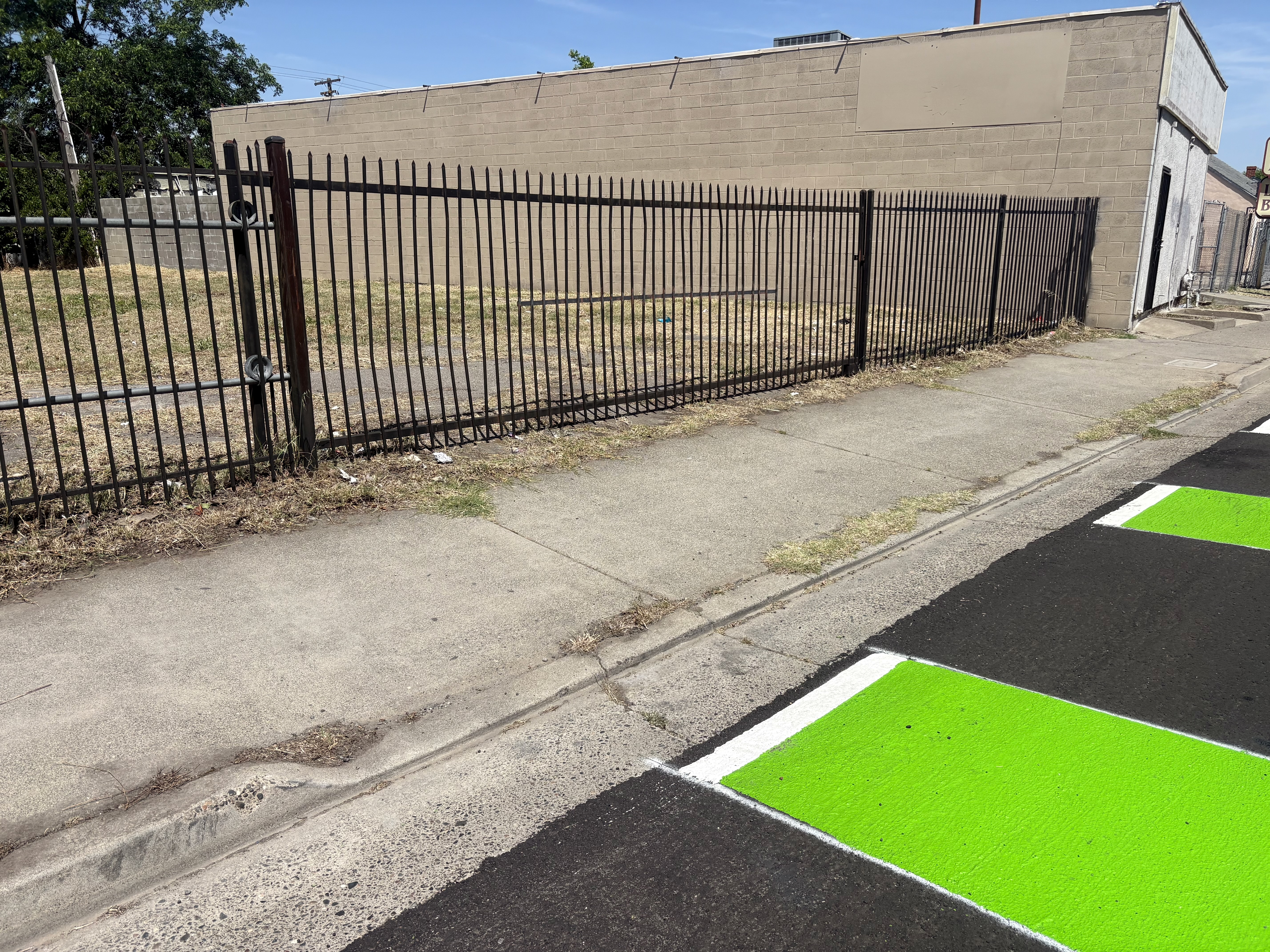
I spoke briefly on the Arden Way-Auburn Blvd Mobility Plan (item 3), mostly just to say this is a walker and bicyclist hostile area, and it will take significant changes to make it useable and welcoming to people. Arden Way adjacent to the Arden Fair Mall is extremely wide, and crossing there is uncomfortable even with signals and walk signs. Of course the worst intersection of all is Arden Way, Alta Arden Expressway, Exposition Blvd, and Ethan Way, a complex and dangerous intersection for all modes, where it is not even obvious where one could go, let alone what might be safe (spoiler: there are no safe ways here). This intersection is partly in the city, and partly in the county, which may be why it was not included here. Commissioners commented that RRFBs (Rapid Rectangular Flashing Beacons) should be removed from this plan and from the city’s toolbox, as drivers do not yield to walkers at these location in this city. There were also comments about the lack for a direct path and wayfinding for moving from the levee trail to the soon to be opened bicycle path on the Business 80 bridge, and through CalExpo to the Arden Fair area.
My longer comments were about the Vision Zero Action Plan Update draft (item 5). The draft plan has just been released, and I will be looking at it in more detail. I’m also part of the task force. The draft plan does not at this time include the appendices, so my comments were based on the SacATC documents and a quick read of the plan.
Positive:
- overall, an improvement over the 2018 plan
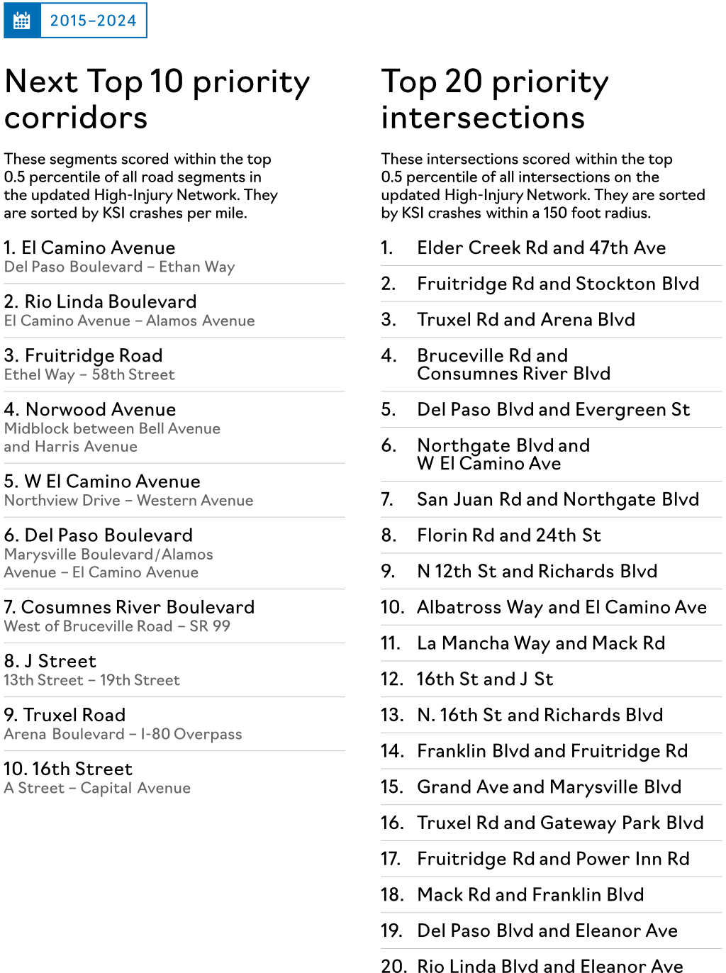
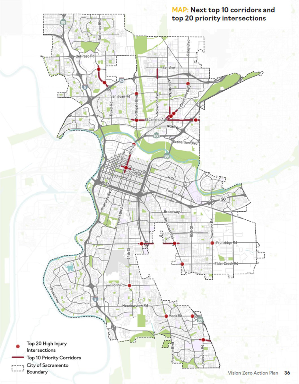
- added focus on Top 20 intersections, as that is where most crashes occur and are prominent in areas of persistent poverty; this was a major weakness of 2018 plan
- prioritization of vulnerable users and sensitive areas is good
- recognition that arterials are almost entirely the problem, which is due to outmoded and unsafe design; though a lot of complaints are made about speed and driver behavior on local streets, that is mostly not where the fatalities and severe injuries are happening
- I particularly like high priority action H7, addressing 10 priority intersections
Would like to see:
- case studies on completed corridor projects showing change since completion
- identification of which Top 20 intersections are good candidates for quick-build under Transportation Safety Team; some intersections are so bad that nothing but major reconstruction will make them safer
- Top 20 intersections should be explicitly added to the Transportation Priorities Plan, not just corridors
Negative:
- this is really just a plan, not an action plan; an action plan would detail what actions will be taken, when, and with what funding
- rejection of using the city’s general fund (p.66) to mitigate safety issues is a mistake; city staff including the City Manager should promote use of general funds, and the council should provide the political leadership to allocate significant funds to the program; failure to use general funds will stretch efforts out by decades
- because traffic signals are so expensive ($1M plus), new and major modifications should be de-prioritized in favor of other actions, though timing modifications are appropriate; new signals are not an affordable safety solution
There will be several more chances to comment on the plan, June 22, July 1, and July 30 for in-person, and June 25 and June 29 for online. You can also comment directly on the plan document with the Konveio tool. See the city plan update webpage for more detail and to register for these workshops.
Slow Down Sacramento has offered a ten points for comment on the Vision Zero plan, listed below. These are well worth considering in your own comments.
- Annual reduction targets for deaths and serious injuries, not just a general goal that crashes should go down.
- A public implementation dashboard showing each action, responsible department, funding status, timeline, and progress.
- A stronger funding strategy that treats traffic violence as a public safety crisis.
- Quick-build safety reviews after every fatal and serious injury crash on the High-Injury Network.
- A higher priority for project evaluation, so the City measures whether completed safety projects are actually reducing crashes.
- A higher priority for the Speed and Conflict Management Plan, because speed is one of the most important factors in whether a crash becomes fatal.
- Default use of proven safety tools like daylighting, leading pedestrian intervals, no right turn on red, protected left turns, and safer signal timing where conditions warrant them.
- A stronger Safe Routes to School commitment, especially near schools, parks, transit stops, and high-speed streets.
- Clear prioritization for Disadvantaged Communities and Areas of Persistent Poverty, where the burden of traffic violence is greatest.
- Ongoing meetings of the Vision Zero Task Force after adoption, so community voices remain part of implementation and accountability.