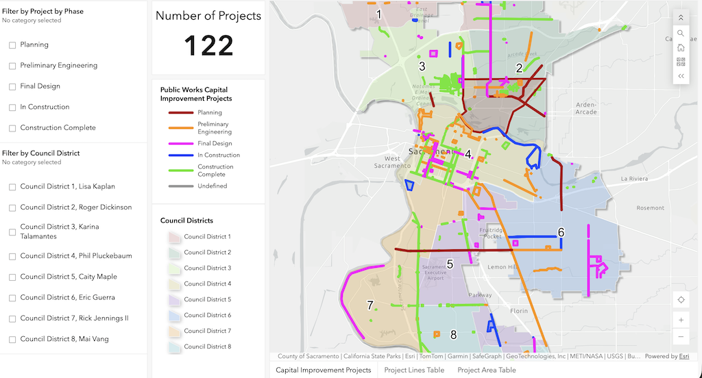
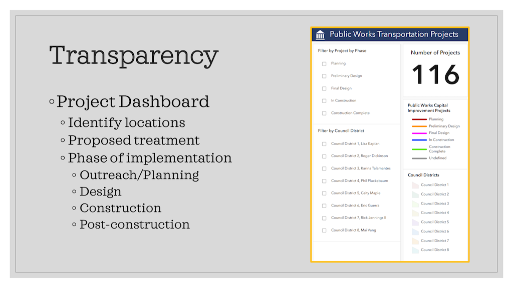
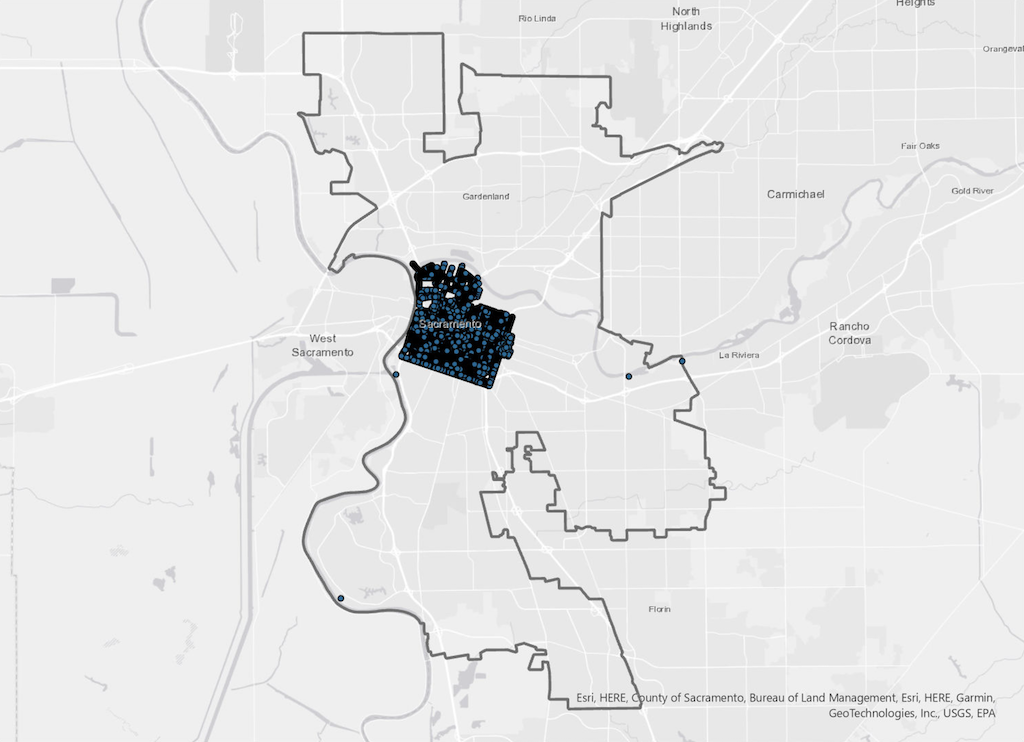
The City of Sacramento, Department of Public Works, has an map or dashboard of transportation projects available online, Public Works Transportation Projects. You can select by project phase (planning, preliminary engineering, final design, in construction, and construction complete), and by council district. You can zoom in or out on the map.
Public Works Transportation Projects map/dashboard
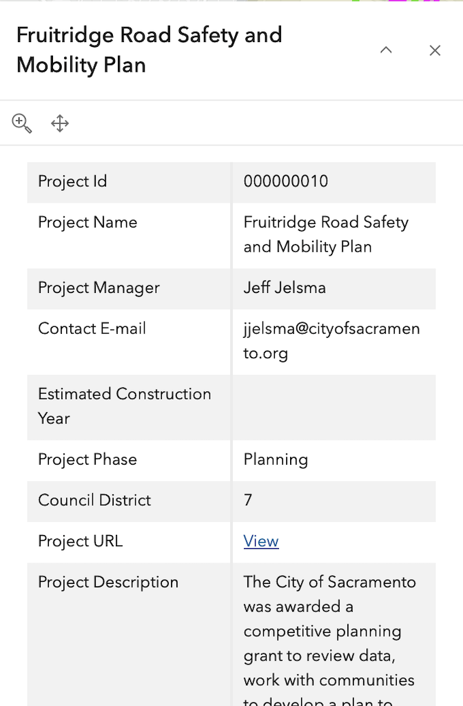
Clicking on a project line or point opens a popup with details. Some of the data seems a little out of date for Project Manager and project phase, but this is nevertheless the best source of information on projects that I am aware of.
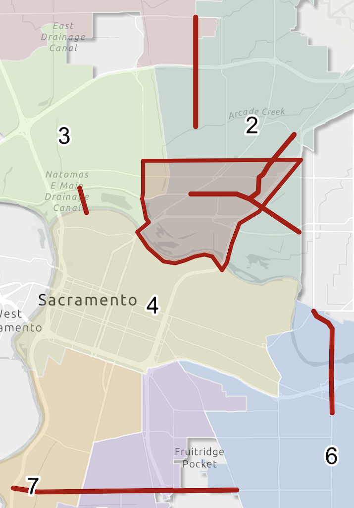
For transportation advocates, selecting planning will probably be of the most interest. Once a project is past the planning stage, it is unlikely that it can be improved by community input.
Public Works Transportation Projects map, selected for ‘Planning’
Sacramento County does not seem to have an equivalent map/dashboard, but it does have a project page.
Folsom does not seem to have an equivalent map/dashboard.
Rancho Cordova has a robust set of GIS data, but does not seem to have an equivalent map/dashboard.
Elk Grove has a robust set of GIS data. It has a CIP (capital improvement program) map, which may contain similar information, but does not seem to be working at this time.
The City of Sacramento established a Tactical Action Group (TAG) otherwise known as Transportation Safety Team, in March 2025. Unfortunately, very slow progress has been made on this. The program lead is in place, Philip Vulliet, and an administrative assistant, but the other five positions have not. The city has a difficult time filling positions, particularly engineering position, as the pay level is low compared to other entities and private industry. A webpage for the program has not been established.
So far as I know, the only information on the program is a presentation given by Mr. Vulliet to Strong SacTown in June 2026. I think there was a presentation to SacATC, but I’ve been unable to find it. The slides are below, but they are not very specific. The Strong SacTown meeting notes have more detail, and follow the slides. Thank you, Strong SacTown.
gallery of slides from presentation on Tactical Action Group, at Strong SacTown 2026-06-04
Phil Vulliet (VOO-lee-ay) is the new lead for the city’s Safety Response Team where he will help Sacramento respond faster to urgent safety needs and continue advancing the City’s goal of eliminating fatal and severe injury crashes.
About Phil: 20+ years of experience. Project manager for capital improvement projects (aka big road projects) for last 11 years. Managed Broadway Complete Streets, Downtown Mobility Project, and others. Prior to that, did consulting.
2018 City passed Vision Zero Action Plan. Based on 10 years previous accident data. Established list of high-injury network – responsible for >70% of serious injuries in cities. Looked at root causes of vehicular violence and impact on pedestrians and cyclists. Looked at impact on bicycles and pedestrians – 40% fatal collisions. We need to protect them.
Planning efforts came from the research – top 5 corridor study, 6-10 corridor study is now in planning and quick builds will be prioritized as well.
Parking protected bike lanes were created and then the central city mobility project was completed in 2024 as well as broadway complete streets, Franklin complete streets wrapping up and northward school access was completed.
Funds are being used to match grants.
13,000 crashes still (all mode crashes)
Transportation safety initiative was passed in 2025 – responsibility to track now.
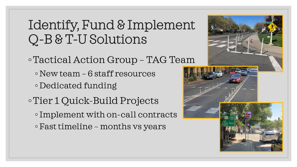
Transportation Safety Team (TST) – established jobs for 6 FTE’s
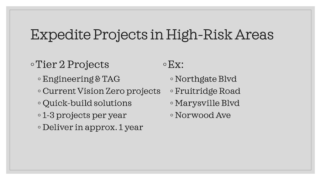
Quick builds – rapid implementation limitations (no land acquisitions), limited electrical work, excavation only by city crews (try not to dig), Council action needed – assigned project in tiers
Tier 1 – quickest of quick builds – surface treatments (Paint and Plastic), includes alterations in traffic circulation. Community informed
Tier 2 – outside of the TST team – require full plans and bidding. Pilot projects. It takes about a year.
Quickbuilds are faster than CIP
CIP – Safety program, quick build CIP – sales tax generates the funds for the safety programs
TST – They require contracting readiness, design delivery capacity, need new processes and new tech as well as outreach, follow-up and reporting needed.
They were given an exception by the city council that they are allowed to go to contract vs. go to bid
Software platforms can share real-time speeds and volumes without having to do a traffic study (speeds up the process of evaluation)
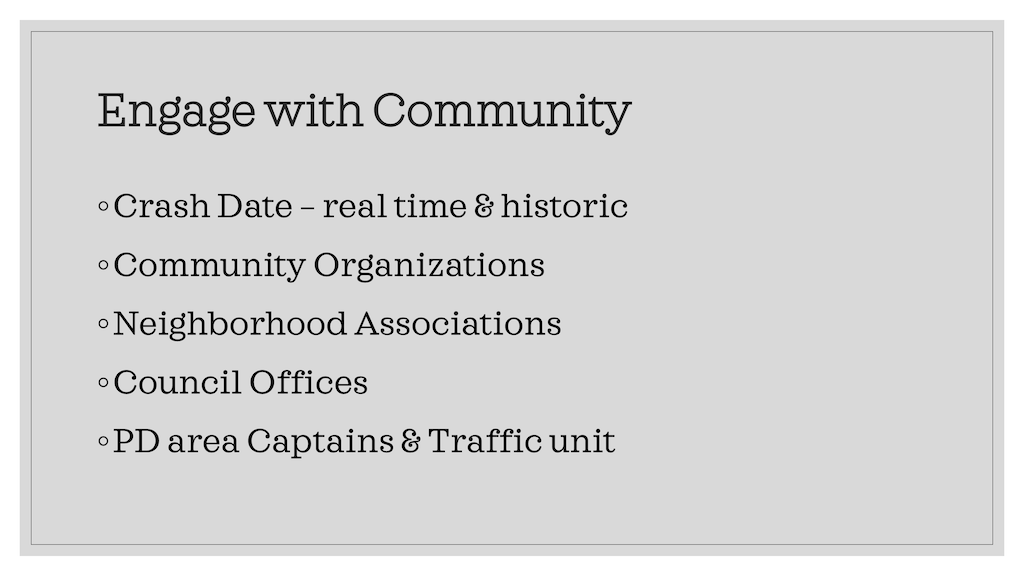
Outreach is beyond critical – it’s about equity, some cities are more organized than others. TST only has so much staffing to support and cannot watch every intersection.
Feedback needed when the quick build has been built and if it’s not working, that’s the beauty of it, they can fix it quickly.
The public facing GIS dashboard is up and is working to create a map to show where in the city there have been quick builds implemented.
Q&A Notes
Q: Gets through
A: Budget will help, it will increase funding, but that is not the limiting factor
Q: Process to determine an LPI (Leading Pedestrian Interval)
A: Megan Carter – give pedestrians a few extra seconds of time to provide more time. LPIs will be implemented everywhere, unless we can justify not doing it. There are some lawsuits if you don’t implement LPS ( not being equitable if it does not include LPS). ATC will go with a plan next year.
Q: What are issues you face when you change the fabric of the street
A: Daylighting and recommended clearance and it was 25% parking loss. New state law that doesn’t require any parking to be provided. Willing to accept delays for cars.
Q: Streets are designed like roads and are in urban areas. When you add parking it does slow people down.
A: They do try to account for that. Ideally if he had a magic wand he would make the traffic slower.
Q: is that a tier 1 or a tier 2
A: We can look at curb usage and how we monetize it and manage uber’s, lyft’s and waymo.
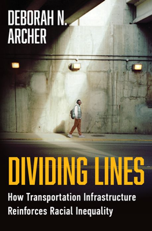
In the 2025 book Dividing Lines: How Transportation Infrastructure Reinforces Racial Inequity (2025; ISBN 978-1-324-13056-7), Deborah N Archer lays out the issues that have long plagued the Black community as their neighborhoods were underinvested, and broken up by transportation infrastructure built for the convenience of white people. She also covers the past legal frameworks that encouraged this, as well as the laws which can be used to fight it and correct it. I am part way though reading the book, but it has deepened my understanding of the racial bias built into our transportation system.
This is not just a problem of other cities. The alignment of Interstate 5 was designed to both erase low income housing and the people of color that lived there, as well as related businesses, and to isolate what remained from the rest of the city. The alignment of Highway 50 was designed to remove low income housing and the people of color that lived there, to isolate the higher income Land Park neighborhood from the city, and erased part of Southside Park. Highway 99 cut directly through south Sacramento and isolated the Black neighborhoods on both sides. And this is just the freeways. Arterial roadways were placed, and widened, and widened again, to separate people of color, and to cater to higher income while people. Many of these were not directed just at Black neighborhoods, but at all immigrant and low income people.
In Chapter 6, ‘The White Man’s Right of Way’, Archer delves more deeply into the issue of sidewalks:
“Even in cities that were not segregated by law, sidewalks in predominantly Black neighborhoods are less common and of poorer quality, often as the result of a legal regime that places greater reliance on private property owners. More than perhaps any other means of transportation, pedestrian infrastructure is highly localized in its construction, funding, and maintenance; the federal government does little to oversee or force accountability on sidewalk quality or even whether sidewalks are required on a particular road. Sidewalks are in some ways “public,” but are also closely associated with adjacent properties or lots. The result is that neighborhood socioeconomic disparities map directly onto pedestrian infrastructure quality, as poorer neighborhoods that are disproportionately Black and Brown are less able to invest private capital into maintaining their sidewalks.”
The City of Sacramento responds to complaints about sidewalk condition such as root heaves by making the adjacent property owner repair the sidewalk, or if the property owner does not do so, doing the repair through a contractor and billing the property owner. This is the city’s policy. State law allows the city to impose this, though it does not require the city to impose it. And just because something is in state law does not make it constitutional. As I have said before, requiring a private property owner to maintain city property is prima facie unconstitutional.
The city could take on responsibility, if it so chose. It is worth noting that some of the most poorly maintained sidewalks in the city are adjacent to property the city itself owns. The city often does not apply the requirement to itself.
The cost of a sidewalk repair does not fall equitably. A commercial property owner or a high income property owner may be able to handle the cost of repair, which can be quite expensive. A low income or even moderate income property owner cannot. So where are low income and moderate income property owners located? In those parts of the city where sidewalks were narrow or nonexistent, where the standards of construction were lower or overlooked, where sidewalk buffers, if they were present at all, were too narrow to allow for healthy trees. In other words, north Sacramento and south Sacramento.
Archer says: “Municipalities that require private property owners to maintain sidewalks can worsen disparities when they enforce those rules in inequitable or unreasonable ways. For example, when cities pay for the cost of repairs themselves, they often will bill the adjacent property owner. This debt can be enforced through a lien that may ultimately result in foreclosure on the property. It should not be a surprise that Black communities bear the brunt of this practice.”
I used to file 311 reports on sidewalks, before I understood that the financial burden fell on property owns, and not on the city. Once I realized this, I stopped reporting. Archer says:
“A related problem comes when cities rely on private complaints to determine where and when the city should repair damaged sidewalks. Several cities use voluntary complaint systems like “311” phone calls to assess which sidewalks need work. Low-income communities of color are far less likely to call to request help. Seattle, Washington, switched from a 311 system to a fixed repair schedule after officials realized that relying on 311 led the city to make a disproportionate number of repairs in high-income, white neighborhoods. Those residents were more comfortable filing complaints and likely had higher expectations that those complaints would be addressed. When Boston embarked on a citywide campaign to address sidewalk inequities in 2017, it opted not to use a 311 system. Instead, city officials went block by block over Boston’s 1,600 miles of sidewalk to set repair priorities. But not all cities have the interest or the resources to follow Seattle’s and Boston’s leads.”
One can argue about whether these disparities were intentional on the part of the city, or inattention by the city, or the result of private developers, or any number of other excuses. The fact remains that Black, Latinx, and immigrant communities have lower quality walking environments, and lower quality sidewalks, and many of the property owners there cannot afford to maintain these sidewalks.
Placing the burden of sidewalk repair on adjacent property owners is racist, if not in intent, then in practice. It is time to change this. It is time for the city to take on responsibility for maintaining sidewalks. I am not talking about situations where damage to a sidewalk is clearly the result of trees planted on private property too close to the sidewalk, or where driving over sidewalks by private property owners (or their tenants) caused damage. But I am most certainly talking about sidewalks where trees in the city right-of-way, which includes sidewalk buffers (planting strips), have caused the damage, and deterioration due to natural causes or substandard construction led to damage. I have looked at miles of sidewalks in the city, and can say with certainty that the city often accepted substandard sidewalk construction because it did not care about the neighborhoods where this shoddy construction was the pattern.
I have written about Denver’s solution (Denver’s approach to sidewalk maintenance, 2024-11-05), and will have more (much more) to say about sidewalks. They are the neglected part of our transportation system.
For previous posts on parking in the City of Sacramento, see category: parking management.
The proposed City of Sacramento budget has increases in penalty fees for parking illegally, as documented in the recent SacBee article (Sacramento proposes hiking parking violation fees amid $66M budget shortfall, Ishani Desai, 2026-04-30). Not explicitly stated, but implied, is that parking fees will not be increased at this time.
I am glad that penalties will be increased, though I think they should be increased a great deal more. The ‘The fee for parking in a bike lane could increase to $150, up from $50.’ is great, though it should be much higher. Not called out in the list is parking blocking crosswalks. This may fall under one of the other categories, or it may not. When I have reported blocked crosswalks via 311, the report back is usually either no citation was issued, or the vehicle was gone, though I have observed many times that the vehicle is still there. Apparently the parking officers don’t consider blocking crosswalks to be a big deal. I do! The penalty for blocking a crosswalk should be enforced, should be a separate listed category, and should be $500. When people walking have to go outside the crosswalk to cross a street, it reduces their visibility and increases their exposure to traffic violence. This is not a victimless habit.
Increasing parking fees was one of the possible budget solutions proposed by Public Works, which controls parking in the city. The proposed budget does not increase parking fees. I understand this, given the current focus on affordability. But I think increased fees should be on the table. Even in the highest rate zones, the parking fee does not cover the true cost of providing that on-street parking space.
But the elephant in the room is that the city gives away free parking almost everywhere.
Residential parking permits, required to park in non-metered parking spots in the central city (the map below shows more or less where those zones are), are available to any resident. The cost? Free, zero, nada, zip. Residents can park their privately owned vehicle on the street within three blocks of their residential address, and pay nothing to the city for that privilege. See Residential Permit Parking (RPP). Charging a minimal fee for a residential parking permit would be a good start on actually managing parking in the city. How about $20 per month, or $240 per year?
How many vehicles are on the street with free residential parking permits? I don’t know, and there is no indication that the city knows, either. But is is clear that this income would make a big dent in the city budget deficit.
Even more egregious is that the city charges absolutely nothing in the vast majority of the city. The map below shows metered parking in the city, which is essentially just the central city. Outside this area, parking is free. Storing a private vehicle on public property provided by the city, and taxpayers? Nothing! These areas outside the central city are probably not a ‘valuable’ as the central city (though the cost of providing free parking is just the same), so maybe a offer a deal, $10 per month, or $120 per year.
How many vehicles are on the street in this vast free parking area? I don’t know, and there is no indication that the city knows, either. But is is clear that this income would make a huge dent in the city budget deficit.
Note that I am not proposing that additional areas of the city be metered, though there are arguments for metering some locations with high commercial and residential activity. The investment in meters, installation and maintenance, is worthwhile only where parking is heavily used, and turn-over is highly desirable.
SacCity boundary, and metered parking
There is no such thing as free parking. The cost of parking includes, but is not limited to:
the original cost of constructing the parking lane
the land value of parking lane that could be occupied instead by more productive uses
maintenance of the parking lane, including street sweeping, leaf season pickup, and pavement replacement
resistance from people parking for free to any change in the street that might decrease parking, while improving safety and livability; this might include wider sidewalks, bike facilities, and traffic calming measures such as curb extensions
increased heat island effect from black asphalt in the parking lane
increased storm runoff from the parking lane
I am not against on-street parking. It does serve a public need, and it does slow traffic speeds a bit through ‘friction’. But why do we give it away for free, ever, and particularly under a budget crisis? Because we privilege the desires of private motor vehicle owners over all other people and all other priorities.
The war of aggression started by The Felon Trump (grifter in chief) has sent gas prices soaring. Though the administration said this war was about nuclear weapons, I suspected from the beginning that is was not just about that. Whatever it was, the actions of Iraq and Israel and the US have now made it about oil.
This has had an impact on those who drive, and will eventually have an impact on those who fly and and even those who take the train, though long term contracts will stretch that increase out over time. For those who drive, this is a big issue. The cost of nearly everything has gone up, in part but not only due to Trump’s tariffs, and now this further increase on top of that. The cost of living is up, up, up. I have noticed myself that there are fewer cars on the street in Sacramento except during commute hours, when there are just as many as ever.
I have also noticed a remarkable lack of thoughtfulness on the part of people about what this means, and how to respond. In California, and elsewhere, politicians who were thought to be progressive are now touting the Republican talking points of reducing gas prices by suspending gas taxes, undoing climate change actions, and using oil reserves.
Several national media articles have summarized what drivers are thinking and how they are responding, with a few below, and thousands more in search (note: There were similar but more apropos articles, but I could not track back to them. Please comment if you have better links):
What nearly every article seems to miss is that dependence on gas prices is the result of decisions made, individually and by government.
Has anyone said “I’m going to get to work on transit.”? Has anyone said “I’m not going to drive to get coffee.”? Has anyone said “I’m considering a different place to work, or a different place to live, so I don’t have to drive to work.”? Has anyone said “I’m going to contact my representative to insist that transportation funds be spent on transit, walking, and bicycling instead of increasing highway capacity.”? Well, actually, yes, to this one, that is the message of transportation advocates every day.
The appropriate response to a crisis, and yes, this is a crisis for low income people, should be to step back and think about what is not working, and how to not get caught by the same crisis next time. The appropriate response is NOT to say “I want gas prices lower so that I can keep on doing what I’ve always been doing.”
An recent article on Streetsblog USA (2026-03-16), What If The Rising Costs of Car Dependency Were As Visible As Gas Prices?, addresses not just the higher prices for gas, but the overall higher prices for everything related to driving. And those higher prices don’t even come close to accounting for the external costs of driving to health, environment, and livability. The degree of car dependency in the US is not some natural effect that somehow just happened. It is the result of the automative industry (“…what was good for our country was good for General Motors, and vice versa.” – Charles Erwin Wilson, Wikiquote) and fossil fuel industries convincing Americans that driving a personal vehicle was the only way to live the good life, and that other ways of getting around were un-American. Of course the government went whole-hog on this, investing trillions of dollars on making it easier to drive (and harder to live). The automotive industry and the fossil fuel industry were wildly successful. Few Americans, and even fewer politicians, believe that any other life is possible. And so long as the government, at all levels, continues to expand highways and invest most of our transportation funds in cars, this will not change.
So, what to do against this backdrop of car dominance and forced car dependency? Resist! Protest! Change!
Most of the foreign actions of our government, under primarily Republican policy, but Democratic as well, have been about oil. We invaded Iraq and overthrew their government because their president had the temerity to think that their oil belonged to the people of Iraq (and himself, or course). We deposed the leader of Venezuela because he could not produce enough oil at low prices for the US desires. The list goes on and on. Though someday our wars may be about water, for now they are about oil.
What can you do? Stop driving for choice trips. Yes, it is convenient, and yes, it harms us all. Start making a long range plan to free yourself of car dependency. It might be quick, it might be slow, but please move in that direction. Speak up to your representatives, and attend meetings, asking that we stop funding highways and cars, are start funding transit, walking and bicycling.
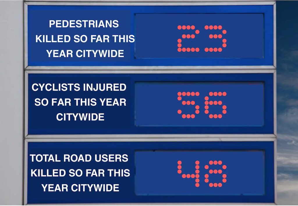
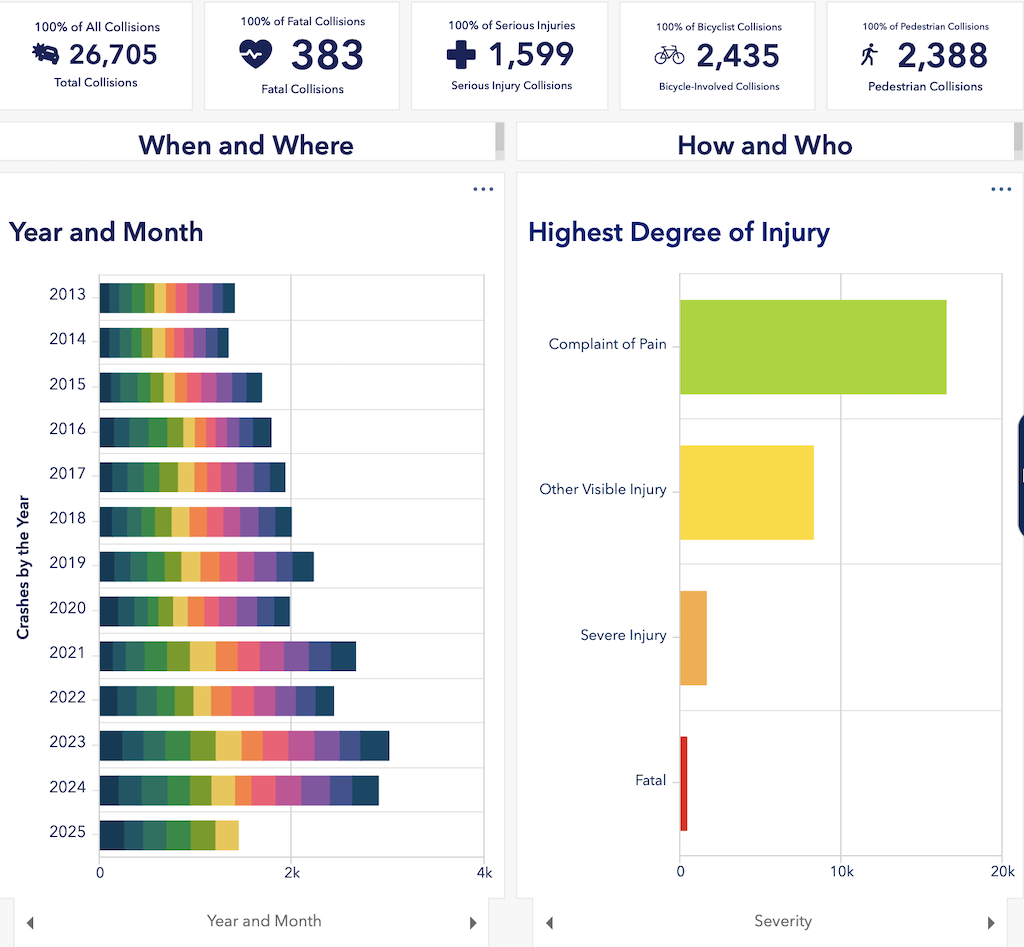
The first image below is from the Streetsblog article. But the City of Sacramento Vision Zero program does, to its credit, have a Crash Dashboard, graphic following.
graphic from Streetsblog USACity of Sacramento Vision Zero Crash Dashboard
The website for Safer Sac Streets (Sacramento Safe Streets and Affordable Transit Measure of 2026) is now up. The website includes the full text of the measure. It has links to donate, get involved, and endorse.
The measure is a citizen measure, developed by a variety of walking, bicycling and transit advocacy organizations and others, unlike the fake ‘citizen’ measure of 2022 which was a Trojan horse for sprawl developer interests, and failed spectacularly. As a citizen measure, it requires only 50% + 1 to pass. It is also limited to the City of Sacramento, which has been strongly supportive of transportation and transit funding in past measures.
Signature gathering will start as soon as the city clerk signs off and assigns a letter, very soon. The measure will require about 31,000 signatures. Though some funds are available to signature gathering, most will be done by advocates, which is good since they will know more about the measure and local needs and perspectives, unlike the signature gatherers at grocery stores and farmers markets who often know nothing about the measures and propositions they are gathering signatures for.
The campaign kickoff will occur Sunday, March 15 at 1:00 PM, New Helvetia Brewing Company, 1730 Broadway, Sacramento.
Getting Around Sacramento will have more posts about the measure.
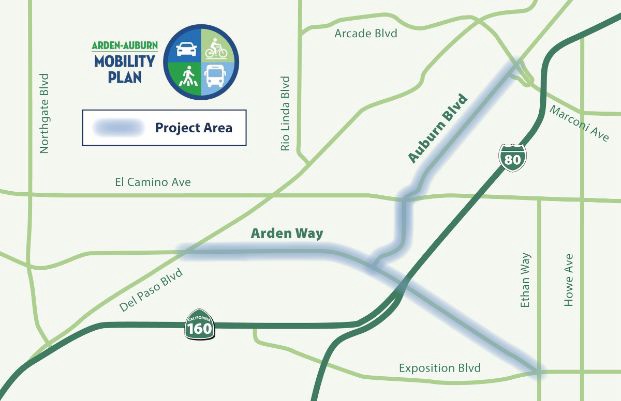
Yet another City of Sacramento planning project, Reconnecting Old North Sacramento. This one is in early stages, no outreach or survey yet, but there is an email signup.
This is not a Vision Zero project, rather a project to addressed past neglect of this community.
A community workshop will be held March 11, details on the webpage, including an optional Eventbrite registration. There will also be a survey and pop-up workshops. You can also sign up for email updates.
These two roadway segments are on the city’s Vision Zero High Injury Network, so attention is appropriate.
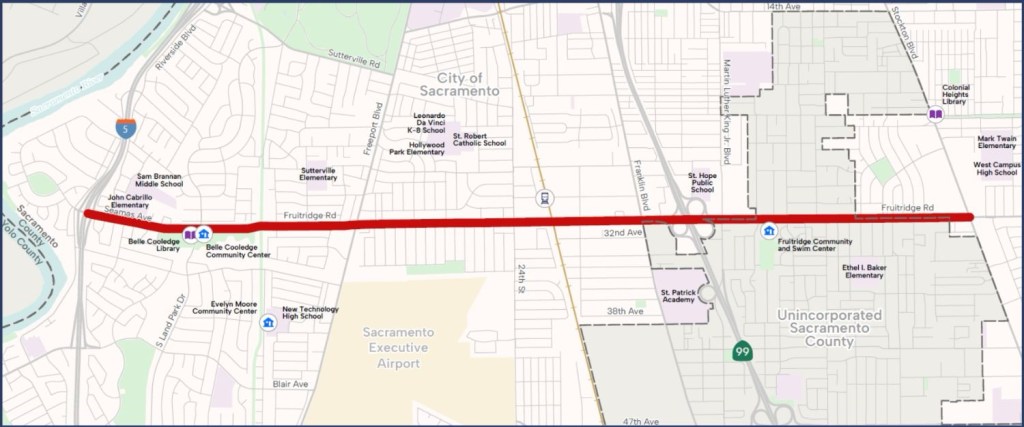
A community workshop will be held March 4. See the webpage for details. There is an Eventbrite registration link, though you do not need to register to attend.
You can also sign up for email updates.
Fruitridge is on the city’s Vision Zero High Injury Network, so attention is appropriate.
The City of Sacramento has announced that it will be enforcing the state intersection daylighting law, AB 413 (Lee, 2024), starting today. Tickets will be $25.
Higher income people will of course just see this as the cost of parking, and won’t care. An open spot at every corner, only $25? Yes! With the new parking rates, a person could park in a daylighted space for 8 hours for less than the cost of a metered space.
Daylighting increases safety for people walking by providing increased visibility between drivers and walkers crossing the street. As with all crosswalk laws, it applies whether the crosswalk is marked (painted) or not.
I’m a little cynical about this. Over the years, I have reported about 60 violations of drivers parked ON the crosswalk. Once, the driver was cited. Often I would wait to see if parking enforcement officers would show up, and what they would do. Sometimes, the vehicle was gone. Often, the vehicle was still there, but the 311 report closed without action. Sometimes, it was closed without the officer even showing up.
Traditionally, parking enforcement has only been concerned about drivers overstaying time at parking meters.
Administration of the parking and parking enforcement program has changed, so perhaps the city is serious about enforcing daylighting. Time will tell.