I’m traveling on a Amtrak Rail Pass, three weeks from Sacramento to the east coast, and back. So far I’m mostly been in Boston and the Boston region of Massachusetts.
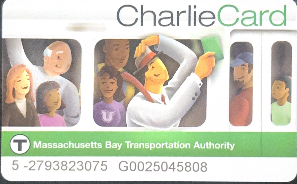
The transit agency is MBTA, Massachusetts Bay Transportation Authority. If you are as old as I am, you will probably remember the Kingston Trio version of “M.T.A.” where Charlie couldn’t get off the train because he didn’t have the exit fare: “Did he ever return? No he never returned, And his fate is still unlearn’d, He may ride forever ‘neath the streets of Boston, He’s the man who never returned.” MTA is now MBTA, but Charlie lives on through the CharlieCard, a fare payment card. Knowing I was going to Boston, I applied for a senior CharlieCard, which provides half off subway, light rail, and bus trips. The system is in transition, so the card is only proof of senior qualification, and fares can’t be added. Yet. But MBTA is one of the major transit systems that have implemented contactless fare payment, and also provides registration for contactless credit cards, so I could use my registered credit card to get the senior fare, $1.10 instead of $2.40.
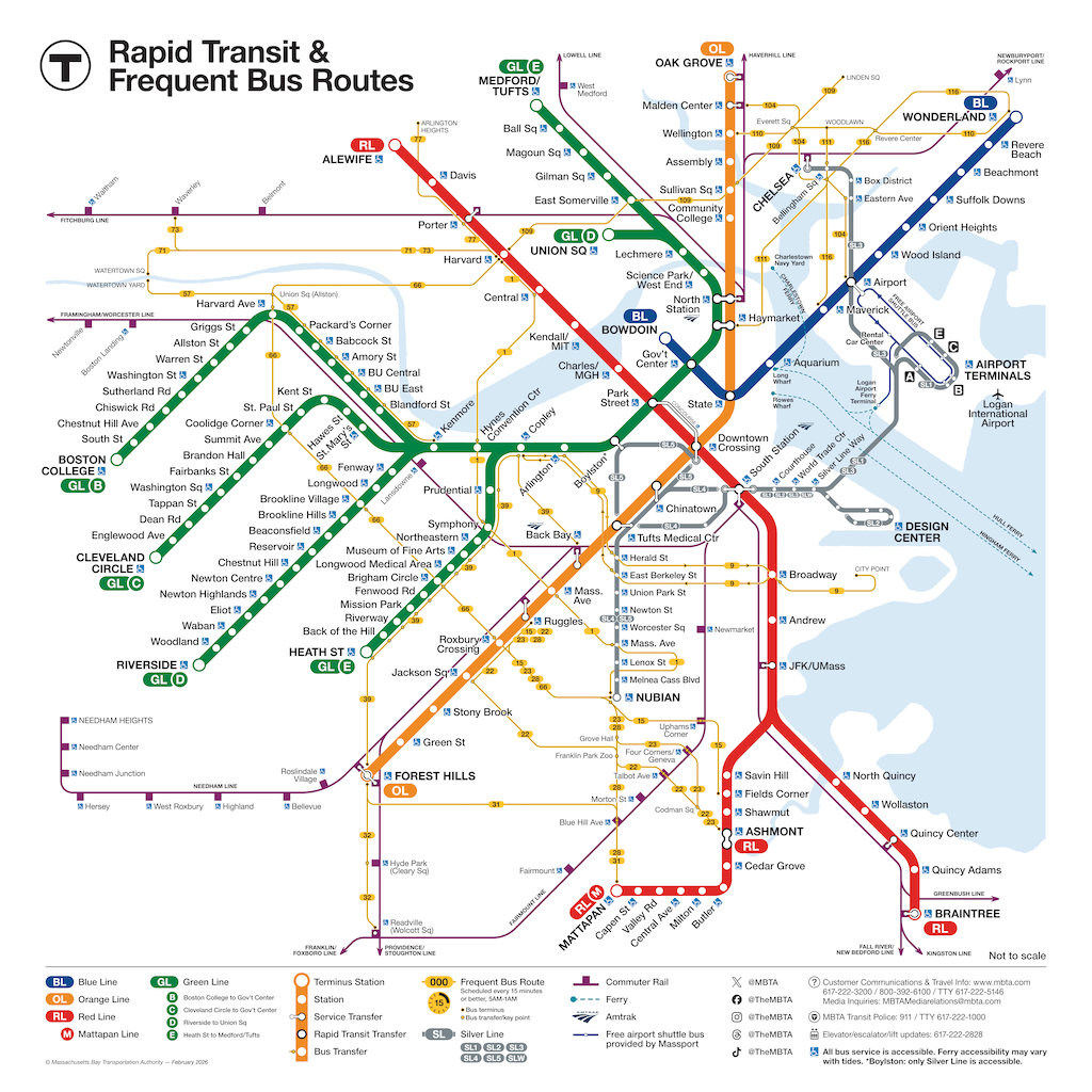
The MBTA Commuter Rail lines, which go to distant suburbs, and even as far as Providence in Rhode Island, use the mTransit app, but I also get half off on that with the RTA senior card. I look the Framingham/Worcester line to Southborough, and then a local bus to Marlboro, to attend the New England Folk Festival (NEFFA). The train I took was an ancient single level train, with very worn seats, though I can’t pin down how old. There are also newer bi-level cars on the route. Both the bus and commuter rail have a much less frequent and less span of service on Sunday, so I caught a ride back into the Boston area and took the Red Line subway back to my hostel (which is only five blocks away from the Red Line).
I also used the Green Line light rail (which is underground in the central city) to get to the Museum of Fine Arts (MFA) and other destinations. This is the original but still existing service, and the cars are noisy and rickety, though much better than when I last rode about 30 years ago. The Green Line was also very close to my hostel, about two block to the Boylston Station at Boston Commons. I did not have occasion to ride the Orange Line or Blue Line subways. These apparently have nearly modern subway cars. There is also a BRT line that serves the airport and downtown, which I have not used.
The City of Boston is about 676,000 population over 48 square miles (14,000/square mile), in a MSA (Metropolitan Statistical Area) of 4.9 million over 49 square miles. For comparison, City of Sacramento is about 525,000 over 100 square miles (5,250/square mile), in an MSA of 2.5 million over an MSA of 21,500 square miles. Though the population of the two areas is not dissimilar, Sacramento has a primitive transit system while Boston has a world-class (for the US) system. Why? Density, density, density. Boston is three times more dense that Sacramento.
Of course transit in Boston started in 1834, and subway service in 1897. Sacramento didn’t even exist in 1834. In 1897, Sacramento had a population of about 30,000. Sacramento is a wet-under-the-collar cow town.
If Sacramento had developed as a dense urban place instead of a sprawl city, it could have had a transit system like Boston, below.
Boston has busy arterials, just like Sacramento. But off the arterials, there is very little car traffic. People get around on transit. About 1/4 of workers (which does not include people too old or too young to drive) are car-free in Boston, and even those that have motor vehicles do not use them on a continuous basis like many in Sacramento.
Yeh, that classic excuse of, well, Sacramento is not Boston. No, but it could have been. It could have been a real city, a ‘world-class city’.