Stockton Blvd workshop

Prior posts on this project, and previous permutations, are available at category: StocktonBlvd.

The City of Sacramento (and partners SacRT and Sacramento County are hosting a public workshop on Thursday, April 15, on the Stockton Blvd Safety and Transit Enhancement Project (STEP). The workshop will start 5:30 PM at the Oak Park Community Center, 3425 Martin Luther King Junior Boulevard, Sacramento, CA 95817. Registration is available (Eventbrite) but not required.

There will probably be a slide presentation, and display boards showing in some detail aspects of the project. These workshops offer the public sticky notes that can be placed on the display boards, and comment cards. If you’d like to see these ahead of time to ponder, or to visit specific sites, tough luck. The city doesn’t do that.

Though the project is about the entire SacRT Route 51, the highest ridership of the system and one of only a few high-frequency (15 minute) routes, the roadway changes would almost entirely be on Stockton Blvd.

The project has three main aspects:

  • Create a transit priority street for Stockton Blvd between Florin Road and Broadway, or perhaps T Street. This will be a bus rapid transit (BRT)-light facility, with dedicated bus lanes (red) in part, and improved bus stops.
  • Add bike lanes, usually buffered but not separated, to Stockton Blvd.
  • Add and improve pedestrian crossings of Stockton Blvd, which current has few safe crossings.

Two bus route alignments are being considered, the existing Route 51, and an alternative 2 that would continue on Stockton north of Broadway to T Street, thereby serving Aggie Square/UC Davis Medical Center.

What the project neglects is:

  • Wider sidewalks. These should be a minimum of 8 feet. Existing sidewalks are often 4 to 6 feet, and are curb-attached, immediately adjacent to motor vehicle danger.
  • Trees, and the wide sidewalk buffers (8 feet minimum) necessary to host healthy trees without root heaves that buckle sidewalks over time.

Though the project benefits include “More inviting public spaces with improved lighting and landscaping”, there are so far no details on what that means. Lighting is often ‘motor vehicle scale’ on tall standards and illuminating the roadway, not ‘pedestrian scale’ and illuminating the sidewalk for safety and aesthetics. Though there are a few locations in Sacramento with pedestrian scale lighting, these were installed by developers long ago when people walking were considered more important than people driving.

What are your thoughts? Concerns? Ideas? If you aren’t able to make the workshop, there is also a survey. The survey asks for your use and interest pattern, but is not intended to gather detailed feedback.

Stockton BRT and Broadway service

I previously wrote about the possible alternative 2 alignment of the Stockton BRT north of Broadway on Stockton, west to T Street and then on 29th/30th streets, and then on L/J streets to Sacramento Valley Station. The big advantage, and it is a big one, is that the BRT would then serve Aggie Square, and all the medical, office, and housing developments along Stockton between Broadway and T Street. Those developments already produce ridership on Route 38, and would in the future produce a large number of riders. However, as previously stated, this alternative is only workable and equitable if SacRT and the city commit to a high frequency route serving Broadway between Stockton Blvd and at least 19th Street. Though residential density drops off after 19th Street, the low-income housing of Alder Grove southwest of Broadway and Muir Way, and the developing area of The Mill southwest of Broadway and 5th Street (which is beyond the current route) should have service. How a replacement route would navigate to downtown is a decision for SacRT planners.

SacRT provided the heat map below of boardings along the existing Route 51. The two highest locations are 19th St/21st St, which is not surprising since this is a transfer point for Blue Line Light Rail at the Broadway Station, and Florin Towne Centre Transit Center at the south end of the route. This high point surprises me since when I’ve been on Route 51, there are few riders south of Fruitridge Rd, but there must be patterns that I’ve not observed. Other clusters are at J Street and N Street, which are most likely state workers and support workers, at Alhambra, at Broadway and Stockton, and on Stockton in the vicinity of 21st Avenue.

map of Route 51 ridership heatmap
Route 51 ridership heatmap (from SacRT)

SacRT also provided weekday ridership data (xlsx). Out of a total weekday ridership of 4787, stops in downtown and along Broadway have a total ridership of 2638 (about 55%), along Stockton 1890 (about 39%), and at Stockton & Broadway 260 (about 1%). Clearly, Broadway and downtown stops along the existing Route 51 are critical to riders, even more so than Stockton Blvd. Therefore, bus service along Broadway must be maintained as frequent service, 15 minutes or better, if a new alignment for BRT is implemented.

No high frequency service on Broadway, no alternative route 2. Period.

Stockton BRT alternative alignment

For additional posts on Stockton Blvd, both the current STEP project and earlier iterations, see category: StocktonBlvd.

Part of the Stockton Boulevard Safety and Transit Enhancement Project (STEP) is consideration of changing the BRT (bus rapid transit) route north of Broadway to part of SacRT Route 38. In a presentation at the STEP stakeholder meeting on February 19, and in the similar presentation to SacATC on March 12, this alternative was presented by a slide (page 7) and additional discussion. That slide is below, followed by a slightly more detailed Alternative 2 – Route 51/38 Hybrid Alignment.

STEP BRT Route Alternatives, from SacATC presentation
STEP Alternative 2 Route 51/38 Hybrid Alignment

At SacATC, Commissioner David Moore raised the issue that the existing Route 51 along Broadway is also a very high ridership corridor, serving to connect equity neighborhoods to downtown and to Stockton. Replacing Route 51 high-frequency (15 minute) service with a moderate-frequency (30 minute) route, as Route 38 currently is, would be a disservice to these riders and raise major equity issues.

The segment of Broadway from Stockton Blvd to 8th/9th Streets, and probably into downtown, MUST have high-frequency (15 minute) service.

The two existing routes, 51 with a high-frequency (in SacRT terms, though this would be considered moderate frequency in major cities), and 38 with a moderate-frequency, are shown below (pdf).

map of SacRT Routes 51 and 38 existing
SacRT Routes 51 and 38 existing

Though it is not stated anywhere, the STEP alternative 2 map implies that the BRT route would end at Sacramento Valley Station rather than 8th St & F St as Route 51 currently does.

The western part of Route 38, which would become Stockton BRT under the alternative 2 51-38 hybrid, follows Stockton from Broadway north to T Street, then northbound on 30th Street or southbound on 29th Street, then west on L Street or east on J Street, and thence to Sacramento Valley Station.

map of SacRT Route 38 west segment, potential Stockton BRT
SacRT Route 38 west segment, potential Stockton BRT

The west portion of the existing Route 51, from Stockton Blvd to 8th/9th Streets, is the segment that must have high-frequency (15 minute) to continue to serve the present high ridership. It is possible that this route would terminate at Sacramento Valley Station as well. It is unknown whether ridership on the existing Route 38 to the east, terminating at 65th Street light rail station, would also justify high-frequency service, and whether it this would be combined with existing Route 51 west. Map below (pdf).

map of SacRT Route 51, west segment, from Stockton Blvd to downtown
SacRT Route 51, west segment, from Stockton Blvd to downtown

SacATC 2026-03-12

SacBee 2026-03-11, Madison Smalstig: What changes could come to Sacramento’s dangerous Fruitridge Road corridor?

The City of Sacramento Active Transportation Commission (SacATC) will meet this Thursday, March 12, starting at 5:30 PM. This is not the usual third Thursday, but the second. The meeting may be held in the old city hall, rather than council chambers, but the agenda is not clear about that.

The agenda is below (pdf). I have not had a chance to look at the four agenda items to make comments here, but will if I am able. The linked items contain both staff reports and presentations. I find it useful to separate these into two documents, but again, only if I have the time. All of these are review and comment items, not for decision.

I have written about Stockton Boulevard Safety and Transit Enhancement Project (STEP) previously, but am not sure if the presentation will be the same as the stakeholder workshop.


Agenda

  1. Fruitridge Road Safety and Mobility Plan: staff report | presentation
  2. Arden-Auburn Mobility Plan: staff report | presentation
  3. Stockton Boulevard Safety and Transit Enhancement Project: staff report | presentation
  4. T Street Bikeway Gap Closure Project: staff report | presentation
graphic of Fruitridge Rd collisions
Fruitridge Rd collisions

Stockton Boulevard Safety and Transit Enhancement Project (STEP)

And yet another City of Sacramento planning effort, the Stockton Boulevard Safety and Transit Enhancement Project. This is a Vision Zero project. Two segments are on the Vision Zero High Injury Network Top 5, Broadway and Stockton (Broadway between Martin Luther King Blvd and Stockton Blvd, and Stockton Blvd between Broadway and 13th Street), and Stockton Blvd South (Stockton between 65th Street and 37th Avenue). However, the project includes the entire route of SacRT 51, from downtown, along 8th and 9th Streets, Broadway, and Stockton as far as Florin Road. It is also a transit project, to enhance bus service along the Stockton part of Route 51, in particular.

Stockton has long been a focus for the city, and county, with many plans developed but none implemented. The current effort is a revision of those efforts to emphasize a potential Bus Rapid Transit (BRT) service along Stockton Blvd, and perhaps some enhancements to the other sections.

A community workshop was held this week at the Southgate Library, with city staff, consultants, and county staff present. Some issues that came up during the workshop include:

  • ridership on bus 51 drops off sharply south of Fruitridge Road, so investment should be focused on the section of Stockton between Broadway and Fruitridge; the nature of the neighborhoods north and south of Fruitridge are quite different, with south being significantly more car-dominated, and so less likely to generate ridership
  • sloped driveway ramps, common along Stockton, must be repaired so that they are compliant with PROWAG; provision of sidewalk buffers which contain the sloped driveways are the optimal solution
  • earlier outreach for Stockton, and every project the city has planned, surfaced a strong community desire for more street trees; healthy street trees need wide sidewalk buffers (the city calls them planting strips) of 8 feet; tiny sidewalk buffers lead to unhealthy trees and root heaves of the sidewalks
  • additional housing going in right now on Stockton, particularly around 8th to 10th Avenues, will generate a lot of walking, and the sidewalks there need to be improved and widened, not in the future, but now
  • several of the design concepts show a center turn lane throughout the project; in most sections, these are a waste of valuable roadway right-of-way; instead, left turn pockets should be provided where clearly needed
  • businesses have concerns about unhoused people using bus shelters and shelter, and crossing Stockton at random places
  • though rail is not being proposed for Stockton, the BRT design should not preclude rail being added at a later time as adjacent density and high ridership develop to justify an investment in rail

The project is also considering changing SacRT Route 51 so that it runs on Stockton from Broadway to Alhambra, and thence on surface streets to downtown. This section of Stockton has a narrower right-of-way, but it also hosts UC Davis Medical Center which could be a major generator of ridership for the bus. The existing Broadway Complete Streets project, and the additional segments from 24th Street to Stockton, have designs with a single general purpose lane in each direction and a center turn lane, which is not a good setting for BRT. The map below shows this option. If SacRT Route 51 was re-routed, there would need to be additional bus service along Broadway, since it is a high transit use corridor.

City and county staff, and consultants, seem to be supportive of a transformed Stockton Blvd, which will effectively serve transit riders, bicyclists, and walkers (and rollers). But there is likely to be pushback from the car-centric people who drive through on their way somewhere else, and who feel that time saving is more important than safety. It will take concerted effort to ensure a strong project.

map of Stockton Blvd Safety and Transit Enhancement Project (STEP)

Stockton Blvd Plan to Planning and Design

The City of Sacramento Planning and Design Commission is holding a hearing on the Stockton Blvd Plan this Thursday, October 10, 5:30 PM. It is item 3 on the overall agenda.

The Stockton Blvd Plan is largely about development and necessary utility infrastructure along the corridor between Alhambra Blvd and 65th Street. I am making documents available here. Note that two of these are huge. I’ve downsampled them a bit, but if something you wish to see is fuzzy, you will have to go back to the original documents on the city website, Upcoming Meeting Materials.

I do not have time to look at these documents, but I’m posting them in the hopes that someone will. Though I use Stockton Blvd a few times a year, I don’t spend enough time there to have useful comments from a community perspective.

The Stockton Blvd Plan is NOT about transportation, which is addressed by a separate Stockton Blvd Corridor Plan. In fact, the Stockton Blvd Plan EIR refers all transportation related comments to this document. This plan was a draft in 2021 (Stockton Blvd Corridor Study, Stockton Blvd needs trees, Stockton Blvd draft available). The related project page has disappeared from the city’s website, and the draft plan is quite hard to find (which is why I’ve linked to my copy). The city and SacRT came to an agreement to consider Stockton Blvd for bus rapid transit (BRT), or something approaching that, rather than the weak tea attention to transit in this draft plan. However, there doesn’t seem to be any trace of that project on the city website. SacRT has a webpage about the project: Ride the Future: Sacramento’s Bus Rapid Transit Solution, but there are few details and no timeline.

cover of Stockton Blvd Plan

SMART hosts Stockton Blvd envisioning

SMART (Sacramento Metro Advocates for Rail and Transit) is hosting Envisioning Our Transportation Future: The Renaissance of Stockton Blvd, on September 27, 2023, 5:30 to 7:00PM. Tickets are free (but not unlimited) via Eventbrite. Check the registration page for more information about the event and the panelists.

From the registration page: “Join us for a transformative panel discussion on shaping a sustainable and prosperous future for Stockton Boulevard. This historic corridor, linking East and South Sacramento, is on the brink of unprecedented growth — but its potential is constrained by outdated transportation infrastructure.”

I encourage you to participate, whether you live or work along Stockton, or are just interested in the evolving community needs of one of the most dis-invested neighborhoods in Sacramento (and Sacramento County – significant part of the roadway are in the county).

The City of Sacramento came up with a tepid Stockton Blvd Corridor Plan in 2021, putting bandaids on the road to try to increase safety, but unwilling to really reduce motor vehicle throughput or speeds. The city has recognized that the plan did not and does not meet the evolving needs of the area and is now proposing a BRT (bus rapid transit) route along much of Stockton. The details of that upgrade are not available. The Stockton Blvd Plan, Community Working Version (draft) from 2022 treats the larger area around Stockton Blvd and all aspects of the built and cultural environment.

SMART graphic for Envisioning Our Transportation Future

lower speed limits on complete streets in Sac

The eternal argument on speed limits has resurfaced on Twitter. The binary solution is: a) lower speed limits, or b) redesign roadways. This is a false dichotomy, to which I answer yes! Ultimately, the solution is to redesign roads (and motor vehicles) so as to physically enforce posted speed limits. But in the meanwhile, speed limits that are posted too high for urban areas (and with speeds that alway exceed that, because the road was designed for a higher speed than is posted) should be reduced.

There are two types of speed: posted speed, on the speed limit sign, and design speed, the speed that the road was designed for. Design speeds have traditionally been much higher than posted speeds, at least 10 mph higher, and often more, because the traffic engineer’s value system says that we must always protect drivers from their errors by providing a road that is safer at higher speeds. This is highway design thinking, applied to city streets, and is always inappropriate outside freeways and rural roads (and maybe even there). Protecting other users of the road (walkers and bicyclists) does not traditionally figure into this at all.

As a starting point, local or residential streets should be 20 mph maximum, collector streets 30 mph maximum, and arterial streets 40 mph maximum. These are maximums, more than is appropriate for many roads. 40 mph may never be appropriate in an urban area. Of course most arterial streets are stroads, roads designed for higher speeds but then knee-capped my multiple driveways and intersections. These roads should never have been built that way, or allowed to evolve that way, and must be radically changed.

Existing posted speed limits for the city are available.

It should be noted that most research indicates that the majority of fatality and severe injury crashes are caused by people egregiously exceeding speed limits, by 10 mph or more. It is not unusual for speed surveys, and the rare law enforcement, to record a few drivers exceeding freeways speeds on surface streets. Roadway design, along with lower speed limits, probably does little to change the behavior of egregious speeders, and those are better addressed through automated enforcement.

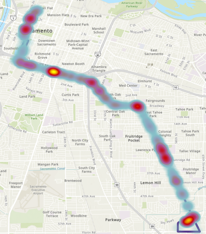
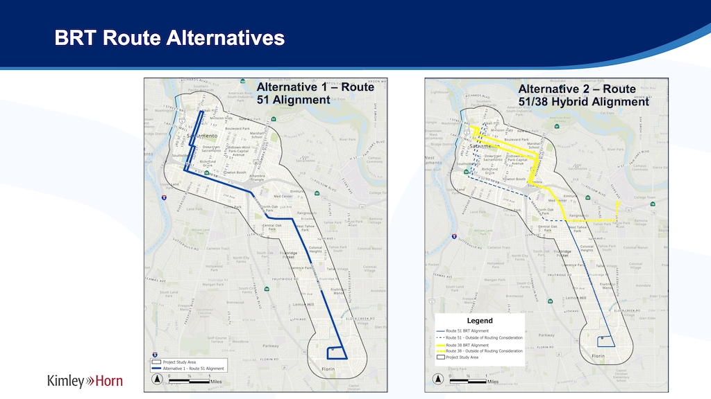
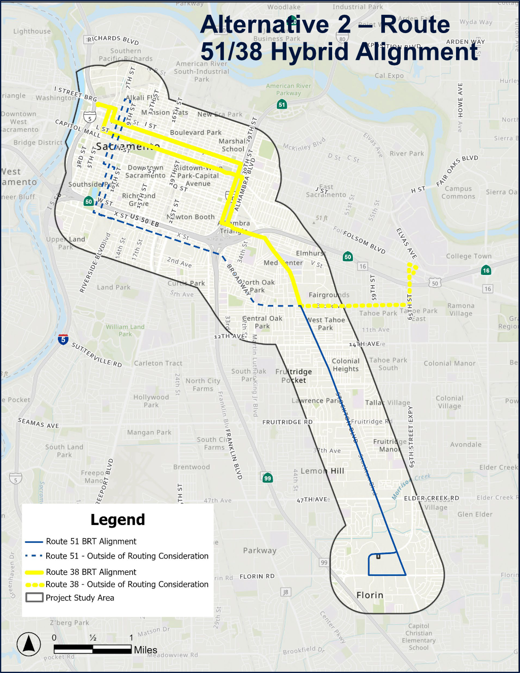
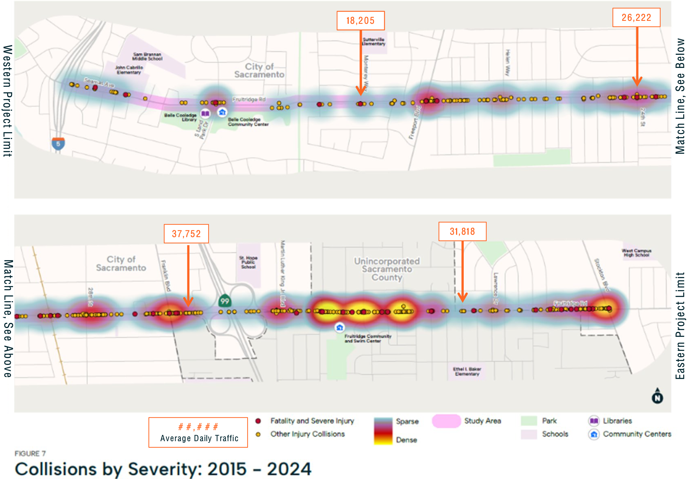
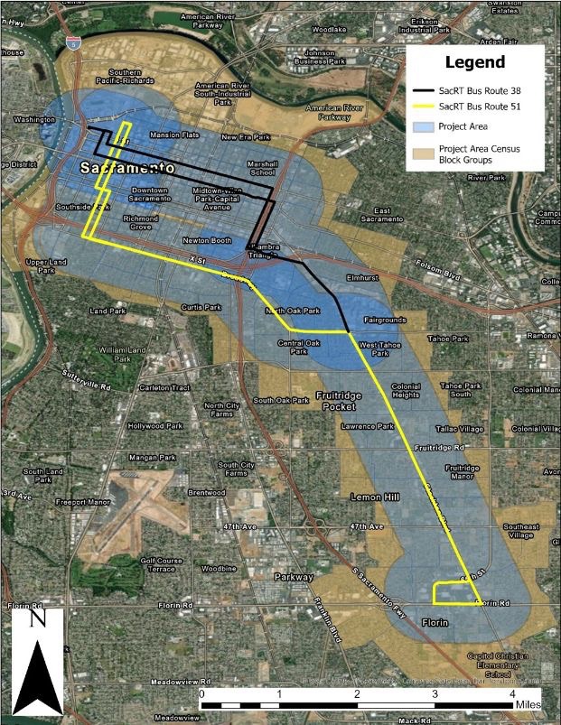
The City of Sacramento has a number of complete streets or road reconstruction projects underway or planned. Two significant ones are Northgate Blvd and Stockton Blvd. Stockton is on the city’s high injury corridor Vision Zero plan, Northgate is not.
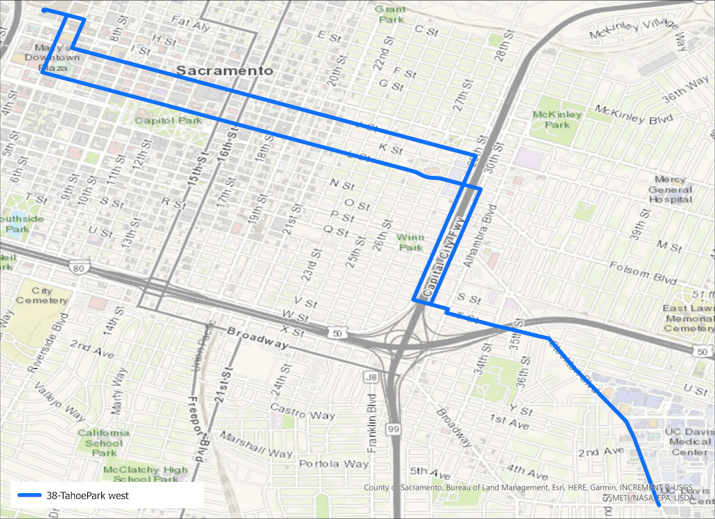
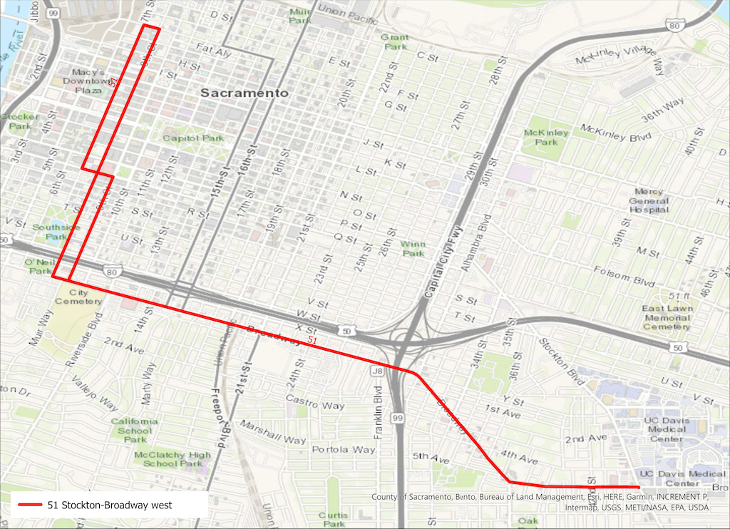
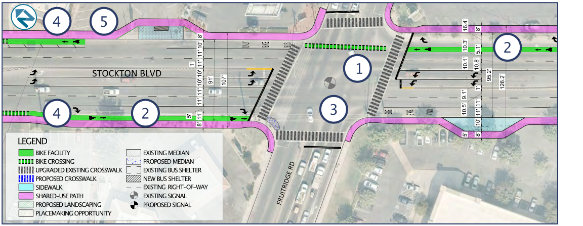
Stockton Blvd

The city has been through several cycles of planning for Broadway and Stockton Blvd. The current plan is the Stockton Blvd Plan – Community Working Version. Though public concerns about motor vehicle speed have been a recurring theme, the city plans to address this by reducing travel lanes and planting trees. They do not intend to reduce the posted speed limit. In fact, speed limit is hardly mentioned in any of the documents. In fact, design speed is never mentioned. The city is pretending that posted speed limits have nothing to do with roadway design. The city is not willing to share with the public its intended design speeds.

The posted speed limits on Broadway and Stockton are 35 mph and, south of Lemon Hill, 40 mph. Broadway and Stockton are ‘other principal arterial’ in the state functional classification system, one step below freeway. And much of Stockton’s current design is very freeway-like. Given the intensity of uses along both Broadway and Stockton, posted speed limits of 30 mph would be appropriate. Instead, the city intends to maintain 35 mph and 40 mph for the redesigned road. This will ensure that they remain stroads rather than streets.

Northgate Blvd

Northgate Blvd is not on the city’s high injury corridor Vision Zero Plan, but was identified because it is a road with intensive local use in a disinvested community. The planning effort for Northgate is in an earlier stage. An existing conditions report, appendices, and initial community outreach are available. These reports document that posted speeds are mostly 40 mph, with a small section 45 mph. Recorded speeds are not that far off from posted speeds. but then again, the 40 mph speed is above what one would normally find in an urban area. Northgate is a ‘other principal arterial’, one step below a freeway. Parts of Northgate are have freeway-like designs, but most of it is more like a simple stroad.

Though public concerns about motor vehicle speed have been a recurring theme, the city plans to address this by narrowing travel lanes and planting trees. I participated in the initial workshop on Northgate, and I and others asked whether the posted speed limit would be reduced. The answer was no. But it is early enough in the planning process that this could be changed by public pressure. Another online workshop was scheduled for yesterday (I was unable to participate), and an in-person open house will be October 22 (Saturday, October 22 from 11:30am-1:30pm at Garden Valley Elementary School).

The city’s standard answer to questions about reducing speed limits is that they cannot be changed, because of the 85% rule (not a law, but guidance by Caltrans and courts), but this is incorrect. When a street is reconstructed, whether complete streets or other, the city can design for and set whatever speed limit it wants. It is as though a new street is being constructed. But the city doesn’t want to see it that way.

I think to redesign a road without seriously considering a reduction of the posted speed limit, as well as the design speed, is throwing money down the toilet. These projects will probably be in place for 30 years. 30 years of less than ideal design, 30 years of less than a fully functional and livable street, 30 years of failure to take climate change seriously, 30 years of unnecessarily high fatalities and severe injuries.

Background

Research on the effects of reducing posted speed limits are mixed. Some have indicated a significant impact, particularly at the higher end of the speed range (over 35 mph), and others indicating no significant change. Though even one life saved by a lower posted speed limit is worthwhile to me, it also points out that the ultimate solution to speeding is not just posted speed limits, or enforcement of those, but also roadway redesign. As I said, both!

Law enforcement of speed limits has been well documented as a tool of harassment and oppression of people of color and low income, so I am not in favor of in-person enforcement. Automated enforcement can easily manage speeds and particularly egregious speeders.

Streetsblog: Vision Zero Cities: How to Fix Our Most Dangerous Roads

Streetsblog: STUDY: 20 Is Plenty — But Signs Alone Don’t Always Get Drivers to Slow Down

Caltrans Setting Speed Limits

NACTO City Limits: Setting Safe Speed Limits on Urban Streets

Stockton Blvd Corridor Plan review

I have finally gotten to reviewing the Stockton Blvd Corridor Plan, following my post noticing the draft plan: Stockton Blvd draft available.

Overall, the plan is great, and when someday implemented, will result in a much safer and livable Stockton Blvd. The plan addresses major concerns raised by the community, including safer and more frequent crossings, better lighting, more trees, more effective transit service, and others. However…

  • The plan is still too oriented to the throughput of motor vehicle traffic. Better, but not as good as it could be. Maintaining the five lane configuration for significant parts of the corridor is unnecessary.
  • The plan does not even mention speed limits. When any street is reconfigured/reallocated, it removes any obligation to the unsafe and outmoded 85% rule, so the city should have considered speed limit changes for the corridor.
  • The plan recommends two-way cycle tracks in some locations. These are great for traveling along, but the problem comes in transitioning into and out of them at the beginning and end. Unless very clear guidance and priority is provided, these transitions can be very unsafe, particularly for less experienced bicyclists. In most cases, a bicycle signal head with exclusive bicyclist phase is required at beginning and end.
  • The plan acknowledges the challenging intersection of Stockton Blvd/34th Street/R Street as a “unique challenge” (page 13), but doesn’t even suggest solutions. I believe that the only way to make this intersection safe is to either restrict R Street or 34th Street, or to construct a flyover for light rail, similar to that for 19th Street, Watt Ave, and Sunrise Blvd. Yes, the expense of any of these might be beyond the scope of this plan, but eliminating this issue from the plan makes it difficult to compare the relative cost and benefit of other solutions.
  • On page 36, a diagram shows a bike lane eastbound on T Street to the right of a dedicated right hand turn lane. Bike lanes should never be to the right of dedicated turn lanes unless there is a bicycle signal head to create an exclusive bicyclist phase, which the plan does not propose. This must be fixed.
  • Shared bus and bike lanes will be a new concept for the city, and region. I support the implementation of these, and have used them in several other cities where transit frequency is not high. But they should be considered a pilot. If they don’t work out for bicyclists, and bus drivers, in this region, how do we fix it?
  • The flared intersection at Stockton Blvd and Fruitridge Road is preserved in the plan, but this is completely inappropriate. Flared intersections are always more dangerous for people crossing the street. The roadway width at the intersection, shown on page 41, is 90 feet. Crossings of this length cannot be safe, no matter what the length of the pedestrian cycle, without a pedestrian refuge median (with push buttons unless the pedestrian crossing is already on auto-recall). Double left hand turn lanes are dangerous for drivers and everyone else, as driver attention is focused on the vehicle beside, and not the roadway ahead, so these should be reduced to single left turn lanes. The right hand turns lanes should probably be eliminated, unless a traffic study shows conclusively that traffic would not clear during a signal cycle without them. The upshot is that this intersection should be completely reconfigured, not just tinkered with.
  • The plan does not indicate which intersection signals and signalized pedestrian crossings will be on auto-recall, or not. There is probably no justification for pedestrians activation buttons at any location on the corridor (pedestrian crossings should have auto-detection), but if there is, these should be called out clearly in the plan.
  • The plan shows most intersections as having skipped (dotted) green bike lanes striped through the intersection, but a few do not. They should be used everywhere. For the protected legs of partially protected intersections, the striping should be continuous rather than skipped (dotted). MUTCD frowns on this, but it has been installed many places with positive safety outcomes.
  • Added item: No right turn on red prohibitions should never be used without leading pedestrian intervals (LPI). Otherwise, drivers turning will immediately come into conflict with walkers in the crosswalk. I don’t think this is being proposed in this plan, but just want to make sure.

The City of Sacramento Active Transportation Commission will consider the plan this evening (2021-03-18). I apologize for not posting this in time for you to consider my suggestions, and relay them to the commission, if you agree.

Stockton Blvd & Fruitridge Road intersection

Added info: There was a discussion about the prioritization of different travel modes during the SacATC meeting this evening. It reminded me of one of my favorite graphics about transportation modes, from Chicago Department of Transportation. I think this is the right answer for Stockton Blvd, and for nearly every other roadway.