J St bikeway

The J Street separated bikeway has problems, as has been highlighted by Streets are Better and many others. Separated bikeways are also called protected bike lanes and cycle-tracks, but in California the official term is separate bikeways.

The City of Sacramento placed a separated bikeway on J Street from 19th Street to 29th Street as part of a repaving and roadway reallocation project called the J Street Safety Project in 2018. This was the second such project in Sacramento, the first being portions of P and Q Street downtown, but it was the first in the heavy retail, parking, and traffic environment of J Street.

The theory of these parking-protected bikeways is that the row of parked cars protects bicyclists from moving cars, and this is true in the length of the block (but not at intersections, which are a separate issue), when there are parked cars. But some times of day there are not parked cars, and throughout the day as cars come and go (particularly on a retail corridor), protection is lacking.

It is true that bikeways don’t need strong protection from PARKed cars, but they do need protection from PARKing cars and delivery vehicles, and bikeway intrusion.

Vertical delineators and pavement markings were used to set off the bikeway, with a sign at the beginning of each block segment showing the new allocation. These vertical delineators are also called bollards and soft-hit posts, with soft-hit meaning that they won’t damage cars when drivers hit them. The first photo below shows the 27th to 28th section. It initially had 14 delineators place, but only three are remaining. The other blocks have fared a little bit better, but overall about half the delineators are gone. The second photo shows the 25th to 26th section sign that has been run over by a driver.

J Street bikeway, 27th to 28th section, missing delineators
J Street bikeway, damaged sign

Some of the vertical delineators are being run over by people parking, some by delivery vehicles parking on top of them, and some by drivers going down the bikeway itself. And probably some just for sport. I don’t know which of these causes are most common.

There are several solutions:

One: Put the delineators closer together so as to make it more obvious that vehicles are not supposed to cross them.

Two: Add bollards which either are, or at least look to be, more substantial. The photo below is from a somewhat different setting in Oakland, with more substantial bollards. Reading blogs and Twitter, these seem to be successful in some cities and some settings, but not in others.

bollards in Oakland

Three: More substantial separators such as planter boxes.

planter separated diagram from C40

Four: Partial hard curbs or medians. The photo shows a median at the start of a bikeway section. It reduces the number of signs flattened by drivers and signals to drivers that there is something different about this block.
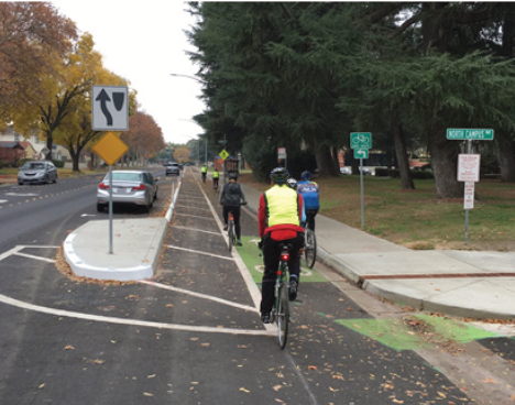
bikeway with hard median start, FresnoCOG

Five: Continuous hard physical curb or median. It is hard to find good photos of these, probably because in the past they haven’t been seen as necessary. There are a lot of photos of hard medians adjacent to moving traffic, and adjacent to two-way cycle-tracks, and alongside raised bike lanes that are at or close to sidewalk level. But the graphic below gives the general idea.

Of course hard curbs or medians are more expensive, but last 20-30 years whereas delineators or bollards may need to be replaced every year, so I think they are a good investment.

A major issue with all separate bikeways is the presence of driveways. In fact streets with a high density of driveways should not have this design. Below at the blocks of the bikeway, with information about driveways.

19th3 drivewayspartially separated; driveways not changeable
20th3 driveways2 changeable driveways
21st1 drivewaydriveway not changeable
22nd2 driveways2 changeable driveways
23rdno driveways
24th2 driveways1 maybe changeable
25thno driveways
26thno driveways
27thno driveways
28th2 drivewayspartially separated; 1 driveway changeable

The changeable driveways will be the topic of a separate post, but the basic idea is that parking lots that have access to the alleyway do not need access to the main street, so in this case, parking lots with access to Jazz Alley do not need access to J Street.

My recommendations

  1. Place hard medians at the beginning of each block, to protect the signs, and better signify to drivers this is a different place. For the locations where there are bus stops (19th, 22nd, 25th, 27th, 28th), the median would be moved down the block a bit. Note that this is too high a frequency of bus stops, but that is an issue for another post.
  2. Place more substantial bollards, and at a closer spacing.
  3. Place a continuous hard median on one of the four blocks without driveways, the same width at the painted buffers present now. This would be a pilot to test the installation, determine costs, and document benefits. If the pilot is successful, the other three blocks with no driveways should receive the same treatment.
  4. Start negotiation between the city and the owners of parcels that are used solely as parking lots, to close J Street driveways and use Jazz Alley access. Some of these parcels will be redeveloped into more productive uses anyway, but that may take longer than desired.
MUTCD sidewalk construction signs

A follow-on to my previous post MUTCD revision comments, and of relevance to all my construction zone posts.

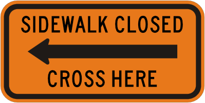
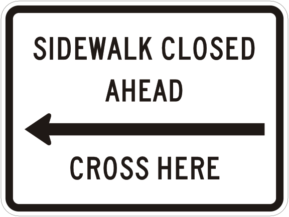
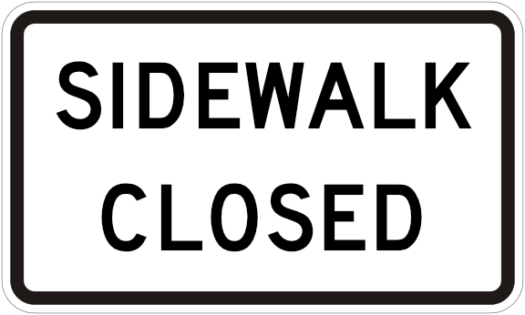
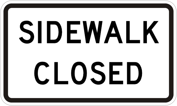
The MUTCD (Manual for Uniform Traffic Control Devices) is a bit confused (and a lot lacking) when it comes to signs for temporary traffic control devices. Orange is supposed to be the color for temporary traffic control devices, yet the manual uses regulatory (white) signs for sidewalks in construction zones. A white sign indicates permanence, an orange sign indicates temporary. That subtlety seems beyond the comprehension of the people who write the MUTCD, but I’m here to help them. Below are the pairs of signs for sidewalk closure in construction zones. On the left is the existing MUTCD sign, on the right is the sign as it should be.

R9-9 regulatory version
R9-9 TTC version
R9-11a regulatory version
R9-11a TTC version
R9-11 regulatory version
R9-11 TTC version

There might be situations in which the permanent, white regulatory sign might be appropriate, though the number of such situations is and should be rare. Sidewalks should be continuous, not broken, not closed.

Note that I did not include the R9-10 sign with arrows pointing both ways, since I can’t think of a context in which that would be the appropriate sign. Unless someone can, it should be removed from the MUTCD.

I have also suggested that all TTC signs be given a unique code, not M, not R, not W, but perhaps T.

J St construction zone bad to worse

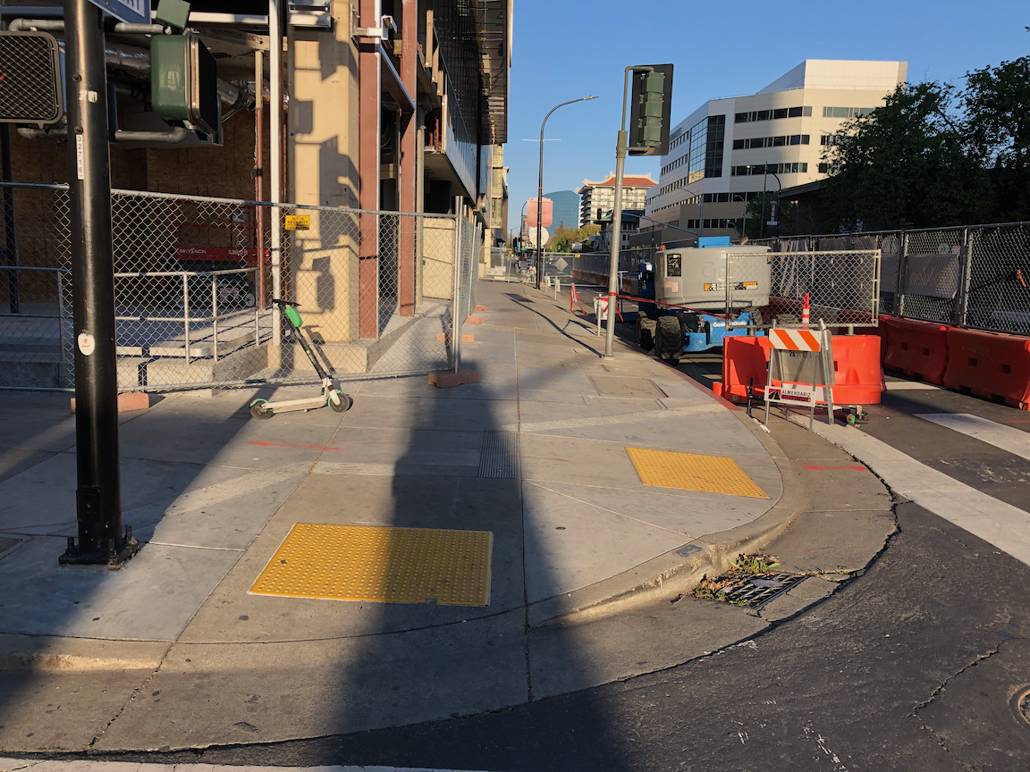
Though in most cases the construction zone signing and barriers improve after they are reported (first time, second time, third time…), sometimes they get worse. I had reported to the Sac311 system that there was no advance warning of the sidewalk closed ahead on the south side of J Street, westbound, at 7th Street. This the left hand photo below.

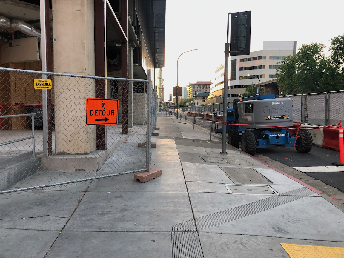
The ‘correction’ was to place an incorrect sign at the location, which is more confusing than the lack of a sign. I observed and listened for a while to people looking at this location. Every single one commented on the confusion. Does the detour sign point to a detour, or does it mean to cross the street? There were discussions and even arguments within couples and groups. The sign is the wrong sign, and it is placed in a very confusing manner, angled toward the sidewalk rather than perpendicular to it. The clear indication is to continue along the sidewalk if one wants to go west on J Street, but this is incorrect, as the sidewalk is closed a short distance away. This is the right hand photo.

7th St & J St sw, no advance signing
7th St & J St sw, wrong advance signing

The correct sign of course is this one, MUTCD R9-11 right, placed perpendicular to the path of travel along J Street. It could be argued that the sign should be orange rather than red, indicating a temporary traffic control (TTC) device, but at this time the MUTCD does not offer this sign in this color.

J Street needs construction bypass

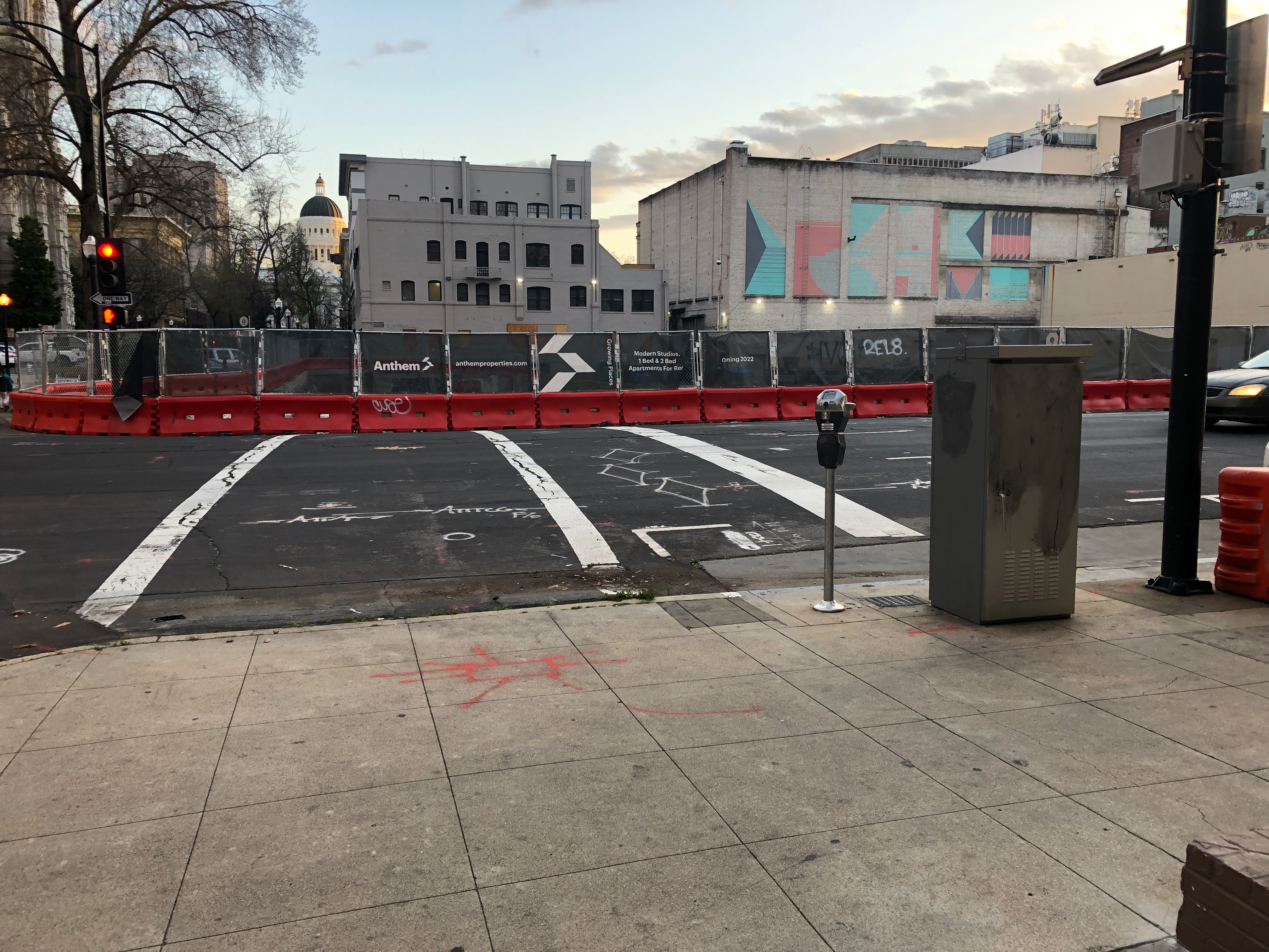
The future development, possibly to be called Anthem Cathedral Square, at J Street & 11th Street is currently a hole in the ground. The old buildings have been razed, and debris hauled away, but new construction has not started, so it will be some while before J Street on the north side of the site (south side of the street) returns to normal.

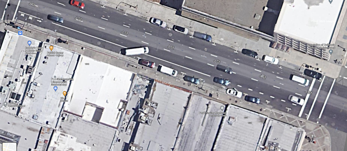
A channelized bypass should be created to carry the sidewalk for walkers and the bike lane for bicyclists past this construction site, between 10th St and 11th St, by removing a general purpose travel lane from J Street. The aerial below (before removal of the buildings) shows a sidewalk, a parking lane, a bicycle lane, three general purpose travel lanes, and a parking lane. The channelized bypass would include a shared pathway for walkers and bicyclists, in place of the right hand general purpose lane. The bypass can be created with use of orange construction barrier, as was done on 9th Street. This bypass would remain in place until construction is complete.

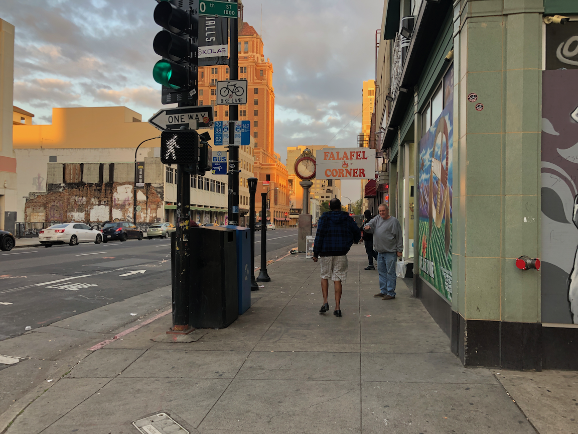
While the razing and cleanup was going on, there was decent signing, but it has disappeared or been moved to the side. The first set is the former signage at J St & 1oth St, and then today without an signage. There should be a sign here, the MUTCD R9-11; a barrier is not appropriate at this location since the closure is ahead and there are businesses open.

J St at 10th St se, signage
J St at 10th St se, no signage

At the sidewalk closure point, there is an acceptable barrier but no signage. At this point, it looks like there could be a bypass, but it is fenced off. The appropriate sign here is MUTCD R9-9.

J St past 10th St, sidewalk barrier

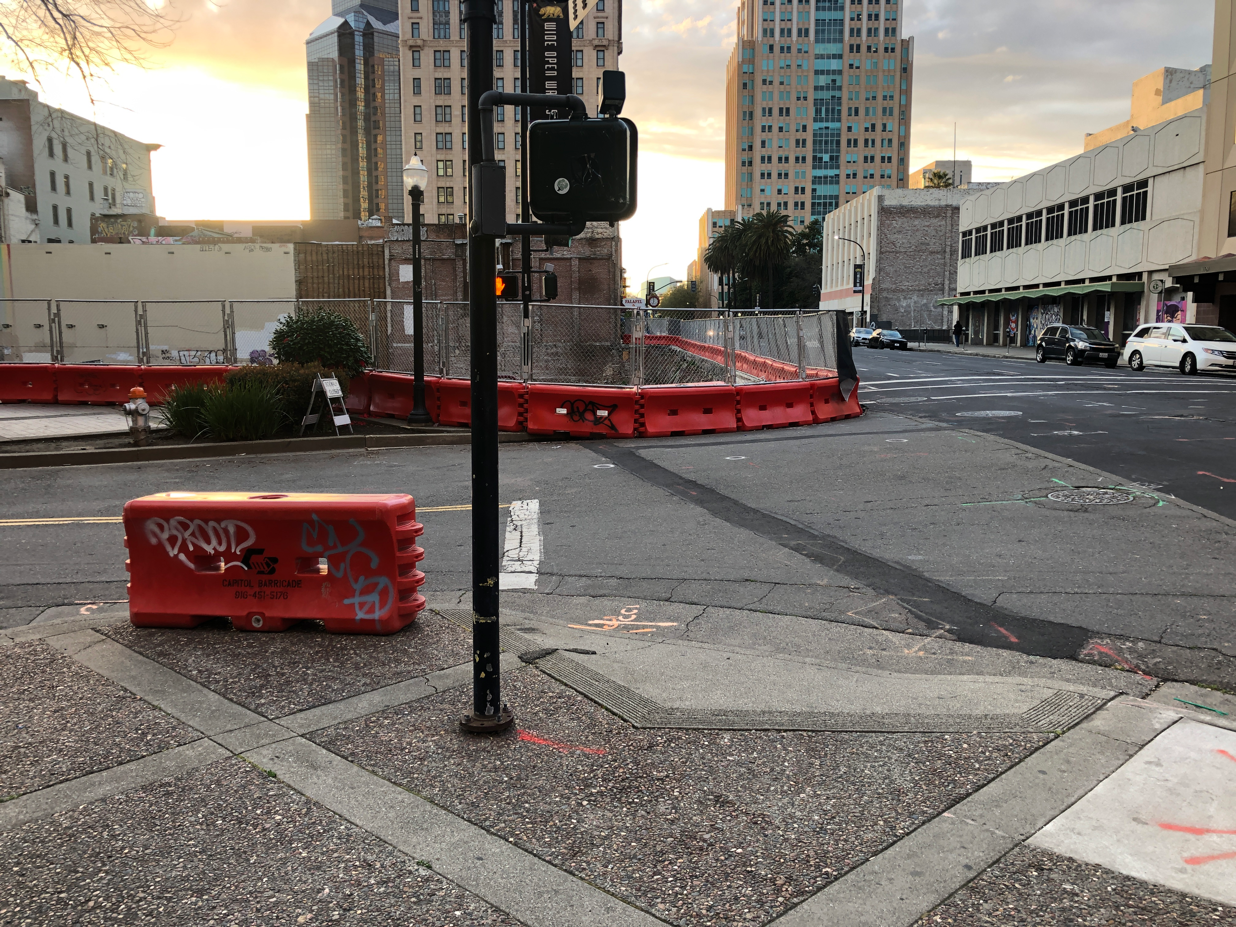
At J St & 11th St southeast corner, there was a barrier and signage, but the barrier has been moved to the side and the signage is gone. There should be a barrier and sign here to indicate that the crosswalk is closed. The third photo is an example of a correct barrier and signage.

11th St at J St se, signage
11th St at J St se, no signage
crosswalk closure barrier
correct barrier and signage

At J St & 11th St northwest corner, there should be a barrier and signing to indicate the crosswalk is closed, but neither is present.

J St & 11th St nw, no barrier or signage

This construction zone failure is one among many in Sacramento. The city is not creating traffic control plans that accommodate walkers and bicyclists, and the construction companies are not appropriately placing signs and barriers. This is a violation of the ADA (Americans with Disabilities Act). Responsibility for encroachment permits (when the construction project goes into the public right of way, which includes sidewalks), and traffic control plans to mitigate the situation, rests with the City of Sacramento Department of Public Works.

I have created a new category, construction zone, which will make is easier to find other posts on the construction zone topic. Photos of many construction zone locations are on Flicker in Sac construction-zone album.

9th St update

Things have changed again. The construction zone on the east side of 9th Street between K Street and L Street has changed again. The east parking lane and east travel lane are now dedicated to the construction project, the general purpose lane has been shifted right into the west parking lane, and the combined pedestrian/bicyclist bypass is now in what was the right hand general purpose lane.

One the plus side, detectable strips have been added to the left side of the bypass, which are required to provide protection from trip and crash hazards presented by the fence bases. Photo below.

detectable strips along bypass on 9th St

The entrance to the bypass is still awkward, too narrow and poorly signed. There are still corrections to be made.

entrance to pedestrian/bicyclist bypass on 9th St

Previous posts: 9th Street update, 9th St fixed, sort of, and 9th St blocked by construction.

curb ramps

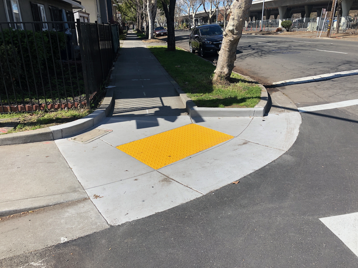
While walking in the central city today, I saw this brand new curb ramp on the southwest corner of X Street and 24th Street.

new curb ramp, southwest corner of X Street & 24th Street

Why, why, why, did the city put in a diagonal curb ramp when they should have put in a two perpendicular ramps? Though I’ve searched in vain through city documents looking to see what the criteria is for a single ramp per corner versus two ramps per corner, I have heard it said by city staff that the single ramps are for residential neighborhoods and the two ramps are for urban neighborhoods. This is definitely an urban neighborhood setting, with both 24th Street and X Street being arterials. Yet the city put in a single ramp. They call this a ‘single flare curb ramp’. What should have been installed here is a ‘standard curb ramp’. The city diagrams do not show exactly this situation, where there is a sidewalk buffer (planter strip) on X Street, with an attached sidewalk on 24th Street, but the diagram below is the closest to the situation.

If the city development code does not specify that single, diagonal ramps should be used only in purely residential situations (if even there), it should be modified to be so.

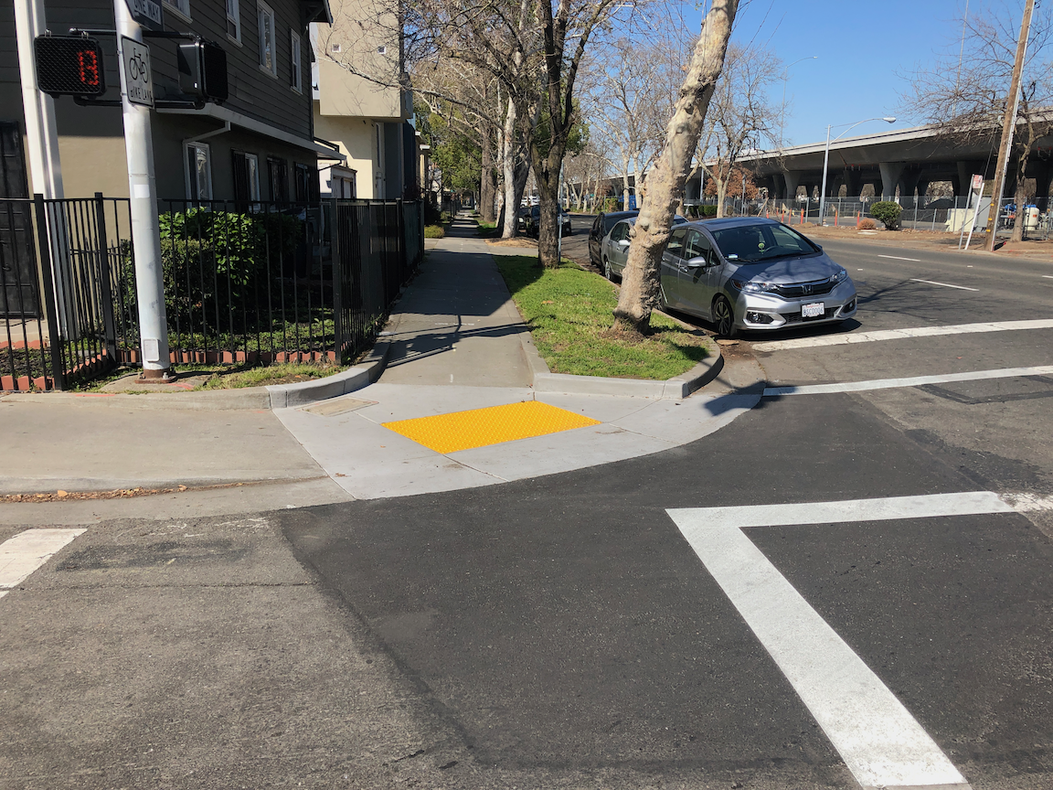
2021-03-12: Adding a photo that better shows the context for this diagonal ramp. This is the southwest corner, X Street to the right and 24th Street to the left. There is space for perpendicular ramps. Of course this would have been a great location for a curb extension (bulb out) on both 24th Street and X Street, but yes, that would be significantly more expensive and might involve drainage issues.

curb ramp at southwest corner of 24th St & X St

2021-03-17: Adding a photo of a new curb ramp in the same area of town, at 22nd Street and W Street, showing the correct perpendicular curb ramps. It isn’t that the city doesn’t know how to do it right, it is that they chose not to at the intersection of X Street and 24th Street.

perpendicular curb ramps at 22nd Street & W Street

use Amazon? – support this!

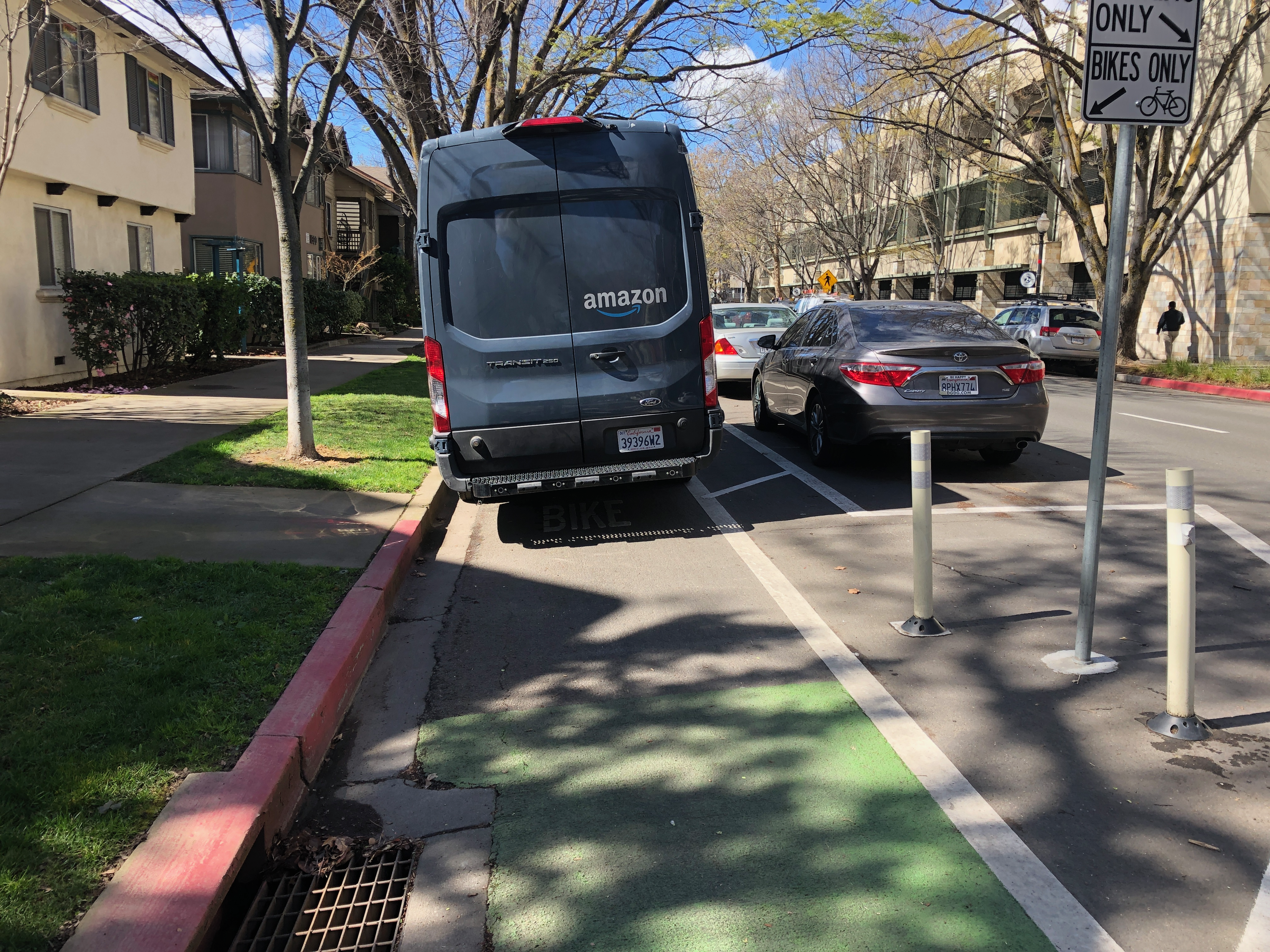
This afternoon I was walking along P Street, not riding my bicycle, when I saw this Amazon delivery van parked in the separated bikeway (cycletrack) just past 13th Street.

When I asked the driver why he was in the bike lane, he said there was nowhere else to park. But in fact there is a cross-hatched, implied no-parking, area just behind the photo on 14th Street, not more than 30 feet from where the van is parked. I can’t show you an aerial of this because the parking has been reconfigured since the last historical Google Earth imagery without leaves on trees, but tomorrow I’ll take a ground photo and add it here. There were also several empty parking spots on 13th Street both north and south of P Street, but apparently this was too far for the driver to walk.

Once making several deliveries, the driver finally left, traveling down the separated bikeway all the way to 13th Street. I reported the parking violation to the city’s 311 app, but of course the van was gone before they could respond. However, I think it is important for everyone to report these violations, otherwise the city can claim it was not aware of the situation.

This is the Amazon attitude, that our deliveries are more important than public safety, and if we actually get caught, the ticket is a small price for our way of doing business, which is raking in the big bucks. So, please think about this photo the next time your order from Amazon. I am not saying Amazon is the only guilty party, other delivery services do similar things, though Amazon seems to be the most brazen. And it is partly the city’s fault. When they repaved and restriped P Street to create the separated bikeway, they could have created delivery spots on both the 15th-14th block and the 14th-13th block, but they did not.

2021-03-12: Adding photo better showing context for the illegal Amazon parking. On the right is the separated bikeway that was being blocked by the Amazon driver. On the left is the crosshatched area that sets off diagonal parking on 14th Street. This morning it was being used by an exempt vehicle, perhaps CADA, but when the Amazon van was there, this was empty and available for delivery.

impassible by design

Another reminder from Enzo. He commented on how dangerous the Watt Ave & Auburn Blvd intersection is, which led to a discussion about the entire section of Watt Ave between the Watt/I-80 light rail station and Auburn Blvd. He pointed out the absolutely ridiculous crosswalk and sidewalk at the westbound onramp to I-80 Business.

westbound I-80 Business onramp with pedestrian crossing and sidewalk

As you can see, the sidewalk leading down to, or up from, the crosswalk on the left hand side is quite steep. It would not be navigable by anyone in a wheelchair, or with any mobility limitations, and Enzo said that even an able bodied person would have difficulty with it. I only walked this sidewalk on the west side of Watt Ave once, and it was such an unpleasant experience that I never did it again. This particular issue did not stand out in my mind because the entire section was so uniformly unpleasant and dangerous.

westbound I-80 Business onramp aerial

As you can see in the Google overhead view, this onramp has a long approach, so most drivers are already going 65 mph when they hit the crosswalk (the speed limit on Watt Ave is 45 mph). So anyone using this crosswalk would be likely to die. For drivers, there is no warning of the crosswalk ahead, and so no reason to take the onramp more slowly. The crosswalk is not even a high visibility crosswalk, but the outmoded two stripe version which can’t even be seen when the pavement is wet.

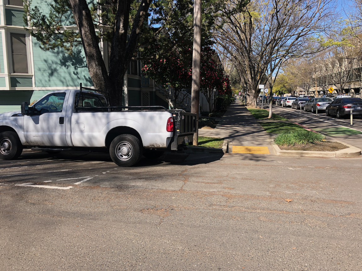
And very few people do use this sidewalk and this crosswalk. When I worked in the eastern suburbs, I initially took light rail and then bicycled south to Auburn Blvd, but with no bicycle facilities and high speed traffic, that got old very quickly. So then I started taking the SacRT bus Route 1. Currently, this bus route starts and ends at light rail, though it used to go further north. I wondered why so many people got on the bus westbound at the last stop on Auburn, and got off the bus eastbound at the first stop on Auburn. So I asked them, and every person said it was to avoid this section of Watt Avenue between light rail and Auburn Blvd. They said the onramps and off-ramps made it just too dangerous to walk. I wasn’t able to talk to any bicyclists, but I’m sure they would have said the same.

This is Caltrans design, and it was designed to not be usable by people walking. This was the entire design philosophy of Caltrans, to discourage walkers and bicyclists from being anywhere near a highway.

Caltrans has reformed somewhat. For example, when the Watt Ave & Hwy 50 interchange was improved in 2015, a separated walking path and bikeway was created that when under the eastbound onramp, westbound onramp, and westbound off-ramp on the east side of Watt, then along the Watt Ave overpass. In the aerial below, you can see the pathway which loops to gain the elevation from the under tunnel to the bridge height. Note, however, that there is no matching facility on the west side of Watt Ave, so a walker or bicyclist must cross to the east side at the nearest intersection, which is Folsom Blvd to the south and La Riviera Drive to the north. Though not great, it is a considerable improvement over what was there before. It did, however, solidify the status of Watt Avenue as an expressway rather than an arterial street.

Watt Ave & Hwy 50 interchange with ped/bike facility

As you can see from the photo at the beginning, and the Watt/Hwy 50 example, the only way to solve this issue is with some sort of flyover for the sidewalk, so that there is an ADA compatible gradient and no crosswalk over the ramp. I’m expecting that Caltrans will start that project in about 2121. There was a proposal by SacRT to improve the section of Watt Ave between light rail and Auburn because they recognized that the walker and bicyclist hostile nature of the corridor was reducing use of light rail. But the city and Caltrans did not seem interested.

Though Caltrans created these hazards, and the hazard is clearly on Caltrans property, the agency has shown little interest in solving the problems they created. They have washed their hands of the roadway part of interchanges by handing these over to the cities or counties. Their preference remains building new stuff rather than maintaining and correcting existing freeways and highways, and I’m not at all sure that will ever change.

Sac Vision Zero top ped intersections

As promised, a follow-on to my post on the top bicycle collision intersections in Sacramento (Sac Vision Zero Top 5 Corridors and top intersections), here is the same sort of analysis for pedestrian collisions. I used a somewhat different data set, this time only killed and severe injury crashes (KSI), for the years 2009-2017. This mirrors the data the city used in the Vision Zero Top 5 Corridors document, and so is not directly comparable to the different criteria I used on the bicycle post.

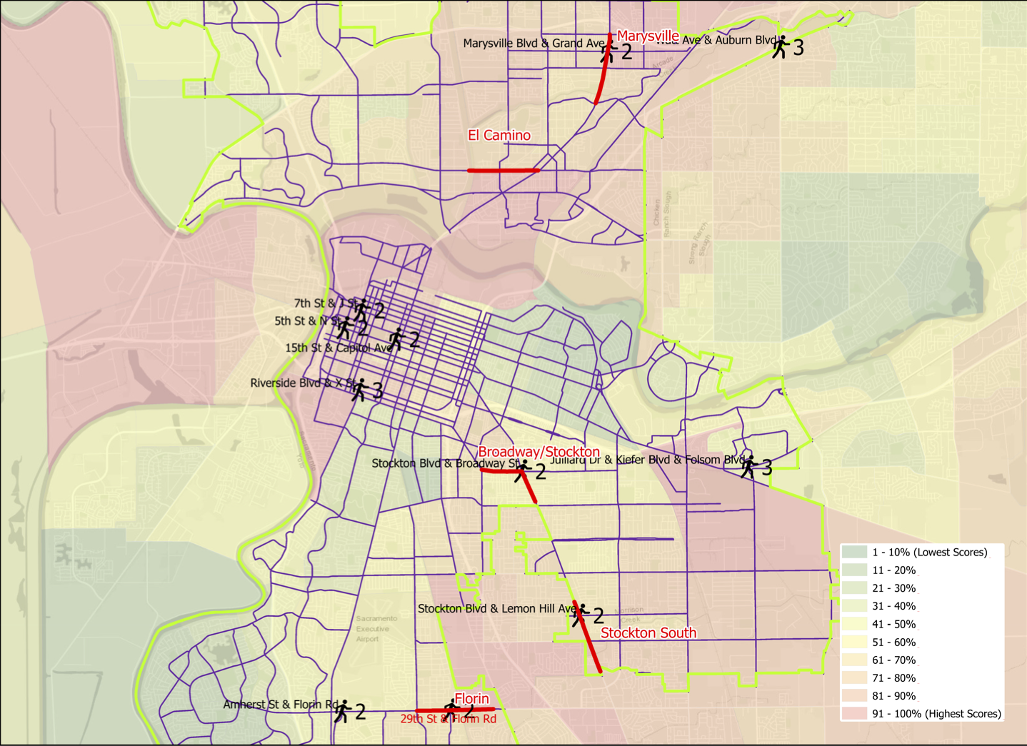
Pedestrian (walker) collisions are more dispersed that bicycle collisions, fewer occurring at intersections and more in between. Of the 408 collisions, 70 were at intersections, 17%, compared to 69% for bicycle collisions. Of these 408 collisions, twelve intersections stood out: Amherst St & Florin Rd, Marysville Blvd & Grand Ave, and Watt Ave & Auburn Blvd, each with three; and 15th St & Capitol Mall, 29th St & Florin Rd, 5th St & N St, 7th St & J St, Stockton Blvd & Broadway, Stockton Blvd & Lemon Hill Ave, Riverside Dr & X St, and Julliard Dr & Kiefer Blvd & Folsom Blvd, each with two. Of these 12 intersections, 4 are on Top Five corridors: Marysville Blvd & Grand Ave on the Marysville corridor, Stockton Blvd & Broadway on the Stockton-Broadway corridor, Stockton Blvd & Lemon Hill Ave on the South Stockton corridor, and 29th St & Florin Rd on the Florin corridor.

The map belows shows the city corridors and the twelve intersections, with the number of collisions and intersection name labeled. There is also a pdf available.

map Vision Zero top pedestrian intersections
Sacramento pedestrian collision top intersections, with Vision Zero corridors

There is a better alignment between the five designated corridors and pedestrian collision intersections than was true for bicycle collisions.

I will point out that the Julliard Dr & Kiefer Blvd & Folsom Blvd intersection is the site of three pedestrian collisions and four bicycle collisions, which is higher than any other intersection in the city. It should really be a focus for the city.

Addition 2021-03-02: Someone asked how the pedestrian collision locations relate to disadvantaged communities. Below, a map with CalEnviroScreen 3 2018-06 (CES) layer, with red end being higher pollution, green being lower, and weighted with income. CES is not the only measure of disadvantage, but it is one commonly used.

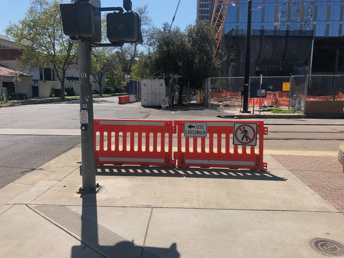
13th & J intersection

I want to acknowledge Enzo of Streets Are Better for reminding me of this intersection and provoking me to write now in more detail. Two previous posts change the signal at J St and 13th St and J & 13th needs a pedestrian scramble were briefer and did not cover all the issues.

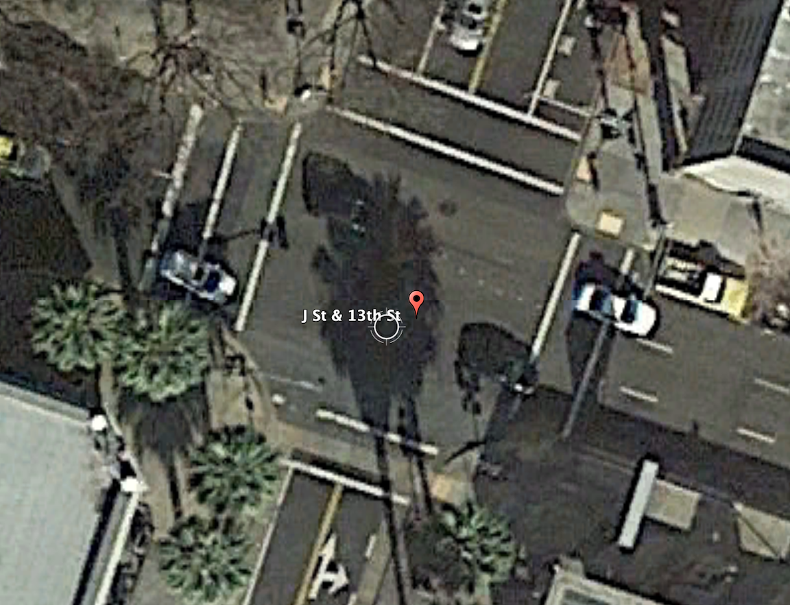
The intersection of 13th Street and J Street in downtown Sacramento is a mess for walkers and bicyclists, largely due to poor decisions that the city has made. The setting is below, with a historical view selected for no leaves on the deciduous trees. On the southeast corner is the convention center, which is under construction now, and the southeast corner is fenced off. On the southwest corner is the Sheraton Grand Hotel. On the northwest corner is a major downtown parking garage, managed by Ace Parking. On the northeast corner is another parking garage managed by Parking.com.

intersection of 13th Street & J Street, downtown Sacramento

In the days before construction on the convention center started and the Sheraton shut down due to the pandemic, this was one of the busiest pedestrian intersections in the central city. The crossing of 7th Street at K Street/DOCO Center, L Street at 11th Street and 10th Street when the legislature is in session, Capitol Mall at Tower Bridge, and a few others are up there, but this one is certainly in the top 10. The city rarely collects pedestrian data, so I do not know what the ranking or volume is.

When the convention center is completed and open, and the Sheraton opens at full scale, this will again become a very busy pedestrian intersection. So you would think that the city would design this intersection and signals to prioritize people walking, but you’d be wrong.

The crossing of J Street on the west leg of the intersection requires pushing the ped button. There are a number of pedestrian signals in the central city that do not require pushing the button, and these are called auto-recall, meaning they automatically change on a cycle. Not this one! I just observed a number of walkers crossing here, and only about 5% of them initially realized they had to push the button. When I mentioned that the signal would never change unless they pushed it, they were surprised, and not happy. When the ped head signal does come on, it has a white hand of 5 seconds, and a countdown of 9 seconds for a total of 14 seconds. There are three lanes of motor vehicle traffic here, lanes about 12 feet wide, for 36 feet. The MUTCD recommended crossing speed is 3.5 feet/second, so 36 feet should be a minimum of 10 seconds, but this assumes that people can leave the curb immediately, not true when the activation button is set well back, and there is pedestrian congestion. In that case, the crossing speed should be 3.0 feet/second. If you want to read about the contortions traffic engineers go through to make walk cycles as short as possible, read pedestrian crossing questions and answers.

The traffic signal for J Street will remain green unless there is a vehicle waiting on 13th Street or someone pushes the ped button to cross. The ped signal to cross 13th Street goes through a white hand, countdown, brief pause, and then back to the next cycle. Without a cross-traffic vehicle or button push, the traffic signal will never cycle. Ever.

crosswalk over J Street at 13th Street

An additional problem is that sometimes the signal controller will just skip the crossing J Street part of the cycle, even when the button is pushed. Since I’m mostly on my bicycle rather than on foot here, I haven’t quite pinned down the behavior. I don’t know if it depends on time of day, or traffic volume, or is just random, but I can affirm that it happens, and not infrequently. So even after the walker presses the button, they may have to wait through another full cycle before they get the walk.

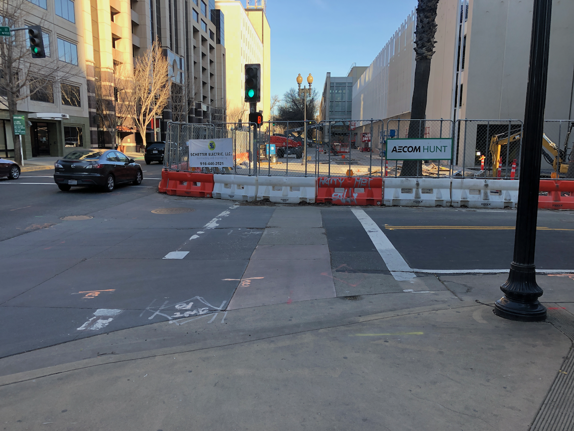
On the southeast corner, the convention center construction has closed the corner and sidewalks. In this situation, there should be a barricade and warning signs on the opposite corner, so J Street south side eastbound and 13th Street east side southbound. A fully sighted person can of course see the barrier and fence across the street, but the point of ADA requirements is to communicate to everyone, not just the sighted. Below is what is looks like, followed by what it should look like. Remember, this is a city project, not a private development, but the city apparently holds itself to lower standards than it holds private developers.

closed crosswalk over 13th Street at J Street
proper barricade and signing for a closed crosswalk, O Street at 8th Street

The east leg crosswalk also suffers from traffic flow design. The walk sign for this crosswalk comes on at the same time as the southbound green signal comes on, bringing drivers into immediate conflict with walkers in the crosswalk. There is no leading pedestrian interval (LPI) to let the walkers get a head start. At this time the crosswalk is closed, but as soon as it is reopened, the conflicts will be immediate, as they have been for years.

Solutions?

  1. Immediately institute auto-recall on the crossing of J Street, and remove the buttons. These are not modern audible buttons, they are antiques.
  2. Immediately institute a leading pedestrian interval on the crossing of J Street, to increase protection from left and right turning drivers.
  3. Immediately lengthen the pedestrian phase for the crossing of J Street to a minimum of 20 seconds.
  4. When then southeast corner of the intersection is re-opened, with completion of the convention center construction, implement an exclusive pedestrian phase for this intersection, in which there is no movement by motor vehicles during the walk cycle, and walkers can cross in any direction including diagonally. If any intersection in Sacramento deserves this treatment, this is it.
  5. Traffic calm J Street to reduce speeds. The most important step is to reduce general purpose lanes to two, and create some sort of bicycle facility. I’m not sure of the best design, as the valet/unloading/loading are for Sheraton Grand may make this challenging.
  6. Get rid of any City of Sacramento Public Works employee who believes the purpose of central city streets is to favor suburban commuters (the J Street traffic) over walkers, bicyclist, and local residents.

I have made at least seven 311 reports on the signal problems at this intersection, asking that it be changed. The only change that I’ve been able to notice is that they lengthened the pedestrian phase for crossing 13th Street, and shortened it for crossing J Street. I just gave up after a while.

Bicyclists

That covers most of the pedestrian problems at this intersection. How about bicyclists? 13th Street is a major bicycle route in downtown, being the only north-south street that crosses through Capitol Park and is not an arterial street, often with heavy traffic and higher speeds. There are bike lanes on much though not all of 13th Street to the south J Street, and there are bike lanes on most blocks to the north, except the half block approaching this intersection. Here, the bike lane has been sacrificed to create a turn lane. There is a required left turn lane and an optional turn lane, but no bike lane. So at this busiest of all intersections on the route, there is no bike lane. There is a clear message here from the city: we will accommodate bicyclists only if it does not reduce motor vehicle capacity. Otherwise, tough luck.

The loop detectors on 13th Street only sometimes detect bicycles. I often see bicyclists during off-times, when there are fewer motor vehicles to trigger the cycle, proceeding through the intersection on red, when it is safe to do so (and occasionally when it is not). They have the right to do so, since by definition a signal that does not detect vehicles (devices) is a non-functional signal, but it is not the best solution.

When the pedestrian button is pushed to cross J Street on the west leg, but no southbound motor vehicles are present, the vehicle signal remains red, so doesn’t allow for undetected bicyclists. This doesn’t protect any walkers, so it makes not sense.

Solutions?

  1. Continue the bike lane on southbound 13th Street to and through (with green skip paint) the intersection with J Street, and remove the left turn lane which prevents the bike lane from continuing. That might mean lengthening the green light for motor vehicles in order to clear the queue.
  2. Install video detection on this intersection that will detect bicyclists on 13th Street so that they don’t have to wait for motor vehicle traffic to arrive and trigger the signal cycle.
  3. Change the traffic signal for southbound to go green at the same time as the pedestrian walk sign. This allows bicyclists to proceed without confusion.