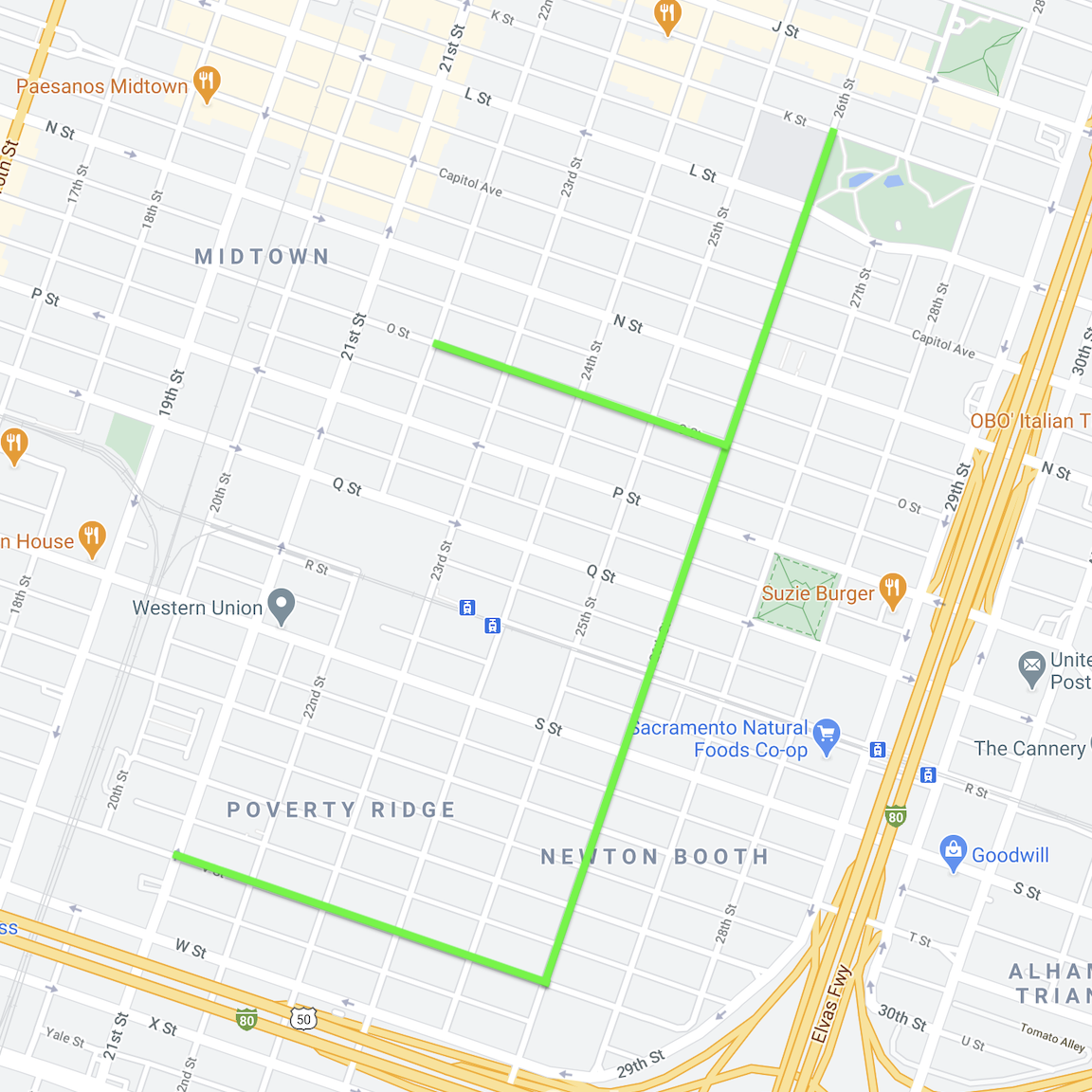
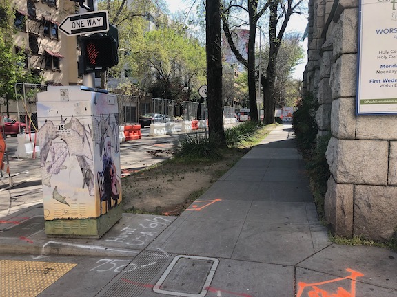
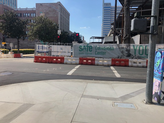
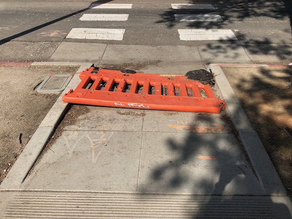
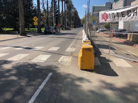
The City of Sacramento implemented the first three Slow & Active Streets on Friday. Eleven blocks of 26th Street, four blocks of O Street, and five blocks of V Street were designated. Apparently these streets were selected based on strong support from the Midtown Neighborhood Association.
These streets are not closed to motor vehicles, this is not an open street type designation, but through traffic is discouraged. The signing below is on 26th Street at S Street, and every block is marked with signing, though some blocks are simpler. The signing is always set to the side, in what would be the parking lane. This is different from the setup used by almost all other cities that have set up slow streets, where drivers have to carefully go into the opposing lane in order to proceed on the street. The signs are less likely to be damaged, which is a problem in some cities where belligerent drivers move or simply run over the signs, and where errant drivers cannot help but hit anything in the roadway, no matter the safety colors used. But they are also less likely to be noticed.
26th Street at S Street, Slow & Active Streets signing
I watched two intersections on 26th Street for some while, and I saw not a single driver avoiding continuing on or turning onto 26th Street because of the signing. This may change over time as people get used to it, or it may not. It is, after all, a pilot. If you walk or bicycle on these Slow & Active Streets, or live on them, please let the city know what you think and what you observe, at https://forms.cityofsacramento.org/f/PW_Transportation_CommentForm.
The city has said the Slow & Active Streets program will be in effect at least through the end of April, but that may be extended to the end of June. Some additional streets are under consideration. The city has said that primary limiting factor for the pilot is the requirement that the signing be checked every day by Public Works staff, and after April these staff will be busy with other tasks. I am sure that local resident can take care of most needs, and report to the city if there is something they cannot fix, but I don’t see a need for staff to check them any more than once a week.
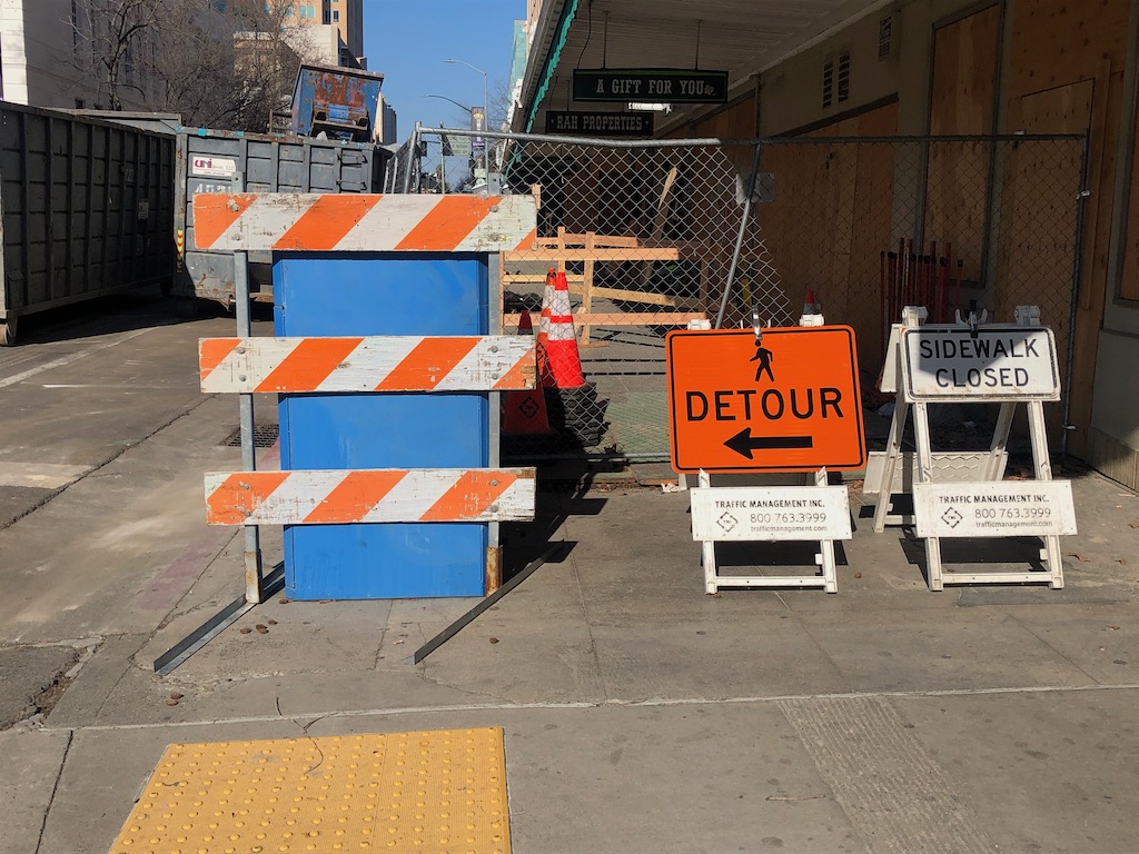
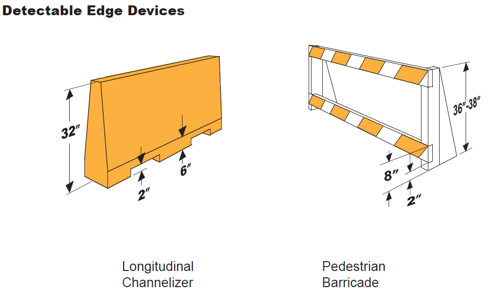
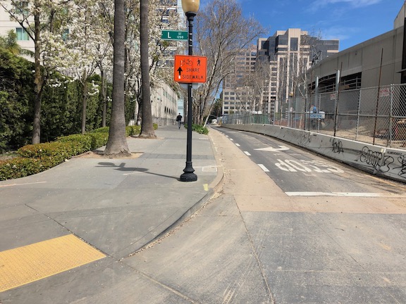
At the south edge of the sidewalk and bikeway closure, at L Street, there is now some signing, below. However, the signing and fencing do not meet ADA detectability requirements. Though there is more than one way of meeting detectability, an example graphic follows, showing a low bar across the entire width, detectable by canes used by vision impaired people. See my earlier post signs and diagrams for construction zones and construction zone solutions for more information on signing and barriers.
9th St at L St sidewalk closure signing
What would otherwise be a reasonable route and signing for northbound pedestrians is blocked by an open construction gate. This open gate was not being actively used in any way, it had just been left open. A person walking is forced to walk outside the crosswalk to get to the bypass.
9th St at L St bypass entrance and signing, blocked by construction gate
For southbound bicyclists on 9th Street at K Street, the diversion starts suddenly, pushing bicyclists into the traffic lane without warning. This is not necessary, the construction cone placed blocking the separated bikeway should not be there. This is just plain sloppiness. The bikeway could remain open, with a half block available to place signing that explains there will be a diversion and bypass ahead.
9th St blocked separated bikeway
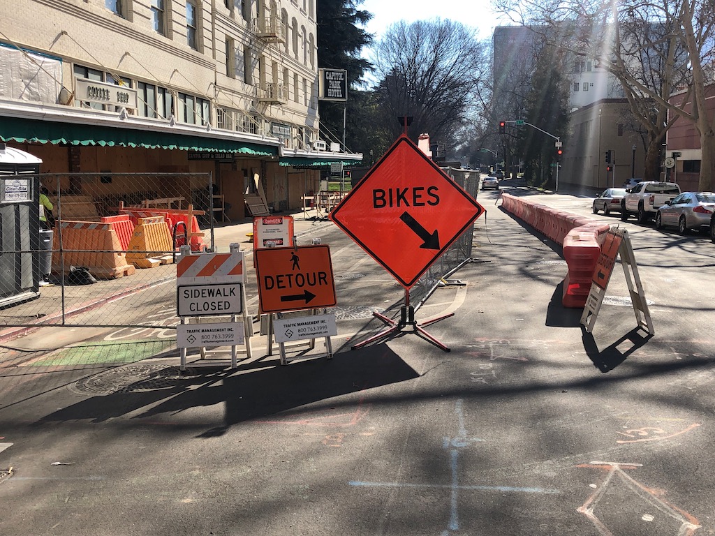
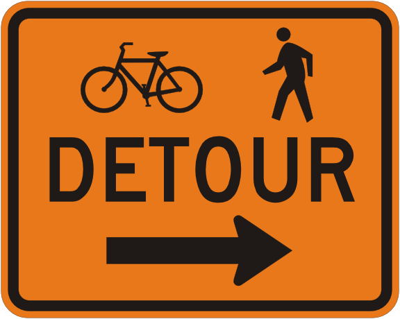
Then there is the entrance to the walking and bicycling bypass, below. The same lack of detectable barriers as in the first item also exists here. If a vision limited walker encountered the construction fencing across the sidewalk, they would have no idea where the bypass is. The ‘sidewalk closed’ and ‘pedestrian detour’ signs are MUTCD compliant signs, MUTCD R9-9 and MUTCD M9-4b respectively, but they need to be placed on or above a detectable barrier, not on sawhorses which do not meet detectability requirements. The ‘bikes’ sign is a made-up sign, and because of its size, it intrudes into the shared bike and pedestrian space. I can imagine bicyclists hitting the sign on their way into the bypass. The correct sign for the location is actually MUTCD M9-4a, shown below.
9th St pedestrian and bicyclist bypassMUTCD M4-9a right
It took about four weeks for the city and construction company to come up with and implement a new traffic control plan, which is ridiculous. If there had been a problem with motor vehicle traffic instead of for walkers and bicyclists, it would have been solved in less than a week. And it would have been done right. Either the new traffic control plan does not really meet ADA requirements, or the signing and barricades placed do not follow the traffic control plan. Remember, this is a city project, reconstruction of Capitol Park Hotel, so not only is the city responsible for managing streets, but also for managing the construction project. Take a look at the photos, or go walk or bicycle the section of 9th Street between K Street and L Street. The sloppiness of the work is glaring. As I’ve said before, the city does not care about walkers and bicyclists, and is not fulfilling its legal responsibilities.
Why is that I, a private citizen, continually have to tell the city when they are doing things wrong, and how to do it right?
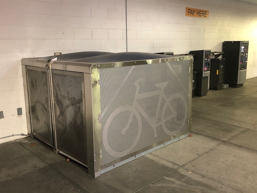
The City of Sacramento has installed some BikeLink bike storage lockers in parking garages. These are the first city-sponsored lockers, though Sacramento Valley Station (Capitol Corridor) has an extensive locker installation, Folsom has had lockers at the three light rail stations for several years, and Roseville has a few locations.
The new city locations are mostly parking garages: Memorial Garage, 805 14th St, City Hall Garage, 1000 I St, Capitol Garage, 1126 11th St, and Tower Bridge Garage, 135 Neasham Cir, with one additional location in the K St pedestrian tunnel to Old Town Sacramento/Sacramento Riverfront. I’m not overly fond of parking garage locations, as they are out of sight and not a place most bicyclists would think of to seek out bike parking, but they are certainly better than nothing, and people will eventually discover and use them.
BikeLink lockers in Sacramento Memorial Garage
I hope that the next set of BikeLink lockers in Sacramento are located centrally and visibly at high bicyclist traffic areas, for example DoCo, and the new convention center and community center. They are particularly important where bicycles will be parked for longer time periods, such as attending events, and where parking is needed at night. For short-term, day-time parking, regular bike racks will serve most users. However, employees who bike to work often do not have safe storage, I see a lot of bikes parked out behind buildings, locked to whatever can be found, and I suspect most of these are low-income employees of service businesses, who deserve better security for their bikes. So high retail locations like restaurant areas and malls should also have them, for the use of employees if not others.
The 2017 video, Why We Cycle, was offered for free streaming for one day, yesterday. Though the freebie is over, I highly recommend you watch the video; at $4.99 it is still a great deal. This video has brought joy to me in ways that I haven’t felt in a while, and I think it will do the same for you.
So if you can push the car out of the city grid, leave it at the edges, and go walking further, it’s an enormous advantage for health, for clear air, for interaction.
Sjoerd Soeters
Though the bicycling infrastructure in the Netherlands has received the greatest notice in the US, this video is only secondarily about the infrastructure, instead focusing on cultural capital and transformation.
My own commute is cycling, that’s because I live cycling distance from work, but that is not a coincidence, that is why I live there.
Erik Verhoef
The video demonstrates the long list of benefits to a cycling culture (note that the video unapologetically uses the term cycling, without the cultural baggage of spandex and Strava and high priced bikes that the term carries in the US):
convenience: the bike is often the quickest way to get somewhere
economics: the bike is far less expensive than private motor vehicles, and even than transit
health: an active life brings measurable and significant benefits to the individual and to society in health care costs
cognitive: because bicycling requires people to be aware and interact with a large amount of information, there are clear benefits to cognitive development and maintenance
creativity: bicycling increase creativity, while on the bike and in life
reduced absenteeism: work absenteeism is lower for people who bicycle, and presumably for school as well
freedom to move: people are much freer to go where they want to go, when they want to go, on a bike
diversity: bicycling exposes people to diversity that they would not be if driving, to meet the ‘other’, to actively negotiate the flow with others
It’s the story of living in a city that is human scaled, that allows me to engage with the social/spatial environment… the intangible effects…
Marco te Brommelstroet
Data on bicycling trips clearly pointed to the conclusion that choices were often governed much more by the senses than the coldly logical plans of traffic designers, even causing people to leave the safe but sometimes boring cycle-ways for more interesting routes.
I noticed in the video, and it was commented on by one interviewee, that some signals have all ways for bicyclists at the same time, a bicycle scramble, so to speak. Because bicyclists have so much experience with negotiating with each other, it just works!
… it relates to the culture of mutual shared respect, but also the culture of trust; instead of infrastructure, by the users of infrastructure
Fariya Sharmeen
The adolescent social area can be the whole city, not a limited area close to the home. It’s about fun, being together. The video highlighted schools where nearly every student walks or bicycles, such a huge contrast to the US.
Dutch children are the happiest children in the world, just because they can go farther and farther from their homes…
Cycling is a good metaphor for a good education.
… to put the priority in relationships between people, then we support the cycling, we support freedom for children. Priorities for children and for bikes are good priorities for a happy politics.
Leo Bormans
A better world is possible, and we can achieve it if we work together and insist that each decision we makes moves us towards that end, and away from the car supremacy under which we have suffered, and died.
The previous post was about prudent drivers. The table below shows how I think of prudent drivers, and irresponsible drivers. It is so hard to not be snarky about driver behavior, but I have toned it down quite a bit. If you think I am exaggerating, then you don’t spend much time on the roads walking and bicycling. I spend a lot of time doing both, probably averaging three hours per day, all of it closely observing driver behavior and the roadway built environment, because it is both my job and my advocacy. The irresponsible behavior is something I see every day, from a significant percentage of drivers. Notice that I did not use the term negligent driver, as is the legal term in my prior post on a prudent driver, because only some of this is negligent; much of it is just sociopathic.
Prudent Driver
Irresponsible Driver
yields to pedestrians in crosswalks and waiting to cross
never yields to pedestrians
takes turn at stop sign intersections
goes out of turn at stop sign intersections
obeys speed limits, within 5 mph
drives as fast as possible in all situations
on multi-lane roads, always slows or stops if a vehicle in another lane is stopped
on multi-lane roads, pulls around other vehicles that are stopped, honks, and proceeds at full speed
rarely uses their car horn, and only to prevent a crash
often uses their car horn to make those other idiots pay attention and get out of the way
is aware of what is going on around them
is focused on other things than the road
doesn’t use their smart phone while driving, other than wayfinding
holds ongoing conversation on smart phone; texts when they think they can get away with it
passes bicyclists with a safe distance, even when it means waiting
yells at, honks at, and close-passes bicyclists, because they don’t belong on the road
believes all people have a right to share the public space on the roadway
believes that right to the roadway is determined by the value of their vehicle and social status
will do anything to avoid a crash
revels in crashes when they know they are right
knows the the cost of building and maintaining roads is subsidized by everyone
is certain that gas tax monies are being illegally diverted to other uses
knows that parking is never ‘free’ and someone, or all of us, are paying
believes that the right to free parking is guaranteed in the constitution, and that the parking space in front of their house belongs to them
So, now that I’ve spent several posts complaining, on to solutions. The city is working an ordinance for construction zone handling, but I have not seen any draft documents. When something is available, I’ll add it.
The City of Oakland has what is generally considered to be the model guidance (http://www2.oaklandnet.com/oakca1/groups/pwa/documents/memorandum/oak062315.pdf), though Seattle also has something good that I’ve not tracked down yet. Sacramento could do well to simply adopt the Oakland guidance, but it is pretty radical for Sacramento, so I’m expecting something weaker to come out. Let me say what I think is most important.
Let me credit Robert Prinz of Bike East Bay for publicizing the guidance (he may have also had a part in developing it, not sure about that), and for monitoring compliance and publicizing failures. He is an inspiration for me.
Management:
Responsibility for approving traffic control plans should be removed from Construction Services and placed in another division of Public Works that will actually ensure quality traffic control plans and enforcement as needed. Construction Services has demonstrated that they cannot be trusted with this responsibility. They continually bias for motor vehicle traffic and drivers, and against walkers and bicyclists.
Construction sites should be inspected on a regular basis by city personnel, to ensure that they have correctly installed the signing and barriers specified in their approved traffic plan, and that these are maintained until completion of the project.
Fines will be imposed on construction companies that do not correct problems within 12 hours of reporting to the city, by city staff or by citizens. If the construction company fails to correct the issue within 48 hours, the construction project should be shut down.
Sidewalks and bike lanes:
For any roadway with more than one general purpose travel lane in the same direction, it shall be automatic that temporary sidewalks and bicycle lanes will be placed instead one lane.
For any roadway with parking lane on the same side as the construction zone, it shall be automatic that temporary sidewalks and bicycle lanes will be placed in the parking lane.
For any roadway where the bicyclist and/or pedestrian traffic is above a certain level (I’m not sure what the number should be), if no accommodation can be made by using a parking lane or general purpose travel lane, then the road will be closed to motor vehicle traffic in one or both directions for the duration of the project.
Crosswalks:
ADA compliant barriers and signing will be used at ALL construction projects which close a crosswalk, no matter what the duration of the project. For any closure of over a week, fixed metal barriers should be used (see photo below). Plastic barricade poles or construction tape will never be used by themselves to mark a closure.
Unless the closest safe crossing is clearly evident from the point of closure, wayfinding signs will be included specifying the shortest distance and safest crossing.
ADA detectable crosswalk closure barrier
Signing off for now with the construction zone topic. I found several more problematic locations on my walk this morning, but I need to take mental break from this, and talk about other things.
As always, I invite your comments and additions. Stay safe walking and bicycling out there, but don’t stay home. Your sanity requires being outside, or at least that is my opinion.
The convention center and community center theater project (3C) project did a very poor job of preserving access for walkers and bicyclists at the beginning. Some issues have been resolved, but some never have, though the project has now been going on for just less than two years.
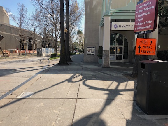
The most significant issue is that there was no provision made for northbound bicyclists on 13th Street, passing the construction between L Street and J Street. 13th is a major bicyclist route of travel, and the city knew this before the construction started. But the original traffic plan did not address this use at all. After public complaints, a sign was installed on the sidewalk for northbound bicyclists, photo below, but not the southbound. The numerous walkers using this sidewalk, adjacent to the Marriott and Sheraton convention facilities, were confused to see bicyclists on the crowded sidewalk. After more public complaints, a sign was added southbound, the second photo, though it is placed in a location where people coming from K Street would not necessarily see it. As you can see in the first photo, the sidewalk is narrow just north of the crosswalk, so bicyclists heading north are brought into immediate conflict with pedestrians heading south, many of whom are headed to the crosswalk over L Street. Of course having an angled ADA ramp here, rather than the two-to-a-corner design that should be used wherever there is significant pedestrian traffic, makes things worse.
Of course the best solution here would have been to just close 13th Street to motor vehicles between K Street and L Street, leaving the narrowed roadway available for two-way bicyclist traffic. There are far more bicyclists using this route than private vehicle drivers. Despite that, the city biased in favor of drivers.
13th Street northbound at L Street13th Street southbound at K Street
One issue on which progress was made was the southeast corner of J Street and 13th Street. Initially this corner was closed, giving walkers only one choice of how to cross, despite this being one of the most heavily used intersection crossings in the city. There was no reason to close the corner off, the area behind the fence was never used for construction. After about a year and a half, the corner was re-opened, photo below, so that walkers have a choice of routes. Note that when the city finally worked on this corner, the work was not done behind the fence, but the fence was moved and then the sidewalk and ramp work done by closing off the corner until it was done.
J Street & 13th Street, southeast corner, finally re-opened
On the east side of the project, issues remain. The sidewalk from J Street south along 15th Street has no signing indicating that it is closed ahead, see photo. When you get half way, there is just a fence blocking access. In daylight, you can see the fence ahead, but a limited vision person and anyone walking at night would not see the fence until they got to it. This is simply unacceptable.
15th Street west side, southbound from J Street, no signage
There are several other less serious issues around the east and south sides. At K Street & 15th Street, there is no signing to indicate how to get to the other side, to go either northbound or southbound. This one is not hard to figure out, at least for sighted people, but it was still not done correctly. This crosswalk ramp should have been barriered off, just like the ADA compliant barriers in the previous post, since it only leads to a closed crosswalk.
On the south side of the project, there are plastic barriers for the crosswalk over 14th Street at L Street, and for the crosswalk over L Street on the west side of 14th Street. These barriers were knocked over months ago and have not been put up again. There were not sufficient to begin with, but laying down on the ground, are both useless and hazardous.
14th Street at L Street, failed barrierL Street at 14th Street, west side crosswalk, failed barrier
I’m going to call this one a failure on the part of both the construction company and the city: the construction company for failing to monitor and maintain the traffic control devices for which they are legally responsible, and the city for failing to monitor the construction company. Blame all around!
And lastly, the closure of a lane on L Street for the construction was not handled well. As you can see, there is a narrow crosshatched area the length of the block. One might reasonable choose not to go this way, but then again I see people going this way every day, both walking and bicycling. I am not sure how this should have been handled, but there must be a better solution. Of course one solution would have been to continue a temporary pedestrian walkway on the north side of the street, set off by concrete barricade, and requiring only a simple fence to separate the walkway from the construction site. If more street width was required, parking could have been removed from the south side and the general purpose lanes shifted to the left. Note there there never was a bicycle lane present in this block, it is dropped at 15th Street and the traffic sewer 3-lane roadway continues west.
L Street westbound at 14th Street, narrow shoulder
In closing, this construction project is probably the worst in the city (though there is competition). It does not involve a private property owner, it does not involve a state construction project, it is a city project on city land. There is simply no excuse for such poor walker and bicyclist accommodation. It is a big middle finger to those to who don’t drive.
Mark your calendars forOctober 26th.The award-winning, inspirational, crowd-sourced cargo bike documentary is screening in Sacramento at the Hacker Lab (2533 R st. Ste 120, Sacramento, CA 95816)!
We’ll have bike valet parking thanks SABA and a discussion panel after. Bring your cargo bikes to show off! Sacramento Kidical Mass is hosting a bike ride to the event from the Coloma Community Center (meet at the playground around the back of the buildingat 1pm, rollout happensat 1:30pm). A huge thank you goes out to the Sacramento Bicycle Kitchen for funding this event!
Please share this event with your bicycle community, as well as anyone who needs a little inspiration to get into biking for transportation or wants to learn more about cargo bikes and family biking. Reach out with any questions:(916)320-7825,tinyhelmets@gmail.com.
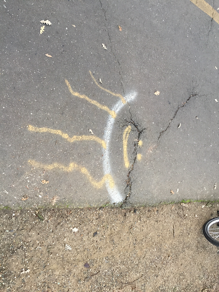
The photo above is a root heave on the American River Parkway path, west of Watt Avenue. This root heave started developing more than a year ago, and has of course gotten worse. Assuming that this will be a rainy winter, come spring the heaving will accelerate greatly.
The heave has been decorated by users at least twice, in an effort to alert other bicyclists to the hazard. But at night, the heave is invisible. The vertical displacement is about 2.5 inches, enough to make a bicyclist hitting it at speed lose control, or to throw them off their bike. It could result in serious injury or even death.
I have reported this issue to Sacramento Regional Parks via email, via phone calls, via Twitter, and directly to park rangers. Nothing has been done. More than a year, and it has only gotten worse.
This is just the worst heave, so far as I know, for the sections I ride. There are many more with less displacement. All have been marked by users in some way, indicating that users care much more about their safety than does Sacramento Regional Parks.
I will therefore suggest that Sac Regional Parks is incapable of maintaining this key part of the transportation network. Though they do from time to tine repave portions of the parkway, they have done nothing significant in the last three years. Measure A allocates $1 million of transportation funds per year to the parkway, but it has never been clear how these funds are being spent and many in the bicycle community question whether it is ending up ‘on the ground’ in path maintenance, or going elsewhere.
The responsibility for the parkway path needs to be transferred to the county department of transportation (SacDOT). It is not because they are a great agency, either, and anyone who drives or rides the streets in the county know how far behind the county is falling in maintaining their roads. The nevertheless, the parkway path is part of the transportation system, and needs to be considered as part of the system.
In my neighborhood, about half the trees have lost all their leaves for the year, and the other half are still hanging on. If I listen closely, I can hear the tick of leaves hitting the ground.
So, how have the bike lanes been doing during leaf season? At least for the parts of the central city and east Sacramento that I ride in, acceptably OK. People are putting their leaf piles in the bike lanes much less often than in previous years. I’m not sure why. I haven’t noticed any city effort to educate about this, other than a vague “When possible, avoid placing piles in bike lanes.” on their Leaf Season page. But I really do believe there are less piles in the bike lanes. Maybe people are beginning to clue in. If only there were a similar improvement in trash cans in bike lanes.
A big concern was how the new separated bikeways (‘protected bike lanes’, ‘cycletracks’) on P and Q and 10th (and now 9th) would do. The city has not yet purchased a device for sweeping these bike facilities. Apparently the ‘the claw’, the loader that collects the leaf piles and moves them into dump trucks, can negotiate the bikeways, and this is how they have been kept clear. This is working pretty well, all except for one block, pictured below. This section of P Street between 15th and 14th has a large accumulation of leaves, and the leaves have developed into leaf slime, with is an incredibly slippery mush of decayed leaves. I am not sure what is different about this block, but it certainly is different. It needs to be cleaned now, and cleaned more frequently.