Note: General information on the Top 20 intersections, with criteria, list, and map, is available in post 1.
I am looking more closely at the Top 20 intersections identified in the City of Sacramento Vision Zero Action Plan Update. Intersection 10 is Albatross Way & El Camino Ave. This is an offset intersection, with Albatross Avenue to the north of El Camino Ave being offset to the east relative to Albatross Avenue to the south.
Design
Lanes: Albatross Way north of El Camino Avenue is three lanes (one left turn, one right turn, one opposite). Albatross Way south of El Camino Avenue is three lanes (one left turn, one right turn, one opposite). Albatross Way is designated as a local street in functional classification. El Camino Avenue is five lanes (two through, one left turn, two opposite). There are faded white dots to guide the left turns from El Camino Avenue to Albatross Way.
Medians: No medians are present.
Crosswalks: Marked yellow crosswalks (for school) are present on the Albatross Way to the south, Albatross Way to the north, and a single crosswalk over El Camino Avenue aligned with the east side of Albatross Way to the south. There is no crosswalk aligned with the east side of Albatross Way to the north.
Bicycle Facilities: El Camino Avenue has Class 2 bike lanes, but they become advisory approaching the intersection, with no green paint or protection. Albatross Way does not have bicycle facilities.
Speed: Albatross Way, as a local street, has a base speed limit of 25 mph, and is not posted. El Camino Avenue has a designated speed limit of 35 mph, but it does not seem to be posted anywhere near this intersection. An Interstate 80 interchange is adjacent to the west, and likely affects speeds on surface streets.
The city no longer has a database or map of speed limits, so it is often necessary to look in Google Maps Street View for speed limit signs. The county (and SACOG) have a database, but it does not include the City of Sacramento roadways.
Crashes
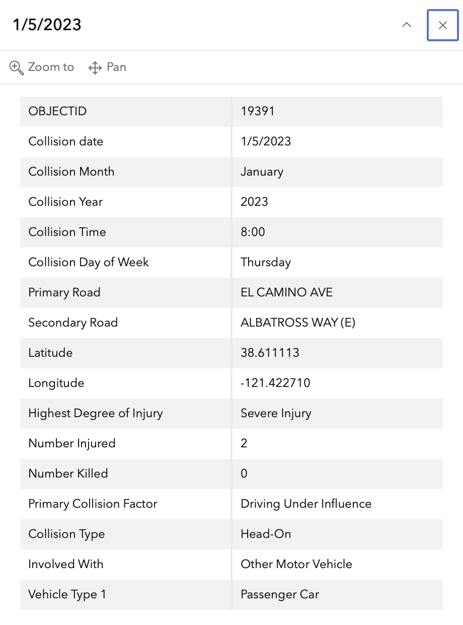
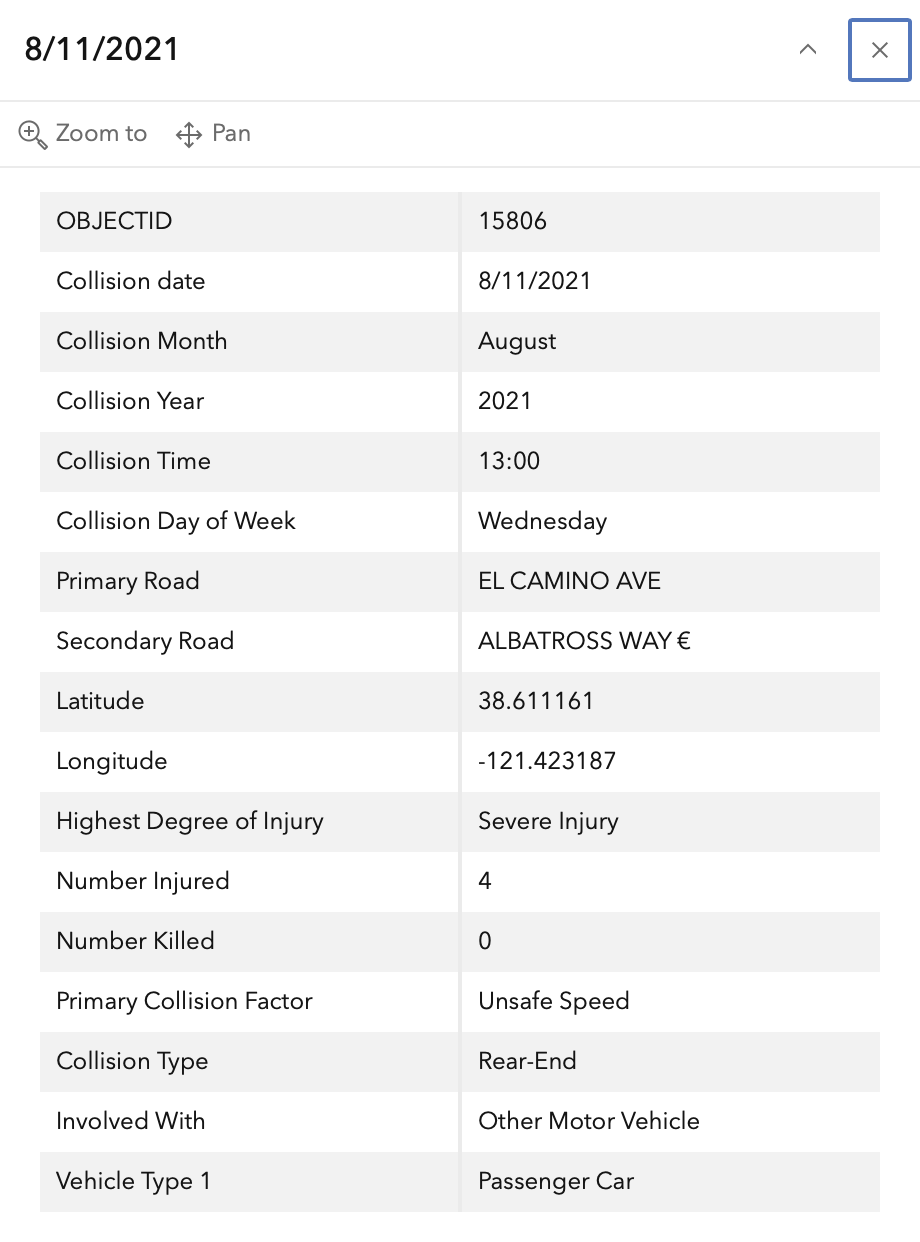
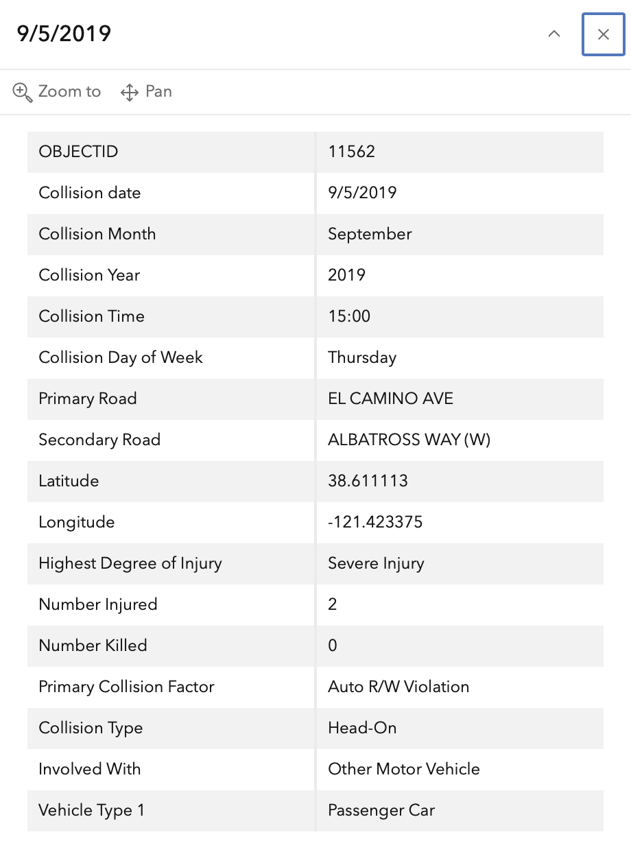
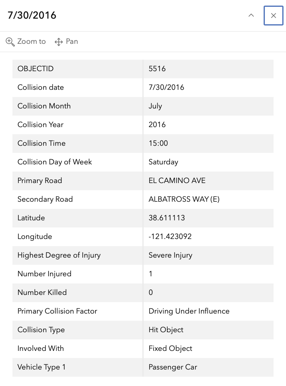
In the 2015 to 2024 period (which is used in the Vision Zero Action Plan Update), there were four severe injuries at this intersection, all with motor vehicles, none with bicyclists or pedestrians. These are mapped below (pdf). There is a fatality just west of the intersection buffer, associated with the northbound Interstate 80 onramp.
The orange dots are severe injuries (one contains three crashes); the red dots are fatal (none). Together, these are know as KSI = killed or severe injury. ‘Other visible injury’ and ‘complaint of pain’ crashes are not shown on my map, since these are not the focus of Vision Zero, however, there are several of these along El Camino Avenue, which you may view in the Crash Dashboard Interactive Map.
Please note that the exact crash locations may not be accurate, as police reports often do not correctly locate crashes. Also note that ‘pedestrian violation’ entry may be false, as police often blame crashes on the person walking when actual responsibility is not clear, or the pedestrian is dead and can’t counter the driver story.
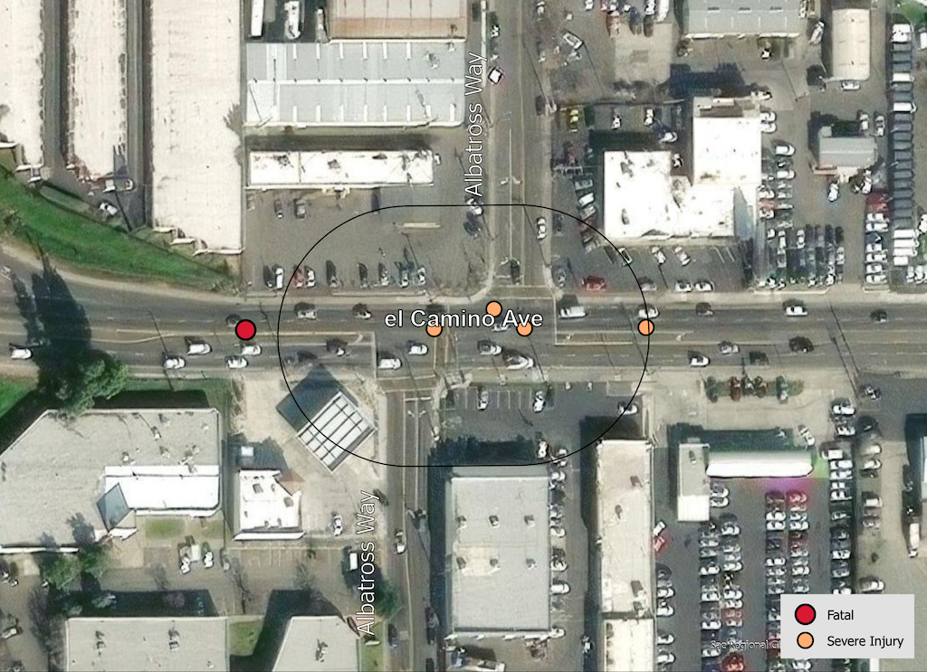
The crash details, available in the Vision Zero Crash Dashboard Interactive Map, are below.