Sacramento’s worst possible place for sharrows

The third place where sharrows need to be eliminated in the central city Sacramento is I Street at the county jail. In the phot below, the right hand lane is a parking lane most of the time, except for commute rush hour, 4:00-6:00PM on weekdays (note the time sign in the ‘bikes may use full lane’ photo following), when it is a general purpose lane. When it is a parking lane, there are sharrows nearly covered up by parking, as you can see in the second photo. This is not a bike lane in any sense of the word, but drivers assume that it is and close pass anyone using that area to ride in. When it is a general purpose lane, there is high speed traffic approaching the Interstate 5 onramps, absolutely not an appropriate location for sharrows. The current trend in use of sharrows is 1) don’t use them at all; 2) if they are used, they should absolutely never be used over 35 mph, and rarely used over 25 mph. Though the posted speed limit of I Street is 25 mph (though it isn’t really posted anywhere), regular traffic speeds are over 35 mph, and during commute hours is over 45 mph except when congestion prevents that. So this is not any appropriate location for sharrows.

Of all the places where bicyclists are at risk of getting doored, this is the place. Everyone parking here has a family member or friend who is in jail. They are upset, they are depressed, they are often angry, they are not thinking about bicyclists and looking before they open their door. There is also a lot of turn-over here, so a lot of door opening. When I ride this area, I ride in the exact middle of the next lane over, taking the lane. But that is something that the average bicyclist will not do. So the sharrows leave them vulnerable to both close passing and dooring.

The city has placed a ‘bikes may use full lane’ sign (MUTCD R4-11), but is is up high against the background of a tree, where it would not likely be noticed by drivers or bicyclists. Of course bicyclists may use the full lane, with or without the sign, but again, most bicyclists will not do that. If signing is to have any meaning at all, the sign must be much bigger than it is, closer to 7th Street, and the message should also be marked on the pavement.

I Street west of 7th Street, part-time lane with sharrows
I St west of 7th St, part-time parking and general purpose lane with sharrows, Sacramento
I St west of 7th St, sharrows and parking in a part-time general purpose lane, Sacramento
I St west of 7th St, bikes may use full lane sign

I am not sure what the best solution is here. It is not to get rid of the parking; this is one location where on-street parking is justified. The right hand lane should be a parking only lane, however. There is no justification of traffic volume requiring another general purpose lane during commute times. That just encourages more driving and higher speeds, as drivers race each other for the on-ramps.

This is also a location where bicyclists separate into two destinations. Riders heading towards Sacramento Valley Station stay on the right so they can turn on 5th Street toward the station. Riders heading to Old Sacramento must move to the left hand side to avoid the high speed on-ramps. The left side bike lane, however, doesn’t even start until just before 5th Street, leaving no refuge for bicyclists trying to merge across traffic to the left side between 7th Street and 5th Street. I think there needs to be an intentional location for bicyclist to shift, at 7th Street or 6th Street or 5th Street. There would be a green bicycle box for waiting, and a signal with exclusive bicycle phase for bicyclists to safety transition from the right side to the left side. A bike lane would be present from that crossing point on I Street, without gaps.

Of course I Street needs to be reallocated so that it serves all users, and is not just a traffic sewer for drivers going to the freeway. It should be no more than two lanes at any location. Fewer lanes would slow traffic, as the prudent driver sets the speed rather than the egregious speeder. There should be a separated (protected) bikeway on either the left or right side, with a safe transition from one side to the other at some point.

Caveat: I post about issues in the central city because I live here, and see the problems every time I am out walking or bicycling. However, I strongly believe that the city should be focused on solving issues in lower income, disinvested neighborhoods, of which there are ample throughout the city. The central city has received more than its share of bike facilities.
Sac kill those sharrows on I St

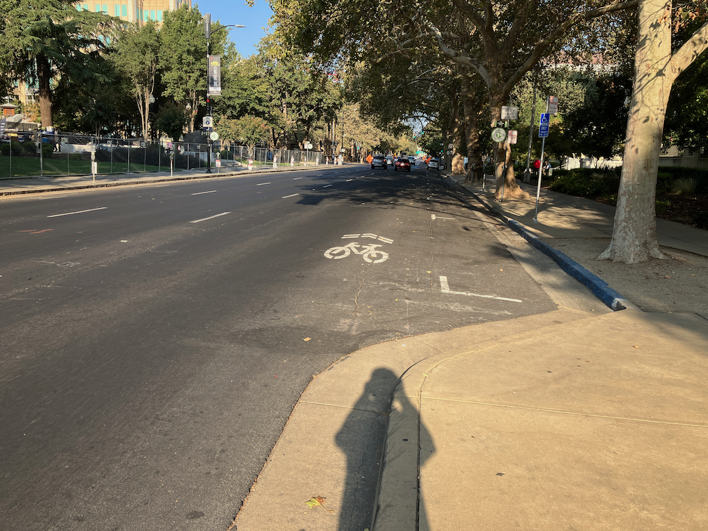
Next sharrows location to address is I Street between 10th Street and 9th Street. The bike lane present to the east disappears in this block, with Cesar Chavez Plaza on the south and Old City Hall on the north, before picking up again west of 9th Street. Not having my tape measure out (and I’d have to measure late night when there is no traffic), it isn’t clear why this one block does not have a bike lane. It may be that the curb extension is too wide, or it may be that the general purpose (car) lanes are not configured correctly. If lanes, then it is an easy problem to fix, just re-stripe the lanes and add a bike lane. If the curb extension, then that would require a bit of infrastructure work. I fully support curb extensions, nearly all intersections should have them, but in some places the city has installed them incorrectly and caused issues for bicycle facilities. This is not, as many places are, a case for removing parking, but for designing the street correctly. Of course ultimately there should be no three-lane one-way traffic sewers in the city, and right of way should be reallocated to a separated (protected) bikeway and wider sidewalks.

I St westbound at 10th St, sharrows, Sacramento
I St westbound at 10th St, Sacramento

Caveat: I post about issues in the central city because I live here, and see the problems every time I am out walking or bicycling. However, I strongly believe that the city should be focused on solving issues in lower income, disinvested neighborhoods, of which there are ample throughout the city. The central city has received more than its share of bike facilities.

Sac kill those sharrows on H St

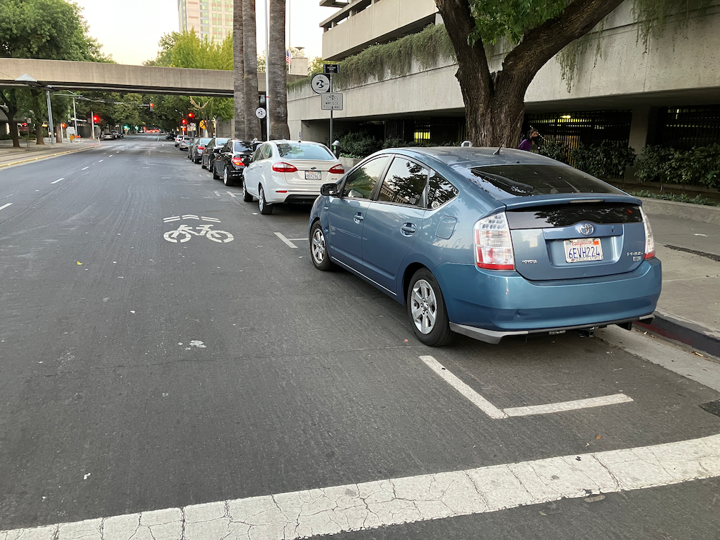
The block of H Street between 7th Street and 8th Street in downtown Sacramento has shadows instead of a bike lane. There is a bike lane in the preceding block, and in the block past, but not this block. Why? Because on-street parking has been preserved on this block in preference to bicycle facilities. The right lane lane is marked with a sharrow. Not a properly placed sharrow, but one in the door zone of the parking lane. When shadows are used, they should be placed in the center of the travel lane. But rare is the situation in which they should be used at all. Research indicates that sharrows are less safe than no markings are all, less safe than marked bike lanes.

So why is this parking here at all? No reason whatsoever. On the north side of this block is a County of Sacramento parking garage. There is even a pedestrian bridge between the parking garage and the Sacramento County administrative building on the south side of H Street, as seen in the photo.

I am certain that all of these cars belong to county employees or contractors. They should be parking in the garage, and this parking should be removed so that at least a marked bike lane can be placed in this block. Of course H Street should have a separated bikeway from 6th Street, Sacramento Valley Station, to 16th Street, where it becomes two-way. But a Continous painted bike lane is at least a first step.

There are a number of locations in the central city where bike lanes are dropped for a block in favor of parking and travel lanes. Every single one of these should be fixed either by the removal of parking or a general purpose lane.

Caveat: I post about issues in the central city because I live here, and see the problems every time I am out walking or bicycling. However, I strongly believe that the city should be focused on solving issues in lower income, disinvested neighborhoods, of which there are ample throughout the city. The central city has received more than its share of bike facilities.

keep Sacramento N St narrowed

Note: As is not unusual, I had forgotten that I’d written about N St before: N Street bike route to cycle track, 2015. Seven years have passed, the city has taken no action.

The construction for the Capitol annex project has narrowed N St to two lanes eastbound, from 10th St to 14th St, and parking has been removed from the south side to shift the lanes over. Now is the time for the City of Sacramento to implement its long-delayed (if not deep-sixed) plans for re-allocating space on N St. There have been ongoing utility projects over the last few years that have narrowed N St to two or even just one lane. At no time did that create significant congestion, during the pandemic or before the pandemic. I live two blocks from N St, and both travel along it and cross it frequently. I’ve never seen more than momentary congestion, in 11 years. What that means is that N St, in its three-lane configuration, has grossly excess capacity for motor vehicles.

While the street has been narrowed is the time to redesign the street so that it has no more than two general purpose lanes, and has a curb-protected or parking-protected bikeway. Probably on the left. This is in fact the perfect setting for a separated bikeway, five blocks from 10th St to 15th St with no intersecting streets from the north side, which is Capitol Park.

It is true that the sidewalk on the north side of N St is a designated bikeway, so bicyclists may use the sidewalk to avoid riding in the street. But bicyclists on the sidewalk are often in conflict with people walking on the sidewalk. The sidewalk has pretty continuous use by walkers, particularly during the lunch time – walk time for state workers, but a lot of people also include a circuit of the Capitol Park on their runs and walks. This conflict is easy to solve: create a safe, welcoming, protected (separated) bikeway on the street. And do it now!

On N St eastbound, the leftmost lane is a designated left turn lane at 10th St, which is what makes possible the two-lane configuration beyond 10th St. As a temporary measure, this works well, and forcing turns off three lane streets is a good solution for so many overbuilt arterials roads in Sacramento, but here it is only temporary, and would be obviated by the conversion of all of N St from 3rd St to 15th St. N St becomes a two-lane street at 15th St, and then becomes a two-way street at 21st St. N St from 15th St to 21 St would probably be a good candidate for a separated bikeway as well, but with paint bike lanes existing, would be a lower priority.

Below is a StreetMix sketch of what N St might look like. Note that the width of the street and the elements are estimated, not measured. I don’t believe parking is needed on both sides, but the diagram shows it for people who think it is necessary. Left side is north, Capitol Park in this case, and right side is south, mostly state buildings.

N St Sacramento between 3rd St and 15th St

As a reminder, I feel strongly, and it is backed up by evidence:

  1. Three-lane streets are significantly less safe than two-lane streets, primarily for the muli-lane threat (one vehicle stops for walkers and the others do not). They are also a clear sign of poor land use planning, which puts residents and the things they need to reach (jobs, stores, recreation and entertainment, medical, etc.) far away. Narrowing all such roadways in the city from three to two, or less, would increase safety, increase livability, and encourage people to make different choices about where they live and visit. Maps of collisions (vehicle vs. vehicle, vehicle vs. walker, vehicle vs. bicyclist) align almost perfectly with overbuilt arterials.
  2. One-way streets are significantly less safe than two-way streets, for the same multi-lane threat, and because there isn’t any friction to slow drivers. However, I think that the only valid argument for one-way streets is to accommodate separated bikeways, bus lanes, or rail transit. That may be true of N St.

And, sorry, can’t resist, get rid of the worthless palm trees while they are at it. We need shade trees, not poles.

Land Park open (car free) roads?

With the exciting news that the closure of a part of JFK Drive in Golden Gate Park will remain permanently closed to private vehicles. This closure was made to provide safe open space during the pandemic, and is only a small portion of the roads in the park. Most of the people who live in San Francisco support this closure to cars (opening to walkers and bicyclists), and most of the people who visit the park from elsewhere (which includes me) also support.

People have started talking about Land Park in Sacramento. I was certainly not the first. This has been an ongoing conversation among advocates for walking and bicycling for years, but it never turned into a movement. Maybe today is the day.

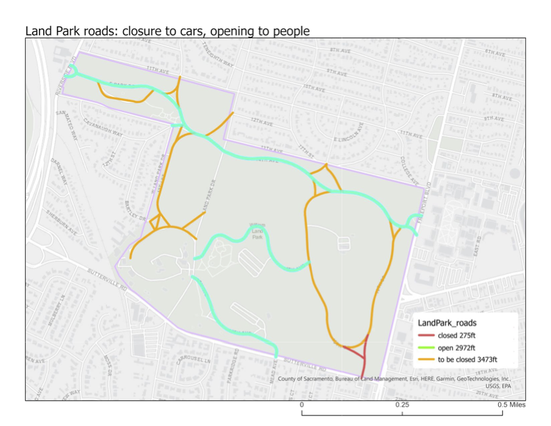
Below is my (modest) proposal for closing some of the roads in Land Park to private vehicles (pdf). There is a small existing closure, of the roadway in from the southeast corner of the park. It has gates that are permeable to bicyclists.

My proposal closes about 53% of the roads in the park, but leaves open roads that access important points such as Fairytale Town and the golf course (if that is important). It also leaves open an east-west route through the park, with ample parking along the roadside, for those who need vehicle access. People who drive are most likely to access the park from Riverside Drive, Land Park Drive, and Freeport Blvd; all those access points remain open.

Of course the use of the term ‘closed to cars’ is really an inversion. Roads that are closed to private vehicles are by nature open to walkers and bicyclists, and so are really ‘open’ to people.

So, what do you think? Constructive comments are always welcome.

and bike lane blockages

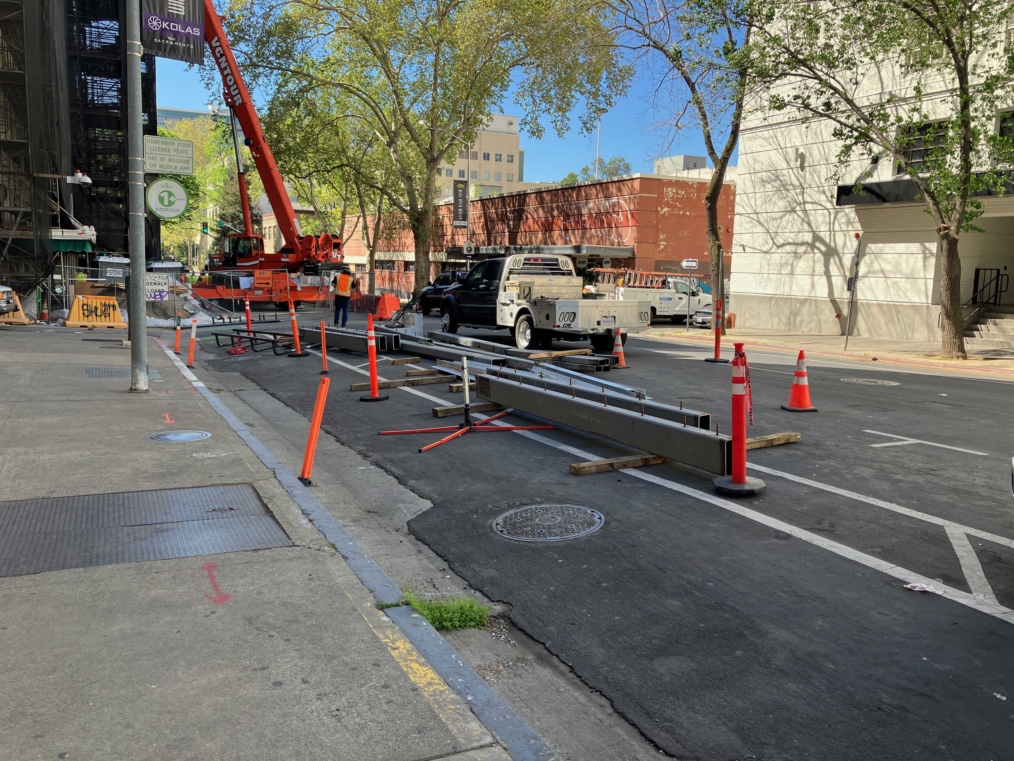
Here is one example (of many) of a bike lane blocked by construction, on J Street between 10th Street and 11th Street in Sacramento. There is a major construction project on the south side in the eastern half of the block for a new apartment building. I’ve written about this issue before: J Street needs construction bypass. As construction progresses, the barriers around the site have moved closer to and further from J Street. The last time I was there, only the parking lane (and of course sidewalk) was blocked, but today, the bike lane is blocked again.

J Street bike lane pinches out at construction barrier

There are no signs along J Street warning of the closure ahead, and there is no ‘share the road’ sign. The commonly used, but not official MUTCD or CA-MUTCD, ‘bicycle share the road’ sign is below. This is, at minimum, the sign that should be installed here.

The solution is to either get the construction company to pull the barrier back from the street, returning the bike lane to function, or for a bike lane to replace the right hand travel lane. Since the sidewalk is also blocked, the accommodation can also serve walkers. As you can see from the photo, the left hand general purpose lane is already blocked for a utility work project. That would result in one lane for an unknown period of time, though the utility project seems to be going fairly quickly and might be done within a couple of weeks or less. The city should do a better job of scheduling construction projects so that they aren’t going on both sides of a busy street at the same time!

bikeway blockages

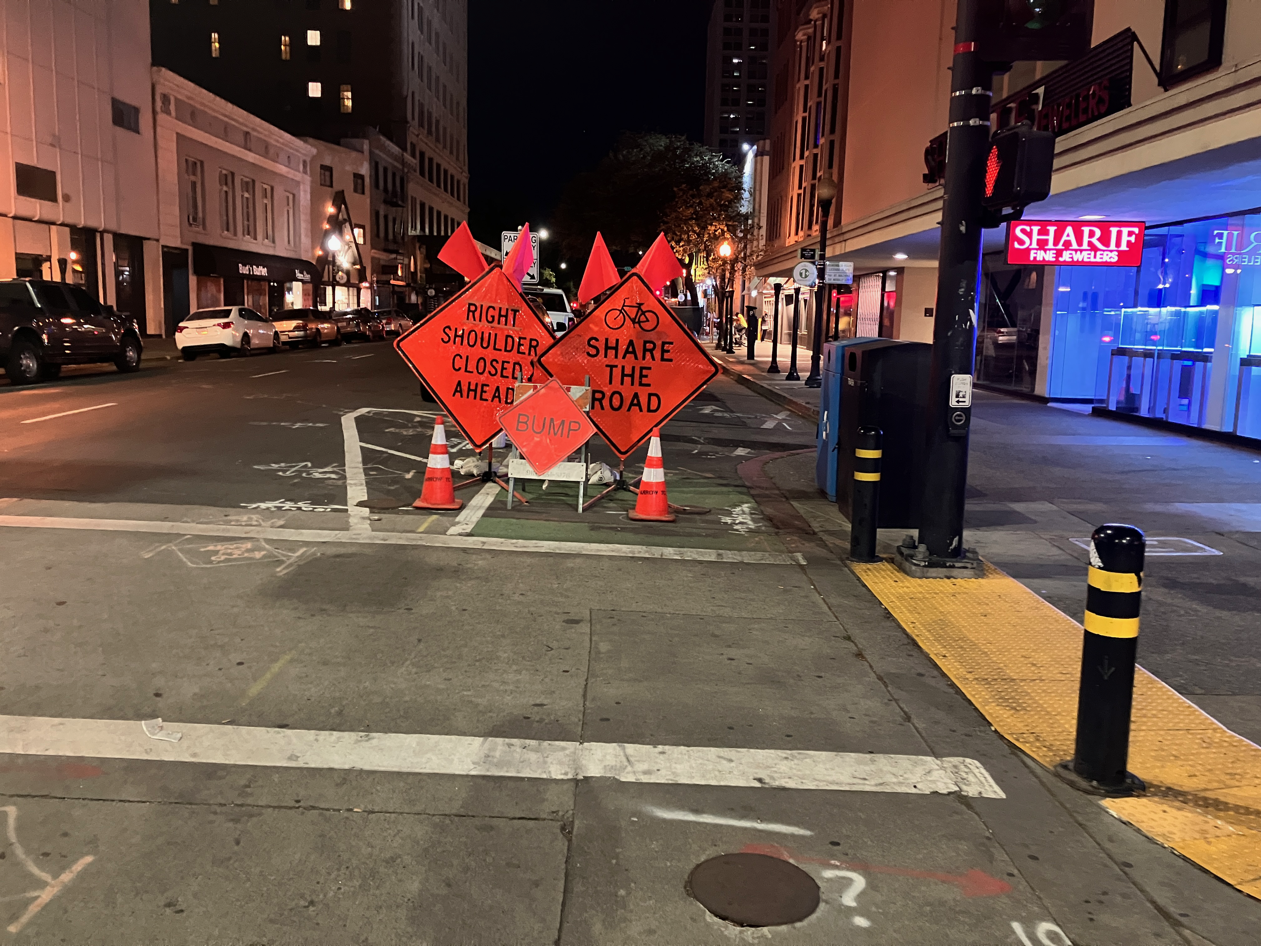
There are active utility projects on 9th Street and 10th Street that have closed parts of the separated bikeways on those streets. Upon noticing this, I thought, no big deal, a few days of work and things will be back. But the closures have been continuing for three weeks now, with no end in sight. It is interesting that the utility work on J Street is moving fairly quickly, but on 9th and 10th, not so much. I am not sure what utilities are being worked on, and whether these are city-led projects with contractors working on city-owned utilities, or whether they are private utilities such as PG&E or communications.

When there is an extended closure of a separated bikeway, more than two days, an accommodation for bicyclists should be provided. I am aware that some bicyclists are willing to ride in the traffic lanes, but the entire point of a separated bikeway is that it needs to work for all bicyclists, including people who are not comfortable riding in traffic. To allow construction to close a bikeway, without any alternative, is a failure on the part of the city. The city is again expressing its favoritism for motor vehicle drivers over bicyclists.

10th Street

10th St at K St bikeway closure
10th St bikeway construction plate

For 10th Street, general purpose lanes should be reduced from two to one, making the other lane a temporary bikeway. Or, remove parking from the left (west) side of the street so as to allow two general purpose lanes and one temporary bikeway.

9th Street, H Street to J Street

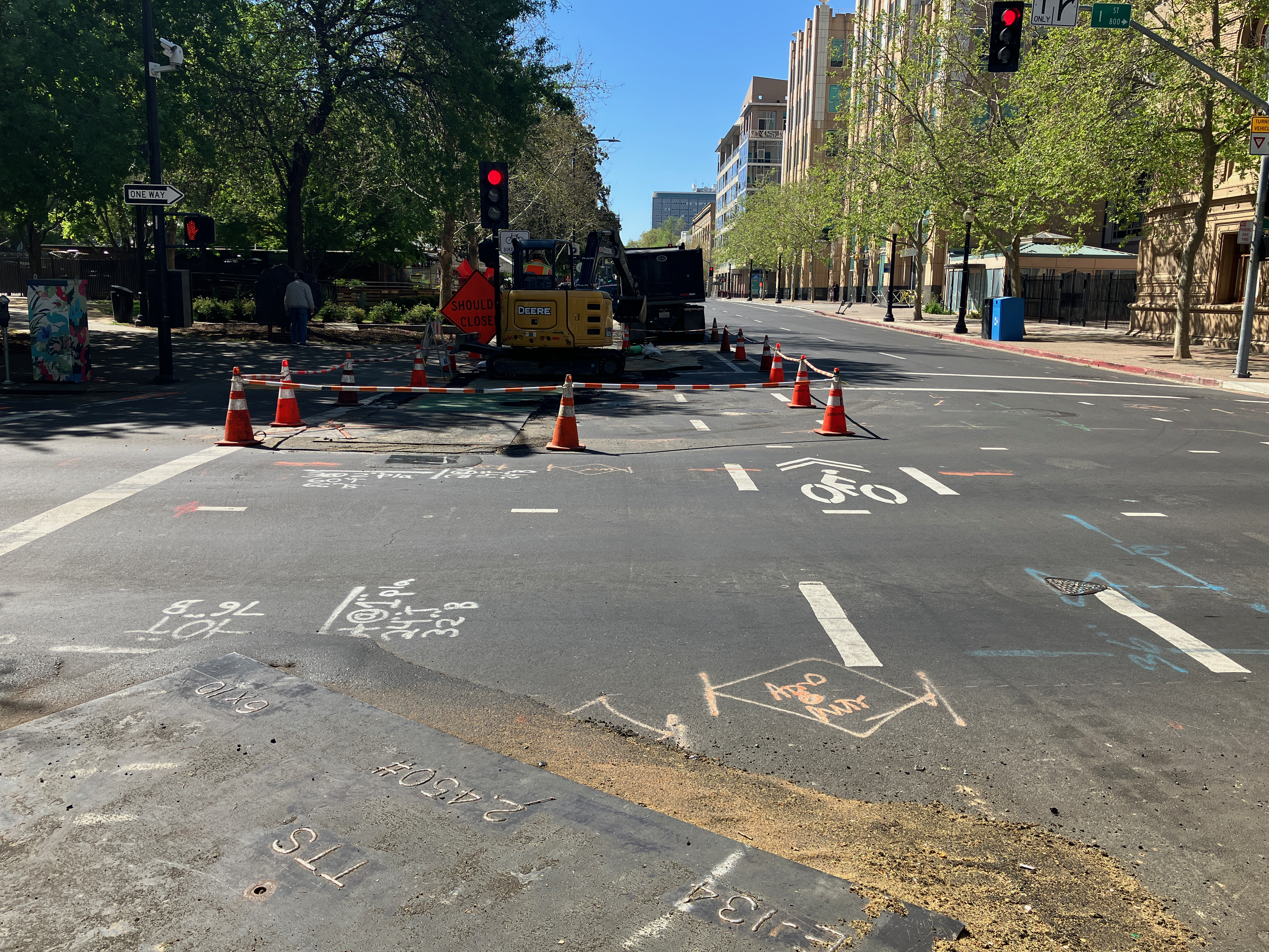
9th St at H St bikeway/bike lane closure
9th St at I St bikeway/bike lane

The bike facility on 9th St is not technically a bikeway until it crosses J St, but since it is intended to provide a similar safe route of travel, I’m including it here. Utility work has closed off the bike lane between H St and J St. No alternative has been provided. The solution is to remove one general purpose travel lane and create a bikeway, or remove parking on the right (west) side of the street in order to maintain two general purpose lanes and one bikeway.

9th Street, K Street to L Street

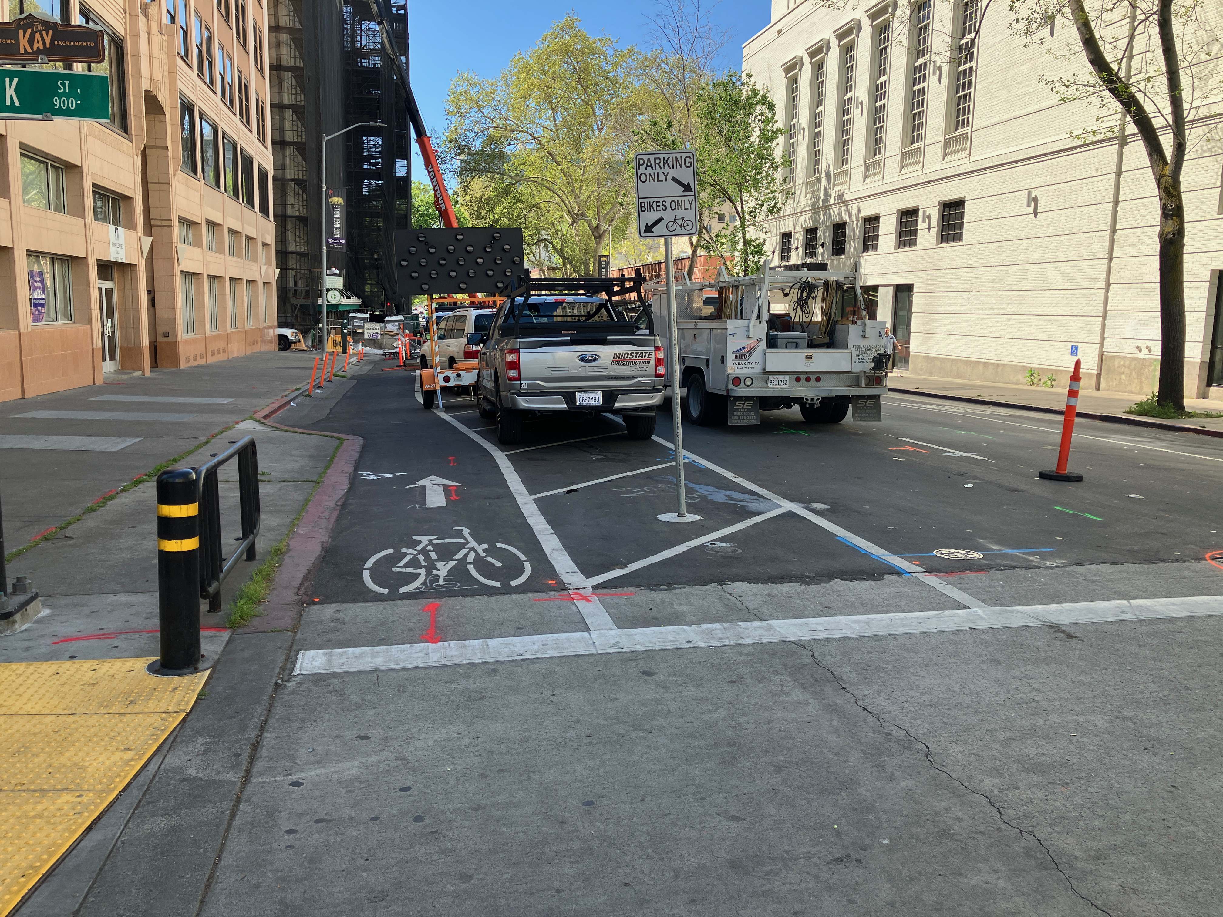
9th St at K St, no signing for bikeway closure
9th St construction materials stored in the bikeway (just south of previous photo)

9th St at Kayak Alley, walkway/bikeway gone

The reconstruction of Capitol Park Hotel, on the east side of 9th Street between Kayak Alley and L Street, has been going on for months. Every time I go by, something has changed about how the roadway is being handled. Today, the safe bikeway and walkway that was there is now gone. Construction has pushed the fence up against what were formerly the barriers that separated the bikeway/walkway from traffic. Today there was a crane filling the space, which may be necessary, but that doesn’t change the clear message that the entire area is now construction zone with stored construction materials.

The section between K St and Kayak Alley is now being used to store construction materials and worker vehicles. The closure of the separated bikeway is not signed in any way; there have been signs here in the past, but they are gone. If you rode the bikeway without realizing it was closed, you would crash into construction materials.

I am not sure whether there is enough space left in the roadway to provide both a separated bikeway and a travel lane. If so, it should be modified for that. If not, the travel lane should be closed until the construction footprint shrinks again to allow the original walkway/bikeway.

It should be noted that the city did not initially provide the walkway/bikeway on 9th Street, and it was only installed after considerably public outcry.

These locations are a fraction of the ones throughout the city where the city has decided that motor vehicle traffic must be accommodated, but walkers and bicyclists do not. The construction guidelines code that the public requested the city develop and implement have been back-burnered because the city has decided to use staff to apply for grants rather than solving current problems on the roadways. I get more frustrated by the city by the day. I don’t really think they care at all. The car-dominated city, which was created by city planners and engineers, is just fine with them.

Sacramento bike superhighways

As a follow-up to the Sac Transportation & Climate Workshop big idea of bike superhighways, I was curious about how the proposed alignments matched with low income and high minority communities in Sacramento.

The map presented at the workshop is low resolution, but I decided to see if I could reproduce the routes, using a combination of the city’s existing and proposed bike network data, the road network where the proposals didn’t seem to match the bike plan, and just plain guessing. You’ll notice gaps and places where the alignment may not be correct, but overall it provide an good impression of the proposal. It is interesting that some of the on-street low-stress bikeways routes are not in the current city bike master plan.

The demographics data for low income high minority communities is from SACOG’s Environmental Justice Areas. This is just one of many possible comparisons. Population density and employment locations would also be interesting. I don’t know what demographic information the city used to come up with the bike superhighways proposal.

The map is below, and pdf. The red lines are the bike superhighways, the blue lines are the ‘on-street low stress bikeways’ that provide to some degree the connection from the bike superhighways to the central city.

bike superhighways and LIHM areas in City of Sacramento

Does the proposal serve the people who need to be served? Meh. To some degree. The Sacramento Northern Parkway, at upper right, probably does the best. It is an existing separated path (Class 1) that does need upgrades at road crossings but otherwise is ready to go. The Jackrabbit Trail at the upper left does serve high minority areas, but not low income. It is mostly an existing route, with some gaps and several completely unsafe roadway crossings. The south area is a major bikeway desert, of course, due to both city and county disinvestment and transportation discrimination, and this proposal does little to correct that.

Sacramento transportation decision time

The City of Sacramento is holding a city council workshop on Tuesday, February 8, 5:00PM. The purpose of the workshop is to gather input to help the city realign its transportation policies and project with its climate change objectives (they are far, far from in alignment now).

Sacramento Area Bicycle Advocates (SABA) with partners has created a petition you can sign to support a more effective and equitable transportation system. The petition and background information are at https://sites.google.com/sacbike.org/cleansac/home.

In its final report, the Mayors’ Commission on Climate Change recommended that to achieve its climate goals, Sacramento must prioritize the use of active transportation, public transit, and shared mobility services, and then electrify remaining vehicles. Reducing vehicle miles traveled by prioritizing walking, biking, rolling, and transit is the most effective way to reduce emissions in Sacramento.

We are asking the Sacramento City Council to:

1. Build a Comprehensive Active Transportation Network.
Commit to and take action to build a seamless, low-stress network of active transportation corridors, for the central city and connections into and out of the city. An infrastructure that supports safe walking, biking and rolling should include the following elements: separated bikeways, secure bicycle parking, adequate lighting, widened sidewalks, traffic calming, and other speed reduction measures.

2. Commit Funding.
Prioritize and set aside funding within the city budget for an active transportation program. Set aside the necessary matching funds to qualify for the federal and state infrastructure programs this year and in future years. Deliberately seek additional funding and financing through grants, state and federal programs, and other revenue sources.

3. Adopt Policy Guidance to Reduce Vehicle Miles Traveled.
All land use decisions should require consideration of reducing vehicle miles traveled when new projects and modifications to existing projects are evaluated by staff and reviewed and approved by City Commissions and Council.

4. Focus on Equity.
Prioritize a consistent focus on equity for project timing and funding.

5. Engage the Community.
Engage the community and regional experts in developing an active transportation program that works for everyone.

6. Ensure Adequate Staffing.
Ensure adequate staffing and resources to develop and administer the program, including the funding/financing aspect.

I’ll comment first on the petition. It is good, but does not go far enough in my opinion. Two improvements I would make:

1. Build a Comprehensive Active Transportation Network. Add short-term bicycle parking everywhere, and secure long-term bicycle parking at all retail and job centers. Recognize bike share as an integral part of the transportation system, including funding it in low-income neighborhoods.

2. Commit Funding. The city should pursue grants and other funding sources, but must also invest significant budget resources to transportation. The city provides the required match for grants, but almost no other funding. The result is that city funds are spent as a match on large projects, and small projects that could otherwise use the funding and have an immediate impact on safety and equity, are neglected. It is rare for cities to rely almost entirely on grant funding, as the Sacramento does for it active transportation and complete streets projects. Sacramento is an outlier.

The city’s page is at http://www.cityofsacramento.org/Public-Works/Transportation/Planning-Projects/Climate-and-Transportation. The major graphic is below, though note that the workshop date has been changed to February 8, 5:00pm.

One of the major programs being proposed to council is a network of bikeway superhighways, shown on the map below. The concept of bicycle superhighways comes recently from Milan, though other European cities have long had such facilities.

The bikeway superhighways part of the proposal seems to be the flagship of the program, so I’ll make a few comments on that.

In the north, the Niños Parkway must be extended over Interstate 80 into the commercial centers to the north. Otherwise, it fails to connect residents to jobs, and falls short at mitigating the major barrier to travel represented by the freeway.

In the south, the 24th St and MLK corridors must be extended south at least to Florin Rd, if not further. Otherwise the residential areas north and south of Florin Rd are isolated from the job opportunities to the north.

Within the bikeways superhighways portion of the city page, there is a statement: 6. Complete the existing bikeway network within 4 miles of the Central City by closing gaps in the network and calming traffic. I do not deny that this might have the greatest impact in reducing VMT (vehicle miles traveled), and since I live in the central city, I’d be a beneficiary. However, this conflicts with the equity goals stated on this page, and throughout city policy. This is the area that has always received the greatest city investment, in infrastructure and in maintenance. The rest of the city to the north and south has largely been neglected. In my view, it is time to turn this on its head. Only projects and investments in low-income areas, or which demonstrably serve to connect low-income neighborhoods to jobs and regional amenities, should be funded. Period. We have a century of disinvestment in low-income areas, greatly accelerated by the urban renewal fiasco of the 1950-1970s. Now is the time to start undoing that damage.

The term ‘congestion relief’ should be removed from the city page, and city documents. Congestion relief is always taken to mean making it easier to drive. Congestion in fact is always a natural check on overuse of motor vehicles, and by reducing traffic speeds, makes it safer for bicyclists. And probably walkers as well, but the research on that is not as clear.

I hope you’ll get involved. SacMoves, the coalition of transportation and air quality advocacy groups, will be discussing the city proposal in depth, and there may be more information to share before the city workshop.

pinching bike lanes

Another classic mistake by the City of Sacramento. Re-striping was just done on several blocks of N Street. Eastbound on N Street 22nd Street, this is what it looks like.

N St eastbound at 22nd St

Take a close look. Extend the dashed line forward, and you’ll see the taper, from a regular bike lane adjacent to a parking lane, to just a bike lane. Look even closer. See where the no parking sign is? A vehicle can park that close to the intersection, completely blocking the bike lane, and in fact blocking part of the general purpose lane. Yesterday, when I rode by, but neglected to take a photo, there was a large pedestrian-killer pickup truck parked right up to the no parking sign, and it was actually covering up three of the dash marks. Riding a bicycle in the bike lane and expecting it to continue? In Sacramento, that is not a reasonable expectation.

I would hope that the striping crew, whether city or contractor (not sure which this was) would notice the problem and stop painting until this was clarified. But it is not really the responsibility of the stripers. This design was signed off on by a ‘professional’ engineer employed by the city. This is the quality of people the city employs.

Westbound on N Street, it is not as bad since the no parking sign is further from the intersection. See below.

N St westbound at 22nd St

It is still a poor design, but nowhere near as dangerous.

As I’ve said before (traffic calming in the central city), these median islands, when placed in this way, as a widening of the center line only at intersections, are a hazard to bicyclists, though they do provide some safety for pedestrians. The best traffic calming measure, and the one that should be used by the city, is traffic diverters.