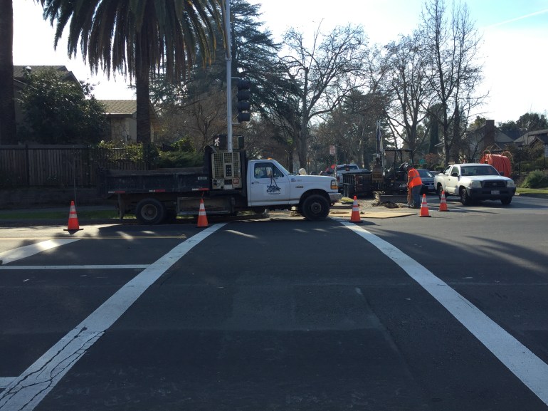
Leading Pedestrian Interval (LPI) signals

Questions about using Leading Pedestrian Interval (LPI) signals at the community meeting on crosswalks reminded me that I had information on these in the city for some while, but hadn’t shared it. A LPI signal gives the pedestrian a 3-second (or more, but the Sacramento ones are all 3 seconds) head start, with the walk sign coming on before the light turns green, so that pedestrians will already be in the crosswalk and more visible before vehicles start to move. These address the common issue of both right-turning and left-turning vehicles failing to yield to pedestrians in the crosswalk. They are one of the pedestrian safety countermeasures identified by the Federal Highway Administration (FHWA), with a crash reduction factor of 60%. If you search for ‘leading pedestrian interval’ on the Internet, you’ll see a great number of useful links. The NACTO page is especially worthwhile.

My purpose in sharing the specific locations is so you can go out and experience LPI for yourself. How does it work for you?

A LPI does slow traffic very slightly since there is an additional 3 seconds per direction during which most vehicles are not moving.

Lastly, this is not a solution that could have been used at the Freeport-Oregon intersection, which is not a signalized intersection. However, it is a solution for the signalized intersections along Freeport. Ryan Moore claimed that these can’t be used at low pedestrian locations, but the response to all such reactionary claims is: “You can’t judge the need for a bridge by the number of people swimming the river.” If crossings are not safe, then fewer people are walking than otherwise could be. The demand is there, but not the facility. LPIs are one solution.

Lead Pedestrian Interval (LPI) locations in City of Sacramento (as of 2015-08-28):

  • 9th Street and I Street
  • 9th Street and P Street
  • 10th Street and I Street
  • 10th Street and J Street
  • 15th Street and K Street
  • 29th Street and K Street
  • 30th Street and K Street
  • 9th Street and Q Street
  • 13th Street and I Street
  • 8th Street and P Street
  • 8th Street and Q Street

Community meeting on crosswalks – 2

Part one, Community meeting on crosswalks, prior posts:  removal of crosswalksDon’t use the ‘A’ word. Next related post will be about Zegeer.

Question and answer session of the meeting:

  • The city is doing a speed study on Freeport from Sutterville Rd to Meadowview Rd, and will include part of Sutterville (not clear what part)
  • There are no red light cameras on Freeport; the city piggybacks on country red light program
  • There are no lead pedestrian interval signals on Freeport, or even is south Sacramento (all are in the central city); Ryan Moore said these should not be used in low pedestrian areas (which is false)
  • Resident commented on Fruitridge Rd, 24th to Freeport, a lot of red light running and few safe crossings
  • Resident who lives on Oregon suggested changing the speed limit on Freeport
  • Steve Hansen says that the city would like to change Freeport, but to do so, the community (residents, businesses, neighborhood associations) will need to come together to decide how; people will have to give up some time for better safety; he also mentioned narrow sidewalks with obstructions
  • Several people asked about or commented on specific sections and intersections; Matt mentioned catching egregious speeders
  • South Land Park Neighborhood Association (Ryan?) asked what public notice there was before crosswalk removal and said they were not notified; not clear if the other two were notified
  • Ryan Moore said that each removal was analyzed, he says they followed the law of CA MUTCD; said most of the removals were result of complaints; said neighborhood input makes no difference; mentioned FHWA info on crosswalks, referring to Zegeer report though not by name (more info about Zegeer in a future post)
  • Neighbor said that any process that removes crosswalks is flawed; mentioned no still phase on signals (time between red one direction and green the other); going out of the way is not reasonable to ask; can’t have data on people walking because people are scared to walk
  • Steve Hansen and Jay Schenirer want to review pedestrian guidelines, not sure what document this is; said we need to talk about equity because the top corridors of Vision Zero concern are not necessarily located in disadvantaged communities
  • Neighbor said speed display signs don’t seem to have any effect on behavior; asks for immediate action and not years out
  • Ryan Moore continually says “we’d like to but we can’t” but offers no proof; continues to say that crosswalks at this volume and speed are not safe
  • Neighbor said there are bus stops close to Oregon which is true and which might make removal a violation of Title 6
  • Issue of sidewalk maintenance responsibility has come up several times; city continues to insist that it is the responsibility of the property owner (even though most sidewalks are part of the public right-of-way and all are part of the transportation network)
  • Many people pointed out that improvements could have been made at the Freeport-Oregon intesection, such as bulb-outs, refuge median, lighting; there is a median already but it is too narrow to provide refuge
  • Participant asked for a pedestrian commission, Jennifer Donlon Wyant said the the city Active Transportation Commission would be seated in April or May
  • Jay Schenirer wrapped, mentioned that McClatchy students drove the changes to Freeport north of Sutterville Rd

My overall take on the community meeting is that the city council members and the public, both residents of the neighborhood and others, want proactive changes to increase pedestrian safety and walkability. They don’t want excuses. Ryan Moore, the Interim City Traffic Engineer, seem prepared only to offer excuses.

Of all the people on stage, Ryan Moore seemed the least sympathetic to the person killed, or the issues that it raises. He said much the same thing he’d said to the SacBee: “Instead, traffic engineers hope that by removing some crosswalks, pedestrians will instinctively choose to cross at a safer, nearby intersection,” Moore said. He kept referring to federal and state standards that were being followed, though a number of people in the audience who know a great deal about traffic engineering noticed that he was mis-stating and mis-using standards and research to defend his actions and opinions.

Community meeting on crosswalks

I had promised I’d report on the community meeting to address the crosswalk removal over Freeport at Oregon and related issues, but it has taken me a while. Previous posts: removal of crosswalksDon’t use the ‘A’ word. For background, see the SacBee article: Why Sacramento erased 23 crosswalks, including one where a grandmother died after removal.

The meeting was hosted by City of Sacramento council members Jay Schenirer and Steve Hansen, and school board president Jessie Ryan, and held March 8 at Hollywood Park Elementary which is east of the intersection where the fatality occurred.

Steve talked about the concept of a stroad, a street/road hybrid that doesn’t do either well, though he did not use the term. Freeport is a stroad. He introduced vision zero, talked about changing both infrastructure and behavior, mentioned that the traffic motor officers are gradually being built up but are far below what they should be, and said “we should enjoy the public space and not be afraid.”

Ryan Moore, Interim Traffic Safety Engineer, and the person responsible for the removal of crosswalks, repeatedly mentioned a ‘Systematic Safety Analysis Report’ but is was not clear what this is, and the city website has no mention of it. He also said that he was following all the federal and state rules, as well as research, by removing the crosswalks.

Jennifer Donlon-Wyant, the Active Transportation Specialist, gave a Vision Zero presentation similar to what many people have seen before, but highlights are that Sacramento is the second worst in the state for pedestrian fatalities per capita. She went over the ten profiles that are the core of the draft Vision Zero Action Plan, of which three are related to speed, and one related to transit stops, which all play a role in this incident. One that does NOT apply is ‘Pedestrian Crossing Outside of an Intersection or Crosswalk.’ Though the city had erased the marked crosswalk, it was and is still a valid legal crosswalk. Freeport Blvd is not one of the top five fatality and injury corridors in the city.

Matt Armstrong, Sergeant of the Motor Team (officers on motorcycles) said he has 7 officers on at a time, maximum, for the entire city. They respond to complaints, but otherwise focus on schools and high volume corridors. He said top concerns are red light running, distracted driving, and speed. He mentioned something I had not heard before, that this was a multi-lane threat crash. A multi-lane threat crash occurs on streets with more than one lane in the same direction (Freeport has two lanes in each direction), when one driver stops for a pedestrian and other drivers does not. This is a violation of CVC 21951 “Whenever any vehicle has stopped at a marked crosswalk or at any unmarked crosswalk at an intersection to permit a pedestrian to cross the roadway the driver of any other vehicle approaching from the rear shall not overtake and pass the stopped vehicle.”

Jessie Ryan said the district recognized that their policies were insufficient and were going to adopt the California School Boards Assocation Safe Routes to School policy (which is very weak), that they were creating heat maps to prioritize unsafe routes, is committed to using and reviewing data, and welcomes public input. The district, prior to this, has shown little interest in Safe Routes to School and has implemented only some minor projects.

Kirin Kumar of WALKSacramento and Jim Brown of Sacramento Area Bicycle Advocates (SABA) spoke briefly about the need for culture change in the community and in the city bureaucracy.

Next post I’ll discuss some of the public comments and questions, and the answers provided.

Serve on SacRT board

From our friends SacTRU and also noticed by Ridership for the Masses.

Mayor Steinberg is appointing a member of the private sector to the SacRT Board. This seat will replace one of the Sacramento City Council seats currently filled by Councilman Rick Jennings and will serve until the end of 2018. The member of the private sector would have full voting rights as a board member representing the city of sacramento.

Position: Seat A – A member of the private sector with an understanding of the importance of regional transit and public transportation.

Deadline to Apply: March 30, 2018 at 5:00pm

The requirements and selection process are vague, but all are encouraged to apply. We hope many qualified members of the community will apply and represent the needs of riders, and that this seat is not simply filled by an interested member of the business community.

Apply at: http://www.cityofsacramento.org/Clerk/Legislative-Bodies/Boards-and-Commissions. Scroll down to Sacramento Regional Transit Board; no direct link is available.

It has been suggested that the best candidate is a woman of color. There is only one woman serving on the board currently, Linda Budge. There are two people of color, Rick Jennings and Phil Serna, but it is Rick Jennings seat that is being offered (see board list). STAR believes it is important to have someone who is a regular user of the transit system, since the current members range from low transit use to no transit use. Finding that ideal candidate that increases the diversity of the board and better represents riders will be a challenge. If you know that person or those people, please let them know and ask them to serve.

At the same time, STAR encourages everyone to apply. This can be a transformative moment for SacRT, and a strong interest in the position may encourage the other entities, county and cities, to appoint citizens. The board suffers from having politicians as members who are already very busy with their other boards and commissions, and other interests, and don’t pay enough attention to transit. We need someone whose passion is transit that works for everyone.

Don’t use the ‘A’ word

I attended the community meeting hosted last evening by Jay Schenirer, Steve Hansen, and the school district, called as the result of the recent fatality and severe life-threatening injury on Freeport Blvd. I’ll write more soon about the meeting itself, but for today, a comment about use of the ‘A’ word, accident. Every public official that evening, with the exception of Jennifer Donlon Wyant, used the word accident. Some of them repeatedly, with Ryan Moore, the Interim City Traffic Engineer, being the worst offender. Many of these uses were made while standing in front of the Vision Zero slide that states “Vision Zero ~ a traffic safety philosophy that rejects the notion that traffic crashes are simply “accidents,” but are preventable incidents that can and must be systematically addressed.” Oh, the irony.

Not the time to go into a detailed explanation of the harm that using this word causes, but you can check out http://droptheaword.blogspot.com, or #CrashNotAccident on Twitter. Basically, the common understanding of the word in traffic violence conversations is to excuse motor vehicle drivers (and engineers) of responsibility for their actions, implying that nothing could have been done, when in fact many things could have been done.

So, a modest proposal. Every time a public official uses the ‘A’ word, they make a contribution of $20 to a local transportation advocacy organization. Eventually, people will cure themselves of using the word, but in the meanwhile it will be an important source of income for nonprofits working to overcome the bias inherent in use of the word, and the underlying windshield perspective that accepts traffic violence as inevitable.

Bike Share Open House Feb 21

from a City of Sacramento email:


Join the City and SACOG for a Bike Share Open House!

What is bike share?

Bike Share provides short-term bike rentals that you can pick up and drop off at various locations around Sacramento, West Sacramento, and Davis. Jump will soon be rolling out 900 bikes for anyone to use, and we want to hear from you!

You can find more information about our regional bike share program here.

When and Where?
Wednesday, February 21st, 5:30-7:00pm

City Hall, 915 I St, Room 1119 (off of H Street)

Can’t attend the meeting?

Share your thoughts on the online map!

Questions?

Email: bikeshare@sacog.org

More information can be found here.

Vision Zero comments

Here are my comments on the draft Vision Zero Action Plan for Sacramento. Most of these were posted on the boards at the 2018-01-31 meeting, and in email to the city.

  • Sacramento essentially has no traffic enforcement currently. More about this tomorrow.
  • I was concerned by the prominence of the bicyclist fatalities increasing 150% without any contextual information. As with any data point with small numbers, as bicyclist KSI (killed and severely injured) is with respect to pedestrian and vehicular KSI, noise can lead to apparently huge changes that may not indicate a pattern. It would be sad if that one statistic were used to argue that changes to protect bicyclists should be prioritized, when it is clear from all the other data in the plan that pedestrians are at the greatest risk.
  • If 78% of KSI occurred at intersections, issues can be addressed more quickly and cheaply by focusing on intersections rather than corridors.

Profiles

All profiles should have the DAC/CES overlay, not just profile 3.

  • Profile 1: unsafe speed and profile 3: 35+ streets: Street Narrowing should say Street Narrowing and Speed Limit Reduction
  • Profile 4: 30+ streets should include lane narrowing
  • Profile 5: broadside: is there evidence that adding signals reduces crashes, anecdotal evidence would argue that it increases crashes
  • What does no bullets for efficacy mean, that there is no benefit, or that there is insufficient research?

I asked about why there was a 30+ and a 35+ profile. The answer is that collision characteristics change considerably between 25 and 35, with 30+ being an issue for bicyclists, and 35+ being an issue for all modes.

Vision Zero Actions (p. 45-50)

  • 1.5 Launch online, interactive crash data map and website. > short-term
  • 2.2 Install 10 low-cost safety improvements, including new road markings, signs, and minor signal modifications per year. > 10 locations
  • 2.3 Develop prioritized list and deliver half of engineering safety projects on the HIN in Disadvantaged Communities (commensurate with share of fatal collisions). > separate so that list is short-term, deliver is long-term
  • 4.4 Install school zones at all schools. > what about reductions at qualified locations?
  • 5.4 Update City signal timing policy to improve safety for all modes (e.g. all red time, pedestrian crossing times). > should include specific mention of LPI at high-pedestrian or high-collision intersections

Sacramento Vision Zero and Bicycle Plan meeting January 31

You might have thought you had other plans for the evening, but…

The City of Sacramento is holding the last of four public meetings on Vision Zero and Bicycle Master Plan implementation tonight, January 31, 5:00 to 7:00PM at city hall.

You can see the new Bicycle Master Plan and draft implementation plan at http://bit.ly/SacBicyclingProgram. You can see the Vision Zero Draft Action Plan and other documents at http://bit.ly/VisionZeroSac.

Just one of these would be reason to attend, but both! Hope to see you there.

What activates parks?

Now that I’ve had some things to say about individual parks in Parks in the central city and Park positives, some comments about what I think activates parks.

  1. People experiencing homelessness. Yes, I’m serious. There is nothing worse than an empty park, and I’d rather see people using a park than not.
  2. Nearby residential, something more than single family. Parks need people who live close, and parks surrounded by single family and other uses cannot gather enough people to activate them except for special events. Nothing wrong with mixed use, but if no one lives there, there won’t be a good park.
  3. Drinking fountains. In a climate like Sacramento, all public spaces should have drinking fountains.
  4. Something unique that does not exist at nearby parks. Restaurant, senior center, stage, basketball courts, water features, etc.
  5. Playground. Parks need kids, and kids need playgrounds. The size can be scaled to use, but the playground needs something unique that appeals to kids and isn’t just like every other playground. Creative ideas.
  6. Restroom. Any Park of a block or larger in size should have a public restroom. Park users will need restrooms, particularly kids, and they should not need to return home or seek out a local business. Of course this is part of a more general issue that Sacramento has almost no public restrooms anywhere.

I am am sure there are official answers to what parks need, and I will look for those when I have the time, but I want to provide my two cents worth.

What do you think?

Park positives

As promised, some positives to say about parks to follow up on the previous park post.

Cesar Chavez Plaza: The park always has people in it. Yes, some complain that it is the wrong (homeless) people, but I think a park full of people is a good park. The park hosts special events such as Concert in the Park, and has a seasonal farmers market. And it finally again has a restaurant. Too high-end for many of the people who use the park, but a positive nevertheless.

Roosevelt Park: The real strength of this park, in my opinion, is the basketball courts. I almost always see people there, playing and socializing. Many are not from this neighborhood, which I see as an indication that there is a much greater demand for high quality community basketball courts than is being met by the city. I'm not a fan of basketball, nor of the Kings who helped upgrade the courts, but I know park activation when I see it.

Fremont Park: This park has a playground used by every kid who lives in the neighborhood. It has a number of special events throughout the year, the biggest of which is Chalk It Up on Labor Day weekend. The park is surrounded by both housing and retail, so it gets a lot of unplanned visits.

Capitol Park: Capitol and Sutter's Fort are of course not primarily parks, but parks surrounding important state buildings. For me, the most interesting thing is the arboretum. It could be better advertised and have an app guide, but nevertheless it is a great resource.

Sutter's Fort and State Indian Museum: Again, a park managed by the state primarily for other purposes, but with some nice park amenities. The ponds and fountains are my favorites.

Grant Park: This would be another big, bland water-wasting grass park, but it is saved by having a great little playground and a drinking fountain.

Zapata Park: Though small, Zapata has a playground, garden, court, grass and trees. The most distinctive thing it has is adjacent multi-family housing, so the park is always full of kids and families.

Southside Park: Southside is of course the gem of the central city, with a large number of amenities. The playgrounds are large enough to have a variety of equipment for different ages, with elements not seen in other parks, and is heavily used by families.

Next up: What activates a park?