Part of an ongoing series of posts to support better streets in the City of Sacramento during their 2023 update of Street Design Standards. New standards must be innovative, safe, and equitable, and it will take strong citizen involvement and advocacy to make them so.
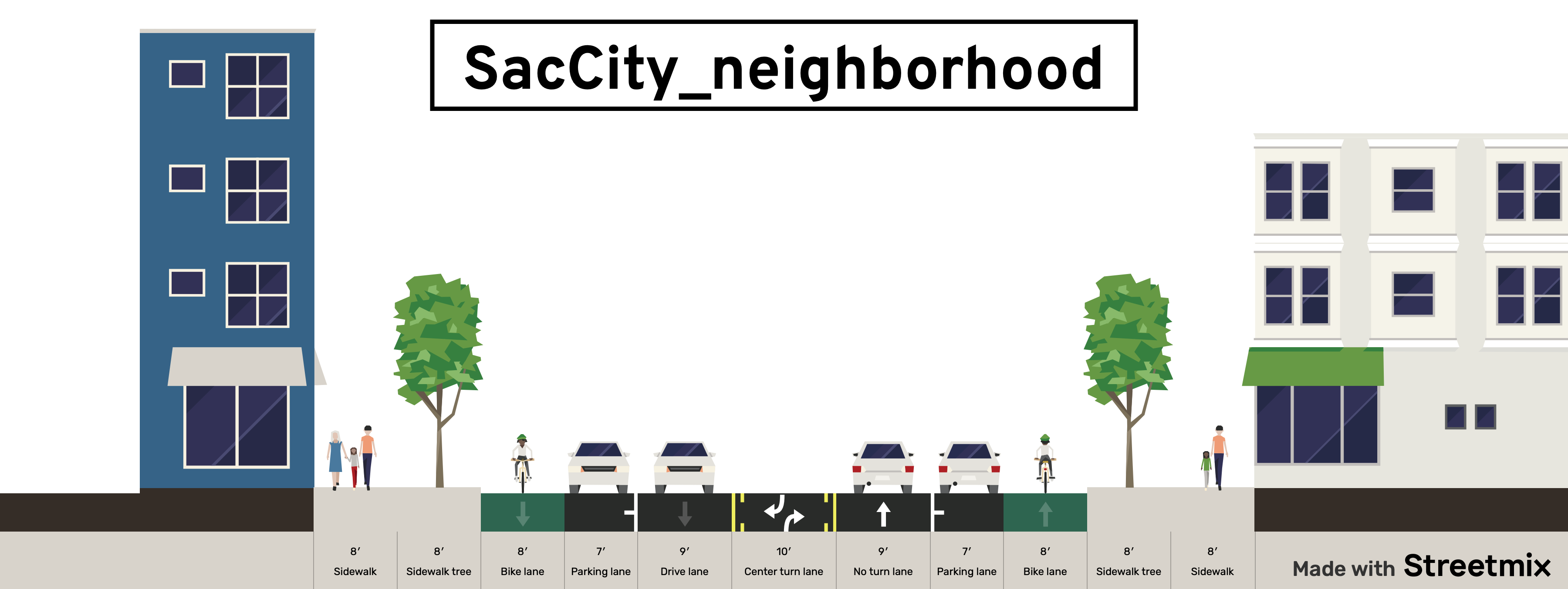
This intersection design post follows on to the SacCity intersections of local streets post, addressing intersections of larger streets. See SacCity street classification for detail on types of streets (local, neighborhood, corridor).
The most important point of intersection design is that multi-lane roundabouts have absolutely no benefit for people walking or bicycling, particularly those with vision or mobility limitations. They are no more safe than regular intersections, and some research indicates they are less safe. They are just more motor vehicle infrastructure masquerading as something innovative and safe. If the city were to include a design for multi-lane roundabout, it would be a travesty.
This is also the last of the design detail posts. I realize that the posts have veered off into related issues, and the piecemeal nature of the posts makes it hard to see the overall pattern, so I will try for a summary post in the near future.
Policy
- New or reconstructed intersections of neighborhood streets will generally use protected intersection design
- New or reconstructed intersections of corridor streets will use prote
- New and reconstructed intersections will include curb extensions, raised crosswalks or raised intersections, and/or protected intersection design
- ADA ramps at intersections will always be perpendicular to the roadway, never diagonal
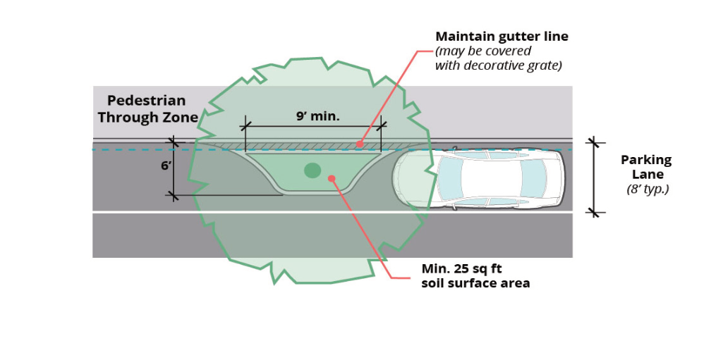
- Daylighting for visibility will be provided at all intersections, through red curbs, curb extensions, or protected intersections; if red curbs alone are used, the offset from intersection should be at least 15 feet
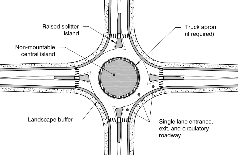
- Roundabouts: single-lane roundabouts will be considered for any reconstructed intersection except local streets; multi-lane roundabouts have no safety benefits and will be prohibited
- Intersection corner radii will be set to ensure slow and safe turning speeds for all motor vehicles; truck and bus routes will never be more than 15 feet
- Safe crosswalks will be provided at no less than every 1/8 mile in all urbanized areas; 30 mph, crosswalks must have at least pedestrian activated or automated flashing beacons; at 40 mph, crosswalks must have full signalization
- Slip lanes will be removed from existing streets and not installed on new or reconstructed streets
- Pedestrian crossing prohibitions will be removed from all intersections except those with freeway onramps and off ramps
Design diagrams will include:
- ADA ramps, including design which prevents accumulation of water at the base of ramps
- intersections of local streets
- intersections of neighborhood streets with neighborhood streets or local streets
- intersections of corridor streets with corridor streets, neighborhood streets, or local streets
- protected intersections
- modal filters/traffic diverters
- single lane roundabouts
- curb extensions (bulb-outs), with concrete curbs
- interim curb extensions with paint/post installations
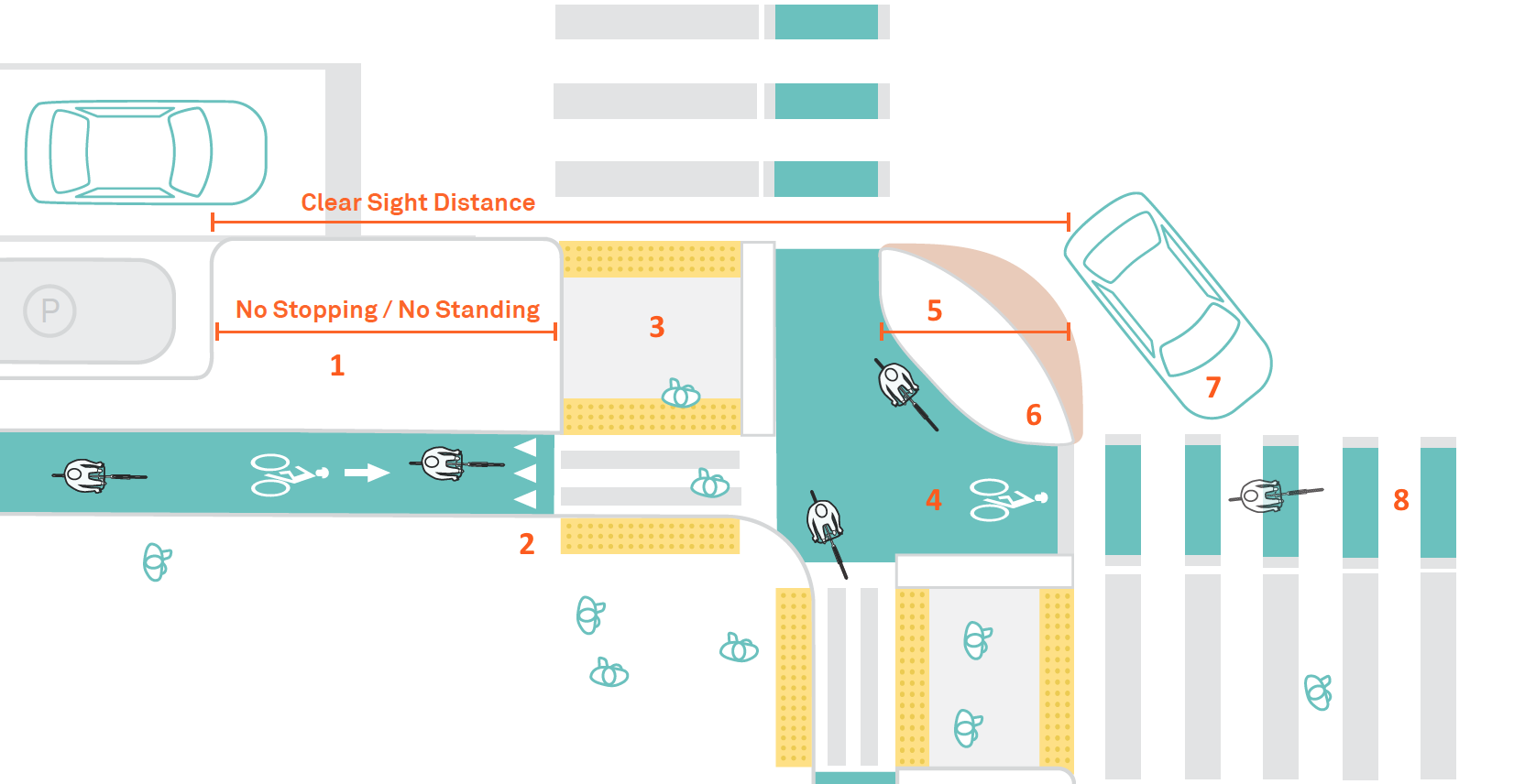
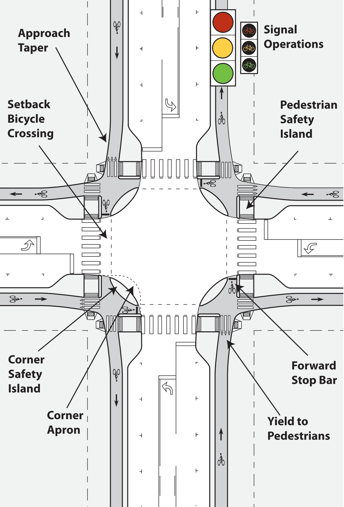
Two design diagrams for protected intersections, the first from NACTO Don’t Give Up on the Intersection: Protected Intersections, the second from Alta Design+Planning Evolution of the Protected Intersection, for protected intersections, followed by NCHRP Roundabouts: An Informational Guide, for a single-lane roundabout.