Sacramento Press is sponsoring a live chat with Jeff Speck, the author of Walkable City: How Downtown Can Save America One Step At A Time. The live chat is tomorrow, January 3, at 12:30PM. The offline chat is already going on, if you want to check it out. I am currently reading the book, in the Kindle version, but am only part way through.
Many of the online comments so far have focused on creating a livable city, and it is wonderful to see so many positive ideas and accurate identification of challenges. Intelligent conversation like this is rare in the Sacramento news blogs. I’ll make some comments specifically on the walkability safety aspects. I’ve written about this before, but it is worth writing about again and again, because the problems still exist.
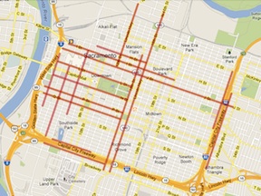
Traffic sewers: Multiple lane and one way streets are traffic sewers. This epithet is used to describe streets designed to flush traffic in and out of employment centers (and to homes in the suburbs) twice a day. They serve no other reasonable purpose, and they make a place very much less walkable. Three (or more) lane roadways are incompatible with walkability. They encourage high speed traffic, and provide too long a crossing distance to pedestrians to be comfortable with. They don’t meet the “8-80” criteria, of being safe and comfortable for people of all ages.Solutions:
- Therefore, I think that all three-lane roadways in Sacramento must be narrowed to two lanes. If a true refuge median is provided between two directions of travel, at least three feet wide, so that a person can cross each direction of traffic separately, then roadways with a total of four lanes are acceptable. If not, then only a total of two lanes. Six lane or more roadways, common in the northern and southern suburbs of the City of Sacramento, are not acceptable.
- One way streets also encourage high speed travel. I think that all of our one way streets should be converted to two way streets. This can be done over time as streets are repaved, it is not as high a priority as the narrowing of streets, above.
Read More »