Carnage
- Boy struck by vehicles on Bruceville Road dies of injuries (SacBee 2013-12-27); Sacramento police seek driver in hit-and-run that injured 11-year-old pedestrian; (SacBee 2013-12-24); Child struck, seriously hurt by vehicles in south Sacramento (SacBee 2013-12-23)
Other
- New year to bring new laws affecting motorists (SacBee 2013-12-29)
- Ask the County Law Librarian – Basketball hoops in the street (SacBee 2013-12-27)
- Sacramento suburban schools expect growth (SacBee 2013-12-26); since development pays only a fraction of the cost of new schools, the rest of us pay through taxes, and sprawl is subsidized
- Holiday DUI crackdown to continue Friday with sobriety checkpoint in Rocklin (SacBee 2013-12-26)
- Sacramento County prosecutor faces drunk driving charges after Highway 50 collision (SacBee 2013-12-26)
- Year in Review: Lack of redevelopment money stalls projects (Sacramento Business Journal 2013-12-24)
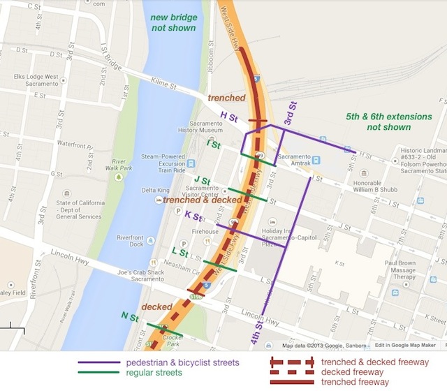
- Sacramento County officials on Watt Avenue backup: It’ll get better (SacBee 2013-12-24)