13th & J intersection

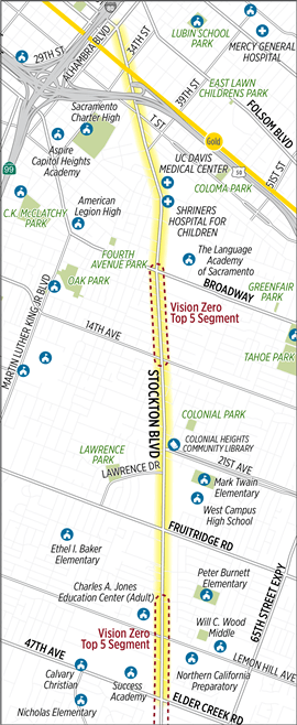
I want to acknowledge Enzo of Streets Are Better for reminding me of this intersection and provoking me to write now in more detail. Two previous posts change the signal at J St and 13th St and J & 13th needs a pedestrian scramble were briefer and did not cover all the issues.

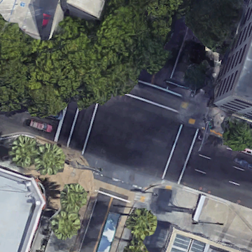
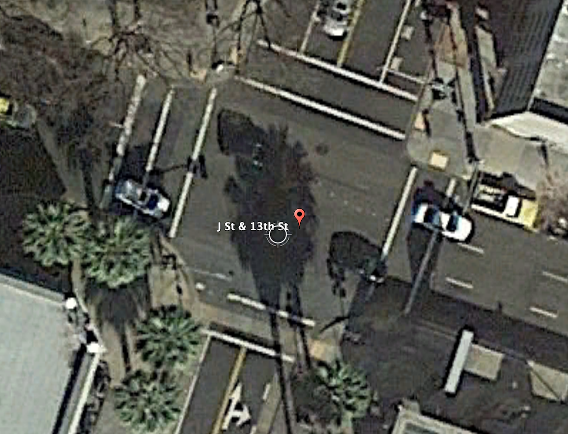
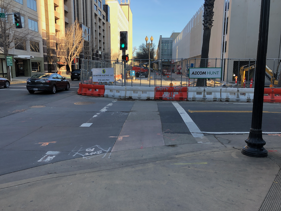
The intersection of 13th Street and J Street in downtown Sacramento is a mess for walkers and bicyclists, largely due to poor decisions that the city has made. The setting is below, with a historical view selected for no leaves on the deciduous trees. On the southeast corner is the convention center, which is under construction now, and the southeast corner is fenced off. On the southwest corner is the Sheraton Grand Hotel. On the northwest corner is a major downtown parking garage, managed by Ace Parking. On the northeast corner is another parking garage managed by Parking.com.

intersection of 13th Street & J Street, downtown Sacramento

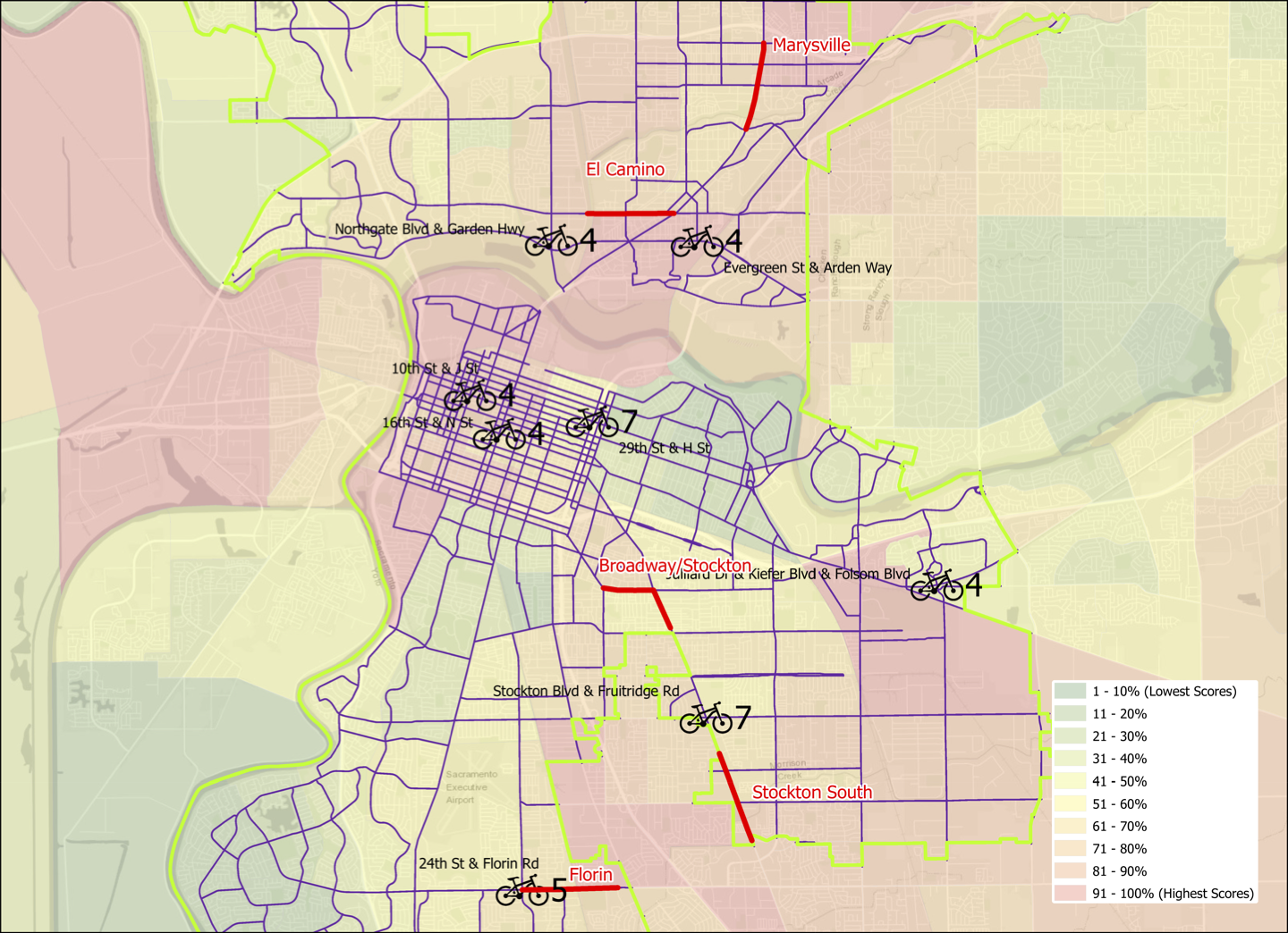
In the days before construction on the convention center started and the Sheraton shut down due to the pandemic, this was one of the busiest pedestrian intersections in the central city. The crossing of 7th Street at K Street/DOCO Center, L Street at 11th Street and 10th Street when the legislature is in session, Capitol Mall at Tower Bridge, and a few others are up there, but this one is certainly in the top 10. The city rarely collects pedestrian data, so I do not know what the ranking or volume is.

When the convention center is completed and open, and the Sheraton opens at full scale, this will again become a very busy pedestrian intersection. So you would think that the city would design this intersection and signals to prioritize people walking, but you’d be wrong.

The crossing of J Street on the west leg of the intersection requires pushing the ped button. There are a number of pedestrian signals in the central city that do not require pushing the button, and these are called auto-recall, meaning they automatically change on a cycle. Not this one! I just observed a number of walkers crossing here, and only about 5% of them initially realized they had to push the button. When I mentioned that the signal would never change unless they pushed it, they were surprised, and not happy. When the ped head signal does come on, it has a white hand of 5 seconds, and a countdown of 9 seconds for a total of 14 seconds. There are three lanes of motor vehicle traffic here, lanes about 12 feet wide, for 36 feet. The MUTCD recommended crossing speed is 3.5 feet/second, so 36 feet should be a minimum of 10 seconds, but this assumes that people can leave the curb immediately, not true when the activation button is set well back, and there is pedestrian congestion. In that case, the crossing speed should be 3.0 feet/second. If you want to read about the contortions traffic engineers go through to make walk cycles as short as possible, read pedestrian crossing questions and answers.

The traffic signal for J Street will remain green unless there is a vehicle waiting on 13th Street or someone pushes the ped button to cross. The ped signal to cross 13th Street goes through a white hand, countdown, brief pause, and then back to the next cycle. Without a cross-traffic vehicle or button push, the traffic signal will never cycle. Ever.

crosswalk over J Street at 13th Street

An additional problem is that sometimes the signal controller will just skip the crossing J Street part of the cycle, even when the button is pushed. Since I’m mostly on my bicycle rather than on foot here, I haven’t quite pinned down the behavior. I don’t know if it depends on time of day, or traffic volume, or is just random, but I can affirm that it happens, and not infrequently. So even after the walker presses the button, they may have to wait through another full cycle before they get the walk.

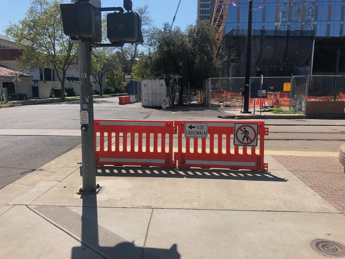
On the southeast corner, the convention center construction has closed the corner and sidewalks. In this situation, there should be a barricade and warning signs on the opposite corner, so J Street south side eastbound and 13th Street east side southbound. A fully sighted person can of course see the barrier and fence across the street, but the point of ADA requirements is to communicate to everyone, not just the sighted. Below is what is looks like, followed by what it should look like. Remember, this is a city project, not a private development, but the city apparently holds itself to lower standards than it holds private developers.

closed crosswalk over 13th Street at J Street
proper barricade and signing for a closed crosswalk, O Street at 8th Street

The east leg crosswalk also suffers from traffic flow design. The walk sign for this crosswalk comes on at the same time as the southbound green signal comes on, bringing drivers into immediate conflict with walkers in the crosswalk. There is no leading pedestrian interval (LPI) to let the walkers get a head start. At this time the crosswalk is closed, but as soon as it is reopened, the conflicts will be immediate, as they have been for years.

Solutions?

  1. Immediately institute auto-recall on the crossing of J Street, and remove the buttons. These are not modern audible buttons, they are antiques.
  2. Immediately institute a leading pedestrian interval on the crossing of J Street, to increase protection from left and right turning drivers.
  3. Immediately lengthen the pedestrian phase for the crossing of J Street to a minimum of 20 seconds.
  4. When then southeast corner of the intersection is re-opened, with completion of the convention center construction, implement an exclusive pedestrian phase for this intersection, in which there is no movement by motor vehicles during the walk cycle, and walkers can cross in any direction including diagonally. If any intersection in Sacramento deserves this treatment, this is it.
  5. Traffic calm J Street to reduce speeds. The most important step is to reduce general purpose lanes to two, and create some sort of bicycle facility. I’m not sure of the best design, as the valet/unloading/loading are for Sheraton Grand may make this challenging.
  6. Get rid of any City of Sacramento Public Works employee who believes the purpose of central city streets is to favor suburban commuters (the J Street traffic) over walkers, bicyclist, and local residents.

I have made at least seven 311 reports on the signal problems at this intersection, asking that it be changed. The only change that I’ve been able to notice is that they lengthened the pedestrian phase for crossing 13th Street, and shortened it for crossing J Street. I just gave up after a while.

Bicyclists

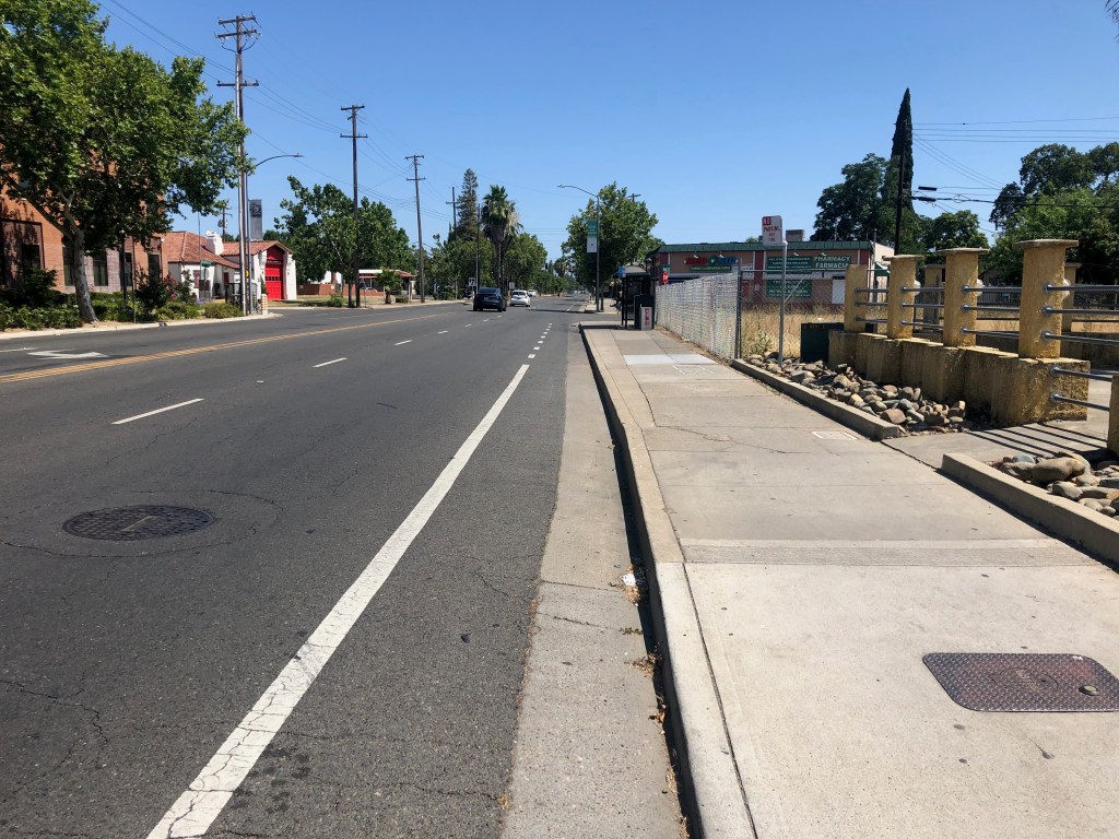
That covers most of the pedestrian problems at this intersection. How about bicyclists? 13th Street is a major bicycle route in downtown, being the only north-south street that crosses through Capitol Park and is not an arterial street, often with heavy traffic and higher speeds. There are bike lanes on much though not all of 13th Street to the south J Street, and there are bike lanes on most blocks to the north, except the half block approaching this intersection. Here, the bike lane has been sacrificed to create a turn lane. There is a required left turn lane and an optional turn lane, but no bike lane. So at this busiest of all intersections on the route, there is no bike lane. There is a clear message here from the city: we will accommodate bicyclists only if it does not reduce motor vehicle capacity. Otherwise, tough luck.

The loop detectors on 13th Street only sometimes detect bicycles. I often see bicyclists during off-times, when there are fewer motor vehicles to trigger the cycle, proceeding through the intersection on red, when it is safe to do so (and occasionally when it is not). They have the right to do so, since by definition a signal that does not detect vehicles (devices) is a non-functional signal, but it is not the best solution.

When the pedestrian button is pushed to cross J Street on the west leg, but no southbound motor vehicles are present, the vehicle signal remains red, so doesn’t allow for undetected bicyclists. This doesn’t protect any walkers, so it makes not sense.

Solutions?

  1. Continue the bike lane on southbound 13th Street to and through (with green skip paint) the intersection with J Street, and remove the left turn lane which prevents the bike lane from continuing. That might mean lengthening the green light for motor vehicles in order to clear the queue.
  2. Install video detection on this intersection that will detect bicyclists on 13th Street so that they don’t have to wait for motor vehicle traffic to arrive and trigger the signal cycle.
  3. Change the traffic signal for southbound to go green at the same time as the pedestrian walk sign. This allows bicyclists to proceed without confusion.

more LPIs

I wrote some while ago about leading pedestrian indicator (LPI) signals, which give the pedestrian a head start of a few seconds before the parallel traffic light turns green. So far as I know, Sacramento has not added any locations to the list of eleven.

But the city should. In fact, I’d argue that any traffic signal where there are a significant number of walkers, and a significant number of turning drivers, should have an LPI. Drivers often fail to yield to people in the crosswalk when turning, or cut in right behind them, and the more chance the walker has to get out into the crosswalk and visible, the better. Of course nothing about the LPI prevents the driver from turning on red, unless turns on red are prohibited. Prohibiting turns on red has been much discussed lately, but I don’t think that treatment is the most important that can happen at intersections.

I live a few blocks from Fremont Park, which is the block between 15th Street and 16th Street, and P Street and Q Street. In fact, many of the parks in the central city are located between pairs of one-way streets, called couplets. 16th is one of the busiest streets in the central city, and the other two are moderately busy, and these four intersections see a lot of turning vehicles. Since I walk nearly every day to and around the park, I get plenty of chance to see how drivers interact with walkers in the crosswalk. I’ve never seen anybody hit, but I often see conflicts, the driver trying to intimidate the walker, trying to beat them to the crosswalk, stopping just short of hitting them, or cutting in close behind them.

P Street and Q Street are two-lane arterials, while 15th Street and 16th Street are three-lane arterials, with higher traffic volumes and vehicle speeds. 16th was a state highway.

So, I’m asking the city to install LPI signals for the south crosswalk at 15th & P, the east crosswalk at 15th & Q, the north crosswalk at 16th & Q, and the west crosswalk at 16th & P. The photos below show the intersection of 15th & P from pedestrian level, and overhead. The video shows two pedestrians crossing, and mostly through the crosswalk before the driver encroaches. This was a low traffic time with only one turning vehicle. When I have a chance to capture a heavier traffic time with pedestrians, I’ll replace it.

P Street westbound, showing crosswalk over 15th St ahead
15th Street & P Street, south crosswalk
crosswalk over 15th Street at P Street

I often write about the Sacramento central city because that is where I live, and I have ample opportunity to observe transportation infrastructure and driver, walker and bicyclist behavior. However, I’d like to state that I DO NOT think that central city issues should be solved first. These issues occur in many places in Sacramento, where the traffic is higher speed, facilities are poorer, and neighborhoods have been disinvested. Drivers in the central city are just as bad as drivers elsewhere, in fact most of them are from elsewhere, the suburbs, but they have grown somewhat accustomed to seeing walkers and bicyclists, and are more careful around them.

Next: LPIs and bicyclists

Sac Vision Zero Top 5 Corridors and top intersections

As promised in my previous post, Sac Vision Zero flaws, here is a limited analysis of high injury network intersections in Sacramento. I used bicycle crashes for 2014 through 2018 from the SWITRS crash database, and matched these to intersections of arterials and collectors in the city. It is known that most crashes occur at or near intersections, not in between. Of the 1112 crashes in this time period, 763 occurred at intersections, or 69% (for all crash types, the city said it is 78%). I selected eight intersections to highlight, which had 4, 5, or 7 crashes at the intersection or within 120 feet of the intersection, meaning on the approach or departure from the intersection. The other 590 intersections had 3, 2, 1, or no crashes. I did not analyze the crashes for fatality or serious injury, but that would be a useful.

The map below shows the Sacramento Vision Zero Top 5 Corridors, in red, and the top eight crash intersections with a bicycle symbol. The number to the right is crashes, and the location is labeled with cross streets. This is also available as a pdf.

Of the eight intersections, one is part of the Florin corridor, at 24th Street and Florin Road. The other seven are not.

I ask that the city revise its Vision Zero program to include high injury intersections. The number might be as many as 10, and selection should include the same equity criteria used to select the corridors. That means that the three central city locations might not be selected, or might be lower on the priority list, and that is good. The challenge of the Stockton Blvd & Fruitridge Road intersection is that it is on the city/county boundary, so complete treatment of the intersection would require some cooperation with the county. But with seven bicycle crashes in the time period, it is a very important intersection.

A strong advantage to giving high injury intersections recognition and attention is that they could receive near-term safety improvements that require only reallocation of roadway width and new paint. Full safety improvements probably would require redesign of the intersection.

Again, I fully support the city’s Vision Zero efforts, and want to see them be the best they can be. That means including high injury intersections.

Addition 2021-03-02: Someone asked how the bicycle collision locations relate to disadvantaged communities. Below, a map with CalEnviroScreen 3 2018-06 (CES) layer, with red end being higher pollution, green being lower, and weighted with income. CES is not the only measure of disadvantage, but it is one commonly used.

Stockton Blvd needs trees

This is a follow-on the the Stockton Blvd Corridor Study post.

Trees

Following the online virtual open house, I realized I could not picture the situation on some segments of Stockton. Though I’ve traveled Stockton many times, I had not in a while, so I went back. I had commented during the open house, as well as after, that I didn’t think the cross-sections presented gave enough information on or weight to trees, so that was part of my agenda, to see the tree situation better. The day I went, last Sunday, was one of the cooler days in a while, high of 80 degrees Fahrenheit, but on the street the lack of shade and heat was noticeable. Add 20 degrees, and it would be intolerable for walking and unpleasant for bicycling.

The tree situation is not good. There are some sections with healthy trees, and some places where trees on commercial properties are healthy and shade the sidewalks, but on the whole, trees are lacking. The first photo below, taken looking south, to the south of Broadway, shows a long section with no trees at all, no buffer, no shade. The sidewalk is wide enough, but who would want to walk here?

Stockton Blvd south of Broadway

The next photo is of the section adjacent to UC Davis Medical Center where trees are present in a slightly too narrow buffer. The trees are relatively young, but when mature, will provide necessary shade and probably also crowd the buffer.

Stockton Blvd near UC Davis Medical Center

The next photo is of a very narrow strip where trees were present but were all cut down, and the following photo, a Google streetview capture of the trees. The trees were obviously planted in a strip far too narrow for them, and some of them were unhealthy as a result, so I’m not presenting this as a model, but as a warning that commercial properties cannot be relied upon to provide trees. Even the small trees in this narrow strip provided some shade and feeling of place to the street. In addition to this instance, there are many commercial properties and some residential properties along Stockton where the trees are dying, dead, or have been removed. And conversely, some where the trees on commercial properties are in good condition, so thank you to these properties. Trees, if they are to serve as a long-term amenity, as I believe they should, must be provided in the public right of way and maintained by the city.

Stockton Blvd, removed trees, near Jansen
Stockton Blvd, trees before removal, near Jansen

A small archive of photos from Stockton Blvd are available in the Flickr album at the end of this post, and those who live along or do business along can provide more detail.

So what is the solution? The first part of the solution is that the city must modify its cross-section renderings and pages so that it highlights the tree situation. Will there be a sidewalk buffer? How wide? What numbers and kinds of trees? To what degree will the project rely on trees on private property, versus trees in the public right-of-way? I find the options presented as unacceptable because they don’t really address this issue. On a few of the pages, trees are mentioned, but never in enough detail.

I would propose for community along Stockton Blvd that there should be continuous sidewalk buffers planted with trees, all the way from Alhambra to 47th Ave/Elder Creek Rd. Where buffers are present with trees, great, make sure they are preserved and cared for. Where buffers are present but the trees are absent or unhealthy, plant new trees and care for them. Where there are no buffers, create them, and plant trees and care for them. Where there is a healthy tree line on private property, this can serve for now, but the buffer should still be provided for the protection of walkers and as a bulwark against possible abandonment of the private trees. I envision Stockton Blvd being a tree-lined community asset, where walking is a pleasure and traffic speeds and volumes are low.

For new buffers, the minimum width of the buffer should be eight feet, as anything narrower does not allow for full development of the trees, and leads to excessive root heaving of the sidewalk. The heaving is to some degree an inevitable consequence of having trees, but wider buffers and correct watering regimes reduce the problem considerably. Where the existing buffers are at least six feet and the trees are healthy, the buffer can be widened or left as is, depending on the situation. Where the buffer is narrower than six feet, the buffer must be expanded.

Where commercial businesses are present and buildings meet the sidewalk, the trees should still be present, but the spacing and species can be adjusted in consultation with the property or business owners so that they don’t block off visibility of local businesses. In most cases the buffer would be paved, with tree wells for the trees, and street furniture or other amenities in the buffer, but the buffer would still be a minimum of eight feet.

Intersections

Another issues that the city diagrams and information do not address is intersections and crossings. The existing conditions report acknowledges that there are long distances between safe crossings on the south end, but doesn’t provide much detail about intersections.

The intersections as they exist actively discourage pedestrian activity. The midblock crossings, of which there are a few, do not have any additional protection. At a minimum, these locations need user-activated RRFBs (Rectangular Rapid Flashing Beacons). At many of the signalized intersections with minor streets, there is a pedestrian prohibition on either the north or south leg. These prohibitions exist solely to speed the signal cycle and encourage traffic flow; they do not exist for safety reasons. They must be removed. The photos below shows just one of the many such prohibitions. A person walking on the south side of Jansen, wanting to go south on Stockton, would have to use two crosswalks, waiting for the signal, and then walk through an overly wide commercial driveway. There is no reason for this.

Stockton Blvd at Jansen Dr, pedestrian prohibition

At the major intersections, where crosswalks are present on all legs, the crossing distances are long. Though not as bad as many other locations in Sacramento, intersections are often flared out to add turn lanes, both left and, often, right turn lanes. This increases crossing distance. This issue can be solved in two ways: removing the unnecessary turn lanes, or adding pedestrian refuge islands in the middle, so that slower walkers can make the crossing in two stages. The medians must be six feet wide, to meet standards, and must have a pedestrian button so that people don’t become stranded. (Note: I’m not in favor of pedestrian buttons at all, except when they: 1) trigger audible information, or 2) lengthen the crossing time; however, this is one situation in which they make sense)

The project information does not really address intersections at all. City staff said that these details would be worked out later, but I find this unacceptable. Intersection design must be part of the options presented. Intersections are where most conflicts occur between pedestrians and vehicle drivers, and bicyclists and drivers as well, so they are a critical element of any effort to improve Stockton.

Driveways

Some of the sections of Stockton are littered with driveways. Each commercial property has one to several. Part of improving Stockton must be to reduce the number of driveways. Each commercial property should have one driveway, or less. One of (the only) advantages of the parking moats that front the street (what I mean by parking moat is that the commercial buildings are set back away from the street, and parking lots face the street; these parking moats contribute significantly to the feeling of Stockton Blvd being a car-dominated place). In several cases, these parking moats can be combined for several properties in order to reduce the frequency of driveways. The issue with driveways is that they not only make a place feel busy and unwelcoming to walkers and bicyclists, but they are safety hazards for walkers and bicyclists very nearly as bad as the hazard of an intersection.

Stockton Blvd, north of Elder Creek, excessive driveways

Built Form

There is a section of ‘old’ Stockton Blvd where the buildings come to the sidewalk, and parking, if any is to the side or back. This traditional pattern (traditional before suburban sprawl) is the best built environment, the one that feels most welcoming to people outside cars. It increases customers, it makes the street feel smaller and the sidewalk feel larger.

The ‘new’ sections of Stockton Blvd where buildings are set back behind a moat of parking have exactly the opposite effect, producing an environment that feels unwelcoming to walkers, makes the sidewalk feel like a part of the street rather than a part of the neighborhood. This built form is a widely recognized mistake, but the correction will take many, many years as these commercial properties evolve. But what can happen, now, is that all new commercial buildings can be required to front the sidewalk. There are a lot of empty or abandoned parcels on Stockton, which everyone hopes will see new development. That development should be the traditional pattern that gives the street a neighborhood feel rather than a traffic sewer feel.

Stockton Blvd, buildings fronting the sidewalk

Speed Limits

Another issue that the study pays scant attention to is speed limits. Whether or not the street design option work depends on design speed and posted speed. The default assumption in transportation planning is that speed limits cannot be lowered, due to California ‘law’. First, it is not a law, it is case law, established by judges, not the legislature, that says traffic tickets won’t be enforced unless speed limits are set to the level at which only 15% of drivers exceed. This will of course be changed, but the process is long, with powerful opponents, most specifically CHP whose lip service to safety is legend. But more important to this study is that streets that are reconfigured, with a change to lane width or number of lanes or mix of modes, can be set to any speed limit the city wishes. The road is new, and the past speed limit doesn’t apply.

So, in accordance with my desire to see a tree-lined neighborhood boulevard, I think that the speed limit for this entire length should be 30 mph. And of course the street must be designed to enforce that posted speed limit.

Highway 50 Interchange

The Hwy 50 and Stockton Blvd interchange is problematic for both walkers and bicyclists. There are no bike lanes through this section, at all, and walkers on the east side of Stockton face long crossing distances in a design that strongly favors high speed motor vehicle drivers. In the photo below, look at the long crossing distance on the north side of the freeway, of the exit and entrance ramps. It’s about 120 feet, with no protection from drivers, at all. I have both used and observed this crosswalk, and can confirm that very few drivers yield to walkers in the crosswalk. It is a guaranteed death trap for walkers.

The roadway striping does not delineate areas for motor vehicles and bicyclists, nor does it indicate where riders or drivers should be merging to reach their destination. It is just a wide-open area, and as with all wide-open areas, drivers will assume they have complete right-of-way. You can see by the tire tracks that the turns on and off the freeways are being taken at high speed.

Stockton Blvd – Hwy 50 interchange

This interchange must be completely reconfigured for the safety of walkers and bicyclists, and drivers for that matter. The entry and exit ramps must connect with the street at 90 degree angles, requiring drivers to make low speed turns. Bicycle lanes with green conflict markings must be installed throughout the interchange. Sidewalks must be improved and crossing distances shortened to no more than 22 feet.

It is disappointing that such a critical safety hazard was not addressed in the study.

Mode Share

The study, online survey, and open house never address the key issue for the entire corridor, which is: what should be the priority of travel modes in design of the street? Some of the options imply a higher priority for some modes than others, but the critical question is never asked of the public. I had said in my previous post that my priorities would be transit first, then walking, then bicycling, then private motor vehicle travel. However, having spent more time looking at and thinking about the corridor, I’m going to change that. The priorities should be walking first, strongly supported by the tree-lined boulevard configuration I’ve outlined and justified, then transit, then bicycling, then private motor vehicles.

What is is important here, though, it not my preference, but that the public, and in particular the residents and customers along the corridor were never asked this question.

What Now?

I’ve laid out what I consider some major flaws in the study. I am not against the particular options that were presented, and from that limited perspective, the study has done a good job. But the number of things NOT considered is glaring. I know the city hopes to address these issues later, but I don’t find later to be acceptable. The public needs a full set in information now, so that it can comment on the study from a perspective of understanding how the street will feel after the changes, not just design diagrams, but how each traveler will get along and across the corridor, and whether it supports their desires for mobility and livability.

I think the city should pause the study process and add in the elements not addressed, then go back out to key stakeholders, and re-do the engagement process including the survey and open house.

Photos on Flickr: https://www.flickr.com/photos/allisondan/albums/72157714923753216

Stockton Blvd Corridor Study

The City of Sacramento is undertaking a Stockton Blvd Corridor Study, covering the section between Alhambra Blvd and 47th Ave / Elder Creek Rd, but focused on the two high injury segments around Broadway to 14th Ave and north of Lemon Hill Ave to south of 47th Ave / Elder Creek Rd. Map below.

Tomorrow, Thursday June 25, there will be a virtual open house at 6:00 pm. There is also a survey which is open through Tuesday, June 30. The survey offers existing conditions information for each of several segments, and then presents two options are asks the user to select one of the other, and make comments if they wish. The options were developed as a result of a community engagement process which was partially led by Jackie Cole of VG Consulting. I attended one of the meetings in February, which had more actual community members than most such meetings, but was only moderately attended. I did not attend any of the other events.

I would encourage anyone who travels on Stockton Blvd, and particularly people who live on or do business on the corridor to take the survey and attend the virtual open house. Please use the comment boxes to tell stories of your personal experiences and concerns using the corridor, as they make a huge difference in the design ultimately selected (we hope).

The nature and width of Stockton (both the street and the right of way) varies considerably over the length of the section, so there is not a single roadway design that can be used throughout.

The survey and background documents do not address the number of driveways along several sections of the road. In some places there are more driveways than not driveways, with each commercial property having one or more driveways. The density of driveways mean that most measures taken to make the street safer for walkers and bicyclists, and faster for transit, will fail. The city must reduce the number of driveways, whereever consolidation is possible. A key question which the survey never asks is what should be the priority of the different travel modes along the corridor. I would argue for:

  1. transit
  2. walking
  3. bicycling
    …..
  4. private motor vehicles

But your priorities may be different. The reason I place transit at the top is that SacRT Route 51, when highest ridership route in the entire system, runs on Stockton from Broadway to 47th Ave and beyond. This is the sort of ridership that would justify bus rapid transit (BRT) in most cities, and some of the options do ease bus travel but fall short of BRT. And of course people must either walk or bicycle to the bus, and so these two modes must come next. High quality sidewalks and bike facilities can ease these ‘first mile’ trips, and make it possible to reduce somewhat the frequency of bus stops, further speeding the bus.

Stockton Blvd at Hwy 50, wide and ugly

city’s 311 app broken

The City of Sacramento recently release a new 311 app. I have been using this app (iOS version), mostly to report issues with construction signing. The app is broken!

What are the issues?

  • If you switch away from the app to some other app, the app logs you out, and you have to log in again.
  • Once you’ve logged in again, it asks you to confirm your contact details. Even though it asked you to do that moments ago – it doesn’t keep track.
  • It will not allow you to upload photos. Usually it give an error message, photo could not be uploaded, but sometimes it hangs the entire app. If you are wondering, it makes no difference whether you take the photo then or try to use an existing photo, nor what size you attempt to upload.
  • The app (and the website) is happy to show you requests you’ve made, but the only information on the request is the cross streets or address that you reported. It doesn’t show what the request was, so if you’ve made more than one request on the same location, or simply don’t remember what the request was, you won’t get any help from the app (or the website).

An ongoing problem, not specific to the app, is that the city closes requests without saying whether they did anything or not. The only way for you to know whether they did anything is to go back to the same location, and look to see. That’s if you remember what your request was.

Walkable Sacramento #3: pedestrian signals

Following on to the previous post on crosswalks, policies are needed for pedestrian signals, which are intended to provide some additional protection for pedestrians crossing at signalized intersections. I am not in favor of creating signalized intersections where they don’t exist (in fact, many should be considered for removal), but where they do exist, the pedestrian signals need to be done right.

It should be noted that the NCUTCD (National Committee on Uniform Traffic Control Devices) just today decided to not recommend that the MUTCD (Manual on Uniform Traffic Control Devices) require that signalized intersections have pedestrian signals. I’m not sure how I feel about this: sometimes I think that we over-sign and over-signalize roadways, causing lack of attention, but at the same time, such a limitation would never be accepted if it had to do with motor vehicle movement.

Pedestrian activation buttons are often called ‘beg buttons’ because the walker must ‘beg’ permission to cross by pressing the button and then waiting an uncertain length of time. Sometimes forever, because some buttons have failed or been disconnected, and no change has been made to the signal logic to address this. Motor vehicle drivers are not required to take any such action, they are detected in various ways, or the signal is set to change automatically without detection.

Some European cities have installed automatic pedestrian detection, which changes the signal based on the presence of a walker. I have heard that some of the detectors can even distinguish people in wheelchairs, with walkers and canes, or elderly, and adjust the cycle to accommodate. I’m not aware of any of these in the United States, but would be happy to hear about them if there are.

The policies are:

  • No crossing will require the pressing of a pedestrian button unless it is a roadway over over 30,000 ADT with a crossing frequency of less than 100 pedestrians per day, or is a mid-block crossing. 
  • All pedestrian buttons will be labeled to clearly indicate whether they have any effect on the signal cycle. Buttons may serve only the purpose of:
    • triggering infrequent crossings, as above, or
    • triggering audible information, or
    • lengthening the crossing time for walkers requiring a longer time, often seniors and the disabled
  • Existing buttons will be removed unless they provide one one of the functions above, and are signed to indicate their function. Removal of others within three years.
  • All pedestrian signals will have a countdown function, unless there is a crossing frequency of less than 50 pedestrians per day, within five years. 
  • Signals will normally have a cycle of 60 seconds or less in order to reduce pedestrian wait times. Revision within two years.
from Dhiru Thadani

21950 and Vision Zero

California Vehicle Code 21950, failure to yield to pedestrians, is in my opinion the most important violation as it applies to implementing Vision Zero in Sacramento. The Vision Zero Sacramento Action Plan (draft) says “Launch high-visibility enforcement campaigns against speeding, failure to yield to pedestrians, distracted driving, and impaired driving. Campaigns will focus on HIN corridors.” The state code says:

21950.
  (a) The driver of a vehicle shall yield the right-of-way to a pedestrian crossing the roadway within any marked crosswalk or within any unmarked crosswalk at an intersection, except as otherwise provided in this chapter.
(b) This section does not relieve a pedestrian from the duty of using due care for his or her safety. No pedestrian may suddenly leave a curb or other place of safety and walk or run into the path of a vehicle that is so close as to constitute an immediate hazard. No pedestrian may unnecessarily stop or delay traffic while in a marked or unmarked crosswalk.
(c) The driver of a vehicle approaching a pedestrian within any marked or unmarked crosswalk shall exercise all due care and shall reduce the speed of the vehicle or take any other action relating to the operation of the vehicle as necessary to safeguard the safety of the pedestrian.
(d) Subdivision (b) does not relieve a driver of a vehicle from the duty of exercising due care for the safety of any pedestrian within any marked crosswalk or within any unmarked crosswalk at an intersection.

VEHICLE CODE – VEH, DIVISION 11. RULES OF THE ROAD,CHAPTER 5. Pedestrians’ Rights and Duties; http://leginfo.legislature.ca.gov/faces/codes_displaySection.xhtml?lawCode=VEH&sectionNum=21950; retrieved 2018-12-15

So, how is the Sacramento Police Department doing on enforcing this code against drivers who fail to yield to pedestrians in the crosswalk? Well, from the ‘Sacramento Police Vehicle Stop Data’ (http://data.cityofsacramento.org/datasets/sacramento-police-vehicle-stop-data) of the last two years, there were 101 violations of 21950 recorded, out of 61,151 violations. This is 0.17 percent, or, other violations were 582 times more common.

Anyone spending more than 10 minutes standing on the corner of any busy pedestrian intersection could count a hundred violations of this law. I know this because I do it. It is part of my job and it is also part of my advocacy. In two years the police only wrote 105 citations? I will also add that I have seen Sacramento Police Department officers in motor vehicles violating this very code hundreds of times, on myself and on others. Even the bicycle mounted officers are frequent violators. I will say that officers have yielded to me in the crosswalk, but it is much more common that they don’t. I’m not saying that they are trying to run me down, rather than they don’t wish to be slowed or inconvenienced, and so will cross through the crosswalk when I’m in it. They are, in this sense, just like other drivers.

So what is this disconnect between what is important and what officers do? I’m going to be blunt here. The police not partners in achieving Vision Zero, in fact they are the main impediment to Vision Zero. If they persist in their windshield perspective that pedestrians are the problems and drivers don’t mean to cause harm, pedestrians will continue to die, and drivers will continue to not face consequences for their violations, for their assaults, for their murders.

If you wish to reply that we all need to work together, and consider perspectives, well, please present evidence that this has worked in the part, or some construct that says it will work in the future. I’m not seeing it. In case you think I am picking on Sac PD, things are actually worse in other jurisdictions, but since this is where I live and observe the issue every day, it is the place I focus on.

By the way, thank you Don Kostelec @KostelecPlan for getting me fired up about all the ways in which our entire system is biased against pedestrians, and that those people whose job it is to consider and act on safety are mostly only concerned about drivers and traffic flow. I encourage you to follow his ‘The Twelve Days of Safety Myths‘ series.

Sacramento Vision Zero Top 5 outreach

This information from the City of Sacramento via email.

Vision Zero Top 5 Corridors Banner

We have added and updated upcoming outreach events for the Vision Zero Top 5 Corridors.

Join us to learn more about the Vision Zero Top 5 Corridors Study and share your experience biking, walking and driving along these streets at one of the following events:


Date and Time Event Location Corridor of Interest
Monday, November 5th

5:00-7:00 p.m.

Community Workshop Peter Burnett Elementary School

6032 36th Ave.

South Stockton Blvd.
Wednesday, November 7th

Noon-2:00 p.m.

Pop-up Event Transit stop at Broadway and Stockton near Food Source (4401 Broadway) Broadway/Stockton Blvd.
Saturday, November 10th

9:30-10:15 a.m.

Old North Sacramento/Dixieanne Community Association GraceCity

701 Dixieanne Ave.

El Camino Ave.
Thursday, November 15th

5:00-7:00 p.m.

Community Workshop Luther Burbank High School

3500 Florin Rd.

Florin Rd.
Thursday, November 15th

6:30-8:00 p.m.

Gardenland/Northgate Neighborhood Association Stanford Settlement Conference Room

450 W. El Camino Ave.

El Camino Ave.
Friday, November 16th

4:00pm-6:00 p.m.

Pop-up Event Grocery Outlet

2308 Del Paso Blvd.

El Camino Ave.
Wednesday, December 5th

6:00-8:00 p.m.

Hagginwood Community Association William J. Kinney Police Facility

3550 Marysville Blvd.

Marysville Blvd.


About the Study


In 2017, the City of Sacramento identified the five corridors in Sacramento with the highest numbers of fatal and serious crashes involving pedestrians, bicyclists, and motorists.

The Vision Zero Top Five Corridor Study will analyze the factors that contribute to these corridors’ high crash rates.  Based on technical analysis, community input, and best practices in roadway safety and design, the study will identify improvements for each of these corridors that can be implemented in the near-term.

More information about the project is available at http://visionzerosac.org

change the signal at J St and 13th St

The signal at J Street and 13th Street in downtown Sacramento (shown at right) does not work well for pedestrians. The signal cycle is long, even compared to other signals on J Street, so the wait for pedestrians is quite long. I have seen the signal cycle skip both pedestrian crossings and vehicle crossings a number of times, which means that the wait is doubly long. Most walkers respond to this long wait by simply crossing the street against the pedestrian signal, and I don’t blame them at all.

A second issue is that the signal is set so that the east crosswalk walk mode occurs at the same time as the left turn from 13th Street southbound to J Street eastbound, meaning there is always a conflict between pedestrians and drivers at this point, and this conflict has been created by the signal setup. Many drivers cut directly behind or in front of people walking, as they know if they wait until the crosswalk is clear, as the law requires, they won’t make the signal.

This signal should be reconfigured so that it gives priority to pedestrians, without making them wait an unreasonable period of time, and does not create unnecessary conflict between turning drivers and people walking. The east crosswalk at a minimum needs a longer leading pedestrian interval (LPI).

Even better would be to make this a pedestrian scramble intersection, with an all-direction crossing phase during which all vehicle turning movement are prohibited. The intersection can be marked with diagonal crosswalks, and additional diagonal pedestrian signal head added, however, simply changing the signal timing is sufficient as an initial step. This is a busy crosswalk intersection, with the convention center on one corner, the Sheraton Grand on another, and the parking garage for the Sheraton and others on the third corner. It is alway busy, and the people crossing here are commonly tourists, who are likely used to more advanced ‘world class’ cities where pedestrians are not second class citizens after car drivers.

Note: There are a number of busy pedestrian crossing intersection in the Sacramento central city that deserve an upgrade, but this is the one that most irritates me, whether walking or bicycling.