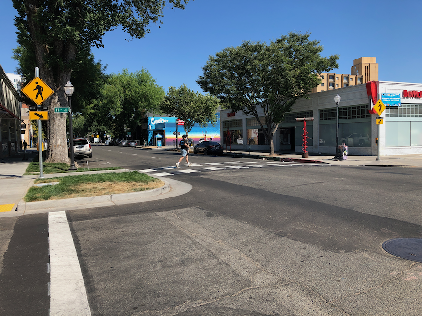
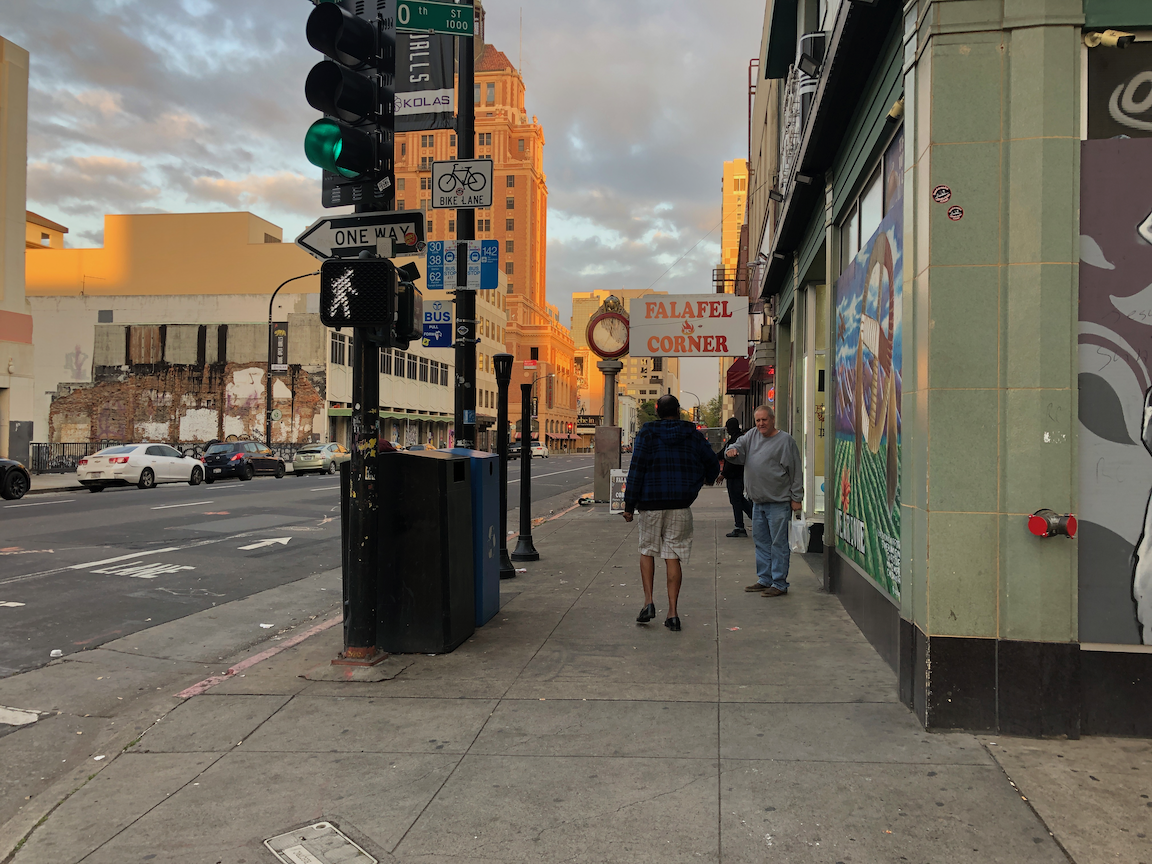
Last week I walked over to the new Target store at J Street & 17th Street in midtown Sacramento. On my way there, I was thinking to myself that with the additional people walking to the store, the crosswalk over J Street was going to need some sort of additional protection, since I knew from experience that most car drivers don’t yield to people walking at that location.
Lo and behold, a RRFB (rectangular rapid flashing beacon) was installed!
RRFB on J St at 17th St
The person walking presses a button which triggers flashing lights mounted on the pedestrian crossing signs. A curb extension on the north side of the crosswalk was installed when the sidewalks around the Target store were installed, so the crossing distance has been shortened somewhat, which also helps.
There are signs with the buttons, below. These are not MUTCD compliant signs, which is ironic, because the city had refused at the beginning of the pandemic to install pedestrian crossing signs that indicated the actual effect of the button, whether it was necessary to press it, because there is no MUTCD sign that does that. Maybe the city is reconsidering it’s signing – unlikely.
RRFB button
A word of warning to anyone who thinks signs and flashing light make it safe to cross. What they do is make is safer than it would be without, but not safe. J Street is a three-lane traffic sewer, on which drivers seldom yield to people walking, whether there is a marked crosswalk or not. Anytime a roadway has multiple lanes in a direction, the multi-lane threat exists, that one driver will stop and others will not. I see this routinely on all the streets in Sacramento that are multi-lane. So, cross with caution no matter what. What I do is step into the street to remind drivers that I have the right-of-way, but walk very slowly until the drivers in all lanes have come to a complete stop. Of course that frustrates the driver who originally stopped, that I am crossing so slowly, but my job is to keep myself safe, not to please drivers.
Due to a miscommunication with a person who gave me a ride from the end of my backpack trip in Foresthill, I ended up in the Galleria part of Roseville yesterday instead of old downtown, which was what I intended. What a hellscape!
Roseville Transit does not run on Sunday, or course not, why would a transit system serve people on Sunday? So there is no way to get from the Galleria area to any place else in Roseville, or to any place else in the world.
Being stubborn, I decided I needed to walk to the closest transit, which is the Louis/Orlando Transit Center just off Auburn Blvd/Riverside Drive in Citrus Heights. On my three mile walk between the Galleria area and old downtown Roseville, I saw two bicyclists and one walker. And thousands of cars, most of them high end SUVs (pedestrian killers). Galleria Blvd has sidewalks in some places, but rarely on both sides, so you have to cross back and forth. No warning ahead, no crosswalks, just cross when you come to the end.
If you wonder what people were doing on the Memorial Day weekend, they were shopping. And shopping. And shopping. Though there is a Roseville Transit line that serves the main mall area, Monday-Saturday, it is almost not possible to walk to or from there. Sidewalks come and go, and with all the freeway onramps and off-ramps surrounding, it does not feel safe to walk. Once on the mall property, there are no sidewalks, just the ones around the buildings.
If you want to see how bad the Galleria part of Roseville is, take a look at Google: https://goo.gl/maps/jGX7BrAJFyDUrwja9/. Follow a piece of sidewalk to see how far it goes, whether it actually connects to anything. Remember that the mall area itself is much more pedestrian friendly that any of the surrounding shopping areas.
I thought, well at least things will be better when I get to old downtown Roseville. In some ways, yes. It is not a place designed for the exclusive needs of cars. There are actual locally owned businesses instead of national chains. There are places to eat, drink, shop. But… it was late Sunday afternoon and the sidewalks had been rolled up. It is hard for local business to compete with the huge subsidies that the national chains and malls get. All that car infrastructure that supports the mall, the six to ten lane roadways, the freeways and interchanges, that all was paid for by you, not by the developers, and that is money out of not just your pocket, but the the pockets of local business owners trying to compete.
On to the transit center, at least some of the walk through quiet OLD residential neighborhoods, the original part of Roseville. Thankfully, SacRT saved the day, bus and then light rail, to home. Of course service is less frequent on Sunday, and other than light rail, it doesn’t run late, but it runs! It is a lifeline for people who can’t drive, who don’t want to drive, who don’t want to be a part of car-centric hell places like Roseville.
I was walking, not bicycling, but of course was also looking at bicycle facilities. There are bike lanes on most of the stroads in Roseville. And what welcoming bike lanes they are! The photo below is of the dashed bike lane on Galleria Blvd northbound, approaching Hwy 65. It runs for 900 feet! Between high speed traffic on the left and high speed traffic on the right (40 mph posted means the minimum speed, not the maximum, most drivers are going about 55). The right hand lane is the freeway access lane, so drivers are accelerating towards the entry, hoping to catch a green light and squeal tires onto the onramp. Yes, this is the behavior I observed. Roseville seems to be of the impression that painting lines on the roadway for bicyclists is all it takes, that and nothing more.
Galleria Blvd bike lane, northbound to Hwy 65
The one good thing about being in Roseville is that it reminds me of how lucky, and how privileged, I am to live in Sacramento central city.
9th Street between K Street and L Street has changed once again. The bicyclist issues have been ‘solved’ by the complete closure of the street. The sidewalk on the west side is open, but there is no motor vehicle traffic, no bicyclist traffic, and no bus traffic. There is a bus stop in this block which is once again inaccessible after having been closed for some while for the construction on the west side, was open briefly, and is now closed again.
9th St closed at K St
I have been out of town, so am not sure when the closure took affect, but judging by the number confused drivers, including one transit driver, it must have been recently. The display sign says the closure will last through mid-July.
9th St at J St, lane reduction begins
I have mixed feelings about these types of complete closures. To some degree they are just excuses for the construction company to store materials on the street, rather than other locations. But maybe with the hazards created for all modes by partial closures, complete closure is the best option. It does point out that drivers will adjust to the new situation without the world ending, as is often claimed by cars-first people.
For bicyclists not used to riding on K Street, be careful of the light rail tracks. To the west, the tracks are not hard to ride along, but to the east, between 9th Street and 10th Street, there is a cross-over that can trap you if you are riding between the two sets of tracks.
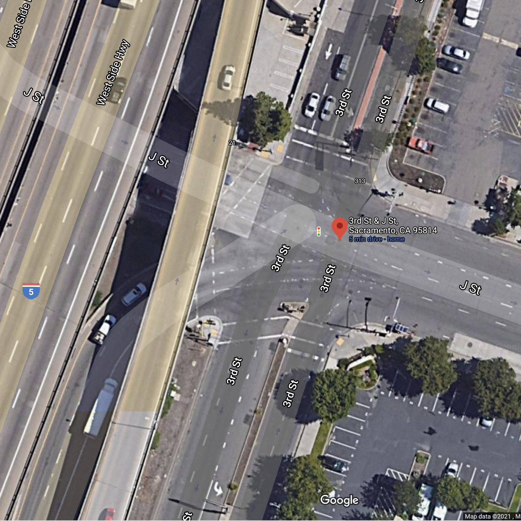
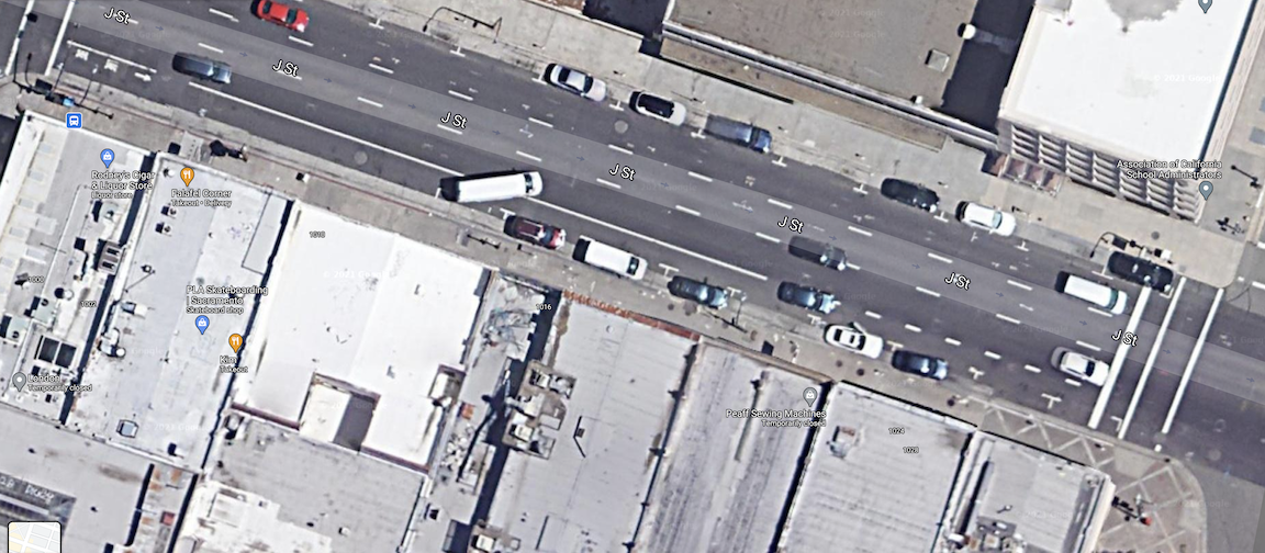
The intersection of 3rd Street and J Street is undergoing construction right now, most of it related to sewer line installation on 3rd Street, but perhaps related to other projects as well. Here is the Google image, not showing the current construction. I thought I had written about this intersection and its pedestrian hostility before, but I can’t find it searching, so it must have been one of those thoughts I never followed through on.
This has always been a problematic intersection. Two freeway off-ramps, coming from I-5 southbound and I-5 northbound, bring high speed drivers onto J Street without causing them to slow much from freeway speeds unless the lights happen to be red. 3rd Street is much calmers but has its own issues.
For a person walking north or south on the east side of 3rd Street, there are five crosswalks to navigate just to cross J Street. You can see in the photo that they are not well maintained, quite faded, low visibility crosswalks that many drivers would not even notice. Each crossing requires pushing a button, and since freeway off-ramp traffic is prioritized, each signal cycle is quite long. (For those counting, the reason I call this five crossings is that the crossing of 3rd Street on the south side had a short pedestrian cycle which was less than required by MUTCD and certainly less than should be available to walkers, so for most people, it had to be crossed in two stages, making for an even longer time to clear the intersection. Of course with no ped button on the median, one the second crossing just has to be done in a gap in traffic, against the signal.)
At this time, the intersection cannot be navigated at all. The northwest corner is under construction. Not sure why, as the ramps and curbs there were fairly new, but it is, which of course closes both the crossing of 3rd St and the crossing of the southbound off-ramp to J St. No signing and no barrier is in place on the northeast corner to indicate the closure. Notice that the pedestrian detour signs are still up on this route, even though it is not accessible. Notice also the very poorly designed curb ramp, with a detectable strip that sends walkers/rollers out into J St with its high speed traffic.
3rd St & J St, construction northwest corner, no warning
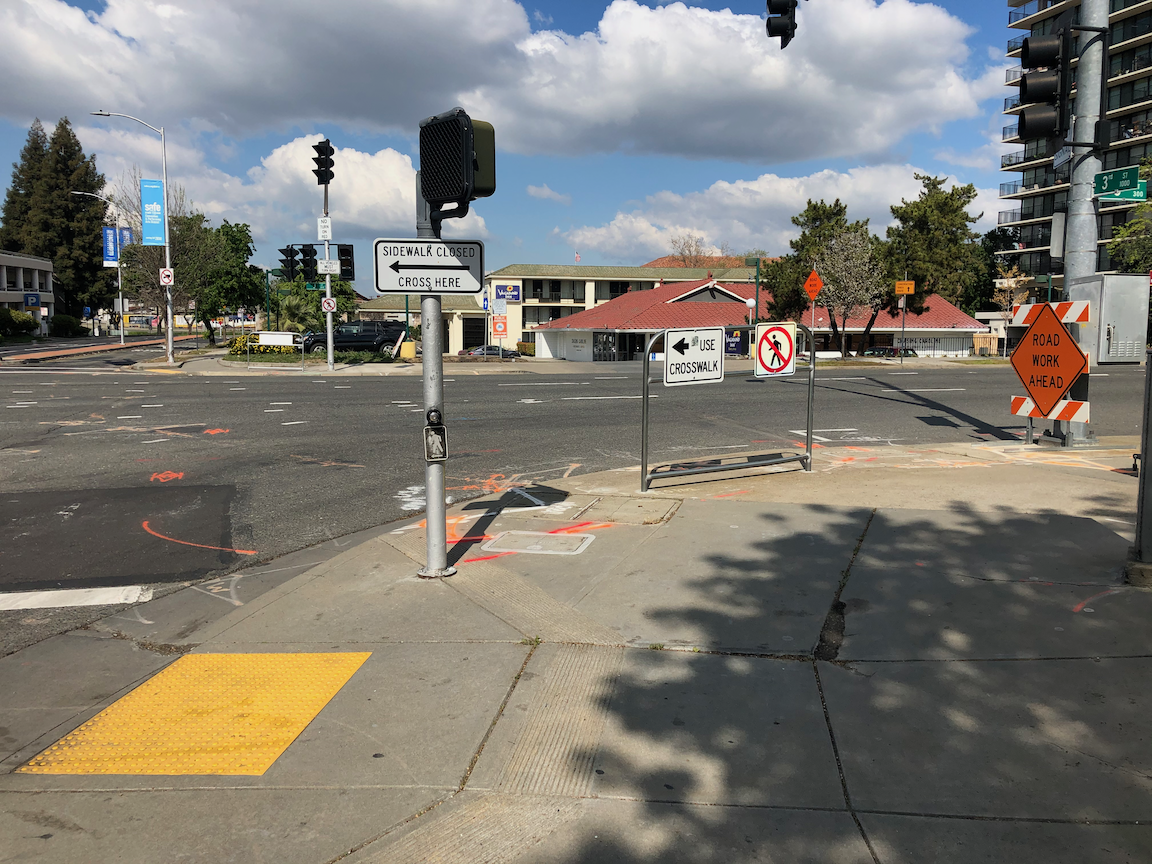
If on the other hand, you started into this mess on the south side of the intersection, there is no advance warning on the southeast corner that the crosswalk and sidewalk are closed ahead. But if somehow you approached the southwest corner, there is a sign placed in the ramp to prevent you from getting to or from the southwest corner. If there were a sign on this side, you would think there would be a sign and barrier on the southeast corner letting you know. You’d be be wrong.
3rd St & J St, southwest corner, sidewalk closed but no warning
What makes all of this particularly egregious is that pedestrian crossing on the east leg of the intersection is prohibited. See the prohibition signing and barricade on northeast and southeast corners, below.
3rd St & J St, northeast corner, crossing prohibition on east leg3rd St & J St, southeast corner, crossing prohibition on east leg
So, solutions:
First, sign and barricades sidewalks and crosswalks properly. It is well known how to do this, and failure indicates intentional neglect on the part of the construction company, and of the city staff that permits these construction projects.
Second, install a crosswalk over J Street on the east side of the intersection, so that walkers can cross in one quick crossing rather than five slow crossings. Crossing prohibitions are more than 90% of the time an effort by traffic engineers to speed motor vehicle traffic. They rarely have anything to do with safety, and in this case, the prohibition is not there for safety.
This construction project is yet one more of the issue in Sacramento where the city requirements and construction company implementation do not meet ADA requirements, nor MUTCD requirements. These practices create a hostile environment for walkers and bicyclists, and this is no ‘accident’. It is intentional, and it is probably criminal.
Added: I missed a great argument for installing a crosswalk over J Street on the east side. There is no reason for there even to be crosswalks to the west side of 3rd Street, as there are no sidewalks on the west side, to the north or to the south. So if one new crosswalk is installed on the east side, four can be removed, including the ped signals. That should make the traffic engineers salivate!
A new traffic calming feature has showed up on 16th Street approaching R Street in midtown Sacramento. Paint and flex posts have been placed between the travel lanes. Advance yield lines (‘sharks teeth’) were also painted, showing where drivers should stop when yielding to pedestrians.
16th St lane channelization
I’m not sure what to think of this. Certainly this is a problematic intersection. Cars stopped for the light rail gates between R Street and Q Street often stop throughout the intersection, blocking both the north and south crosswalks over 16th Street, as well as the intersection itself, preventing vehicles along R Street from proceeding while the traffic is stopped. As with all multilane streets, but particularly high speed, one-way arterials, drivers in one lane may stop for a walker while the others will not. I see this every day, and this intersection is worse than most. For reasons I don’t understand, traffic speeds on 16th Street northbound are noticeably higher than 15th Street southbound, even though the design of both streets in the same.
So, how’s it working. Well, I’ve so far only had the chance to observe it for 15 minutes. I’m not sure it is making much difference. About 10% of drivers stopped at or close to the advance yield lines. About 70% of drivers stopped at the forward edge of the flex posts, about 10% stopped over the crosswalk, and about 10% did not stop for people using the crosswalk. I saw three people nearly hit by drivers. This is not unusual, and it not worse than before, but it is not good.
Below is an example. The driver to the left stopped over the top of the crosswalk, even though it was clear that traffic ahead was stopped for the light rail gate, and there was no space to proceed into. The driver to the right stopped before the crosswalk, but not at the advance yield line. Not visible it the driver in the closest lane who did not stop at all because there was a space in that lane across the intersection.
walker using the crosswalk over 16th St at R St
While I appreciate the effort, I’m not sure if the results will be what is desired, which is the ability of walkers to safely cross the street.
In the long run, the reallocation of roadway on 16th Street to reduce the general purpose lanes from three to two will help this location a great deal, but I don’t know when that will happen. It could be years away.
With the new businesses on R Street to the east, and the street dining area on R Street to the west of 15th Street, this intersection has become quite busy with walkers, bicyclists, scooters, and motor vehicles. It does deserve attention.
The J Street separated bikeway has problems, as has been highlighted by Streets are Better and many others. Separated bikeways are also called protected bike lanes and cycle-tracks, but in California the official term is separate bikeways.
The City of Sacramento placed a separated bikeway on J Street from 19th Street to 29th Street as part of a repaving and roadway reallocation project called the J Street Safety Project in 2018. This was the second such project in Sacramento, the first being portions of P and Q Street downtown, but it was the first in the heavy retail, parking, and traffic environment of J Street.
The theory of these parking-protected bikeways is that the row of parked cars protects bicyclists from moving cars, and this is true in the length of the block (but not at intersections, which are a separate issue), when there are parked cars. But some times of day there are not parked cars, and throughout the day as cars come and go (particularly on a retail corridor), protection is lacking.
It is true that bikeways don’t need strong protection from PARKed cars, but they do need protection from PARKing cars and delivery vehicles, and bikeway intrusion.
Vertical delineators and pavement markings were used to set off the bikeway, with a sign at the beginning of each block segment showing the new allocation. These vertical delineators are also called bollards and soft-hit posts, with soft-hit meaning that they won’t damage cars when drivers hit them. The first photo below shows the 27th to 28th section. It initially had 14 delineators place, but only three are remaining. The other blocks have fared a little bit better, but overall about half the delineators are gone. The second photo shows the 25th to 26th section sign that has been run over by a driver.
J Street bikeway, 27th to 28th section, missing delineatorsJ Street bikeway, damaged sign
Some of the vertical delineators are being run over by people parking, some by delivery vehicles parking on top of them, and some by drivers going down the bikeway itself. And probably some just for sport. I don’t know which of these causes are most common.
There are several solutions:
One: Put the delineators closer together so as to make it more obvious that vehicles are not supposed to cross them.
Two: Add bollards which either are, or at least look to be, more substantial. The photo below is from a somewhat different setting in Oakland, with more substantial bollards. Reading blogs and Twitter, these seem to be successful in some cities and some settings, but not in others.
bollards in Oakland
Three: More substantial separators such as planter boxes.
planter separated diagram from C40
Four: Partial hard curbs or medians. The photo shows a median at the start of a bikeway section. It reduces the number of signs flattened by drivers and signals to drivers that there is something different about this block.
bikeway with hard median start, FresnoCOG
Five: Continuous hard physical curb or median. It is hard to find good photos of these, probably because in the past they haven’t been seen as necessary. There are a lot of photos of hard medians adjacent to moving traffic, and adjacent to two-way cycle-tracks, and alongside raised bike lanes that are at or close to sidewalk level. But the graphic below gives the general idea.
Of course hard curbs or medians are more expensive, but last 20-30 years whereas delineators or bollards may need to be replaced every year, so I think they are a good investment.
A major issue with all separate bikeways is the presence of driveways. In fact streets with a high density of driveways should not have this design. Below at the blocks of the bikeway, with information about driveways.
19th
3 driveways
partially separated; driveways not changeable
20th
3 driveways
2 changeable driveways
21st
1 driveway
driveway not changeable
22nd
2 driveways
2 changeable driveways
23rd
no driveways
24th
2 driveways
1 maybe changeable
25th
no driveways
26th
no driveways
27th
no driveways
28th
2 driveways
partially separated; 1 driveway changeable
The changeable driveways will be the topic of a separate post, but the basic idea is that parking lots that have access to the alleyway do not need access to the main street, so in this case, parking lots with access to Jazz Alley do not need access to J Street.
My recommendations
Place hard medians at the beginning of each block, to protect the signs, and better signify to drivers this is a different place. For the locations where there are bus stops (19th, 22nd, 25th, 27th, 28th), the median would be moved down the block a bit. Note that this is too high a frequency of bus stops, but that is an issue for another post.
Place more substantial bollards, and at a closer spacing.
Place a continuous hard median on one of the four blocks without driveways, the same width at the painted buffers present now. This would be a pilot to test the installation, determine costs, and document benefits. If the pilot is successful, the other three blocks with no driveways should receive the same treatment.
Start negotiation between the city and the owners of parcels that are used solely as parking lots, to close J Street driveways and use Jazz Alley access. Some of these parcels will be redeveloped into more productive uses anyway, but that may take longer than desired.
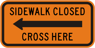
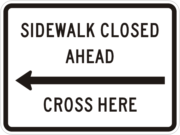
The MUTCD (Manual for Uniform Traffic Control Devices) is a bit confused (and a lot lacking) when it comes to signs for temporary traffic control devices. Orange is supposed to be the color for temporary traffic control devices, yet the manual uses regulatory (white) signs for sidewalks in construction zones. A white sign indicates permanence, an orange sign indicates temporary. That subtlety seems beyond the comprehension of the people who write the MUTCD, but I’m here to help them. Below are the pairs of signs for sidewalk closure in construction zones. On the left is the existing MUTCD sign, on the right is the sign as it should be.
R9-9 regulatory version
R9-9 TTC version
R9-11a regulatory version
R9-11a TTC version
R9-11 regulatory version
R9-11 TTC version
There might be situations in which the permanent, white regulatory sign might be appropriate, though the number of such situations is and should be rare. Sidewalks should be continuous, not broken, not closed.
Note that I did not include the R9-10 sign with arrows pointing both ways, since I can’t think of a context in which that would be the appropriate sign. Unless someone can, it should be removed from the MUTCD.
I have also suggested that all TTC signs be given a unique code, not M, not R, not W, but perhaps T.
Though in most cases the construction zone signing and barriers improve after they are reported (first time, second time, third time…), sometimes they get worse. I had reported to the Sac311 system that there was no advance warning of the sidewalk closed ahead on the south side of J Street, westbound, at 7th Street. This the left hand photo below.
The ‘correction’ was to place an incorrect sign at the location, which is more confusing than the lack of a sign. I observed and listened for a while to people looking at this location. Every single one commented on the confusion. Does the detour sign point to a detour, or does it mean to cross the street? There were discussions and even arguments within couples and groups. The sign is the wrong sign, and it is placed in a very confusing manner, angled toward the sidewalk rather than perpendicular to it. The clear indication is to continue along the sidewalk if one wants to go west on J Street, but this is incorrect, as the sidewalk is closed a short distance away. This is the right hand photo.
7th St & J St sw, no advance signing
7th St & J St sw, wrong advance signing
The correct sign of course is this one, MUTCD R9-11 right, placed perpendicular to the path of travel along J Street. It could be argued that the sign should be orange rather than red, indicating a temporary traffic control (TTC) device, but at this time the MUTCD does not offer this sign in this color.
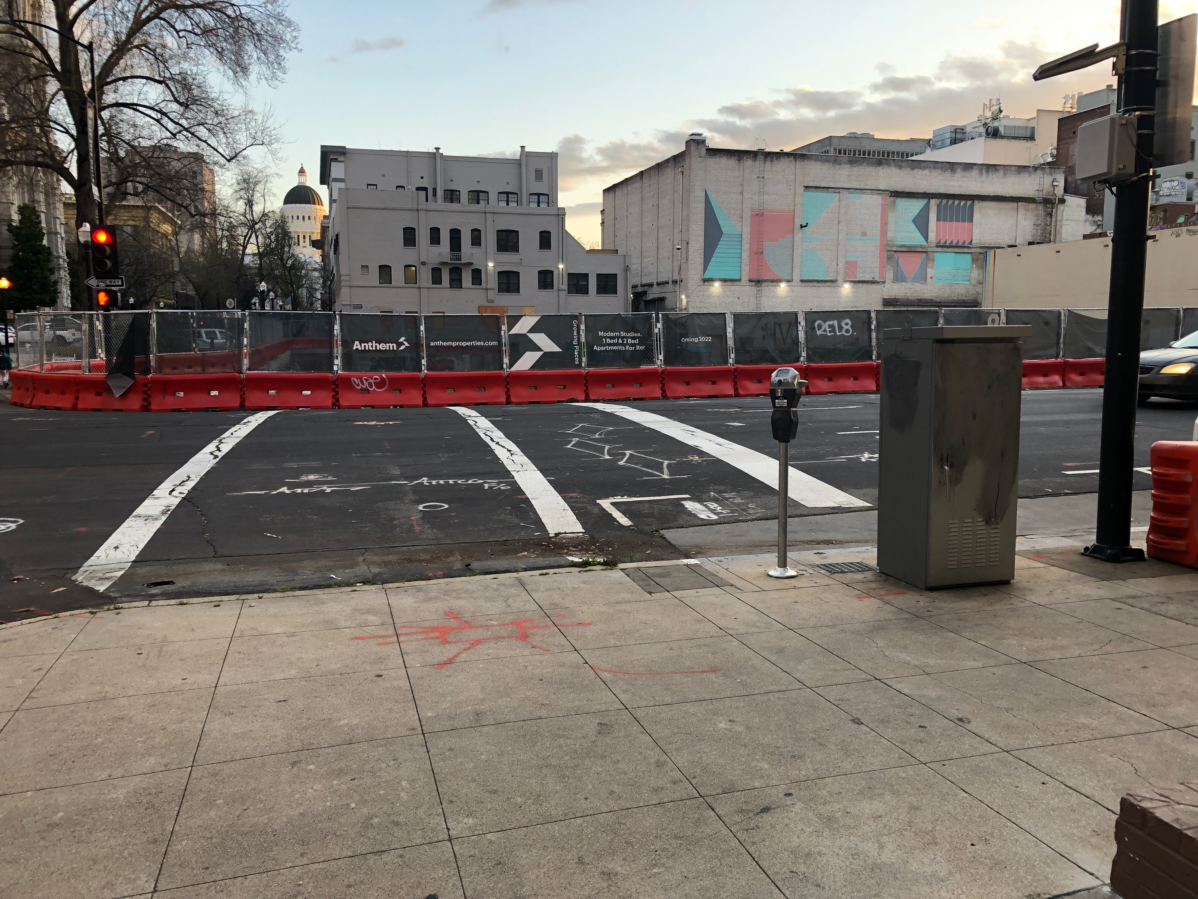
The future development, possibly to be called Anthem Cathedral Square, at J Street & 11th Street is currently a hole in the ground. The old buildings have been razed, and debris hauled away, but new construction has not started, so it will be some while before J Street on the north side of the site (south side of the street) returns to normal.
A channelized bypass should be created to carry the sidewalk for walkers and the bike lane for bicyclists past this construction site, between 10th St and 11th St, by removing a general purpose travel lane from J Street. The aerial below (before removal of the buildings) shows a sidewalk, a parking lane, a bicycle lane, three general purpose travel lanes, and a parking lane. The channelized bypass would include a shared pathway for walkers and bicyclists, in place of the right hand general purpose lane. The bypass can be created with use of orange construction barrier, as was done on 9th Street. This bypass would remain in place until construction is complete.
While the razing and cleanup was going on, there was decent signing, but it has disappeared or been moved to the side. The first set is the former signage at J St & 1oth St, and then today without an signage. There should be a sign here, the MUTCD R9-11; a barrier is not appropriate at this location since the closure is ahead and there are businesses open.
J St at 10th St se, signage
J St at 10th St se, no signage
At the sidewalk closure point, there is an acceptable barrier but no signage. At this point, it looks like there could be a bypass, but it is fenced off. The appropriate sign here is MUTCD R9-9.
J St past 10th St, sidewalk barrier
At J St & 11th St southeast corner, there was a barrier and signage, but the barrier has been moved to the side and the signage is gone. There should be a barrier and sign here to indicate that the crosswalk is closed. The third photo is an example of a correct barrier and signage.
11th St at J St se, signage
11th St at J St se, no signage
correct barrier and signage
At J St & 11th St northwest corner, there should be a barrier and signing to indicate the crosswalk is closed, but neither is present.
J St & 11th St nw, no barrier or signage
This construction zone failure is one among many in Sacramento. The city is not creating traffic control plans that accommodate walkers and bicyclists, and the construction companies are not appropriately placing signs and barriers. This is a violation of the ADA (Americans with Disabilities Act). Responsibility for encroachment permits (when the construction project goes into the public right of way, which includes sidewalks), and traffic control plans to mitigate the situation, rests with the City of Sacramento Department of Public Works.
I have created a new category, construction zone, which will make is easier to find other posts on the construction zone topic. Photos of many construction zone locations are on Flicker in Sac construction-zone album.
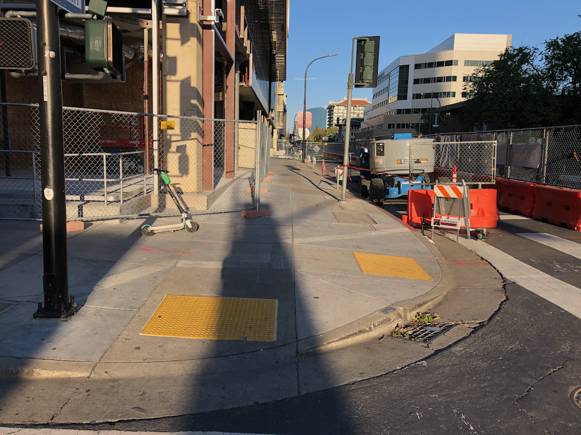
Things have changed again. The construction zone on the east side of 9th Street between K Street and L Street has changed again. The east parking lane and east travel lane are now dedicated to the construction project, the general purpose lane has been shifted right into the west parking lane, and the combined pedestrian/bicyclist bypass is now in what was the right hand general purpose lane.
One the plus side, detectable strips have been added to the left side of the bypass, which are required to provide protection from trip and crash hazards presented by the fence bases. Photo below.
detectable strips along bypass on 9th St
The entrance to the bypass is still awkward, too narrow and poorly signed. There are still corrections to be made.