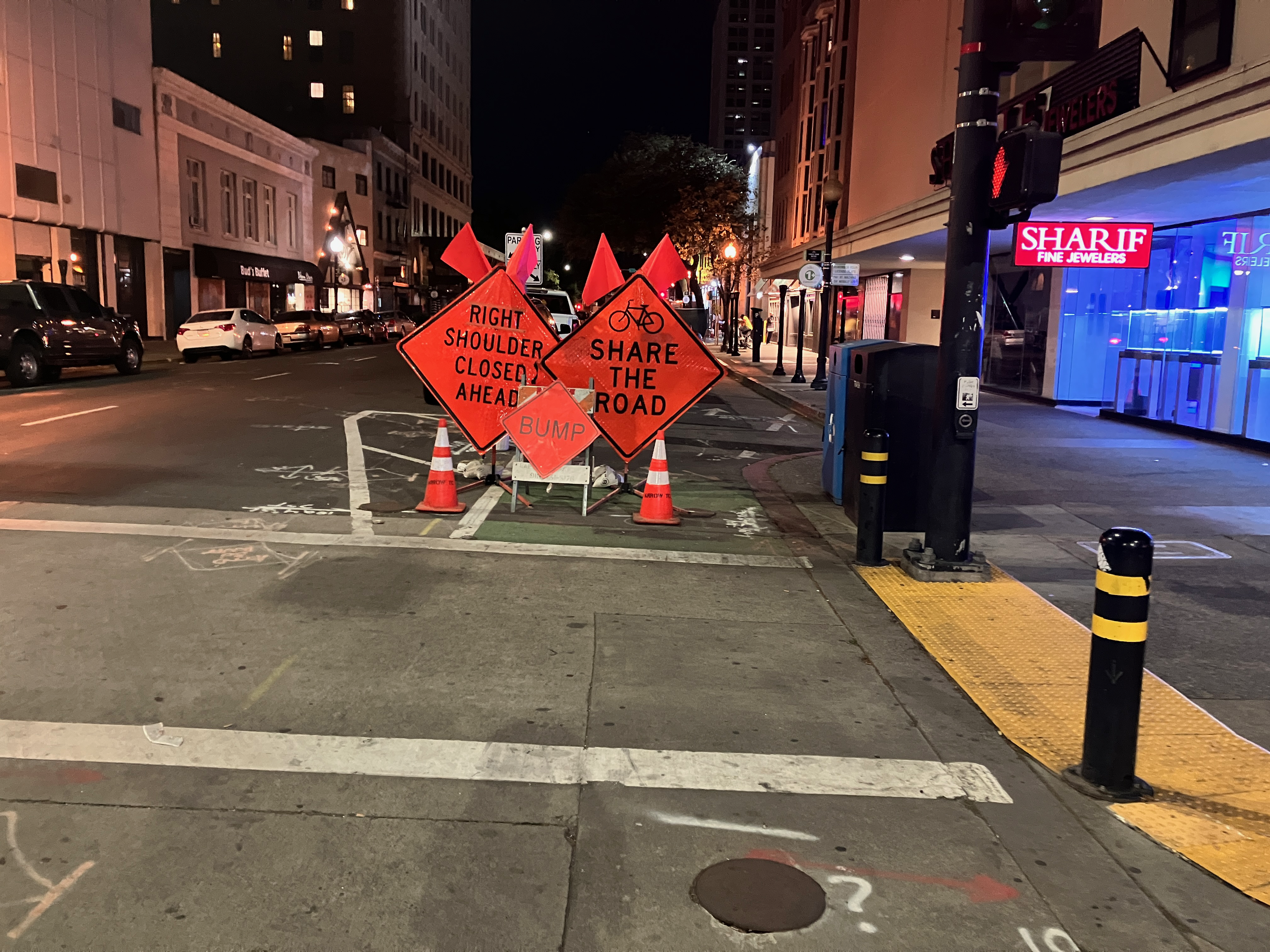
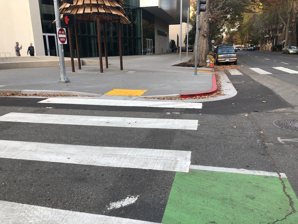
Here is one example (of many) of a bike lane blocked by construction, on J Street between 10th Street and 11th Street in Sacramento. There is a major construction project on the south side in the eastern half of the block for a new apartment building. I’ve written about this issue before: J Street needs construction bypass. As construction progresses, the barriers around the site have moved closer to and further from J Street. The last time I was there, only the parking lane (and of course sidewalk) was blocked, but today, the bike lane is blocked again.
J Street bike lane pinches out at construction barrier
There are no signs along J Street warning of the closure ahead, and there is no ‘share the road’ sign. The commonly used, but not official MUTCD or CA-MUTCD, ‘bicycle share the road’ sign is below. This is, at minimum, the sign that should be installed here.
The solution is to either get the construction company to pull the barrier back from the street, returning the bike lane to function, or for a bike lane to replace the right hand travel lane. Since the sidewalk is also blocked, the accommodation can also serve walkers. As you can see from the photo, the left hand general purpose lane is already blocked for a utility work project. That would result in one lane for an unknown period of time, though the utility project seems to be going fairly quickly and might be done within a couple of weeks or less. The city should do a better job of scheduling construction projects so that they aren’t going on both sides of a busy street at the same time!
There are active utility projects on 9th Street and 10th Street that have closed parts of the separated bikeways on those streets. Upon noticing this, I thought, no big deal, a few days of work and things will be back. But the closures have been continuing for three weeks now, with no end in sight. It is interesting that the utility work on J Street is moving fairly quickly, but on 9th and 10th, not so much. I am not sure what utilities are being worked on, and whether these are city-led projects with contractors working on city-owned utilities, or whether they are private utilities such as PG&E or communications.
When there is an extended closure of a separated bikeway, more than two days, an accommodation for bicyclists should be provided. I am aware that some bicyclists are willing to ride in the traffic lanes, but the entire point of a separated bikeway is that it needs to work for all bicyclists, including people who are not comfortable riding in traffic. To allow construction to close a bikeway, without any alternative, is a failure on the part of the city. The city is again expressing its favoritism for motor vehicle drivers over bicyclists.
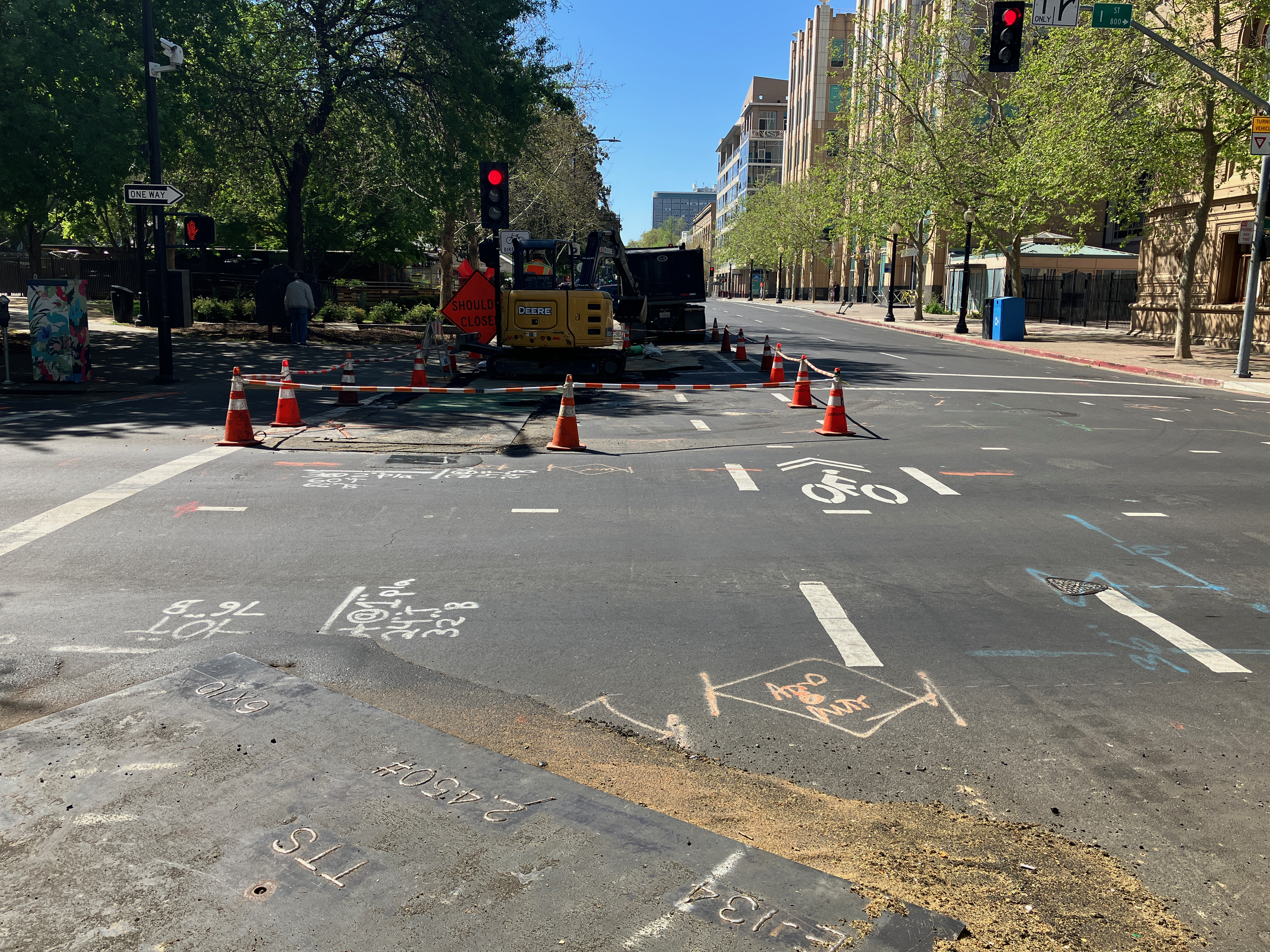
10th Street
10th St at K St bikeway closure10th St bikeway construction plate
For 10th Street, general purpose lanes should be reduced from two to one, making the other lane a temporary bikeway. Or, remove parking from the left (west) side of the street so as to allow two general purpose lanes and one temporary bikeway.
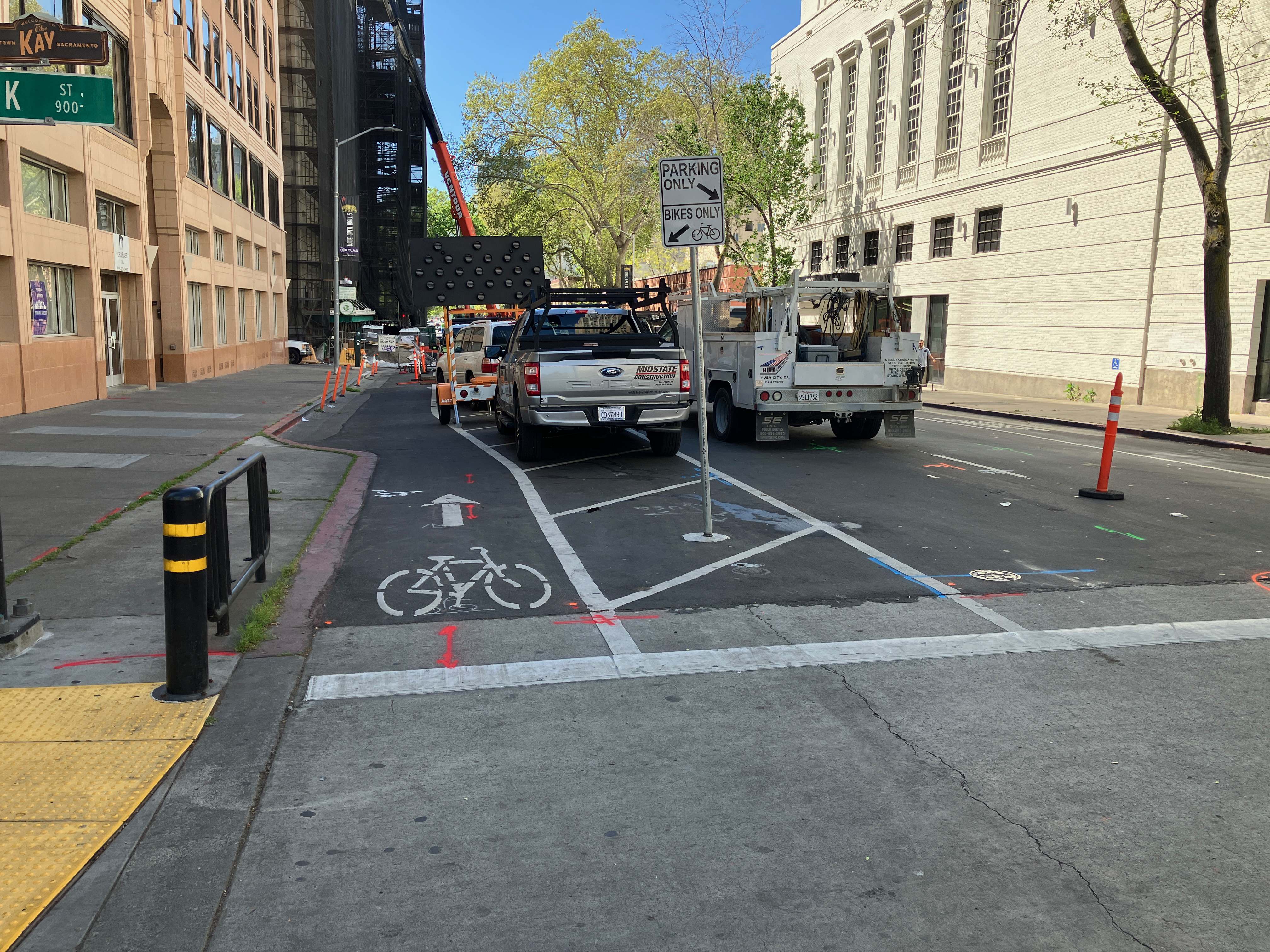
9th Street, H Street to J Street
9th St at H St bikeway/bike lane closure9th St at I St bikeway/bike lane
The bike facility on 9th St is not technically a bikeway until it crosses J St, but since it is intended to provide a similar safe route of travel, I’m including it here. Utility work has closed off the bike lane between H St and J St. No alternative has been provided. The solution is to remove one general purpose travel lane and create a bikeway, or remove parking on the right (west) side of the street in order to maintain two general purpose lanes and one bikeway.
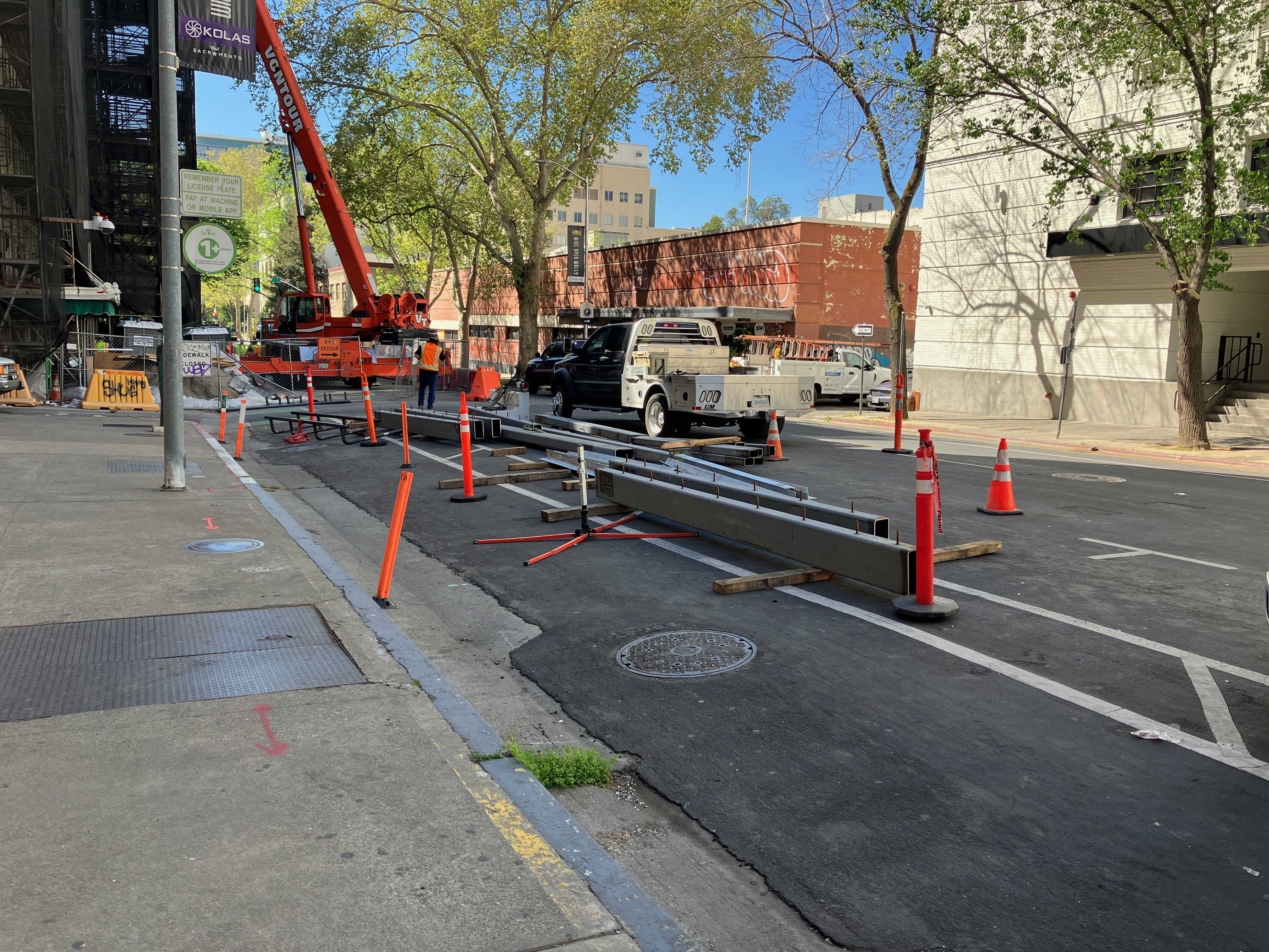
9th Street, K Street to L Street
9th St at K St, no signing for bikeway closure9th St construction materials stored in the bikeway (just south of previous photo) 9th St at Kayak Alley, walkway/bikeway gone
The reconstruction of Capitol Park Hotel, on the east side of 9th Street between Kayak Alley and L Street, has been going on for months. Every time I go by, something has changed about how the roadway is being handled. Today, the safe bikeway and walkway that was there is now gone. Construction has pushed the fence up against what were formerly the barriers that separated the bikeway/walkway from traffic. Today there was a crane filling the space, which may be necessary, but that doesn’t change the clear message that the entire area is now construction zone with stored construction materials.
The section between K St and Kayak Alley is now being used to store construction materials and worker vehicles. The closure of the separated bikeway is not signed in any way; there have been signs here in the past, but they are gone. If you rode the bikeway without realizing it was closed, you would crash into construction materials.
I am not sure whether there is enough space left in the roadway to provide both a separated bikeway and a travel lane. If so, it should be modified for that. If not, the travel lane should be closed until the construction footprint shrinks again to allow the original walkway/bikeway.
It should be noted that the city did not initially provide the walkway/bikeway on 9th Street, and it was only installed after considerably public outcry.
These locations are a fraction of the ones throughout the city where the city has decided that motor vehicle traffic must be accommodated, but walkers and bicyclists do not. The construction guidelines code that the public requested the city develop and implement have been back-burnered because the city has decided to use staff to apply for grants rather than solving current problems on the roadways. I get more frustrated by the city by the day. I don’t really think they care at all. The car-dominated city, which was created by city planners and engineers, is just fine with them.
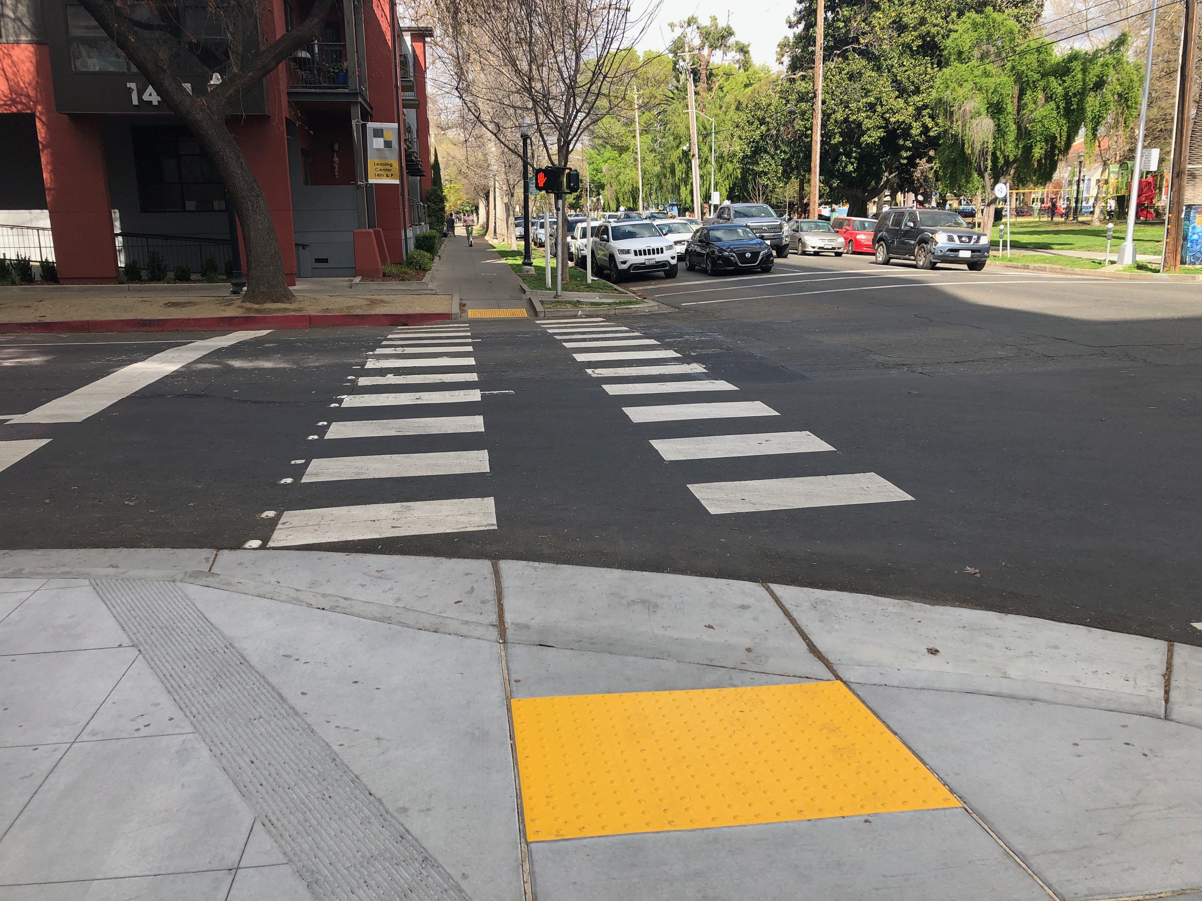
I live in downtown Sacramento, and walk through the 15th Street & Q Street intersection almost every day, sometimes multiple times a day. On the southeast corner is my favorite coffee shop, Naked Lounge (I drink tea, not coffee, but they have a good selection). I often sit outside watching people and traffic, so I am very familiar with this intersection. Fremont Park is on the northeast corner, and again, I walk through the park pretty much every day. Let me say up front that this is not a high injury intersection that must be fixed soon. There are so many more dangerous intersections in the city to address first, and so many locations where poor engineering and disinvestment and discrimination has left walkers and bicyclists at great risk. But I can start here because I think about it so much.
A photo of the intersection. The trees on the northwest corner obscure the corner and part of what I’m going to talk about. The sidewalk, curb, ramps, and parking on the southwest corner are all new, as this was reconstructed along with the 1430Q apartments and ground floor retail. The other corners have not changed recently. 15th Street is a three-lane one-way street (it should be reduced to two lanes and bike facilities added), and Q Street is a two-lane one-way street with bike lane on the left side. The northwest, northeast, and southeast corners have small radii, meaning tight corners. The southwest has a high radii corner, meaning loose corners. This is new.
15th Street & Q Street, Sacramento
The wide radius corner on the southwest must have been someone’s idea of necessary for trucks turning from Q Street eastbound onto 15th Street southbound. But notice the northeast corner, which is just as likely to have such turning movements, has a small radius corner, and I’ve never seen a problem with trucks turning there.
Three of the corners do not have curb extensions. On the southwest corner, there is a curb and sidewalk extension along 15th Street, running about half way to the alley. Curb extensions (also called bulbouts) extend the curb and sidewalk out over the parking lane, slow drivers due to perceived friction, and shorten crossing distances for people walking. They are a known and frequently implemented safety solution. You can see curb extensions at a number of locations in the central city, though strangely, only about half the reconstructions install them. The extensions also create more sidewalk waiting or queueing space for walkers, important on busy pedestrians intersections such as this.
The southwest corner gets a lot of deliveries, both for the businesses below and the apartments above. The southeast corner has fewer deliveries. Delivery use should be considered in any change that is made at and near this intersection. On 15th Street, there are green 15 minute parking spots, one on the east, primarily for the coffee shop, and two on the west. On Q Street, there is one green spot on the south, along with about two white curb spots. There are no delivery (white curb) zones on the southeast corner. Green limited time parking and white commercial loading zone markings are relatively rare in Sacramento.
While having tea this afternoon, I saw a driver on 15th Street run a red light and almost collide with a Sacramento Fire Department truck turning from Q Street onto 15th Street. Lights, siren, loud horn, makes no difference to some drivers. I see a lot of close calls at this intersection, but have never witnessed a collision. A person sitting nearby mentioned that she works at another coffee shop on J Street, and sees collisons fairly regularly. Those who claim the solution to street safety is solely redesigning streets to slow traffic ignore that there are also drivers who won’t drive safely no matter what. There is nothing about street design that can prevent someone from running a red light, except of course not having a traffic signal there at all (too many traffic signals?).
To make this intersection safer for everyone (walkers, bicyclists, motorists), these changes could be implemented:
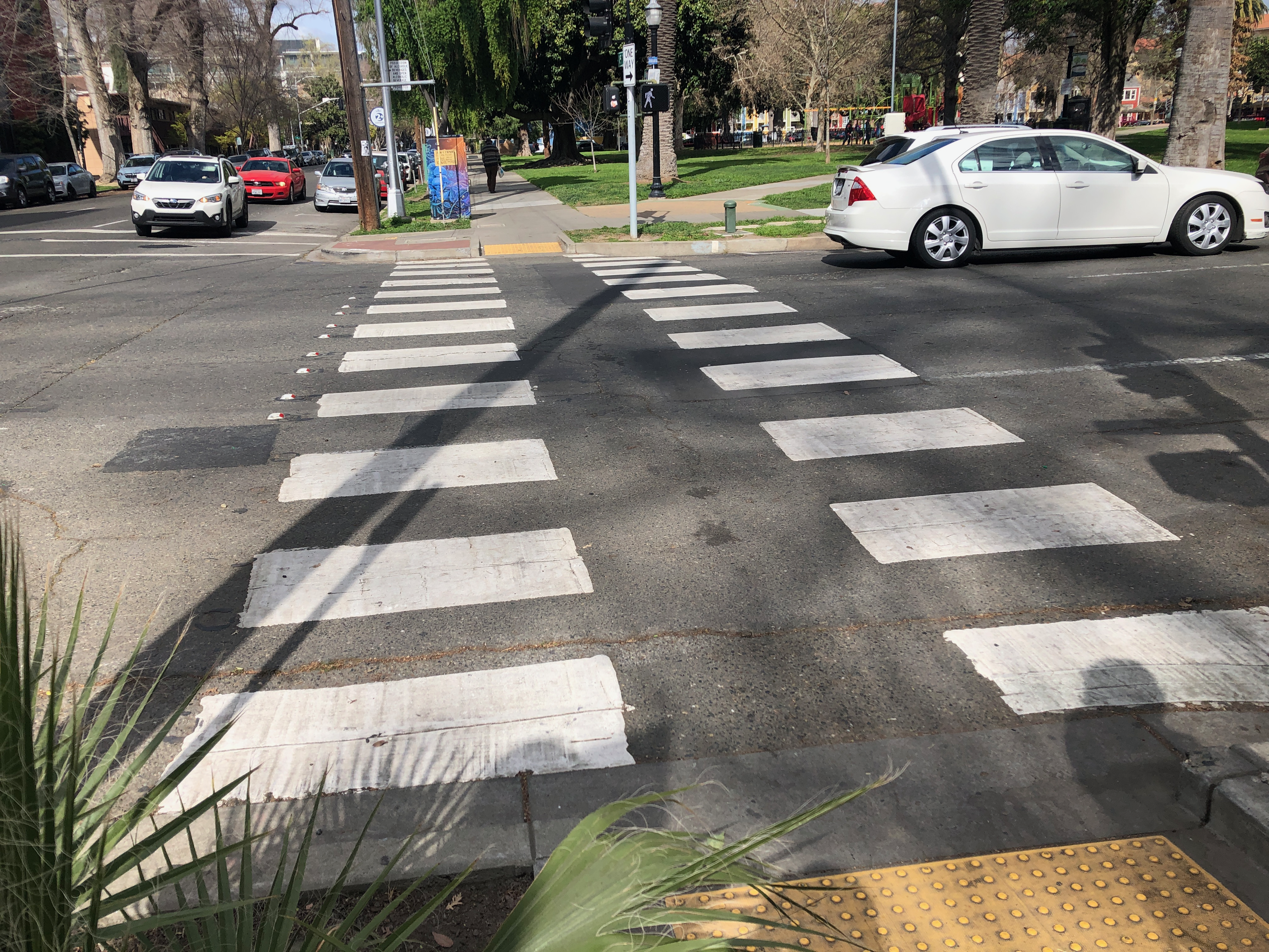
Paint high visibility crosswalks on the north and south legs of the intersection, similar to what the west and east legs already have. Sacramento is nearly unique in using these split crosswalk patterns, but they are probably as safe as any other high visibility pattern, which are often called Zebra crosswalks.
Create red curb offsets for each of the four corners, in the upstream direction. For 15th Street southbound, that means removing the last parking spot before the intersection on the west and east sides. For Q Street eastbound, that means removing the last parking spot before the intersection on the north and south sides. There is already an offset on the north side, and a small offset on the south, but it should be longer. You will notice in the photo above that there is a car stopped illegally in this area on the south side.
Immediately install temporary curb extensions on all corners. These extensions would fill the parking lane. Vertical delineators (posts or bollards) and paint (tan or purple is often used) set off this area. Why temporary? Temporary is low cost, and allows observation of how the installations are used by walkers, bicyclists, and drivers. The corner radius actually needed can be determined before any permanent installation.
Observe the temporary extensions, and then design permanent extensions with hard curbs and sidewalks. The permanent extensions must consider bike facilities on both Q Street and 15th Street. Q Street up through 14th St has a parking protected separated bikeway on the left side, and it is assumed that this will be continued to the east. 15th Street should have a parking protected separated bikeway on one side or the other, and the city will have to determine which side before installing permanent extensions. The curb and sidewalk extension on the west side of 15th Street south of Q Street may indicate the city has already made that decision, or it may be an oversight.
The photos below show crosswalks and offset locations for the intersection.
Q St west crosswalkQ St east crosswalkQ St short offset15th St no offset15th St south crosswalk15th St north crosswalk
As a follow-up to the Sac Transportation & Climate Workshop big idea of bike superhighways, I was curious about how the proposed alignments matched with low income and high minority communities in Sacramento.
The map presented at the workshop is low resolution, but I decided to see if I could reproduce the routes, using a combination of the city’s existing and proposed bike network data, the road network where the proposals didn’t seem to match the bike plan, and just plain guessing. You’ll notice gaps and places where the alignment may not be correct, but overall it provide an good impression of the proposal. It is interesting that some of the on-street low-stress bikeways routes are not in the current city bike master plan.
The demographics data for low income high minority communities is from SACOG’s Environmental Justice Areas. This is just one of many possible comparisons. Population density and employment locations would also be interesting. I don’t know what demographic information the city used to come up with the bike superhighways proposal.
The map is below, and pdf. The red lines are the bike superhighways, the blue lines are the ‘on-street low stress bikeways’ that provide to some degree the connection from the bike superhighways to the central city.
bike superhighways and LIHM areas in City of Sacramento
Does the proposal serve the people who need to be served? Meh. To some degree. The Sacramento Northern Parkway, at upper right, probably does the best. It is an existing separated path (Class 1) that does need upgrades at road crossings but otherwise is ready to go. The Jackrabbit Trail at the upper left does serve high minority areas, but not low income. It is mostly an existing route, with some gaps and several completely unsafe roadway crossings. The south area is a major bikeway desert, of course, due to both city and county disinvestment and transportation discrimination, and this proposal does little to correct that.
Here is another antique post that was not posted, but more recent, from 2021. As an update, this is slightly less of a problem today than it was. The city has enforced the requirement that only permit holder Lime (bikes and scooters) can deploy to the racks that were installed by JUMP for the JUMP Bike program. The photo below shows one of those racks. There are also many more scooter and bike parking areas (outlined in white, with symbols, but without racks). With this, I’ve cleaned out my drafts folder.
Rentable scooters, called shared rideables by the city, are thick as flies in Sacramento central city. They are being deployed to bike rack areas, completely filling the racks and leaving no space for bikes. The photo shows a rack with each space occupied by a scooter, no spaces available. It also illustrates a JUMP rack at which other companies are deploying their scooters. These JUMP racks, and the trapezoidal racks, were purchased for the original SoBi and later JUMP systems, and so ‘belong’ to the JUMP/Lime system.
Individuals are free to part their own bike or scooter, or any bike scooter they rent, at these racks, but the other companies are prohibited from deploying to them.
And there are simply too many scooters in some areas, particularly Old Sacramento and R Street. Lime, Bird, Spin, and Razor, are deploying more scooters to high demand areas than can possibly be rented in a day. I assume that they are trying to drive each other out of business so they can dominate and raise prices, which is the business model for all app-based companies. In some ways, a fallout would be good, but in the meanwhile, the huge number of scooters is occupying public space, the sidewalks, and reducing livability.
Where two previous posts come together (Reset for SacATC and don’t forget the little things) is suggested policies for the City of Sacramento that support walking for many reasons: to protect vulnerable users from drivers, to reduce vehicle miles traveled (VMT) and thereby greenhouse gas emissions (GHG), to create a walking-first city where everyone feels safe to walk, and to support infill housing that is the next most important action to reduce GHGs. I’ll make a brief suggestion for a policy that would implement each walking idea.
These are the policies that the Sacramento Active Transportation Commission (SacATC) should be addressing, and then making recommendations to the city council. I’ll be blunt: if SacATC is not addressing these issues, then why does it exist?
The ideas presented are, not in any priority order (numbers for reference only):
1. Mark crosswalks at every intersection. Except in purely residential neighborhoods, these should be zebra design. Policy: The city will mark (paint) every crosswalk in the city. The standard will be zebra or continental markings (the solid bars), but parallel lines are acceptable at purely residential intersections. Implementation within one year. Considerations: Yes, this will be expensive to install and to maintain. But the safety benefit makes this a great investment. Since the DMV fails to ensure that drivers understand that every intersection has crosswalks whether marked or not, it is incumbent on the city to mark crosswalks.
2. Daylight intersections by removing parking from within 15 feet of every crosswalk, at least on the near side (far side is a lesser safety benefit) Policy: Marked parking spots will be removed from within 20 feet of an intersection on the near side. Unmarked parking will be converted to no parking with red curb offsets of 20 feet. The resulting area may be used for shared rideables parking. Where a curb extension is present, parking need not be removed. Implementation within two years. Considerations: This increases visibility at every intersection by making walkers more visible to motorists (and bicyclists), and making vehicles more visible to people walking. Near side means the first crosswalk at every intersection in the direction of travel. Removal of parking on the far side confers little safety benefit.
3. Re-program traffic signals to create leading pedestrian intervals, everywhere. Policy: Every traffic signal with a pedestrian signal head will be programmed to offer a leading pedestrian interval (LPI) of at least three seconds. Implementation within one year. Considerations: The greatest risk walkers face at intersections is right-turning drivers who do not yield to people in the crosswalk. The LPI gives walkers a head start so that they are visible to drivers while the traffic light is still red. State law will soon be changed to allow bicyclists to also use the LPI.
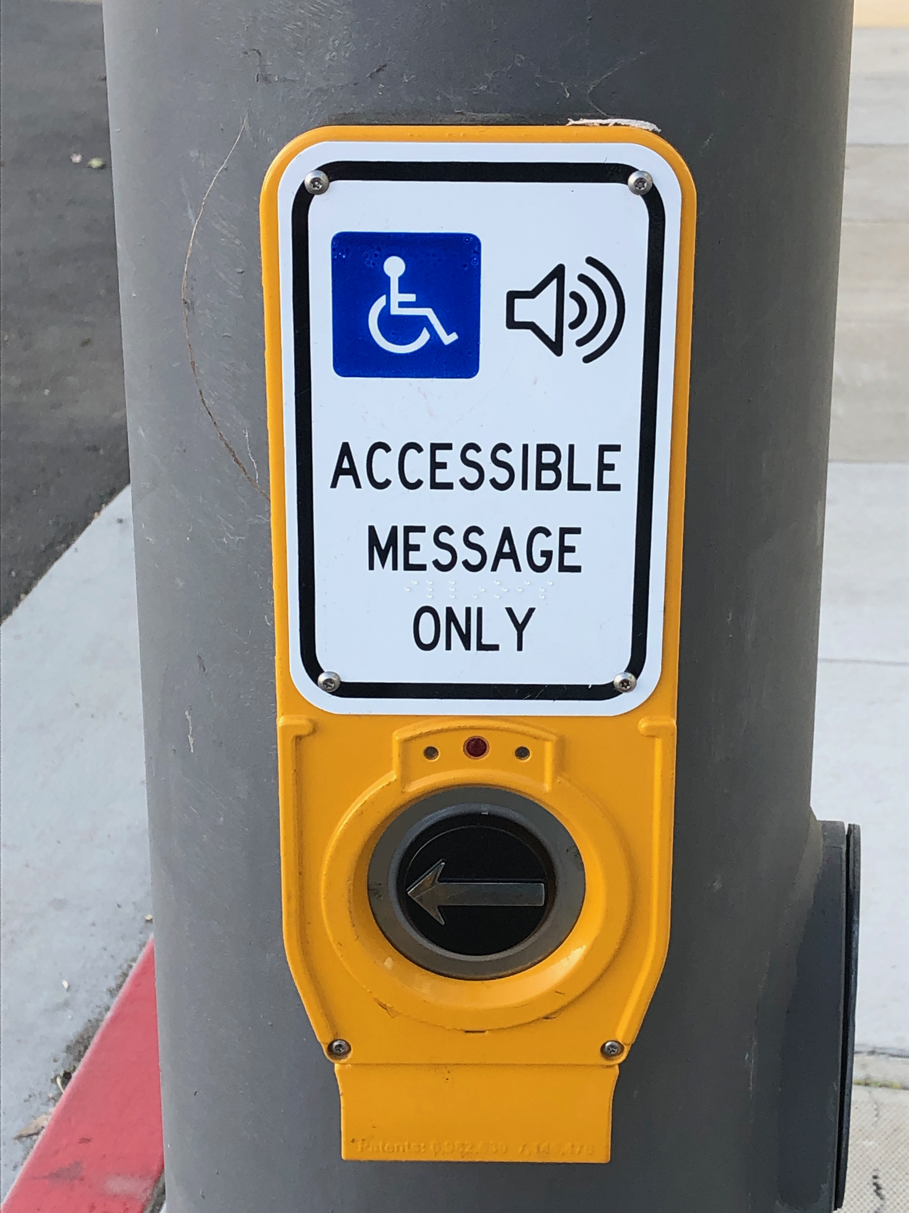
4. Remove or properly label every pedestrian push button. Don’t make walkers play the guessing game. Except at very low use intersections, pedestrian signals should be on auto-recall. Policy: Every pedestrian push button will either be removed or labeled with its function. Implementation within one year. Considerations: The presence of push buttons without indication of whether they are necessary to push is a case of clear discrimination against people walking. The city has refused to change signage to indicate whether the push button activates a signal change, triggers an audible warning only, or does nothing at all. In the long run, all pedestrian signals everywhere should be on auto-recall, meaning no push is needed, but this correctly labeling the button is the first step.
5. Remove pedestrian prohibitions which serve traffic flow rather than safety of walkers. This is the majority of them. Policy: The city will study every instance of a pedestrian prohibition to determine if the prohibition is necessary to ensure safety for people walking. Traffic flow will not be used to justify a prohibition. Each location where the study determines there is no safety benefit for walkers will be removed, crosswalks marked, and appropriate pedestrian signal heads installed. Implementation within three years. Considerations: Most, though not all, of these pedestrian prohibitions were installed to promote the flow of traffic, not to protect walkers. Studies will result in the removal of most.
6. Install traffic diverters (modal filters) on about one-quarter of all streets, at no less than 1/8 mile intervals. This discourages through-traffic on most streets, and discourages longer driving trips, while being permeable to bicyclists and walkers. Policy: At every location in the city where a grid street system or alternate travel streets are available, the city will install traffic diverters (modal filters) which require motor vehicles to turn off current street. The interval should be no less than 1/8 mile. This will not apply to designated collector or arterial streets. Implementation within for years. Considerations: Diverters discourage drivers from traveling long distances on streets which should be low traffic, and they also slow traffic. Diverters are the most effective traffic calming device available. Despite the clear effectiveness of the existing diverters, the city has decided not to install any more. This policy would reverse that unofficial policy. Where a grid street system exists, diverters are completely appropriate. Unfortunately the winding streets and lack of connectivity in the sprawling parts of the city make these impractical.
7. Charge for all street parking, everywhere, even in residential neighborhoods. Policy: End all free street parking. Charge residents a reasonable fee for a parking permit that covers the cost of maintaining the portion of the street that contains the parking. Set fees for paid parking in such a way that there is always at least one open parking spot on every block. Implement within one year. Considerations: The city has done much better at managing paid parking, raising rates to more closely reflect (though not fully cover) the actual costs to the city. But outside of paid parking areas, drivers are getting a free ride, which encourages ownership and use of vehicles, contributing to VMT. In residential areas, it is not unusual for a single residence to own multiple vehicles, some of which are rarely used and just take up space that could better be used for other purposes.
8. Reduce speed limits to 20 mph, citywide and all at once, on every street that is not an arterial or collector street. Policy: The speed limit on all streets that are not collectors or arterials will be reduced to 20 mph. Implementation within six months. Considerations: The benefits to walkers and bicyclists (and drivers) of lower speeds are well known, reducing the severity of crashes and reducing the likelihood of crashes due to more reaction time. The ’20 is plenty’ movement is becoming widespread. Some argue that changing speed limits without changing roadway design is pointless, but my philosophy is “Yes, and…” – we should be redesigning roadways, but while that work is in progress, we can save lives now by reducing speed limits. It will take some while to change speed limit signs, so simply blocking out the existing 25 number would be acceptable in the interim.
9. Ensure that every construction project that reconstructs sidewalks also installs curb extensions (bulb-outs) where there is a parking lane present. This is not uniformly happening. Policy: Curb extensions will be required on every corner which is reconstructed for any purpose. Street faces on corners where a bicycle lane is present but parking lane is not present will be excepted. Curb extensions will be designed so as to not interfere with bicycle lanes, and existing or planned separated bikeways. Implementation immediately. Considerations: Curb extensions, also called bulb-outs, significantly increase safety by shortening crossing distances and by increasing visibility between walkers and drivers. The entity making the change to the sidewalk/corner would be responsible to the extension, though where drainage issues exist, the city might help with partial funding to move or enhance drainage. There are many instances in the city where curb extensions should be installed as part of construction projects, but are not being.
10. Create interim curb extensions with paint and flexible posts. Policy: At any intersection where a pedestrian fatality or severe injury has occurred within the last ten years, temporary curb extensions created with paint and vertical delineators will be installed. Implementation within one year. Temporary curb extensions will be replaced by permanent concrete curb extensions within ten years. Considerations: This policy would allow the ‘quick fix’ of curb extensions at relatively low cost, but eventually create curb extensions at all hazardous intersections, city-wide.
11. Take on responsibility for maintaining sidewalks, since they are an integral part of the transportation network. Policy: The city accepts maintenance responsibility for all sidewalks that are within the public right-of-way. The city will develop a plan for bringing all sidewalks to a state of good repair, with implementation first in low-income neighborhoods. Considerations: State law allows the city to shirk its responsibility for maintaining sidewalks by shifting the burden unfairly onto adjacent property owners. The result is poorly maintained sidewalks that do not serve the needs of anyone waking or rolling, but particularly discriminate against people with mobility limitations. Some sidewalks are not within the public right-of-way, but this is uncommon.
12. Buy every employee of Public Works and Community Development a copy of Walkable City Rules (Jeff Speck), and hold sessions to develop a new city mission that prioritizes walkers (and bicyclists and transit riders) over private vehicles. Policy: Buy the books! Implementation immediately. Hold sessions within six months. Develop new mission within one year. Considerations: Every city employee should be responsible for doing their part to make the city a walkable place where people are safe and welcomed on every street. City employees and politicians have in the past created a car-dominated city where it is unsafe to walk and bicycle, and now is the time to set a new vision and way forward. Note that this does not address the issue that people don’t feel safe walking in some locations, and this is a critically important issue that the city should also address.
The City of Sacramento is going to consider some big, transformative projects Tuesday evening. That’s great. But let’s not forget all the small things they could be doing, but aren’t:
Mark crosswalks at every intersection. Except in purely residential neighborhoods, these should be zebra design.
Daylight intersections by removing parking from within 15 feet of every crosswalk, at least on the near side (far side is a lesser safety benefit)
Re-program traffic signals to create leading pedestrian intervals, everywhere.
Remove or properly label every pedestrian push button. Don’t make walkers play the guessing game. Except at very low use intersections, pedestrian signals should be on auto-recall.
Remove pedestrian prohibitions which serve traffic flow rather than safety of walkers. This is the majority of them.
Install traffic diverters (modal filters) on about one-quarter of all streets, at no less than 1/8 mile intervals. This discourages through-traffic on most streets, and discourages longer driving trips, while being permeable to bicyclists and walkers.
Charge for all street parking, everywhere, even in residential neighborhoods.
Reduce speed limits to 20 mph, citywide and all at once, on every street that is not an arterial or collector street.
Ensure that every construction project that reconstructs sidewalks also installs curb extensions (bulb-outs) where there is a parking lane present. This is not uniformly happening.
Create interim curb extensions with paint and flexible posts.
Take on responsibility for maintaining sidewalks, since they are an integral part of the transportation network.
Buy every employee of Public Works and Community Development a copy of Walkable City Rules (Jeff Speck), and hold sessions to develop a new city mission that prioritizes walkers (and bicyclists and transit riders) over private vehicles.
The City of Sacramento is holding a city council workshop on Tuesday, February 8, 5:00PM. The purpose of the workshop is to gather input to help the city realign its transportation policies and project with its climate change objectives (they are far, far from in alignment now).
Sacramento Area Bicycle Advocates (SABA) with partners has created a petition you can sign to support a more effective and equitable transportation system. The petition and background information are at https://sites.google.com/sacbike.org/cleansac/home.
In its final report, the Mayors’ Commission on Climate Change recommended that to achieve its climate goals, Sacramento must prioritize the use of active transportation, public transit, and shared mobility services, and then electrify remaining vehicles. Reducing vehicle miles traveled by prioritizing walking, biking, rolling, and transit is the most effective way to reduce emissions in Sacramento.

We are asking the Sacramento City Council to:

1. Build a Comprehensive Active Transportation Network.
Commit to and take action to build a seamless, low-stress network of active transportation corridors, for the central city and connections into and out of the city. An infrastructure that supports safe walking, biking and rolling should include the following elements: separated bikeways, secure bicycle parking, adequate lighting, widened sidewalks, traffic calming, and other speed reduction measures.

2. Commit Funding.
Prioritize and set aside funding within the city budget for an active transportation program. Set aside the necessary matching funds to qualify for the federal and state infrastructure programs this year and in future years. Deliberately seek additional funding and financing through grants, state and federal programs, and other revenue sources.

3. Adopt Policy Guidance to Reduce Vehicle Miles Traveled.
All land use decisions should require consideration of reducing vehicle miles traveled when new projects and modifications to existing projects are evaluated by staff and reviewed and approved by City Commissions and Council.

4. Focus on Equity.
Prioritize a consistent focus on equity for project timing and funding.

5. Engage the Community.
Engage the community and regional experts in developing an active transportation program that works for everyone.

6. Ensure Adequate Staffing.
Ensure adequate staffing and resources to develop and administer the program, including the funding/financing aspect.
I’ll comment first on the petition. It is good, but does not go far enough in my opinion. Two improvements I would make:
1. Build a Comprehensive Active Transportation Network. Add short-term bicycle parking everywhere, and secure long-term bicycle parking at all retail and job centers. Recognize bike share as an integral part of the transportation system, including funding it in low-income neighborhoods.
2. Commit Funding. The city should pursue grants and other funding sources, but must also invest significant budget resources to transportation. The city provides the required match for grants, but almost no other funding. The result is that city funds are spent as a match on large projects, and small projects that could otherwise use the funding and have an immediate impact on safety and equity, are neglected. It is rare for cities to rely almost entirely on grant funding, as the Sacramento does for it active transportation and complete streets projects. Sacramento is an outlier.
One of the major programs being proposed to council is a network of bikeway superhighways, shown on the map below. The concept of bicycle superhighways comes recently from Milan, though other European cities have long had such facilities.
The bikeway superhighways part of the proposal seems to be the flagship of the program, so I’ll make a few comments on that.
In the north, the Niños Parkway must be extended over Interstate 80 into the commercial centers to the north. Otherwise, it fails to connect residents to jobs, and falls short at mitigating the major barrier to travel represented by the freeway.
In the south, the 24th St and MLK corridors must be extended south at least to Florin Rd, if not further. Otherwise the residential areas north and south of Florin Rd are isolated from the job opportunities to the north.
Within the bikeways superhighways portion of the city page, there is a statement: 6. Complete the existing bikeway network within 4 miles of the Central City by closing gaps in the network and calming traffic. I do not deny that this might have the greatest impact in reducing VMT (vehicle miles traveled), and since I live in the central city, I’d be a beneficiary. However, this conflicts with the equity goals stated on this page, and throughout city policy. This is the area that has always received the greatest city investment, in infrastructure and in maintenance. The rest of the city to the north and south has largely been neglected. In my view, it is time to turn this on its head. Only projects and investments in low-income areas, or which demonstrably serve to connect low-income neighborhoods to jobs and regional amenities, should be funded. Period. We have a century of disinvestment in low-income areas, greatly accelerated by the urban renewal fiasco of the 1950-1970s. Now is the time to start undoing that damage.
The term ‘congestion relief’ should be removed from the city page, and city documents. Congestion relief is always taken to mean making it easier to drive. Congestion in fact is always a natural check on overuse of motor vehicles, and by reducing traffic speeds, makes it safer for bicyclists. And probably walkers as well, but the research on that is not as clear.
I hope you’ll get involved. SacMoves, the coalition of transportation and air quality advocacy groups, will be discussing the city proposal in depth, and there may be more information to share before the city workshop.
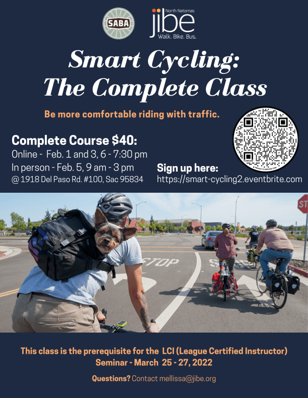
North Natomas Jibe, Sacramento Area Bicycle Advocates (SABA) and other partners are offering a Smart Cycling class in the Sacramento area on February 1 and 3, evening ‘classroom’ presentations through Zoom, and an in-person field day on Saturday, February 5, for parking lot skills and road skills.
This class is oriented towards people who would like to go on to the League Cycling Instructor (LCI) Seminar which will be offered March 27-29, for which passing scores on the skills and test are a prerequisite, but it is open to anyone who is interested. North Natomas Jibe’s Project Ride Smart, San Juan Unified’s Bicyclist Education Program, and several other programs in the Sacramento region use LCI’s as instructors for in-school and out-of-school youth programs.
When you sign up for the class (use the QR code in the graphic above), you will receive a Zoom link to the ‘classroom’ presentation, held Tuesday, February 1 and Thursday, February 3, 6:00 to 7:30PM. There will be a chance to ask questions.
The class includes Saturday, February 5 field day, 9:00AM to 3:00PM. It will include parking lot skills for bike handling and hazard avoidance, and a road ride in traffic in the area of the Jibe office, followed by a debrief and multiple choice exam for people who want a certificate and/or are going on to the LCI Seminar. Lunch will be provided, but you can bring your own. Bring snacks as well, if you get hungry.
For the field day, you need a bike in good working order (ABC Quick Check), a bicycle helmet (required for our insurance), clothing appropriate for the forecasted weather, and a water bottle if you wish. The class will take place in most weather, except heavy rain and high winds. If you are borrowing a bike, please ride it beforehand so you are familiar with how it handles. If your bike needs repairs or adjustments, we can suggest a bike shop in your area to get it ‘up to speed’ before the class.
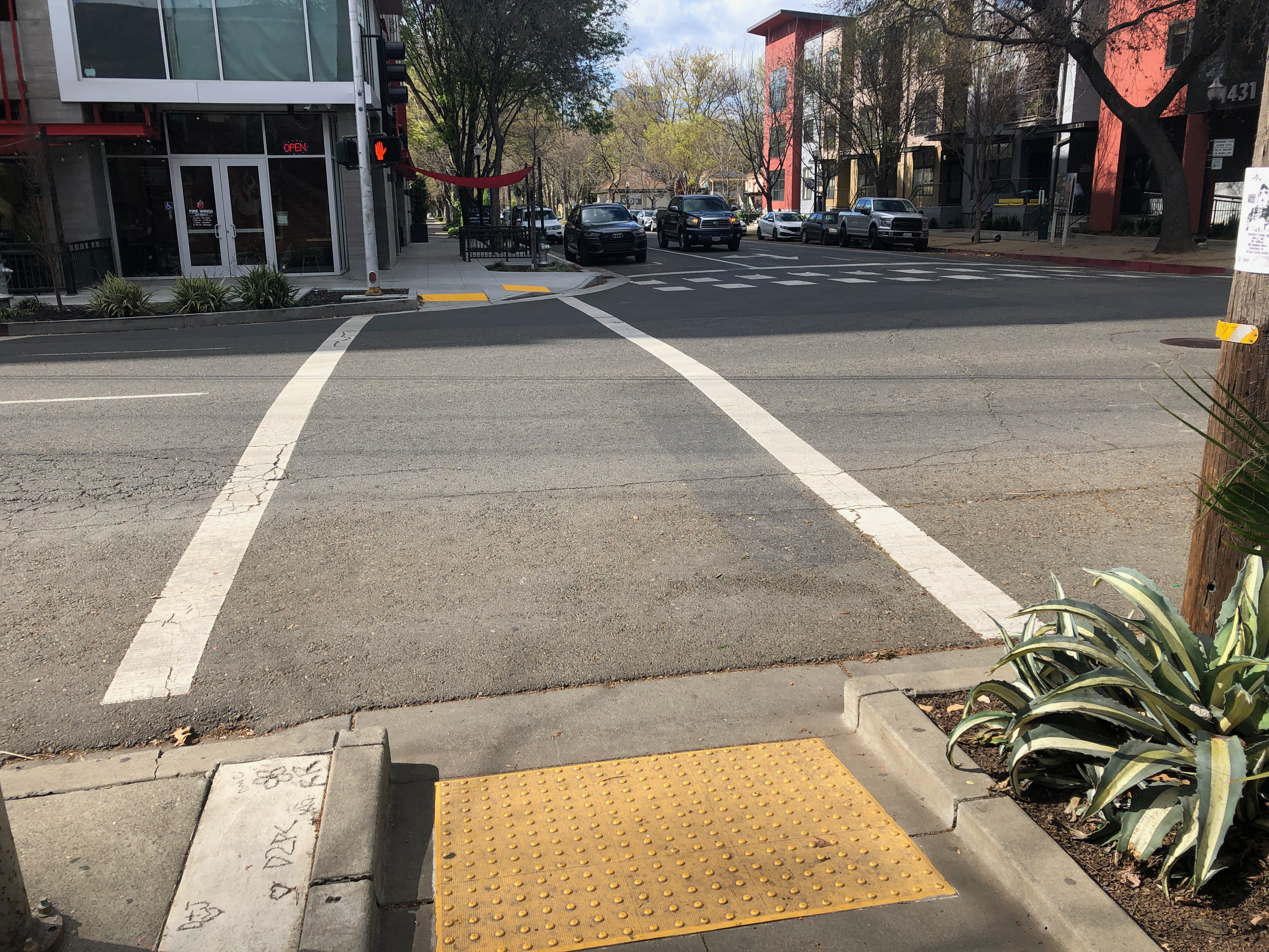
There has been a tremendous amount of infill building, much of it housing, in midtown Sacramento and even downtown. This is a wonderful thing. As part of the construction projects, sidewalks and curbs are often torn up and replaced. In some instances, the replacement is done the right way, with wider sidewalks, directional curb ramps (two to a corner, not diagonal), and curb extensions. But in at least half the replacements, but curb extensions are missing.
15th Street at K Street, missing curb extension, Sacramento
The photo above shows the new sidewalks and curb ramps at the southeast corner of the SAFE Convention Center, at 15th Street and K Street. That much is good, and a big improvement over what was there before.
However, the curb extension on 15th Street is missing. The purpose of curb extension is to slow traffic speeds, to shorten the crossing distance, and to increase visibility between drivers and walkers. But it is missing here. Once the convention center really opens, this will be a very busy crossing for pedestrians, and is already receiving increased use from the performing arts center.
What gives, Sacramento? Every reconstructed corner should have curb extensions. Yes, they must be designed appropriately so they only block the parking lane and not a bike lane, but in this case, there is no bike lane.