bike left turn Carlson Dr to H St

I was at a meeting last evening with transportation advocates when the subject of the turn left from Carlson Drive to H Street came up. Most people expressed discomfort about this turn, and most of the people were also experienced and skilled bicyclists. They felt that left turning motor vehicles, which go at the same time as left turning bicyclists, would encroach on the dashed green lane and hit bicyclists. They were also uncomfortable turning across the straight through lane, as they had seen people run this red light. This is a critical intersection and area for bicyclists, as it is one of four main routes onto and off the Sacramento State campus for bicyclists.

So today I went to take a look. I have not written about this intersection before, but two articles are of interest: SABA https://sacbike.org/carlson-corridor/ and City of Sacramento https://www.cityofsacramento.org/Public-Works/Engineering-Services/Projects/Completed-Projects/Carlson-Drive-Improvements.

So far as I know, this was the first use of green paint, and the first use of a bicycle signal head in the city. The installation was intended to be innovative, and it was, for its time, in Sacramento, but it hasn’t stood up to the test of time.

Here is what it looks like from above. As you can see, it is a complicated intersection with several features intended to ease and speed motor vehicles. The city attempted to make the intersection safer without really changing it at all, beyond the green paint. Green paint helps communicate, but it does not protect in any way, and it has no legal meaning under California Vehicle Code or city code.

Carlson Dr - H St intersection aerial
Carlson Dr – H St intersection aerial

The two photos below show the setting of the left turn. The bicycle lane on the right side of the street leads to a dashed (skip) green lane turning through the intersection. The bike lane stop line is somewhat in front of the motor vehicle stop line, and there is a button to trigger the bicycle signal. The bicycle signal face is mounted to the right of the motor vehicle signal face, and there are two, before the intersection and on the far side.

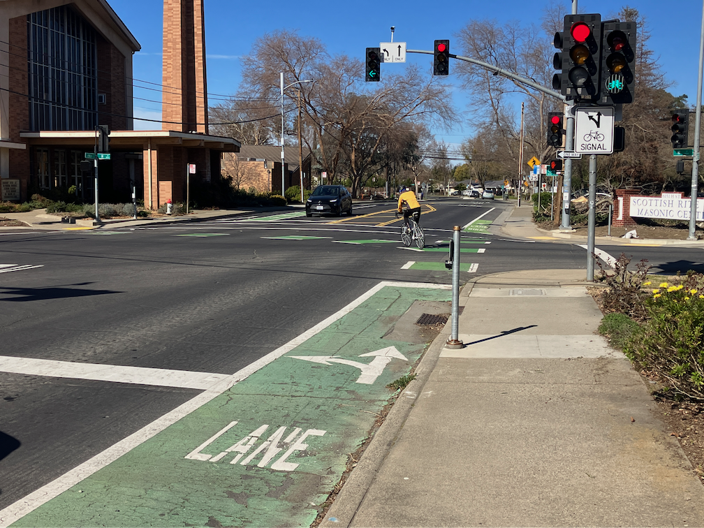
bicyclist pressing the button to trigger the bicycle signal
bicyclist turning left from Carlson to H St; bicycle signal face green

I was there at a low traffic (motor vehicles and bicyclists) time of day and was unable to capture a bicyclist and motor vehicle adjacent to each other on the turn.

I have to say that I was not uncomfortable with the left hand turn. I’m a strong bicyclist and good at anticipating and mitigating for driver misbehavior. But I’m not the person bicycle facilities should be designed and built for. They need to be comfortable and legible (understandable) for any bicyclist, of any age and skill level, including Sac State students who seem to be the majority of the bicyclists here. This left turn is not.

There has been only one reported bicyclist injury crashes at this intersection since the green paint was put in (as of December 2020), and one in the 6-1/2 years before, so it is not a high injury intersection. But intersections like this discourage bicyclists, and so fewer people are willing to bicycle here. The poor quality of most of the access points to the Sac State campus probably in large part explains why the school has a much lower bicycling rate than most universities.

I don’t have a ready solution for fixing this intersection so that it is safe and comfortable (low stress) for bicyclists. But I do believe it is the city’s responsibility to study it, design a safe and welcoming intersection, and install it.
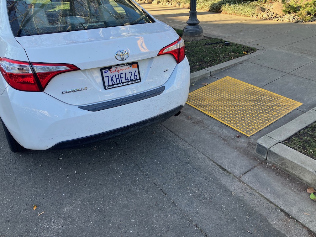
does Sacramento enforce illegal parking?

As a person who walks a lot in the central city, and some in other areas, I often see and report illegal parking to the city through the 311 app. I’m not talking about parking too long, or not paying, but about blocking driveways, sidewalks, and crosswalks. 90% of the time, the response that I get was that a parking officer was dispatched and the vehicle was no longer there, so no citation was issued. I provide the license number, vehicle description, and a photo, but the city will not use that information to ticket once a vehicle has moved. But, the real issue it that they often ignore the violation completely.

An example. I reported this illegally parked vehicle at 9:17AM. It was blocking the crosswalk over 13th St, and the ADA ramp. The remaining ramp area was not wide enough to allow a wheelchair to pass. At 11:09AM I received an email reply from the city, stating: “A Parking Enforcement Officer arrived at P ST & 13TH ST, SACRAMENTO, 95814 to find that the vehicle(s) reported were no longer on the scene.” At 7:30PM, the vehicle was still in exactly the same place. The officer was lying. The vehicle was still there. Either the officer never visited the location, or decided not to cite the vehicle.

illegally parking vehicle blocking crosswalk and ADA ramp
illegally parked vehicle, 13th St, not cited

This is the sort of attitude the city has toward people who walk, or roll. They are always less important than people who drive.

Sacramento disdains walkers

The City of Sacramento, both the city government and many people who live here, have a picture of a pretty good place to live, and work, and play. And that is true, to some degree. Good climate (except middle of summer), a wealth of trees, interesting and useful businesses (at least in midtown), mostly flat (for bicyclists), two rivers and the confluence, moderately friendly people. But the transportation network sucks.

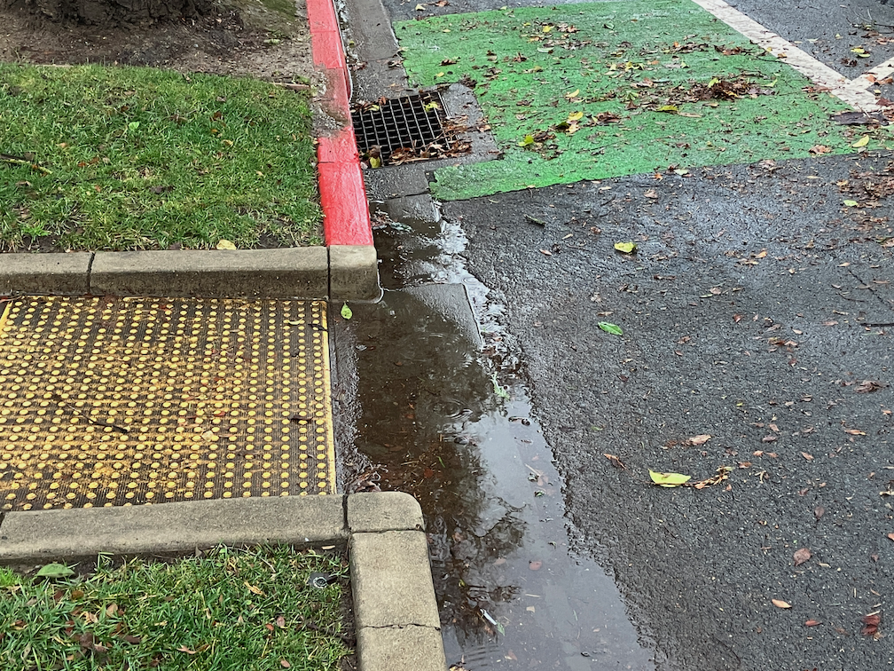
Heavy rain of course brings out the flaws in the transportation system. Flooded roadways that at the least make it hard to get places, and at worst kill people. Trees and tree debris blocking both sidewalks and bike lanes. Light rail that runs late or not at all, buses behind schedule. All of those are important issues. But this post is about flooded ADA ramps.

flooded ADA ramp, Q St at 13th St

The above photo is a mild case, as it does not make the ADA ramp and connecting sidewalks impassible. It just means wet feet for people who can’t jump the puddle, or wet wheels for people with mobility devices. You might think that this is a problem created by the storms. But look closer. The ADA ramp was built so that it is LOWER than the drain inlet. This puddle will remain until it evaporates, and if the rain continues, it will be there for quite some while. There are two explanations, and I don’t know which is correct. 1) The ramp and drain inlet was designed by an incompetent engineer; or 2) ramp and drain inlet were not built as designed, meaning that the construction inspector did not notice or did not care that it was not installed as designed. In either case, it is the fault of the city.

You might think that this is an unusual circumstance, but if you walk and notice, about half the ADA ramps in the city have this same problem. Why is this so common? Because the city doesn’t care. The engineer doesn’t care, or the inspector doesn’t care. Every one of these situations expresses the city’s disdain for walkers, and users of mobility devices.

I started with a mild example, but to present a much worse example:

flooded ADA ramp and sidewalk, 3rd St at O St

This puddle won’t disappear for at least a week, even without additional rain. This is not a problem of a plugged drain inlet. The ramp and sidewalk was designed to be BELOW the gutter level along the street.

I have reported this location multiple times to the city, over the years. It has never been fixed. When I submit a 311 report, it is marked as complete without anything being done. Which is not untypical for the city, most of my 311 reports are ignored, marked as complete without anything being done.

Does this bother you? Get in touch with your city council member, provide photos and stories about how this impacts you and the people you know. Ask council members to hold city staff responsible for their incompetence and lack of care. If the city manager can’t fix these problems, it is time for a new city manager. If Public Works can’t fix this problem, it is time for a new head of Public Works. Anything else is not acceptable.

the worst ADA violation in Sacramento?

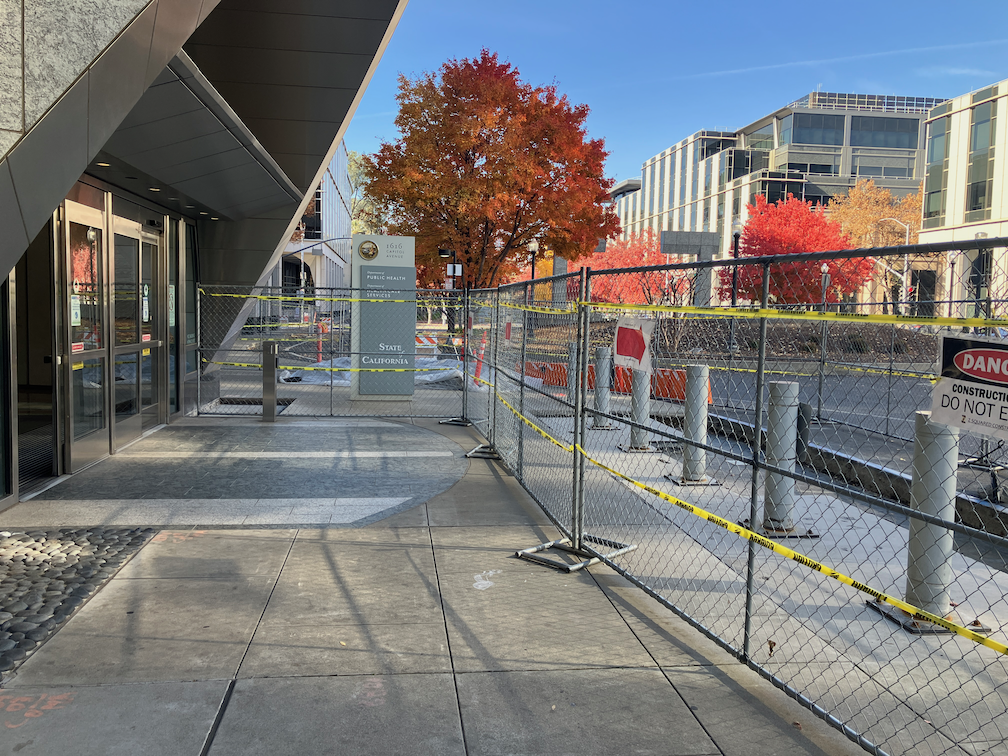
Let me say up front that there is a lot of competition for ‘the worst’, but I think the sidewalk and other construction on Capitol Ave between 16th St and 17th St is certainly in the running.

What are the issues?

  • No advance warning of sidewalk closure at the preceding corners on 17th St.
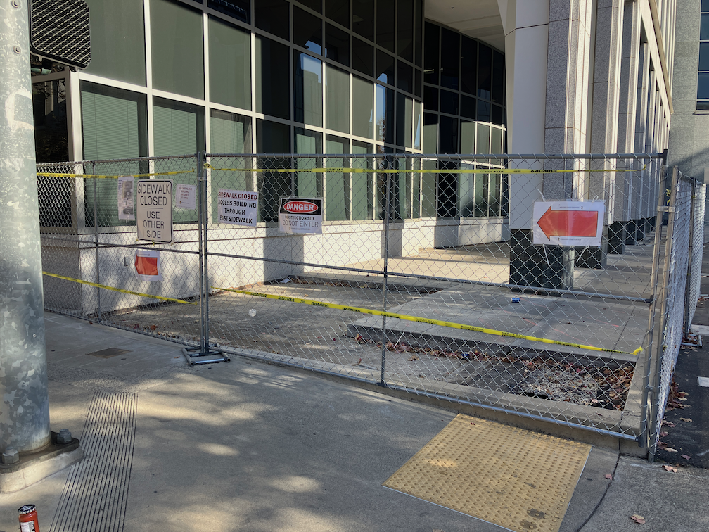
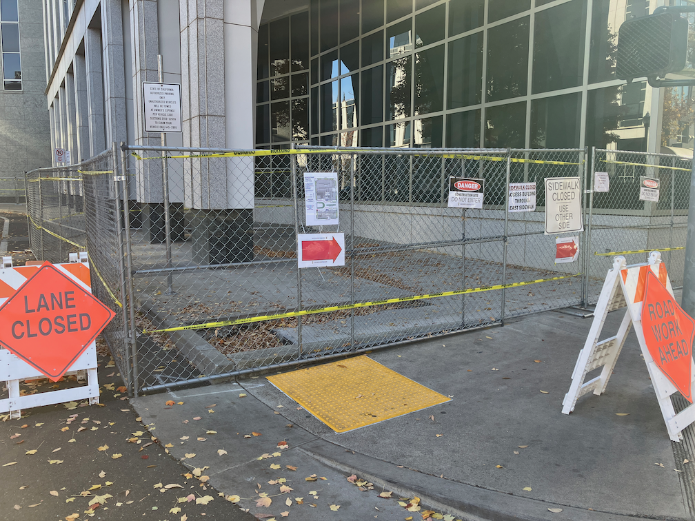
  • No ADA detectable barrier. The project is using chain link fencing with yellow caution tape strung through the fence.
  • Fence bases protrude into the sidewalk, presenting a tripping hazard for blind or low vision persons, or anyone at night.
  • No appropriate ‘sidewalk closed’ sign at the point of closure.
  • Both sides of Capitol Ave have closed sidewalks, so there is no choice between sides of street.
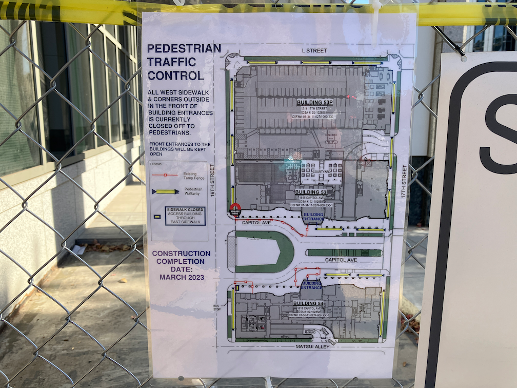
  • The small sign on the fences at 16th St indicate very long detours to reach the entrances of both 1616 Capitol Ave (south side) and 1615 Capitol Ave (north side). Photo below. This sign of course would be of absolutely no use for someone with impaired vision, or anyone on a dark day or early in the morning or late afternoon (at this time of year).
  • The bike lanes on both sides of Capitol are partially obstructed by fencing. No signing for bicyclists or drivers indicates this. Bicyclists have to merge away from the fencing into the general purpose lane, with no advance warning.

This is a California Department of General Services (DGS) project, and signing indicates that the construction contractor is Z Squared. I have reported these violations to both the City of Sacramento 311 (case 221130-1423348) and DGS Facilities Management Division.

It is worth noting that his current construction seems to be part of an ongoing construction project that was stalled for about a year. DGS removed the rocks from a sidewalk adjacent area meant to protect walkers from walking into the awkward building buttresses, then fenced these areas. About a year ago. Then, nothing.

There is also construction going on Capitol Ave between 15th and 16th, but I was so depressed by this one that I didn’t include it.

1616 Capitol Ave construction blocking sidewalk
1615 Capitol Ave construction blocking sidewalk
Capitol Ave at 16th St construction blocking sidewalk, north
Capitol Ave at 16th St construction blocking sidewalk, south
Capitol Ave detour signing for pedestrians

What City of Sacramento ISN’T doing

The City of Sacramento, that bastion of doing the least amount possible, has failed to notice that progressive cities in the US and worldwide are making changes to their environment to make is safer for people who walk and bicycle, and more efficient and welcoming for people outside of cars.

What the city is NOT doing, that it could:

  • Accept responsibility for maintaining sidewalks, as an integral part of the transportation network. The city continues to shirk its responsibility, spending funds on motor vehicle infrastructure instead of maintaining walker infrastructure.
  • Installing leading pedestrian intervals (LPIs) at every traffic signal in the city. The same eleven have been in place for years; none have been added. The recent legislation, AB 2264, only applies to state highways; it is up to cities and counties to implement on other roadways.
  • Daylighting intersections. This means removing parking from within 15-20 feet of the crosswalk or stop bar, either by painting and enforcing red curbs, or building curb extensions (bulb-outs) at every intersection. Upstream, approaching the intersection, is the big safety feature, downstream, leaving the intersection is much less important. There are interim solutions here, such as painting curb extensions and using soft-hit posts (vertical delineators).
  • Implementing construction zone requirements that accommodate walkers and bicyclists. The current city policy is to provide safe bypasses only if it does not in any way inconvenience drivers. The public has asked that a policy be developed along the lines of the Oakland construction policy, but the city has stonewalled against that.
  • Making transportation improvements that benefit walkers and bicyclists, except with county, state or federal grants. The city simply will not spend any of its general funds on improving transportation safety.
  • Waiting until a roadway is completely repaved to reallocate roadway width to bicycle lanes or separated bikeways, or transit. Compounding this issue is that the city doesn’t share with the public the repaving projects that it intends to do, so the public has no chance to comment beforehand.
  • Lowering speed limits citywide. While it is true that spot reductions have little effect on travel speeds, there are a growing number of cities that have lowered speed limits citywide, with a significant reduction in speed.
  • Enforce traffic laws. The Sacramento Police Department has essentially stopped enforcing laws related to the safety of walkers and bicyclists. This of course is also true in many other places. Police don’t see traffic safety as an issue worthy of concern. Of course so much of law enforcement is used as pretext to oppress, and I’m not in favor of any of that, but if the police won’t even enforce failure to yield to people in the crosswalk, what use are they? We would all be much safer if traffic law enforcement were removed from the police, largely automated, and the money saved diverted to real community needs. Yes, defund the police.
  • Painting marked crosswalks at every intersection. Yes, I know that unmarked crosswalks are legal crossings, but most drivers either don’t know or don’t care, so marking crosswalks is critical.
  • Remove beg buttons. These buttons, which sometimes a walker must press to get a walk sign, and sometimes don’t need to press (this is called auto-recall) are a direct attempt to discriminate against people walking. The city, after much pressure from the public at the beginning of the pandemic, set five crossings to auto-recall, out of the thousands. Of course they didn’t change the signing, so people walking don’t know this. The city it being intentionally obstinate in its defense of this outmoded requirement.
  • Remove pedestrian prohibition signs unless that is a demonstrable safety reason for the prohibition. There are numerous signs all over the city that were placed solely to preference motor vehicle drivers over people walking. The default should be that every one is removed unless the city wishes to do a traffic study to justify them.
  • Install traffic diverters (mode filters) all over the city. These diverters, which allow bicyclists free travel but turn motor vehicle drivers aside, are the single most effective safety measure that city could implement. But the city has decided to take these off the menu of solutions, for no reason that it has ever been made public. The few that exist are in the central city, almost none in other neighborhoods. Another example of privileging the already privileged over lower income neighborhoods.
  • Charge for parking, eveCavrywhere. Residential neighborhoods, where there is usually open parking space, would be charged through permits for the cost of maintaining that portion of the street. Any place where parking is in short supply, market rates for parking should be charged. Giving away free parking is subsidizing drivers and throwing your tax money in the trash.

I could go on with this list for pages. In fact, I have: walking policies for SacCity, and many related posts. But the city is still not taking meaningful action on any of these items, so I will keep reposting. For as long as it takes. And it will probably take quite some while before the city gets over its culture of doing the least amount possible.

Caveat: The city has disinvested in lower income and high minority neighborhoods, probably for its entire history. The first steps should be taken in these neighborhoods, with input from the residents, of course, and not in higher income and non-minority neighborhoods which have always gotten more than their share.

why are bike lane gaps so important?

My last three posts have been about locations where sharrows replace bike lanes for one-block sections in the Sacramento central city: Sacramento’s worst possible place for sharrows; Sac kill those sharrows on I St; Sac kill those sharrows on H St. There may well be other such locations that did not come to mind. If so, please let me know so I can document and post on them. I’m not asking about locations that should have bike lanes, or where bike lanes should be upgraded to separated (protected) bikeways. There are simply too many of those locations for me to deal with.

So, why are bike lane gaps so important? Bike lanes are basically a promise to bicyclists that the city is providing a safe place to ride your bike. Yes, I know traditional bike lanes have serious safety issues (they are called door zone bike lanes, or DZBLs), but for the average rider, they are safer than no bike lane. But this promise is broken when there is a gap. For these gap sections, bicyclists who felt comfortable riding in a bike lane are suddenly left to deal with motor vehicle traffic in a location where neither the bicyclist nor drivers are sure how to behave. What does the average bicyclist then do? Decide never to ride on that street again. And if they have a scary experience, they may even decide not to ride again at all.

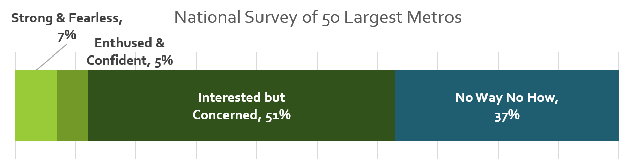
I’m a bicyclist with strong vehicular bicycling skills. I know where the safest place to ride is on every street, and I ride there no matter what motor vehicle drivers or law enforcement happens to think about it. But I am far, far from a typical Sacramento bicyclist. I am ‘strong and fearless’, though as I get older, I’m tending towards ‘enthused and confident’. The four types of bicyclists, or levels of comfort, developed in Portland but applicable to Sacramento, are shown in the graphic:

four types of bicyclists and levels of comfort diagram

The city should be designing bicycle facilities that work for all three categories of people who will bicycle. When there is a gap in a bike lane, the city has designed bicycle facilities that serve the ‘strong and fearless’, only 7% of potential bike riders. This is discriminatory. It is wrong. I suspect that with the resurgence of bicycling and the availability of e-bikes, the ‘no way, no how’ category has shrunk a bit.

The city must close bike lane gaps. Not off in the future when the street is repaved, or when a grant is obtained, but NOW. To do otherwise is to intentionally discourage bicycling and to risk people’s lives.

Sacramento’s worst possible place for sharrows

The third place where sharrows need to be eliminated in the central city Sacramento is I Street at the county jail. In the phot below, the right hand lane is a parking lane most of the time, except for commute rush hour, 4:00-6:00PM on weekdays (note the time sign in the ‘bikes may use full lane’ photo following), when it is a general purpose lane. When it is a parking lane, there are sharrows nearly covered up by parking, as you can see in the second photo. This is not a bike lane in any sense of the word, but drivers assume that it is and close pass anyone using that area to ride in. When it is a general purpose lane, there is high speed traffic approaching the Interstate 5 onramps, absolutely not an appropriate location for sharrows. The current trend in use of sharrows is 1) don’t use them at all; 2) if they are used, they should absolutely never be used over 35 mph, and rarely used over 25 mph. Though the posted speed limit of I Street is 25 mph (though it isn’t really posted anywhere), regular traffic speeds are over 35 mph, and during commute hours is over 45 mph except when congestion prevents that. So this is not any appropriate location for sharrows.

Of all the places where bicyclists are at risk of getting doored, this is the place. Everyone parking here has a family member or friend who is in jail. They are upset, they are depressed, they are often angry, they are not thinking about bicyclists and looking before they open their door. There is also a lot of turn-over here, so a lot of door opening. When I ride this area, I ride in the exact middle of the next lane over, taking the lane. But that is something that the average bicyclist will not do. So the sharrows leave them vulnerable to both close passing and dooring.

The city has placed a ‘bikes may use full lane’ sign (MUTCD R4-11), but is is up high against the background of a tree, where it would not likely be noticed by drivers or bicyclists. Of course bicyclists may use the full lane, with or without the sign, but again, most bicyclists will not do that. If signing is to have any meaning at all, the sign must be much bigger than it is, closer to 7th Street, and the message should also be marked on the pavement.

I Street west of 7th Street, part-time lane with sharrows
I St west of 7th St, part-time parking and general purpose lane with sharrows, Sacramento
I St west of 7th St, sharrows and parking in a part-time general purpose lane, Sacramento
I St west of 7th St, bikes may use full lane sign

I am not sure what the best solution is here. It is not to get rid of the parking; this is one location where on-street parking is justified. The right hand lane should be a parking only lane, however. There is no justification of traffic volume requiring another general purpose lane during commute times. That just encourages more driving and higher speeds, as drivers race each other for the on-ramps.

This is also a location where bicyclists separate into two destinations. Riders heading towards Sacramento Valley Station stay on the right so they can turn on 5th Street toward the station. Riders heading to Old Sacramento must move to the left hand side to avoid the high speed on-ramps. The left side bike lane, however, doesn’t even start until just before 5th Street, leaving no refuge for bicyclists trying to merge across traffic to the left side between 7th Street and 5th Street. I think there needs to be an intentional location for bicyclist to shift, at 7th Street or 6th Street or 5th Street. There would be a green bicycle box for waiting, and a signal with exclusive bicycle phase for bicyclists to safety transition from the right side to the left side. A bike lane would be present from that crossing point on I Street, without gaps.

Of course I Street needs to be reallocated so that it serves all users, and is not just a traffic sewer for drivers going to the freeway. It should be no more than two lanes at any location. Fewer lanes would slow traffic, as the prudent driver sets the speed rather than the egregious speeder. There should be a separated (protected) bikeway on either the left or right side, with a safe transition from one side to the other at some point.

Caveat: I post about issues in the central city because I live here, and see the problems every time I am out walking or bicycling. However, I strongly believe that the city should be focused on solving issues in lower income, disinvested neighborhoods, of which there are ample throughout the city. The central city has received more than its share of bike facilities.

Sac kill those sharrows on I St

Next sharrows location to address is I Street between 10th Street and 9th Street. The bike lane present to the east disappears in this block, with Cesar Chavez Plaza on the south and Old City Hall on the north, before picking up again west of 9th Street. Not having my tape measure out (and I’d have to measure late night when there is no traffic), it isn’t clear why this one block does not have a bike lane. It may be that the curb extension is too wide, or it may be that the general purpose (car) lanes are not configured correctly. If lanes, then it is an easy problem to fix, just re-stripe the lanes and add a bike lane. If the curb extension, then that would require a bit of infrastructure work. I fully support curb extensions, nearly all intersections should have them, but in some places the city has installed them incorrectly and caused issues for bicycle facilities. This is not, as many places are, a case for removing parking, but for designing the street correctly. Of course ultimately there should be no three-lane one-way traffic sewers in the city, and right of way should be reallocated to a separated (protected) bikeway and wider sidewalks.

I St westbound at 10th St, sharrows, Sacramento
I St westbound at 10th St, Sacramento

Caveat: I post about issues in the central city because I live here, and see the problems every time I am out walking or bicycling. However, I strongly believe that the city should be focused on solving issues in lower income, disinvested neighborhoods, of which there are ample throughout the city. The central city has received more than its share of bike facilities.

Sac kill those sharrows on H St

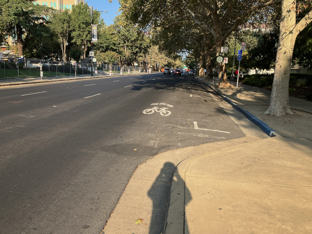
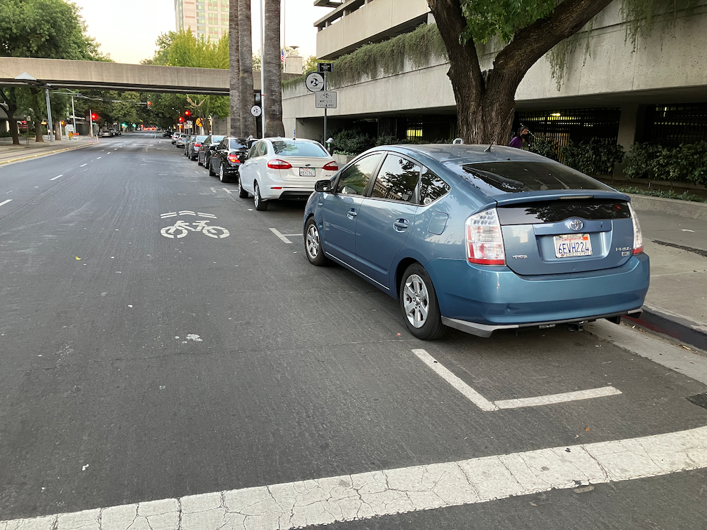
The block of H Street between 7th Street and 8th Street in downtown Sacramento has shadows instead of a bike lane. There is a bike lane in the preceding block, and in the block past, but not this block. Why? Because on-street parking has been preserved on this block in preference to bicycle facilities. The right lane lane is marked with a sharrow. Not a properly placed sharrow, but one in the door zone of the parking lane. When shadows are used, they should be placed in the center of the travel lane. But rare is the situation in which they should be used at all. Research indicates that sharrows are less safe than no markings are all, less safe than marked bike lanes.

So why is this parking here at all? No reason whatsoever. On the north side of this block is a County of Sacramento parking garage. There is even a pedestrian bridge between the parking garage and the Sacramento County administrative building on the south side of H Street, as seen in the photo.

I am certain that all of these cars belong to county employees or contractors. They should be parking in the garage, and this parking should be removed so that at least a marked bike lane can be placed in this block. Of course H Street should have a separated bikeway from 6th Street, Sacramento Valley Station, to 16th Street, where it becomes two-way. But a Continous painted bike lane is at least a first step.

There are a number of locations in the central city where bike lanes are dropped for a block in favor of parking and travel lanes. Every single one of these should be fixed either by the removal of parking or a general purpose lane.

Caveat: I post about issues in the central city because I live here, and see the problems every time I am out walking or bicycling. However, I strongly believe that the city should be focused on solving issues in lower income, disinvested neighborhoods, of which there are ample throughout the city. The central city has received more than its share of bike facilities.

Sacramento bike share update

There are a number of new white and green Lime bikes on the street in Sacramento. There are not the easy-to-steal white and green ones of a few months ago, some of which were promptly stolen and the others quickly pulled from service. Though they still seem to be called Gen 4 bikes, they now have a cable lock very similar to those used on scooters. I have seen more of these bikes downtown/midtown than elsewhere. See photo.

Lime bike cable lock

There continue to be red JUMP/Lime bikes on the street. I had the impression that there were fewer of these bikes than there used to be, but it may be that they are just being distributed differently. I’ve seen racks (the old SoBi/JUMP racks) full of these bikes, which had not had more than one or two bikes since the return of bike share. Lime does not make its GBFS (General Bikeshare Feed Specification) available to the public, nor does it have a map of bike share other than in the app, so it is difficult to say whether the bikes are being appropriately distributed/balanced.

While looking to see if there was a web map, I ran across an interesting ArcGIS Story Map from the City of Sacramento, Shared-Rideables in Sacramento. It was created in January 2022, and has not been updated, but is quite interesting.

Lime still seems to be failing to track and pick up dead bikes. By dead, I mean that the battery has run down to the point that it no longer powers the GPS unit, so Lime loses track of where these bike are. Several months ago there were a number of these bikes, reported to both Lime and the city, but not picked up after three weeks. Lime promised to me and to the city to do better. However, recently there were two bikes parked on the pathway from Sacramento Valley Station to the platforms for more than five days. Bike parked anywhere other than in very visible location on the street network do not get picked up for significant periods of time.

I used a Lime bike (white and green) Saturday without incident, returning from a trip. But on my outbound trip, using Lime/JUMP bikes, when I was on a tight schedule, I had no luck finding a bike that worked properly. The first one was stuck in first gear. The second had no pedal assist. The third had a jammed seat post that could not be adjusted. I managed to make the train on time, but barely. The bikes are simply not being maintained as they should be. I have noticed that if I report a problem, though the app, the bike is still there days later, and still rentable by another victim.

When reporting a bike problem, the app provides a limited number of issues (below), and no longer provides a text field for entering detail. The diagram says pedals, but there is no indication here or anywhere whether than means a problem with the pedals or cranks, or means problem with the pedal assist.

Lime app, problem report screen

One feature that was added to the app a few months ago that I really like is that the user can select scooters only, or bikes only, or both, for map display.

The app seems to show whether the bike in question is one of the new white and green ones or the older red Lime/JUMP bikes with the fabric covered locking cable. I’ve said before and will say again that it was a mistake for JUMP to drop the U-bar lock mechanism used on the SoBi and early JUMP bikes. So far as I know, a properly locked bike with U- bar was never was stolen.