The agenda and key documents were posted in SacRT Board 2026-08-24. This is a brief report on the meeting. For more detail, please watch the meeting recording on YouTube at https://www.youtube.com/watch?v=ktR8Jmlzuac.
Agenda item 4.1 was to adopt the SacRT Strategic Plan 2026-2030. As I had previously commented, the plan seems very general and vague. Board member Roger Dickinson had the same impression, and specifically wondered where a budget and funding projection was for this period of time. The plan document is only 18 pages long, most of it filler, and is labeled on one page an executive summary. Where is the rest of the document? Staff member Shelley Valenton said that the plan is based on a large number of other documents, so the detail is not in the plan, as these other documents change about once per year. Roger asked where these document were. They have not been posted or linked, so the board and public can’t view them. It was promised they would be. The Strategic Plan 2021-2025 is even briefer, 12 pages. The plan webpage lists several scorecards, but does not contain a single background document.
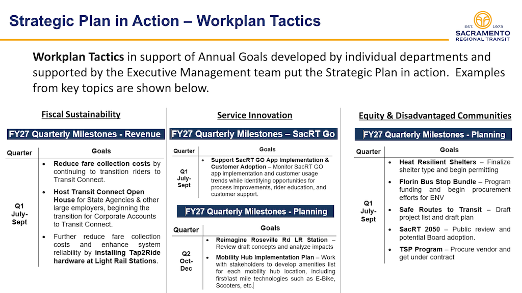
The board presentation includes a page below, Work Plan Tactics, which is the only page that presents useful information, and this is NOT in the plan document.
If the strategic plan is general and vague, with supporting documents not available, it would not provide any information for board or staff on where SacRT is going over five years. What then is the point in having the plan, or presenting it to the board and public?
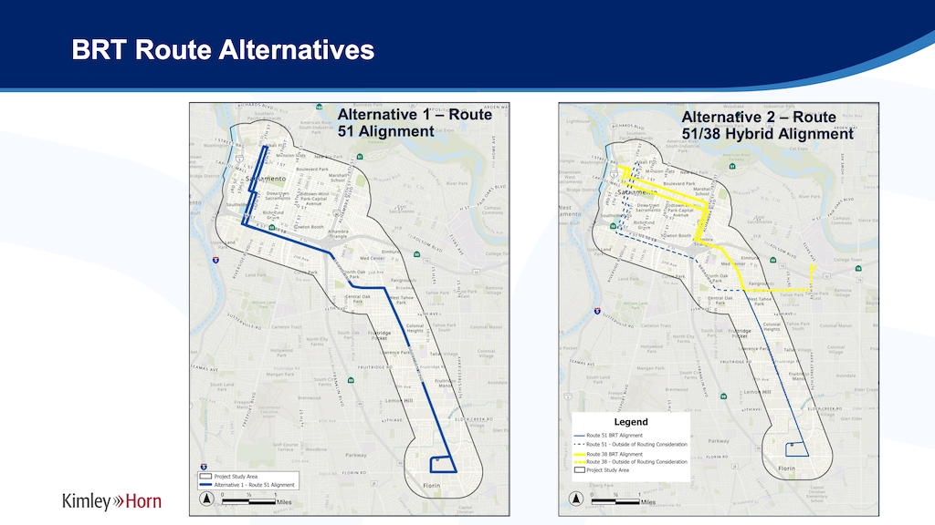
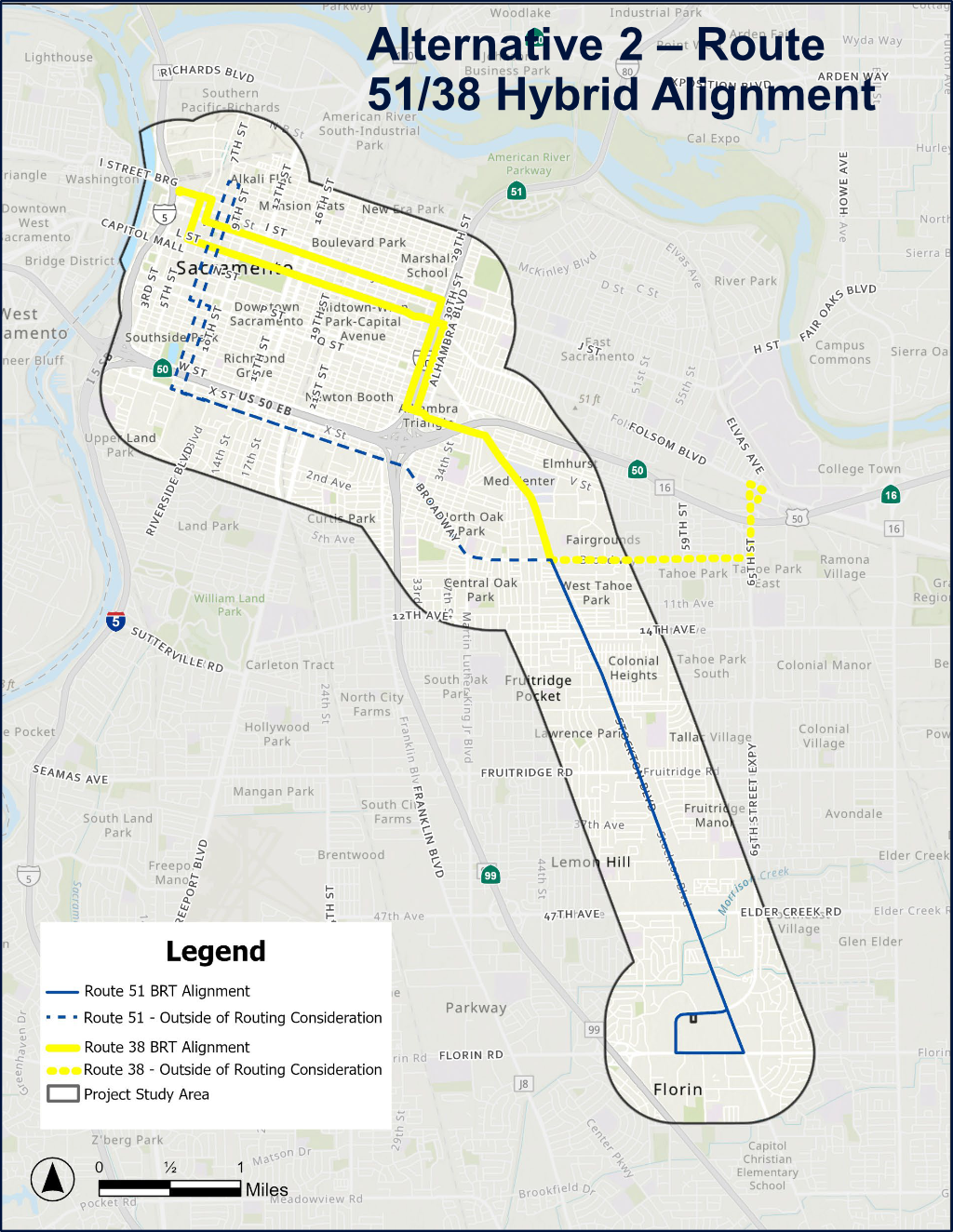
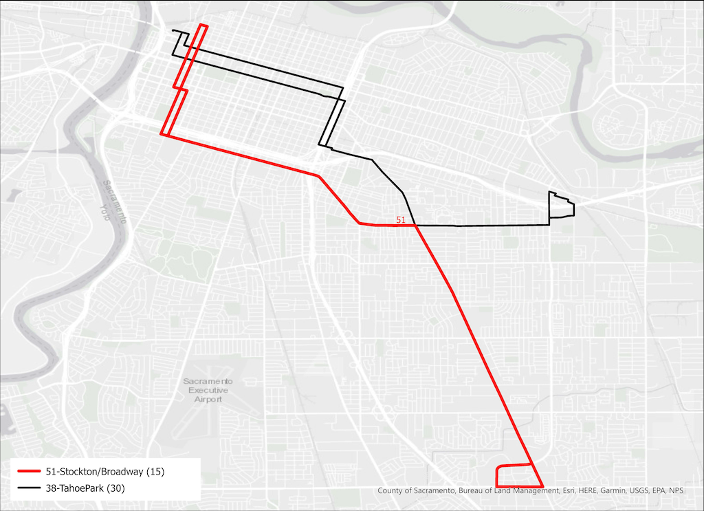
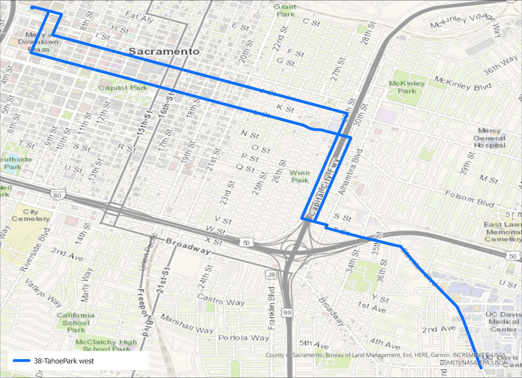
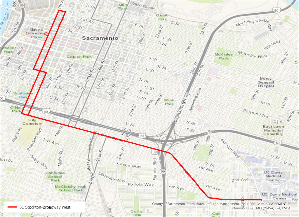
Agenda item 6.1, adoption of locally preferred alternative (LPA) for Stockton Safety and Transit Enhancement Project (STEP) was presented and adopted. Though there was lot of unrelated filler in the presentation, about the benefits and characteristics of BRT in general, the key points are that the alignment of the existing SacRT Route 51 will be the BRT route (not hybrid Route 51/38), and that the BRT will be curb running and not center running. All other decisions are for future planning, this is just the first step.
I participated in both the stakeholder meetings and the public meeting on STEP. My sense of the consensus is that there wasn’t one, that the participants saw value in both alignments, and in center running and curb running. After quite of bit of research on my part, I still was not sure. So I do appreciate SacRT doing this analysis, and it was probably time to make a decision. However, there was some fuzziness and missing information in the staff report and presentation.
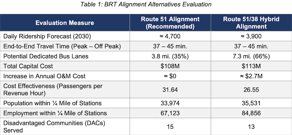
The heart of the argument is in the table below, from the staff report and also in the presentation. The data point highlighted are daily ridership forecast, which favors Route 51, though I don’t believe that the analysis considered that there will be considerably more development – medical, commercial and residential – between Broadway and Alhambra, with the Aggie Square / UC Davis Medical Center developments, than on either the Stockton segment to the south or on Broadway. The second point was the ‘increase in annual O&M cost’ of $2.7M per year. I searched for why the cost for Broadway service was included, but not the savings that would result from running BRT on the former Route 38 into downtown. The two routes would essentially be swapped under the hybrid alignment. There might be some additional cost, but $2.7M per year is not justified in the report.
In the stakeholder and public meetings, representatives of UC Davis Medical Center/Aggie Square spoke enthusiastically about extending BRT north on Stockton to serve that development. They stated that they really wanted a partnership with SacRT, and the city, to make the most of transit service. This fact does not show up anywhere in the staff report or presentation. Staff did several times say, ‘well, its only a quarter mile walk’. Yes, to the middle of campus on Stockton, but not to the north edge, and not to the east edge. I think this was just a spurious justification of a decision made for other reasons.
The third point that struck me as critically important, but was not really mentioned, is the ’employment with 1/4 mile of stations’. The hybrid route would serve 25% more employees than Route 51. That is nothing to be glossed over, particularly since UC Davis Medical Center was enthusiastic about promoting transit use to employees and others.
The decision was made, and it is probably not a bad decision. The devil is in the details, as they say, and the details are yet to come. But I continue to be concerned that SacRT planning either misses important information that should be included, or suppresses information that doesn’t support a foregone conclusion. Is this report and presentation unbiased? I’m not sure.
Agenda item 5 ‘Public Addresses Board on Matters Not on the Agenda’ saw an number of comments, most of them about service and continuing issues with the zero tolerance policy. I did not capture these, so I refer you to the meeting recording.
Note that the STEP project is a joint City of Sacramento, County of Sacramento, and SacRT project. If you are looking for my previous posts on Stockton, they might be attributed to the city or SacRT.