I have been gradually compiling data on two types of properties that could be developed into housing, or mixed use, removing unproductive uses such as surface parking and empty lots. The data at the moment is just the southwest portion of the Sacramento central city, bounded by Capitol Mall/Ave on the north, Broadway on the south, Sacramento River on the west, and 16th Street on the east.
I am not claiming high accuracy. The polygons are parcels from the Sacramento County parcel layer, selected using ArcGIS Imagery basemap, with consultations to Google Maps and Google Earth (the historical imagery allows selection of views without leaves on the trees, making it much easier to see what is on a parcel). I am sure I have missed some parcels, and included some that should not be. Nevertheless, I think the pattern is worth thinking about. Parcels that contain significant parking but also contain a building are not included, though obviously when counting parking, it is important. And, the map does not include street parking or structured parking. If those were included, the map would be a mass of red. There is a remarkable amount of structured parking (often called parking decks), both freestanding, and layered into other buildings.
I have not distinguished who owns these parcels. Probably about half the parking is owned by the state, and the rest by private parking companies. Of the empty parcels, it is less clear, but there is a mix of public (state and city) and private. It would take a great deal of time to determine ownership in order to code these differently. Maybe in the future, but I’m not sure this is a significant issue.
The graphic is below, but more useful will be the ArcGIS Online WebApp Sacramento parking & empty. This is my first experiment with presenting information through a WebApp map, but I realized that people would otherwise be ruining their eyes trying to parse out the polygons of surface parking and empty lots in the static map. Red is surface parking, orange is empty parcels.
So, why the data compilation. There are a significant number of empty parcels in the central city, all of which could be housing instead of empty. And every surface parking lot could be and should be developed into a more productive use. By productive, I mean something of direct use to humans instead of cars, and more productive of sales tax and property tax. Our property tax system values empty lots and parking lots are virtually zero, meaning they contribute little to our tax base needed to provide services. I’ll say more about this shortly.
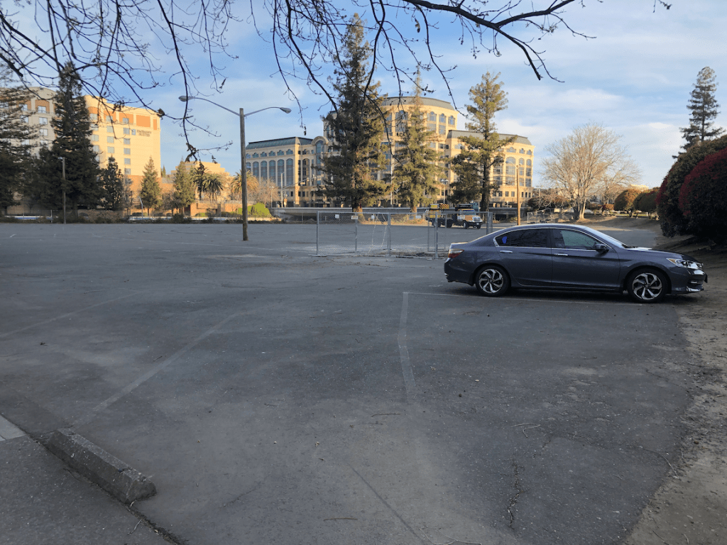
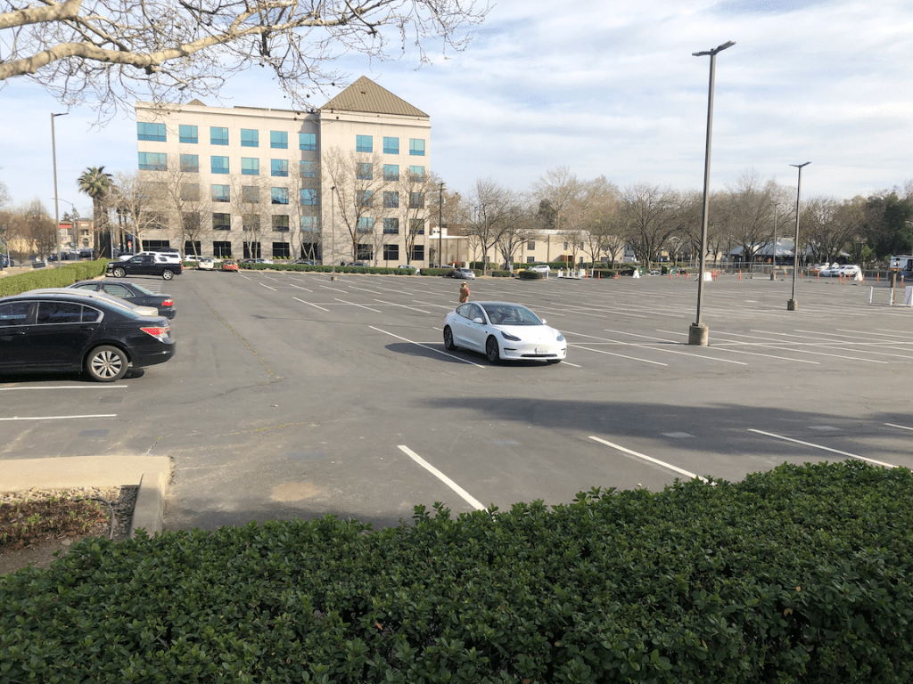
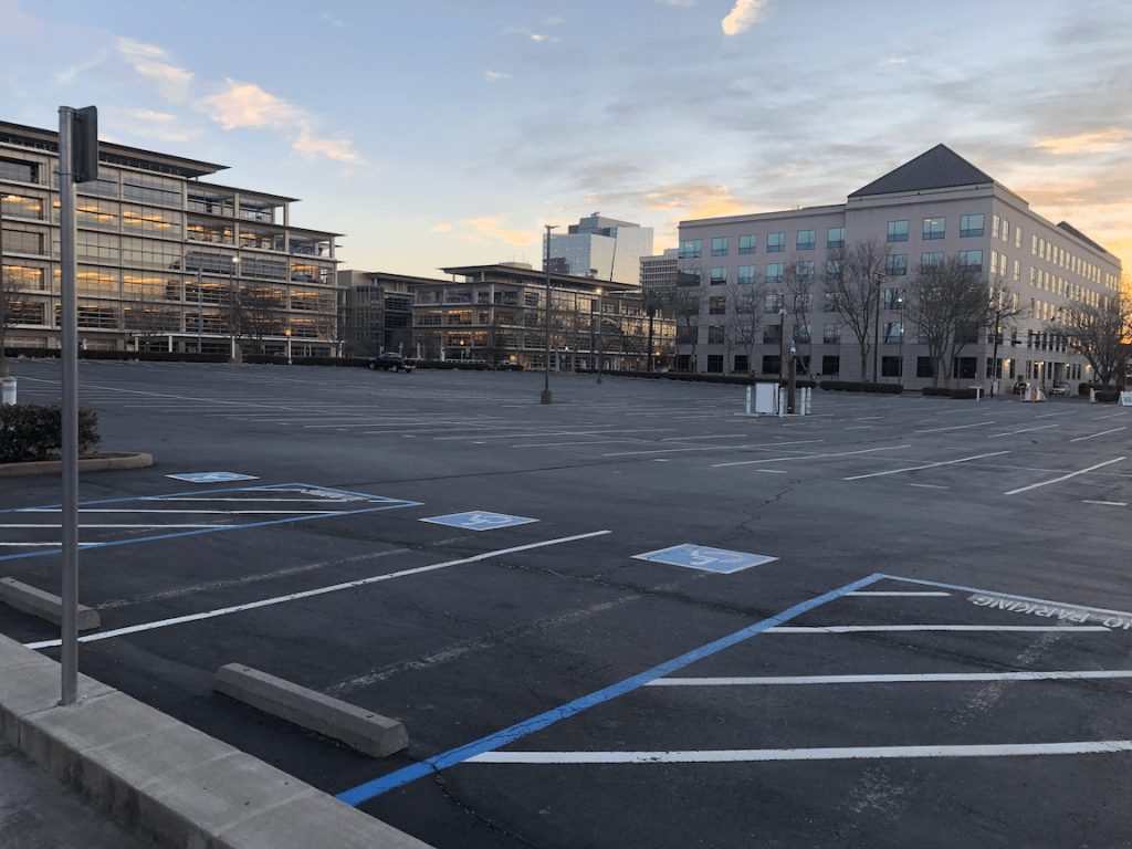
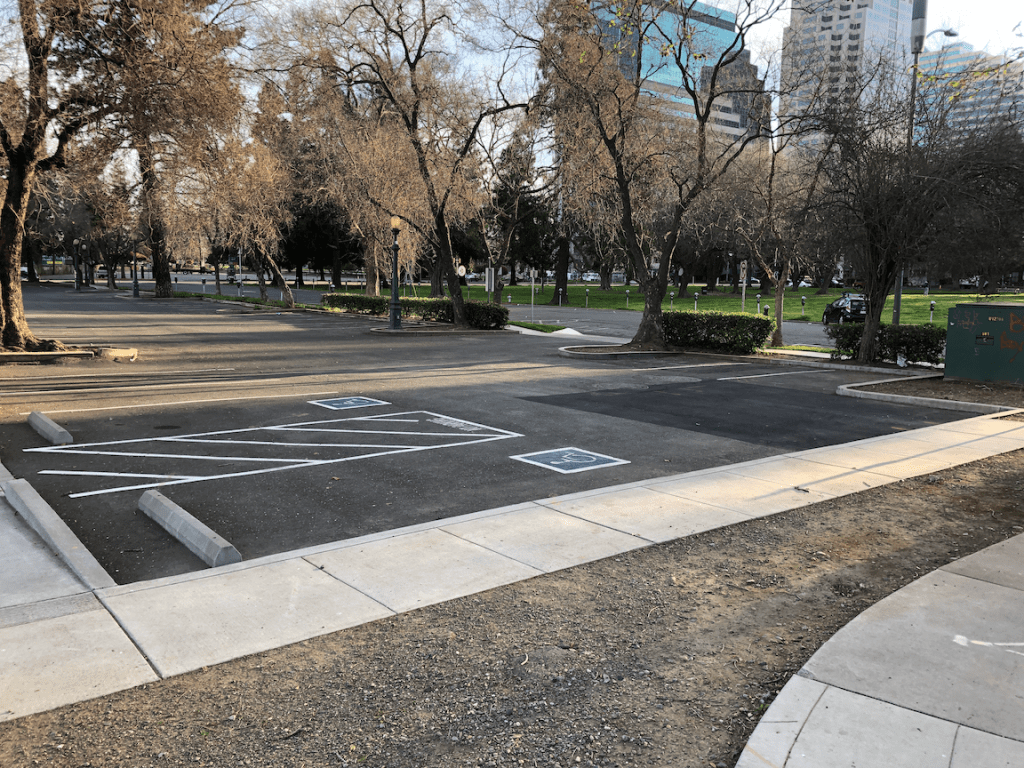
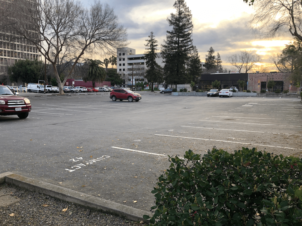
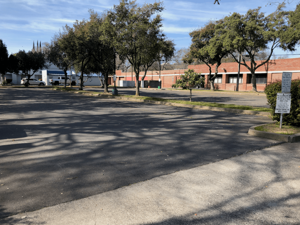
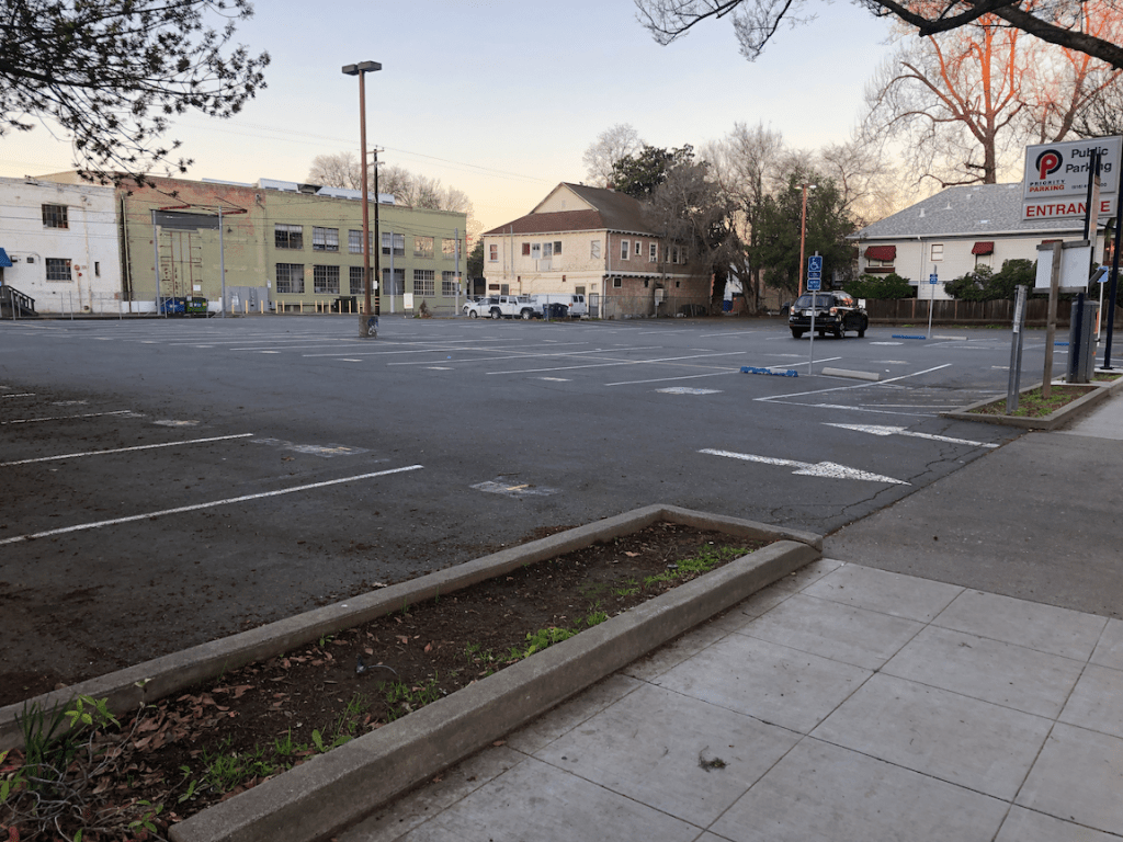
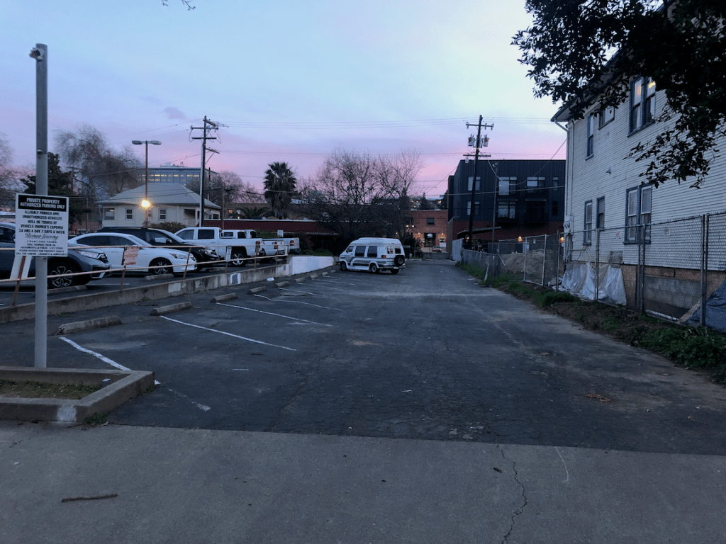
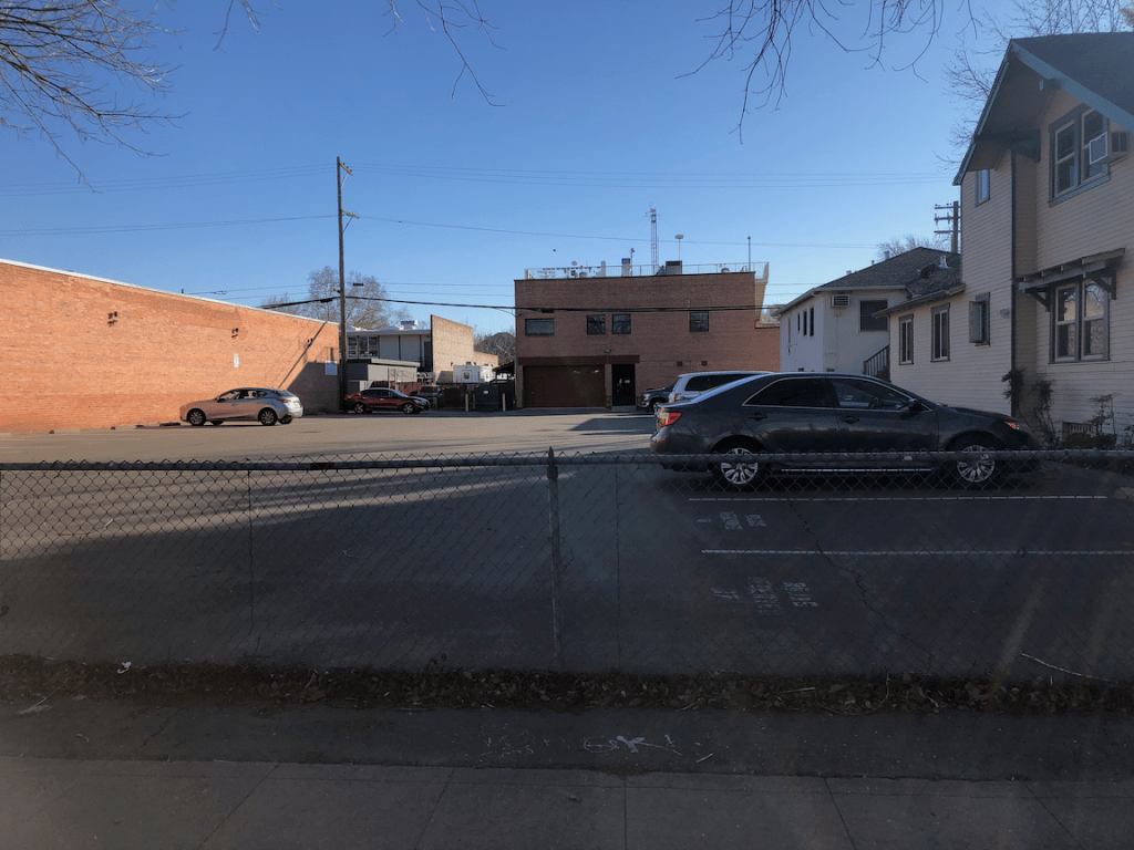
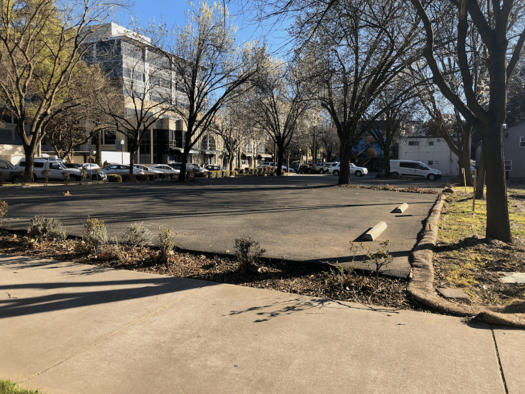
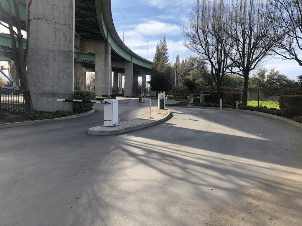
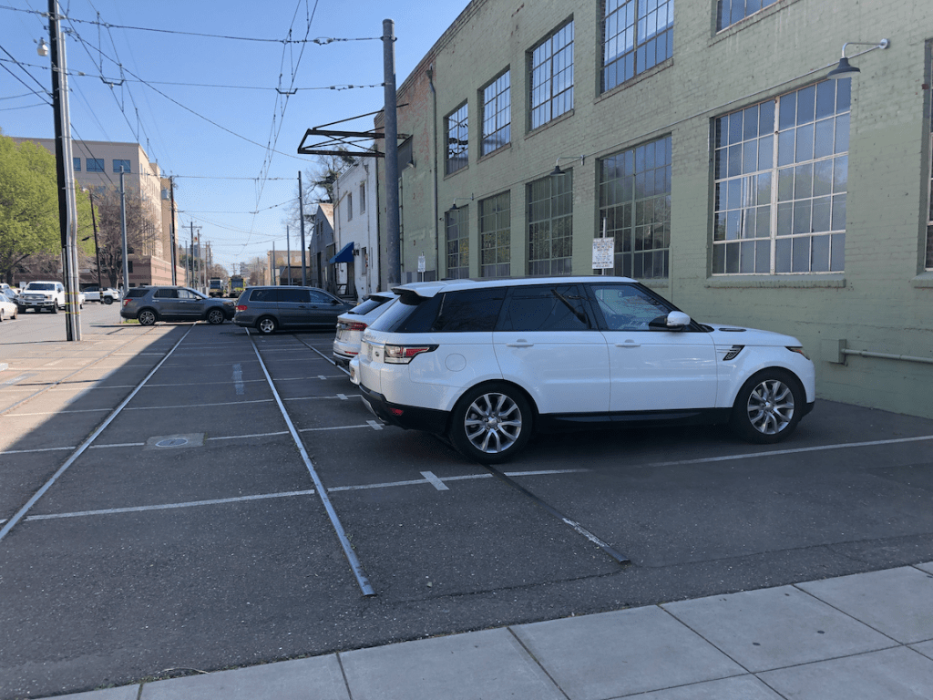
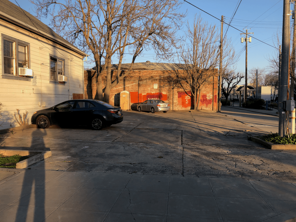
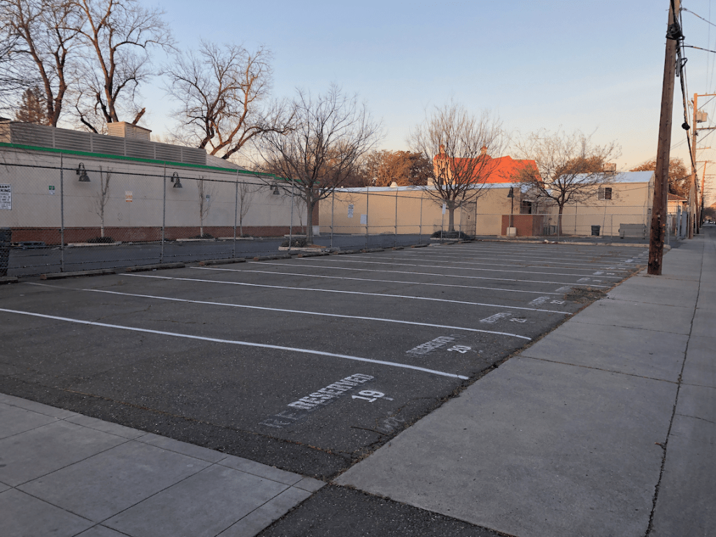
The slideshow below shows many of the surface parking lots in the southwest quadrant of the central city. It may include photos of parcels that contain a building but also have excess parking.
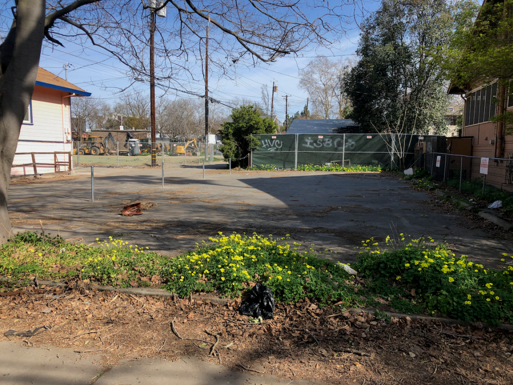
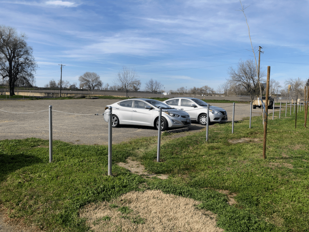
The next slideshow shows many of the empty lots in the southwest quadrant of the central city.
I am really, really growing tired of the electric vehicle boosterism that pervades the environmental community. It is sucking all the air out of organizations and meetings, diverting attention away from solutions that would have a much greater impact on greenhouse gas emissions (GHG). The transportation sector is responsible for 41% of GHGs in California (2020), and that percentage will continue to climb as we work to reduce the other sectors. Except for this pandemic period, GHG emissions from vehicles have continued to climb every year, and they will probably go back to their rise when the pandemic is over, and that is already happening in some places.
Do electric vehicles have a lower emissions impact than fossil fuel vehicles? Yes, but the difference is not enough to justify the boosterism. Until our electricity supply is 100% renewable (with storage of course needed for peak periods), and we are not importing electricity from other states, the impact from electric vehicles will be unacceptably high.
And there is the other impact of vehicles. You’ve all seen the images, a take off on the old one showing the number of and space used by cars, buses, bicycles and walkers, showing congestion from electric vehicles being exactly the same as fossil fuel vehicles. But congestion is actually a friend to walkers and bicyclists, so mostly a concern to transit and drivers.
The biggest problem with cars is that they dominate our cities, and make compact, walkable development and neighborhoods impossible. I live in a place (downtown Sacramento) where nearly all of my needs are within walking distance, and the few that are not are within bicycling distance. I’m car free and have been for ten years (I had written care free instead of car free, but you know, it is much the same thing).
Yet car drivers through downtown, many but not all of them people who don’t live in downtown, challenge me for right-of-way every time a use a crosswalk. Crossing the street should not require either yielding my right of way to drivers, or trying to intimidate them into stopping (which most walkers are too afraid to do, rightly so). When I’m bicycling, drivers running red lights and not coming close to stopping at stop signs are a constant danger, meaning I have to be on high alert rather than enjoying my place and my ride. The nature of the majority of drivers is that they willingly intimidate walkers and bicyclists. People driving electric vehicles are not any better. Tesla drivers are giving BMW drivers a run for their money in competition for the worst drivers on the road.
Because of the space taken up by cars, the roadway, on-street parking, off-street parking, everything is further away. Downtown and midtown, things are still within a reasonable distance, but that is not true anywhere else in the region except downtown Davis, old town Folsom, and old town Roseville. The amount of land devoted to cars is truly amazing, and sad, and criminal. Six lane or more arterials, with parking lanes and turn lanes. Six lane or more freeways, with the ever present threat to widen them. Katy Freeway (26 lanes in Houston area), coming to your community, courtesy of Caltrans!
I suspect a lot of the energy behind electric cars is just people who really don’t want to give up their car, at all, ever. They are the same people who bought Prius cars because they were more environmental, and continued driving the same or more, and then bought Tesla cars because they are even more green, and continued driving the same or more.
Car drivers kill more than 40,000 people every year in the US, and it looks like 2020 is going to be 43,000 when the official data is in. Motor vehicle fatalities are usually a bit above gun-related deaths. Cars are the leading cause of death for children and young people. Many people tolerate this as just part of the way things are, but it is not the way things are. It is the result of our American car addiction, and the design of our roadways (engineers are morally and legally responsible for this), and the choices of drivers.
Here is my suggestion. We remove one-half of all cars from service, by whatever means necessary, with whatever funding it takes. There should be criteria that prioritizes: 1) the most polluting cars; and 2) cars owned by drivers who drive a lot, 3) cars that are not used but still take up space on the street. I realize that there are homeless people living in vehicles, and I’m not talking about those, but the ones just gathering dust and leaves and cobwebs. I am not suggesting that the government pay going prices for these vehicles, but something quite a bit less. If necessary to induce the change, we can simply refuse to renew registration on vehicles in these categories.
Then, and only then, we start subsidizing replacement of the remaining internal combustion cars with electric, starting with the lowest income people. If we devote X amount of dollars to this, and X amount only gets us up to 40% of the median income, that is just fine with me. As many studies have shown, it is high income people that are receiving almost all the benefits from electric vehicle incentives. That is classist and racist, and must stop. We might eventually get to higher income levels, but only after replacement in the lower income levels has been achieved. That means we need to immediately end the programs as they exist and revise them to be equitable. If you are an electric car booster and and not working to achieve equity, you are just being an entitled jerk.
Please, let me not hear anything about electric vehicles the next time I go to a meeting or jump on Twitter. Please.
The MUTCD is an incredibly complex document, with cross-references everywhere that require you to jump around through the document, terms used but never defined (though 287 terms are defined), incredible detail on some topics while pretty much ignoring other topics (like bicyclists and walkers). The document is intended to cover signs and markings (the paint on roadways) but does not address roadway design except in a very minor way. That is deferred to private organizations such as Association Association of State Highway and Transportation Officials (AASHTO). Many people have suggested that the main reason FHWA is updating MUTCD is to add the section on automated vehicles, and the other changes are an afterthought.
One could devote their life to reading and understanding the MUTCD, and probably would not, in fact I’m not sure that anyone in FHWA has ever read the entire document. The reason it is so important, however, is that it is the document to which transportation engineers constantly refer to as the reason they can’t do the right thing, or must do the wrong thing.
My comments so far are below.
The MUTCD should be separated into two documents, one for highways and another for streets. Local engineers continually refer to items that should only apply to highways in designing or refusing to design facilities for streets.
Section 1C.02 Definitions of Words and Phrases Used in this Manual 106. Intersection—intersection is defined as follows: (b) The junction of an alley, or driveway, or side roadway with a public roadway or highway shall not constitute an intersection, unless the public roadway or highway at said junction is controlled by a traffic control device.
The definition uses the term ‘side roadway’ but this term is not otherwise defined. If used, it must be defined.
2B.59 Traffic Signal Pedestrian and Bicycle Actuation Signs (R10-1 through R10-4, and R10-24 through R10-26) Figure 2B-26. Pedestrian Signs and Plaques of the signs document The activation signs in 2B-59 should be greatly simplified. There should be a sign for signal heads that count down, a sign for symbols only, a sign to activate audible message, and a sign to extend crossing time. Having 18 signs does not help pedestrians in any way. Signs reflecting old pedestrian signal heads should be phased out in five years, along with changing all pedestrian signal heads to reflect the current standard.
4I.05 Pedestrian Detectors Push button pedestrian detectors which are not required (the signal is on auto-recall) SHALL be removed, or converted to accessible pedestrian detectors, within five years of the date of publication. Accessible push button detectors will have associated signing which clearly indicates the purpose of the button, and that a button press is not required to cross. The existence of push buttons which serve no purpose is confusing to pedestrians and indicates a bias against people who walk.
Figure 4I-4 Pedestrian Intervals In the Relationship to associated vehicular phase intervals: diagram, the third option (Part of Yellow Change Interval + Red Clearance Interval = Buffer Interval) and the fourth option (Red Clearance Interval = Buffer Interval) should be removed. These two options may significantly reduce safety for pedestrians while having only minor impact on traffic throughput. These types of signal setups discourage people from crossing streets.
Part 6: Temporary Traffic Control
The entire Part 6 Temporary Traffic Control is extremely weak in the accommodation and protection of pedestrians and bicyclists.
Bicycles
Figure 6P-48. Bicycle Lane Closure with on-Road Detour (TA-48) Whenever construction signs are placed in a bike lane, as they often are, the ‘bike lane closed ahead’ sign should precede the ‘road work ahead’ sign, since bicyclists will be forced into the roadway by the sign and motor vehicle drivers need the warning of bicyclists before they need the warning of road work.
W11-1/W16-1P assembly is shown on the figure, but the sign is not in associated sign document. The ‘bike lane closed ahead’ sign is not in the associated sign document, nor does it seem to exist anywhere in the current MUTCD.
The ‘bikes may use full lane’ (R4-11) and the ‘share the road’ assembly are shown as optional. They should not be optional, since the detour roadway does not have a bike lane, whereas the construction roadway did.
Figure 6P-47. Bicycle Lane Closure without Detour (TA-47) Again makes the ‘bikes may use full lane’ and ‘share the road’ assembly optional. It should not be. Signing in this situation must communicate to both the bicyclist and the motor vehicle driver. The ‘bikes merge’ sign is not in the TTC signs document, nor anywhere else in the MUTCD.
There is no diagram that shows signing and marking for a temporary separated bicycle pathway placed in the roadway. There must be a diagram for this situation.
Pedestrians
Almost nowhere in the TTC sign diagrams are sidewalks shown nor the appropriate treatment of temporary closures, whether through detour or added pathways. The implication is that pedestrians don’t exist and need not be accommodated.
Figure 6K-2. Pedestrian Channelizing Device shows how a channelization should be constructed, but says nothing about where that channelization might occur.
Figure 6P-29. Crosswalk Closures and Pedestrian Detours (TA-29) shows sidewalk closures, with a mid block temporary crosswalk, but it does not show the barriers themselves, nor are these sidewalk barriers shown anywhere in the MUTCD so far as I can determine. Transportation agencies routinely use inconsistent signing and barriers for sidewalk closures, which is just as much of a hazard as inconsistent roadway signing, so this must be addressed in the MUTCD.
A diagram should be added that shows a pedestrian channelization placed in the roadway to provide safe and direct travel for pedestrians, in addition to the detour situation.
legend for intersections on maps belowSacramento top collision intersections, north sectionSacramento top collision intersections, south section
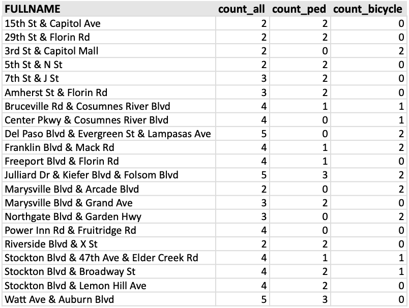
The intersection data is in the table below.
What’s next? I’ll take a closer look at some of these intersections. For people who follow traffic engineering, it will probably be immediately obvious why these intersections are dangerous. A detailed analysis requires looking at each collision record individually, which I don’t have time to do. The city did make use of incident reports, which contain more information than the data in SWITRS, in developing the Vision Zero Plan.
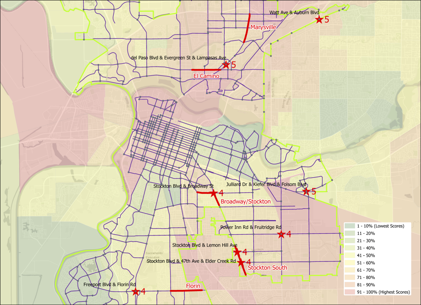
And now for the third analysis of high injury network intersections and the relationship to the Sacramento Vision Zero Top 5 Corridors. The dataset this time is all killed or severe injury collisions in Sacramento, for all modes of travel, for the period 2009-2017. Of the 1641 collisions in the city, 322 (20%) were at intersections defined by the intersection of arterial and/or collector streets. There is also a pdf map available.
Sacramento high injury network intersections and Vision Zero Top 5 Corridors
Of the eleven intersections with four or five collisions, three are on the Top 5 Corridors:
Stockton Blvd & Broadway, 4 (on Stockton-Broadway corridor)
Stockton Blvd & Lemon Hill Ave, 4 (on the Stockton South corridor)
Stockton Blvd & 47th Ave & Elder Creek Rd, 4 (on the Stockton South corridor)
and eight are not:
Watt Ave & Auburn Blvd, 5
Del Paso Blvd & Evergreen St & Lampasas Ave, 5
Julliard Dr & Kiefer Blvd & Folsom Blvd, 5
Power Inn Rd & Fruitridge Rd, 4
Freeport Blvd & Florin Rd, 4
Center Pkwy & Cosumnes River Blvd, 4 (not on map)
Bruceville Rd & Cosumnes River Blvd, 4 (not on map)
Franklin Blvd & Mack Rd, 4 (not on map)
The three last intersections are not on the map because I wanted to maintain the same scale as used for the previous maps, but they would be off the south edge of the map. Note that the number of collisions at these intersections is not directly comparable to the bicycle collisions map I created because I used a different dataset, degree of injury and span of years. I may go back and update the bicycle map to be consistent, but it is probably more worthwhile to look at some of these intersections in more detail.
Another reminder from Enzo. He commented on how dangerous the Watt Ave & Auburn Blvd intersection is, which led to a discussion about the entire section of Watt Ave between the Watt/I-80 light rail station and Auburn Blvd. He pointed out the absolutely ridiculous crosswalk and sidewalk at the westbound onramp to I-80 Business.
westbound I-80 Business onramp with pedestrian crossing and sidewalk
As you can see, the sidewalk leading down to, or up from, the crosswalk on the left hand side is quite steep. It would not be navigable by anyone in a wheelchair, or with any mobility limitations, and Enzo said that even an able bodied person would have difficulty with it. I only walked this sidewalk on the west side of Watt Ave once, and it was such an unpleasant experience that I never did it again. This particular issue did not stand out in my mind because the entire section was so uniformly unpleasant and dangerous.
westbound I-80 Business onramp aerial
As you can see in the Google overhead view, this onramp has a long approach, so most drivers are already going 65 mph when they hit the crosswalk (the speed limit on Watt Ave is 45 mph). So anyone using this crosswalk would be likely to die. For drivers, there is no warning of the crosswalk ahead, and so no reason to take the onramp more slowly. The crosswalk is not even a high visibility crosswalk, but the outmoded two stripe version which can’t even be seen when the pavement is wet.
And very few people do use this sidewalk and this crosswalk. When I worked in the eastern suburbs, I initially took light rail and then bicycled south to Auburn Blvd, but with no bicycle facilities and high speed traffic, that got old very quickly. So then I started taking the SacRT bus Route 1. Currently, this bus route starts and ends at light rail, though it used to go further north. I wondered why so many people got on the bus westbound at the last stop on Auburn, and got off the bus eastbound at the first stop on Auburn. So I asked them, and every person said it was to avoid this section of Watt Avenue between light rail and Auburn Blvd. They said the onramps and off-ramps made it just too dangerous to walk. I wasn’t able to talk to any bicyclists, but I’m sure they would have said the same.
This is Caltrans design, and it was designed to not be usable by people walking. This was the entire design philosophy of Caltrans, to discourage walkers and bicyclists from being anywhere near a highway.
Caltrans has reformed somewhat. For example, when the Watt Ave & Hwy 50 interchange was improved in 2015, a separated walking path and bikeway was created that when under the eastbound onramp, westbound onramp, and westbound off-ramp on the east side of Watt, then along the Watt Ave overpass. In the aerial below, you can see the pathway which loops to gain the elevation from the under tunnel to the bridge height. Note, however, that there is no matching facility on the west side of Watt Ave, so a walker or bicyclist must cross to the east side at the nearest intersection, which is Folsom Blvd to the south and La Riviera Drive to the north. Though not great, it is a considerable improvement over what was there before. It did, however, solidify the status of Watt Avenue as an expressway rather than an arterial street.
Watt Ave & Hwy 50 interchange with ped/bike facility
As you can see from the photo at the beginning, and the Watt/Hwy 50 example, the only way to solve this issue is with some sort of flyover for the sidewalk, so that there is an ADA compatible gradient and no crosswalk over the ramp. I’m expecting that Caltrans will start that project in about 2121. There was a proposal by SacRT to improve the section of Watt Ave between light rail and Auburn because they recognized that the walker and bicyclist hostile nature of the corridor was reducing use of light rail. But the city and Caltrans did not seem interested.
Though Caltrans created these hazards, and the hazard is clearly on Caltrans property, the agency has shown little interest in solving the problems they created. They have washed their hands of the roadway part of interchanges by handing these over to the cities or counties. Their preference remains building new stuff rather than maintaining and correcting existing freeways and highways, and I’m not at all sure that will ever change.
As promised, a follow-on to my post on the top bicycle collision intersections in Sacramento (Sac Vision Zero Top 5 Corridors and top intersections), here is the same sort of analysis for pedestrian collisions. I used a somewhat different data set, this time only killed and severe injury crashes (KSI), for the years 2009-2017. This mirrors the data the city used in the Vision Zero Top 5 Corridors document, and so is not directly comparable to the different criteria I used on the bicycle post.
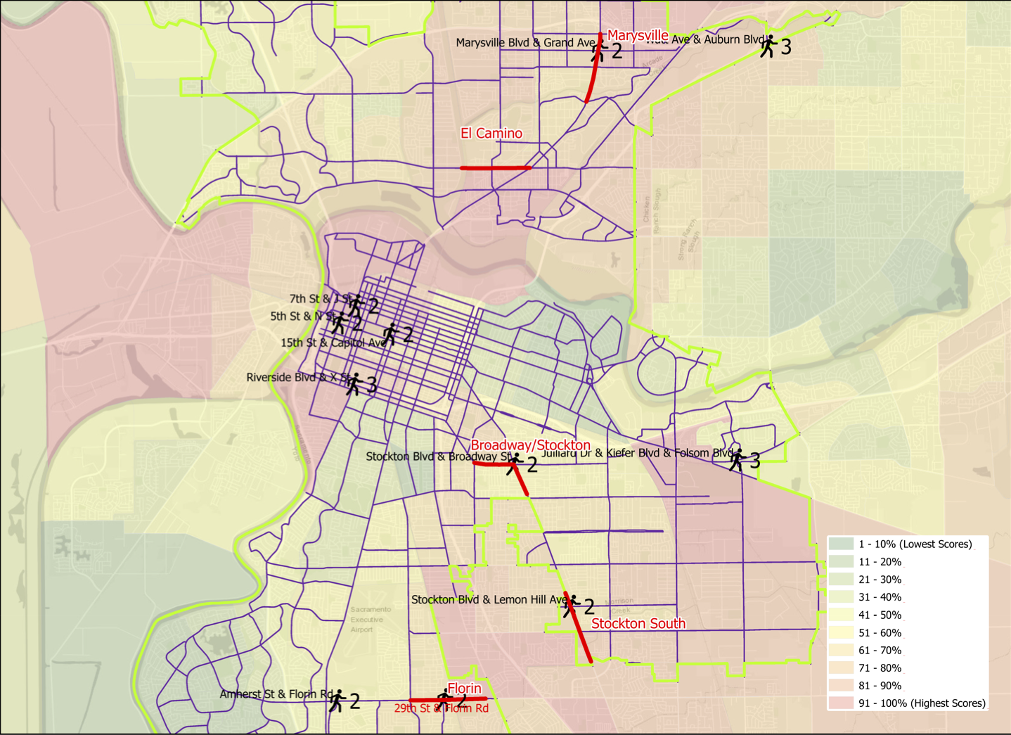
Pedestrian (walker) collisions are more dispersed that bicycle collisions, fewer occurring at intersections and more in between. Of the 408 collisions, 70 were at intersections, 17%, compared to 69% for bicycle collisions. Of these 408 collisions, twelve intersections stood out: Amherst St & Florin Rd, Marysville Blvd & Grand Ave, and Watt Ave & Auburn Blvd, each with three; and 15th St & Capitol Mall, 29th St & Florin Rd, 5th St & N St, 7th St & J St, Stockton Blvd & Broadway, Stockton Blvd & Lemon Hill Ave, Riverside Dr & X St, and Julliard Dr & Kiefer Blvd & Folsom Blvd, each with two. Of these 12 intersections, 4 are on Top Five corridors: Marysville Blvd & Grand Ave on the Marysville corridor, Stockton Blvd & Broadway on the Stockton-Broadway corridor, Stockton Blvd & Lemon Hill Ave on the South Stockton corridor, and 29th St & Florin Rd on the Florin corridor.
The map belows shows the city corridors and the twelve intersections, with the number of collisions and intersection name labeled. There is also a pdf available.
Sacramento pedestrian collision top intersections, with Vision Zero corridors
There is a better alignment between the five designated corridors and pedestrian collision intersections than was true for bicycle collisions.
I will point out that the Julliard Dr & Kiefer Blvd & Folsom Blvd intersection is the site of three pedestrian collisions and four bicycle collisions, which is higher than any other intersection in the city. It should really be a focus for the city.
Addition 2021-03-02: Someone asked how the pedestrian collision locations relate to disadvantaged communities. Below, a map with CalEnviroScreen 3 2018-06 (CES) layer, with red end being higher pollution, green being lower, and weighted with income. CES is not the only measure of disadvantage, but it is one commonly used.
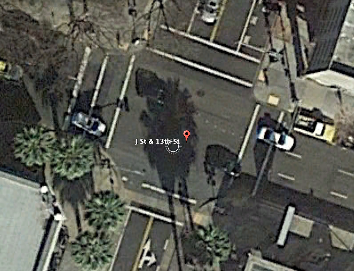
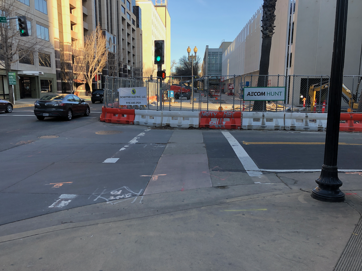
The intersection of 13th Street and J Street in downtown Sacramento is a mess for walkers and bicyclists, largely due to poor decisions that the city has made. The setting is below, with a historical view selected for no leaves on the deciduous trees. On the southeast corner is the convention center, which is under construction now, and the southeast corner is fenced off. On the southwest corner is the Sheraton Grand Hotel. On the northwest corner is a major downtown parking garage, managed by Ace Parking. On the northeast corner is another parking garage managed by Parking.com.
intersection of 13th Street & J Street, downtown Sacramento
In the days before construction on the convention center started and the Sheraton shut down due to the pandemic, this was one of the busiest pedestrian intersections in the central city. The crossing of 7th Street at K Street/DOCO Center, L Street at 11th Street and 10th Street when the legislature is in session, Capitol Mall at Tower Bridge, and a few others are up there, but this one is certainly in the top 10. The city rarely collects pedestrian data, so I do not know what the ranking or volume is.
When the convention center is completed and open, and the Sheraton opens at full scale, this will again become a very busy pedestrian intersection. So you would think that the city would design this intersection and signals to prioritize people walking, but you’d be wrong.
The crossing of J Street on the west leg of the intersection requires pushing the ped button. There are a number of pedestrian signals in the central city that do not require pushing the button, and these are called auto-recall, meaning they automatically change on a cycle. Not this one! I just observed a number of walkers crossing here, and only about 5% of them initially realized they had to push the button. When I mentioned that the signal would never change unless they pushed it, they were surprised, and not happy. When the ped head signal does come on, it has a white hand of 5 seconds, and a countdown of 9 seconds for a total of 14 seconds. There are three lanes of motor vehicle traffic here, lanes about 12 feet wide, for 36 feet. The MUTCD recommended crossing speed is 3.5 feet/second, so 36 feet should be a minimum of 10 seconds, but this assumes that people can leave the curb immediately, not true when the activation button is set well back, and there is pedestrian congestion. In that case, the crossing speed should be 3.0 feet/second. If you want to read about the contortions traffic engineers go through to make walk cycles as short as possible, read pedestrian crossing questions and answers.
The traffic signal for J Street will remain green unless there is a vehicle waiting on 13th Street or someone pushes the ped button to cross. The ped signal to cross 13th Street goes through a white hand, countdown, brief pause, and then back to the next cycle. Without a cross-traffic vehicle or button push, the traffic signal will never cycle. Ever.
crosswalk over J Street at 13th Street
An additional problem is that sometimes the signal controller will just skip the crossing J Street part of the cycle, even when the button is pushed. Since I’m mostly on my bicycle rather than on foot here, I haven’t quite pinned down the behavior. I don’t know if it depends on time of day, or traffic volume, or is just random, but I can affirm that it happens, and not infrequently. So even after the walker presses the button, they may have to wait through another full cycle before they get the walk.
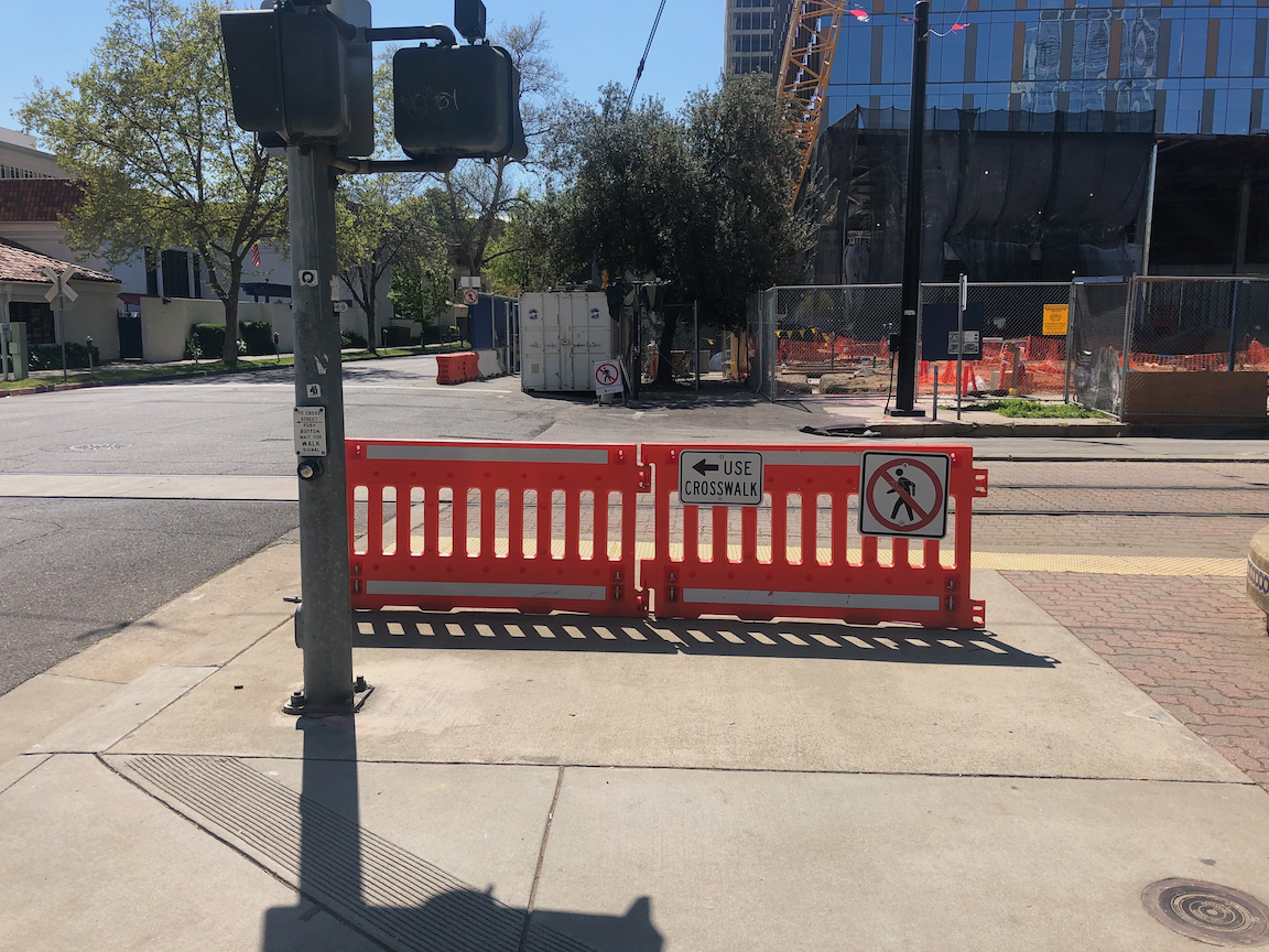
On the southeast corner, the convention center construction has closed the corner and sidewalks. In this situation, there should be a barricade and warning signs on the opposite corner, so J Street south side eastbound and 13th Street east side southbound. A fully sighted person can of course see the barrier and fence across the street, but the point of ADA requirements is to communicate to everyone, not just the sighted. Below is what is looks like, followed by what it should look like. Remember, this is a city project, not a private development, but the city apparently holds itself to lower standards than it holds private developers.
closed crosswalk over 13th Street at J Streetproper barricade and signing for a closed crosswalk, O Street at 8th Street
The east leg crosswalk also suffers from traffic flow design. The walk sign for this crosswalk comes on at the same time as the southbound green signal comes on, bringing drivers into immediate conflict with walkers in the crosswalk. There is no leading pedestrian interval (LPI) to let the walkers get a head start. At this time the crosswalk is closed, but as soon as it is reopened, the conflicts will be immediate, as they have been for years.
Solutions?
Immediately institute auto-recall on the crossing of J Street, and remove the buttons. These are not modern audible buttons, they are antiques.
Immediately institute a leading pedestrian interval on the crossing of J Street, to increase protection from left and right turning drivers.
Immediately lengthen the pedestrian phase for the crossing of J Street to a minimum of 20 seconds.
When then southeast corner of the intersection is re-opened, with completion of the convention center construction, implement an exclusive pedestrian phase for this intersection, in which there is no movement by motor vehicles during the walk cycle, and walkers can cross in any direction including diagonally. If any intersection in Sacramento deserves this treatment, this is it.
Traffic calm J Street to reduce speeds. The most important step is to reduce general purpose lanes to two, and create some sort of bicycle facility. I’m not sure of the best design, as the valet/unloading/loading are for Sheraton Grand may make this challenging.
Get rid of any City of Sacramento Public Works employee who believes the purpose of central city streets is to favor suburban commuters (the J Street traffic) over walkers, bicyclist, and local residents.
I have made at least seven 311 reports on the signal problems at this intersection, asking that it be changed. The only change that I’ve been able to notice is that they lengthened the pedestrian phase for crossing 13th Street, and shortened it for crossing J Street. I just gave up after a while.
Bicyclists
That covers most of the pedestrian problems at this intersection. How about bicyclists? 13th Street is a major bicycle route in downtown, being the only north-south street that crosses through Capitol Park and is not an arterial street, often with heavy traffic and higher speeds. There are bike lanes on much though not all of 13th Street to the south J Street, and there are bike lanes on most blocks to the north, except the half block approaching this intersection. Here, the bike lane has been sacrificed to create a turn lane. There is a required left turn lane and an optional turn lane, but no bike lane. So at this busiest of all intersections on the route, there is no bike lane. There is a clear message here from the city: we will accommodate bicyclists only if it does not reduce motor vehicle capacity. Otherwise, tough luck.
The loop detectors on 13th Street only sometimes detect bicycles. I often see bicyclists during off-times, when there are fewer motor vehicles to trigger the cycle, proceeding through the intersection on red, when it is safe to do so (and occasionally when it is not). They have the right to do so, since by definition a signal that does not detect vehicles (devices) is a non-functional signal, but it is not the best solution.
When the pedestrian button is pushed to cross J Street on the west leg, but no southbound motor vehicles are present, the vehicle signal remains red, so doesn’t allow for undetected bicyclists. This doesn’t protect any walkers, so it makes not sense.
Solutions?
Continue the bike lane on southbound 13th Street to and through (with green skip paint) the intersection with J Street, and remove the left turn lane which prevents the bike lane from continuing. That might mean lengthening the green light for motor vehicles in order to clear the queue.
Install video detection on this intersection that will detect bicyclists on 13th Street so that they don’t have to wait for motor vehicle traffic to arrive and trigger the signal cycle.
Change the traffic signal for southbound to go green at the same time as the pedestrian walk sign. This allows bicyclists to proceed without confusion.
I am working on a project to find some of the land in the central city that could be housing instead of empty land, or surface parking lots. To me, every surface parking lot is a crime against the climate because it spreads out housing and other amenities to the point where driving becomes preferred if not necessary. But while comparing the county parcel map to the current land use, I was struck by what a sad, sad loss of housing there has been, particularly in the downtown section of the central city. To highlight this, I picked a block very close to where I live, the block bounded by P Street, Q Street, 11th Street, and 12th Street. On this entire block, there is one temporary building, a state child care center, and a small power facility related to the SacRT light rail tracks on 12th Street.
The image below shows the county parcels, labeled with addresses, overlaid on up-to-date ESRI Imagery layer. The child care building is in the lower right corner, at the intersection of 12th Street and P Street, and the SacRT facility is on the unlabeled square on 12th Street. The entire remainder of the block is parking. Some of the parking is state-owned, some privately owned. Every single one of these parcels at one time had either housing or business, or both, though there is some indication that the northwest corner large lot may have been a gas station for a period of time.
Sacramento parcels overlaid on imagery, P Street to Q Street, and 11th Street to 12th Street
I first looked at Google Earth historical imagery, but the only fact from that is that in 1993 all of the block had been converted to parking, and the child care center was probably there (the photo is fuzzy). Then I looked through Center for Sacramento History photos. I have only started through the archive, but did find some photos of the block or nearby blocks. One things that surprised me is that in the early 1950s homes were already being torn down to build state buildings. The photo below shows 1116, 1118, and 1124 P Street in 1949. If I’m able to get a better image, I will replace this one. It shows what seems to be typical of housing in this area, single-family and multi-family mixed in.
The Sacramento Redevelopment Agency was established by 1951, and its mission was to remove all housing that didn’t meet its standards, which meant all housing occupied by lower income and people of color, centering on Japantown.
CADA (Capitol Area Development Authority) was established in 1978 to save what little was left of housing in downtown, so it is probable that the housing had been torn down by the state or city well prior to that. If so, that means that this block has been a parking lot for at least 43 years. Probably much longer, perhaps back into the 1950s. What used to be homes and businesses, has been essentially worthless for that entire time. So, so sad.
For more info on the destruction of downtown, I recommend any books by local author Bill Burg (in local bookstores for paper copies or on Amazon for Kindle copies). You can also find a number of papers and research documents on the Internet by searching ‘Sacramento redevelopment’. I have hardly scratched the surface.
There are several entire blocks of parking in downtown, and many, many blocks that are mostly parking. What a waste!
I ask that the state transfer all surface parking lots under its control to CADA. The state has as many office buildings as it will ever need, but there is no housing to support the office workers, and particularly the lower income maintenance workers that support these office buildings. More to come on that idea.
I welcome historians, particularly Bill Burg, to correct or amplify my information.