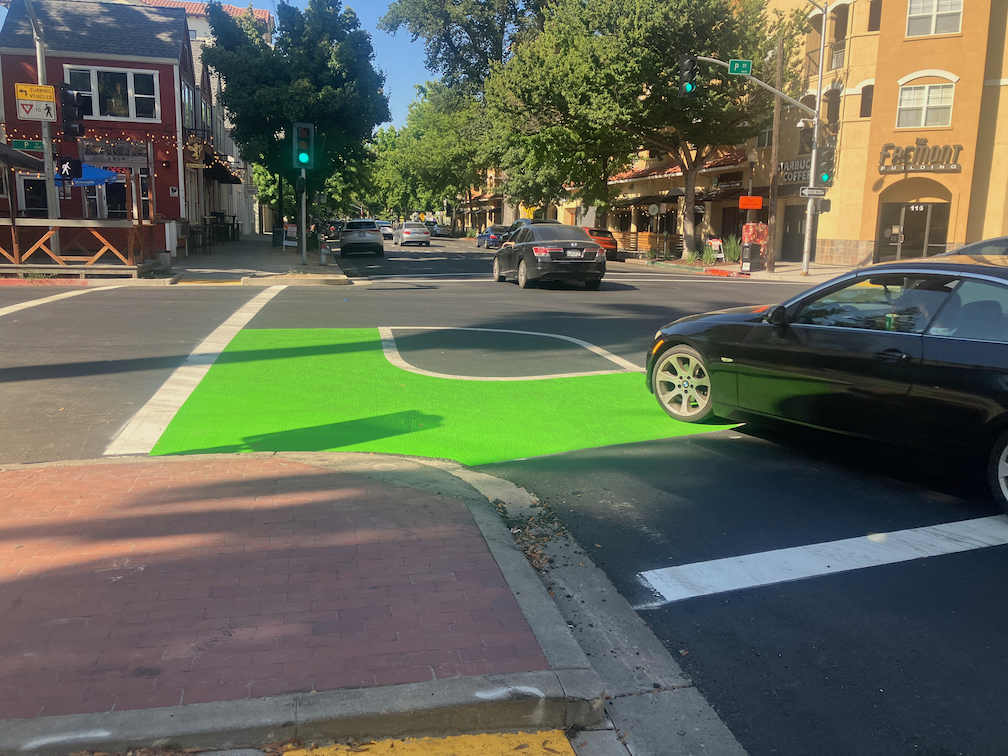
Parking reform for Sacramento

Note: Added item to Parking fees below, in italic, based on an idea from an article in Streetsblog USA.

Following on to the discussion group topic this week of Walkable City this week, Part 3: Get the Parking Right, here is a list of my thoughts about parking reform in the City of Sacramento. Almost all applies to parking anywhere. I think nearly every one of these has been mentioned in previous posts, but I’ve not brought them together in a single place.

The City of Sacramento has a Parking Services website. Parking Services is part of Public Works.

  • Parking management:
    • Parking must be managed under a city-wide parking management plan, and the plan must be consistent with city and state policy for reducing motor vehicle use and vehicle miles traveled (VMT). The city does not have a parking management plan, so far as is known.
    • Parking mandates must be removed city-wide, not just for the central city and transit oriented locations.
    • The city should foreswear any new structure parking (parking garages or parking decks). Though the city does not have any active plans for new parking, it has had recently, and they may come back.
    • Require all new housing or mixed use developments to unbundle parking, meaning that no free parking is provided for residents, and all parking is available to any person who wants to rent the space. Unbundling should be phased in over five years for all existing parking.
    • Prohibit commercial parking lots adjacent to sidewalks, meaning the buildings must face sidewalks and not parking lots.
    • Property assessment of surface parking lots will be at the same value as the productive land use that existed there before, to discourage building removal and and to keeping of land in less productive or unproductive uses; this requires cooperation from the county
  • Parking fees:
    • A base rate for all parking will be set such that it covers installation, maintenance, and management of all public parking; this rate might vary by whether parking is metered or not, or might be uniform throughout the city.
    • Charge at least the base rate for all street parking, everywhere in the city, via meters or permits, that recovers base rate; NO FREE PARKING!
    • Set variable rates for residential parking permits based on the size, weight, and fuel source of the vehicle
    • Formally implement variable pricing of street and structured parking to achieve Shoup’s 85% utilization
    • Charge for handicapped spaces (this eliminates the motivation for non-handicapped drivers to illegally use handicapped spots)
    • Eliminate all holiday or promotional free parking; research indicates that free parking actually reduces business customers by reducing parking turnover
    • Pilot ideas for charging for delivery use of street parking
  • Parking revenue:
    • Parking revenue will not go into the general fund or to pay off bonds not related to parking, but be used for specific purposes related to parking and neighborhood improvement
    • 50% of parking revenue (above base rate) will be spent on neighborhood improvements on the same streets or within parking districts
    • 50% of revenue (above base rate) will be allocated to transit operations and transit amenities
  • Parking conversion to higher uses:
    • Add trees in the parking lane on all streets without sidewalk buffers; many of the lower income neighborhoods in the city lack sidewalk buffers and private trees, making walking unpleasant and hazardous
    • Do not charge for conversion of street parking to dining space, and minimize permit costs for street dining
    • Provide one or more short-term (20 minutes or less) parking spaces on every block with retail
    • Provide one or more delivery spaces per block with any retail, and enforce against double-parking for delivery where delivery spaces are available
    • Replace parallel parking with diagonal parking on overly wide streets, to slow traffic; most streets in the city are overly wide
    • Where sidewalk or sidewalk buffer space is not available for micro-mobility (bike share, scooter share) parking, street parking will be converted in sufficient quantity
    • Modify development standards to allow only one-side parking in new residential developments
    • Allow conversion of parking to bike facilities where a reduction of travel lanes is not practical (on streets 30 mph or higher)

I strongly believe that the single city action most responsible for the renewal of midtown Sacramento, all the infill development and successful business, is the removal of parking minimums (mandates) from the central city in 2012. Since that time, the city has removed parking mandates from land near major transit stops, and in 2022, the state prohibited cities from establishing mandates near major transit stops (the definition of a major transit stop is fuzzy, however).

The city has proposed, in its draft 2040 General Plan, to remove parking mandates city-wide. It remains to be seen whether pressure from politicians and suburban protectors of ‘their’ street parking spot will subvert this recommendation. 2040 General Plan draft, Chapter 8 Mobility, Goals and Policies M-2.17 Parking Management Strategy, page 8-18.

Other resources:

Walkable City Book Club

A local transportation advocate Tom has started a discussion group/book club for the book by Jeff Speck, Walkable City: how downtown can save America, one step at a time. The third meeting of the group will be this Wednesday, May 17, 6:00PM at Lefty’s Taproom, 5610 Elvas Ave, Sacramento, CA 95819. The meetings will likely be on the second Wednesday of the month, same time and location, but his meeting will be the third Wednesday. You may just show up, and you may also send me your email address (to allisondan52@gmail.com) and I will get you added to the announcement list. Lefty’s has beer, wine, and food, but you are not obligated to buy anything. We meet outside.

The group has been going through the book part by part, and this meeting will focus on Part 3: Get the Parking Right. If you can read ahead of time, great, but you can also just show up. The group is a variable number of people and a variety of backgrounds and interests, so you will fit in.

This second edition, ten years after the first, has additional information since that time. Sometimes Jeff amplifies what he said before, or brings things up to date with what has happened in the last ten years. He makes up for his prior lack of emphasis on equity. And if a few cases, he simply say – I was wrong! If you have a choice, get the second edition, which contains all of the first, plus new info. But if you have the old, don’t worry, because we won’t get to the new for a while.

If you don’t have a copy of the book, Sacramento Public Library has three copies. The original edition, 2012, is on the shelf at Central and Carmichael branches. The second edition, 2022, is checked out as of today (probably a book club member!). For the discussion of the parts, which are little changed from the first edition, either will serve you. You can order a copy from your local bookstore ($20). My local bookstore, Capital Books, does not have it in stock but can get it in two days. Amazon has a Kindle edition, if you prefer digital over a physical book ($12.99). But you don’t have to have your own copy, nor even have read the part to be discussed. Your presence is welcome in any case.

Walkable City is a seminal work in transportation urbanism. This book, and his Walkable City Rules, are must-reads for anyone who cares about their city, and livability, safety, and fiscal responsibility. Even if you can’t make the book club meetings, I highly recommend you read it!

Meetings week of May 15

Note: This will not be a regular feature, but occasional, to share meetings you might be interested in. Some are organizations, some are agencies.

Monday

  • SACOG Bikeshare Policy Committee: 2:00PM, in person (1301 L St) or Zoom; the agenda is Overview of the Regional Bike Share Program (Nicole Zhi Ling Porter) and Update on Bike Share Technical Expert Agreement (Nicole Zhi Ling Porter). The presentations are not available ahead of time.

Wednesday

  • Walkable City Book Club: an informal group meets to discuss Walkable City, by Jeff Speck, on occasion of the 10th Anniversary Edition; this week the group is discussing Part 3: Getting the Parking Right (page 117). The group meets 6:00PM at Lefty’s Taproom, 5610 Elvas Ave, Sacramento, CA 95819. Usually second Wednesday, but for May third Wednesday. If you want to be added to the email list, please email me (allisondan52@gmail.com) and I’l get you added.
  • Sacramento Climate Coalition: meets 6:30PM once a month via Zoom to discuss climate action at the regional and state level; email info@sacclimate.org to get added to the email announcement list

Thursday

  • ECOS Climate Committee: meets 6:00PM once a month via Zoom to discuss local climate concerns and actions; this month the topic is the recently released City of Sacramento Climate Action and Adaptation Plan.
  • City of Sacramento Active Transportation Commission (SacATC): meets 6:00PM monthly in person (city council chambers) or via Zoom; agenda on the Upcoming Meetings page; this month the main agenda items are 21st Ave Beautification Project, Pocket Greenhaven Neighborhood Transportation Plan Final Draft, and Streets For People: Sacramento Active Transportation Plan Phase I Outreach.

Friday

  • SacMoves Coalition: meets 10:00AM on third Fridays via Zoom; the coalition is primarily a gathering of organizations working in transportation, environment, and housing, but individuals may participate in meetings; to get added to the announcement list, please email Mia Machado, MMachado@sacbreathe.org.

Sacramento Transit Advocates and Riders (STAR) maintains a calendar of transit and transportation meetings on groups.io. You may subscribe to that calendar at https://groups.io/ics/1509831/783555437945795328/feed.ics. The calendar is not intended to be exhaustive, but is useful.

Sac 2040 General Plan draft released

The City of Sacramento has released the draft 2040 General Plan. There are three ways to find out more:

  1. Self Guided Workshop
  2. Three orientation webinars (scroll down the page above to the webinar signups)
  3. The plan itself, available as a pdf on the General Plan page. The Climate Action and Adaptation Plan is also available there.

A number of organizations. and individuals, will be reviewing the plan, and providing information to their members. Dive in if you have the time, or wait for some guidance from others.

The General Plan is probably the most important document that the city will put out, since it will address zoning changes to allow more housing, and more affordable housing, which helps every other aspect of livability in the city.

support AB-645 speed camera bill

California Assembly Bill ‘AB-645: Vehicles: speed safety system pilot program‘ is going to be before the Assembly Appropriations Committee shortly. Though it breezed through the Assembly Transportation Committee, it faces challenges in Appropriations. Chair Rendon is rarely a supporter of safe streets, and has killed a lot of street safety bills in his committee, so it is important that the public make it clear how important this bill is.

Walk San Francisco is sponsoring a letter writing campaign to Anthony Rendon and Chris Herndon (as are many other organizations, you can check your favorite walking/bicycling advocacy organizations) at https://walksf.org/2023/05/04/the-speed-safety-camera-bill-ab-645-faces-its-next-hurdle-what-you-can-do-now/.

The bill would establish a pilot program in six cities. The City of Sacramento is not part of the pilot program (I think because the city did not request that it be), but the pilot results will be critical to implementing the program statewide. There are a tremendous number of privacy protections built into the program, far beyond those required for other motor vehicle code violations, but at least it stands to move forward in this legislative session.

Law enforcement has in the past opposed this legislation because it reduces the number of pretextual traffic stops they can make, though these stops often lead to the dead of motorists and even law enforcement officers. They apparently are not opposing this bill, at least not publicly.

Please check it out and support!

cartoon with speed camera and driver

SacCity ADA ramps and Central City Mobility

This is Central City Mobility Project update #3.

I now know why all the of initial ADA ramp projects were on 21st Street. That is the first street being repaved as part of the Central City Mobility Project. 21st has been identified in the project for separated bikeways. Since there is a bus route on 21st (SacRT Route 62), I assume that the bus stops will be on the right hand side northbound, and the bikeway on the left hand side. The design shown on the project webpage shows a parking-protected separated bikeway on the left, along with a buffer zone (to protect against car doors opening). This seems to be the standard that the city has adopted, and side so far the city is placing separated bikeways only on roadways that also have bus service, presumably this design will be used in every case.

Another diagram indicates that there will be vertical delineators (K-71) in the buffers, but there are no details about the frequency. There’s are the delineators that are run over and destroyed by vehicle drivers on a regular basis, and these will suffer the same fate. The larger diameter delineators (NOT bollards, the city is incorrect in calling vertical plastic a bollard; bollards are made of metal or concrete, not plastic) that are now installed on part of J Street are not specified here. Though these don’t provide any more actual physical protection, they seem to raise doubts among drivers and get run over less often.

diagram of separated bikeway

There were several curb islands along 21st Street on the left hand side. All but one have been removed. The remaining one at 21st Street and Capitol Ave may just be an oversight, but if not, it is in the middle of what is expected to be the separated bikeway.

21st St at Capitol Ave SW corner curb islands
Sac_21st-St-Capitol-Ave-SW_curb-islands

The fourteen blocks of 21st Street from W Street to H Street has been stripped down about two inches, for repaving. The restriping after paving will include the separated bikeway.

The project webpage has a diagram for the transition of a separated bikeway on the left side of 19th Street southbound to the right side of 19th Street south of W Street, which is a two-way street. However, it does not have a diagram for the transition of this 21st Street separated bikeway at the north end, where 21st Street becomes a two-way street at I Street. This is already a hazardous intersection due to the double left-turn lane from 21st Street to I Street westbound.

Separated bikeways are only as safe as their intersection treatments, and the transition from and to separated bikeways to regular bike lanes are critically important. I hope that the city has a good design for 21St Street and H Street, otherwise bicyclists will be placed in more danger than existing conditions. The solution is of course bicycle signal faces that allow bicyclists to move when other traffic is held, but the city has been reluctant to use these.

Read More »

fixed bike/scooter corral

A bike/scooter corral was installed on R Street in a parking space, next to the Sacramento Natural Foods Co-op. Though for a while drivers respected the set-aside, marked for bikes and scooters, drivers came to use the space as regular parking, with a car parked there almost all day long, preventing the intended use as a bike and scooter parking area. I reported this illegal parking to the city a number of times, but to my knowledge, no one was ever ticketed. It should be noted that parking is not short on the streets around the co-op, and there is a parking garage adjacent to the co-op, which I have never seen full. So drivers were using the spot for personal convenience.

The city recently installed vertical delineators (flex posts) in the spot and repainted the while line that signifies are bike parking area. So far it is working, I’ve not seen anyone run over the posts in order to park there.

The majority of the bike/scooter corrals in the city have been placed on wide sidewalks, where they don’t interfere with walking. The in-street corrals are mostly being respected; this is the only one I am aware of that was routinely violated.

These corrals are designed to solve two issues: 1) provide parking where traditional bike racks are not present or insufficient; and 2) to keep scooters (mostly rental scooters from the scooter-share companies) from filling up the regular bike racks and preventing their use by the public.

photo: R St micromobility corral with posts
Sac_R-St-corral-with-posts

Capitol Corridor gets more TIRCP funds

Capitol Corridor has received more funds from the TIRCP (Transit and Intercity Rail Capital Program) for some projects in the Sacramento region. It includes full funding of the Sacramento Valley Station transit hub, additional funds for the Sacramento-Roseville third track project, and contactless readers for Thruway buses (presumable the same readers that have been installed on the trains, which will allow direct payment for trips once the Tap2Ride pilot is complete).

https://www.capitolcorridor.org/blogs/get_on_board/capitol-corridor-awarded-42-million-from-california-state-transportation-agency

leaving Twitter?

I have been using a Twitter connection to announce my blog posts on my Twitter feed (@GetAroundSac). I’ve removed that connection. I’ve added a subscribe button prominently on each page, just below the categories drop-down.

I’ve been a pretty active Twitter user. Though I don’t think of myself as addicted, I certain spend a lot of time there. But a lot of the people I follow have either left Twitter or are using it much less. I notice less and less local (Sacramento region) tweets. Some of the users I follow have taken to retweeting everything they see, which is clogging my Twitter feed with items that I already see, or am not interested in. This may be a desperation move as their own followers drop away. So I’m getting bored with Twitter.

Of course as nearly everyone does, I question whether I should even be on Twitter, that social media platform owned by one of my least favorite people in the world. Some days it seems like Twitter is working OK, but then he makes a nonsensical change that makes everything less useful. His management is pretty clearly oriented towards amplifying right wing voices. I’m guessing he wants to be the first person to accomplish throwing $44 billion in the toilet (that’s what he paid for it, but his own valuation is now $20 billion, and falling).

So, I haven’t left Twitter. Yet. But am thinking about leaving more and more.

update on SacCity ADA ramps

Note: I discovered that I have often used ‘detectible’, but should have been using ‘dectectable’ for detectable warning strips.

This is Central City Mobility Project update #2.

This is an update to the update on work being done on corner ADA ramps in the Sacramento central city, apparently as part of the Central City Mobility Project.

So far as I have seen, curb extensions are not part of this project.

There are now a number of locations where the concrete ramp is being cut so that the detectable warning strip can be installed, but the curbs are not being touched. See below for an example.

Q-St & 16th-St, SW corner, ADA ramp construction

One of the corners I have been monitoring, 21st St and O St northeast corner, is complete, but with temporary patches that make the ramps useable, though ironically still blocked by folding barricades and caution tape, which absolutely does not meet ADA guidelines for contruction signing and safety. This seems to be the pattern with the city, trying to make things better, but not paying attenteion to the details. I don’t know when the asphalt will be restored and the corner opened. Maybe the contractor is waiting until all the corners are ready before patching, though that would be stupid.

21st-St & O-St, NE corner, completed corner with ADA ramps

I am still not able to make sense of the asphalt cuts that are being done on the corners where the curb will be or has been modified. I’m guess that there was a standard cut design, implemented everywhere, no matter what the actual project.

Walking around the central city, it appear that most of the corners which did not have ADA-compliant ramps will have them when the project is done, but some may not. I don’t know what the criteria is for which corners are being done, and which are being done at a higher level of replacing the curbs and widening the ramps. Many of the existing ramps are narrow, with edging curbs, which was apparently the design at the time they were placed, but the new corners are a different design, with a sloping area between the two ramps, similar to the diagram below, from the 2020 Department of Utilities Standard Specifications: Transportation drawings, not from the 2009 Department of Public Works Street Design Standards, which contain no ADA diagrams. I think the detectable warning strip width is at least 60 inches on the new installations, which is an improvement. The 48 inch width does not allow two people to stand on the strip. Corners with new curb extensions seem to have 72 inch strips.

SacCity T-76 Curb Ramp Dual Combination Planter diagram
SacCity_T-76_CurbRampDualCombinationPlanter