Mayor Darrell Steinberg used his third State of the City address on Friday to introduce his concept of a housing and transportation measure for the 2024 ballot, called the ‘Climate, Clean Transportation and Affordable Housing Measure’. The half cent sales tax would generate about $8-9 billion over the 40 years, and the transportation aspects would be administered by Sacramento Transportation Authority (SacTA) which administers the current Measure A. More detail is available on the Mayor’s Community Engagement website https://engagesac.org/blog-civic-engagement/2023/8/25/a-new-vision-to-fund-affordable-housing-and-transportation.
One-third would go to a countywide housing trust fund, to provide affordable housing, permanent supportive housing, and other types. One-quarter of the one-third would be devoted to keeping people in their housing so they don’t become homeless to begin with.
Another one-third would go for public transportation. Specifically, initiate bus rapid transit routes, increase bus frequencies on all routes, buy new fleet, and create express buses across the region.
The other one-third would be for safe streets and active transportation. Implement vision zero, build sidewalks and protected bike lanes, multipurpose trails, car and bike share, and repair roads, all with an equity lens.
All of these investments would help the city and county reach the agreed-upon greenhouse gas (GHG) reduction target of 19% for the region.
Steinberg acknowledged that there will be opposition from the old guard, who want to keep doing the same things that don’t work and have never worked for most citizens of the city and county.
He pointed out that transit cannot be effective unless we achieve a density of housing and destinations that allows transit to work.
The mayor said that he would prefer a countywide measure, but would go for a city measure if the other partners (county and the four cities) are not interested. He emphasized several times that climate change compels us to change directions and invest more wisely.
Panel
A panel was composed of Elk Grove Mayor Bobbie Singh-Allen, Steve Cohn of SMART (Sacramento Metro Advocates for Rail and Transit), Cathy Creswell, Chair of Sacramento Housing Alliance, Luke Wood, President of Sacramento State, and Gabby Trejo of Sacramento Area Congregations Together (SacACT).
I won’t detail the panel questions and answers, except to say that there was a recognition among all that housing and transportation are inextricably linked. If you watch the video of the session, note that the first ten minutes is dead air space, and the quality of the video is poor. But still worth watching.
As I say, “You can’t have affordable housing without effective transit, and you can’t have effective transit without a density of housing and services”.
I have written twice before about the SacATC recommendations: support SacATC status on walking/biking (now!) and SacATC meeting Jan 19 with report, Northgate, Freeport. I recommend you read the full set of recommendations. Do they go far enough? No. Do they miss some important issues? Yes. But these recommendations are beyond anything that the city has considered before, and deserve the support of everyone in the city (and county and region).
Several representative from Land Park talked about how much they loved the slow streets in the park, and how disappointed they were when the city nixed them. They want them back! So do a number of other speakers. Grace Bartley talked about how she was hit by a driver while riding her bike to McClatchy High on Freeport, probably the most impactful speaker of the evening. Several speakers mentioned the imperative to control motor vehicle speeds, by whatever means necessary. (The ultimate solution to this issue is not any action of the city, but speed-limited motor vehicles.)
Eric Guerra mentioned again, as he has other times, that many parents seem to care about only their own children, once their children are safely dropped off at school, they speed away, endangering other people’s children. And some not ever their own children, encouraging their kids to run across the street at drop-off and pick-up. There was general agreement that there needs to be more money in next year’s budget for active transportation, though no one said what would be cut to accomplish that. SacATC had wanted their recommendations to go to the council for consideration in adopting this year’s budget, but a roadblock (intentional?) was thrown up by requiring that the report go first to the Personnel and Public Employees Committee, which meant that it did not come to the council until August. Katie Valenzuela suggested that Public Works come up with guidelines for citizen-initiated ‘tactical urbanism’ projects so that quick-builds can happen now, when the city does not have the funds or materials or personnel to complete in a timely manner. Jennifer Donlon Wyant was open to the idea, but I’m sure it would get nixed in Public Works. Darrell Steinberg talked about his proposal for a housing and transportation measure in 2024, that would provide some of the additional funding needed. This will be the topic of my next post.
I spoke along with the other 19 people, and my comments are below:
I strongly support all of the recommendations included in the 2022 report from the ATC to the city council. In particularly, I would like to address two of those, 3. Develop a Citywide Safe Routes to School Program, and 4. Finalize the Construction Detour Policy.
I was the Safe Routes to School Coordinator for San Juan Unified for 10 years. Having that position funded through federal and ATC grants, and district funding, allowed the completion of many infrastructure project though collaboration with the City of Citrus Heights and Sacramento County. Most of these would not have occurred without the position. We also offered an extensive program of walking and bicycling education to students, and to the community. Civil Thread/WALKSacramento was a key partner in these efforts. I recommend that Sac City schools and the city create and fund a Safe Routes position to head an ongoing program in the support of students and their families.
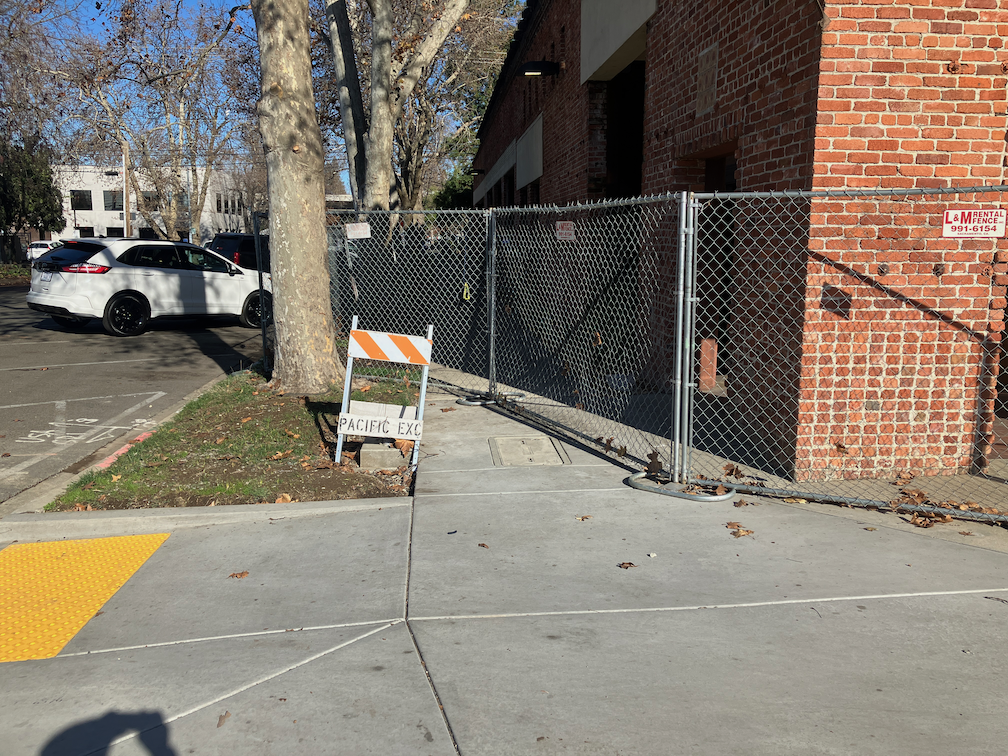
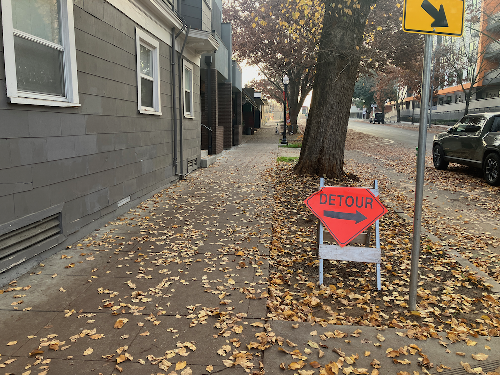
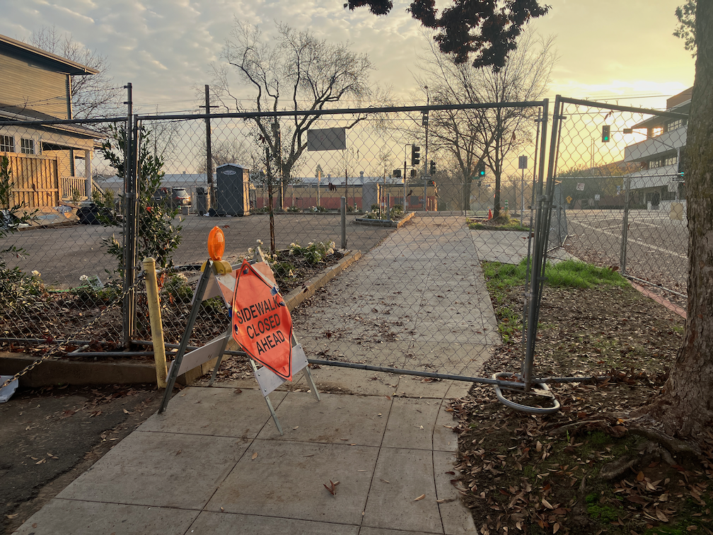
It is long past time for a policy to accommodate walkers and bicyclists during construction projects. Nearly every construction project that has occurred in the central city has violated ADA guidelines, which require accommodation. City staff is on record as saying that walkers and bicyclists would be accommodated when it does not remove capacity from motor vehicles. So every project presents dangers to walkers and bicyclists. The are poorly signed and do not provide detectable barriers. I spend a lot of time reporting these violations, and over time many though not all of them are corrected. However, it should not be the responsibility of citizens to hold the city to ADA requirements. A progressive city would develop traffic plans that accommodate all travel modes, and would then inspect and enforce those plans.
A new organization and effort has been developed in Sacramento to encourage drivers to slow down, in order to protect walkers and bicyclists from the traffic violence of high speed traffic. You can read the organization intro and charter at Slow Down Sacramento, and sign up to join the effort.
Gonzalez held a press conference yesterday (Tuesday, 2023-08-29) at Sacramento City Hall to kick off the organization. Isaac spoke at length about the need to improve driver behavior, following the speed limit and being respectful of other road users. He pointed out that though better infrastructure is the ultimate answer to traffic violence, that will be very expensive and very slow, but the solution we have available right now is for drivers to be more responsible. Press conference attendees included many local advocates, parents, and kids, as well as a number of city staff. Four council members attended, and city council members Eric Guerra, Lisa Kaplan, and Mai Vang spoke on the issues. City transportation planning staff also supports the effort.
Isaac Gonzalez speaking at Slow Down Sacramento press conference
I tend to be cynical about the prospect of improving driver behavior. Drivers become aggressive when they get behind the wheel, and infrastructure that prevents their recklessness and aggression is the long term answer. But in the meanwhile, for the many years it will take to create safer streets, drivers can act responsibly. If the Slow Down Sacramento effort saves even one life, it is worth it, but it has the potential to save more. I encourage you to follow the organization’s work. I think the fact that this is a citizen-led effort, rather than the safety theater of government agencies that blames victims more than perpetrators, increases the chances of success.
9th Street: 9th Street has a pavement overlay from L Street to Q Street. This is not repaving, removing old pavement and placing new, as has been done on many of the streets in the Central City Mobility Project, but a thin overlay. This was done very recently and there is no marking of any sort on the street. I had guessed that this section of 9th Street would not receive any treatment until the construction projects were complete, but I was wrong. I don’t know what kind of roadway allocation will be done in these five blocks. The left side is constrained by construction from L to Capitol Mall, and the right side from N Street to O Street and from P Street to Q Street. Note that in the photo below, there is a bus stop on the right hand side, which is why the city has designed the separated bikeway design on the left side.
9th St at L St, overlay and no markings
10th Street: 10th Street is largely complete from W Street to Q Street, where a pre-existing separated bikeway continues north, but a few things are left unfinished and not all of the green vertical delineators have been installed. The block from Broadway to X Street has been marked. It does not appear that anything will be done with the block from X Street to W Street, under the freeway.
10th Street from Broadway to X St, new markings for separated bikeway
I Street: Nothing has been done on I Street since the pavement patching. There are lane marker tabs for three general purpose lanes and no bicycle facilities.
19th Street: Work south of Q Street is now underway, with repaving complete and the beginnings or markings for the left side separated bikeway. I have not ridden south on 19th to see what is being done beyond this point.
19th St at Q St, initial markings for separated bikeway
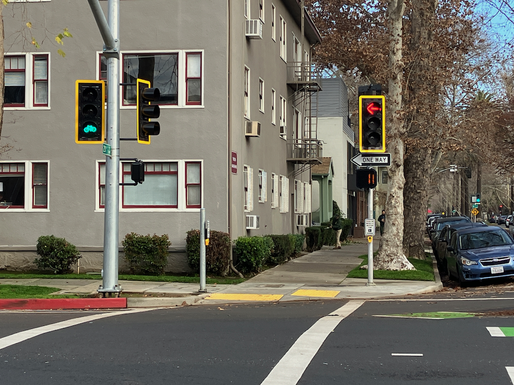
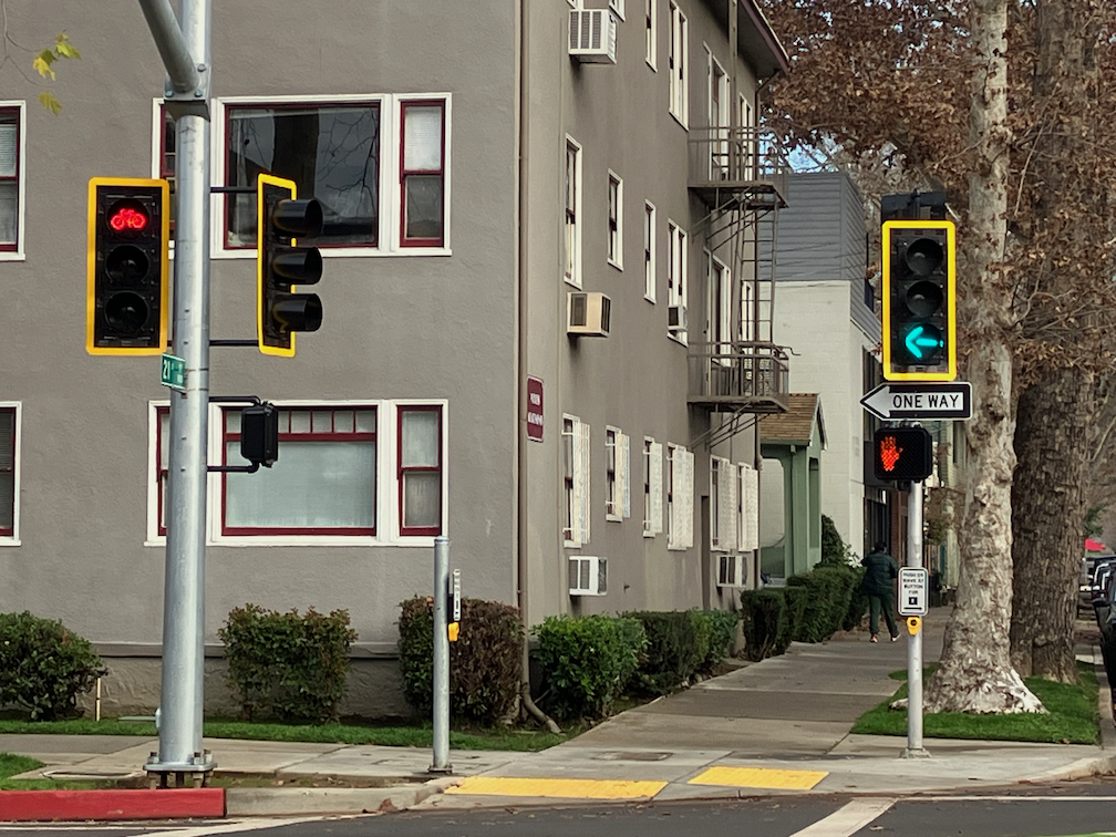
There is no change to the ‘turn wedges of death‘. The bicycle signal at 21st Street and I Street has not been installed. No further work is in evidence on 5th Street.
I started the Getting Around Sacramento blog on March 14, 2012 with Getting started. The blog initially contained a lot about transit, but when Sacramento Transit Advocates and Riders (STAR) was formed, much of my thinking and research on transit moved over there.
I hope those with me from the beginning, or joining in later, have been entertained and edified.
I have been backpacking and traveling, so not keeping up as much with the Central City Mobility Project. I may do updates on my days back in town, about once a week.
19th St: Paint and vertical delineators are mostly complete from H St to W St. Nothing has happened in the two blocks from W St to Broadway. Though pavement has been patched from Q St to W St, no other work has occurred.
21st St: Paint and vertical delineators are complete from W St to I St. No bicycle signal at I St, so the intersection of 21st St and I St remains extremely hazardous to bicyclists (and walkers).
P St: Paint and vertical delineators are complete from 21st St to 15th St.
Q St: Paint is mostly complete from 14th St to 21st St. Vertical delineators have been installed on some blocks but not others, probably due to materials shortages. Some crosswalks are missing.
10th St: Paint is mostly complete from W St to Q St (Q St to I St was already ‘complete’ before this project). No vertical delineators yet. The block from Broadway to X St has a traditional bike lane on the right, but no changes. The block from X St to W St, under the freeway, has a wide right side shoulder, but it is not a bike lane, nor is it marked as such. The parking-protected separated bikeway on 10th St is on the right side, because 10th St does not have bus service to be accommodated by a left-side bikeway.
9th St: Other than some patching, nothing has happened on 9th St. The new bikeway from L St to Q St will be on the left side. A construction project from L St to Capitol Ave closes the left side bike lane, and there is no accommodation for bicyclists. Though there is a bus area on the right, followed by a parking lane, it is not marked as a bike lane, nor is it safe as a bike lane. There is no signed on 9th St approaching L St to indicate that the bikeway ends, nor how to ride south. See photo below.
9th St at L St, no bicycle accommodation
Another construction project from O St to P St closes the right side of the roadway, but the existing bike lane on the left hand side is still open. As previously noted, it is unlikely that the bikeway on 9th St will be installed until both construction projects are complete.
I St: Other than pavement patches, no other work has taken place. No-parking signs continue to be up even though no active work is occurring. Most blocks from 21st St to 12th St will be reduced from three general purpose travel lanes to two, but from 20th St to 19th St, and part way to 18th St, the three lanes will be retained. It is not clear why.
5th St: No further work has occurred.
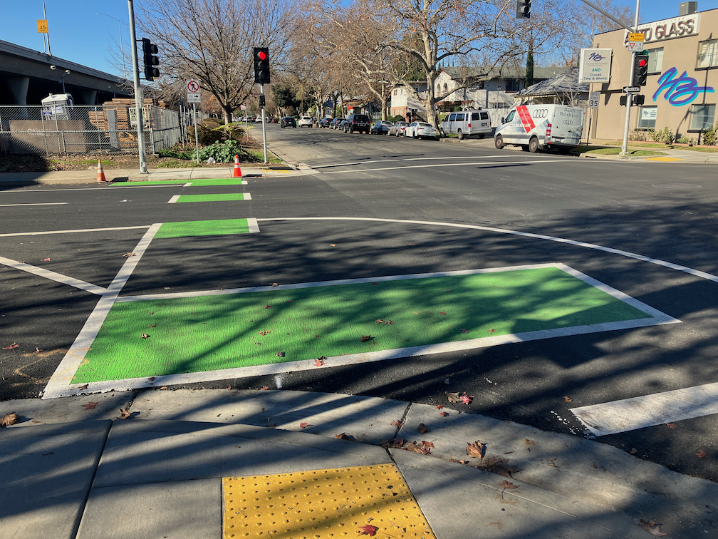
Nothing has changed about the ‘turn wedges of death‘. A closer look at the design diagrams (thanks to the person who provided them) shows that the wedges at intersections of the separated bikeways are intended to have hard curbs, 4 inches with sloped sides (regular curbs are six inches or more) with stamped concrete interiors (style 3), but the other intersections will have ‘rubber speed bumps’, and vertical delineators. The bumps are apparently as shown in the photo below, though the photo shows a bump in the travel lane, and these are in the turn wedges. The bumps are 2.25 inches high, which won’t be even noticed by trucks and SUVs, though might be noticed and respected by passenger car drivers.
Note: This post was rushed out and not well written, so I’ve revised it.
The Caltrans-led Yolo 80 Managed Lanes Project suggests adding roadway capacity to the Yolo Causeway in a number of different configurations. The project alternatives listed are:
No build: Alternative 1: This alternative does not address the purpose and need of the project by not making corridor improvements and relieving traffic congestion.
Build Alternative 2: Add a High Occupancy Vehicle (HOV) lane in each direction for use by vehicles with two or more riders (HOV 2+).
Build Alternative 3: Add a High Occupancy Toll (HOT) in each direction for use by vehicles with two or more riders (HOT 2+).
Build Alternative 4: Add a HOT lane in each direction for use by vehicles with three or more riders (HOT 3+) Lane in Each Direction.
Build Alternative 5: Add an Express Lane in each direction (everyone using the lane pays to use the lane, regardless of number of riders.).
Build Alternative 6: Add a Transit-only lane in each direction.
Build Alternative 7: Repurpose the current #1 general purpose lane to HOV 2+. No new lanes would be constructed.
Build Alternative 8: Add a HOV 2+ lane in each direction with I-80 connector ramp.
Of these alternatives, the only one which would not increase VMT (vehicle miles traveled) is #7, converting an existing general purpose lane to HOV 2+. Caltrans has on many projects claimed that state law does not allow this, but Yolo County forced Caltrans into including this option. All the other alternatives (except no build) would increase VMT ranging from a little to a lot.
It is true that the bulk of the motor vehicle traffic between Sacramento and Davis is not commuting traffic, but it is also true that the addition of commuter traffic to the background bay area to Sacramento and beyond is what causes the worst congestion episodes. Actually, the worst episodes are caused by traffic crashes, which none of these alternative would address. Caltrans sees traffic crashes as just part of the cost of doing business, and does not see reducing these as their responsibility.
The alternatives identified are missing two important ideas.
One alternative not mentioned is to increase service on Capitol Corridor between Sacramento and Davis to hourly or better, all day, over a longer range of hours. The trip on the Capitol Corridor takes only 15-minutes, about the same as the freeway when it is free-flowing, and far better than the one hour bus trip.
Many people have said that increasing passenger service on Union Pacific-owned tracks is impossible, because UP won’t allow more passenger trains without substantial taxpayer subsidies for track improvements. The Sacramento-Roseville third track project is basically a bribe to UP to allow some more passenger service. I don’t see this as a valid argument. Though freight railroads are regulated by the federal government, not the state, there are dozens of ways in which the state can put pressure on UP by withdrawing support and permission unless there is cooperation. UP net worth is $139B, large for a transportation company but very small in the world of corporations, while California is the fifth largest economy in the world. Are you saying that California has no leverage over UP? California could even buy out all UP tracks in the state, thereby solving the passenger vs. freight issue.
The second missed alternative is to subsidize high frequency bus service, 15-minute or 30-minute, on all weekdays, with a long range of hours, at least 5:00AM to 11:00PM. Service on weekends might be only hourly, but it would be a 30 minute trip without stops, rather than the hour-long Yolobus service. If Yolobus could afford to offer high frequency service between Sacramento, West Sacramento, and Davis, they would already be doing so. High frequency service could be offered for years on the same amount of money that will be wasted on capacity expansion for motor vehicles. The project alternatives do offer some support for buses, as buses can use HOV (high occupancy vehicle) and HOT (high occupancy toll) lanes, and alternative 7 even has dedicated bus lanes. But there is no mention of how this would be taken advantage of. If funding for buses is not increased, buses will not be a significant solution for the corridor.
Caltrans of course has no desire to fund non-motor vehicle transportation, despite slapping the ‘multi-modal’ label on everything they propose. As always in Caltrans District 3, walking, bicycling and transit are an afterthought, crumbs added if it doesn’t seem to interfere with private vehicles and commercial freight, not part of the project design criteria.
The Caltrans presentation on the project does not mention bicycles at all. There is an existing bike route all the way from Davis at Olive Drive offramp to West Sacramento at the Capitol Avenue onramp. There is a 3-mile Class 1 path from Olive Drive to county road 32A, then a shoulder on 32A, then a 4-mile Class 1 path to the edge of West Sacramento. There portion of the path on the elevated causeway bridge is in decent shape, but the asphalt part is seriously deteriorated. Whether the project means to improve the path or not is unanswered. To Caltrans, ‘multi-modal’ is just a catch phrase, not meant to be taken seriously. Even if this path is improved, the ride alongside the freeway will still be very unpleasant. The ultimate solution is to move the path north of the railroad, far away from the freeway.
Check the City of Davis, City of West Sacramento, and Yolo County pages on the project. Note that the alternatives listed, project description, and maps are somewhat different on each of these pages, because they were created at different point in time of the project planning.
It is not clear from any of the pages whether there is a still a chance for public input. Workshops were conducted in 2022. Whether or not there is still an open process, you can email Caltrans (Yolo80corridor@dot.ca.gov), City of Davis, City of West Sacramento, and Yolo County with your opinions.
The parking-protected, separated bikeway on 9th Street between K Street and L Street is finally open again, 2-1/2 years after it was closed for construction conversion of the Capitol Park Hotel by Mercy Housing. Though the area was occasionally used for active construction, mostly it was used for long-term storage of construction materials.
Apparently it does help to complain, at least sometimes. The city is fixing the root heave and gutter on 19th Street between Matsui Alley and N Street, which I posted on recently (hazardous bikeway on 19th St). I had submitted several 311 reports on this issue, and so had other people, and it seems we got through to Public Works.
The gutter is being replaced at the root heave, and other deteriorated locations in that half block. The photo below shows a night-time view, and I’ll add a daytime view and a view when the project is complete. Note that the bikeway is being appropriately diverted into the parking lane. It is unusual for the city to provide an equivalent accommodation for bicyclists.
gutter fix work on 19th St bikeway between Matsui Alley and N St
Of course there are several more blocks on 19th Street where the gutter pan is deteriorated enough that it doesn’t provide a bikeway surface and the bikeway therefore does not meet standards. However, this was the worst and most dangerous location, so there is progress.
I have mentioned the problems with the gutter pan on several blocks of the new bikeway on 19th Street being so deteriorated that the effective width of the bikeway is only about two feet. It is clear that the city did not look at the existing conditions of the gutter before deciding to place the bikeway in this gutter. But, this is not an easy thing to fix. There are at least four blocks that are unacceptable, but it will probably require reconstruction of the gutter pan to fix it.
What can be fixed, but has not been, is the root heave in the 19th Street bikeway at Matsui Alley (note that Matsui is discontinuous, and is present only on the west side of 19th Street; the alley does not exist on the east side.) The photo below shows the root heave, but doesn’t really emphasize how big it is. There is a four inch displacement. This is a pavement flaw that could easily cause a bicyclist to crash. I don’t know whether the orange paint marking is from the city or bicyclists, but orange paint is not visible at night, and even in daytime it doesn’t make clear what the rider should do to avoid the hazard.
19th St bikeway at Matsui Alley root heave
I have reported this issue to the city 311 app several times. I know of at least two other bicyclists who have reported it multiple times. The city 311 incident map shows only my latest report (230805-1907594), which means that the city has closed all the other reports without any action.
Allowing this type of hazard to exist, when it is a known hazard, particularly in a location designed to attract bicyclists, is criminally negligent. Let me repeat that for the idiots in Public Works, who seem to be hard of hearing – CRIMINALLY NEGLIGENT.
If you are a bicyclist who is using 19th Street, I encourage you to NOT use the bikeway in this block between Capitol Avenue and N Street. Ride in the middle of the general purpose travel lane instead. And if you have the time, file a 311 report on the hazard. It will become increasingly difficult for the city to claim it didn’t know about this problem (by closing the reports without action), the more people report it.