fatality on Franklin

A bicyclist was murdered by a hit-and-run driver on Franklin Blvd four days ago. Hit-and-run driver kills bicyclist, 59, as she repairs bike on Franklin Boulevard (SacBee, 2026-09-03, Darrell Smith). I intentionally use the term ‘murdered’, as I believe that hit-and-run qualifies as murder. It is an intentional decision on the part of the driver to not provide any aide to the victim, possibly saving the life. It is the lowest of driver behavior, and that is a low bar indeed. Unfortunately, state law treats traffic violence as less important than other violence, and except in very few circumstances does the driver/murderer suffer any significant legal consequence.

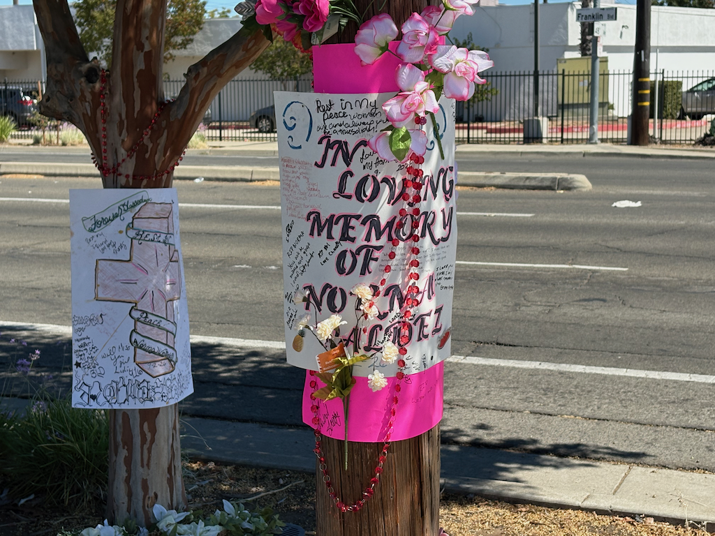
The person killed, Norma Valdez, was in the southbound bicycle lane on Franklin. The murderer drifted into the bicycle lane and killed her, and then left the scene. So far as I know, the driver has not been found. A memorial has been created on the site by friends.

photo of memorial for Norma Valdez on Franklin Blvd
memorial for Norma Valdez on Franklin Blvd

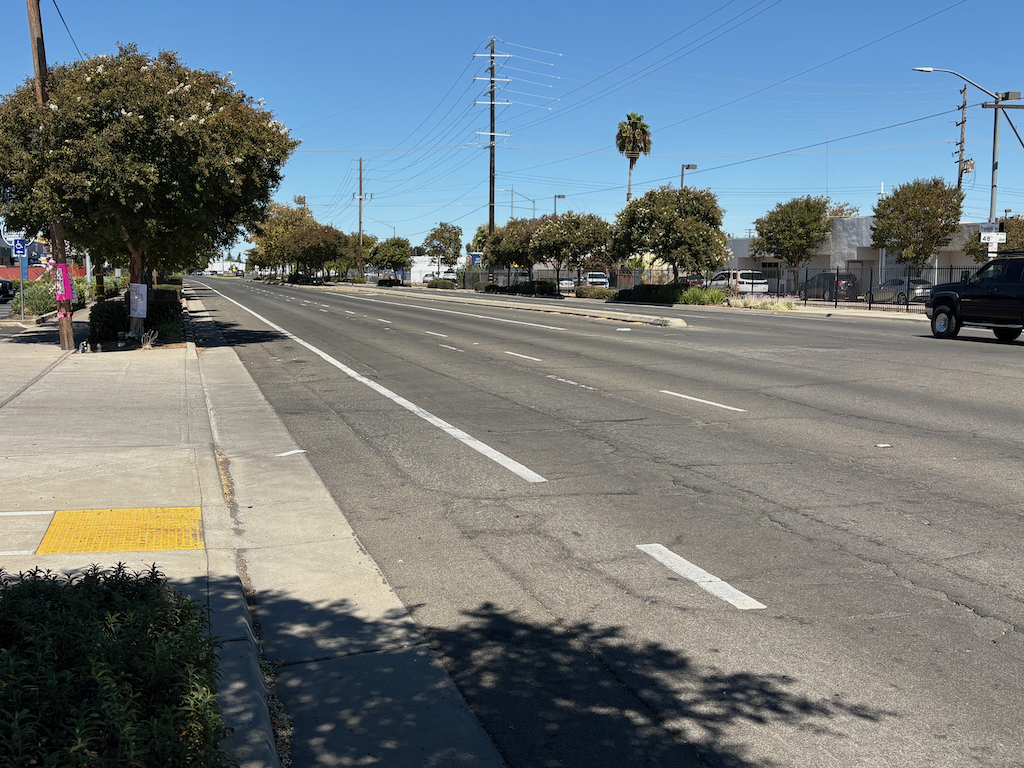
I was initially interested because I thought the crash was within the area of Vision Zero Complete Street on Franklin, but it is south of Fruitridge Road, in Sacramento County rather than the city. The location is opposite 48th Avenue. At this location, the bike lane is a little wider than usual, about 5.5 feet. There is no protection of any sort for the bike lane.

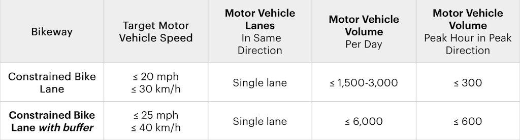
Conventional Class 2 bike lanes should never be installed on roadways over 30 mph, and generally not over 25 mph. The NACTO Urban Bikeway Design Guide, 3rd Edition, Constrained Bike Lanes, has the following table for ‘constrained’ (conventional) bike lanes. Nothing in this table matches Franklin Blvd at this location. It is higher speed, higher volume, and is two lanes per direction. Franklin should never have been designed this way. Caltrans CA-MUTCD and Highway Design Manual conveniently do not provide an upper speed limit for Class 2 bike lanes. Caltrans treats bicyclists with disdain, though with more respect than walkers. It is widely recognized that Class 2 bike lanes on high speed roadways will lead to fatalities. Such as this one.

The roadway is four lanes, two southbound and two northbound. A median is present in much of this section, but there is a gap here for 48th Avenue, which is only to the east, with no street to the west. La Grande Blvd to the west is a little to the south. The posted speed limit here is 40 mph. Readers will know that if a posted speed limit is 40, actual speeds are 50 to 55 mph. Even at 40 mph, and certainly above that, any collision with a bicyclist or walker will be fatal.

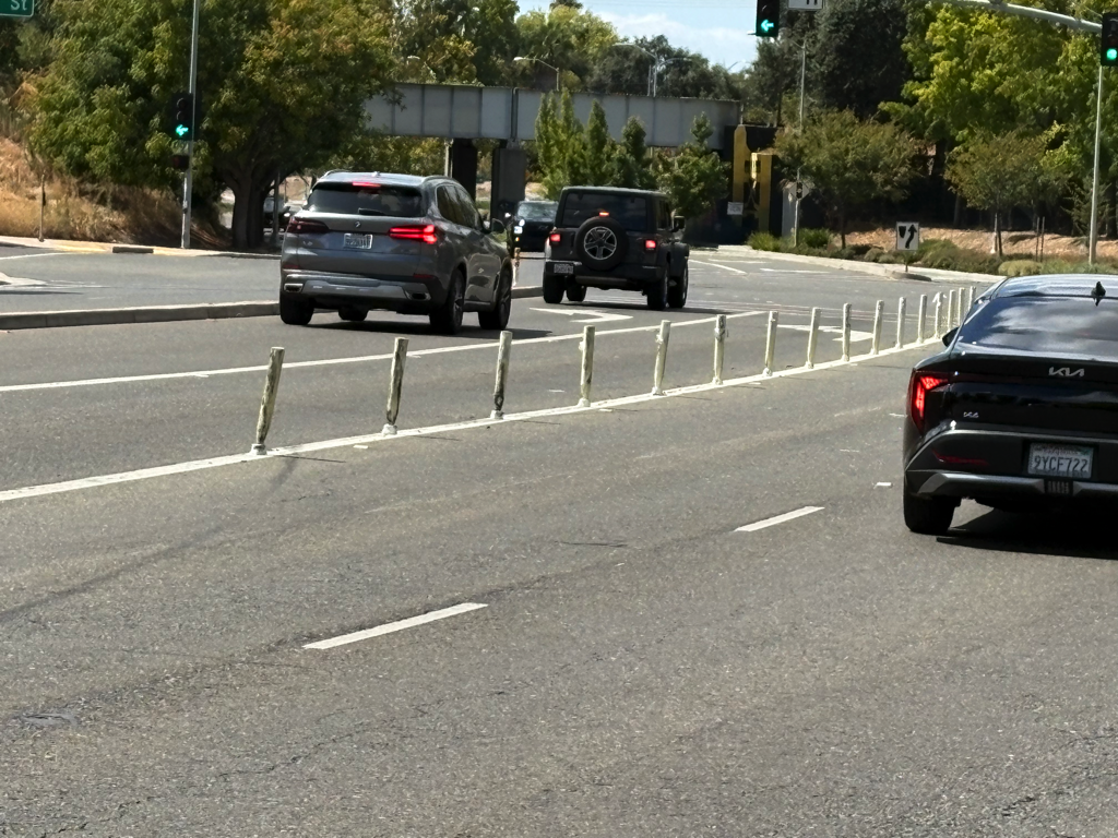
photo of Franklin Blvd near 48th Ave
Franklin Blvd near 48th Ave

I walked north on Franklin to Fruitridge Road, which is the southern terminus of the city’s project. City and county are mixed in this area. The county portion is actually better designed than the city portion. The city portion has no bike lanes at all, narrow sidewalks, mostly 4 feet, with either a center turn lane (‘suicide lane’) or with opposing posted 40 mph traffic separated by only a yellow stripe.

This entire area of south Sacramento, both city and county, is a place where motor vehicles dominate all other life.

It is worth noting that the bike lanes on Franklin Blvd and 47th Avenue adjacent to the former Campbells factory could have curb separation since there is only one active driveway in 2900 feet along Franklin and one in 2200 feet along 47th. These would not have prevented this murder, but any improvement is valuable.

Though I would have guessed otherwise, in the five years of TIMS/SWITRS data, 2019 through 2024, there were no bicyclist fatalities or severe injuries in the section of Franklin Blvd between Fruitridge Road and Florin Road.

WestSac: traffic calming around Sutter Health Park

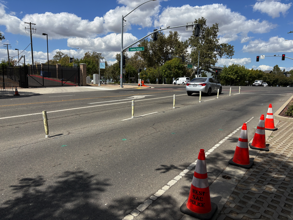
In response to a comment from a reader, I went to look at the area around Sutter Health Park, primarily the intersections of 5th Street and Cabaldon Parkway, and 3rd Street and Cabaldon Parkway. Note that Google Maps and Google Earth photos from July 2024 do not show the current configuration of these intersections with various traffic calming features, and vertical delineators often do not show up. If you want to see or experience it, you’ll need to go out there for yourself.

The city has kept adding vertical delineators to this entire area in an effort to regulate driver behavior around the ballpark. Things have improved but are still not safe. It is a comment on the drivers that pass though this area, and attend games, that so much has needed to be added, but is still insufficient. I can imagine the city saying “Well that didn’t work, lets add more of that”.

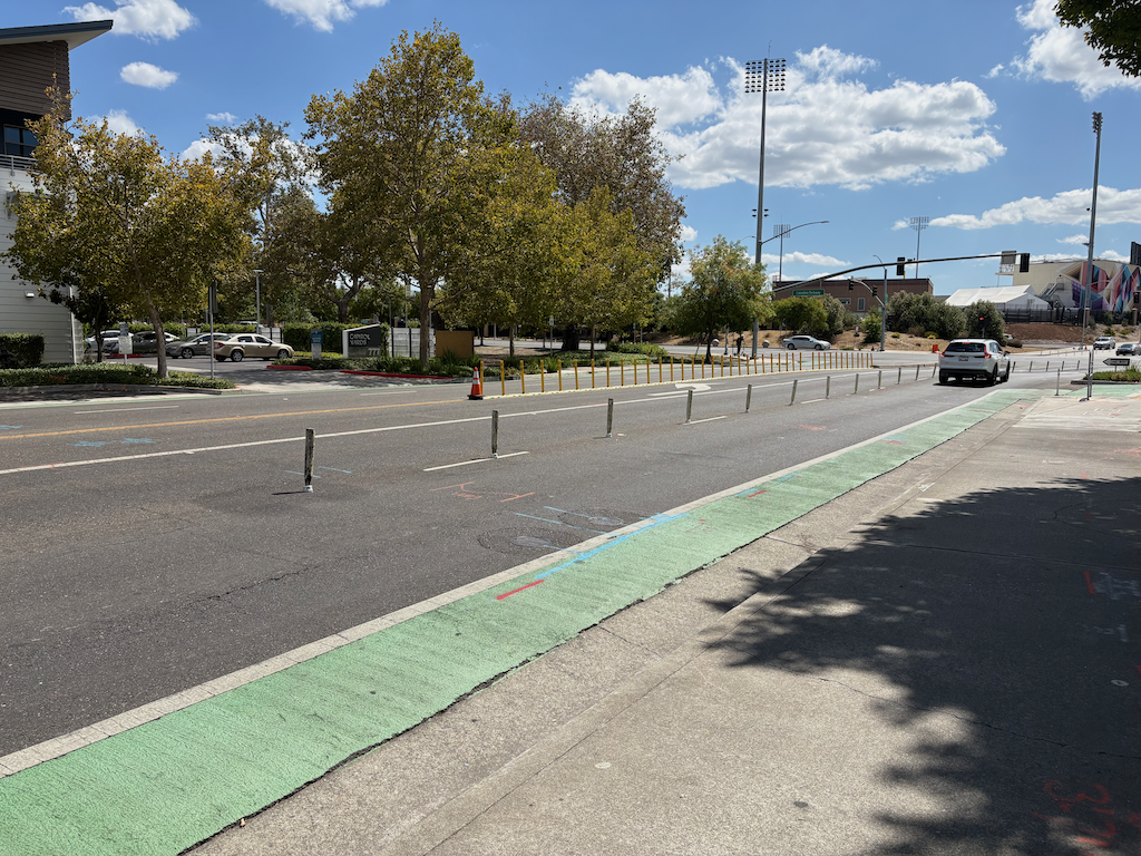
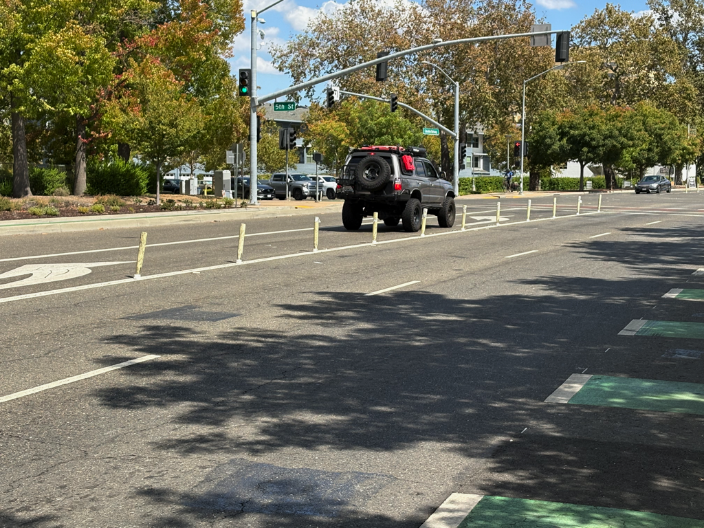
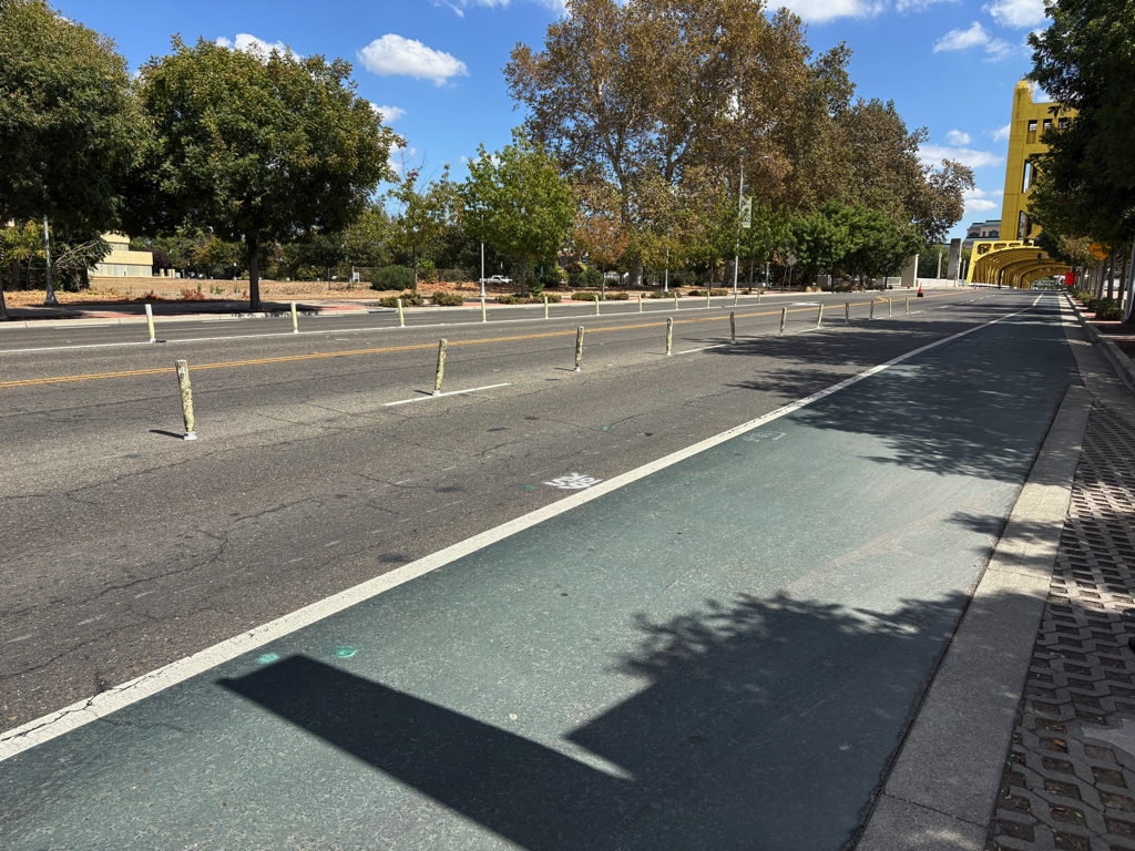
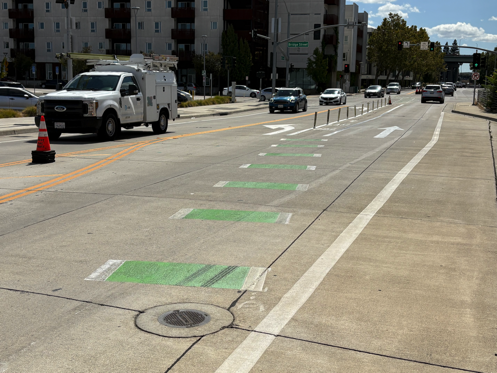
The photo below shows 5th Street southbound approaching Cabaldon Parkway. It is the only one that shows both lane delineators (white) and centerline hardening (yellow). The traffic lane adjacent to the bike lane is very narrow, and the bike lane is not protected in any way from this traffic lane. Much of the lane is in the gutter with a linear seam between the two. Which means it is not actually a legal bike lane, despite the message of green paint. This roadway need to be reconfigured to create a safe bikeway with at least a buffered separation, or ‘protected’ by vertical delineators, or best of all, a hard concrete curb. While riding this bike lane, I was passed by a large truck that drifted into the bike lane, forcing me to the curb.

This roadway design is completely UNSAFE for bicyclists, and must be corrected immediately by the City of West Sacramento.

photo of 5th St at Cabaldon Pkwy lane delineators & centerline hardening
5th St at Cabaldon Pkwy lane delineators & centerline hardening

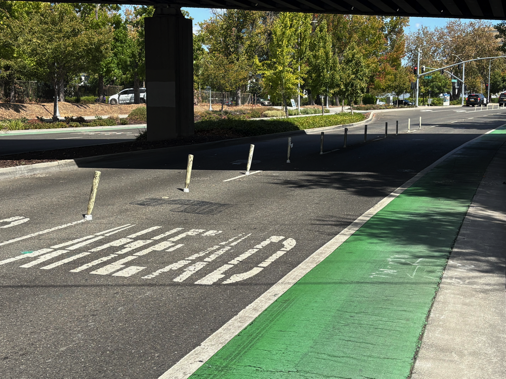
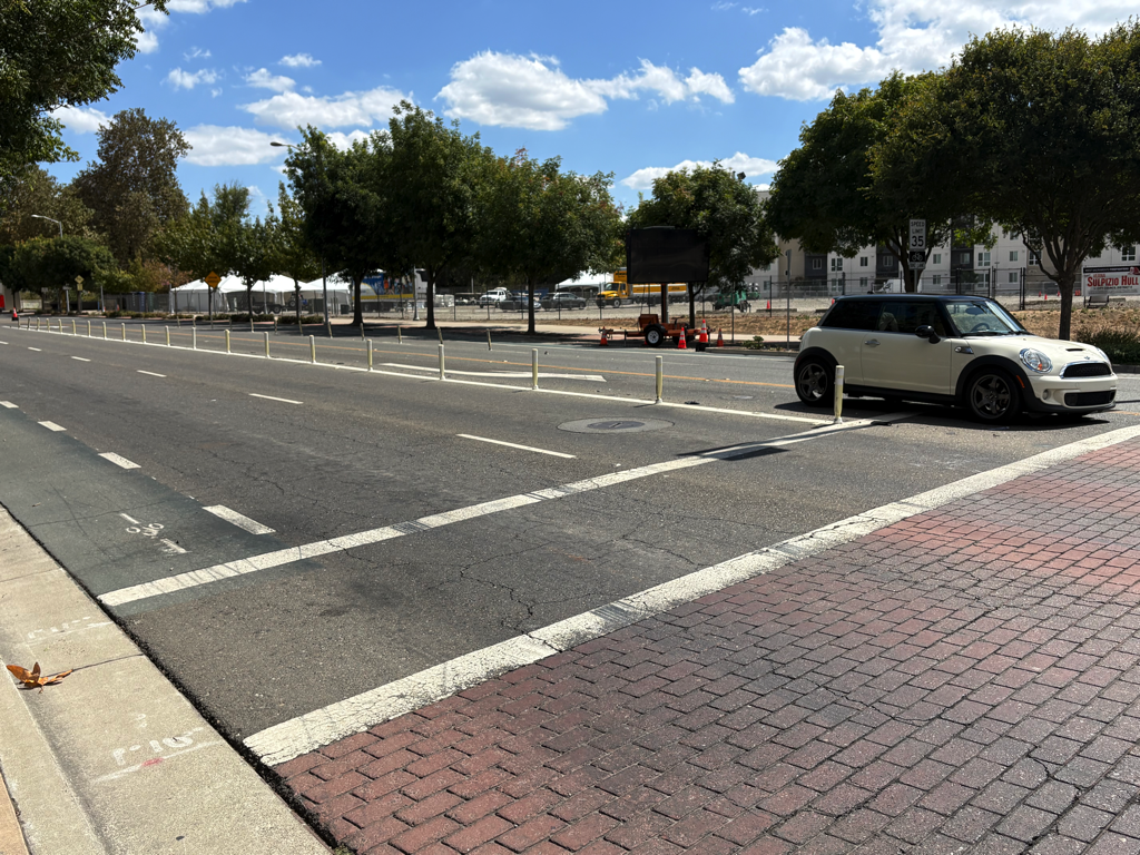
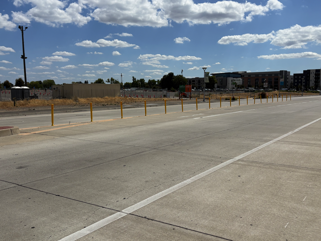
The next set shows lane channelization delineators (white). Note that they are no longer white and unbent, they have been run over by drivers multiple times. But they do have a traffic calming effect by discouraging drivers from changing lanes in unsafe locations or at intersections.

The reader commented that motor vehicles in lanes to the right of the delineators, westbound and eastbound on Cabaldon Parkway, drift to the right and into the bike lane. I did not observe this in my time there, and I did not feel unsafe, but I am not discounting the reader’s concern. I may have felt OK because these bike lanes are wider, not the barely legal lanes found many places, including the one above.

The longer stretches of bike lanes, particularly on Cabaldon Pkwy eastbound under the bridge, should be curb protected. Except for the bus stop at West Gateway Apartments, there are no driveways in this section.

A side note: the car in the left hand turn lane in Cabaldon at 3rd photo below sat through two signal cycles because it was not detected, and finally went on the red.

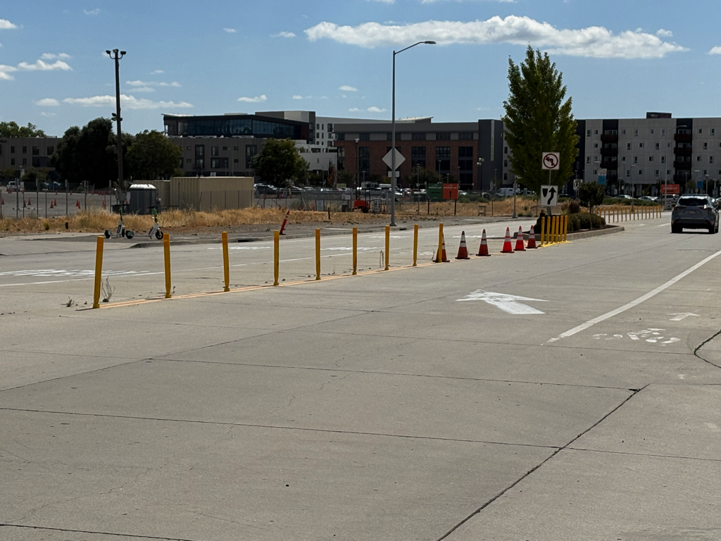
The next set shows centerline hardening (yellow). Most of these are more recent installations, so are mostly still yellow. These appear to be installed to keep drivers from turning into and out of the parking lot areas where they are not supposed to.

And lastly, the transition point on 5th Street southbound from the right-side traditional bike lane to the left-side two-way separated bikeway, often called a cycletrack. Note the very narrow bike lane between two lanes of motor vehicle traffic, ‘protected’ (not protected) by a line of lane channelizers on the left side of the bike lane. This is a horrible design. The bike lane should have been continued to the intersection, two-stage turn box, and an exclusive bicycle phase light.

photo of 5th St SB transition to cycletrack
5th St SB transition to cycletrack

What’s next: freeways

As I said in my post Slow Down Sacramento’s response to the initiative failure, I really like Slow Down’s thoughts about where to go after the failure of the Safer Sac Streets initiative to make the November ballot. But of course I also have some more radical ideas. It will probably take a few posts to get to them.

Our transportation system is broken. Seriously broken. It kills people on a regular basis, to a level that is unheard of in the developed world, and puts us solidly down in the third world statistics. It damages the earth, most prominently as the primary cause of climate change, but in many other ways as well. Perhaps most importantly, it has led to a society that is fragmented and unhappy, because we have turned much of our urban form into a lonely, sad place. Except for those lucky enough to live in diverse, walkable communities (I am one), the livability of our places is declining at an accelerating rate. I take that as a given, and it is not my purpose here to amplify that argument. If you don’t buy that, you probably won’t be interested in what comes next.

The interstate highway system was probably a plus for society, and for our economy, though it made the mistake of destroying central cities for the benefit of through traffic. But as Strong Towns has so well documented, we finished that project in 1992, and mostly earlier, The Interstate Was Finished. The Program Wasn’t (Mission Accomplished). See a local focus, End Highway Expansion by Strong SacTown’s Troy Sankey. Caltrans has not slowed down in its expansions of highway capacity, and despite the lip service of Caltrans headquarters, our regional District 3 has recommitted itself to the maximum number of new lanes miles, and a never ending supply of make-work projects.

Why is this important? Caltran’s mission is to supply all the highway capacity that anyone might ask for. If there is congestion, add capacity. If traffic slows below 65 mph, add capacity. If new interchanges are needed to support sprawl development, add capacity. This is really all District 3 knows how to do. Their world view is that the purpose of our transportation system is to ease and speed motor vehicle travel, and their constituency is people who want to drive more at a faster pace. The engineers, and particularly the leadership of District 3, is living in the 1950s.

So, highway capacity is increased. Yolo Causeway on Interstate 80, add a lane. Hwy 50, add one or more lanes. Interstate 80, add lanes (this was already done, but I’m sure they are planning more). Interstate 5, add lanes. Hwy 99, add lanes (this was already done, but I’m sure they are planning more). Sacramento is not really a city of trees, it is a city of highways.

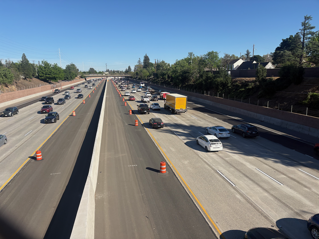
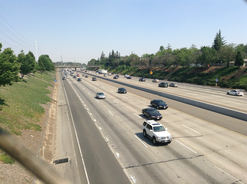
Each and every capacity expansion induces more traffic, and in particular encourages longer distance travel. Want to live far from where you work? Sure, Caltrans will accommodate. Want to get to the coast or Lake Tahoe with a short easy drive? Sure, Caltrans will accommodate. Want to develop agricultural lands into suburbs? Sure, Caltrans will accommodate. What Caltrans does not do, and seems uninterested in, is ensuring that freight traffic, which we all depend upon to some degree whether we drive or not, has the capacity to move. The freeways are full of commuters and travelers, with freight crawling along in the traffic. Stand on a bridge over any of our freeways, and notice who the freeway was designed for. For private cars, not for freight and commerce.

Why is this pattern so important? When highway capacity is expanded, it induces more motor vehicle traffic. That in turn induces more traffic on local roadways, particularly arterials and collectors. So the local agencies (SACOG, counties, cities) have to expand their roadways to accommodate all the induced traffic. And just as with the freeways, there is no apparent end to capacity expansion. In more urban areas, some cities are now moving in the other direction, reducing capacity for safety, but at the edges, capacity is still being increased, in many cases at a rapid rate. Caltrans has its hands deep in the taxpayers pockets, and gets essentially unlimited funds to expand capacity (with the complicity of California Transportation Commission (CaTC), the governor, and the legislature), while local agencies don’t have the money to even maintain what they already have, let alone expand capacity. Yet the actions of Caltrans forces them into expanding capacity and accumulating debt and deferred maintenance that they will never, ever be able to catch up on.

So, solutions. Discourage freeway use for commuting and non-essential travel. That would include:

  • stop current and planned capacity increases
  • all freeway lanes in excess of two per direction to be tolled (and eventually, all lanes)
  • convert all existing HOV lanes to tolled lanes

Stopping capacity expansion would free up the money (and more) to create the tolling infrastructure on all freeways in the region, including converting HOV (high occupancy vehicle) lanes to tolled lanes. The not yet finished Hwy 50 project, Fix50, added an HOV lane, which should have been a tolled lane. Now is the time to fix that. We already have a regional tolling agency, Capital Area Regional Tolling Authority, ready to operate the tolled lanes, and redirect income to maintenance and mitigation.

I have no illusions that this change would be easy. There are vast forces that will try to delay and subvert it. Not just Caltrans, not just commuters, but politicians who want to cut ribbons on increased capacity. The asphalt lobby, as it is called, though it includes concrete and everything that goes into a freeway. Suburban and exurban land developers. Owners of remote shopping malls who want an interchange just for their development. And the forces of status quo: ‘we’ve been doing this for 80 years, why would we change now?’

To make this change, it would take a strong, organized, and committed coalition of organizations that support equity, environment and financial solvency and transparency, and are willing to do whatever it takes to rein in Caltrans. And every citizen who knows we are on the wrong road, which is a continually growing group.

Caltrans District 3 is a rogue agency, not controlled in any significant way by anyone outside the district. Not Caltrans Headquarters, not the CaTC, not the governor, not the legislature. Bringing it under control might well be the hardest thing that could be accomplished, it will take years, and labor, and tears, and money. The best time to start was 50 years ago, the next best time is tomorrow.
SacBee’s Ariane Lange keeps focus on victims of traffic violence

In today’s SacBee, two articles by Ariane Lange keep the focus on victims of traffic violence.

Before Ariane Lange, now joined by Madison Smalstig, the SacBee had always parroted law enforcement assessments of traffic violence crashes, which almost always blamed the victim, and rarely the driver, except in cases of egregious DUI. Law enforcement has a well-known windshield bias, in which motor vehicle drivers like themselves are blameless, whereas walkers and bicyclists, unlike themselves, are assumed to be at fault. Later investigations often reveal that law enforcement had either fabricated information or neglected to report key information, but that was never covered in follow-up articles. The SacBee went along with this bias. As result, readers assumed just what defenders of our car-centric transportation system wanted them to assume, that crashes are just accidents, that are not avoidable. We know better. Since Ariane Lange, readers know better.

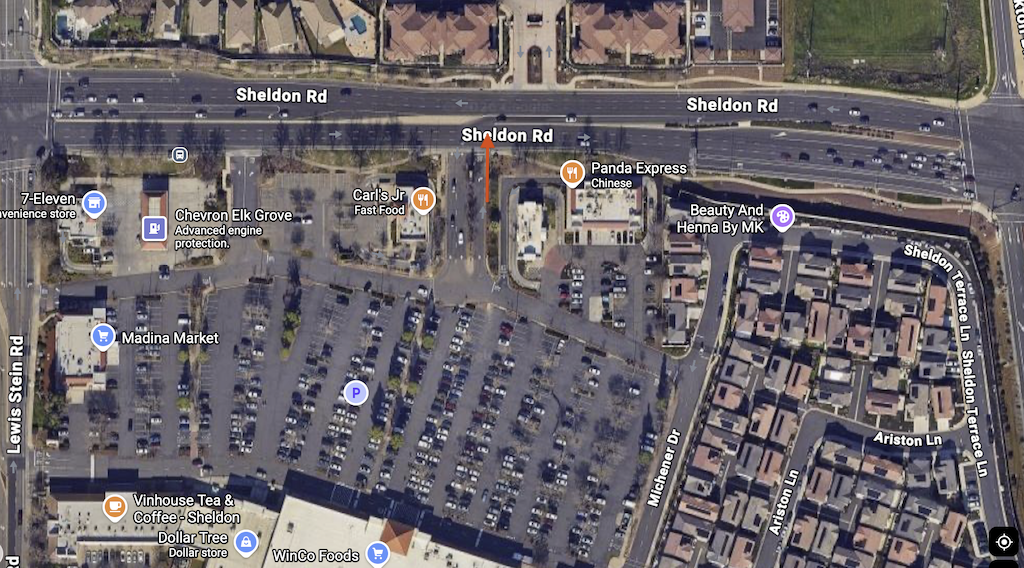
The one thing I will comment on is that Ariane let Elk Grove off the hook too easily. “The speed limit on that part of the road is 45 mph. In the immediate area of the crash, Sheldon Road has six general-purpose lanes plus the center turn lanes. It’s wide and fairly straight, with clear sightlines and few reasons to slow down.” “A spokesperson for the city of Elk Grove, Sydney Robertson, said that after Lopez was killed, the Public Works Department reviewed the site and “concluded that the intersection was properly constructed to applicable standards. Although not required, a yield sign was installed.” “The roadway, the city determined, had nothing to do with his death.”

In fact, the roadway had everything to do with the death. Six general purpose lanes means that the road is an arterial, designed to carry high speed traffic. An unprotected left turn lane into a commercial area means that the road is a street. This road/street hybrid is called a ‘stroad‘ (Strong Towns), and it is well known by all that stroads kill people, and also kill communities and livability. At 45 mph, as though most drivers are not driving way faster, crashes with walkers and bicyclists and motorcyclists, are almost guaranteed to result in death. Elk Grove designed and built that road. Just because the road meets ‘standards’ (which were written by people who believe the purpose of roads is to carry the maximum number of motor vehicles at the maximum possible speed) doesn’t mean that it is safe, and doesn’t mean that such designs are not malfeasance on the part of the city.

If a roadway is designed for high volume and high speed, it should have no commercial access. If the city wants commercial access, the roadway should be designed for lower volume and lower speed. Yet the shopping center that contains WinCo was permitted with two driveways, and the driveway that the driver was aiming for has two entry lanes, further encouraging drivers to cross the opposing lanes of traffic at a high speed. Just to make the message clear that this is a place for motor vehicles and nothing else, there are three drive-through fast food chains, and a huge parking lot for the shopping center. As a sop to people walking from their cars, there are two walkways in the parking lot. For the west one, at the north side, there is no marked crosswalk. On the south side, there is no safe crossing at all. For the east one, that leads towards WinCo, there is a marked crosswalk on the north side, but on the south side, the walkway does not align with the cross-hatched pedestrian areas, nor is it protected by the stop signs. The shopping center designers clearly do not walk, but more importantly, the city did not question the unsafe design, and permitted it.

It is bad enough that our car-centric culture and legal system largely excuse drivers of traffic violence, but it is even worse, in my opinion, that we give planners and traffic engineers a pass on the roadways they design in a way that they know will result in fatal crashes. This is no way excuses the driver at fault here of both legal and moral responsibility, but if we keep blaming crashes only on drivers, or blaming no one at all, we will never solve the problem.

overview of Sheldon Rd in Elk Grove, with site of fatal crash
Sheldon Rd in Elk Grove, with site of fatal crash

Caltrans gives the middle finger to walkers on 15th St

As part of the Fix 50 project, which has been going on for an indeterminate period of time, and may be complete sometime in this century, Caltrans tore up sidewalks and curbs under the freeway overpasses so that they could use the area under the freeways to store construction material and equipment. One locations was 15th Street under Highway 50. The sidewalk was replaced by uneven asphalt pavement, accessible for some people walking, but certainly not people with mobility devices.

15th Street under the freeway has never had sidewalks on the west side. As with almost all Hwy 50 underpasses, the design was for high-speed on-ramps and off-ramps which would have made walking there suicide. And bicycling as well. Cars first, cars only, the Caltrans motto.

Caltrans started to repair the damage to sidewalk and curb on the east side of 15th. Sometime before June 3, a fence was put up blocking the sidewalk. The result is that there is no path for people walking to follow 15th Street under the freeway. This is a violation of PROWAG, which Caltrans, along with every transportation agency, is legally mandated to follow. Though the regulations provide more detail, the summary says it well: “When an entity closes a pedestrian access route for construction, it must provide a temporary alternate pedestrian access route with basic accessible features. Alternate pedestrian access routes ensure that construction in the public right-of-way does not prevent pedestrians with disabilities from reaching their destinations.” Caltrans did not do so. It could have done so by closing one of the motor vehicle lanes and providing a protected pedestrian access route (and a bicyclist route as well, which is not required by PROWAG but is required by the California MUTCD).

So far as I can determine (remember, Caltrans has fenced off this area), the work remaining to be done is to patch the pavement between the curb and the existing roadway. This is something that would take one day, at most. But as of today, June 16, nothing had changed, nothing had been done. Two weeks. This is the middle finger that Caltrans is giving to people walking. Thirteen days, or more, of no access for people walking, for no good reason, just because Caltrans can’t get its act together to fix something it broke.

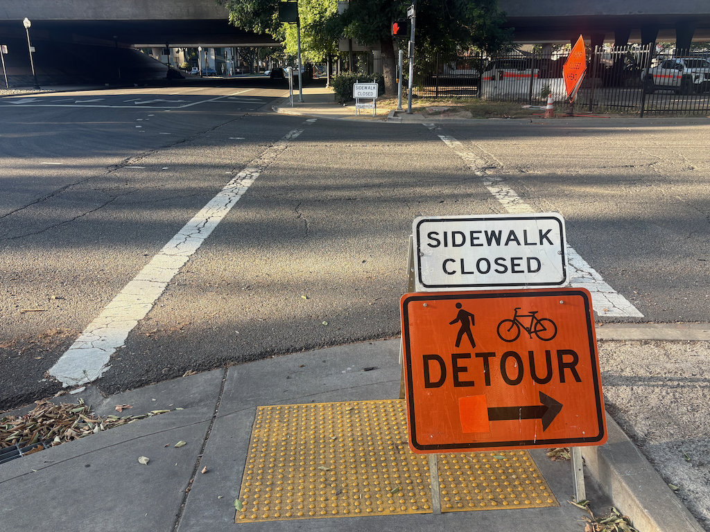
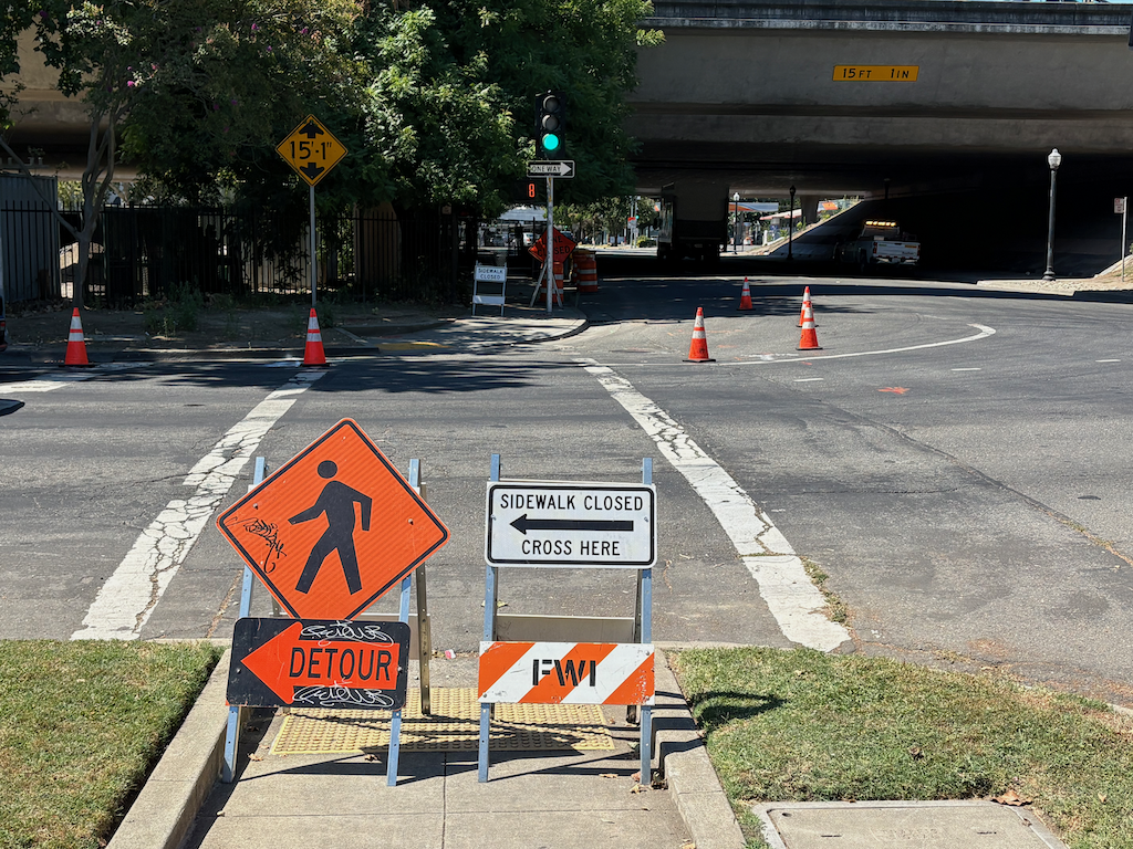
First, what it looks like going south to north on 15th Street. The detour is to… 16th Street, a full block away. That intersection is even more hazardous than this one, with two lanes with high volumes of high speed drivers turning left from 16th Street northbound to W Street westbound. You take your life in your hands there. Actually, you take your life in your hands whenever and wherever you use a facility designed by Caltrans, but 16th Street is one of the worst.

photo of 15th St at X St, pedestrian detour sign
15th St at X St, pedestrian detour sign

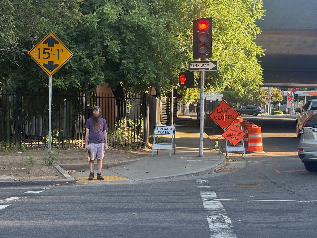
Second, what it looks like going south on 15th Street. You can see the fence that blocks access, but you can’t see, from here, the minor fix that would remove this problem. Apparently the person walking had gone around the fence, unwilling to go two blocks out of their way, to and from 16th Street. This is the target audience for Caltrans, and by ‘target’, I mean a person at risk of bodily injury or death at the hands of Caltrans. At least Caltrans put up a small ‘bicycles share the road’ at a locations where drivers are sure not to see it. This should be an illegal sign in any case, as drivers take it to mean, bicyclists should get out of the way and ‘share’ the road with cars. California MUTCD also required bicyclist accommodation in this situation.

photo of 15th St at W St, pedestrian access blocked
15th St at W St, pedestrian access blocked

And this is what it looked like today, June 16. No change, except that the ‘bicyclists share the road’ sign is gone. Again, the suggested detour is to the even more hazardous intersection of 16th Street and the freeway.

photo of 15th St at W St, pedestrian detour, sidewalk blockage
15th St at W St, pedestrian detour, sidewalk blockage

I have said before, but it bears repeating, that Caltrans District 3, which includes Sacramento county, is a rogue agency, funded by taxpayers (your tax money) but accountable to no one. Not Caltrans headquarters, not California Transportation Commission, not the governor, not the federal government. And most particularly, not the citizens of Sacramento. They do what they want, when they want. They want you to just accept that they are killing you, using your own money for the crime.

I sometimes wonder if the felon Trump got his ideas for grift, criminality and incompetence from observing Caltrans District 3.

Am I pissed? You bet.

Yolo causeway bike path to close

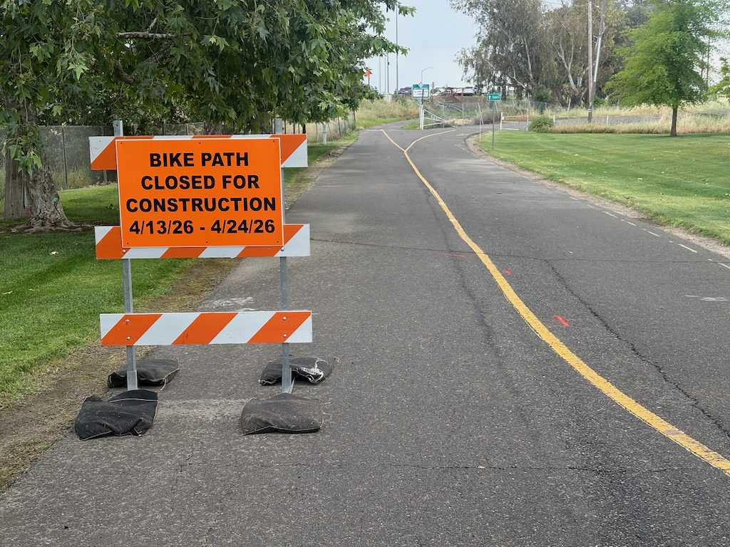
Yolo causeway bike path closed sign

The Yolo causeway bike path will close for a week and a half starting Monday April 13 (tomorrow). The part that will close is actually very short, from the path rest area in West Sacramento to the beginning of the causeway bridge, but since there is no alternative route, the entire distance from West Sac to Davis is closed.

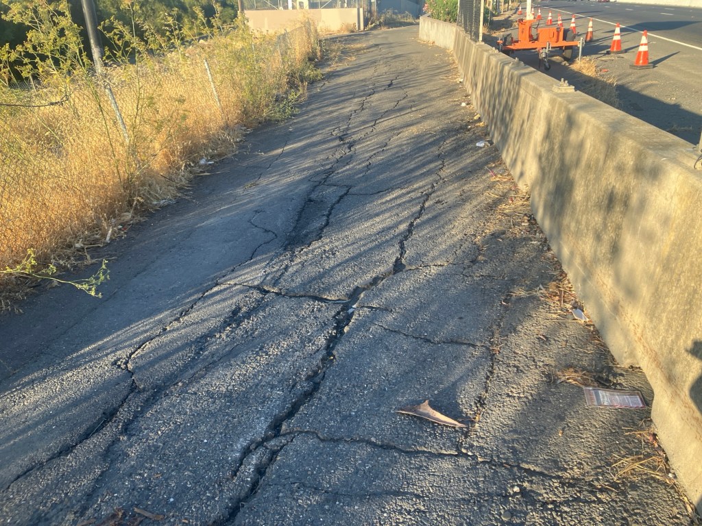
Presumably the closure will be to improve or replace the section of very deteriorated path as it ramps up to bridge level. This is a good thing. The problem is that most users of the path would have no way of knowing beforehand. It is not signed where the path departs West Capitol Avenue westbound, nor is it signed where the path departs County Road 32A eastbound.

Yolo causeway bike path deteriorated pavement

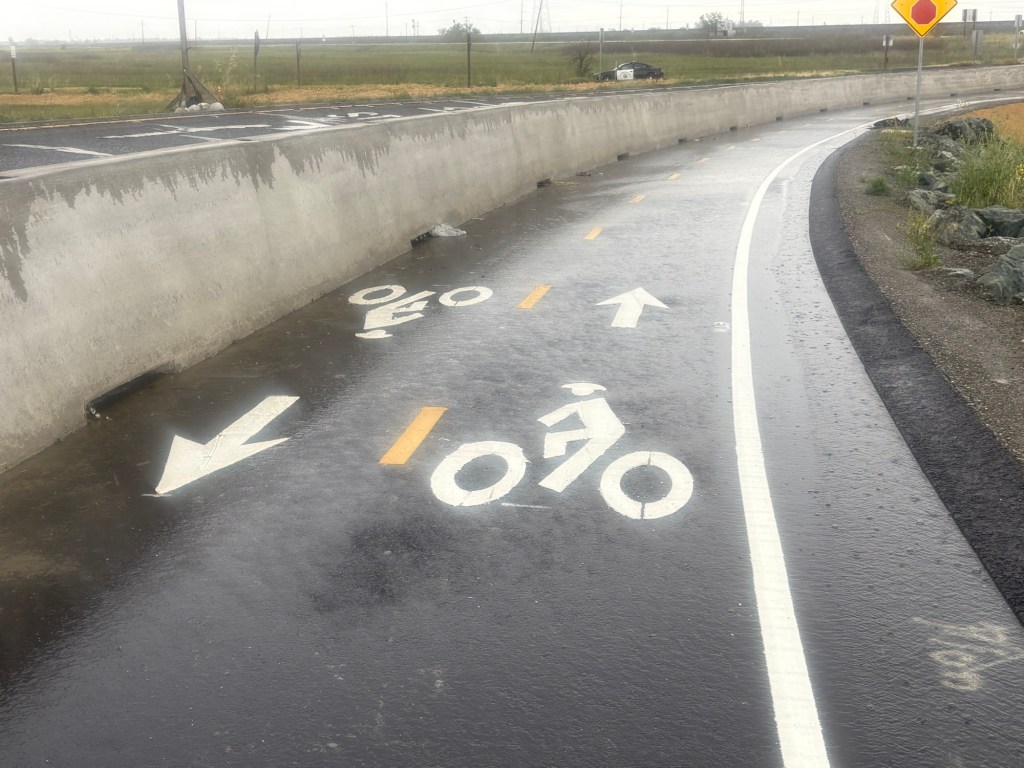
The west end has been improved. Rather than turning on to the levee, it follows the off-ramp from the freeway, protected from motor vehicles by concrete barrier ( sometimes called K-rail or Jersey barrier, but it isn’t clear if this is the term for permanent barriers). However, the junction with County Road 32A is not complete, and may have safety issues.

Yolo causeway bike path approaching County Road 32A

The drainage problems on the causeway portion of the path have not been solved, so there will be extensive puddles after rain, as yesterday. The path continues to collect debris from the highway, car and truck parts and trash. Caltrans passed on the opportunity to provide path lighting, even though electric was embedded in the new barrier. And of course noise from the highway is oppressive. As with all Caltrans projects, two steps forward and one step back.

Davis regresses on sidewalks

This post was initiated by an article in the SacBee on Tuesday – SacBee (Yolo County News)/Daniel Lempres, 2026-04-07: Davis considers code update to shift liability of sidewalk maintenance. For prior (many) posts on sidewalk maintenance and responsibility, see category: sidewalks.

There is a misstatement in the article: “California law places the responsibility for sidewalks on the adjacent property owner, but Davis typically accepts responsibility for all repairs and replacements.” State law allows a city or county to make property owners responsible for sidewalks, but it does not require that a city or a county do so. It is not uncommon for a government, including the City of Sacramento, to claim that state law forces them, but this is a lie, and they know it is a lie. Davis was more responsible than most cities in that it generally did repair on its own dime. What has changed is that the budget crisis, which Davis and every other city faces, has them searching for ways to extract more money from citizens without raising taxes. This is just one example.

I will state, as I have many times before, that it is unconstitutional for the government to require a citizen to maintain city-owned property. Sidewalks are city-owned property on city-owned land. The adjacent property owner does not own the sidewalk, and does not own the land on which it sits (with a few exceptions when property boundaries do not reflect where curbs and sidewalks are). Sidewalks are an integral part of the transportation network, and should be maintained in the same way as the rest of the roadway. We don’t ask adjacent property owners to repave the street, and we should not ask them to fix the sidewalk. Unless of course the damage was caused by a privately-owned tree.

For the 2026-04-07 Davis city council agenda item (#7) on sidewalks, see Ordinance Adding Article 35.09 to Chapter 35 of the City’s Municipal Code Related to Responsibility and Maintenance of Sidewalks and Update on Sidewalk Inspection Program, staff report | presentation.

To the considerable credit of the City of Davis, it does have a sidewalk inspection program, under the Sidewalk Accessibility for Everyone program, which the City of Sacramento does not. Though the Davis presentation states that the City of Sacramento does, there is no evidence for a regular inspection program; rather the city inspects when there is a complaint. Also to the credit of Davis, fines paid by adjacent property owners who do not fix the sidewalk would go back into the sidewalk maintenance program, not into the general fund, as it would in the City of Sacramento.

Video of the staff presentation, council discussion, and decision is available on video at 2:35. One council member asked the question about responsibility if the sidewalk damage was caused by a city-owned tree (as it often the case). Legal counsel said that the ordinance still places responsibility on the adjacent property owner. Another council member asked about how low-income property owners and affordable housing would be handled. Counsel said that if the damage was caused by a utility, it would be paid for by the utility, whether the city or private (PG&E), but that city-owned trees were not included because most damage was caused by city-owned trees, and that would mean less income to the city from property owners (!). A number of other questions were raised by council members, which are not answered in the ordinance.

The ordinance presented and passed (first reading) is the first step in developing policy to underlie the ordinance. City staff was vague about when the policy would be in place, and when the ordinance would be enforced.

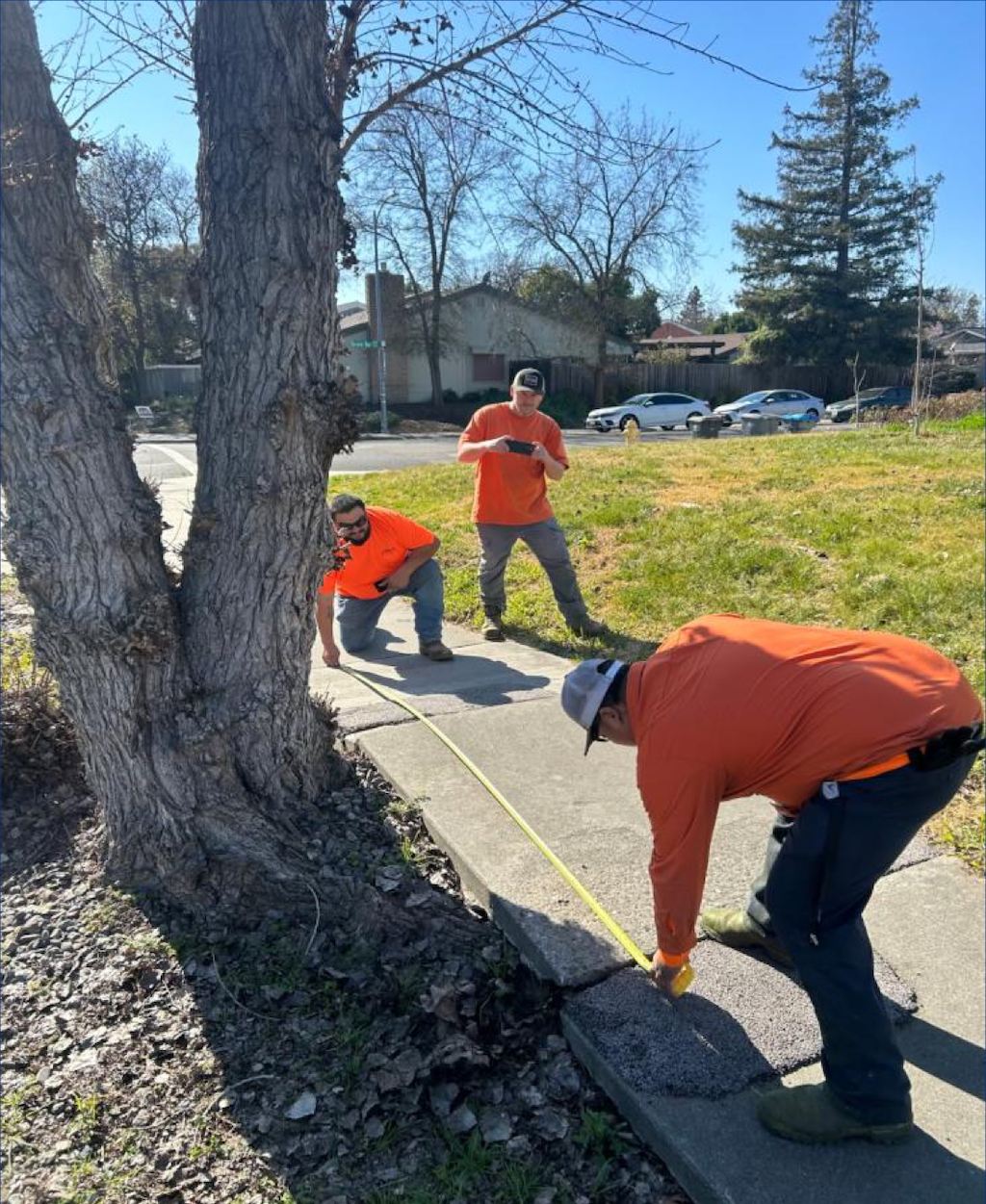
The photo below is from the City of Davis staff presentation on the sidewalk ordinance. Note that this is a city-owned tree that has caused the damage. Also, a prior repair, which did not solve the problem, is under the worker to the right side.

photo of Davis city crew measuring for sidewalk repair
Davis city crew measuring for sidewalk repair (City of Davis)

CTC = the highway lobby

California OKs a lot of new freeway lanes during climate change-fueled heat wave (SacBee, Ariane Lange, 2026-03-21)

The California Transportation Commission (CaTC; CTC is Commission on Teacher Credentialing) has approved yet more of your tax dollars to serve a small segment of the population, those who commute long distances. Freeways will be expanded all over the state. Why is more highway capacity needed? Because more lanes equals more driving, equals more gas tax, equals more money for highways. It is a circular loop, also known as a growth ponzi scheme.

The CTC has long been in the pocket of the highway lobby, which is composed of the asphalt and concrete providers and construction companies, the fossil fuel companies, and the politicians who love ribbon cuttings over actually doing something to benefit their voters (of course, as we all know, most politicians first consider their campaign contributors, and only if it doesn’t conflict, citizens).

But because CTC continually funds highway expansion, basically giving Caltrans everything that asks for, so long as it is capacity expansion, and refuses to give serious discussion or attention to climate change and the evolved transportation environment, it has really become the highway lobby.

Because nearly all transportation funding (otherwise known as your tax dollars) goes to highway expansion, there is little left at the state level for maintaining highways. And little at the regional (SACOG) level. And almost nothing at the county and city level. Your street is likely falling apart, because the money is going elsewhere.

Caltrans has built a transportation system based almost solely on the needs of commuters and freight, though because of congestion induced by commuters, it no longer serves freight very well. Active transportation was not just an afterthought, but was actively planned against. The most dangerous roadway locations in the state are highway onramps and off ramps, which were designed for the highest possible motor vehicle speed, and usually have minimal or no accommodation for people walking and bicycling. As if the ramps were not bad enough, Caltrans retains control of overpasses and underpasses, though they spend none of their money on improving those, forcing local entities to spend their own limited funds to fix Caltrans mistakes. And there are plenty of Caltrans mistakes to be fixed. Billions of dollars worth. Instead of fixing things, Caltrans builds more. More problems to solve, more infrastructure to maintain, but without asking for very much for that maintenance.

Nine of the eleven members of the CTC are appointed by the governor. So our windshield governor owns the misallocation of taxpayer dollars. Of these members, only two could be considered advocates for active transportation, transit, and rail: Adonia Lugo and Darnell Grisby. A few others are not opposed to these, but not very supportive. Some are actively opposed to spending state money on anything but highways.

Strong Towns has addressed this travesty by documenting how the era of Interstate Highway expansion is and should be at an end:

Of course Caltrans and its enabler CTC is not just expanding the Interstate system, which they are, but the entire state highway system.

CTC is broken. Can it be reformed? It seems to me unlikely. Since CTC largely serves to give Caltrans whatever it wants, maybe it would be better to just give the budget directly to Caltrans. Nothing would improve, but at least active transportation, transit, and rail advocates would only have to monitor one agency instead of Caltrans and CTC.

SACOG Board 2025-11-20

The SACOG Board of Directors will meet on November 20, 2025, at 9:30 AM.

  • Attend: SACOG’s offices, 1415 L Street, Suite 300, Sacramento, CA
  • Watch: https://www.sacog.org/meetings/meetingagendas, at the time of the meeting
  • Comment: In-person, or submit via email to the clerk at lespinoza@sacog.org at least 24 hours prior to the meeting. (see agenda for details)

Agenda (pdf)

Pledge of Allegiance

Roll Call

Public Communications

Disclosures

Consent:

  1. Approve Minutes of the October 16, 2025, Board Meeting
  2. Approve the Transportation Development Act Claims for City of West Sacramento, County of Yolo and Yuba-Sutter Transit Authority
  3. May is Bike Month Contract Extension
  4. SACOG Flexible Funding Program Grant Extension Request and Funding Transfer for the City of Isleton
  5. 511 Traveler Information Systems Consultant Services — Contract Terms Standardization

Action:

  1. Approve 2026 Meeting Schedule
  2. 2025 Blueprint Adoption: Certification of the Final Environmental Impact Report and adoption of Findings of Fact, Statement of Overriding Considerations, and Mitigation Monitoring and Reporting Program; Approval of Amendment #11 to the 2025-28 Metropolitan Transportation Improvement Program (MTIP) and Conformity Analysis, associated with the proposed Metropolitan Transportation Plan/Sustainable Communities Strategy (MTP/SCS); and Adoption of the 2025 Blueprint (MTP/SCS); there are 10 attachements, which can be viewed in the html agenda or meeting packet at https://www.sacog.org/meetings/meetingagendas

Information:

  1. Tracking Blueprint Implementation through the Regional Monitoring Program

Reports:

  1. Chair’s Report, Board Members’ Reports and Executive Director’s Report

Receive & File:

  1. 2026 Regional Trail Implementation Strategy Update – Governance and Funding
  2. Quarterly Report on Contracts
  3. Land Use Implementation Activities for October 2025

SACOG Transportation Committee 2025-11-06

The SACOG Transportation Committee meets today, Thursday, November 6, 2025, starting at 10:00 AM. This is a thin agenda, but may still be of interest for the trails strategy.


Agenda (pdf)

Consent:

  1. Approval of the October 2, 2025, Transportation Committee Meeting
  2. May is Bike Month Contract Extension
  3. SACOG Flexible Funding Program Grant Extension Request and Funding Transfer for the City of Isleton
  4. 511 Traveler Information Systems Consultant Services — Contract Terms Standardization

Information:

  1. 2026 Regional Trail Implementation Strategy Update – Governance and Funding (Summer Lopez) (Est. Time: 30) • Governance and funding options for trails

Other Matters

Adjournment