California needs to drop Caltrans, and create a Department of Highway Maintenance

Caltrans has sliced and diced cities with highways, dancing to the tune of segregationists who wanted to isolate and destroy communities of color so that they could ignore the existence of ‘those people’. Caltrans is not likely to be building any completely new highways in the future, though many in Caltrans would still like to. What they will be doing is continuing to widen existing highways, increasing motor vehicle capacity and inducing more driving. It seems that nothing will cure them of this, except disbanding of the agency and firing most of the highway engineers. So that is what I am proposing. In it’s place, there would be a Department of Highway Maintenance. The purpose would be to maintain our existing infrastructure, and I mean actually maintain, not just use safety and maintenance as a cover for widening. If bridges were replaced, they would be required to have the same or less motor vehicle capacity as before.

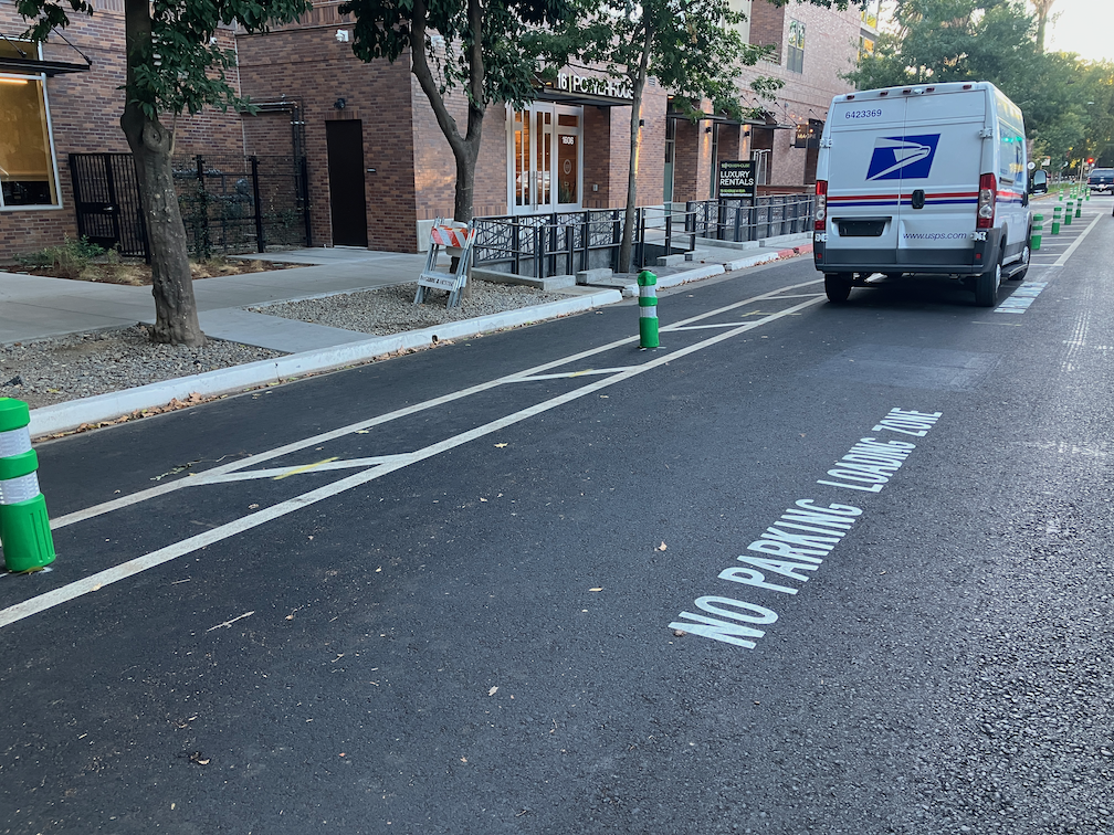
The department could do projects which remove motor vehicle capacity. This might include removing freeways completely, but with guidelines that prevent the design of ‘boulevards’ that are just as much traffic sewers as the freeways. It might include converting existing general purpose highway lanes to managed lanes, but would never include constructing new managed lanes. It might include projects which reduce on-ramps and off-ramps from two or more lanes to one lane, shortening the crosswalk distance over on-ramps and off-ramps, and creating right-angle on-ramps and off-ramps which slow motor vehicle drivers by design, and it might include narrowing freeway lanes and posting lower speed limits.

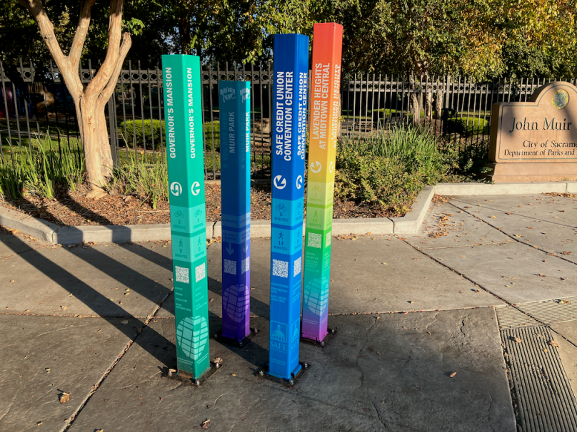
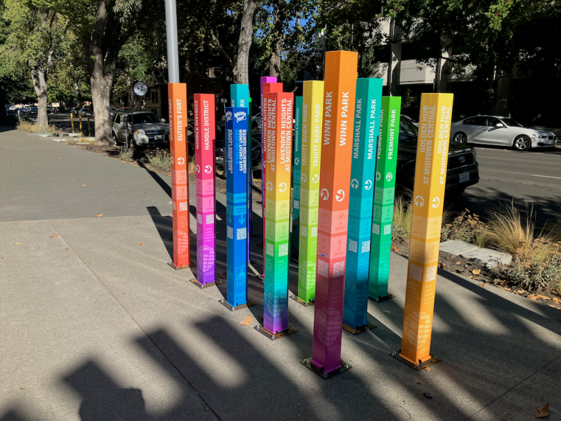
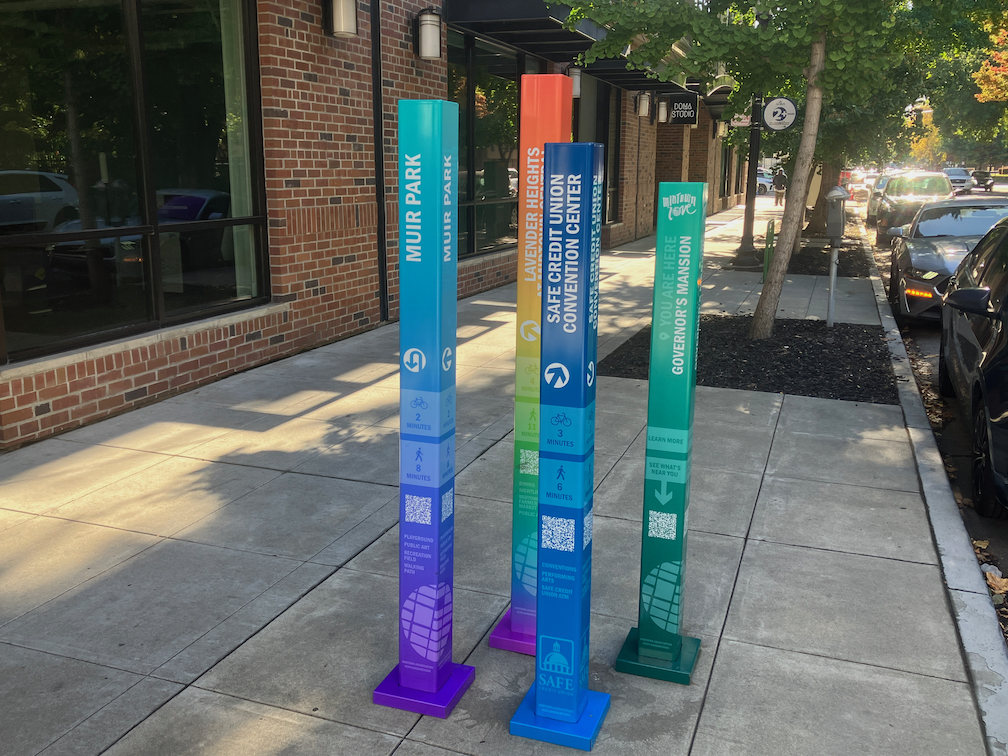
All designated state highways which are actually surface streets would be transferred to local transportation agencies, so the state highway system would shrink to actual freeways.

So what would happen to the funds that currently go to widening highways? I propose that one-third be given to local transportation agencies, on a competitive basis, for active transportation projects. All of this funding would go through the California State Transportation Agency; Caltrans would have nothing to do with it.

The other two-thirds would go for rail and transit. A Department of Rail and Transit would be created out of the existing Division of Rail and Mass Transportation. The purpose of this new department would be to purchase rail right-of-way, by condemnation if necessary, from the freight railroads, so that passenger rail may run in California without interference from the freights. It would also fund infrastructure and operations for rail and transit throughout the state. With the movement of funds from highway widening to rail, it should be possible to complete High Speed Rail on schedule, and to greatly enhance the operating frequency of the three regional rail services (Capitol Corridor, San Joaquins/Altamont Commuter Express (ACE), and Pacific Surfliner). Once higher frequency service and modern ticketing are in place, the regional rails would separate from Amtrak and be operated completely by the state. The state already owns the equipment. Though the agency could fund other transit, the emphasis would be on rail.

midtown wayfinding

Update: With some help from others, I located the Governors Mansion and Handle District signs, and have added that information.

The Midtown Association (Sacramento) has installed a series of wayfinding signs in the midtown area. More information is available at Explore Midtown – Your Way!. It appears that SAFE Credit Union is also a sponsor, as the central origin of the signing is the northwest corner of 15th Street and K Street, on the grounds of the SAFE Credit Union Convention Center and Performing Arts District. This location references 15 other wayfinding locations with its 16 posts. The other locations have four posts, one for the location itself and three destinations. The posts have QR codes which link to an Explore Midtown page for that location, listing nearby attractions and businesses. Businesses not a member of the association are not shown.

Midtown Association wayfinding signs at SAFE Convention Center and Performing Arts District
NumberLocationIntersectionURL
01SAFE Credit Union Convention Center1401 K St; 15th & K NWhttp://bit.ly/MA-SAFE
02Memorial Auditorium1515 J St; 16th & J NWhttps://bit.ly/MA-Memorial
03Governors Mansion1526 H St; 16th & H SEhttps://bit.ly/MA-Governors
04Muir Park1515 C St; 16th & C NWhttps://bit.ly/MA-Muir
05Fremont Park1515 Q St; 16th & P SWhttps://bit.ly/MA-Fremont
06Truitt Bark Park1818 Q St; 19th & Q SWhttps://bit.ly/MA-Truitt
07Handle District18/19/L/Capitol; 19th & L NWhttps://bit.ly/MA-Handle
08Lavender Heights20th & K NWhttps://bit.ly/MA-Lavender
09Golden Hub24th & K NWhttps://bit.ly/MA-Golden
10Marshall Park915 27th St; 28th & J NWhttps://bit.ly/MA-Marshall
11Sutter’s Fort2701 L St; 28th & L NWhttps://bit.ly/MA-Fort
12Midtown Sutter27/28/J to N; 28th & Capitol SWhttps://bit.ly/MA-Sutter
1329th & R Streets29th & R SEhttps://bit.ly/MA-29th
14Winn Park1616 28th St; in parkhttps://bit.ly/MA-Winn
15Alhambra DistrictAlhambra Blvd, J to S; Alhambra & J SWhttps://bit.ly/MA-Alhambra
table of Midtown Association wayfinding locations

Note that I am not completely sure about the location numbers. Just as I was visiting each site, a contractor was placing base plates on each sign post, which covered the location numbers that were on each post.

Some of these names are well known and long used, but several seem to be made up for this project. I’m not against this idea – giving people a neighborhood name can increase identification and therefore support for your local neighborhood. On the other hand, efforts by developers to create their own neighborhood or district names are often laughed at, and San Francisco has a number of those.

The wayfinding sign locations are in the slideshow below. I’ve also included bike racks and utility box designs that highlight the Alhambra District.

Walkable City: The Interesting Walk

To encourage you to participate in the last Walkable City book club meeting, tomorrow evening (Walkable City final book club November 8), some thoughts about the two steps in the ‘The Interesting Walk’ section (page 235 of the 10th Anniversary Edition).

Step 9: Make Friendly and Unique Faces

This step has five points: Invisible Parking, Sticky Versus Slippery Edges, Attack of the Starchitects, Too Much of a Thing, and Boring Nature. In invisible parking, Speck says structured parking should not be visible to people walking, but tucked away behind interesting buildings that draw in people walking. Of the parking garages in Sacramento, some are indeed hidden away, underground in some cases (good visually, but way too expensive to build), and behind commercial businesses in others. Other garages are glaringly obvious, presenting long stretches of sameness that discourages people walking, no matter how they go there (including the people who drove). Sticky edges have interest and variety, slippery edges are long stretches of sameness, often entire blocks where each foot look identical. Though thankfully Sacramento has less of the bland (I intended to type blank, but then, bland fits) than many cities. Government buildings are often the worst offenders. Walk along the north side of J Street between 14th and 15th Street, and you will know just how bad this can be. Starchitects is about cities selected star architects, who tend to design buildings that are interesting or beautiful, but have absolutely no connection to their surroundings. Too much is about how large developments look too much the same along their street faces, or if they do no, have fake variety. The solution is many buildings with a smaller face, built at different times by different developers (see Encouraging Fine-Grained Development by Andrew Price for an introduction). And finally, too much nature, in the city, can be just as boring as a suburb. We need small parks within walking distance of everyone, and of course we need street trees. But large expanses of park within city boundaries make for a less interesting place to walk, and push destinations further apart. An example it Land Park. It is wonderful, but it is just too much of a good thing. The park is mostly empty most of the time, and the parts that are more used are the zoo and Fairytale Town, the non-park parts of the park.

Step 10: Pick Your Winners

This step includes four points: Urban Triage, Anchors and Paths, The Lessons of LoDo, and Downtowns First. Urban triage means to focus effort and investment on places where it will make a big and immediate difference. Not places that are doing just fine, and not places that are hopeless, but places that can use a little help. This is not the Sacramento way. Anchors and paths means connecting two successful places that are close together but have an unwalkable or uninviting barrier between them, by fixing the walkability over short distances. The lessons of LoDo (lower downtown in Denver) is that an initial core of walkability and interest can spark transformation over a larger area. In LoDo, it was a brewery, and then restoration of the train station, and the area is now many square blocks that are largely successful. I’ve spent time there, and it is great, particularly the station. And focus on downtown means to not spread out investments everywhere in hopes they may make some difference, but rather on downtown where things are sort of good and have an existing structure of decent or historical old buildings (good bones is the common expression).

Part III: Update to the 10th Anniversary Edition

All of the book up through Step 10 is essentially unchanged since publication in 2012. The update section which follows Step 10 (page 263) goes into depth on several issues, addresses new trends over the 10 years, corrects some mistakes (particularly as it related to bicycles), and has a fascination section on responsibility for urban planners. Well worth a read, though there is anything directly related to these last two steps of the original book.

Book Club

What do you think? Do you agree? Disagree? Have a different vision, or a different approach? Come to the book club to listen to others and share your ideas. You do not need to have read this section of the book to participate, though you may enjoy it more if you have.

Jeanie Ward Waller

Jeanie Ward Waller, former Deputy Director for Planning and Modal Programs Caltrans, was fired in September, in retaliation for questioning illegal expenditures on highway widening, and threatening to file a whistleblower complaint. Though I’ve added several comments about this to other blog posts, these deserve their own prominence.

Blowing the whistle on widening freeways (KPBS Freeway Exit podcast);
https://www.kpbs.org/podcasts/freeway-exit/bonus-blowing-the-whistle-on-widening-freeways

I Lost My Job at Caltrans for Speaking Out Against Highway Widening; 
https://cal.streetsblog.org/2023/11/03/i-lost-my-job-at-caltrans-for-speaking-out-against-highway-widening

Jeanie Ward Waller at ECOS Climate Committee;
https://gettingaroundsac.blog/2023/10/16/jeanie-ward-waller-at-ecos-climate-committee/

CalBike Joins 100 Organizations Urging More Oversight of Caltrans;
https://www.calbike.org/calbike-joins-60-organizations-urging-more-oversight-of-caltrans/

California Transportation Commission Chair: “Widen Freeways for the People”; 
https://cal.streetsblog.org/2023/10/24/california-transportation-commission-chair-widen-freeways-for-the-people

More Than 60 Organizations Urge Governor Newsom to Intervene at Caltrans; 
https://cal.streetsblog.org/2023/10/17/letter-to-governor-newsom-intervene-at-caltrans

Sign-on to Support a Moratorium on Highway Expansions in California (for organizations); 
https://docs.google.com/forms/d/e/1FAIpQLSdQI_O5bdYPjAPxi7pMP-SzuMGPYlrxOMwaak21CT90Eh6GOg/viewform?fbzx=4437060886318091529

A Caltrans executive questioned a freeway expansion. Then she was demoted; 
https://www.latimes.com/california/story/2023-10-13/caltrans-whistleblower-says-demoted-block-freeway-expansion

Caltrans official says she was demoted for objecting to highway expansion; https://www.politico.com/news/2023/10/03/caltrans-official-demoted-whistleblower-complaint-00119767

Caltrans “Shakeup” is a Bad Sign;
https://cal.streetsblog.org/2023/09/19/caltrans-shakeup-is-a-bad-sign

Central City Mobility update #27

It has been a long while since I’ve posted on the Central City Mobility Project. I’ve been traveling, and backpacking, and project implementation has slowed down.

This is Central City Mobility Project update #27.

I Street is largely complete, from 21st Street to 12th Street. Part of the route is pretty standard separated bikeway, as below, but of the new bike facilities, it is the most erratic, changing design almost every block. The bikeway, at 16th Street, second below, is not a bike facility at all, but a car facility, designed to not inconvenience drivers turning right from I Street to 16th Street.

I St at 21st St separated bikeway
I St at 16th St separated bikeway across motor vehicle turn lane

The concrete turn wedges were being hit by drivers frequently (and some bicyclists), shortly after they were installed. Reflective strips were added, below, and most drivers have gotten accustomed to the turn wedges and are not hitting them, but it continues on a rarer basis. I believe that additional warning signing is going to be installed on the turn wedges, but I haven’t seen this yet.

reflective strips on concrete turn wedges

The concrete turn wedge at Q Street and 21st Street was never installed, so it may have been dropped from the plan.

The paint, not concrete, turn wedges have had K-71 green vertical delineators installed, making them somewhat more visible, and somewhat more respected by drivers. The promised rubber speed bumps have not been installed anywhere, probably a supply chain issue.

The promised bicycle signal at 21st Street and I Street is still not installed.

Though most of the separated bikeways have received green K-71 vertical delineators, a few have not.

Along P Street an added double white line has been installed on some blocks, photo below. I don’t know why, but it must be to solve some issue that was not solved by the original design.

added double white line on P St

After being mostly neglected, curb designations for loading zones and short term parking have been installed in several places. The photo below shows the white curb with added pavement stencils for a loading zone on P Street approaching 16th Street. This is probably the location that was most being abused by both delivery drivers and private vehicle drivers, so this is good to see. White curb loading zones don’t have a designated time limit, and I have seen this location abused by private vehicle drivers, which should not be here at all since this designation is for commercial loading, but it is far better than before.

curb marking and pavement message for loading zone, P St

Lastly, there seems to be new activity on 5th Street, so that part of the project may be moving forward again. I’ll check it out and post.

I have not visited the south end of 19th Street, nor the south end of 21st Street, so I don’t know if those locations have been improved. Both were a mess. I’ll try to get there and report.

Walkable City final book club November 8

The Sacramento area book club gathering for Walkable City by Jeff Speck continues on the second Wednesday of November, October 8, 6:00PM to about 7:30PM, at Lefty’s Taproom, 5610 Elvas Ave, Sacramento. This will be the last meeting of the book club on this book.

The book section for this gathering is ‘The Interesting Walk’, with Step 9: Make Interesting and Friendly Faces and Step 10: Picking Winners. The 10th Anniversary Edition also contains supplementary material updating these chapters.. The Sacramento Public Library has a copy of the 10th Anniversary Edition (2022) and the original edition (2012). Local bookstores may have a copy on hand, but if not, can order it in few days. It is also available as an Amazon Kindle e-book and Audible audio book.

You do not need to have attended a previous book club gathering. If it is your first time, welcome! You also do not need to have read the relevant sections of the book, but you will probably enjoy the conversation more if you have. Previous participants have included transportation and housing professionals, but also just interested citizens. We want you, we want your voice and ideas! We realize that some people have a hard time getting somewhere at 6:00 sharp after work or other obligations, so come when you can, and jump in.

An Eventbrite event has been set up to let us know you are coming: https://www.eventbrite.com/e/copy-of-walkable-city-jeff-speck-book-club-tickets-752991326327. However, a ticket is NOT required, you can just show up. Getting a ticket helps us plan, and provides the ability to have it entered on your calendar, so you don’t forget, but please come in any case.

Lefty’s Taproom has a wide selection of beer, and some wine and cocktails, and non-alcoholic drinks. They also have a variety of dinner items. You are not required to drink or eat, but it does help support our venue. We meet outside on the patio, so come dressed appropriately. Sunset will be at 5:05PM that day. There is bike parking at the front entrance. Lefty’s is a 10 minute walk from SacRT route 30, or a 30 minute walk from SacRT Gold Line light rail. There are good bicycle facilities on Elvas, but not necessarily on streets connecting to Elvas.

See previous posts: Walkable City book club October 11, Walkable City book club: Step 5: Protect the Pedestrian,, Walkable City book club nextWalkable City Book Club.

Caltrans D3, the criminal highway wideners

Caltrans District 3 (which covers Sacramento, Yolo, El Dorado, Placer, Nevada, Sierra, Butte, Glenn, and Colusa counties), is committed to widening freeways, now and forever. They do not intend to comply with direction from Caltrans headquarters, or with the upcoming complete streets policy, or with guidance such as Cal STA CAPTI (California Action Plan for Transportation Infrastructure), which requires Caltrans to consider climate impacts of its projects. Caltrans D3 only knows how to build and widen highways, and they don’t believe that any other transportation modes are important.

Take a look at the list of current projects on the D3 web page. Most are highway widening projects. Of course Caltrans never uses the term widening, it uses terms such as enhancement, improvement, and multimodal to hide the true nature of these projects.

Caltrans has a long list of on-the-shelf projects which it will move to when these projects are done. Some of these projects were designed 20 or more years ago, when much of society had not yet woken up to the environmental and social damage that freeways cause, and before the surge of deaths and severe injuries to walkers on the state highway system. They will be pulled off the shelf and built, because that is what Caltrans does.

All of this is well to anyone who works with or follows Caltrans. Many engineers and planners won’t talk about this on the record, but privately confirm it.

A recent article on Politico (Caltrans official says she was demoted for objecting to highway expansion)explains why Jeannie Ward Waller was fired/demoted. It was for calling out Caltrans D3 for violating the law, misusing maintenance funds to widen highways. This one goes beyond earlier articles on StreetsblogCal (Caltrans “Shakeup” Is a Bad Sign) about the firing/demotion.

Retribution is an interesting action, usually reserved for dictators and right wing politicians, but it seems to be alive and well in Caltrans.

Caltrans likes killer interchanges

See Caltrans Readies Guidance for Complete Streets, with a Giant Exemption (StreetsblogCal, 2023-09-29) and Caltrans: We Need Complete Streets at Freeway Interchanges (CalBike, 2023-09-28).

I worked for 10 years as the Safe Routes to School Coordinator for San Juan Unified School District. Three of those years were focused on Citrus Heights schools, and the rest on schools in unincorporated Sacramento County (Orangevale, Fair Oaks, Carmichael, Arden-Arcade, and Gold River). The interchanges with Interstate 80 presented barriers for students who lived on one side and went to school on the other. They could not walk or bike across the freeway, because the interchanges were designed to be safe only for motor vehicle drivers (and not really even those), not to be safe for walkers and bicyclists. Crosswalks over on-ramps and off-ramps were placed where drivers would cross them at freeway speeds, with poor visibility due to the curves. Bike lanes were usually non-existent, and when they were there, exposed bicyclists to high speed merges at on-ramps and off-ramps. If you have ever had the ‘pleasure’ of walking or riding across one of these interchanges, you will know how scary and unpleasant they are. Generally only ‘fearless’ bicyclists and people who have no other choices will walk or bicycle here.

Since these horrible interchanges were designed and constructed by Caltrans, you might think that they are responsible for fixing them. They deny responsibility. They say to cities and counties, if you want a better interchange, you build it on your own money, or with grants. One of the interchanges in Citrus Heights, Antelope Road, was repaved by Caltrans, and they removed the bike lane from the westbound direction. Of course that bike lane was not safe to begin with, but removing it was criminal.

Same Caltrans denial of responsibility for ped/bike bridges over the freeway. There is one ped/bike bridge over I-80 in the entire stretch between Sunrise Blvd and Watt Ave, a distance of about eight miles. One. And it is no a pleasant crossing to use, often full of trash and graffiti. Again, to the cities and counties, Caltrans says, if you want it, you pay for it, don’t expect it to come out of our budget.

Given this, Caltrans will not even allow the application of complete streets designs to these interchanges. They want them to remain as they are, barriers to travel, and killers of the few walkers and bicyclists who use them.

All of this after spending four years developing a new complete streets policy, which could have been done in a year if Caltrans were not dragging its feet. Caltrans says that it has changed its ways, and is now concerned with people who walk and bicycle. Their actions say otherwise.

Walkable City book club October 11

The Sacramento area book club gathering for Walkable City by Jeff Speck continues on the second Wednesday of October, October 11, 6:00PM to about 7:30PM, at Lefty’s Taproom, 5610 Elvas Ave, Sacramento.

The book section for this gathering is ‘The Comfortable Walk’ (page 211), with Step 7: Shape the Spaces and Step 8: Plant Trees. The 10th Anniversary Edition also contains ‘More Comfort’ (page 345). The Sacramento Public Library has a copy of the 10th Anniversary Edition (2022) and the original edition (2012). Local bookstores may have a copy on hand, but if not, can order it in few days. It is also available as an Amazon Kindle e-book and Audible audio book. The last gathering will be Wednesday, November 8, and will cover ‘The Interesting Walk’ (page 235), with Step 9: Make Friendly and Unique Faces and Step 10: Pick Your Winners.

You do not need to have attended a previous book club gathering. If it is your first time, welcome! You also do not need to have read the relevant sections of the book, but you will probably enjoy the conversation more if you have. Previous participants have included transportation and housing professionals, but also just interested citizens. We want you, we want your voice and ideas! We realize that some people have a hard time getting somewhere at 6:00 sharp after work or other obligations, so come when you can, and jump in.

An Eventbrite event has been set up to let us know you are coming: https://www.eventbrite.com/e/walkable-city-jeff-speck-book-club-tickets-728394807477. However, a ticket is NOT required, you can just show up. Getting a ticket helps us plan, and provides the ability to have it entered on your calendar, so you don’t forget, but please come in any case.

Lefty’s Taproom has a wide selection of beer, and some wine and cocktails, and non-alcoholic drinks. They also have a variety of dinner items. You are not required to drink or eat, but it does help support our venue. We meet outside on the patio, so come dressed appropriately. Sunset will be at 6:35PM that day. There is bike parking at the front entrance. Lefty’s is a 10 minute walk from SacRT route 30, or a 30 minute walk from SacRT Gold Line light rail. There are good bicycle facilities on Elvas, but not necessarily on streets connecting to Elvas.

See previous posts: Walkable City book club: Step 5: Protect the Pedestrian,, Walkable City book club next, Walkable City Book Club.