This post complements my recent post on pedestrian collisions in Sacramento. Please see that post for details about data sources (SWITRS GIS Map in TIMS) and mapping.
The collisions mapped are:
- Date: 01-01-2004 to 12-31-2012
- Location: City of Sacramento only (no, I can’t explain why some are outside the city)
- Victim role: Bicyclist
- Victim degree of injury: Killed or Severe Injury
- 143 collisions (the pedestrian collisions were 388)
The overall number of bicyclist collisions in the killed or severe injury category over this nine year period is low enough that patterns may not accurately represent hazardous roadways since a small number of collisions can significantly change the pattern.
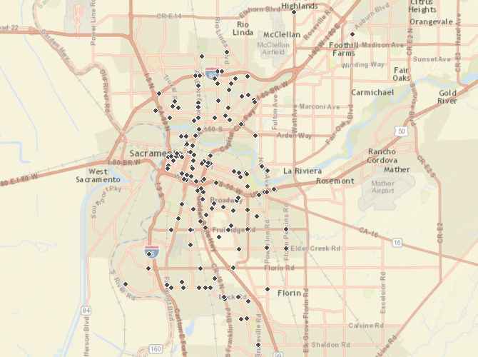
The first map, a point map of the entire city, shows:
- the greatest density of collisions is in downtown/midtown, but there are certainly plenty in other areas
- almost all collisions happen at intersections, not mid-block
- almost all collisions are associated with major streets, called arterials and collectors, which are wide and high speed, intended to move motor vehicle traffic at speed rather than provide for multi-modal transportation
The next map is a heatmap of the same area, and provides a more visual indicator of patterns.
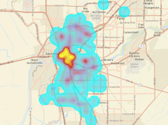
In downtown/midtown, the highest concentration by far is the intersection of J St and 26th St, with a second along 12th St from B St south to the railroad tunnel. I am not sure what explains J St and 26th. The area along 12th St may be due to the large number of people accessing homeless services in this area whose primary mode of transportation is bicycling.

In the south area, the highest concentrations are the intersection of Fruitridge Rd and 24th St, the intersection of Stockton Blvd and 11th Ave, and (just south of map) the intersection of Mack Rd and Franklin Blvd. Though Stockton is a known hazard for bicyclists, I don’t know what explains the particular hotspot at 11th St. Fruitridge and 24th is a busy intersection, with Fruitridge experiencing traffic speeds much above the speed limit.

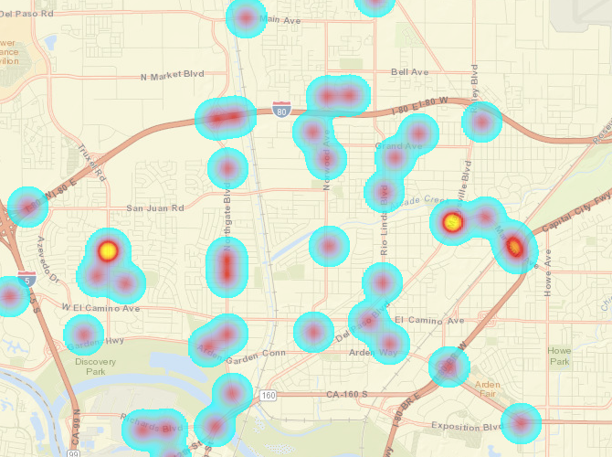
In the north area, there are two concentrations, at Truxel Rd and Pebblewood Dr, and at Marysville Rd and Arcade Blvd but also stretching east along Arcade Blvd and Marconi Ave. I am unsure why that particular spot along Truxel. Marysville and Arcade is a busy intersection and Marysville in particular has high speed traffic.

Glad to see your good work Dan.
LikeLike