Prior posts on this project, and previous permutations, are available at category: StocktonBlvd.
The City of Sacramento (and partners SacRT and Sacramento County are hosting a public workshop on Thursday, April 15, on the Stockton Blvd Safety and Transit Enhancement Project (STEP). The workshop will start 5:30 PM at the Oak Park Community Center, 3425 Martin Luther King Junior Boulevard, Sacramento, CA 95817. Registration is available (Eventbrite) but not required.
There will probably be a slide presentation, and display boards showing in some detail aspects of the project. These workshops offer the public sticky notes that can be placed on the display boards, and comment cards. If you’d like to see these ahead of time to ponder, or to visit specific sites, tough luck. The city doesn’t do that.
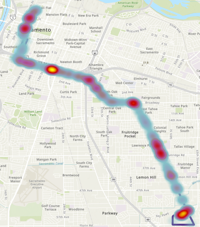
Though the project is about the entire SacRT Route 51, the highest ridership of the system and one of only a few high-frequency (15 minute) routes, the roadway changes would almost entirely be on Stockton Blvd.
The project has three main aspects:
- Create a transit priority street for Stockton Blvd between Florin Road and Broadway, or perhaps T Street. This will be a bus rapid transit (BRT)-light facility, with dedicated bus lanes (red) in part, and improved bus stops.
- Add bike lanes, usually buffered but not separated, to Stockton Blvd.
- Add and improve pedestrian crossings of Stockton Blvd, which current has few safe crossings.
Two bus route alignments are being considered, the existing Route 51, and an alternative 2 that would continue on Stockton north of Broadway to T Street, thereby serving Aggie Square/UC Davis Medical Center.
What the project neglects is:
- Wider sidewalks. These should be a minimum of 8 feet. Existing sidewalks are often 4 to 6 feet, and are curb-attached, immediately adjacent to motor vehicle danger.
- Trees, and the wide sidewalk buffers (8 feet minimum) necessary to host healthy trees without root heaves that buckle sidewalks over time.
Though the project benefits include “More inviting public spaces with improved lighting and landscaping”, there are so far no details on what that means. Lighting is often ‘motor vehicle scale’ on tall standards and illuminating the roadway, not ‘pedestrian scale’ and illuminating the sidewalk for safety and aesthetics. Though there are a few locations in Sacramento with pedestrian scale lighting, these were installed by developers long ago when people walking were considered more important than people driving.
What are your thoughts? Concerns? Ideas? If you aren’t able to make the workshop, there is also a survey. The survey asks for your use and interest pattern, but is not intended to gather detailed feedback.