Obviously there are different kinds of streets that serve different purposes. One of the simplest is street-stroad-road, the Strong Town concept that there should be only streets and roads, and the combination is a failure which they have labeled stroads. But a two-category classification is probably too simple.
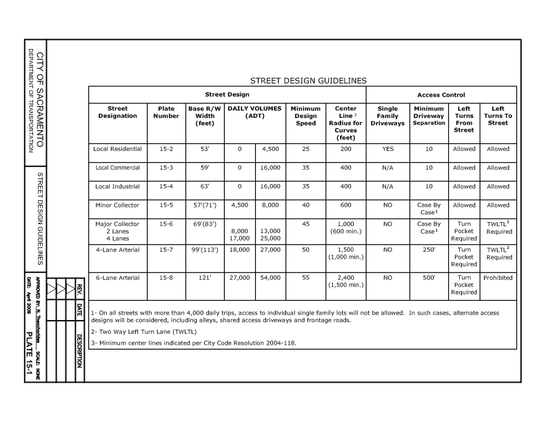
The existing City of Sacramento Street Design Standards (2009) offers the table below.

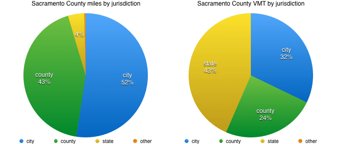
Both of these classification systems were developed for and reflect motor vehicle throughput. The more vehicles and the more speed, the higher the classification. This is the wrong way to go about designing roadways. It assumes that the primary purpose of roadways is to move motor vehicles. We know that is not true, or at least shouldn’t be true.
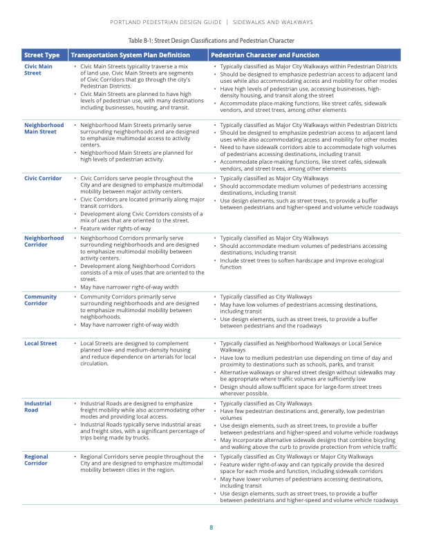
Portland (PBOT) uses a street classification system with eleven street designs, which are supplemented by five pedestrian classifications, four bicycle classifications, six transit classifications, and nine freight classifications. Yow! An advantage of the Portland system is that it includes details about each category, including land use, lanes, width, function, curb zone, separation, design elements, design treatment, and utilities. The Pedestrian Design Guide, simplifies down to eight classifications, shown below (pdf).
First, I believe that it is critically important that the city drop use of functional classification from its updated street design standards. Not only does the public not understand this classification system, it leads to roadways dominated by motor vehicles. That is not what we want in the city.
I don’t yet know what street classification system might work well for Sacramento, but I am certainly thinking about it, and researching for it. Probably not more than five classifications, for simplicity of understanding by the public, and so that the number of different designs are limited.
I have written about a three-classification system based on speed. That is a useful concept, and easy to understand, but it does not illuminate the surrounding land use nor the feeling and livability of the street. So rather than being a classification, speed limits (design and posted) should be set for each street classification, after the classification description is developed.