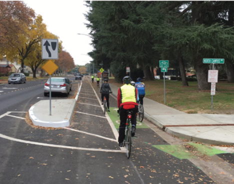
Marysville Blvd VZ Phase 1 complete

This post updates the Marysville Blvd VZ Safety Project starts post from March 2026. The Phase 1 quick-build project is complete.

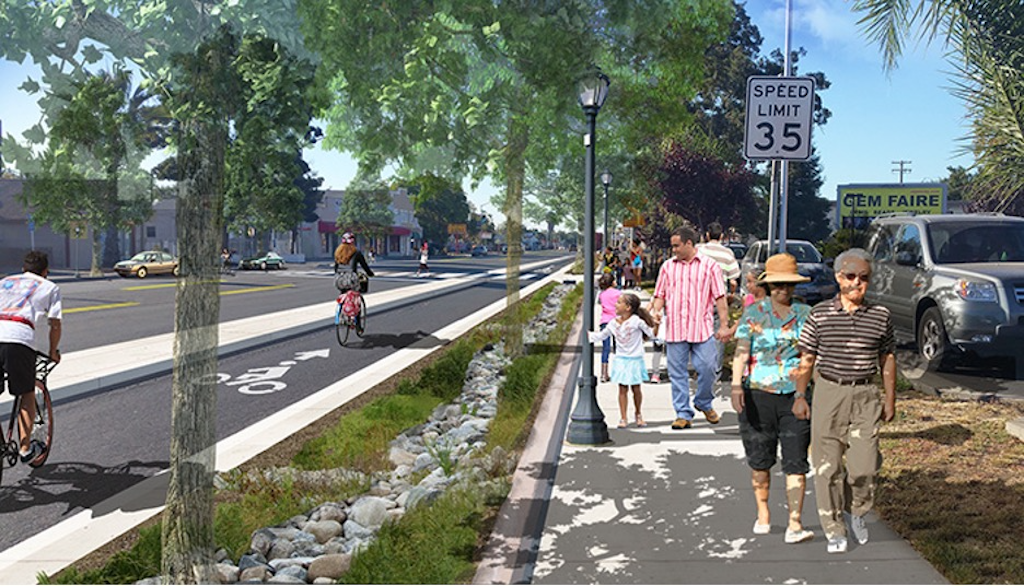
Northbound, the project starts just beyond Los Robles Blvd, and ends at Grand Avenue. Southbound, the project starts just beyond Harris Avenue, and ends just beyond Nogales Street. The focus of the project is narrowing the roadway from four lanes to two lanes with adjacent bike lanes or separated bikeways. Some bicycle facilities are just paint on the ground, while some stretches use vertical delineator (both green K-71 and white ‘wands’ with bases). A typical section is below. The bike lanes at the north and south ends are of poor quality, depending on the gutter pan with a strong linear seam to achieve minimum width. In the middle section, the quality varies but is mostly acceptable.

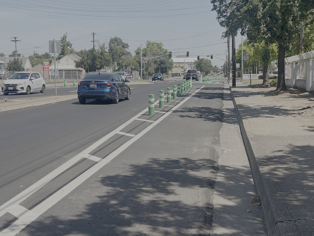
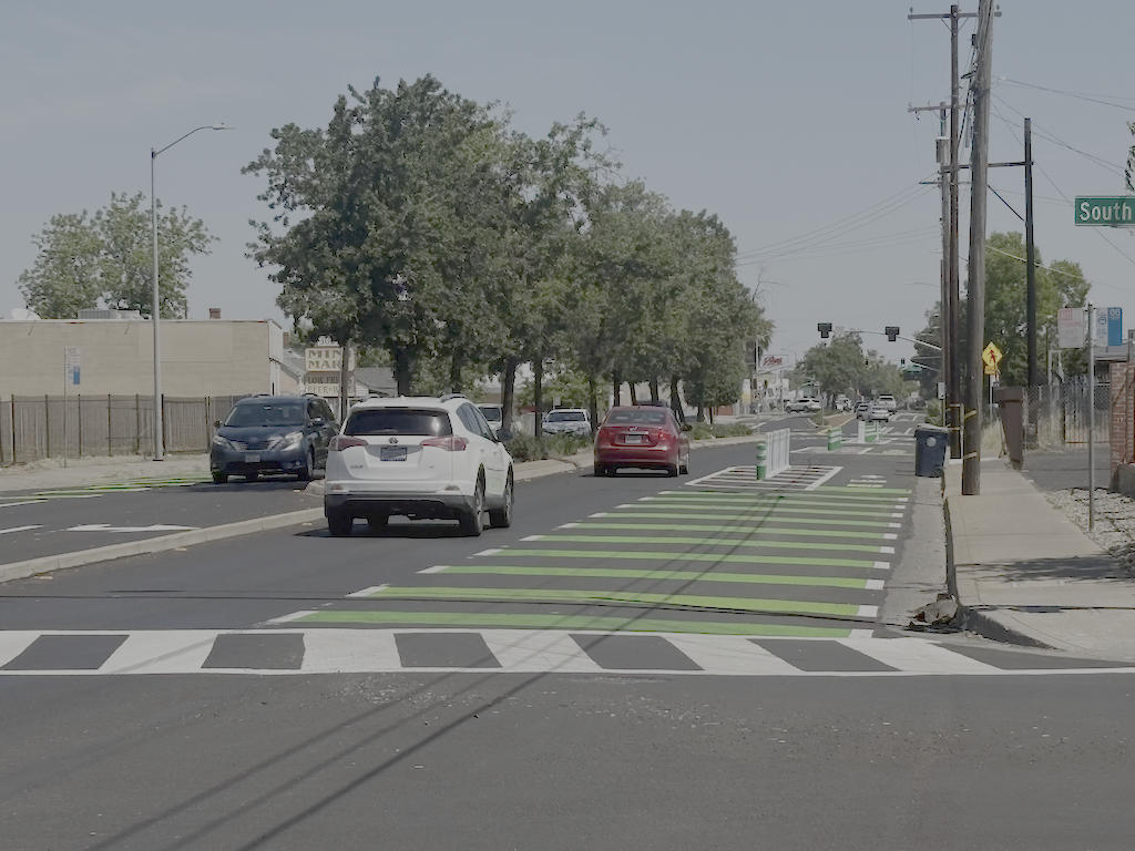
photo of Marysville Blvd northbound, north of Rosalind St, separated bikeway with K-71 delineators
Marysville Blvd northbound, north of Rosalind St, separated bikeway with K-71 delineators

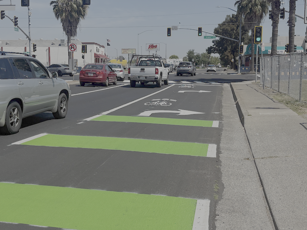
The project uses shared bike lane/turn lane areas at Grand Avenue, below. This is not the worst design, placing bike lanes to the right of right-turning vehicles, but neither will it be comfortable for many bicyclists.

photo of Marysville Blvd northbound at Grand Ave, shared bike lane and right turn lane
Marysville Blvd northbound at Grand Ave, shared bike lane and right turn lane

Observing motor vehicle traffic on a Saturday, it appears that drivers have adjusted to the change. Though the varying treatment of the right-of-way might be confusing, it seems to be handled OK. The only issue is that a police motorcycle used the bike lane to bypass traffic, and almost hit me. I did not see anyone bicycling along Marysville, though I did see a number of bicyclists crossing Marysville at side streets.

The signal faces at Marysville Blvd and Grand Avenue were replaced. Other signals were not changed, so far as I can determine. One of the signal faces for Marysville northbound at Grand is out, probably due to mis-wiring.

SacRT bus Route 86 runs on this section of Marysville Blvd. Bus stops were marked with dashed (skip) green markings for sharing with bicyclists, below. I suspect the bus area is not long enough for bus use, but since I did not see an buses along the route today, I’m not sure. The bus only runs once per hour on Saturdays. I think the design is safe for bicyclists since it is such a clearly marked area. The only better design would be a bikeway behind (curb-side) from a bus boarding island, though with only one lane for motor vehicles, the city is very reluctant to have buses stop in traffic. I’ve got not problem with it, transit riders have no problem with it, but engineers just can’t stomach giving priority to buses.

photo of Marysville Blvd shared bus and bike area
Marysville Blvd shared bus and bike area

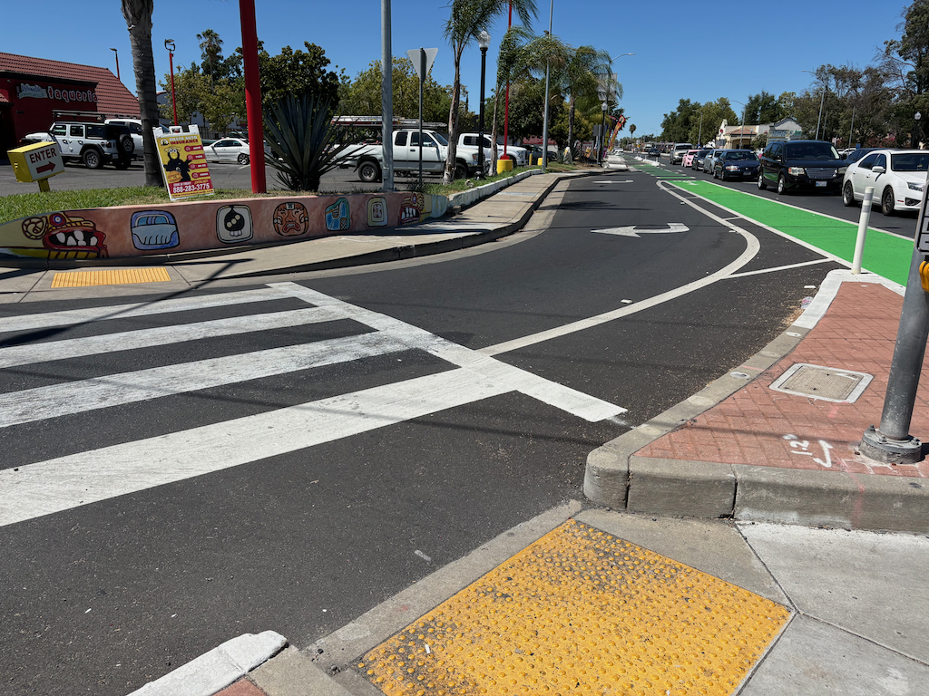
No improvements to sidewalks were made, not even corner curb ramps at the most critical intersection of Marysville Blvd and Grand Avenue.

This section of Marysville Blvd is characterized by:

  • moderate to poor sidewalk conditions and width
  • sidewalk cross-slopes at nearly every driveway, which is a hazard for mobility devices and many walkers
  • abandoned business building, and abandoned parcels that may have once been occupied by businesses or residences
  • an excess for driveways, most of are not in use; a number of the parcels have two or more abandoned driveways; even the City of Sacramento Hagginwood Park has an abandoned driveway

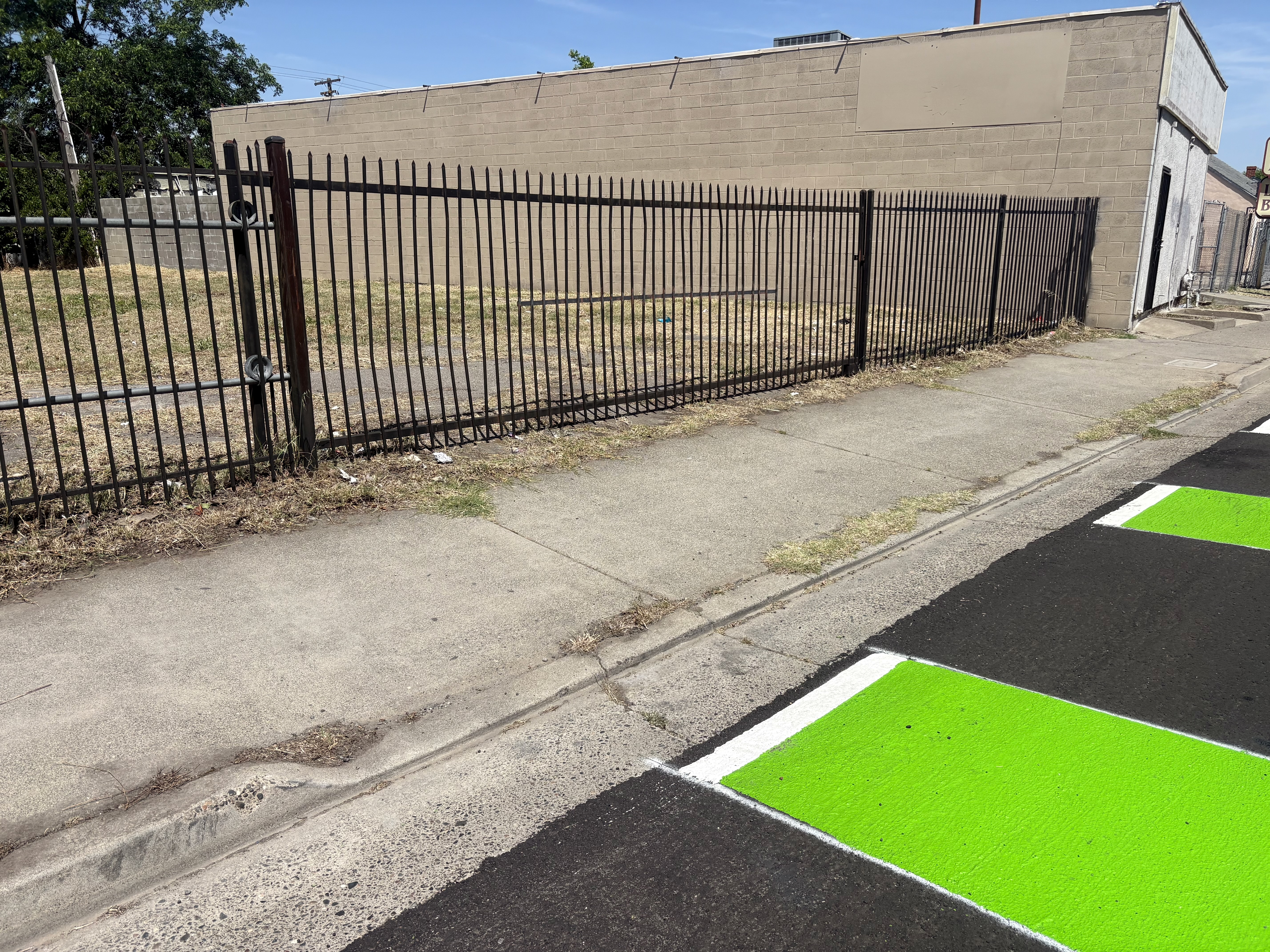
One example of a driveway that slopes across the sidewalk is below. There are dozens of locations just in this section of Marysville, to say nothing of north and south of the project. Some are active driveways for commercial buildings and residences, but probably at least one-third are abandoned, serving no purpose whatsoever except to make the walking/rolling experience less pleasant and more dangerous.

photo of 3617 Marysville Blvd, abandoned driveway with cross-sidewalk slope
3617 Marysville Blvd, abandoned driveway with cross-sidewalk slope

The project has done nothing to improve the walkability of Marysville Blvd.

The signal which seems to be most confusing to walkers and drivers is the partial signal at Los Robles Blvd on the east and Hagginwood Park on the west. It was not improved in any way. Drivers are unclear about the signal, and so are not sure whether to yield to walkers in the two crosswalks.

I will have at least one more post on Phase 2 of the project, which is not fully funded and has not started.

Photos on Flickr: Marysville-Blvd; https://www.flickr.com/photos/allisondan/albums/72177720333687456

H Street Bikeway: driveway speed bumps

For other posts on the H Street Bikeway project, see category: H Street Bikeway. For the city webpage on the project, see H Street Bikeway to Sacramento Valley Station.

The H Street Bikeway design has 6 driveways crossing it, 2 on 5th Street to 6th Street, 3 on 6th Street to 7th Street, 1 on 7th Street to 8th Street, and none on 8th Street to 10th Street. Though none of these driveways are heavily used, all are potential conflict points for the bikeway. The 30% design diagrams do not detail how these driveways crossing the separated bikeway will be handled. It is imperative that motor vehicles using the bikeway are moving slowly enough that drivers will see and yield to bicyclists, and bicyclists have time to avoid collisions with drivers who do not yield.

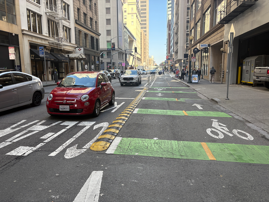
San Francisco has a two-way separated bikeway (cycletrack) on Battery Street in the financial district. Each driveway has speed control devices to ensure that drivers are moving slowly entering and exiting the driveways. The photo below shows one installation, between Pine Street and Bush Street. As a frequent user of this bikeway, I can attest that they are a critical safety feature.

A note about speed bumps. Speed bumps are illegal across roadways in the US. They are most often seen in parking lots, where they are still legal. This use across driveways, and not streets, is legal. The traffic calming devices that are legal across roadways are speed humps, speed cushions, and speed tables.

photo of speed bumps across driveway on Battery St bikeway
speed bumps across driveway on Battery St two-way bikeway, San Francisco

Freeport Blvd Transportation Plan

The City of Sacramento has released the final draft Freeport Blvd Transportation Plan. Appendix F Design Layouts is a key part of the document. This post reflects my original comments (Freeport Boulevard Emerging Design Concepts) and the new plan. The city’s plan page is at http://www.cityofsacramento.org/Public-Works/Transportation/Planning-Projects/Freeport-Blvd-Corridor. The plan is on the Active Transportation Commission agenda for January 20, 2023, and will go to the city council within the next two months.

The ten common design elements on page 21 (24 of the pdf) include: “10. Maintained necessary travel lanes, turn lanes, and parking: Maintaining travel lanes and turn lanes ensures that drivers traveling along the corridor will not be compromised, and preserving parking spaces where 5 the utilization is higher so it serves better adjoining businesses.” This is statement is contrary to all walkability, bikeability and vision zero goals. It should be removed from the document, and removed from planning goals. It is offensive. It means that no matter what other improvements to the corridor will be made, cars and motor vehicle drivers will be preferenced over all others.

The ten common design elements do not mention trees. Trees are an integral part of the walking experience, as well as providing climate and heat island benefits. They should be prominently recognized throughout the document, but they are not. The phrase ‘existing trees’ occurs many time in the document, but nowhere are ‘proposed trees’ identified.

Frequent driveways along much of this section present hazards to walkers and bicyclists, and handicap the design of safe streets. It is clear that the city did not consider reduction or narrowing of driveways to address this hazard. If you look at the design layouts (Appendix F), the number of gaps in the bikeway, shown as dashed green, is remarkable. Each of these is a driveway. Again, this is a clear indication that the city intended to maintain the car-dominated character of this street.

All crosswalks at intersections should contain all three or four legs (three for T-intersections). The design leaves many intersections with only one crosswalk over Freeport Blvd, meaning pedestrians must cross three streets in order to reach some destinations, rather than just one. Though not mentioned in the plan, this often means installing pedestrian crossing prohibition signs and barriers. These should be outlawed, not encouraged.

North Section

pages 25-26 (28-29 in the pdf)

The intersection of Sutterville Road to the east with Freeport Blvd is shown with a two-lane roundabout. Two lane roundabouts have almost none of the traffic calming and safety benefits of one lane roundabouts, in fact they should not even be called roundabouts, with the implication that they have safety benefits. This roundabout should be redesigned to a single-lane. Traffic levels on Freeport to the north certainly do not justify two lanes, in fact Freeport become single lane each direction a short distance to the north at 13th Avenue.

The dedicated right turn lane on Freeport Blvd southbound at Sutterville Road to the west is not needed and presents an unnecessary hazard to bicyclists. Dedicated right turn lanes should be eliminated from this plan, and from all city roadways. They are rarely justified by traffic volume, create conflicts for bicyclists, and widen roadways and therefore crossing distances for walkers. They also encourage drivers to make right hand turns without looking for people walking.

There should be a crosswalk on the north side of the Freeport-Sutterville intersection. There is no justification for leaving it out, unless an attempt to discourage walkers from accessing the park.

South Section

pages 27-31 (30-34 in the pdf)

The offset crosswalks with median refuge at Oregon Drive and Potrero Way/Virginia Way are a good design, but there is no reason to not provide crosswalks on the other leg of the intersection.

The median gap at Arica Way, with dedicated left turn lanes, is not needed. Arica Way is a low volume street that is a good candidate for right in/right out treatment. The shopping center access can be provided for northbound traffic.

At the intersection of Fruitridge Blvd and Freeport, there should be no dedicated right turn lanes. They create a hazard for bicyclists, that cannot be mitigated by pavement marking, and they lengthen the crossing distance for walkers. In this location, where center refuge medians are not proposed, this is particularly egregious. The dual left turn lanes southbound on Freeport are a hazard to bicyclists and motor vehicles, and should be reduced to a single left turn lane. This intersection, due to long crossing distances, should provide center refuge medians on both the north and south crosswalks.

J St bikeway

The J Street separated bikeway has problems, as has been highlighted by Streets are Better and many others. Separated bikeways are also called protected bike lanes and cycle-tracks, but in California the official term is separate bikeways.

The City of Sacramento placed a separated bikeway on J Street from 19th Street to 29th Street as part of a repaving and roadway reallocation project called the J Street Safety Project in 2018. This was the second such project in Sacramento, the first being portions of P and Q Street downtown, but it was the first in the heavy retail, parking, and traffic environment of J Street.

The theory of these parking-protected bikeways is that the row of parked cars protects bicyclists from moving cars, and this is true in the length of the block (but not at intersections, which are a separate issue), when there are parked cars. But some times of day there are not parked cars, and throughout the day as cars come and go (particularly on a retail corridor), protection is lacking.

It is true that bikeways don’t need strong protection from PARKed cars, but they do need protection from PARKing cars and delivery vehicles, and bikeway intrusion.

Vertical delineators and pavement markings were used to set off the bikeway, with a sign at the beginning of each block segment showing the new allocation. These vertical delineators are also called bollards and soft-hit posts, with soft-hit meaning that they won’t damage cars when drivers hit them. The first photo below shows the 27th to 28th section. It initially had 14 delineators place, but only three are remaining. The other blocks have fared a little bit better, but overall about half the delineators are gone. The second photo shows the 25th to 26th section sign that has been run over by a driver.

J Street bikeway, 27th to 28th section, missing delineators
J Street bikeway, damaged sign

Some of the vertical delineators are being run over by people parking, some by delivery vehicles parking on top of them, and some by drivers going down the bikeway itself. And probably some just for sport. I don’t know which of these causes are most common.

There are several solutions:

One: Put the delineators closer together so as to make it more obvious that vehicles are not supposed to cross them.

Two: Add bollards which either are, or at least look to be, more substantial. The photo below is from a somewhat different setting in Oakland, with more substantial bollards. Reading blogs and Twitter, these seem to be successful in some cities and some settings, but not in others.

bollards in Oakland

Three: More substantial separators such as planter boxes.

planter separated diagram from C40

Four: Partial hard curbs or medians. The photo shows a median at the start of a bikeway section. It reduces the number of signs flattened by drivers and signals to drivers that there is something different about this block.

bikeway with hard median start, FresnoCOG

Five: Continuous hard physical curb or median. It is hard to find good photos of these, probably because in the past they haven’t been seen as necessary. There are a lot of photos of hard medians adjacent to moving traffic, and adjacent to two-way cycle-tracks, and alongside raised bike lanes that are at or close to sidewalk level. But the graphic below gives the general idea.

Of course hard curbs or medians are more expensive, but last 20-30 years whereas delineators or bollards may need to be replaced every year, so I think they are a good investment.

A major issue with all separate bikeways is the presence of driveways. In fact streets with a high density of driveways should not have this design. Below at the blocks of the bikeway, with information about driveways.

19th3 drivewayspartially separated; driveways not changeable
20th3 driveways2 changeable driveways
21st1 drivewaydriveway not changeable
22nd2 driveways2 changeable driveways
23rdno driveways
24th2 driveways1 maybe changeable
25thno driveways
26thno driveways
27thno driveways
28th2 drivewayspartially separated; 1 driveway changeable

The changeable driveways will be the topic of a separate post, but the basic idea is that parking lots that have access to the alleyway do not need access to the main street, so in this case, parking lots with access to Jazz Alley do not need access to J Street.

My recommendations

  1. Place hard medians at the beginning of each block, to protect the signs, and better signify to drivers this is a different place. For the locations where there are bus stops (19th, 22nd, 25th, 27th, 28th), the median would be moved down the block a bit. Note that this is too high a frequency of bus stops, but that is an issue for another post.
  2. Place more substantial bollards, and at a closer spacing.
  3. Place a continuous hard median on one of the four blocks without driveways, the same width at the painted buffers present now. This would be a pilot to test the installation, determine costs, and document benefits. If the pilot is successful, the other three blocks with no driveways should receive the same treatment.
  4. Start negotiation between the city and the owners of parcels that are used solely as parking lots, to close J Street driveways and use Jazz Alley access. Some of these parcels will be redeveloped into more productive uses anyway, but that may take longer than desired.

Getting around… with a knee scooter

I fractured a bone in my right foot on July 7 while backpacking along the Pacific Crest Trail in the Granite Chief Wilderness. I initially thought it was a tendon problem, because I’d had some discomfort with the tendon before, however, in stepping on the outside edge of my foot on a rock, the pain level increased manifold. I walked out on it. On Friday, I went into the doctor, got an x-ray, and now have a lower leg cast. What does this have to do with transportation? Well, I’m now getting around with a knee scooter, rather than walking or bicycling.

It has been interesting, and here is my take on it so far. The knee scooter has small wheels, about eight inches, so it is less stable than a bicycle, or a wheelchair. Because it is somewhat unstable, I use a lot of energy maintaining balance. Though I’ve noticed, now that I’m paying more attention to people using wheelchairs, that the unpowered ones are not all that stable either. But it does move along quickly, faster than walking though not as fast as bicycling.

Read More »