Note: General information on the Top 20 intersections, with criteria, list, and map, is available in post 1.Other posts on Top 20 intersections are available at Tag: Top 20 Intersections.
I am looking more closely at the Top 20 intersections identified in the City of Sacramento Vision Zero Action Plan Update. Intersection 2 is Fruitridge Road and Stockton Blvd.
Design
Lanes: Stockton Blvd at this intersection is 7 lanes wide (two through, two left turn, one right turn, and two opposing). Fruitridge westbound is 5 lanes wide (two through, one left turn, two opposing) while eastbound is 6 lanes wide (two through, one left turn, one right turn, two opposing). Double left turn lanes are a known safety hazard. Total lane count is 25.
Medians: Each leg has medians approaching the intersection.
Crosswalks: All four legs of the intersection have crosswalks, however, they are low-visibility parallel lines.
Bike Facilities: There are Class 2 bike lanes both roadways, but they are discontinuous, become advisory approaching the intersection, and are poorly marked.
Speed: The posted speed limit on Stockton is 35 mph, and on Fruitridge is 40 mph. Both streets are classic suburban sprawl stroads which were designed for, and driven at, much higher speeds than posted.
Transit: The intersection area is served by SacRT route 51 Stockton/Broadway on Stockton, and SacRT route 68 Oak Park on 47th and Stockton.
Crashes
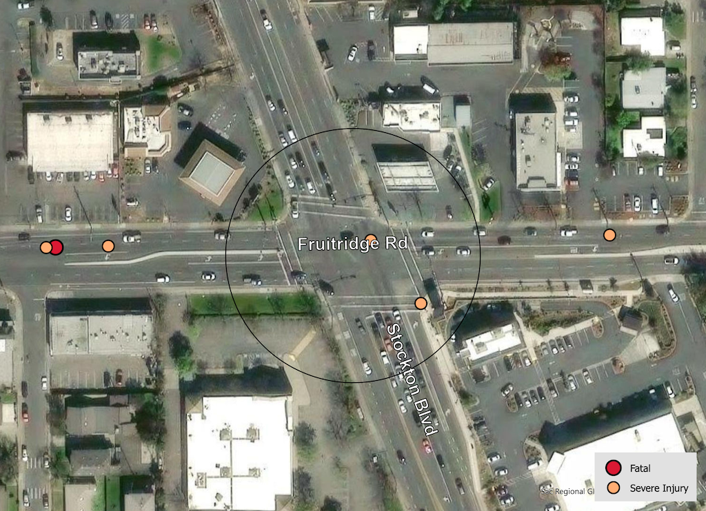
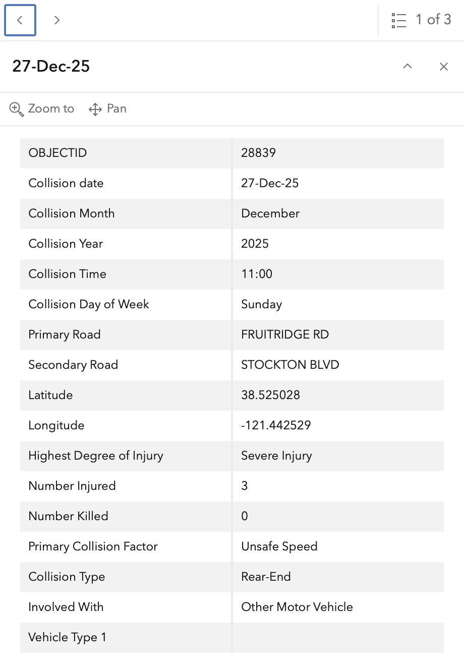
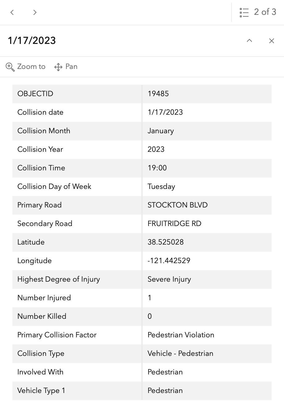
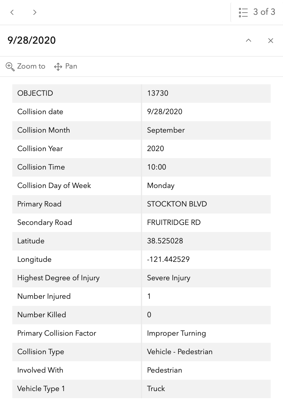
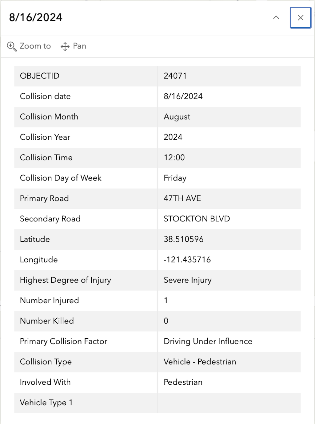
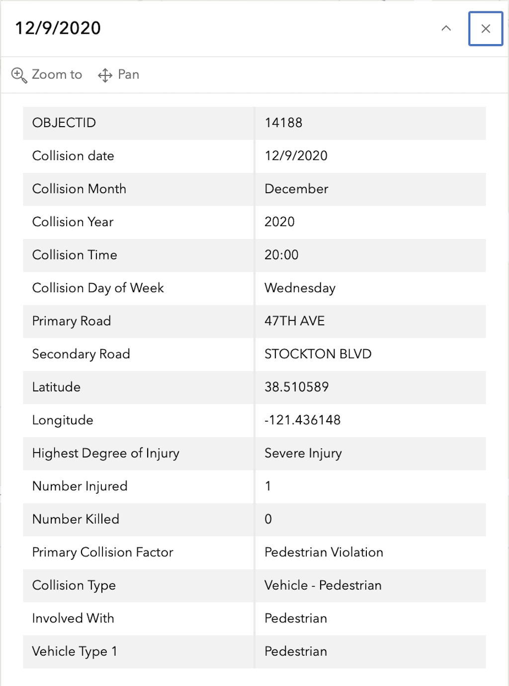
In the 2015 to 2024 period (which is used in the Vision Zero Action Plan Update), there were four severe injuries at this intersection, two with pedestrians and two with motor vehicles, mapped below (pdf). Please note that the exact crash locations may not be accurate, as police reports often do not correctly locate crashes. Also note that ‘pedestrian violation’ entry may be false, as police often blame crashes on the person walking when actual responsibility is not clear, or the pedestrian is dead and can’t counter the driver story.
The orange dots are severe injuries (one contains three crashes); there are no red dots (fatal). Together, these are know as KSI = killed or severe injury. ‘The other categories of crashes, ‘Other visible injury’ and ‘complaint of pain’ crashes are not shown on my map, since these are not the focus of Vision Zero, however, there are quite a number of these at this intersection, on both Stockton and Fruitridge, which you may view in the Crash Dashboard Interactive Map.
Note: This is only one of 20 intersections. It is unlikely that I will be able to map and analyze all, but this post will provide an indication of the information available. General information on the Top 20 intersections, with criteria, list, and map, follows the information about this intersection.
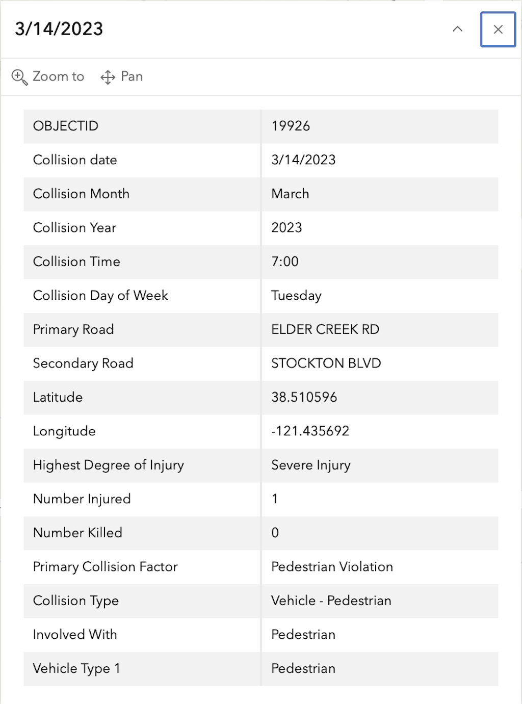
I am looking more closely at the Top 20 intersections identified in the City of Sacramento Vision Zero Action Plan Update. The intersection at the top of the list is Elder Creek Road/47th Avenue and Stockton Blvd. This is mis-labeled in the document, as Elder Creek Rd and 47th Ave, but the east-west roadway changes names at Stockton Blvd, so the intersection is with both roads and Stockton Blvd.
Design
Lanes: Stockton Blvd at this intersection is 7 lanes wide (two northbound, two southbound left turn, two southbound through, and one southbound right turn). 47th Avenue is 6 lanes wide (two westbound, two eastbound through, and two eastbound left).
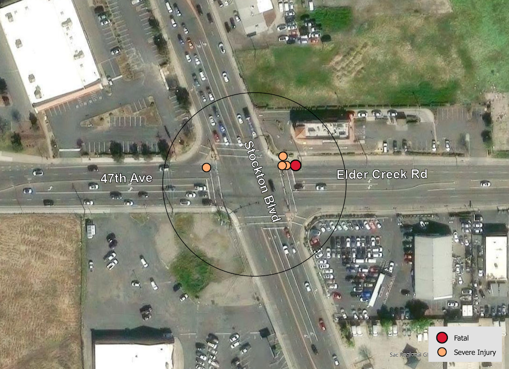
Elder Creek Road is 6 lanes wide (two eastbound, two westbound left turn, two westbound through), but also has a 6.5 foot wide ‘lane’ on the right that appears to be used as a right turn lane by some drivers. This indeterminate lane seems to be the locale of four of the five crashes at this intersection.
The intersection has two uncontrolled slip lanes, which are a known safety hazard, from Stockton Blvd southbound to 47th Avenue westbound, and Stockton Blvd northbound to Elder Creek Road eastbound. However, these were not the location of the crashes shown.The intersection has double left turn lanes on all legs, which are a known safety hazard. However, these were not the location of the crashes shown.
Total lane count is 26.
Medians: All four legs of the intersection have concrete medians.
Crosswalks: All four legs of the intersection have crosswalks, however, these are low-visibility parallel lines.
Bicycle Facilities: All roadways have Class 2 bike lanes, however, they have major gaps, are poorly marked, become advisory approaching the intersection. None have green paint or protection.
Speed: The posted speed limit on Stockton is 40 mph, on Elder Creek is 45 mph (!), and on 47th is 40 mph.
Transit: The intersection area is served by SacRT routes 51 Stockton Broadway and 68 Oak Park.
Crashes
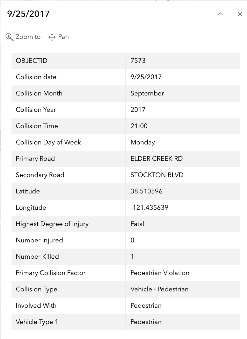
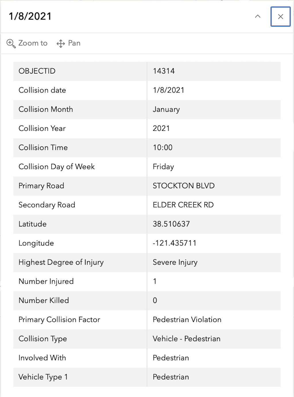
In the 2015 to 2024 period (which is used in the Vision Zero Action Plan Update), there was one fatality and four severe injuries at this intersection, all of pedestrians, mapped below (pdf). Please note that the exact crash locations may not be accurate, as police reports often do not correctly locate crashes. Also note that ‘pedestrian violation’ entry may be false, as police often blame crashes on the person walking when actual responsibility is not clear, or the pedestrian is dead and can’t counter the driver story.
The red dot is the fatal, and the orange dots (one is covered by another) are severe injuries. Together, these are know as KSI = killed or severe injury. The other categories of crashes, ‘other visible injury’ and ‘complaint of pain’ are not shown on my map, since these are not the focus of Vision Zero, however, there are quite a number of these at this intersection, concentrated on the crosswalk over Elder Creek Road on the east side of the intersection, which you may view in the Crash Dashboard Interactive Map.
SacCity Elder Creek Rd/47th Ave and Stockton intersection crashes
The selection criteria for the Top 20 Intersections is: “These intersections scored within the top 0.5 percentile of all intersections on the updated High-Injury Network. They are sorted by KSI crashes within a 150 foot radius.”
It is not clear how this criteria was used. Though there is some information about how the the High Injury Network (HIN) was developed, there is none on the Top 20 intersections, nor are there scores that led to the ranking. For intersection 3 Truxel & Arena, and 7 San Juan Rd & Northgate Blvd, there aren’t any KSI crashes, so I don’t know how they ended up on the list.
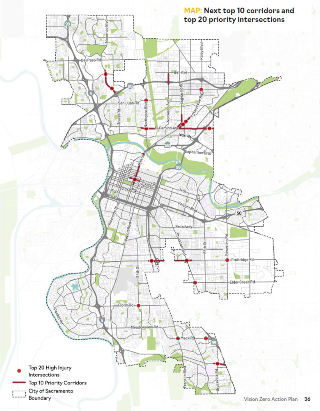
The list (pdf) of Top 10 corridors and Top 20 intersections is shown below, followed by the map (pdf) of these.
Note: I had said I was pausing on the proposed transportation sales tax Measure 2022, but I’d forgotten to write about interchanges.
The proposed transportation sales tax measure Exhibit A: Transportation Expenditure Plan includes 31 instances of ‘interchange’. If you aren’t familiar with the term, it means the intersection of freeways and expressways with other sorts of roadway, or with other freeways and expressways. Two examples, one of a freeway interchange, and one of a freeway and arterial interchange:
Hwy 50 & Business 80 & Hwy 99 interchangeHwy 5 & Cosumnes River Blvd interchange
Interchanges are very popular in the proposal.
location
#
Citrus Heights
2
Elk Grove
2
Folsom
5
Galt
1
Rancho Cordova
4
City of Sacramento
5
County of Sacramento
2
Highway Congestion Improvements
4
interchanges in the TEP
Interchanges are very expensive. Miles of sidewalk or bike lanes could be constructed for the cost of one single interchange. Or new buses or bus-only lanes, or new light rail cars, or a bike-share program. Interchanges are far more expensive than the straight sections of freeways. Interchanges take a good deal of land, removing it from productive use and leaving wastelands in between that are not accessible and not usable for anything else. Interchanges are complex for drivers, so have many far more crashes than the straight sections.
Probably most important, freeway on-ramps and off-ramps create the most hostile and dangerous points for people walking and bicycling. Though interchanges can be build with right angle turns to enter from and exit to surface streets, and can be signalized so as to allow safe passage by walkers and bicyclist, they were never built that way in the past, and are only sometimes built that way now. Instead, there are swooping on-ramps that encourage drivers to reach freeway speeds while still on the surface street and ramp, and off-ramps that encourage drivers to maintain freeway speeds coming off the ramp and continuing on the surface streets. If you don’t believe this, please watch a freeway off-ramp for a while, for example, if you live in central city Sacramento, I-5 to P Street off-ramp, or I Street to I-5 on-ramp. You will see people going 55 mph or more on the surface street, slow to decelerate and quick to accelerate. Freeway on-ramps and off-ramps kill hundreds of walkers and bicyclist a year.
Our freeway system was essentially complete years ago, with the 1972 completion of the I-80 (then I-880) northern bypass. Freeways provide quick travel from point A to point B. As earlier explained in the streets – stroads – roads post, roads that imitate railroads, for quick travel between productive places, are a good thing. The original idea of Interstate highways was, for the most part, a good idea. Of course then they were driven through the heart of cities, including Sacramento, lost most of their value as travel routes, and destroyed the value of the cities they went through.
So why, now, do we need more interchanges, more points of access to and from freeways? The answer is almost entirely greenfield development, and the promotion of car trips for commuters from those greenfield developments. Interstate 5 and Interstate 80 could easily handle all the freight and long distance travel demands with two lanes in each direction. So what are all the other lanes for? Commuters. And what are all the new interchanges for? Commuters. Note that in this use of ‘commuter’, I’m including not just home to work trips, but all the other trips that are induced by having more lanes and more interchanges. Job-related trips are now only about 20% of all trips, even before the pandemic. For the existing interchanges proposed to be improved, the reason again is primarily the induced travel through greenfield development. If there weren’t new greenfield development, there wouldn’t be increased traffic.
Each interchange reduces the safety and speed of the freeway. Each interchange encourages motor vehicle trips that would otherwise not occur, by allowing people to travel longer distances more quickly, therefore considering living and working and shopping and recreating in places they would not have otherwise considered. Of course the convenience is illusory. It makes sense right after the new lanes and interchanges are added, but the law of induced travel quickly fills those lanes and those interchanges, generating calls for more lanes and ‘improved’ interchanges. Which induces more travel, which…, well, you get the idea.
If you haven’t, please walk or bike to any of the freeway overpasses in the Sacramento region, and spend some time observing the traffic below. You will see freight traffic, trucks trying to get through the area on their way somewhere else, stuck behind commuter traffic, crawling along. You will see most vehicles carrying a single person, what are called single-occupant vehicles (SOVs), but taking up the space that could be serving multiple individuals. Though there are only a few freeways where buses also run (I-80 towards Davis and I-5 towards the airport), you will see those multi-passenger vehicles stuck in traffic with SOVs.
The second Google map above, showing the new interchange at I-5 and Cosumnes River Blvd, is instructive. Why is the interchange here? To serve the Delta Shores development, which is currently just a suburban big box store shopping area, though it was intended to and may eventually serve new housing. This area was greenfield before, agricultural farming or ranching. The purpose of the interchange is not to serve existing drivers or residents or city, but to create new drivers, new customers in this case. It is true that a portion of the cost of the interchange was paid for by the developers, but there was still a huge cost to us, the taxpayers.
If you want a lot of new and improved interchanges, which induce more motor vehicle trips, pave over greenfield areas, and create serious hazards for walkers and bicyclists, then the proposed measure may be to your liking. If not, then I hope you see it as the wrong road to travel.
Search for category Measure 2022 to see posts as they are added.
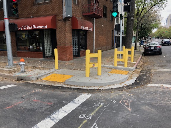
The city has installed substantial bollards on the southwest corner of I Street and 12th Street in an effort to protect the Bangkok@12 Thai Restaurant there.
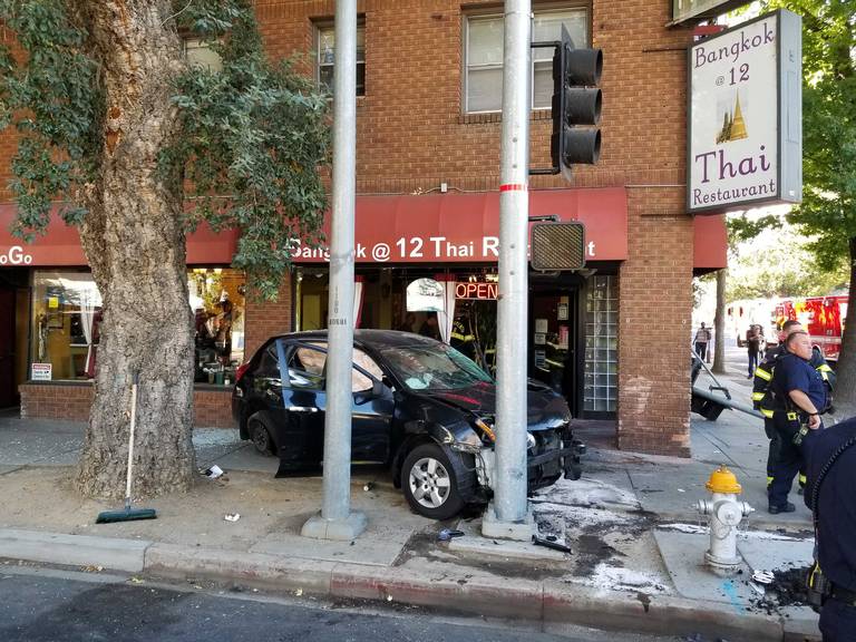
There were at least two major injury crashes into the restaurant in 2019, and the location has a history of crashes (see https://www.sacbee.com/article235349392.html for one example). There were 26 collisions at this intersection in the five year period 2015-2019. This is the most for any intersection in the central city, with the next closest being 19th Street and X Street, at 17.
2019-09-20 crash (photo from SacBee)
Why? Well, the primary reason is that this is the intersection of two 3-lane, one-way arterials, both of which are known to have a history of speeding. The city installed a speed display sign on 12th Street approaching I Street, but has not done so for I Street approaching 12th Street. I had not noticed this sign before yesterday, so I don’t know how long it has been there. Even a brief watch of it indicated that many drivers are exceeding the speed limit, some egregiously so, at more than 10 mph over the speed limit. And then, of course, there are the bollards pictured above. These are not solutions.
The city has identified the section of I Street east of 12th for a reduction in travel lanes from three to two, and that will help. But to the west, no reduction, so drivers will likely be speeding up through the intersection to spread out into the increased capacity. For 12th Street, a reduction from four (!) to three lanes will occur north of H Street, which may reduce speeds approaching here, but in the section between H Street and J Street, it will remain three lanes.
I strongly feel that all roadways of three or more lanes must be reduced to two lanes. Drivers simply cannot be trusted to behave properly on 3-lane roads. It doesn’t matter how much signing we add, or bollards we add, drivers will still speed and will endanger walkers, pedestrians, people in other vehicles, and people sitting down to eat a meal at restaurants.
Solution? The reduction in lanes on I Street must continue westward at least to 10th Street (I would continue it all the way to the freeway, but that is another issue). 12th Street must be reduced from three lanes to two lanes in the section between H Street and J Street (I would reduce it from C Street south). Most of the traffic on 12th Street turns left onto J Street, only a portion continuing south, so having one through lane and one left turn lane would not significantly reduce capacity, but would make things a great deal safer. A bonus would be that the left hand travel lane can be allocated to the exclusive use of the southbound light rail tracks. Currently, the southbound lane is shared between motor vehicles and light rail, and the light rail train is often delayed by congestion and by left turning vehicles. Two birds with one stone, as the saying goes.
The city’s Vision Zero effort focuses on corridors, stretches of street with a high crash rate, and this is not a bad focus, given that most of these corridors are in disadvantaged/disinvested communities. It does not focus on intersections, not even on very high crash rate intersections. San Francisco’s Vision Zero program, one of the leading in the country, identifies the top five corridors, AND the top five intersections. There has been significant though not necessarily complete infrastructure work on each of these. I would like to see the I Street and 12th Street intersection be prioritized for Sacramento.
The credit for returning a low battery $ bike to a drop zone is now $1.00, up from 50 cents.
I notice a lot of scrapes on the bikes. It seems that there are a lot of minor crashes occurring. I have not heard of any major injuries, but there must be a lot of minor injuries going on, because there are minor injuries to the bikes. In addition to the scrapes on the basket, the brake lever, particular the right, is often turned under, which requires some impact to accomplish. The front fenders seem to get bent out of alignment as well.
I have heard directly from several people about crashes on the tracks, particularly along K Street. I initially discounted the rumors, as I assumed that it would be hard for these wide-tired bikes to have problems with tracks, but apparently I was wrong. I’m not sure if these are occurring at the rail crossover (between 9th and 10th), or all along K. K probably sees more bike share bikes than any other street with rails in Sacramento. There are many inexperienced bike riders on these bikes, who may not know that tracks should be crossed at a high angle, 90 degrees perpendicular if possible, but at least 45 degrees. Anything less risks capturing the wheel and taking you someplace you didn’t intend to go.
There seem to be new bikes out (nice and shiny, without scrapes), with 6000 series numbers, so I think that the overall total is now above 600, but I don’t have any specific numbers.
I’m seeing more and more bikes outside the system boundary in Sacramento, some miles outside. I’m not sure if JUMP has given up on charging the out-of-bounds fee, or these are people with money to pay it, but it kind of irritates me, as these bikes are often unavailable until picked up by JUMP field staff, meaning they are used much less than those that stay within the boundaries. I know that an expansion of the boundaries is planned, but I’d heard it will not occur until the system reaches its total of 900 bikes.
The transformation of the central city continues, at least during evenings. There are many fewer private vehicles, fewer ride hailing vehicles, and a continuous stream of JUMP bikes. When I park a bike, it is often gone within five minutes. These bikes are getting used!