Note: General information on the Top 20 intersections, with criteria, list, and map, is available in post 1.
I am looking more closely at the Top 20 intersections identified in the City of Sacramento Vision Zero Action Plan Update. Intersection 2 is Fruitridge Road and Stockton Blvd.
Stockton Blvd at this intersection is 7 lanes wide (two through, two left turn, one right turn, and two opposing). Fruitridge westbound is 5 lanes wide (two through, one left turn, two opposing) while eastbound is 6 lanes wide (two through, one left turn, one right turn, two opposing). Double left turn lanes are a known safety hazard. Each leg has medians approaching the intersection. The posted speed limit on Stockton is 35 mph, and on Fruitridge is 40 mph. Both streets are classic suburban sprawl stroads which were designed for, and driven at, much higher speeds than posted.
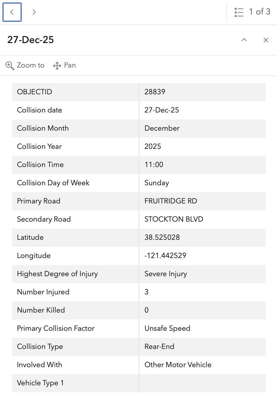
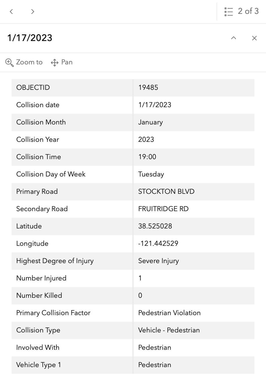
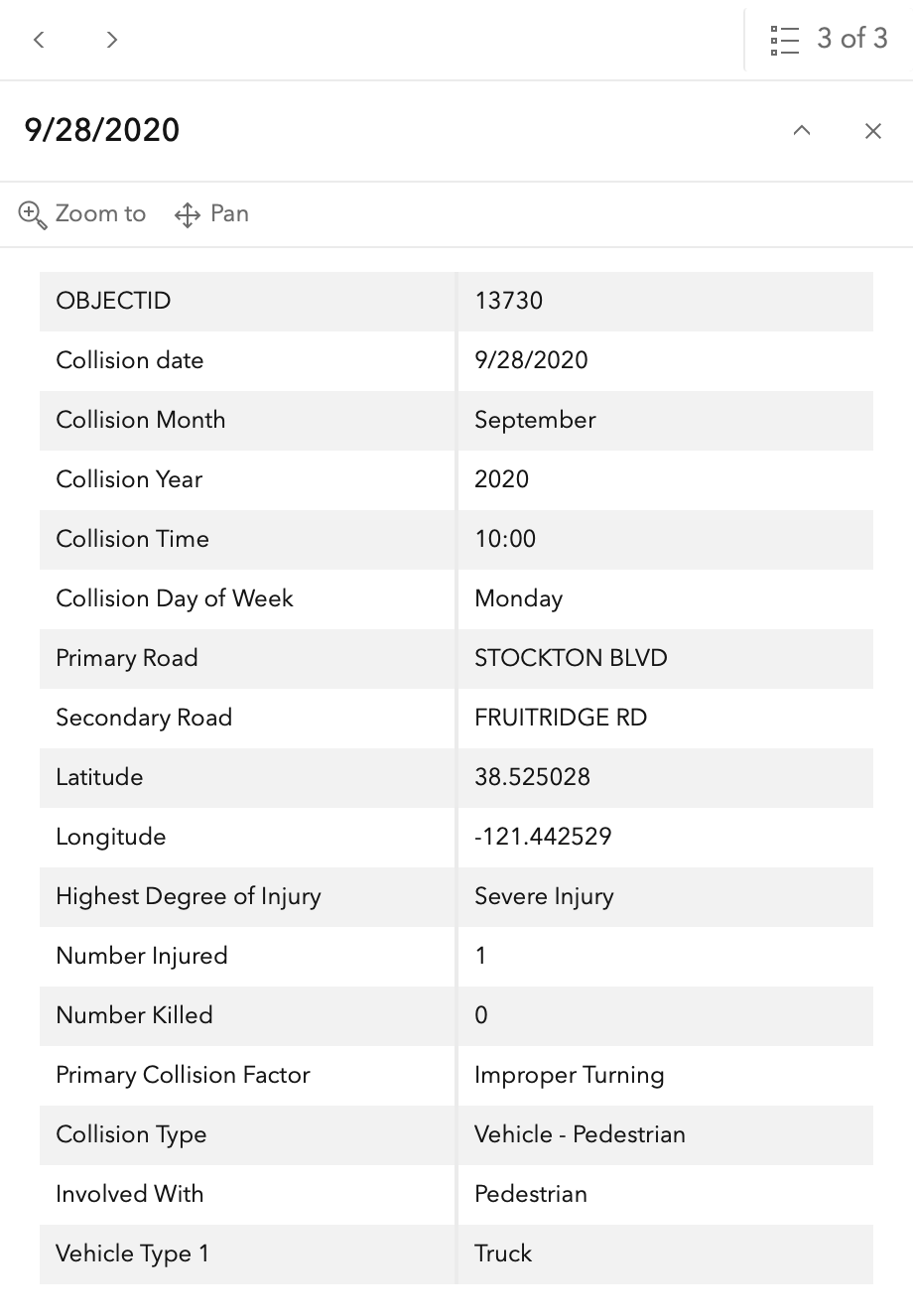
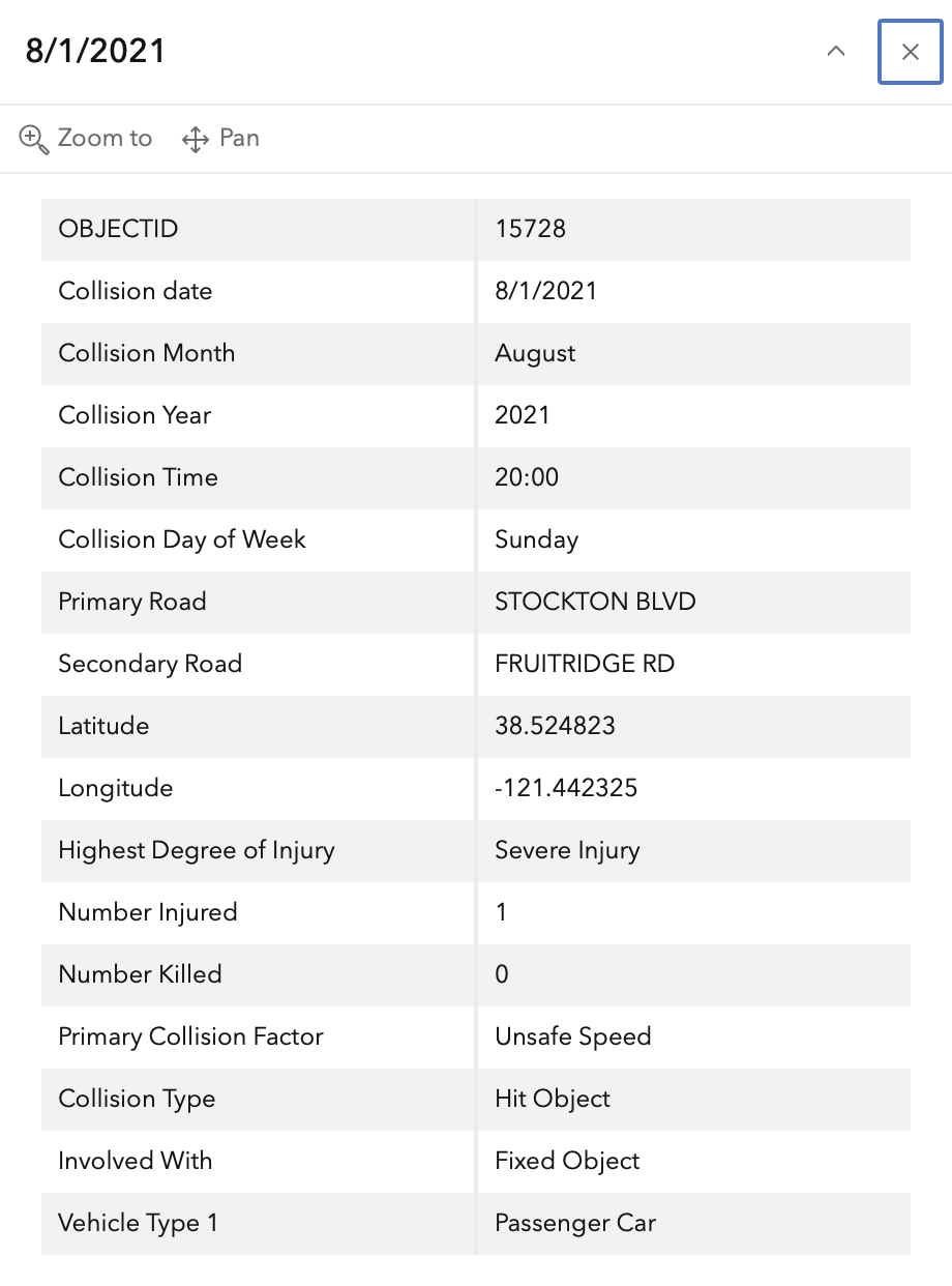
In the 2015 to 2024 period (which is used in the Vision Zero Action Plan Update), there were four severe injuries at this intersection, two with pedestrians and two with motor vehicles, mapped below (pdf). Please note that the exact crash locations may not be accurate, as police reports often do not correctly locate crashes. Also note that ‘pedestrian violation’ entry may be false, as police often blame crashes on the person walking when actual responsibility is not clear, or the pedestrian is dead and can’t counter the driver story.
The orange dots are severe injuries (one contains three crashes); there are no red dots (fatal). Together, these are know as KSI = killed or severe injury. ‘The other categories of crashes, ‘Other visible injury’ and ‘complaint of pain’ crashes are not shown on my map, since these are not the focus of Vision Zero, however, there are quite a number of these at this intersection, on both Stockton and Fruitridge, which you may view in the Crash Dashboard Interactive Map.
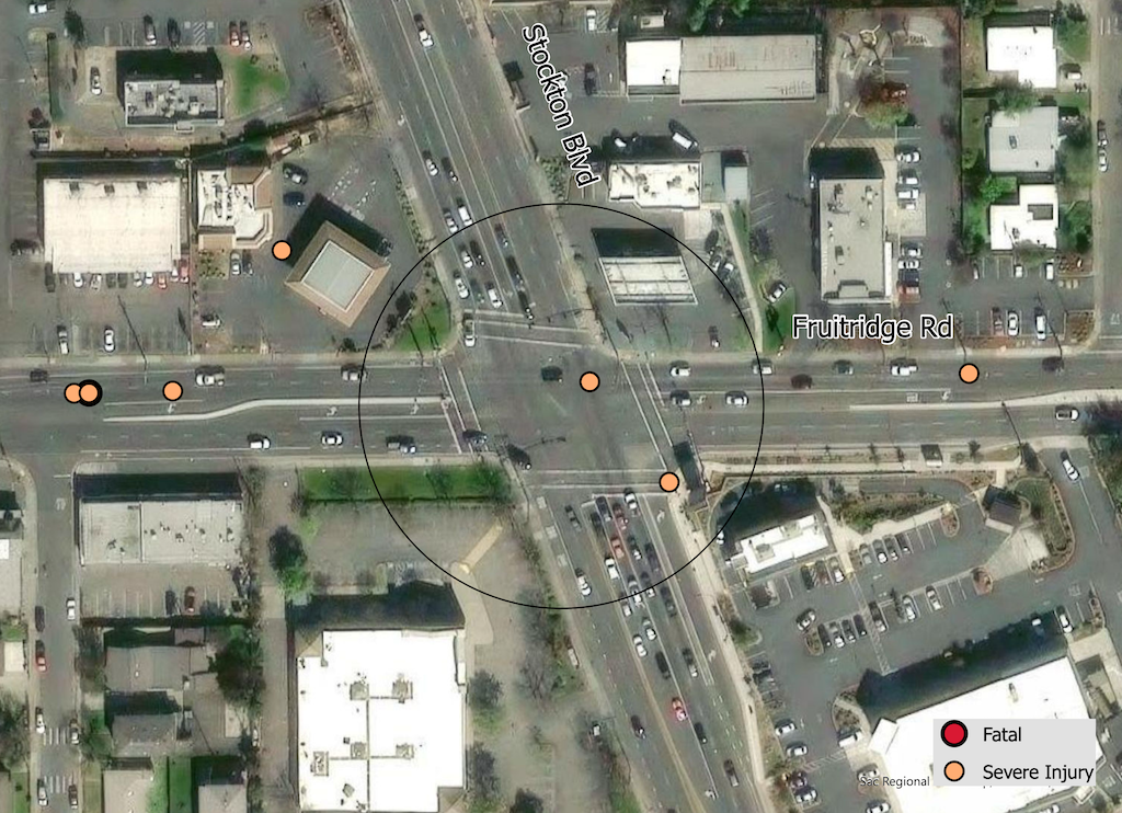
The crash details, available in the Vision Zero Crash Dashboard Interactive Map, are below.