A bicyclist was murdered by a hit-and-run driver on Franklin Blvd four days ago. Hit-and-run driver kills bicyclist, 59, as she repairs bike on Franklin Boulevard (SacBee, 2026-09-03, Darrell Smith). I intentionally use the term ‘murdered’, as I believe that hit-and-run qualifies as murder. It is an intentional decision on the part of the driver to not provide any aide to the victim, possibly saving the life. It is the lowest of driver behavior, and that is a low bar indeed. Unfortunately, state law treats traffic violence as less important than other violence, and except in very few circumstances does the driver/murderer suffer any significant legal consequence.
The person killed, Norma Valdez, was in the southbound bicycle lane on Franklin. The murderer drifted into the bicycle lane and killed her, and then left the scene. So far as I know, the driver has not been found. A memorial has been created on the site by friends.
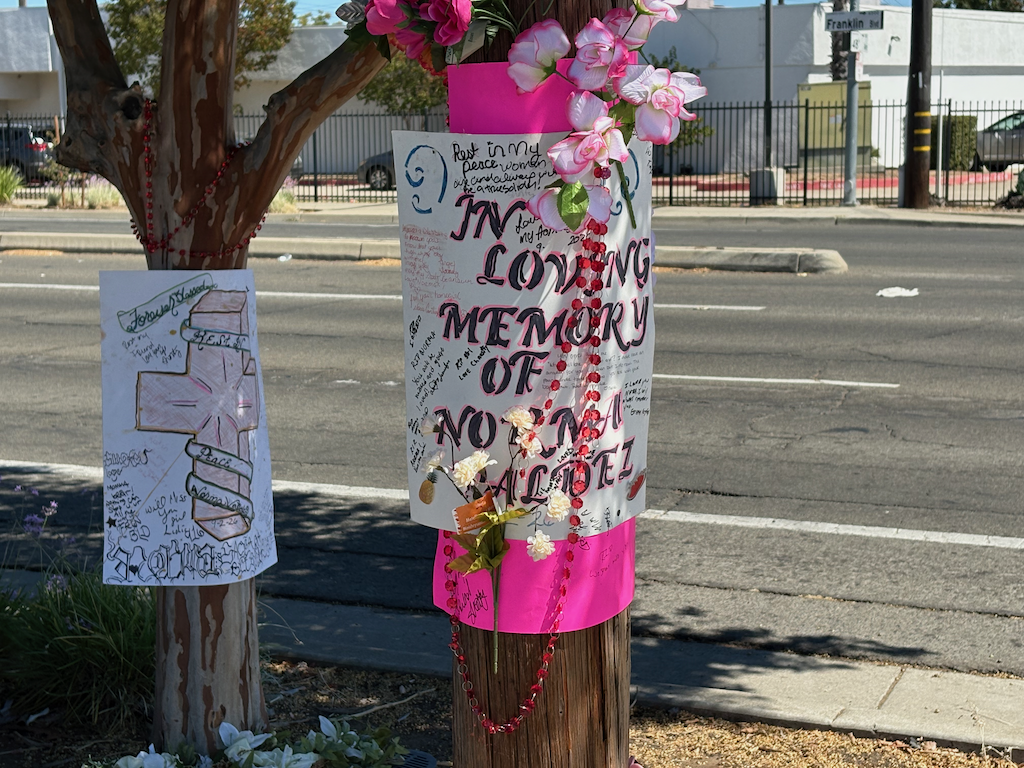
I was initially interested because I thought the crash was within the area of Vision Zero Complete Street on Franklin, but it is south of Fruitridge Road, in Sacramento County rather than the city. The location is opposite 48th Avenue. At this location, the bike lane is a little wider than usual, about 5.5 feet. There is no protection of any sort for the bike lane.
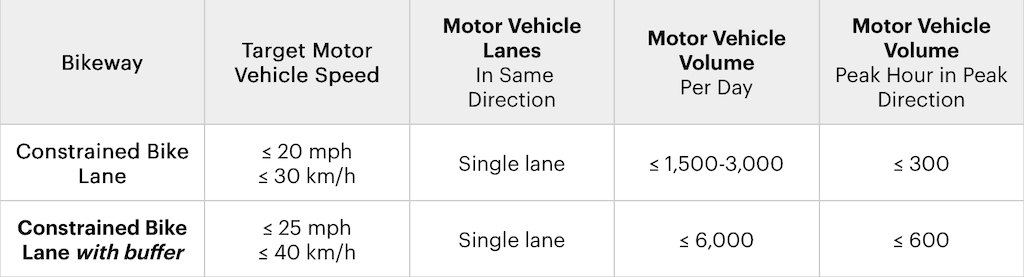
Conventional Class 2 bike lanes should never be installed on roadways over 30 mph, and generally not over 25 mph. The NACTO Urban Bikeway Design Guide, 3rd Edition, Constrained Bike Lanes, has the following table for ‘constrained’ (conventional) bike lanes. Nothing in this table matches Franklin Blvd at this location. It is higher speed, higher volume, and is two lanes per direction. Franklin should never have been designed this way. Caltrans CA-MUTCD and Highway Design Manual conveniently do not provide an upper speed limit for Class 2 bike lanes. Caltrans treats bicyclists with disdain, though with more respect than walkers. It is widely recognized that Class 2 bike lanes on high speed roadways will lead to fatalities. Such as this one.
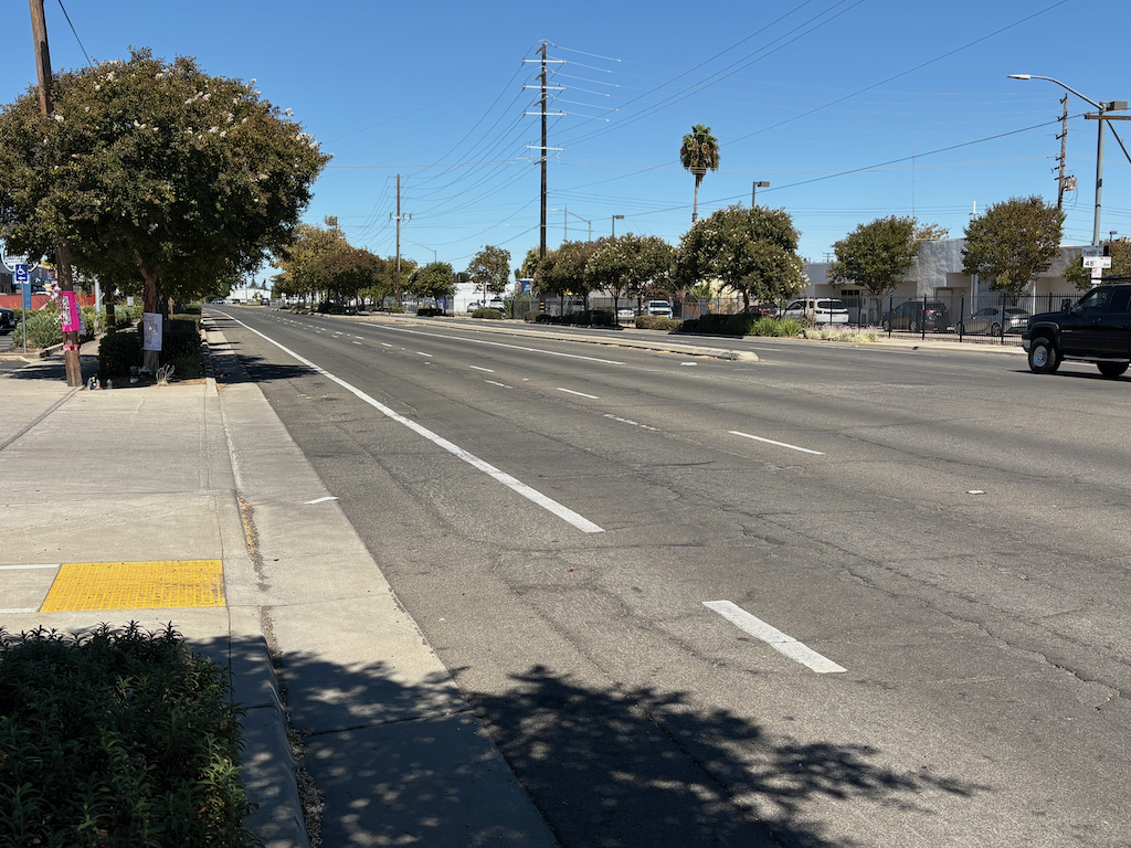
The roadway is four lanes, two southbound and two northbound. A median is present in much of this section, but there is a gap here for 48th Avenue, which is only to the east, with no street to the west. La Grande Blvd to the west is a little to the south. The posted speed limit here is 40 mph. Readers will know that if a posted speed limit is 40, actual speeds are 50 to 55 mph. Even at 40 mph, and certainly above that, any collision with a bicyclist or walker will be fatal.
I walked north on Franklin to Fruitridge Road, which is the southern terminus of the city’s project. City and county are mixed in this area. The county portion is actually better designed than the city portion. The city portion has no bike lanes at all, narrow sidewalks, mostly 4 feet, with either a center turn lane (‘suicide lane’) or with opposing posted 40 mph traffic separated by only a yellow stripe.
This entire area of south Sacramento, both city and county, is a place where motor vehicles dominate all other life.
It is worth noting that the bike lanes on Franklin Blvd and 47th Avenue adjacent to the former Campbells factory could have curb separation since there is only one active driveway in 2900 feet along Franklin and one in 2200 feet along 47th. These would not have prevented this murder, but any improvement is valuable.
Though I would have guessed otherwise, in the five years of TIMS/SWITRS data, 2019 through 2024, there were no bicyclist fatalities or severe injuries in the section of Franklin Blvd between Fruitridge Road and Florin Road.

