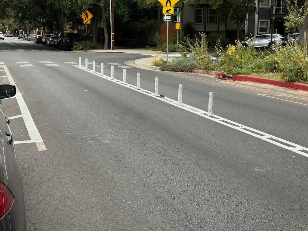
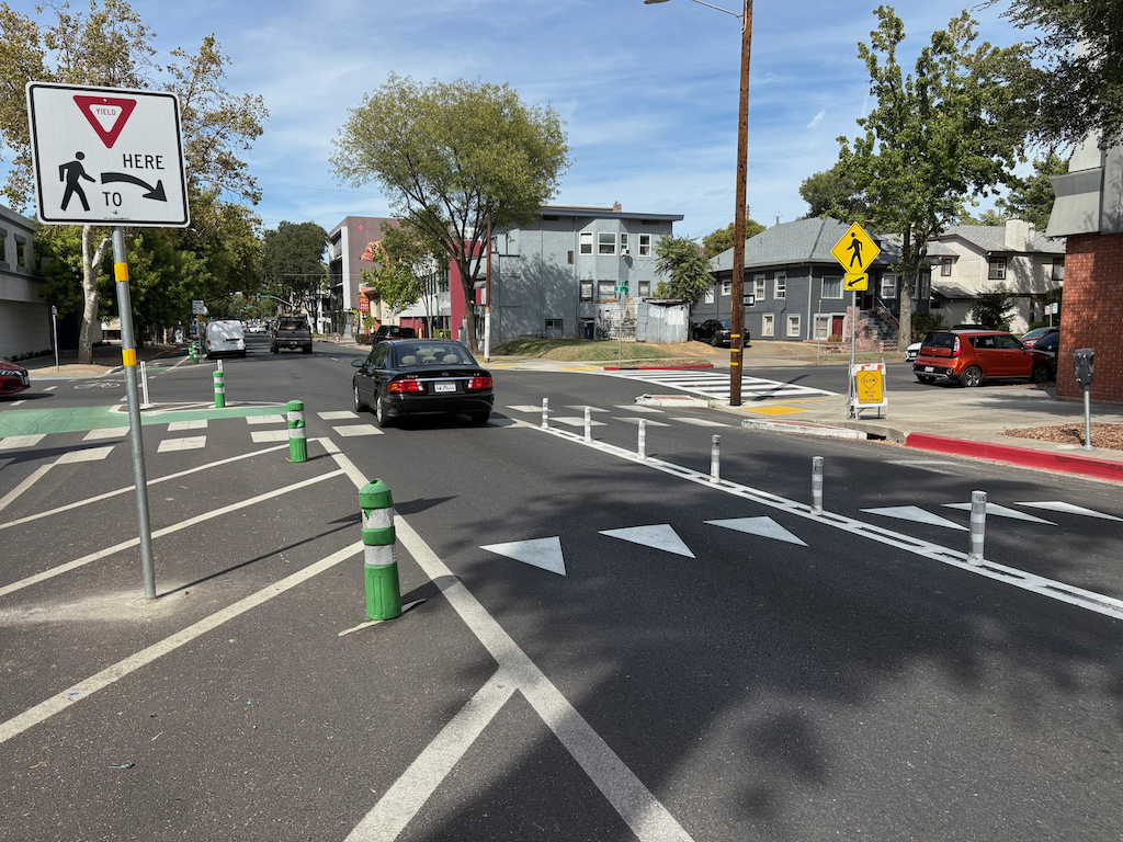
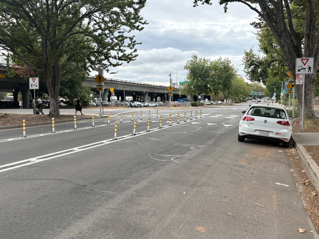
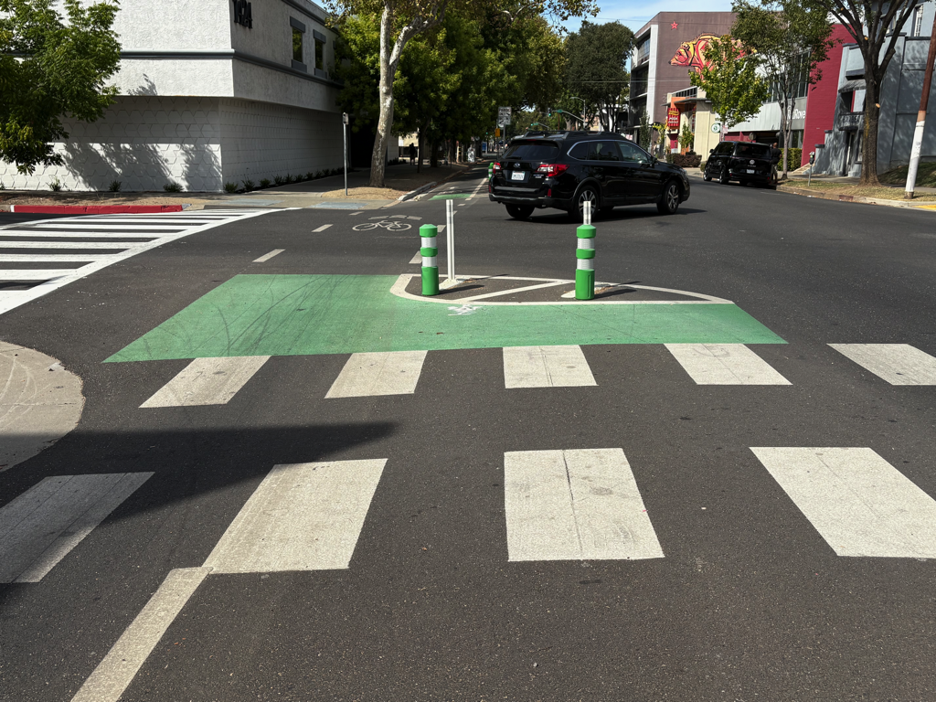
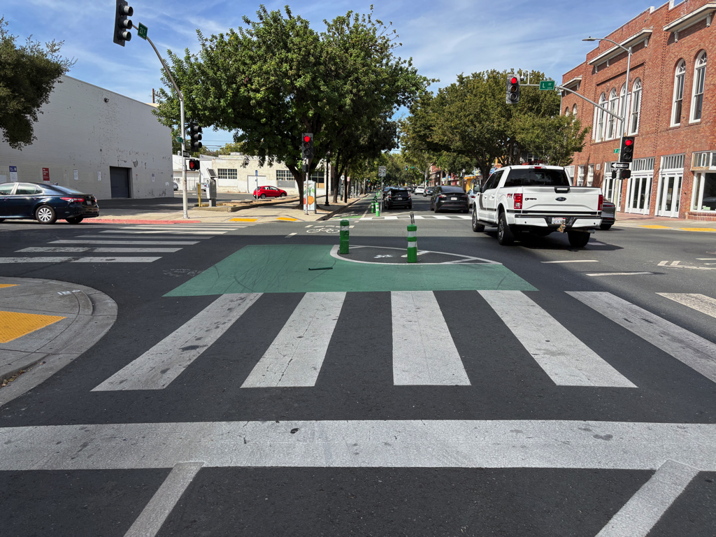
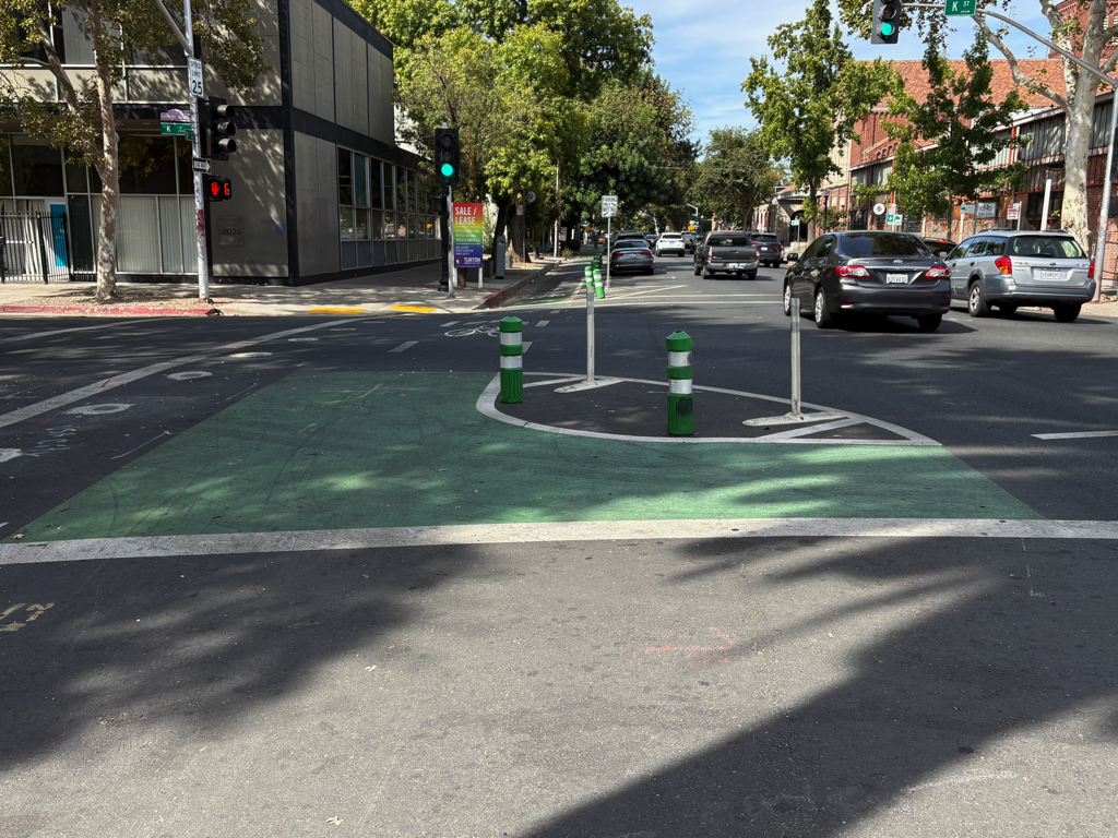
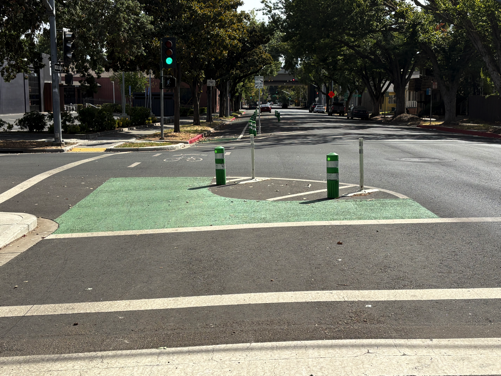
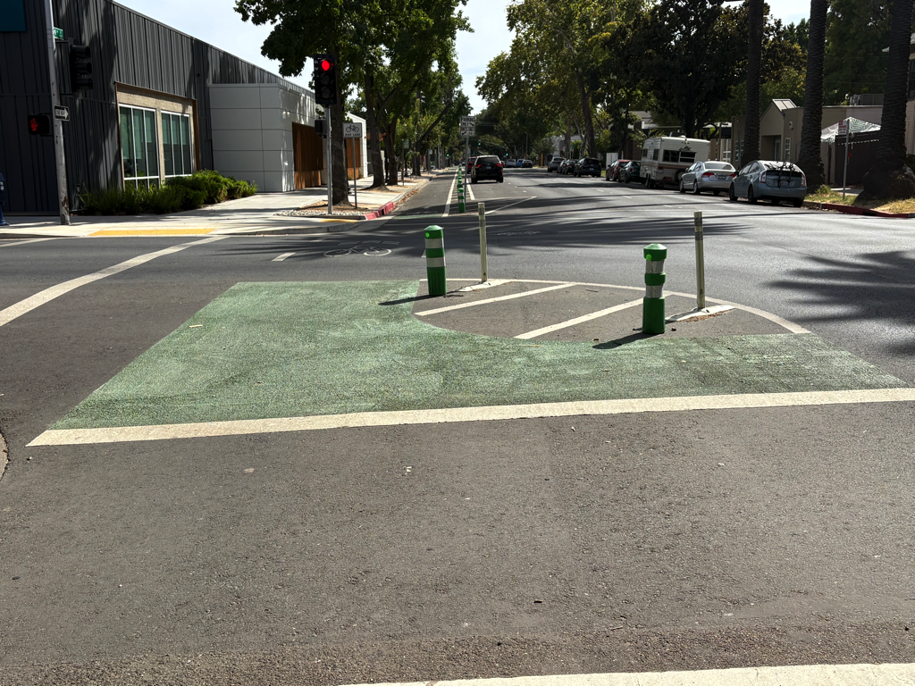
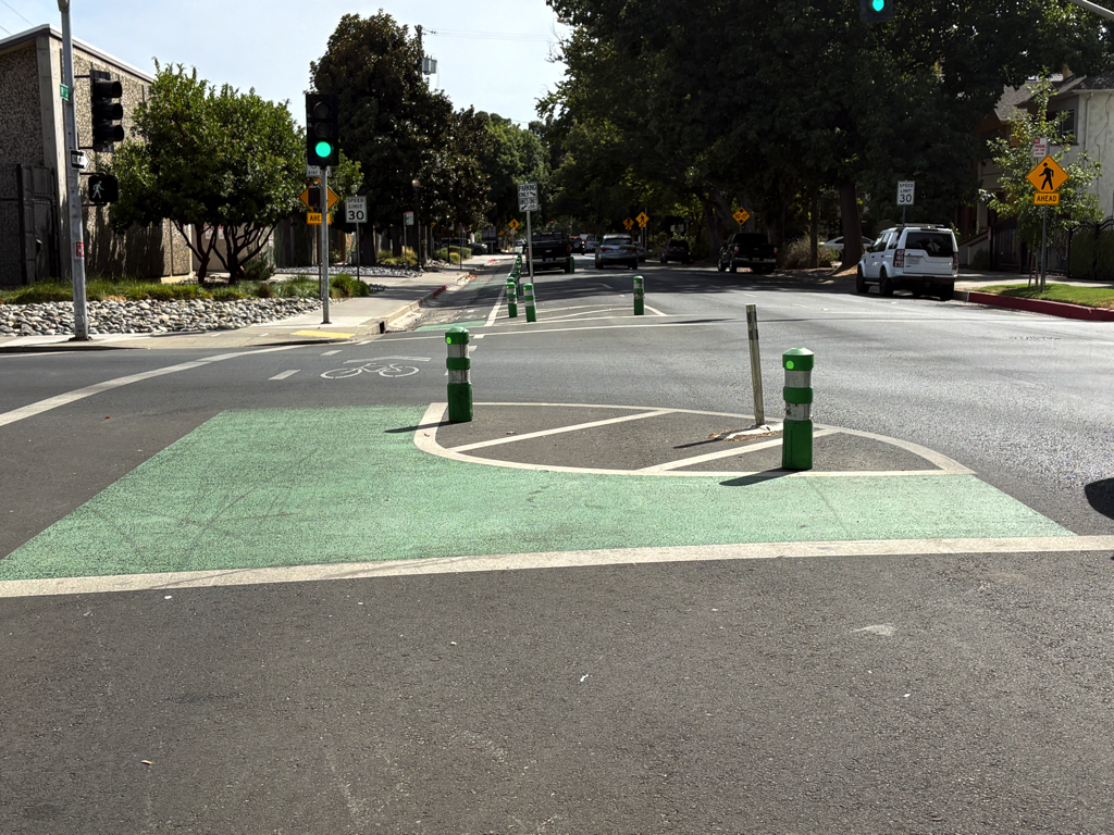
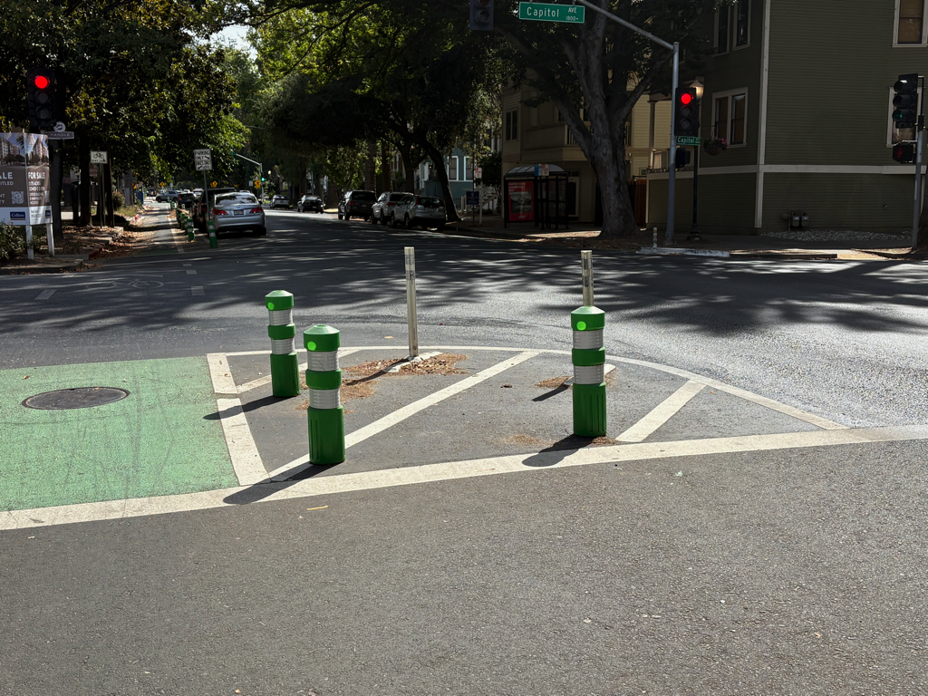
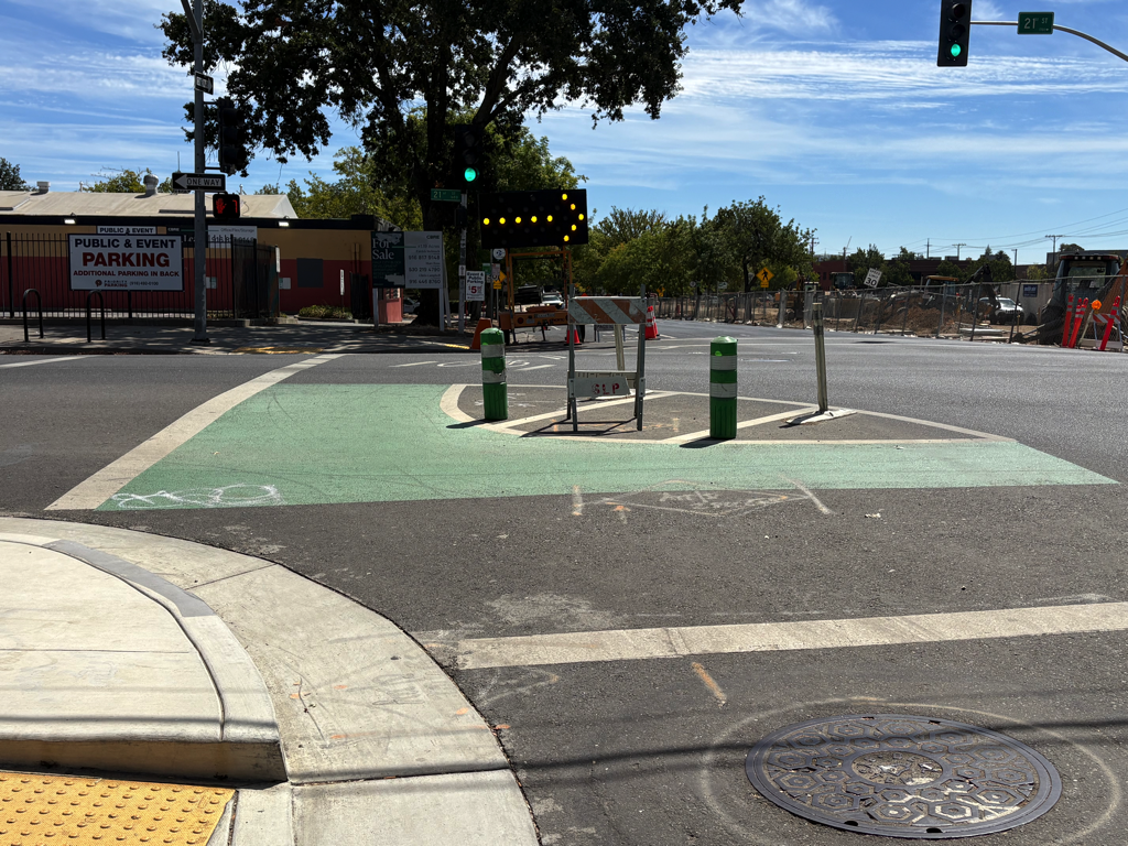
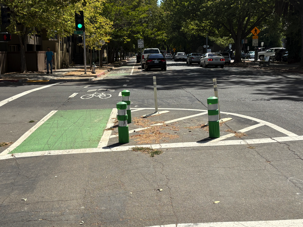
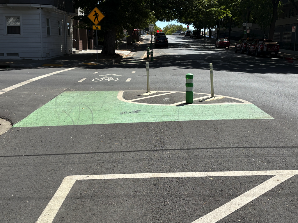
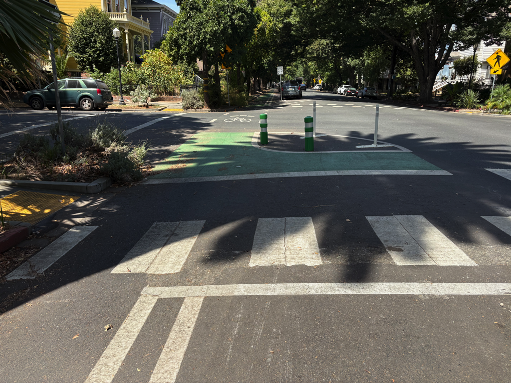
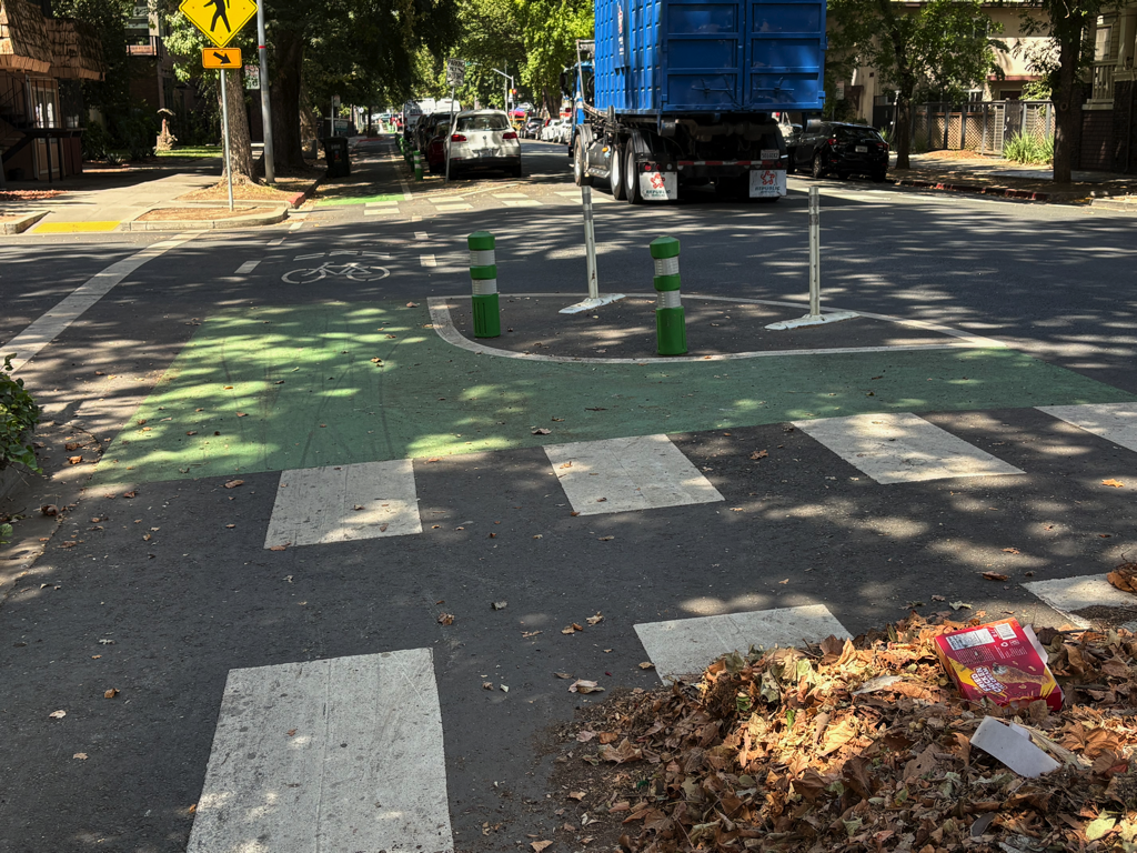
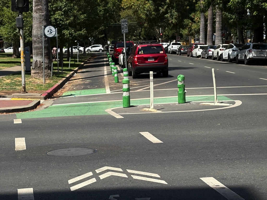
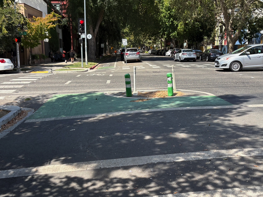
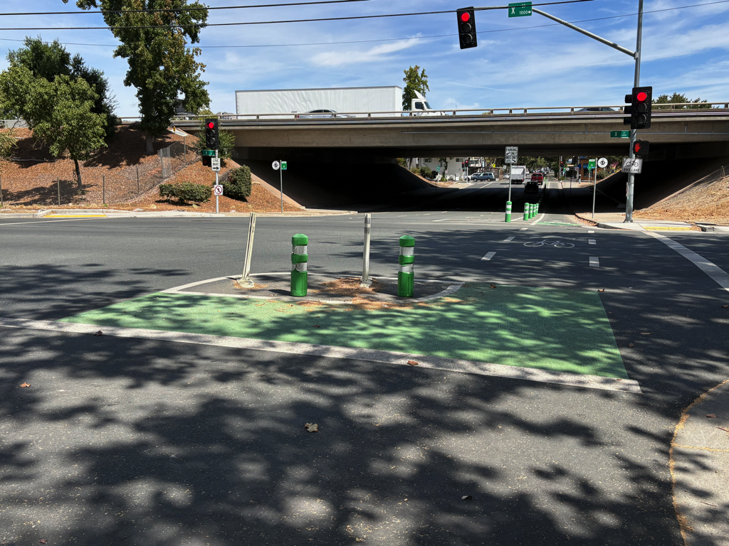
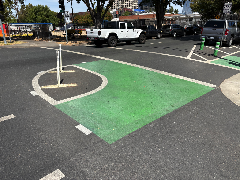
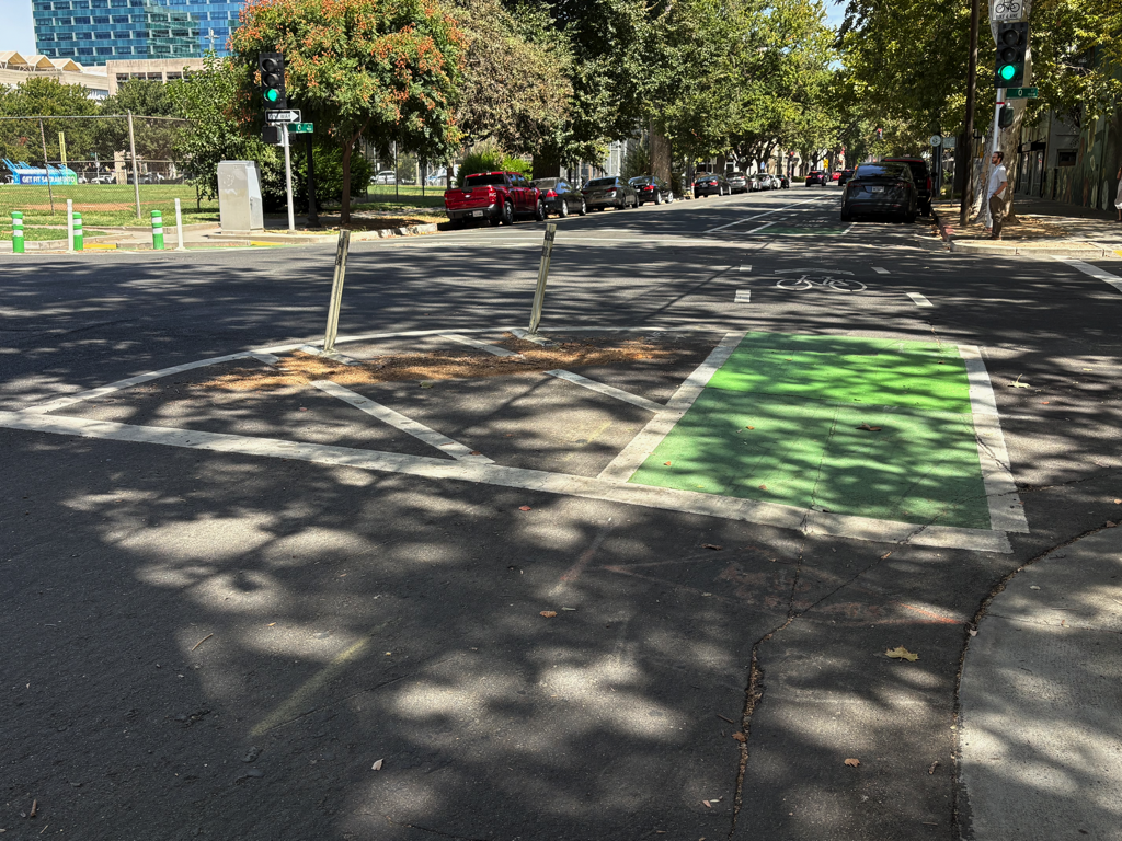
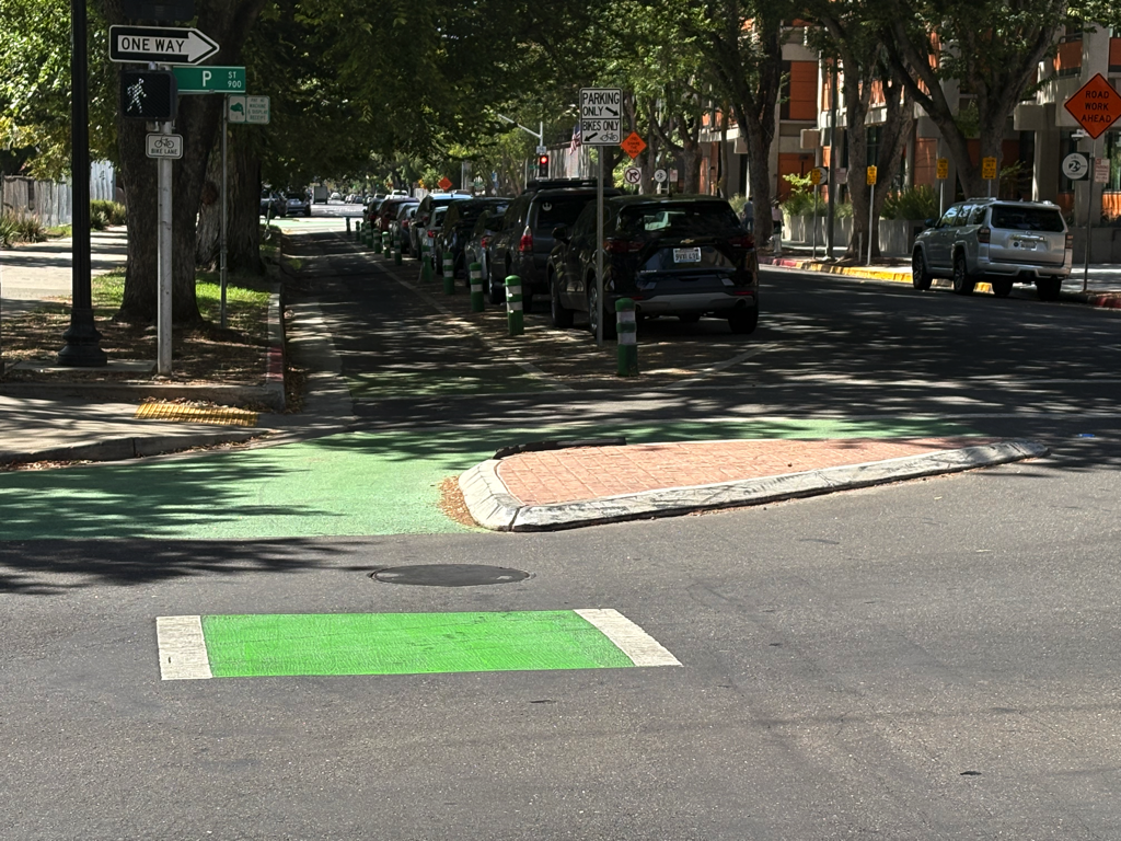
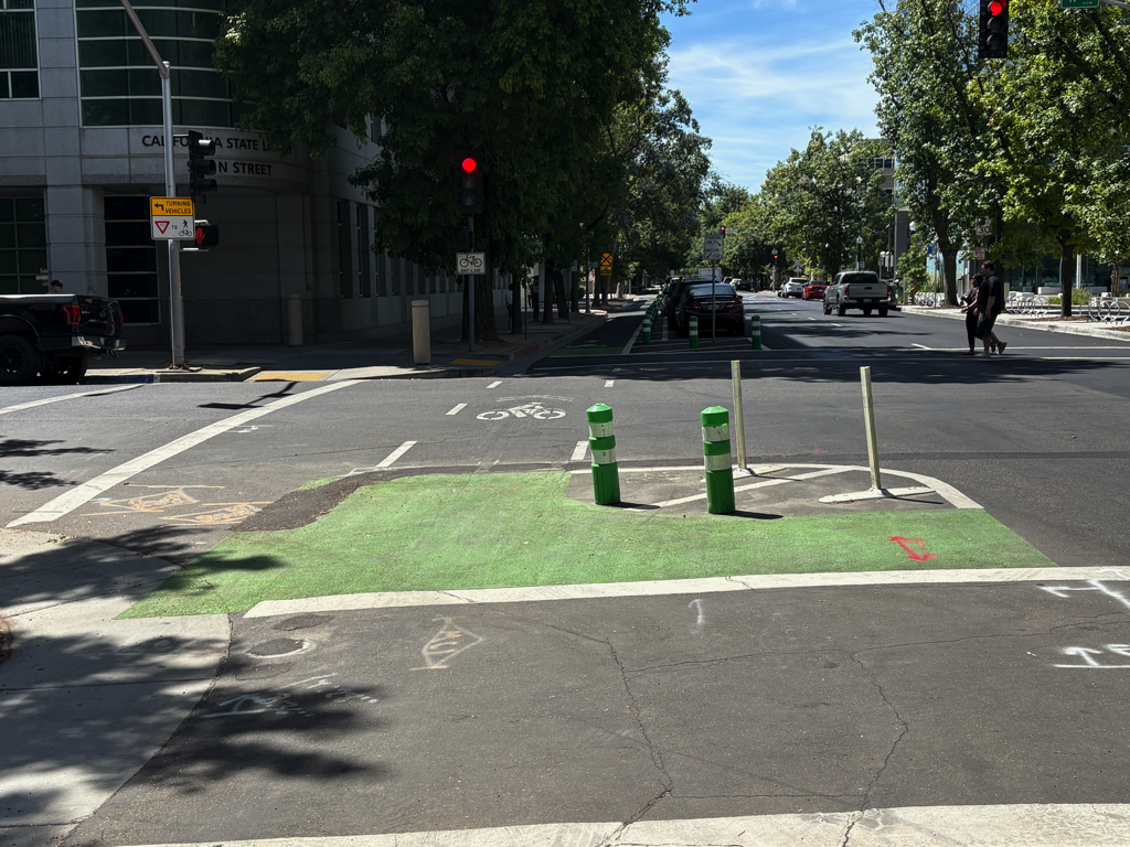
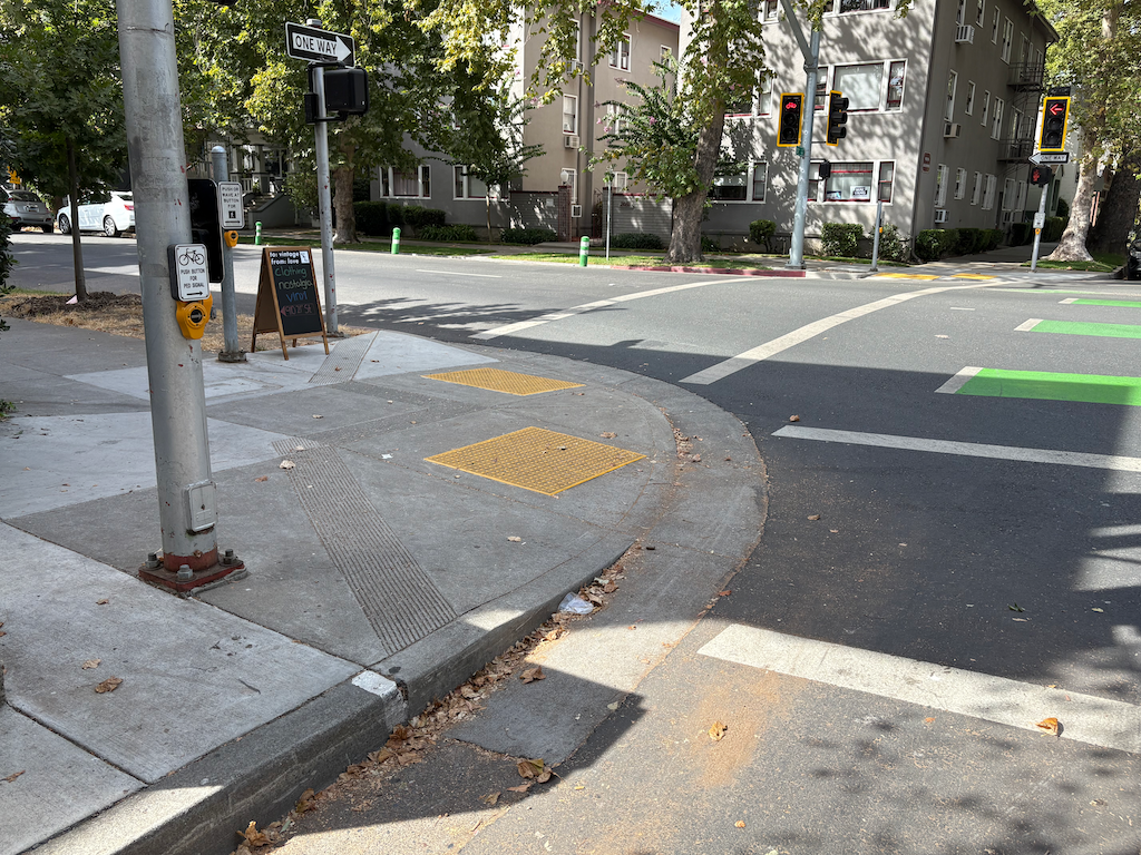
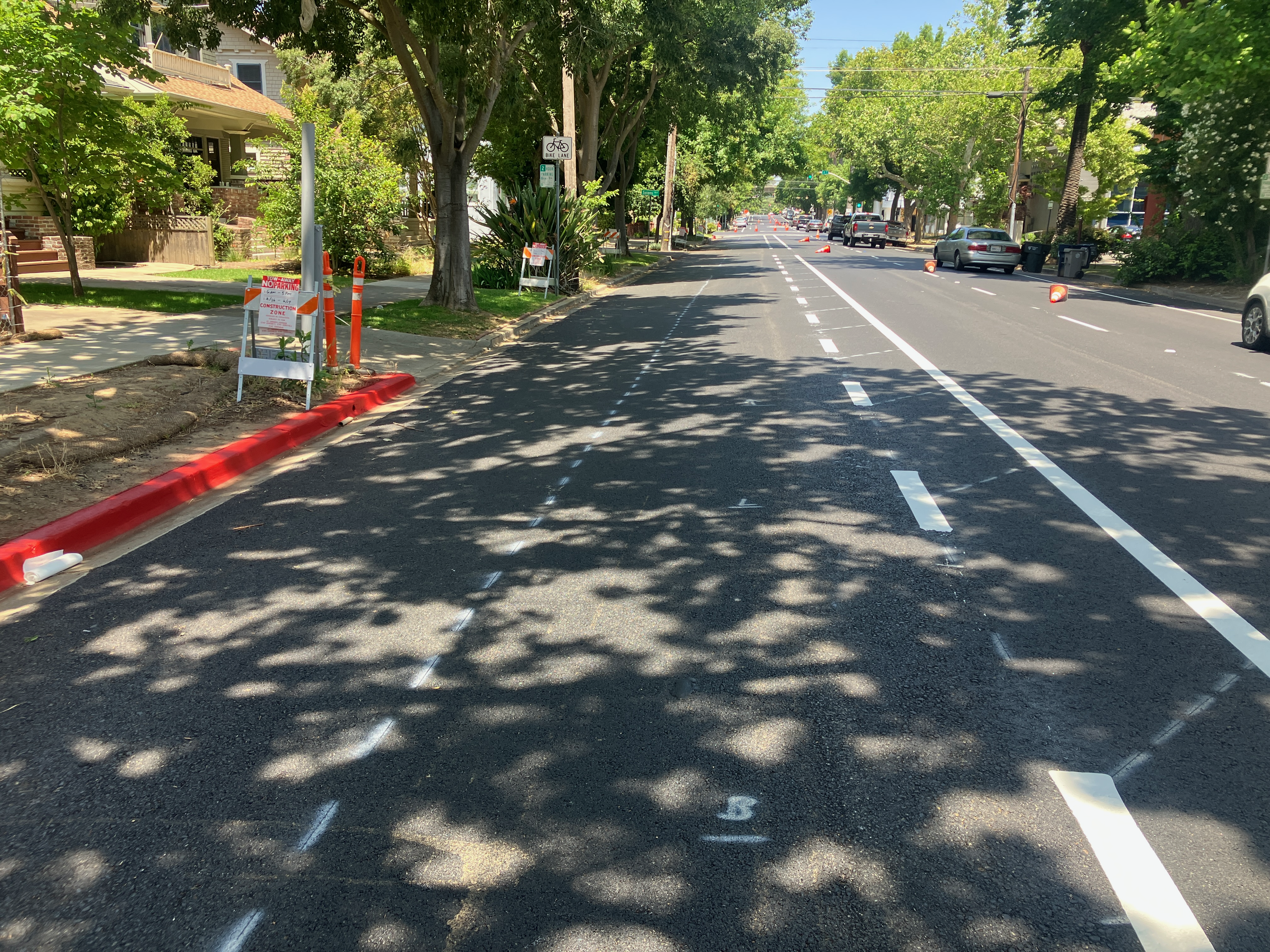
The City of Sacramento has recently installed lane channelizers at new locations in the central city. The three I’ve noticed are shown below. If you are aware of others, please let me know. The four locations that have been in place for several years are 15th Street (southbound) at O Street and at R Street, and 16th Street (northbound) at R Street and O Street. See Strong SacTown: Things that work: traffic posts and traffic calming measures, Lane Channelization, for these older locations. There are other locations where vertical delineators separate opposing lanes of traffic, which I call centerline hardening; for another post.
19th St at O St, channelization with vertical delineators21st St at O St, channelization with vertical delineators, also yield markersW St at 8th St, channelization with vertical delineators, also yield markers
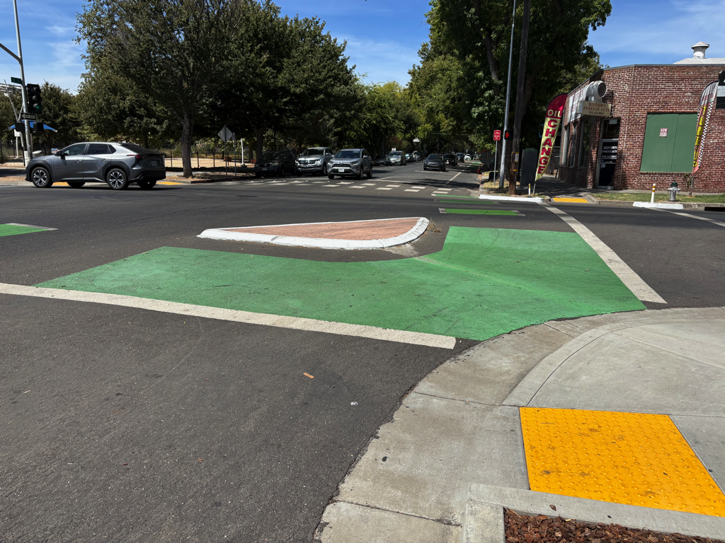
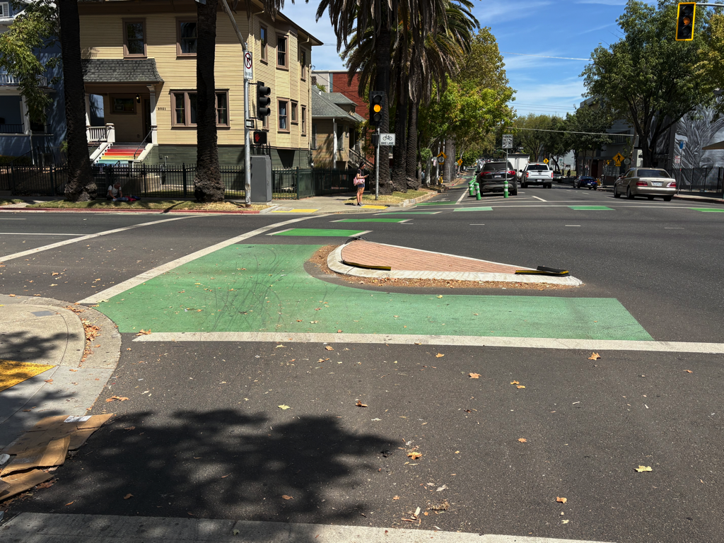
As part of the separated bikeways projects in the central city, turn wedges were installed at 30 locations, initially on the P Street and Q Street bikeways, and later on the 19th Street, 21st Street, and I Street bikeways. Though there is a bikeway on J Street, it does not have turn-wedges. My earliest posts on turn wedges, turn wedges of death and Central City Mobility update: turn wedges, I expressed doubt about these features, and added posts about real turn wedges and NACTO protected intersection and Sac semi-protected intersection showing how the designs fell short of best practice designs from NACTO and Alta Design+Planning.
However, after extensive observations of driver behavior around turn wedges, I now believe that these are a positive addition to streets in the central city. These features slow turning drivers, and cause them to face crosswalks more directly. I observe much higher rates of yielding to walkers than at other intersections. Not perfect, by any means, but better. Though these were installed as part of the Central City Mobility Project for bikeways, their greatest benefit is to people walking.
Some turn wedges work better than others, depending on the details of the wedge and the intersecting streets.
Five of the wedges are concrete. Initially, these were being hit by drivers almost constantly. You can see the tire marks on all of the concrete wedges, and even chipping of the concrete. The city added reflective strips to the edges of the wedges, though almost all of the strips have fallen off over time. It would have been good to add delineators or more reflective markings (see the Santa Monica example in real turn wedges). But drivers have adjusted, and I have not seen a driver hit a wedge in quite some time. These concrete wedges are at the intersection of two bikeways, though not all these intersections have concrete.
Two types of vertical delineators were added, initially green K-71 delineators, and later white FG 300 delineators. All of these have been hit by drivers, sometimes repeatedly with significant damage. I don’t see this as necessarily a failure – better a delineator than a walker or bicyclist. There is nothing in the world that can prevent all drivers from hitting objects in or close to the roadway, but good designs reduce the chances of those objects being walkers and bicyclists. This is critically important.
One turn wedge, northeast corner of I Street and 13th Street, is paint only, no delineators. As such, it doesn’t really serve any purpose.
Where buffers, and particularly wide buffers exist, the turn wedges work better because there is a longer approach for the driver before reaching the crosswalk.
Two wedges do not work because the gap between the wedge and the curb is too wide, inducing drivers to cut the corner inside the wedge and negating the benefit of the wedge to walkers and bicyclists. These are at the northeast corner of 9th Street southbound and Q Street eastbound, and the northeast corner of 10th Street northbound and S Street. These locations could be corrected, but they have not been. The 9th Street & Q Street location is particularly problematic because there is a high volume of turning drivers at this location, and speeds are higher due to the design of these two roadways.
There are projects to extend the bikeway on 9th Street south to Broadway, and to extend the P Street and Q Street bikeways to the west. Hopefully these projects will take the lessons of these initial turn wedges to improve the designs. The closer the designs come to the NACTO model, the better. And of course fully protected intersections, all four corners, are the optimal.
Photos of the 30 turn wedges are below. If you are aware of any other locations, please let me know. If you have experiences with any of these, as a walker, bicyclist or driver, please comment.
I-St at 13th-St turn-wedge paint only21st-St at T-St turn-wedge21st-St at O-St turn-wedge21st-St at L-St turn-wedge21st-St at K-St turn-wedge19th-St at V-St turn-wedge19th-St at T-St turn-wedge19th-St at S-St turn-wedge19th-St at N-St turn-wedge19th-St at K-St turn-wedge19th-St at Capitol turn-wedgeQ-St and 21st-St turn-wedgeQ St and 19th-St turn-wedge-concreteQ-St and 10th-St turn-wedgeQ-St at 18th-St turn-wedgeQ-St at 17th-St turn-wedgeQ-St at 16th-St turn-wedgeP-St and 21st-St turn-wedge-concreteP-St and 19th-St turn-wedge-concreteP-St at 18th-St turn-wedgeP-St at 17th-St turn-wedgeP-St at 16th-St turn-wedgeP-St at 15th-St turn-wedge10th-St at X-St turn-wedge10th-St at T-St turn-wedge10th-St at S-St turn-wedge10th-St at Q-St turn-wedge9th-St and Q-St turn-wedge-concrete9th-St and P-St turn-wedge-concrete9th-St at N-St turn-wedge
I last wrote about this intersection of 21st Street & I Street when the bikeway project was just finished, Central City Mobility: 21st & I bike signals (2024-01-26). A bicyclist signal face had been installed, but the arrangement of the signal phases was dangerous and discriminatory against bicyclists northbound on the 21st Street bikeway. I assumed that the issues would be fixed. They have not.
Drivers continue to turn left from 21st Street to I Street, against the red arrow. If this were a regular round red light, this would be permitted, as it is from a one-way street to a one-way street. However, it is not legal against a red arrow.
If a bicyclist uses the bicyclist actuator button on the southwest corner, they do get an exclusive bicyclist phase to turn left to the bikeway on the north side of I Street, or to go north on 21st Street, or east on I Street (which becomes two-way at this intersection). The pedestrian signal on the west leg of the intersection is ganged with the bicyclist signal, which introduces a small conflict between people bicycling and walking, but this can usually be negotiated without problems. The problem is that criminal drivers still turn left against the red arrow, endangering both bicyclists and walkers.
The larger issue is that the bicyclist actuator button is not located in a place usable by bicyclists. As shown in the photo, the button is four feet away from the curb. A bicyclist cannot reach the button without dismounting their bike. This is such an obvious mis-design that I assumed the city would fix it. It was reported as an issue to the city via 311, by myself and other bicyclists. But it was never fixed.
There are two possible solutions. The bicyclist actuator button could be replaced with a ‘push or wave at’ actuator/button. These distance at which these actuators sense a ‘wave’ can be adjusted, and could be adjusted so that bicyclists are detected without additional action. If the location is already a ‘wave’, it fails to function as such. The other option is to use video detection for bicyclists waiting at the intersection. It appears that there is a video detection camera located on the mast arm over 21st Street on the north leg of the intersection, but it is not being used to detect bicyclists.
As is so typical of city projects, a lot was changed, to the good, but the projects always fall short of transformative safety.
bicyclist actuator button at 21st St & I St is inaccessible for bicyclists
Note: This post is not about the bicyclist fatality that occurred in this area recently. Not enough is known about that to post, yet. This is Central City Mobility Project update #34.
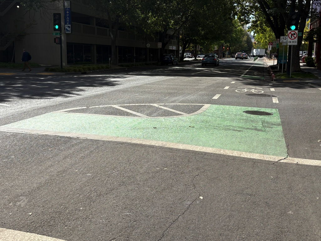
There is an issue with the 21st Street separated bikeway at W Street. The northbound bikeway transitions from the east side of 21st Street to the west side of 21st Street at W Street. There is a two-stage turn box on the northeast corner, intended for bicyclists who have crossed W Street on the green light to wait to cross 21st Street on the green light, to access the separated bikeway on the west side of 21st Street. The photo below shows the box being used by a walking bicyclist, who waited in the box. The signal has turned green and he has started to cross. A right-turning driver from W Street to 21st Street stopped suddenly to avoid hitting the bicyclist/pedestrian, because the driver did not expect to see someone there. The vegetation somewhat but not completely obscures someone in the box.
21st St at W St NE two stage turn box with bicyclist in box
The city has placed a ‘no turn on red’ sign on W Street, photo below. In about 40 minutes of observation, 60% of the drivers who could turn, meaning they were not blocked by a vehicle in front of them, did turn on red. This is the time when the box would be occupied by a bicyclist.
W St ‘no turn on red’ sign to 21st St
On the green light, drivers are taking the right turn at high speed. If there were a bicyclist or a walker crossing 21st Street, here, it is doubtful that many drivers would notice the person and brake in time. This is a severe injury or fatality waiting to happen. The video below shows drivers cutting across the two-stage turn box.
video of drivers cutting across the two-stage turn box on 21st St
Solution
A temporary solution is to install vertical delineators (flex posts) to block off the right hand lane of W Street approaching the intersection. There is a short section of red curb here, where the ‘no turn on red’ sign is, but the blocked off area should extend 20 feet up to the crosswalk, and be the width of the parking lane. A green K-71 vertical delineator, or two, should be placed at the southwest corner of the two-stage turn box, to force drivers to go around the turn box, and also slow turning movements. The diagram below indicates possible locations of vertical delineators, white dots. Base excerpted from CCMP plans.
A more permanent solution would be to reconfigure the northeast corner to add concrete barrier protection for the turn box. The city, having enticed bicyclists to this location, owes them a much higher level of protection that is currently offered.
Nothing has changed on 21st Street since the last post.
On 19th Street, some of the striping has been completed as far south at P Street. This is only white, long-line striping, none of the details have been painted. While riding 19th Street today, I was very nearly hit by a driver at O Street. The long-lines lead drivers to think that they have full width right of way, and to not expect bike riders to be coming out to pass the curb extensions at O Street. As I have said all along, I question putting extensions in locations with separated bikeways. It may be less dangerous once the detailed striping and green paint are installed, but it won’t be as safe as it could be if the city had simply not installed extensions on the east side of the 19th Street and O Street intersection.
A friend pointed out that the separated bikeway on 19th Street southbound is more than half in the gutter pan, and that the gutter pan is deteriorated in many locations. Therefore the effective width of the separated bikeway is not six feet, but about two feet. Smooth sailing for drivers, not for bicyclists!
19th St separated bikeway in the gutter pan
As is true of every street that has been repaved, or patched, so far, the lane tabs have indicated that the general purpose lanes are very wide, and there are no bike lanes. Bike riders are now exposed to higher speed traffic (because of the very wide lanes), with not even the slight protection of paint. Though this might be the fault of the project contractor, I doubt it. If the city had told the contractor to keep temporary bike lanes, they would have. I’m almost certain that the city did not say anything about accommodations for bicyclists to the contractor. The city is endangering bicyclists during this construction project, on purpose and with full knowledge. If someone is hurt or killed here, it will be on the city, and I hope they get sued for millions. The city philosophy, overall, for this project and every other construction project on streets and sidewalks, is that bicyclists and walkers don’t matter.
The city has claimed that they are now, finally, working on a construction accommodation policy. I suspect that it will come out very weak, because Public Works still believes strongly in cars-first. Traffic flow and ease for drivers controls all their decisions.
P Street has been repaved, but does not have any marking yet. Q Street has been patched, though I can’t tell if there is more to be done. A reader pointed out that there is some active work on 10th Street, but I haven’t gotten there yet.
A friend mentioned that traffic was a disaster when the city closed Q Street and 15th Street, with traffic backed up for many blocks. Though I did not observe this, I’ve had reports now from many people that the detour signage for this project does not provide drivers (or bicyclists) with any information about which way to go (the detour signs, I have observed, frequently point two directions, and the signage along the detours is incomplete. This could, possibly, be the fault of the contractor, but if the city was not out inspecting the detours and getting them corrected, the city was also failing. I have talked to a number of people on the street for whom this project has left a bad taste in their mouth. They have seen that the city has done a poor job of communicating with drivers, bicyclists and walkers, and there is a lot of doubt being expressed about whether the separated bikeways will actually be safer.
Lastly, I will note that there was no public outreach on this project. There are no plans available to the public. I am sure if there had been outreach, some of the design details would be different, some of the flaws would have been caught, communication would have been continuous and effective, and construction signing would have been done correctly. This was an internal Public Works project, and it was not done well.
The separated bikeway (protected bike lane) and repaving is mostly complete on 21st Street in Sacramento, part of the Central City Mobility Project. Almost all the white striping and green paint is complete. No vertical delineators (soft hit posts) yet. When I rode the street a few days ago, most vehicles were parked in the correct location in the parking spaces separated from the curb. There are two blocks where the bikeway is adjacent to the travel lane, and parking adjacent to the curb, between T Street and S Street, and between N Street and Capitol Ave. There is no obvious reason for this.
The beginning of the left side separated bikeway at W Street is marked oddly, see photo below. The arrow in the green turn box would imply that one should immediately turn onto 21st Street, when it should indicate to cross 21st Street the the bikeway on the other side. The shadow shows the correct move.
21st Street at W Street, green turn box with incorrect arrow
The ‘turn wedges’ noted in a an update post are is far only white paint, nothing that would prevent a driver from cutting the corner across the bikeway area. In fact, I observed several drivers doing just that.
21st St at T St turn wedge
The big concern is where the separated bikeway approaches I Street. The bikeway is on the left. Travel lanes are in the middle, one left turn only and one combined left turn-through-right turn. I Street becomes one-way westbound at this point, is two-way to the east, and 21st Street is two-way. Before repaving, the left side bike lane had a left turn arrow. The right side bike lane that was there before repaving is not there now, and it isn’t clear that there is intended to be. There is no warning that the separated bikeway ends at I Street, and no bike facility for transitioning to the right side to continue north on 21st St. This would be a good location for a bicycle signal to allow bicyclists to continue through the intersection on a bicyclist-only phase.
The repaving of 21st Street between W Street and I Street is complete. The section has been marked with ‘temporary road marker tabs’ (these have various names). The marking is for parking lanes on both sides, of eight to ten feet, and ultra-wide general purpose travel lanes, of at least 16 feet. No bike lanes were marked, though the street previously had marked bike lanes. A typical move on the part of the city and its contractors, to take care of motor vehicle travel and parking, but forget about bicyclists. This is of course temporary, but state and federal law require accommodation of bicyclists in construction zones. No such accommodations was made.
21st St between J St and I St, ultra-wide travel lanes, parking lanes, NO bike lanes
There are temporary paint markings for the first several blocks north of W Street, showing what the paint configuration will be. The parking protected separated bikeway is, as was likely, on the left side because most of this stretch has bus service on the right. The bike area is about seven feet wide. The buffer strip of about three feet wide, and the parking lane is about eight feet wide. The buffer may or may have vertical delineators (soft hit posts) continuously or at conflict points. There is no indication at any location, so far, that there will be hard curbs to actually protect bicyclists when parked cars are not present. For information on why a seven foot bikeway is not sufficient, please see bike lane widths. NACTO recommends at least eight feet.
21st St temporary marking for separated bikeway
As I rode up 21st Street, I noticed that the bus stop is marked in the same way that the parking lane is. I hope this is just a temporary mistake, otherwise there will be parking in the bus stop despite the red curb. The city is still failing to do two things it can to better support transit: 1) install concrete bus pads so that the weight of the bus at the stops does not distort the pavement and cause potholes, and 2) paint the pavement red at each bus stop so as to make it clear that this is a place for buses only, and not private vehicles. And, yes, it would be nice if transit islands were installed so that the bus does not need to pull out of and then into traffic. The city keeps saying that it supports transit, but doesn’t actual do anything to support transit.
21st St bus stop, marked as though it were a parking lane
Lastly, in the category of ‘be careful what you wish for’… I had wondered why the city was not taking advantage of the ADA ramp project to put in curb extensions (bulb-outs) at some critical intersections for walker safety. This afternoon, I noticed that they are putting in curb extensions on the northeast and southeast corner of 19th Street and O Street. Yay? Nay? The problem is that the location of the extensions would extend into the separated bikeway on the left side of 19th Street southbound. The photo below, looking north along 19th Street at O Street, shows the extension under construction. There is supposed to be a curb-adjacent, parking protected separated bikeway here. I assume that bus stops for SacRT Route 62 southbound will be on the right hand side of the street, and the separated bikeway on the left hand side. Is there anyone paying attention? Anyone? Ferris? Anyone?
There has been construction on several of the corners I had previously mentioned (half-measure corners?), with 21st Street and O Street being the most advanced. It seems that I was wrong about curb islands being put in – there is no evidence of such construction. I don’t know why the asphalt cutting implied that. When more of these are complete, I’ll post again.
What seems to be going on is simple updates to place ADA-compliant curb ramp with detectable warning strips. Of course any improvement to curb ramps helps everyone, disabled and otherwise, and I’m not criticizing that. Rather, wondering why when the city is changing these corners, they did not take the opportunity to do true curb extensions. The ADA ramp and detectable warning in place for O Street is wider, than previous ramps and strips, looks to be more than four feet rather than the prior narrow ones. If all the ramps end up wider, that will be a plus.
This work is probably part of the city’s Central City Mobility Project. The project detail mentions ‘turn wedges’. Maybe the wedges will be added later, or maybe these will be at different locations than the ones I’ve looked at. The page does not specifically mention ADA ramp improvements.
21st St & O St, northeast corner, ADA ramp construction, partially complete
I had mentioned in the previous post curb extensions being extended to serve as bus boarding areas. I am not aware of any of these in Sacramento, but San Francisco has many. Many earlier posts have mentioned bus boarding islands, but this is for a street without bike lanes (yet), which allows the bus to stop in-lane and people to board directly. Notice that the extension allows for a bus shelter without constraining the sidewalk width for walkers. This should be the standard for Sacramento for all streets with bus routes but not bike lanes.
curb extension and bus boarding extension, San Francisco, Leavenworth & Sutter