Sacramento Vision Zero Top 5 outreach

This information from the City of Sacramento via email.

Vision Zero Top 5 Corridors Banner

We have added and updated upcoming outreach events for the Vision Zero Top 5 Corridors.

Join us to learn more about the Vision Zero Top 5 Corridors Study and share your experience biking, walking and driving along these streets at one of the following events:


Date and Time Event Location Corridor of Interest
Monday, November 5th

5:00-7:00 p.m.

Community Workshop Peter Burnett Elementary School

6032 36th Ave.

South Stockton Blvd.
Wednesday, November 7th

Noon-2:00 p.m.

Pop-up Event Transit stop at Broadway and Stockton near Food Source (4401 Broadway) Broadway/Stockton Blvd.
Saturday, November 10th

9:30-10:15 a.m.

Old North Sacramento/Dixieanne Community Association GraceCity

701 Dixieanne Ave.

El Camino Ave.
Thursday, November 15th

5:00-7:00 p.m.

Community Workshop Luther Burbank High School

3500 Florin Rd.

Florin Rd.
Thursday, November 15th

6:30-8:00 p.m.

Gardenland/Northgate Neighborhood Association Stanford Settlement Conference Room

450 W. El Camino Ave.

El Camino Ave.
Friday, November 16th

4:00pm-6:00 p.m.

Pop-up Event Grocery Outlet

2308 Del Paso Blvd.

El Camino Ave.
Wednesday, December 5th

6:00-8:00 p.m.

Hagginwood Community Association William J. Kinney Police Facility

3550 Marysville Blvd.

Marysville Blvd.


About the Study


In 2017, the City of Sacramento identified the five corridors in Sacramento with the highest numbers of fatal and serious crashes involving pedestrians, bicyclists, and motorists.

The Vision Zero Top Five Corridor Study will analyze the factors that contribute to these corridors’ high crash rates.  Based on technical analysis, community input, and best practices in roadway safety and design, the study will identify improvements for each of these corridors that can be implemented in the near-term.

More information about the project is available at http://visionzerosac.org

Traffic Skills and Project Ride Smart

Jibe (formerly North Natomas TMA) and partners are offering two Traffic Skills 101 workshops, in December and January. Though the workshops are schedule to train new instructors for the Jibe Project Ride Smart program that teaches bicycling skills and safety in schools, they are open to others. Traffic Skills is a League of American Bicyclists course that qualifies people to go on to take the League Cycling Instructor Seminar.

The first workshop is Thursday, December 6, evening, and Saturday, December 8, daytime.

Please check the flier for more information.

Parking thoughts

Applicable to the City of Sacramento, but also to any urbanized area:

  • Any block on which parking capacity regularly fills on any day of the week and any time of day should charge parking fees.
  • The price of parking should be managed so as to always have at least one free space per block (the Shoup criteria)
  • Any block with mixed use should have one spot per block for bike racks and scooter parking, and one spot for ride-hailing and delivery use. These spots could be in the space daylighted by red curbs for crosswalk visibility.
  • The fees paid for by residents for parking permits should be sharply increased so that they more closely reflect the cost to the city of providing car storage space for car-owning residents.
  • The income from all new parking fee areas should go into a fund to be spent on the neighborhood that generated it, to enhance livability. It should not go into the general fund, and not be used to bond against. (again, the Shoup criteria)

Free and underpriced parking is one of the largest subsidies the city provides to car owners, but everyone who doesn’t own a car or has on-property parking pays for the subsidy. Which is not fair, and which encourages car ownership and car use.

I’m not suggested we get rid of on-street parking, it is a good use for some of the space we’ve set aside for it, but we do need to manage it more intentionally for the benefit of everyone and all modes of transportation, and charge for what it really costs.

Much more could be said, but that is enough for today.

JUMP news

I learned from a JUMP field staff how to deal with U-bars that won’t insert. Just move the rear wheel a bit, and it will go in. The U-bar is hitting the spokes, so rotating the rear wheel removes the block. This happens particularly with the charging rack, since with the front wheel locked into the rack, the rear wheel doesn’t move as much.

JUMP just changed their return to hub policy. Users will get a 25 cent credit for returning a bike to any hub, on that trip, and a dollar credit for returning to any charging hub. The email (graphics below) doesn’t make it clear if this applies to any drop zone hub, or only the charging hubs, but my experience yesterday and today is that it is for any drop zone hub (the green icon with lightning bolt). The credit I got for drop zone hubs was $1.25, both credits together. This could change. It could also vary depending on your membership type. I hope that this will encourage people to return bikes to hubs at the end of their trip. I often see bikes parked less than a half block from hub. Will 25 cents make a difference? Probably not, but it is a start. How about 50 cents, JUMP? In some other cities, there is a charge of $2 for leaving a bike outside a hub, in addition to the trip charge. I hope that we don’t need to go there in Sacramento.

I now have a student membership in JUMP Sac since I’m a student at American River College. At $30 a year, it is a great deal for anyone who uses JUMP regularly. You get 60 free minutes a day. Almost makes it worth being a student! An oddity is that taking a bike to a drop zone hub for credit counts against my daily minutes, until the daily minutes are used up, then the ride time is no longer charged. So it seems I get partial credit while I still have minutes, and full credit after I don’t have minutes remaining. I’m not sure I understand this structure, and I’m not sure it is consistent.

I, and everyone else, had hoped that bike parking would improve over time as people got used to the system, but parking seems to be getting worse rather than better. I’m not talking about parking in the buffer zone or to the side on wide sidewalks, which while technically illegal is practical where there are no bike racks, but parking in the sidewalk. This morning there were six bikes parked on and blocking the sidewalk on S Street. I don’t know why users would do this, as there was a sidewalk buffer immediately adjacent with plenty of space for bike parking (though nothing to lock to). Get it together people! There is no excuse for this kind of parking. It is both rude and hazardous for people walking, particularly if they have mobility issues and can’t go around. I moved the bikes. Yes, they are heavy.

I have been finding a lot of dead GPS bikes, with no display and no lights on the GPS unit. I’m not sure if this is common, or I’m just adept at finding them. If you find a bike like this, that does not wake up when buttons are pressed, please report it to support@jumpbikes.com. Sometimes they have lost track of these bikes, and sometimes they know the last location before the unit went dead, but it doesn’t hurt to report it.

change the signal at J St and 13th St

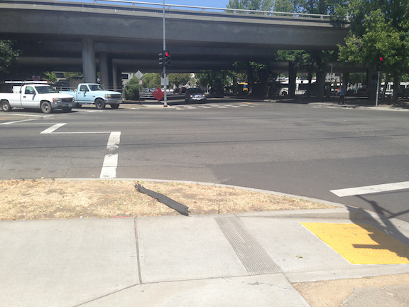
The signal at J Street and 13th Street in downtown Sacramento (shown at right) does not work well for pedestrians. The signal cycle is long, even compared to other signals on J Street, so the wait for pedestrians is quite long. I have seen the signal cycle skip both pedestrian crossings and vehicle crossings a number of times, which means that the wait is doubly long. Most walkers respond to this long wait by simply crossing the street against the pedestrian signal, and I don’t blame them at all.

A second issue is that the signal is set so that the east crosswalk walk mode occurs at the same time as the left turn from 13th Street southbound to J Street eastbound, meaning there is always a conflict between pedestrians and drivers at this point, and this conflict has been created by the signal setup. Many drivers cut directly behind or in front of people walking, as they know if they wait until the crosswalk is clear, as the law requires, they won’t make the signal.

This signal should be reconfigured so that it gives priority to pedestrians, without making them wait an unreasonable period of time, and does not create unnecessary conflict between turning drivers and people walking. The east crosswalk at a minimum needs a longer leading pedestrian interval (LPI).

Even better would be to make this a pedestrian scramble intersection, with an all-direction crossing phase during which all vehicle turning movement are prohibited. The intersection can be marked with diagonal crosswalks, and additional diagonal pedestrian signal head added, however, simply changing the signal timing is sufficient as an initial step. This is a busy crosswalk intersection, with the convention center on one corner, the Sheraton Grand on another, and the parking garage for the Sheraton and others on the third corner. It is alway busy, and the people crossing here are commonly tourists, who are likely used to more advanced ‘world class’ cities where pedestrians are not second class citizens after car drivers.

Note: There are a number of busy pedestrian crossing intersection in the Sacramento central city that deserve an upgrade, but this is the one that most irritates me, whether walking or bicycling.

surface parking to residential

Wasted space for parking. This was once residences, and should be again.

Part two of posts about O Street activation, but also of more general applicability. See also my related post No more pure office buildings downtown.

The activation of O Street under the CADA-led ‘Envision O Street: A Community Planning Process to Transform the Streetscape‘ effort will be only partially successful unless there are a lot more residents along O Street and the adjacent neighborhood to activate it. As it currently stands, the street is largely dead evenings and weekends. Even the homeless folks don’t much like hanging out there.

So, forthwith, my modest proposal. All surface parking lots along N, O, P and Q streets will be transferred to CADA and developed for residential and/or mixed use. These developments might even include some office space, but no development would be purely office. We have enough state office space as it is, and we have enough parking garages (decks) as it is. Significant parts of the parking decks are empty even on weekdays, and they are completely wasted space the rest of the time. Many of them are even locked up evenings and weekends, so they could not be used even if people wanted them to be used. The state seems to not care about whether downtown and its part of midtown (extending to 17th Street) are dead. It sees downtown as just a collection of office buildings, and is fine with the buildings and streets being empty off work hours. The state also believe that it is their responsibility to provide unlimited parking for their employees, no matter how much that parking decreases the livability of the places they work. I’m not sure if these attitudes come only from DGS (Department of General Services) which manages state property, or is a more general view, but it is wrong. The state should be encouraging workers to get out of their cars and onto transit (light rail runs on O Street), bicycles and foot, not providing them free and low cost parking. The state should be encouraging livability, not thwarting it.

All surface parking lots along N, O, P and Q streets will be transferred to CADA and developed for residential and/or mixed use.

O Street Activation

CADA (Capital Area Development Authority) is undertaking a process to activate O Street between 7th and 17th streets in downtown and midtown Sacramento. There was a community meeting at noon today, which I participated in. Not many people there, but there is also a meeting this evening which might gather residents who work during the day.

There are a lot of intriguing ideas and overall I think the draft framework is a good one. CADA said the diagrams and maps would be posted within a few days, so you will be able to see them at http://www.cadanet.org/projects/o-street-improvements-project.

Some comments I made:

  • the design needs to be compatible with the new light rail stations that will be constructed, probably in phases, to accommodate the new low-floor rail cars which require an 8-inch curb above the rails; the mini-high platforms needed for the current fleet of high-floor rail cars will eventually be removed, making for a much more pleasant street environment
  • rather than putting in bicycle facilities on O Street, separated bikeways on P Street and Q Street (partially complete) and N Street (not started) should handle most of the through bicycle traffic; instead, these things should be done to make the street bikeable without any special facilities:
    • speed limit 15 mph throughout
    • most sections become single-lane one-way, with narrowed travel lane; where two-way sections are needed (if at all), streets should be narrowed significantly
    • textured pavement, for streets or crosswalks or intersections, should either be sufficiently smooth to accommodate bicyclists, or have smooth pathways specifically for bicyclists
  • without bicycle-specific infrastructure, more of the right-of-way width can be devoted to pedestrians, sidewalks and the amenity zone; the pedestrian space will make the biggest difference in how the street is perceived
  • no section that is now closed to motor vehicles (9th to 10th and 11th to 12th) should be opened to motor vehicles, and no section that is currently one-way should become two-way
  • all corners should have bulb-outs (curb extensions) to calm motor vehicle speeds, reduce crossing distances, and preserve visibility at corners from parked vehicles; many corners are proposed for bulb-outs, but not all
  • raised intersections should be considered for all intersections
  • traffic on 15th Street (southbound) and 16th Street (northbound) must be calmed; it is currently difficult and hazardous for both walkers and bicyclists to cross through these intersections, traveling along O Street

The big issue, though, is that there is insufficient residents along the corridor, specifically between N Street and Q Street, to activate the corridor. More about that in my next post.

The improvements to O Street will be very expensive, if all are completed, but there are low cost items to start with, and I’m hopeful about seeing some of these in the near future.

JUMP at SacATC

JUMP Bikes representative Alex Hagelin made a presentation at the September 19 meeting of the Sacramento Active Transportation Commission (SacATC). Below are my notes from the presentation, and you can view it online at http://sacramento.granicus.com/MediaPlayer.php?clip_id=4254.

JUMP Bike Share Update at SacATC 2018-09-26, agenda item 5

Alex Hagelin, Sacramento General Manger

  • Launched in May
  • 900 bikes by October
  • Metrics
    • 80% month to month growth
    • 350,000 miles
    • > 300,00 Lbs CO2 saved
    • 13,000,000 calories burned
    • Parking complaints about 0.3% of trips
    • (no stats on trips per bike)
  • Parking
    • > 600 bike racks within city, 300 racks pending review for placement
    • Gathered community input on locations 11,000 votes
  • Charging
    • 10 plus with SacRT light rail stations, additional locations at private businesses (due to electrical drop requirements)
  • Bike parking behavior change
    • 2-3 times more use of JUMP as compared to GoBike in San Francisco
    • Considering photo requirement that users would have to take a photo of their parking job
    • Education, carrots, sticks, response time
  • Community
    • Drafting equity plan, available soon
    • Boost membership, $5 per year for low income; Pay Near Me to allow cash addition to account
    • Participating in local events
  • Looking forward
    • Community outreach
    • Responsible and responsive vendor
    • Growth: new bikes, expanded service area
  • Questions/answers
    • Bike clubs complaining about rider skills
    • JUMP seeing people on bikes who are not regular riders
    • City talking to JUMP about what education will look like
    • Raised issues about where bikes are located, neighborhood equity
    • Asked about service area, north to American River, and south a ways, will need new hubs in these areas
    • Charging stations SacState, city college, SacRT, private property

http://sacramento.granicus.com/MediaPlayer.php?clip_id=4254

preserving access during construction

Sacramento central city is booming with construction, which I consider to be a wonderful thing. Mixed use buildings, single lot apartments and  homes, state office buildings. But the construction is having a serious impact on walkability, and often bikeability. (Note: this post is not about road construction or about temporary closures, which also need to be addressed, but not today.)

Two examples, both of state developments, but with principles applicable to private developments, will illustrate the issues. For the new California Natural Resources Agency building between O and P, and 8th and 7th, the sidewalk, parking and one travel lane on the south side (P St) were removed from service. These are not being used in any way for the project. Perhaps they will be eventually, but in the meanwhile, presumably for the entire life of the construction project, they are just sitting empty and unused. For the new O Street office building at O and 12th, the sidewalk and parking were removed from the east side of 12th between the N-O alley and the O-P alley. The section to the north, where the building is being constructed, needs closure, as the underground level is being dug and the sidewalk will be replaced. But on the section to the south, which is being used for storing construction materials, do not need to be closed. There is plenty of space on this former parking lot.

12th Street construction closure

For some of the private construction going on, of which there are many examples, some closures are no doubt necessary. But the closures seem to be occurring from the very first day of construction to the very last day of construction, even though it is needed for only part of the time.

Construction companies are doing this because they can, out of convenience or laziness. And the city is allowing them to. Each construction project requires a traffic control plan, and the permit specifies allowable areas and time frames.

When I questioned the closure on the southern section of 12th Street, Matt from Construction Services in Public Works argued that since parking was removed, it was only fair that the sidewalk access be removed. His thinking was that fairness required making everyone lose something, and that the loss of parking was equivalent to the loss of sidewalk access.

This of course is a ridiculous argument. Parking is in no way equivalent to access. And priority must be given on all roadways to the most vulnerable users, which are in order of importance, pedestrians, bicyclists, and motor vehicle drivers.

At the recent Sacramento Active Transportation Commission meeting, Jennifer said that she though there might be guidance on access restrictions, but wasn’t sure, and would look into it.

In the meanwhile, let me propose:

  1. For any roadway with more than one lane in a direction, space will be taken from a general purpose travel lane:
    • If a sidewalk or informal walking path is present, pedestrian access will be preserved by the creation of a temporary sidewalk protected by delineators or barriers.
    • If a bike lane or separated bikeway is present, access will be preserved by the creation of a temporary bike lane protected by delineators or barriers.
  2. For any roadway with a single lane in a direction, space will be taken by closing the general purpose lane in one direction, with appropriate detours for motor vehicles:
    • If a sidewalk or informal walking path is present, pedestrian access will be preserved by the creation of a temporary sidewalk protected by delineators or barriers.
    • If a bike lane or separated bikeway is present, access will be preserved by the creation of a temporary bike lane protected by delineators or barriers.