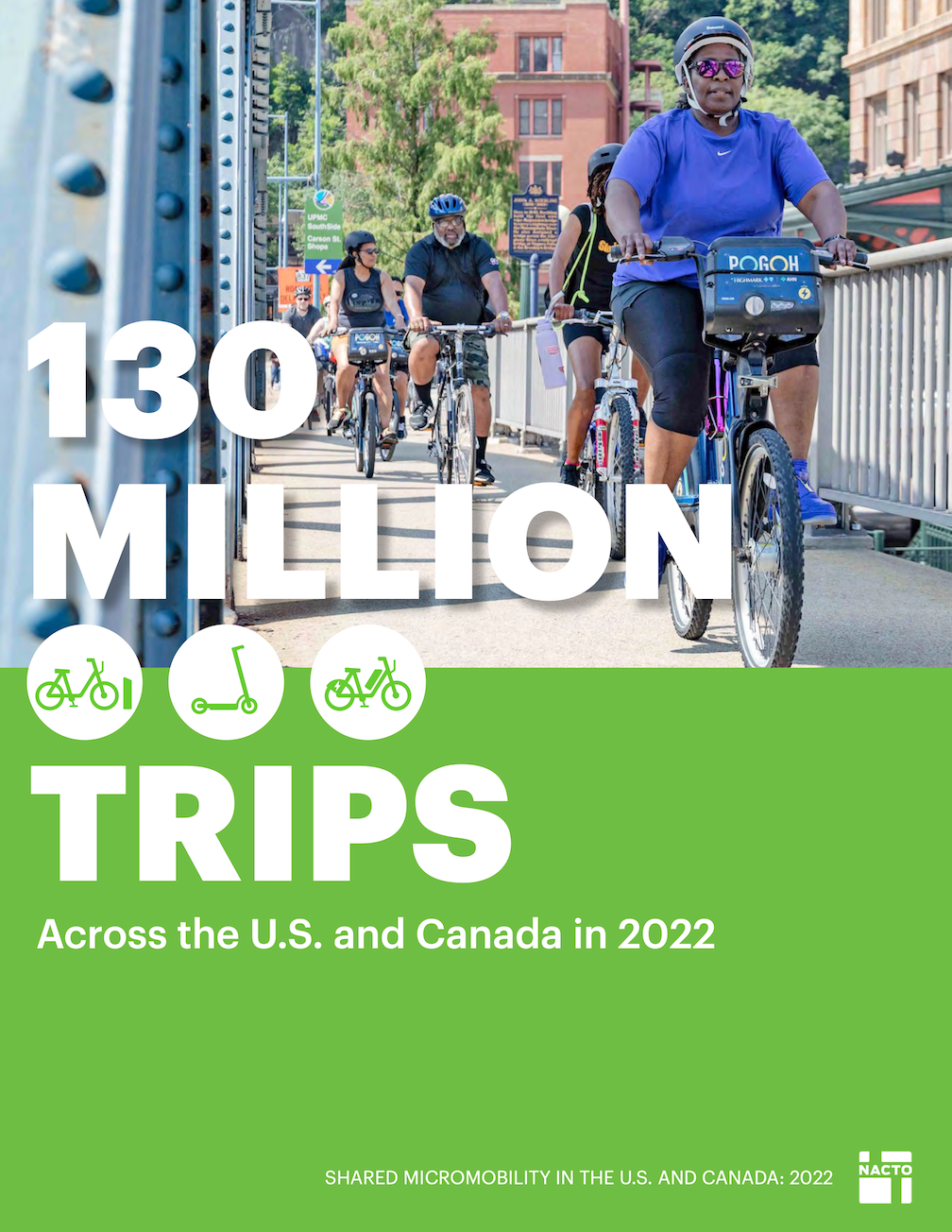
Walkable City: The Interesting Walk

To encourage you to participate in the last Walkable City book club meeting, tomorrow evening (Walkable City final book club November 8), some thoughts about the two steps in the ‘The Interesting Walk’ section (page 235 of the 10th Anniversary Edition).

Step 9: Make Friendly and Unique Faces

This step has five points: Invisible Parking, Sticky Versus Slippery Edges, Attack of the Starchitects, Too Much of a Thing, and Boring Nature. In invisible parking, Speck says structured parking should not be visible to people walking, but tucked away behind interesting buildings that draw in people walking. Of the parking garages in Sacramento, some are indeed hidden away, underground in some cases (good visually, but way too expensive to build), and behind commercial businesses in others. Other garages are glaringly obvious, presenting long stretches of sameness that discourages people walking, no matter how they go there (including the people who drove). Sticky edges have interest and variety, slippery edges are long stretches of sameness, often entire blocks where each foot look identical. Though thankfully Sacramento has less of the bland (I intended to type blank, but then, bland fits) than many cities. Government buildings are often the worst offenders. Walk along the north side of J Street between 14th and 15th Street, and you will know just how bad this can be. Starchitects is about cities selected star architects, who tend to design buildings that are interesting or beautiful, but have absolutely no connection to their surroundings. Too much is about how large developments look too much the same along their street faces, or if they do no, have fake variety. The solution is many buildings with a smaller face, built at different times by different developers (see Encouraging Fine-Grained Development by Andrew Price for an introduction). And finally, too much nature, in the city, can be just as boring as a suburb. We need small parks within walking distance of everyone, and of course we need street trees. But large expanses of park within city boundaries make for a less interesting place to walk, and push destinations further apart. An example it Land Park. It is wonderful, but it is just too much of a good thing. The park is mostly empty most of the time, and the parts that are more used are the zoo and Fairytale Town, the non-park parts of the park.

Step 10: Pick Your Winners

This step includes four points: Urban Triage, Anchors and Paths, The Lessons of LoDo, and Downtowns First. Urban triage means to focus effort and investment on places where it will make a big and immediate difference. Not places that are doing just fine, and not places that are hopeless, but places that can use a little help. This is not the Sacramento way. Anchors and paths means connecting two successful places that are close together but have an unwalkable or uninviting barrier between them, by fixing the walkability over short distances. The lessons of LoDo (lower downtown in Denver) is that an initial core of walkability and interest can spark transformation over a larger area. In LoDo, it was a brewery, and then restoration of the train station, and the area is now many square blocks that are largely successful. I’ve spent time there, and it is great, particularly the station. And focus on downtown means to not spread out investments everywhere in hopes they may make some difference, but rather on downtown where things are sort of good and have an existing structure of decent or historical old buildings (good bones is the common expression).

Part III: Update to the 10th Anniversary Edition

All of the book up through Step 10 is essentially unchanged since publication in 2012. The update section which follows Step 10 (page 263) goes into depth on several issues, addresses new trends over the 10 years, corrects some mistakes (particularly as it related to bicycles), and has a fascination section on responsibility for urban planners. Well worth a read, though there is anything directly related to these last two steps of the original book.

Book Club

What do you think? Do you agree? Disagree? Have a different vision, or a different approach? Come to the book club to listen to others and share your ideas. You do not need to have read this section of the book to participate, though you may enjoy it more if you have.

Jeanie Ward Waller

Jeanie Ward Waller, former Deputy Director for Planning and Modal Programs Caltrans, was fired in September, in retaliation for questioning illegal expenditures on highway widening, and threatening to file a whistleblower complaint. Though I’ve added several comments about this to other blog posts, these deserve their own prominence.

Blowing the whistle on widening freeways (KPBS Freeway Exit podcast);
https://www.kpbs.org/podcasts/freeway-exit/bonus-blowing-the-whistle-on-widening-freeways

I Lost My Job at Caltrans for Speaking Out Against Highway Widening; 
https://cal.streetsblog.org/2023/11/03/i-lost-my-job-at-caltrans-for-speaking-out-against-highway-widening

Jeanie Ward Waller at ECOS Climate Committee;
https://gettingaroundsac.blog/2023/10/16/jeanie-ward-waller-at-ecos-climate-committee/

CalBike Joins 100 Organizations Urging More Oversight of Caltrans;
https://www.calbike.org/calbike-joins-60-organizations-urging-more-oversight-of-caltrans/

California Transportation Commission Chair: “Widen Freeways for the People”; 
https://cal.streetsblog.org/2023/10/24/california-transportation-commission-chair-widen-freeways-for-the-people

More Than 60 Organizations Urge Governor Newsom to Intervene at Caltrans; 
https://cal.streetsblog.org/2023/10/17/letter-to-governor-newsom-intervene-at-caltrans

Sign-on to Support a Moratorium on Highway Expansions in California (for organizations); 
https://docs.google.com/forms/d/e/1FAIpQLSdQI_O5bdYPjAPxi7pMP-SzuMGPYlrxOMwaak21CT90Eh6GOg/viewform?fbzx=4437060886318091529

A Caltrans executive questioned a freeway expansion. Then she was demoted; 
https://www.latimes.com/california/story/2023-10-13/caltrans-whistleblower-says-demoted-block-freeway-expansion

Caltrans official says she was demoted for objecting to highway expansion; https://www.politico.com/news/2023/10/03/caltrans-official-demoted-whistleblower-complaint-00119767

Caltrans “Shakeup” is a Bad Sign;
https://cal.streetsblog.org/2023/09/19/caltrans-shakeup-is-a-bad-sign

Central City Mobility update #27

It has been a long while since I’ve posted on the Central City Mobility Project. I’ve been traveling, and backpacking, and project implementation has slowed down.

This is Central City Mobility Project update #27.

I Street is largely complete, from 21st Street to 12th Street. Part of the route is pretty standard separated bikeway, as below, but of the new bike facilities, it is the most erratic, changing design almost every block. The bikeway, at 16th Street, second below, is not a bike facility at all, but a car facility, designed to not inconvenience drivers turning right from I Street to 16th Street.

I St at 21st St separated bikeway
I St at 16th St separated bikeway across motor vehicle turn lane

The concrete turn wedges were being hit by drivers frequently (and some bicyclists), shortly after they were installed. Reflective strips were added, below, and most drivers have gotten accustomed to the turn wedges and are not hitting them, but it continues on a rarer basis. I believe that additional warning signing is going to be installed on the turn wedges, but I haven’t seen this yet.

reflective strips on concrete turn wedges

The concrete turn wedge at Q Street and 21st Street was never installed, so it may have been dropped from the plan.

The paint, not concrete, turn wedges have had K-71 green vertical delineators installed, making them somewhat more visible, and somewhat more respected by drivers. The promised rubber speed bumps have not been installed anywhere, probably a supply chain issue.

The promised bicycle signal at 21st Street and I Street is still not installed.

Though most of the separated bikeways have received green K-71 vertical delineators, a few have not.

Along P Street an added double white line has been installed on some blocks, photo below. I don’t know why, but it must be to solve some issue that was not solved by the original design.

added double white line on P St

After being mostly neglected, curb designations for loading zones and short term parking have been installed in several places. The photo below shows the white curb with added pavement stencils for a loading zone on P Street approaching 16th Street. This is probably the location that was most being abused by both delivery drivers and private vehicle drivers, so this is good to see. White curb loading zones don’t have a designated time limit, and I have seen this location abused by private vehicle drivers, which should not be here at all since this designation is for commercial loading, but it is far better than before.

curb marking and pavement message for loading zone, P St

Lastly, there seems to be new activity on 5th Street, so that part of the project may be moving forward again. I’ll check it out and post.

I have not visited the south end of 19th Street, nor the south end of 21st Street, so I don’t know if those locations have been improved. Both were a mess. I’ll try to get there and report.

Walkable City final book club November 8

The Sacramento area book club gathering for Walkable City by Jeff Speck continues on the second Wednesday of November, October 8, 6:00PM to about 7:30PM, at Lefty’s Taproom, 5610 Elvas Ave, Sacramento. This will be the last meeting of the book club on this book.

The book section for this gathering is ‘The Interesting Walk’, with Step 9: Make Interesting and Friendly Faces and Step 10: Picking Winners. The 10th Anniversary Edition also contains supplementary material updating these chapters.. The Sacramento Public Library has a copy of the 10th Anniversary Edition (2022) and the original edition (2012). Local bookstores may have a copy on hand, but if not, can order it in few days. It is also available as an Amazon Kindle e-book and Audible audio book.

You do not need to have attended a previous book club gathering. If it is your first time, welcome! You also do not need to have read the relevant sections of the book, but you will probably enjoy the conversation more if you have. Previous participants have included transportation and housing professionals, but also just interested citizens. We want you, we want your voice and ideas! We realize that some people have a hard time getting somewhere at 6:00 sharp after work or other obligations, so come when you can, and jump in.

An Eventbrite event has been set up to let us know you are coming: https://www.eventbrite.com/e/copy-of-walkable-city-jeff-speck-book-club-tickets-752991326327. However, a ticket is NOT required, you can just show up. Getting a ticket helps us plan, and provides the ability to have it entered on your calendar, so you don’t forget, but please come in any case.

Lefty’s Taproom has a wide selection of beer, and some wine and cocktails, and non-alcoholic drinks. They also have a variety of dinner items. You are not required to drink or eat, but it does help support our venue. We meet outside on the patio, so come dressed appropriately. Sunset will be at 5:05PM that day. There is bike parking at the front entrance. Lefty’s is a 10 minute walk from SacRT route 30, or a 30 minute walk from SacRT Gold Line light rail. There are good bicycle facilities on Elvas, but not necessarily on streets connecting to Elvas.

See previous posts: Walkable City book club October 11, Walkable City book club: Step 5: Protect the Pedestrian,, Walkable City book club nextWalkable City Book Club.

Caltrans D3, the criminal highway wideners

Caltrans District 3 (which covers Sacramento, Yolo, El Dorado, Placer, Nevada, Sierra, Butte, Glenn, and Colusa counties), is committed to widening freeways, now and forever. They do not intend to comply with direction from Caltrans headquarters, or with the upcoming complete streets policy, or with guidance such as Cal STA CAPTI (California Action Plan for Transportation Infrastructure), which requires Caltrans to consider climate impacts of its projects. Caltrans D3 only knows how to build and widen highways, and they don’t believe that any other transportation modes are important.

Take a look at the list of current projects on the D3 web page. Most are highway widening projects. Of course Caltrans never uses the term widening, it uses terms such as enhancement, improvement, and multimodal to hide the true nature of these projects.

Caltrans has a long list of on-the-shelf projects which it will move to when these projects are done. Some of these projects were designed 20 or more years ago, when much of society had not yet woken up to the environmental and social damage that freeways cause, and before the surge of deaths and severe injuries to walkers on the state highway system. They will be pulled off the shelf and built, because that is what Caltrans does.

All of this is well to anyone who works with or follows Caltrans. Many engineers and planners won’t talk about this on the record, but privately confirm it.

A recent article on Politico (Caltrans official says she was demoted for objecting to highway expansion)explains why Jeannie Ward Waller was fired/demoted. It was for calling out Caltrans D3 for violating the law, misusing maintenance funds to widen highways. This one goes beyond earlier articles on StreetsblogCal (Caltrans “Shakeup” Is a Bad Sign) about the firing/demotion.

Retribution is an interesting action, usually reserved for dictators and right wing politicians, but it seems to be alive and well in Caltrans.

Caltrans likes killer interchanges

See Caltrans Readies Guidance for Complete Streets, with a Giant Exemption (StreetsblogCal, 2023-09-29) and Caltrans: We Need Complete Streets at Freeway Interchanges (CalBike, 2023-09-28).

I worked for 10 years as the Safe Routes to School Coordinator for San Juan Unified School District. Three of those years were focused on Citrus Heights schools, and the rest on schools in unincorporated Sacramento County (Orangevale, Fair Oaks, Carmichael, Arden-Arcade, and Gold River). The interchanges with Interstate 80 presented barriers for students who lived on one side and went to school on the other. They could not walk or bike across the freeway, because the interchanges were designed to be safe only for motor vehicle drivers (and not really even those), not to be safe for walkers and bicyclists. Crosswalks over on-ramps and off-ramps were placed where drivers would cross them at freeway speeds, with poor visibility due to the curves. Bike lanes were usually non-existent, and when they were there, exposed bicyclists to high speed merges at on-ramps and off-ramps. If you have ever had the ‘pleasure’ of walking or riding across one of these interchanges, you will know how scary and unpleasant they are. Generally only ‘fearless’ bicyclists and people who have no other choices will walk or bicycle here.

Since these horrible interchanges were designed and constructed by Caltrans, you might think that they are responsible for fixing them. They deny responsibility. They say to cities and counties, if you want a better interchange, you build it on your own money, or with grants. One of the interchanges in Citrus Heights, Antelope Road, was repaved by Caltrans, and they removed the bike lane from the westbound direction. Of course that bike lane was not safe to begin with, but removing it was criminal.

Same Caltrans denial of responsibility for ped/bike bridges over the freeway. There is one ped/bike bridge over I-80 in the entire stretch between Sunrise Blvd and Watt Ave, a distance of about eight miles. One. And it is no a pleasant crossing to use, often full of trash and graffiti. Again, to the cities and counties, Caltrans says, if you want it, you pay for it, don’t expect it to come out of our budget.

Given this, Caltrans will not even allow the application of complete streets designs to these interchanges. They want them to remain as they are, barriers to travel, and killers of the few walkers and bicyclists who use them.

All of this after spending four years developing a new complete streets policy, which could have been done in a year if Caltrans were not dragging its feet. Caltrans says that it has changed its ways, and is now concerned with people who walk and bicycle. Their actions say otherwise.

Walkable City book club October 11

The Sacramento area book club gathering for Walkable City by Jeff Speck continues on the second Wednesday of October, October 11, 6:00PM to about 7:30PM, at Lefty’s Taproom, 5610 Elvas Ave, Sacramento.

The book section for this gathering is ‘The Comfortable Walk’ (page 211), with Step 7: Shape the Spaces and Step 8: Plant Trees. The 10th Anniversary Edition also contains ‘More Comfort’ (page 345). The Sacramento Public Library has a copy of the 10th Anniversary Edition (2022) and the original edition (2012). Local bookstores may have a copy on hand, but if not, can order it in few days. It is also available as an Amazon Kindle e-book and Audible audio book. The last gathering will be Wednesday, November 8, and will cover ‘The Interesting Walk’ (page 235), with Step 9: Make Friendly and Unique Faces and Step 10: Pick Your Winners.

You do not need to have attended a previous book club gathering. If it is your first time, welcome! You also do not need to have read the relevant sections of the book, but you will probably enjoy the conversation more if you have. Previous participants have included transportation and housing professionals, but also just interested citizens. We want you, we want your voice and ideas! We realize that some people have a hard time getting somewhere at 6:00 sharp after work or other obligations, so come when you can, and jump in.

An Eventbrite event has been set up to let us know you are coming: https://www.eventbrite.com/e/walkable-city-jeff-speck-book-club-tickets-728394807477. However, a ticket is NOT required, you can just show up. Getting a ticket helps us plan, and provides the ability to have it entered on your calendar, so you don’t forget, but please come in any case.

Lefty’s Taproom has a wide selection of beer, and some wine and cocktails, and non-alcoholic drinks. They also have a variety of dinner items. You are not required to drink or eat, but it does help support our venue. We meet outside on the patio, so come dressed appropriately. Sunset will be at 6:35PM that day. There is bike parking at the front entrance. Lefty’s is a 10 minute walk from SacRT route 30, or a 30 minute walk from SacRT Gold Line light rail. There are good bicycle facilities on Elvas, but not necessarily on streets connecting to Elvas.

See previous posts: Walkable City book club: Step 5: Protect the Pedestrian,, Walkable City book club next, Walkable City Book Club.

Central City Mobility update: I Street

This is Central City Mobility Project update #26.

Work is occurring on I Street this week. The street has been marked from 21st Street to 12th Street, and some of the white striping has been completed. No green paint yet. This section is all right side of the street bikeways.

The design is rather erratic:

  • 21st Street to 20th Street, parking protected separated bikeway
  • 20th Street to 19th Street midblock, bike lane
  • 19th Street midblock to 16th Street, buffered bike lane
  • 16th Street to 13th Street, buffered bike lane
  • 13th Street to 12th Street, parking protected separated bikeway

At the intersection of 21st Street and I Street, there are markings for dashed green bike lanes on the west, south, and east legs, adjacent to the crosswalks (not yet painted). No sign of the promised bike signal yet. The markings imply to me that bicyclists continuing north on 21st Street will have to make a two-stage crossing, first across 21st Street, and then across I Street. This is not what was advertised, which was that bicyclists would have an exclusive signal phase during which they could go to any of the three destinations without any moving motor vehicle traffic. To to seen.

photo 21st St & I St intersection bike lane markings
21st St & I St intersection bike lane markings

At 20th Street, the street becomes three motor vehicle lanes (general purpose travel lanes) and a curb-side regular bike lane. I’m guessing this is to provide stacking area for motor vehicles when trains are crossing. Makes some sense, but it also makes the bikeway erratic, and will encourage poor behavior as drivers speed into the third lane, and then have to merge back into two lanes.

photo I St at 20th St, unprotected bike lane and three motor vehicle lanes
I St at 20th St, unprotected bike lane and three motor vehicle lanes

At 16th Street, the street design is two motor vehicle lanes and a buffered bike lane. The reason for this is that the Memorial Auditorium loading dock extends into the street, which was an earlier design mistake that the city made to choose auditorium convenience over people walking (Sac permanently closes sidewalk).

photo I St at 16th St, two vehicle lanes and buffered bike lane
I St at 16th St, two vehicle lanes and buffered bike lane

12th Street is the end of the project, and I Street is again a three-lane traffic sewer towards the freeway. At 6th Street it becomes a five-lane traffic sewer.

Since work is actively going on today, I would guess that the white paint will be complete by the end of this week, and green paint added next week. There is still a national shortage of the green K-71 vertical delineators, so I would guess that only a few will be placed in the near future. There are a few places with gaps in the white stripes, which will be a designated color for parking or loading.

Comstock’s Magazine: Free Parking?

In a measure of how much the world has changed, strongly pro-business Comstock’s Magazine has come out with an article, Free Parking? It recognizes that abundant parking everywhere does not promote economic success, but in fact handicaps it. Several properties that have been repurposed from parking to higher uses are mentioned, and there are quotes from one of the largest developers in the city. The article recognizes that the success of midtown is in part due to the removal of parking minimums years ago.

Take a read!