At a recent meeting, people asked me about the crossing of N Street at 14th Street, what I thought of the pedestrian prohibition, and why I hadn’t reported it as I do most other construction related issues.
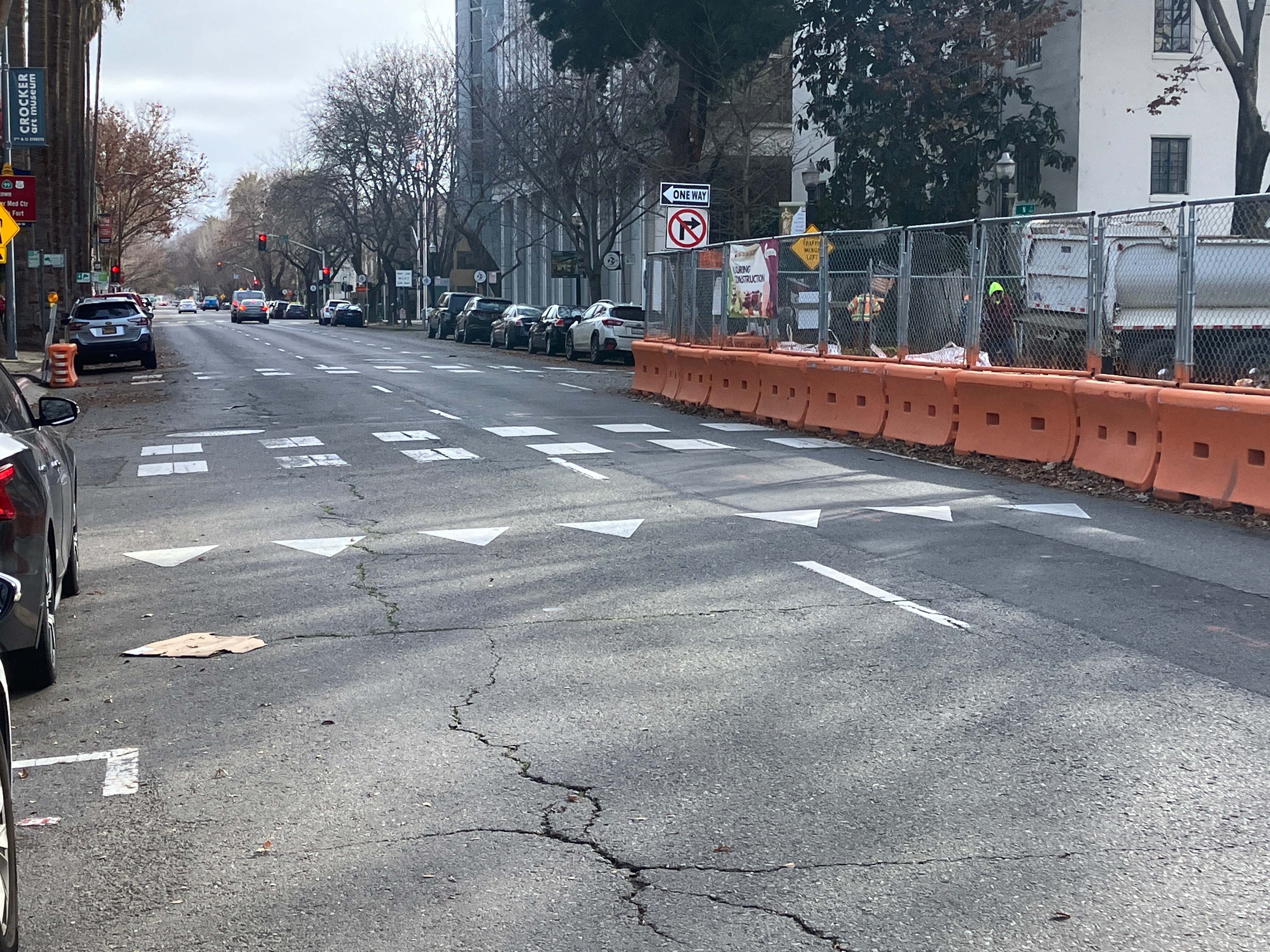
N Street is a three lane one-way street, reduced to two lanes by construction at the state capitol, and the CADA construction project on the southwest corner of N Street and 14th Street. At this construction project, the parking lane and rightmost lane are closed, with a barrier and fence along N Street. The barrier and fence block driver view of the crosswalk on the east side of the N Street/14th Street crosswalk, until just before the crosswalk. This is a situation not addressed by CA-MUTCD, nor the proposed city Draft Criteria and Guidance to Accommodate Active Transportation in Work Zones and at Events, or work zone guide for short.
There are probably ways of safely handling this limited visibility situation, but it is not immediately obvious to me how. So I have not reported the closure of this crosswalk. It is a low volume crosswalk, I believe. Any detour for walkers is an issue, and this one requires a detour of a block to the east or west, because both the east crosswalk and the west crosswalk are closed.
While it is true that this crosswalk closure is no absolutely necessary, it is also true that it would take some sort of traffic control at this location to make it safe for walkers.