Intersection Control

Intersection control means the devices used at intersections to control the actions and behavior of motor vehicle drivers and others including walkers. The types of controls are:

  • none
  • 2-way yield
  • 2-way stop (or minor approach stop, MAS)
  • 4-way stop (or all-way stop, AWS)
  • roundabouts without signals
  • partial traffic control signals, such as flashing red or flashing yellow, and HAWK or RRFB
  • complete traffic control signals, with a cycle of green-yellow-red

It is often assumed, by traffic engineers and by the public, that safety increases moving down the list of intersection controls. However, there is research both supporting and contradicting this assumption.

Intersections may have features designed for people crossing, such as pedestrian crossing signals, with or without a countdown, and accessible pedestrian signals, compliant with PROWAG (Public Right-of-Way Accessibility Guidelines). Pedestrian signals may require user activation (the beg button) or may use automated pedestrian detection. Exclusive pedestrian phases allow people to cross when no motor vehicles are moving, thereby reducing the chance for crashes to near zero.

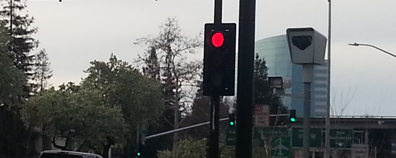
Other features may increase or decrease safety. Examples that may increase safety if properly designed and implemented, are curb extensions, refuge islands, automated red light cameras, near-side traffic signal placement, raised crosswalks or raised intersections, and roadway design that slows vehicles approaching the intersection. Examples that may decrease safety, particularly for walkers and bicyclists, are dedicated turn lanes, faded or non-existent crosswalks, pedestrian crossing prohibitions, and roadway designs that encourage speeding approaching the intersection.

Traffic Signals

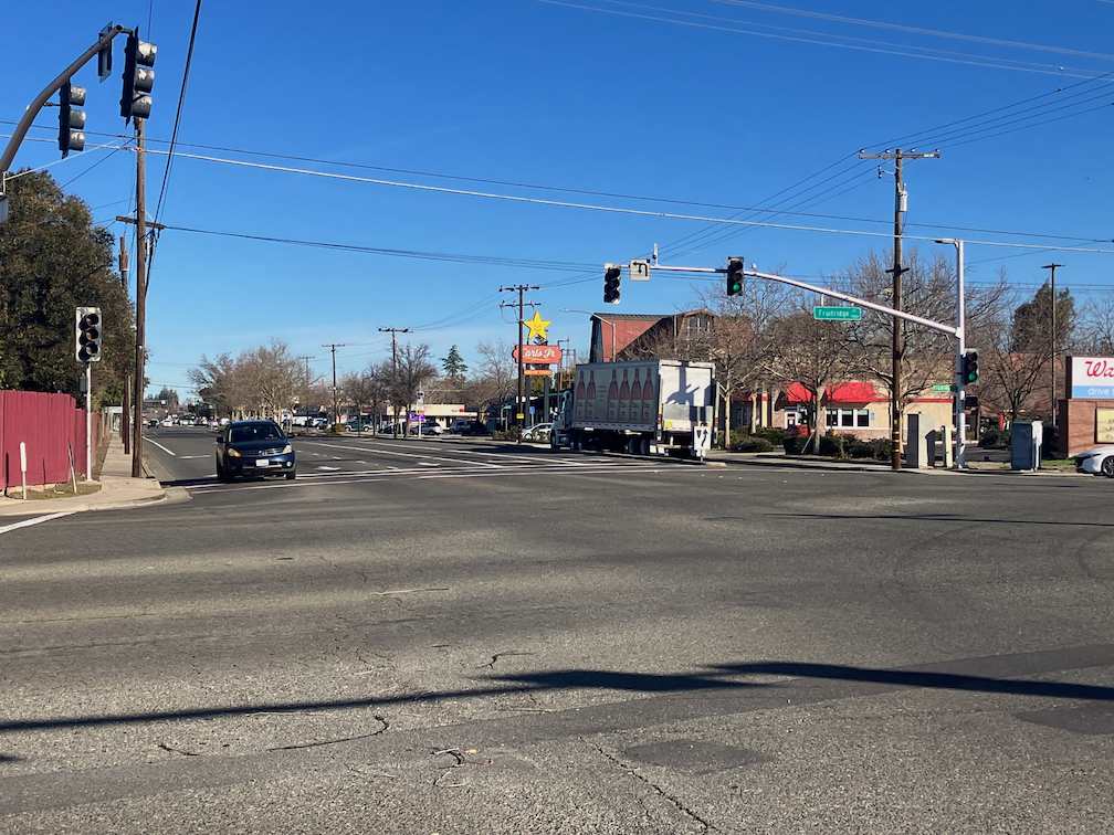
Traffic engineers often try to solve known safety issues by adding new traffic signals. Little attention is paid to alternative solutions such as adding traffic calming features, or removing hazardous features. New or enhanced traffic signals are VERY expensive, ranging up to $1,000,000 per intersection. The addition of new signals ensures that money will not be available for traffic calming solutions that would be less expensive and more effective.

Traffic signals do not decrease the speed of motor vehicles in between intersections. Drivers immediately accelerate to the speed they had before stopping at the signal (if in fact they do stop). But signals do delay drivers, leading to frustration and increased violation of motor vehicle codes, particularly in yielding to walkers in the crosswalk. Red light running has become epidemic in the Sacramento region, perhaps worse than other regions, so it is not safe for anyone to proceed on a green signal or a pedestrian walk signal. This indicates a failure of traffic signals to control driver behavior, and that they may no longer be effective for safety.

The fact is, traffic signals are largely intended to smooth and ease traffic flow, and are often not safety features at all. Safety is used to justify new or upgraded signals, often without evidence.

Traffic signals are a classic example of ‘orderly but dumb’. Intersections should be ‘chaotic but smart’. (Strong Towns concept and Carlson’s Law)

Traffic engineers often claim that existing traffic signals were installed based on meeting warrants defined in the Manual for Uniform Traffic Control Devices (MUTCD, and the California version CA-MUTCD), but generally can’t produce those warrant documents. Many signals were installed based on politician requests and were not and are not justified by intersection characteristics. The warrant process emphasizes traffic flow and de-emphasizes safety for walkers and bicyclists.

All existing traffic signal locations should be analyzed every ten years, and signals which did not meet, or no longer meet, warrants, shall be removed. As roadways are modified or rebuilt with traffic calming features, far fewer traffic signals will be necessary.

When are traffic signals justified?

  1. At the intersection of two major roadways.
  2. Where the flow of traffic on one roadway does not provide gaps in traffic for crossing that roadway.
  3. At offset or skewed intersections where visibility or understanding may be difficult.

Most existing and proposed traffic signals do not meet any of these criteria. Major roadways, almost always designed as stroads, which are roadways designed for higher speed but with land use or design features that require slower speed, including driveways and turning movements, should be uncommon in urban areas.

Signals should never be installed to serve driveways, including shopping centers.

For any new traffic signal installed, it must include:

  • Signal cycles no longer than 90 seconds. Longer cycles are biased against walkers, and encourage walkers to cross against the signal.
  • Leading pedestrian interval (LPI) which provides the walk sign three or more seconds before the green light for drivers. Leading pedestrian interval (LPI) should be installed at ALL traffic signals in the city within five years. Bicyclists may proceed on the walk signal.
  • Elimination of slip lanes, dedicated right-hand turn lanes, and dedicated left-hand turn lanes more than one. Turning movements constitute the greatest danger to all roadway users.
  • No right (or left, for one-way roads) turn on red. No right on red should be installed at ALL traffic signals in the city within ten years.
  • Automated pedestrian detection to eliminate the need for beg buttons while achieving compliance with PROWAG. No person walking or rolling shall be required to manually actuate a pedestrian signal.
  • Implementation of exclusive pedestrian phases at any intersection with significant pedestrian flow. This phase may be achieved with turn prohibitions during pedestrian movement, or by all-way pedestrian crossing, called pedestrian scrambles.
  • Demand-responsive operation so that the signal cycle responds to demand by drivers, walkers and bicyclists, rather than set to an unchanging cycle.

Existing signals should meet the same criteria when upgraded.

HAWK and RRFB signals

HAWK (High intensity Activated crossWalK) and RRFB (Rectangular Rapid Flashing Beacon) are partial signals installed to allow walkers to cross roadways which would be difficult or unsafe to cross. However, HAWK signals are violated by some drivers, and RRFB signals are violated by many drivers. These signals are often justified by traffic engineers as ‘safer than nothing’, but it only takes one violating driver to kill a walker. RRFBs should not be used on roadways with a posted speed limit over 30 mph, and HAWKs over 35 mph.

Other Intersection Control

Intersections without signals can have stop signs, yield signs, or no signs at all.

The intersection of two low-speed (20 mph or less), low volume streets do not need any sign. They can be left uncontrolled, with drivers and bicyclists negotiating right of way at intersections, based on the universal first-come/first-served principal.

Intersections of moderate-speed (up to 30 mph), moderate volume streets may justify some signing. In order of increasing regulation, these are:

  • Two-way yield
  • Two-way stop
  • Four-way stop

The lowest level of signing that can provide safety for the intersection is the right level of signing. Stop signs should not be installed based on neighborhood or politician request, but rather based on observation of user behavior and the intersection, and crash history. The objective should not be to eliminate all possibility of crashes but to eliminate any possibility of fatal crashes.

With roadways designed for safety and placemaking rather than motor vehicle speed and throughput, intersection control can be the minimum necessary rather than the maximum control and expense.

Roundabouts

A roundabout is a circulatory intersection in which motor vehicles and bicyclists yield to others already in the roundabout, but otherwise do not need to stop. By eliminating traffic signals and stop signs, they ease traffic flow (and therefore driver frustration) and reduce crashes, particularly fatal and severe injury crashes. Other than low speed, low volume local streets that require no traffic control but do require user negotiation, roundabouts are the safest sort of intersection. Multi-lane roundabouts should really not be called roundabouts at all, and are generally no safer than signalized intersections.

References

Previous Getting Around Sacramento posts

lawsuits against Yolo 80

For earlier posts on Yolo 80 and managed lanes, see category ‘managed lanes‘.

Two lawsuits have been filed against Caltrans over the Yolo 80 freeway widening project.

Sierra Club and ECOS: Sierra Club, ECOS file lawsuit against Caltrans over I-80 project; Sierra Club and ECOS Sue Caltrans over Yolo I-80 Freeway Widening Project

“Caltrans’ Environmental Impact Report (EIR) grossly underestimates increased vehicular travel, which would emit far larger quantities of greenhouse gases (GHG) and air pollutants than claimed. The EIR fails to consider viable alternatives, such as increased public transit or alternate tolling strategies. Therefore, the project neither adequately manages demand nor produces adequate revenue to fund needed transit alternatives. Also, Caltrans’ proposed mitigation is woefully inadequate to offset the resulting increased GHG and air pollutant emissions.” – Sierra Club/ECOS Press Release

NRDC (Natural Resources Defense Council)/Planning and Conservation League/Center for Biological Diversity: Environmental Groups File Suit Against I-80 Highway Expansion; Environmental Groups Challenge Highway Expansion Project in Court

“First, Caltrans improperly chopped this project into two pieces to use funding in illegitimate ways and obscure environmental impacts, as documented by a Caltrans whistleblower. The first project, already underway, is using maintenance-only transportation dollars to strengthen the shoulders of the highway so they can accommodate heavy vehicle travel. The second project would restripe the road to accommodate the additional lane of traffic in each direction.” – NRDC

I tend to be cynical about the chances of stopping this widening project. However, the lawsuits can have several beneficial impacts:

  • requiring Caltans to supplement or revise its Environmental Impact Report, because it failed to consider several impacts, and failed to address induced demand
  • requiring Caltrans to allocate more funding to environmental and GHG mitigation; the existing project only partially mitigates impacts, and depends on income from a single tolled lane, which may fall short of projections
  • highlighting the failure of the California Transportation Commission, and in particular Chair Carl Guardino, to provide legally required oversight of Caltrans

I am in favor of tolling freeway lanes in order to recovered construction and maintenance costs, and to fund mitigation measures, not just for GHG but for other environmental impacts. A tolling authority (CARTA) has been set up to administer the added toll lane, but there are great uncertainties about how much will be raised, and the fee structure (vehicles and time of day) has not been developed.

“The EIR does not consider tolling existing lanes, which could be based on income, with funds used to provide clean public transit and bike and pedestrian options along the corridor, facilitating affordable infill development.” – Ralph Propper, ECOS Climate Committee Chair, from the press release

Strong SacTown quick-build street safety

Strong SacTown has created a great visual introduction to quick-build fixes for street safety, posted to Instagram. I encourage you to take a look. The series includes curb extensions and modal filters (traffic diverters), both quick build with temporary materials, and permanent installations. Of course temporary materials should eventually be replaced with permanence, but it is better to get something on the ground now rather than waiting for the planning and money it takes for permanent installations. We are experiencing an epidemic of traffic violence, and even small actions can reduce fatalities and injuries. These installations are also called tactical urbanism, though the definition of quick-build and tactical urbanism is not identical.

Some additional ideas that are not always thought of as traffic calming.

Street Design

We can design better streets to begin with so that the need for traffic calming is reduced. Example one is the wide medians in Boulevard Park, which reduces turning movements to the intersections while providing a pleasant environment. Example two is wide sidewalk buffers in the Poverty Ridge area, where narrow streets reduce vehicle speeds, and the sidewalk buffers provide a pleasant environment. I have watched motor vehicle drivers passing each other on these narrow streets in the Poverty Ridge area. They are slowing to about 5 mph to pass. This is a traffic violence reduction design in action!

wide street median, 22nd St at C St in Boulevard Park
photo of narrow street with wide sidewalk buffers, V St at 21st St
narrow street with wide sidewalk buffers, V St at 21st St in Poverty Ridge
Read More »

the end of red light enforcement

A SacBee article today notes the end of the red light camera program in City of Sacramento, which was part of Sacramento County’s program: Sacramento’s red light camera program has been shut down by the Sheriff’s Office. Here’s why. (sorry about the firewall)

This is very sad news, given the epidemic of red light running in the City of Sacramento (and elsewhere). I’ve written about this before: how do we get more red light cameras?, red light running consequences, SacCity red light cameras and crashes, Sac Vision Zero intersections & red light cameras, red-light-running bullies, and pandemic of red light running. It has only gotten worse over time, and will continue to get worse unless the city takes action to reduce it.

A quote from the Sacramento County Sheriff’s Office is particularly galling: “Gandhi said the Sheriff’s Office wants to focus on its mission of suppressing violent crime and other criminal activity.” Apparently, in the view of law enforcement, traffic violence is not a violent crime. Apparently, the fact that red-light runners kill and injure walkers, bicyclists, passengers, and other drivers is of little concern. Sadly, this is a very common law enforcement attitude.

If cost-cutting were an appropriate response to criminal activity, it would be reasonable to just eliminate law enforcement. Law enforcement responds to criminal activity; it does little to nothing to prevent criminal activity. Automated red light enforcement is an effective response to criminal activity, and it does reduce future criminal activity. Why is the Sheriff’s Office and the City of Sacramento not interested?

If you think that direct law enforcement of red light running is a good replacement, you would be wrong, for two reasons. One, almost no enforcement of motor vehicle violations occurs anymore, other than some enforcement of speeding. Two, the law enforcement practice of pretextual stops, stopping people of color for traffic violations to search for other violations, and to intimidate people of color, results in law enforcement violence against drivers of color.

One of the useful things the city was doing to reduce traffic violence is no longer. Don’t you feel safer now? You can visit the city’s Red Light Running Program page, in case you wish to leave condolences, remembrances, or flowers.

photo of red light camera, from City of Sacramento
red light camera, from City of Sacramento

convert HOV lanes to Express Lanes

With the establishment of the regional tolling authority, Capitol Area Regional Tolling Authority (CARTA), a joint powers authority (JPA), the opportunity exists for existing HOV (high occupancy vehicle) lanes to tolled lanes, specifically Express Lanes. HOV lanes had their time, but that time is past. HOV lanes are routinely violated. If you stand on an overpass and look down at vehicles in the HOV lane, you will see that many of them are single occupant vehicles, not high occupancy. You could also do the same while driving, but I’d rather you kept your eye on the road. The HOV 2+, used in the Sacramento region, which requires two occupants, is a pretty low bar, but even that is not achieved by many drivers. HOV lanes, being free, also generate no funds to maintain the lanes.

The SACOG region current has about 144 lane-miles of HOV lanes. It has no HOT (high occupancy toll) lanes, and no Express Lanes (all vehicles tolled, though toll may vary with occupancy or time of day). The map below (pdf) shows the existing HOV lanes (blue), and the HOV lane now being constructed as part of the Fix50 project. I have seen a SACOG map of the intended Managed Lane Network, but am unable to find it at the moment.

While the Yolo 80 project initiated the current tolling effort, SACOG in the 2020 MTP/SCS, identified managed lanes as a key component of both managing traffic and paying for maintenance of the system.

Read More »

the long awaited death of ‘share the road’

The ‘share the road’ sign, which has been very popular with traffic engineers, is NOT in the 2023 MUTCD. So this sign is dead, and a well deserved death. The ‘share the road’ sign was often interpreted by drivers to mean, bicyclists must share the road with motor vehicles, or in less polite terms, “get out of my way, the sign says so”. The share the road diamond shaped sign was never a legal MUTCD sign, though they were and are quite common.

W16-1P sign, which used to say ‘share the road’ now says ‘in road’, as in, bicycles in roadway. The left sign is common, the middle sign can be used, and the right sign is for temporary traffic control (TTC). Since this new sign content replaces the old with the same sign designation, I take it to mean that the old sign may no longer be used at all, and must be replaced by the new sign.

The plaque is not used by itself, but with the W11-1 bicycle sign, below. Though the yellow version of the W11-1/W16-1P assembly is permitted, this sign would more likely be used at TTC in a construction zone.

MUTCD W11-1/W16-1P assembly sign 'bicycles in road'
MUTCD W11-1/W16-1P assembly sign ‘bicycles in road’

Outside of construction zones, the preferable sign would be MUTCD R9-20 ‘bikes allowed use of full lane’, below, and this sign can also be used in construction zones. This sign is similar to the old MUTCD R4-11 sign, which is no longer in the MUTCD.

MUTCD R9-20 'bicycles allowed use of full lane'
MUTCD R9-20 ‘bicycles allowed use of full lane’

Only in a few cases does the MUTCD require replacement of existing signs, but does require that the current sign be used in any new installation.

The new MUTCD recognizes the green painted bicycle lanes and green dotted bicycle lanes (often called skip marking) through conflict areas such as merges and intersections. Unfortunately, it did not drop recognition of the ‘sharrow’ shared lane marking. Though the sharrow can be legitimately used to show a bicyclist path in confusing locations, it has generally been used to bias roadways against bicyclists and to encourage motorists to fail to yield to bicyclists in the roadway. Maybe next time!

The MUTCD now has an entire chapter devoted to bicycles, Part 9: Traffic Control for Bicycle Facilities. This is progress, even if less than desired.

MUTCD released

The 11th edition of the Manual for Uniform Traffic Control Devices (MUTCD) was released in December by FHWA (Federal Highway Administration), so is the 2023 version. The update included solicited comments from the public for the first time, as previously it had been solely the work of traffic engineer insiders. As a result, it is better than the previous version, but still has many unsafe practices included. Though it is supposed to be only about signs and pavement markings, it grades into roadway design, with an emphasis on high speed freeways. Much of it should be limited to highways, but it is regularly applied, or mis-applied, to local streets.

I have been focused on Part 6: Temporary Traffic Control, because it relates to the City of Sacramento work zone policy update. The diagrams are much easier to digest than the text, but the text is also critical. Most of the text and diagrams relate to freeways and expressways, where sidewalks and bike facilities are absent, but it does have some information that affects walking and bicycling. The document uses the phrase ‘shall’ to indicate that a practice must be followed, however, the entire document is prefaced with allowance and encouragement to use engineering judgement. Other terms such as guidance and support are used, for ‘good ideas’ but not requirements. It is very unlikely that I will ever read the entire document; it is 1,150 pages!

NACTO (National Association of City Traffic Officials, a much more progressive organization than FHWA) has done a preliminary review of the new MUTCD: NACTO Statement on the Release of the 11th Edition of the MUTCD, Which Governs How Nearly Every Street in the U.S. Is Designed. NACTO has promised a more though review.

California has in the past adopted its own version of the federal MUTCD, the CA-MUTCD. The current California version is 2014, and it took the state five years to develop this version and get it approved. Hopefully it will take far less time this go-round. The California version deletes some text and diagrams from the federal, adds some diagrams, and adds quite a bit of text. In most case, the California version specifies clearer or safer information, but not always. In some cases the California version has been included in the new federal version, so does not need to vary. I have not seen any announcement from Caltrans about a state update.

tolling authority at SacTA

At the Sacramento Transportation Authority (SacTA) board meeting today, SACOG gave a presentation on the tolling authority and governance, as part of agenda 9, Receive Information on the creation of the Capital Area Regional Tolling Authority (CARTA) and the Yolo 80 Managed Lane Project and provide direction as appropriate. The two presentations, one by SACOG staff and the other by Executive Director Kevin Bewsey on possible SacTA role, are available: SACOG, SacTA role. SACOG estimated in the current MTP/SCS (not the update being worked on) that about 70% of the expected tolled lanes will be in Sacramento County. See map at bottom.

In my public comment, I spoke on these points, similar to the points I’d also made at the SACOG Transportation Committee meeting:

  • Support creation of regional tolling JPA
  • Support governance options with one Caltrans voting member, but not two
  • Support inclusion of Sacramento Transportation Authority as the Sac county agency
  • Tolling advances user pays concept, which transportation advocates support
  • If the JPA had been in place, Fix50 project would have had toll lanes rather than HOV: HOV lanes don’t work for management because they are routinely violated
  • Support does not indicate that I support adding lanes in Yolo, but if lanes are added, they should be tolled
  • Questions about JPA membership, board members and voting are probably best answered by proportional representation based on tolled lane miles rather than county representation, which is more consistent with citizen representation; this would also entice counties to add or convert tolled lanes so they could be part of the process and benefits
  • Conversion of HOV lanes and general purpose lanes to tolled lanes will be required in the future to maintain our very expensive highway system, so this is a start

Brian Abbanat of YoloTD also spoke.

Several board members spoke, and to summarize and paraphrase their comments:

  • Rich Desmond and Eric Guerra supported a lanes miles voting idea
  • Karina Talamantes expressed concern but seemed satisfied by the answers
  • Bret Daniels expressed the standard ‘I don’t want to pay anything’ and tolling is for rich Tesla people
  • Phil Serna asked about safety of adjacent lanes, SACOG responded that safety can be part of the infrastructure and/or tolling design; I don’t think the idea of separation on the causeway has come up before; also asked about detection and enforcement
  • Eric Guerra said benefit or presentation is raising awareness
  • Patrick Hume actually said that eventually we will need to toll not just lanes but entire facilities

Overall, the concerns of the board were mainly that Sacramento County be treated equitably in terms of tolled projects, design of tolls, and distribution of toll revenue; several people also commented that the focus on excess revenue may be premature since it isn’t clear that there will be excess revenue, and some of it is already dedicated to mitigation measures.

Kevin Bewsey presented on SacTA’s role in the JPA, including how votes would be handled.

Though no motion was made on the issue, nor any vote taken, the consensus of the board seems to be:

  • Support for creation of the JPA
  • Support for creating tolled lanes in Sacramento County
  • Yes to SacTA being the agency for Sacramento County
  • Yes to appointing members of the SacTA board to the JPA board, probably with one county representative and one city representative (under the staff recommended governance structure, SACOG would appoint another from its own board, and from Sacramento County or a city within)
  • Concern about the governance model treatment of Sacramento County, and concern about a voting methodology that is equitable for Sacramento County, but willingness to allow some uncertainty here for the time being (the voting document created by SACOG was not presented, but was discussed since several SacTA board members are also SACOG board members)
map of potential tolled lanes in the SACOG region

Note: I am unsure of the source of this map. It was referred to as being in the 2020 SCS, but I don’t find it there. Apologies for the low resolution, it was extracted from the SACOG presentation today, not from an original source.

For additional posts on managed lanes in general, this regional tolling authority, and the Yolo 80 project, see category ‘managed lanes‘.

tolling authority at SACOG Transportation

The proposal for a tolling authority JPA for the Sacramento region came before a special meeting the SACOG Transportation Committee yesterday. Agenda item 2 was to recommend to the SACOG Board that the JPA effort move forward, and that was passed after a whole lot of information and even more discussion. The reason for it coming back is that several options for governance membership are now included, which were not available in December. The tolling authority would be called Capital Area Regional Tolling Authority (CARTA). The meeting can be viewed on YouTube, and the supporting documents are available from SACOG.

presentation page on tolling JPA governance options

For reasons that were not clear to me, SACOG staff added an addendum to the item at the last minute, Evaluation of Voting Options, about how votes might be allocated on use of excess revenue. At least one-third of the meeting time was taken up by discussing this issue, though it was not to be voted on, and is not even relevant in the near future. It will be years before there is any excess revenue to be spent, there will not likely be a large amount of excess revenue, and there is already a long list of mitigations to be funded by excess revenue that are part of the Yolo 80 project. Just when the committee was ready to move on from this topic, SACOG staff brought it up again. Argh!

It is typical of government councils or boards, when composed of more than one government agency, to spend an absurd amount of time haggling over membership. The situation is created when these boards adopt a one-member/one-vote policy, where the vote of each member weighs equally with each other. This sounds like representative government, analogous to one-person/one-vote that our democracy is founded on (with the exception of the US Senate, of course). But it is NOT analogous, and it is NOT representative. Smaller agencies have an outsized affect on the outcome, which is the case of transportation related boards means that smaller cities and rural areas have a much larger voice than they would have if voting were population weighted. We recognize this in creating city council districts, supervisor district, legislative districts, and US House of Representative districts, where each district has an approximately equal number of people. And it is why we do redistricting, so that this balance is maintained over time as population shifts. But for some reason, when it comes to transportation, the usual solution is to give each entity the same voice. I believe this is wrong. In most cases, voting should be population weighted.

In the case of the tolling authority, however, I believe that membership and voting should be weighted by tolled lane miles. This means that initially, only Yolo County, through YoloTD, would have that voice, and other counties would gain that voice over time as they added tolled lane miles. It would make sense to add membership and voting rights at the beginning of construction, not at opening of the toll facility, since decisions about tolling amounts, discounts or exceptions, and hours would start to be made at that point. Since Sacramento County has the largest number of freeways likely to be eventually tolled, it would end up with the highest membership and weighted voting, but not at this time.

Caltrans spend an inordinate amount of time in the meeting defending their right to one or two voting memberships. They had a long list of expertise they could provide, though when challenged to put a dollar value on in-kind or contracted work, was flummoxed. Though both Caltrans District 3 denied it, it was pretty clear to me that they had their eye on excess revenue for future capacity expansion projects. Caltrans has never really had to justify its work or existence to anyone, and when challenged to do so, is quite inept at it.

I spoke at the meeting, the only member of the public to do so. My points were:

  • Support creation of regional tolling JPA
  • Support governance options with one Caltrans voting member, not two
  • Support inclusion of Sacramento Transportation Authority as Sac county agency
  • Voting options for excess revenue can be deferred because there likely won’t be any for a while
  • Tolling advances user pays concept, which transportation advocates support
  • HOV lanes don’t work for management because they are routinely violated
  • Support does not indicate that I support adding lanes in Yolo, but if lanes are added, they should be tolled

For additional posts on managed lanes in general, this regional tolling authority, and the Yolo 80 project, see category ‘managed lanes‘.