What are stop signs for? Part 2

Continued from Part 1

Streets should be designed to induce traffic speeds that are appropriate to that street, consistent with surrounding uses. In my mind, that means 20 mph in residential areas and up to 30 mph in commercial areas. What about all those other roadways? They are mis-designed stroads. Properly designed streets:

  1. have a grid pattern so that use is spread out rather than concentrated on a few streets, so that intersections may functions without stop sign or signal control
  2. have good visibility at intersections
  3. have both physical constraints and visual clues to ensure that they are used at the intended speed
  4. have a minimum of signs

Of course that is largely not what we have now. What to do?

r1-2
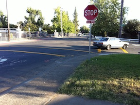
The solutions to an excess of stop signs are:

  1. Roundabouts, covered in my previous post What is a roundabout?
  2. Spread out traffic by installing traffic calming equally on parallel streets, rather than focusing traffic on select streets by installing traffic calming on other streets.
  3. Change intersections to increase visibility, by modification or removal or vegetation, fences, and parking.
  4. Replace four-way stops with two-way stops where there are sufficient gaps in traffic on the busier street.
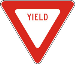
  5. Replace both four-way and two-way stops with two-way yields, with the yield signs being on the lower traffic street.
  6. Remove all signs from low traffic streets, and allow vehicles normal yielding behavior at the intersection.
  7. Analyze all intersections over time to assess whether signing is really necessary, with the default assumption being that it is not.

I suspect that after analyzing intersections for the purpose of the stop sign, and alternate solutions, the number of stop signs would be reduced by at least 60%. Safety would not be reduced. Speeds would not increase. Both motor vehicle drivers and bicycle drivers would be happier.

What are stop signs for?

Rosswood-GrandOaks_crosswalksIn the month of May I bike commuted to work in Carmichael and Citrus Heights most of the days. I had plenty of time to think about stop signs, as there are a lot of them on my regular routes. A few less, now that the county has removed some from the parkway path, but still, a lot. At most of these stop signs, there are no cars anywhere in sight, particularly at the beginning of AM and PM commute hours when I’m riding, but even at other times of day. So I started thinking, why are these stop signs here, and what are stop signs for?

Stop signs get used for these purposes:

  1. When there is a busy intersection with a more or less equal flow of vehicles on both streets. The four-way stop signs assist people in taking turns.
  2. When one street is so busy that gaps long enough to cross that street are rare.
  3. When there are visibility issues that prevent vehicle drivers to see each other.
  4. When motor vehicles are going too fast, and they need to be slowed down.

Looking at each purpose in more detail:

Read More »

What is a roundabout?

I have noticed a lot of confusion in Sacramento amongst both transportation professionals and citizens interested in traffic calming about roundabouts. If you live, work or play in downtown and midtown Sacramento, you’ve seen a lot of structures in the intersections which people call roundabouts, but which are not, they are traffic circles. So what is a roundabout?

intersection conflict points

A modern roundabout is a structure that allows a free flow of traffic without stop signs. Instead, they use yield signs and markings. They are most appropriately used at street intersections where both streets are fairly busy. The biggest advantage of a roundabout, for all users, is the reduction of conflict points in the intersection from thirty-two to four, as illustrated in the diagram at right!

Read More »

Transportation Choices Summit

Bromptons at the summit, including Cynthia Rose of Santa Monica Spoke

Yesterday I attended the Transportation Choices Summit, sponsored by TransForm, at the Sacramento Library Tsakopoulos Galleria. The purpose of the summit was to bring together advocates and others in the areas of transportation, health, and housing. Speakers were Brian Kelly, Acting Secretary, CA Business, Transportation & Housing Agency, Mary Nichols, Chair, California Air Resources Board, and James Corless, Director, Transportation for America. There were plenary panels on Building California’s Future, and Cap & Trade Auction Revenues to Support Sustainable Communities. Breakout sessions were held on a variety of issues.

Read More »

Sac TPG allocation

I’ve now had time to look at Sacramento’s 2010 Transportation Programming Guide in more detail. What I’ve seen convinces me that updating the project list without revisiting the ranking criteria would be a huge mistake. The ranking criteria represent at 1970s view of transportation planning, with a little 2000s language thrown in. It will not lead to a modern transportation system that welcomes all transportation modes, but to the same system that got us in the fix we are already in. What fix? That we spend huge amounts of money to reduce congestion and increase mobility, which is the ability of people to drive long distances at high speeds. In contrast, we spend very little on accessibility, which is the ability of people to get to services they need, including but not limited to employment. As mobility goes up, accessibility goes down, because we allow everything to spread out, and then have to build wide, high-speed arterials and freeways between these far-flung places.

2010TPG-allocationThe chart at right shows the allocation to auto, walking, bicycling, and transit. It is based on the standard that sidewalks add about 3% to the cost of transportation project, and bicycle lanes add about 5%. Reading the project descriptions of the top 20 projects (out of 42 projects), I assigned a percent to ped and bike, and then calculated the project cost. I was pretty liberal, increasing the percentage for projects that actually had some purpose beside widening or extending streets, and only decreasing it when the project didn’t have any significant ped or bike component at all. Transit is even worse. The TPG doesn’t really even address transit, though it should. Transit is usually the best solution to congestion problems, yet it is never identified in the TPG as a solution. And in fact roadway projects can have a negative impact on transit when they clog areas that buses need to move freely, and place cars on top of light rail tracks.

Related posts:

rank transportation projects by accessibility?

Just in time to serve as an alternate method for ranking transportation projects in Sacramento, which I criticized a few days ago in my Sacramento Transportation Programming Guide post, comes A Better Way to Grade City Transportation Systems (Streetsblog, 2013-04-16). The new method uses a measure of accessibility, how far things are from each other, rather than mobility, which equates to level of service or lack of congestion. The Access Across America study, from the University of Minnesota’s Center for Transportation Studies, uses accessibility to jobs by car. Of course accessibility by foot and bike would yield even better results, but even just focusing on distance rather than congestion yields interesting results. It is jobs, not roadway miles, that create economic health.

Sacramento overall ranks 32 out of 51 metro areas studied, not great but not horrible either. The example maps and the geographic mapping utility seem to only be available for Minneapolis/St. Paul, but the concept is usable for any metro area.

The top three accessible metro areas are Los Angeles, San Francisco, and New York City. People associate these cities with congestion, but since they also have a high density of jobs in a small area, they rate as highly accessible. What if we see congestion as not something to be solved but as a sign of economic vitality? What kind of transportation system would we build?

Sacramento Transportation Programming Guide

Sacramento is updating its Transportation Programming Guide, and has sought public input on projects. A survey (deadline April 15) seeks input on specific improvements at specific locations, but it does not seek input on the overall approach of the guide. The 2010 guide is available for review. Since the survey did not allow me to comment on the overall plan, I submitted some comments, below. I could have said a lot more about each of these, but only have time for this at the moment.

  • Roadway widening is not needed anywhere in Sacramento. Widening generally induces more traffic, and when it does not, is a waste of limited resources. We need a fix-it-first policy, and roadway widening is not part of that.

Read More »

wrap-up of changing downtown/midtown

Nine posts (linked below) have outlined my thoughts about how to create a livable, walkable, bikeable and safe downtown/midtown Sacramento. These have been nearly all from a transportation perspective, how we change the way people get around. Though I will continue to post on these topics, I want to wrap up for the moment. I need to pay attention to some other things, and I need to finish my taxes!

Livability is not created merely by transportation changes – it takes a lot more than that. But it does provide fertile ground for the changes that are needed. I am pleased to know of and be a small part of efforts to transform downtown/midtown. I attended CivicMeet Sacramento on Wednesday, where the participant selected topics were save the bikes (bike theft), rooftop utilization, fresh fruit and veggies downtown, and human capital clearinghouse. I attended the Turn Downtown Around open forum two weeks ago. Good energy from (mostly) young people, directed towards creative solutions to making downtown/midtown a vibrant place. I’m sure there are many others working towards the same ends (many ends). It is sad that the city government is trailing, slowly, rather than leading, but it also an opportunity for creatives to step in and fill the gap.

Let me acknowledge that transportation is only a small part of the big picture, but I write about it because it is my small part.

and the freeways

I-5 separating Old Town from downtown Sacramento

Sometimes I catch a ride from a friend or take an Amtrak bus, and am on freeways in the Sacramento area, which most of the time I never see. I wonder why there are so many lanes for so few cars, so much expanse of empty concrete and expensive bridges. Of course I know the answer, the freeways have been built for two rush hours, morning and afternoon, on five days a week, perhaps 13 hours per week out of 168 hours in the week. Oh, and the Friday up to the snow or Tahoe and Sunday back home, that weekly migration of bay area people. The rest of the time they are largely empty.

Yet freeways take up a huge amount of space, have a huge carbon footprint for construction and maintenance even before fuel consumption comes into play, spew pollution into neighborhoods, and suck up the largest portion of our transportation funds. As an example of cost, the nine miles of the six-lane Capitol City Freeway (Business I-80) from Interstate 80 to Highway 50 is 54 lane-miles. Though the cost to construct a lane-mile varies widely, from $2M to $80 million, lets take a very conservative number of $5M and say that this section of freeway cost a quarter of a billion dollars. And this is not even an expensive highway, with its simple interchanges. Pretty amazing, huh? What else could we have done with that money?

Read More »