You might have thought you had other plans for the evening, but…
The City of Sacramento is holding the last of four public meetings on Vision Zero and Bicycle Master Plan implementation tonight, January 31, 5:00 to 7:00PM at city hall.
Note: I discovered yesterday, to my chagrin, that I had a number of draft posts dating back to early 2013, which I’d never finished. So I’m going to post them now, all in a flurry. Some of these issues I’ll get back to and do an in-depth and up-to-date post, and some of them I probably never will. This is the fifth and last post, and I discarded two that were worth preserving. This just points out that I have more good ideas than I have time to carry them out.
My point here was that beg buttons should not be used on streets which are meant to encourage or emphasize walkability, of which K Street is certainly one. I will definitely be writing more about this.
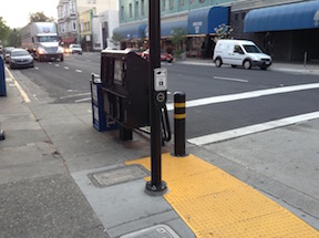
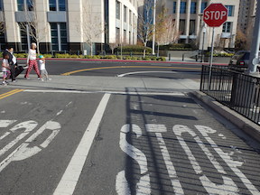
Pedestrian beg button on a commonly used crosswalk (9th St at K St), this location should have a pedestrian signal on every cycle, not just when someone presses the button.
Original 2015-04-11: I have to admit that sometimes I walk past things every day and don’t notice them, but this morning I noticed the pedestrian activated buttons on K Street in downtown Sacramento. Yes, they’ve probably been here since the street was re-opened to cars on November 12, 2011. These are technically called pedestrian pushbuttons, and their purpose is to activate the pedestrian signal head and a change of the traffic signal. They are often called beg buttons, because the pedestrian has to “beg” to cross the street by pushing the button, rather than being an accepted part of transportation on the street.
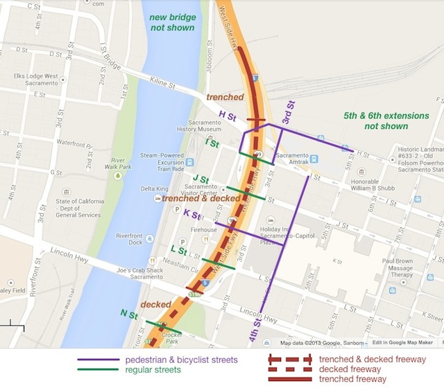
Interstate 5 is a Berlin Wall through the heart of Sacramento, severing the connections between downtown and Old Sacramento. It was a product of a time when cars ruled the world, and no other values were of importance. Those times are over, and now it is time to tear down the wall and re-unify Sacramento. A map showing the general idea follows the break, but here are the highlights:
the current Interstate 5 elevated freeway would be torn down, and replaced by a trenched and decked section
I Street, J Street, L Street, and N Street would be reconnected over the freeway as regular streets; K Street would be reconnected over (not under) the freeway as a pedestrian and bicyclist street, the main grand entrance to Old Sacramento for tourists and many locals
Old Sacramento would not only be easily accessible from downtown, but visible from downtown
other adjustments would be made to the streets and circulation in this area
This will certainly not be my last post on these ideas, and I will explore the why and how of the pedestrian and bicyclist streets shown.
Note on terms: “cut and cover” is often used for underground transit and rail lines, but the term seems less commonly used for freeways, so I’ve used “trench and deck”; “the big dig” is also often used, after the project in Boston, which went way over budget and took years longer than intended, but apparently has had a very positive affect on the city
Traffic circulation, for everyone, is handicapped or prevented by an incomplete grid system in downtown and midtown Sacramento. Three recent posts have addressed this issue, I’m thinking about several more, and several posts over the last year were also on the same topic. So I created a new category for the Getting Around Sacramento blog, re-gridding Sacramento.
Re-gridding is an awkward phrase, but I haven’t come up with a better one yet, so I’ll use it for now.
I Street entrance to Old Sacramento, from Envision Sacramento
The topic uses the photo at right to illustrate the question. What you can’t see in the photo is that behind the photographer and across 3rd Street (to the left), pedestrian access is on the south side, but to the west, it is on the north side.
Comments include a number about the aesthetics of this entrance to Old Sacramento, including the having a dark freeway under crossing as the main route into the one of the highlights of Sacramento, with poor signing for motor vehicle drivers, bicyclists, and pedestrians. A surprising (to me) number of comments, though, were about the transportation aspects, that it is really not safe for bicyclists or pedestrians to use this entrance, even if they know it is there, and the paucity of other options. I think it is clear that the commenters agreed that the way in which Interstate 5 severed the connections between downtown and Old Sacramento is a major issue.
A gallery of photos shows some of the specific problems at this location.
These photos are of the I Street entrance to Old Sacramento, showing various problems and hazards that exist for pedestrians and bicyclists at this location. The crosswalks here are not really safe. All sorts of signing has been installed to try to make them safe, but that is a poor substitute for correct design. The […]
With this post, I’ve added a new category to my blog: re-gridding Sacramento. I’ll have more to say about that category, and many more posts, in the near future.
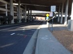
Sac Valley Station exit, forced right
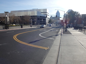
5th St to I St, forced right turn
Let’s say one was driving and wanted to leave the Sacramento Valley Station (Amtrak and Capitol Corridor) to head southbound or eastbound. Tough luck. The exit at the east end of the parking lot forces you to turn right, to the south, onto 5th Street. I often see people turning across the double yellow line to go northbound on 5th Street, and to be honest, I don’t blame them, because this is the logical though illegal way to go south or east.
SACOG in the 2013 funding round allocated $9M to the Riverfront Reconnection project in the City of Sacramento. This phase extends 2nd Street from Old Sacramento to Capitol Mall, providing an easier access to Old Sacramento, and also adds sidewalks to O Street and improves sidewalks and bike lanes on Capitol Mall between 3rd Street and the Tower Bridge. The overall purpose is to create or restore connections between downtown Sacramento and Old Sacramento which were severed by Interstate 5.
William Burg started a wonderful conversation on Facebook about removing Business 80 from B Street to Hwy 50, returning the traffic to surface streets. The post is now up to 115 comments, and still going after two weeks. I believe that you have to be a member of Facebook to view this thread, but don’t need to be friends with William Burg (though you should). I agree with Jared that this topic should be amplified for Sacramento Press.
Some people think that this is crazy thinking, it will never happen. I think it will. Why? Not because it is a good idea, though it is, but because we will not be able to continue to keep these freeways open and in decent condition with future transportation funding. Caltrans and others have just spent or are spending $202 million on Hwy 50, basically just to keep in it usable condition. Not to improve it in any significant way, but just to keep it working. Where is the money going to come from to maintain Hwy 50, Interstate 80, Interstate 5, and Business 80 (Capital City Expressway)?
A “green wave” is a traffic signal sequence set so that vehicles will encounter green lights for some distance, so long as they are traveling at the selected speed. A green wave can also be set for bicycle speeds, though it very rarely has been, and never in Sacramento.
To some degree, all signals are set this way, though the degree and distance of sequencing varies widely. Many of the east-west streets in the Sacramento grid have signals set for motor vehicles, and when traffic is not congested, it may be possible to go all the way across downtown and midtown on green lights, for example on J Street. Very few north-south streets are set this way, I can think of only the 15th & 16th couplet, and the 9th & 10th couplet. At intersections with the east-west couplets, these north-south couplets seem to have their green wave broken. Only if the grid spacing and the selected speed calculate out is it possible to have a green wave in all directions. Sadly, many signal sequences in the Sacramento region are set above the posted speed limit, encouraging drivers to speed so that they make all lights.
 You might have thought you had other plans for the evening, but…