Someone asked me recently about the locations of JUMP bike charging hubs in Sacramento. There are 18 on the map below, and one new on on 19th Street just north of Q Street, at the Q19 Apartments development. I captured this map from the JUMP bikes website, which took a little doing.
JUMP bike charging hubs in Sacramento
I recently took photos of all the hubs I could find, and they are part of the Sac bike-share album at https://www.flickr.com/photos/allisondan/albums/72157713653167982. I was able to locate only one of the three hubs shown for Sacramento City College. It may be: 1) I just couldn’t find the other two (they are much harder to see at this time since they don’t have any bright red bikes in them), or 2) they are not charging hubs but regular bike racks, or 3) they are located where construction is going on and are inaccessible or removed. All the rest of them have at least one photo in the album.
So far as I know, there are no charging hubs in Davis, nor in West Sacramento (which shown on the map as part of Sacramento).
When you actually rent a bike, the app shows the location of these hubs, but with no bikes to rent (the system is currently shut down, in case you had not heard), I can’t see what the live map shows. But other than the one new one, I think this map is accurate. Let me know if you know otherwise.
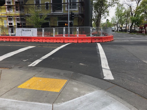
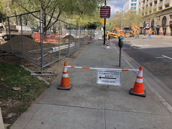
An new housing development at 16th Street and E Street (remember, I’m not against housing developments) has significant problems. At the southeast corner of 16th and E, the corner has been completely blocked by construction barriers and fencing, so there is no safe wait space for people using the crosswalk, and therefore both crosswalks should be closed. There should be a barrier and signing on the east side crosswalk over E Street, and there should be a barrier and signing for the south side crosswalk over 16th Street. Neither are there.
16th Street & E Street, no crosswalk barrier
The project also has problems on 16th Street approaching from the south, where the sidewalk end, but a small sidewalk closed sign is not visible because it is on a canted fence, and there is no advance warning at F Street.
16th Street northbound, no visible signing
On E Street westbound, there is a construction fence with no sidewalk closed signing, nor is there any advanced signing at the last safe crossing at 17th Street.
E Street westbound, no signing
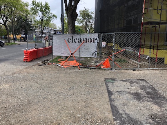
This property and development is apparently owned by SKK Development, Sotiris Kolokotronis, and is called Eleanor Apartments.
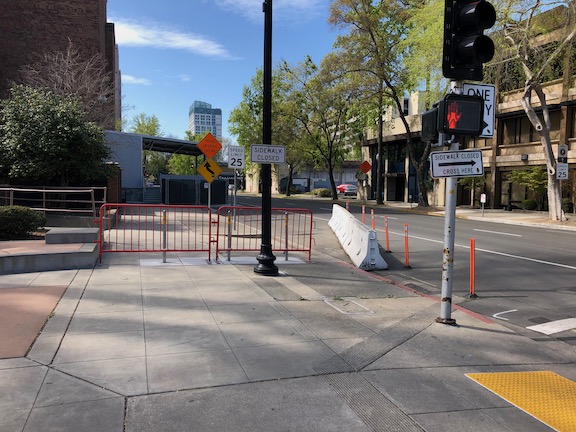
The apparently dead redevelopment project at 700 16th Street, the old Clarion Hotel, which occupies the block between 16th and 15th, and H Street and Government Alley, has closed sidewalks for a long period of time, even though nothing is happening there. The sidewalks closed are on H Street, the entire block, and 15th Street, the half block. As seen in the first photo below, there is enough pedestrian traffic on 15th Street to have worn a path in the sidewalk buffer. The solution here is to require the developer to remove this fence. If fencing is needed, which is doubtful on this side of the building, it should be on the property and not in the buffer. Re-opening this piece of sidewalk until such time as there is active development is the right thing to do.
15th Street use path, north of H Street, old Clarion Hotel
On the northwest corner of 15th Street and H Street, the corner could have been left open so that the two crosswalks could be safely used, but it was not. Instead, a sloppy fencing job leaves a sidewalk too narrow for ADA use.
15th Street & H Street, northeast corner, no ADA access for crosswalks
The sidewalk closure on H Street might need to remain because there is building access on this side, but it should be properly signed approaching from the east, which is is not.
H Street & 16th Street no signing
Lastly, on 15th Street southbound at Government Alley, there is a fence but no signing, and there is no advance warning at G Street that the sidewalk is closed ahead.
15th Street at Government Alley, no signing
This property is apparently owned by SKK Development, Sotiris Kolokotronis, and is called The Bernice. This failure to accommodate walkers is both the fault of the owner/developer, for the poor job of fencing and signing, and of the city for failing to monitor the situation (and perhaps for allowing it to exist in the first place). This also points out that there must be bonds for construction zone fencing and signing so that if a owner/developer fails to proceed with development, the city can go in and partially or fully restore access at the developer’s expense.
Note: updated 2020-03-28 to correct lane descriptions and add a photo of the lane shift.
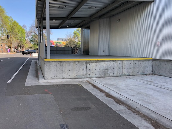
On the south side of I Street, between 15th Street and 16th Street, the city has permanently closed the sidewalk. This was to construct a loading dock for Memorial Auditorium. I had noticed the construction going on there, the first phase of the city’s project for the convention center and community center theater, and just assumed things would be returned to normal when construction was complete. How wrong I was. I was flabbergasted when I saw this. The loading dock sticks quite a ways into what used to be the public right of way, erasing the sidewalk and two parking lanes (the general purpose lanes were shifted to the right). The loading dock is concrete, intended to be there forever. See the photos below.
If the loading area was really than important, and could not be provided anywhere else, the city could have set things up for easy temporary closure of some of the street so as to allow loading when needed. They did not, they made it permanent.
I have walked by here, on the sidewalk, when events were going on at the Memorial Auditorium and there were a lot of walkers using this sidewalk. I imagine for a lot of other uses as well.
Also note that the ‘ bike lane’ stripe does not meet standards for a bike lane because it is immediately adjacent to a hard barrier and fence, so requires shy distance not provided. So that means when there are eventually bike lanes on I Street, this will be a gap, permanently.
What the fuck were you thinking, City of Sacramento?
I Street, south side, east of 15th StreetI Street, south side, east of 15th StreetI Street, south side, west of 16th StreetI Street, south side, west of 16th StreetI Street westbound, lanes shifted right
JUMP (Uber) pulled out of the Sacramento region (the cities of Sacramento, West Sacramento, and Davis) in order to meet their concerns about COVID-19. They announced this on March 18, though the bikes and scooters were mostly gone two days before that (except for a few dead ones they still haven’t picked up because without GPS they don’t know where the devices are).
Of course the bikes and scooters were getting used a great deal for recreation and socialization, but they were also being used by many people to get to and from work, and to go grocery shopping (small loads) and other errands. Some of these people do not have an alternative, they do not own a bike, or their bike is not functional. I don’t know what the level of participation was in the JUMP Boost program for low income individuals, but I suspect most of those people do not own cars, or cannot afford to keep them running, so JUMP bikes were a major transportation solution for these people. JUMP pulled the rug out from under these people. As a private company, they are entitled to do so. I will note that Spin scooters still seem to be available, and Spin has publicly made a commitment to continuing to offer scooters.
I am not one of the people depending on JUMP bikes. I have a bike, and using JUMP was just a matter of convenience for me, letting me make faster trips to the store and other errands, and during the warm/hot months, get there without a sweat. But there are others not so fortunate.
I consider bike share to be a part of the transit system for Sacramento. Both JUMP and SacRT also seem to see it this way – they cooperated to install JUMP charging hubs at a number of light rail stations in the city of Sacramento. But now we are without that first mile/last mile option (as it is called, though bike certainly allow more than a mile). Just as transit is funded by the public (as well as user fees), bike share, and probably scooter share, should be funded by the public (as well as user fees).
Going forward, the city needs to give serious thoughts to whether it is acceptable to have a private system as the only provider of mobility devices. Coronavirus is only one ‘natural’ disaster emergency. There will be others from other causes that demand we continue to have a functional transportation system. I am not suggesting that JUMP be eliminated in favor of a public system. JUMP (Uber) has had its issues, but when I think back to where we were before SoBi > JUMP, I can’t doubt it was a good thing. Certainly the fairly rapid expansion of the number of bikes and scooters, and the service area enlarged to much more (though not all) of the city of Sacramento, could not have happened without private investment.
Maybe the city can work out an agreement with JUMP that a certain number of bikes would remain available through any disaster. And through education, make it clear that this limited set of bikes if for Boost members and people in essential occupations.
I don’t know the best solution, and am happy to hear from others. What I do know is that if we come out the other side of the pandemic without having talked about this, we have failed to plan for the future and ensure an effective and equitable transportation system.
Dr. Destiny Thomas (@DrDesThePlanner) posted on Twitter today that if we are serious about bicycling as an alternative during these times, we need to address how to get bikes into the hands of those who don’t have them and can’t afford them. I agree!
There is a national movement, 10 Minute Walk, with a goal of every person in cities of all sizes is within a 10-minute walk to a park, by 2050.
In the Sacramento region, the City of Sacramento (Darrell Steinberg), the City of Elk Grove (Steve Ly), and the City of Citrus Heights (Jeannie Bruins) have signed on. None of the other cities have. Looking at the listing for the western United States, all are cities except for Los Angeles County. I am not sure if park districts can sign on, but that might make some sense for Sacramento County which has a large number of separate park districts as well at Sacramento Regional Parks.
Why is this important right now? Many neighborhoods do not have sidewalks, so people out for physical and mental health must walk in the street. Sometimes that is OK, on very low traffic and low speed streets, but as you may have noticed, some drivers are using the empty roads as an opportunity to speed and driver recklessly, unconstrained by congestion. Even on streets that have sidewalks, they are often much too narrow (4 feet, 5 feet, occasionally 6 feet, rarely more; I am talking about neighborhoods were most people live; central business districts often have wide sidewalks but few residents) to share with the 6-foot physical distancing requirement. Parks are a great alternative. I am not talking about gathering in parks, which has been prohibited or strongly discouraged in most places, but just a safe and pleasant place to walk. Though many of us will be working to prevent a return to previous traffic levels and speeds, the mostly empty streets we are seeing now have a limited shelf life, and the need for parks will be even greater.
Though I’ve been aware of this goal for a while, I have not looked into it or gotten involved yet. As I have the chance, I will post more, perhaps a map of the city or county showing ten minute walk buffers around parks, and information about whether this goal is in the existing and updated general plans for the counties and cities in the region.
In the meanwhile, you might want to look at the National Recreation and Parks Association (NRPA) web page on 10 Minute Walk for some background information.
So, now that I’ve spent several posts complaining, on to solutions. The city is working an ordinance for construction zone handling, but I have not seen any draft documents. When something is available, I’ll add it.
The City of Oakland has what is generally considered to be the model guidance (http://www2.oaklandnet.com/oakca1/groups/pwa/documents/memorandum/oak062315.pdf), though Seattle also has something good that I’ve not tracked down yet. Sacramento could do well to simply adopt the Oakland guidance, but it is pretty radical for Sacramento, so I’m expecting something weaker to come out. Let me say what I think is most important.
Let me credit Robert Prinz of Bike East Bay for publicizing the guidance (he may have also had a part in developing it, not sure about that), and for monitoring compliance and publicizing failures. He is an inspiration for me.
Management:
Responsibility for approving traffic control plans should be removed from Construction Services and placed in another division of Public Works that will actually ensure quality traffic control plans and enforcement as needed. Construction Services has demonstrated that they cannot be trusted with this responsibility. They continually bias for motor vehicle traffic and drivers, and against walkers and bicyclists.
Construction sites should be inspected on a regular basis by city personnel, to ensure that they have correctly installed the signing and barriers specified in their approved traffic plan, and that these are maintained until completion of the project.
Fines will be imposed on construction companies that do not correct problems within 12 hours of reporting to the city, by city staff or by citizens. If the construction company fails to correct the issue within 48 hours, the construction project should be shut down.
Sidewalks and bike lanes:
For any roadway with more than one general purpose travel lane in the same direction, it shall be automatic that temporary sidewalks and bicycle lanes will be placed instead one lane.
For any roadway with parking lane on the same side as the construction zone, it shall be automatic that temporary sidewalks and bicycle lanes will be placed in the parking lane.
For any roadway where the bicyclist and/or pedestrian traffic is above a certain level (I’m not sure what the number should be), if no accommodation can be made by using a parking lane or general purpose travel lane, then the road will be closed to motor vehicle traffic in one or both directions for the duration of the project.
Crosswalks:
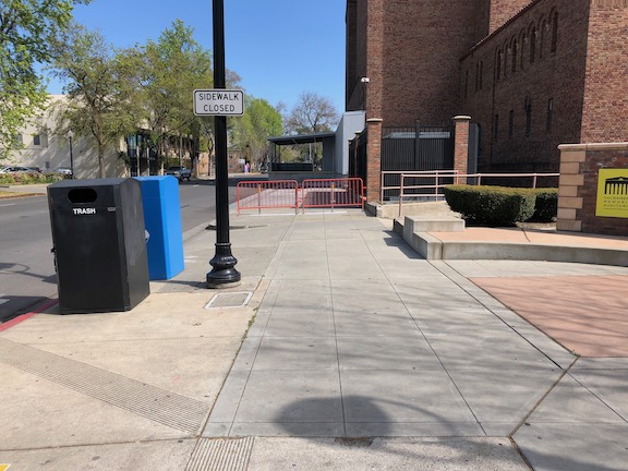
ADA compliant barriers and signing will be used at ALL construction projects which close a crosswalk, no matter what the duration of the project. For any closure of over a week, fixed metal barriers should be used (see photo below). Plastic barricade poles or construction tape will never be used by themselves to mark a closure.
Unless the closest safe crossing is clearly evident from the point of closure, wayfinding signs will be included specifying the shortest distance and safest crossing.
ADA detectable crosswalk closure barrier
Signing off for now with the construction zone topic. I found several more problematic locations on my walk this morning, but I need to take mental break from this, and talk about other things.
As always, I invite your comments and additions. Stay safe walking and bicycling out there, but don’t stay home. Your sanity requires being outside, or at least that is my opinion.
A brief aside before I get to the solutions for construction zones.
I’ve been out walking I don’t do that much talking these days These days These days I seem to think a lot About the things that I forgot to do, for you And all the times I had the chance to
Jackson Browne, “I’ve Been Out Walking” or “These Days” 1967/1973
I’ve realized in the last few days that I could spend a week, and fill up a week with blog posts, about construction zone problems in just the central city, and could probably spend a month on it in the entire city. Prior to the shelter-in-place, I was mostly bike riding for time reasons, but now that I have more time, I’ve been walking a lot more, and I see a lot of construction activity that I failed to notice on bike. When I’m bicycling, I just go around the construction zone, taking the lane, because that is what I mostly do anyway, and don’t think about it that much. However, most people aren’t willing to take the lane in traffic, and therefore are stopped cold by these construction zones that do not carry the bike lane through. My posts will continue to be mostly about issues for walkers because I see walkers as being more vulnerable users of the public right-of-way, as compared to bicyclists, and collision statistics back that up, however, I recognize that there are plenty of issues for bicyclists as well.
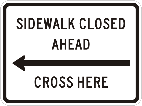
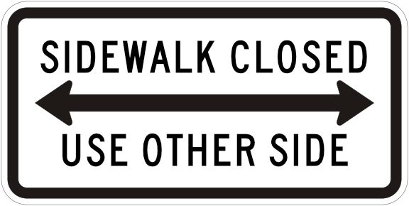
Coming up, some suggested solutions for construction zone accommodation for walkers and bicyclists, but first, the relevant signs and markings. These are MUTCD (Manual for Uniform Traffic Control Devices) compliant signs, which are always what should be used, not the hand-made and/or non-compliant signs that are sometimes used.
Note: I have modified the presentation of signs here, using two slideshows: Temporary Traffic Control (TTC) signs M (orange), and regulatory signs R (white). MUTCD R9-10 is not a favored sign because it gives no indication about what the most direct route for a walker is.
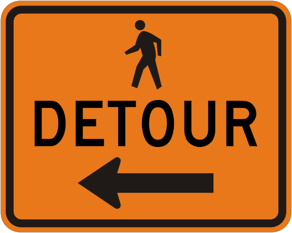
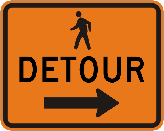
MUTCD M4-9a left
MUTCD M4-9a right
MUTCD M4-9b left
MUTCD M4-9b right
MUTCD M4-9c left
MUTCD M4-9c right
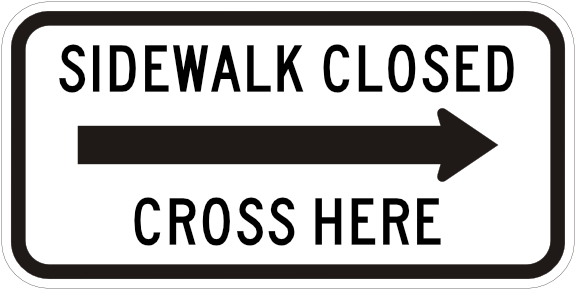
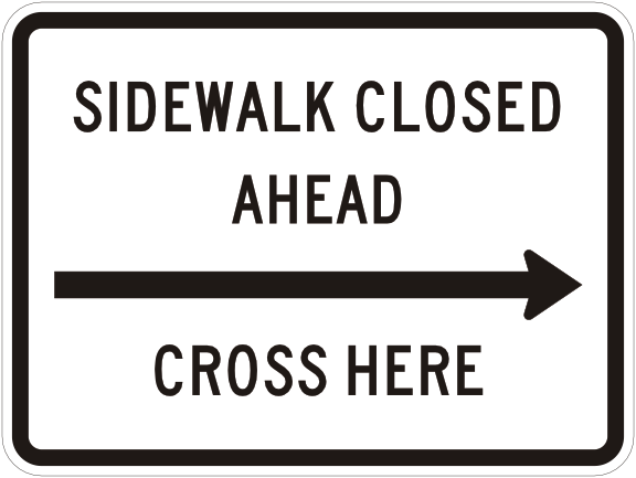
MUTCD R9-11a right
MUTCD R9-11a left
MUTCD R9-11 right
MUTCD R9-11 left
MUTCD R9-10
MUTCD R9-9
The no pedestrians sign, MUTCD R9-3a, is intended for permanent closures of crosswalks, not temporary closures of sidewalks, and so should not be used for construction zones.
In the MUTCD, 154 pages are dedicated to Temporary Traffic Control Devices, almost all of which treat roadways as though walkers and bicyclists did not exist, but there are four pages and two diagrams which do show accommodation. For those unfamiliar with the MUTCD, the word shall means there is no choice, it must be done. So every construction zone that does not follow these is a violation of the law. The most important text is below, and the two diagrams follow.
“Standard:
When crosswalks or other pedestrian facilities are closed or relocated, temporary facilities shall be detectable and shall include accessibility features consistent with the features present in the existing pedestrian facility.
Standard:
When crosswalks or other pedestrian facilities are closed or relocated, temporary facilities shall be detectable and shall include accessibility features consistent with the features present in the existing pedestrian facility.
Curb parking shall be prohibited for at least 50 feet in advance of the midblock crosswalk.”
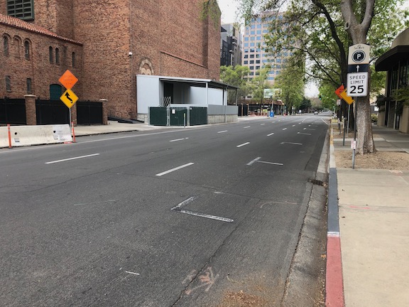
I recognize that all the examples of construction zone problems (and a few done right) have been central city Sacramento. This is for two reasons, one is that I live downtown, and when I’m out on my physical distancing walks, these are the places I’m seeing. The second is that a lot of the construction happening in the entire city is happening in downtown, particularly the projects which require extensive closure of sidewalks, and bike lanes. If you have examples from other places, please let me know (allisondan52@gmail.com) and I will try to get there to take photos and analyze the situation. For those of you in the county, well, that is too much to tackle, and in a relative sense the county is economically moribund, so much less construction is going on.
Please don’t take my criticism of construction zones at being a criticism of construction. I love that there is a lot of construction going on. In midtown, most of the construction is housing, and nothing could make me happier. In downtown, there is more office construction than housing construction, and that is not a good thing, as it further exacerbates the jobs/housing imbalance in downtown. Except right around the arena, and in old town, there are few businesses and almost none are open on weekends because there is so little housing as compared to offices.
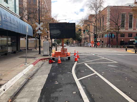
Below, a few last examples, before I move on to solutions. The first was a temporary issue, but it is illustrative of the problems. A mobile message board was placed in the center of the separated bikeway on 9th Street, even though there was a cross-hatched area immediately adjacent where is could have been placed, without constraining the bikeway or the general purpose lanes. I am not sure whose mistake this was, but anyone with a brain would know that this was the wrong place to put it. The sign was moved within a day of my reporting it to the city, but these are things that should be done right, not relying on citizens to correct mistakes.
9th Street separated bikeway, mobile message board
There is currently a utility project along the north side of L Street between 13th St and 10th Street. The photo belows shows the situation at L Street & 11th Street. The signing is acceptable, though the use of plastic barricade poles is not, but the issue is that the detour doesn’t tell you how far. A block? Several? Where is the nearest safe crossing? As referred to in the What? Cross Where? post, the west side of this intersection has a pedestrian prohibition, but you can see someone crossing here. And why not? What else could they do?
L Street at 11th Street, signing but no information, improper barricade
This next one was a temporary closure on 10th Street. There is signing, but rather than being placed at the point where a walker could either choose to cross to the east side of the street, or to walk through Cesar Chavez Plaza and back to the sidewalk, it was placed where the closure starts. Again, the plastic barricade poles do not meet ADA requirements because they are not detectable for person with vision limitations. While some would say, well this is just temporary, for a day, and standards should be lower, I disagree. It may be perfectly acceptable to not provide an alternative route for a temporary closure, but the signing and sign locations should be the same for all closures, whether they last an hour, a day, a week, a month, a year.
10th Street, west side, temporary closure
And one last example, though I have dozens more. The 3rd Street Sewer project has closed off 3rd Street from S Street to U Street. An attempt has been made to keep the sidewalks open, and I seriously appreciate this effort, as many construction projects would simply close off the sidewalks along with the street, and not think twice. However, construction tape does not a safe route make. The detour signs are clear, but no attempt is made to provide a detectable barrier. And construction tape…