The Sacramento Tweed group is hosting the annual Tweed Ride on Saturday, December 4, starting at 12:00 noon. The ride is “Winter Wonderland Ride and Picnic”. It meets at WAL Public Market at 1104 R St, at 11:30AM, and rolls about at noon. It is a ‘bring your own picnic’ event. The picnic occurs in a local park. There is sometimes an unofficial after-event visit to a drinking establishment.
There were a number of tweed riders on the SABA Mural ride on Sunday, distributing handbills and encouraging local bicyclists to join. Period clothing is appreciated and celebrated (roughly 1902-1920), but certainly not required. Period bicycles are also appreciated and celebrated, but certainly not required. Come as you are!
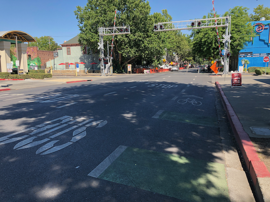
The City of Sacramento has 11 red light camera locations: Red Light Running Program. Of these, some are at high-injury intersections, but most are not. These locations are cross-referenced with high injury intersections shown in the post Sac Vision Zero new intersections map.
Location
Top all
Top ped
Top bike
Mack Rd & La Mancha Way/Valley Hi Dr
no
no
no
El Camino Ave & Evergreen St
no
no
no
Howe Ave & Fair Oaks Blvd
no
no
no
Mack Rd & Center Parkway
no
no
no
Exposition Blvd & Ethan Way
no
no
no
Broadway & 21st St
no
no
no
Folsom Blvd & Howe Ave/Power Inn Rd
no
no
no
Arden Way & Challenge Way
no
no
no
5th St & I St
no
no
no
16th St & W St
no
no
no
Alhambra Blvd & J St
no
no
no
My first thought is that the city was putting these cameras in the wrong location. But then I thought, what if the presence of red light cameras is making these locations safer and therefore dropping them out of the highest injury intersection list. I don’t have the information to answer that question, which would take analysis of crashes at the intersections, and before/after data.
What I do know is that many more red light cameras are needed to counteract the pandemic of red light running: pandemic of red light running. I spend time around the edges of Fremont Park, close to where I live, which includes the intersection of arterial streets P, Q, 15th, and 16th, and one of the things I do is watch traffic in the intersections. It has now become rare for a signal cycle for 16th St northbound at P St to not see an incidence of red light running. The other intersections are not quite as bad, but the pattern is there. And this is happening everywhere in Sacramento that I go; these are not likely to even be the worst intersections.
I believe that most of the red light running is by egregious violators, people who routinely and continuously violate traffic law for their own convenience or thrill seeking. This is true of most traffic violations, but red light running is the one most likely to result in fatality and serious injury, for people in all modes of travel. So having a more widespread set of red light cameras would serve to catch these red light violators. Of course the follow-up is necessary, to revoke the licenses and confiscate the vehicles of these repeat offenders. The longer the city looks the other way on this issue, the more people will come to see it as normal behavior, and the less safe our streets will be.
The standard response by cars-first entitled drivers is that tickets are just a money-making scheme by the government. The purpose of red light cameras is to make streets safer, and if that results in some income, so be it. I’m more than happy to have these sociopathic drivers hit in the pocketbook, and the money can be used to make our streets safer, such as by installing more red light cameras. Red light tickets, with photos, are part of the documentation needed to revoke licenses and confiscate vehicles.
North Natomas Jibe, Sacramento Area Bicycle Advocates (SABA) and other partners are offering a Smart Cycling class in the Sacramento area on November 2 & 4, evening ‘classroom’ presentations through Zoom, and an in-person field day on Saturday, November 6, for parking lot skills and road skills.
This class is oriented towards people who would like to go on to the League Cycling Instructor (LCI) Seminar which will be offered in the spring, for which passing scores on the skills and test are a prerequisite, but it is open to anyone who is interested. North Natomas Jibe’s Project Ride Smart, San Juan Unified’s Bicyclist Education Program, and several other programs in the Sacramento region use LCI’s as instructors for in-school and out-of-school youth programs.
When you sign up for the class (use the QR code in the graphic above), you will receive a Zoom link to the ‘classroom’ presentation, held Tuesday, November 2 and Thursday, November 4, 6:00 to 7:30PM. There will be a chance to ask questions.
The class includes Saturday, November 6 field day, 9:00AM to 3:00PM. It will include parking lot skills for bike handling and hazard avoidance, and a road ride in traffic in the area of the Jibe office, followed by a debrief and multiple choice exam for people who want a certificate and/or are going on to the LCI Seminar. Lunch will be provided, but you can bring your own. Bring snacks as well, if you get hungry.
For the field day, you need a bike in good working order (ABC Quick Check), a bicycle helmet (required for our insurance), clothing appropriate for the forecasted weather, and a water bottle if you wish. The class will take place in most weather, except heavy rain and high winds. If you are borrowing a bike, please ride it beforehand so you are familiar with how it handles. If your bike needs repairs or adjustments, we can suggest a bike shop in your area to get it ‘up to speed’ before the class.
It has become popular these days to claim that the only real solution to traffic violence is re-design of roadways to prevent bad driver behavior, and to eliminate traffic enforcement as a solution to bad driver behavior. I’m not in disagreement with this. Re-design does prevent a lot of bad driver behavior. Traffic enforcement is very often a tool of oppression by law enforcement on people of color. All true.
But… There is also a blind spot. Roadway re-design does not force drivers to yield to walkers in the crosswalk. Sure, if traffic is going slower, it is less likely that collisions will be fatal to the walker, and perhaps slightly less likely to result in a collision at all, with more reaction time. But a driver that won’t yield at 35 mph is a driver that won’t yield at 25 mph. Failure to yield to someone in the crosswalk is sociopathic behavior, in that it intimidates people against walking, and it is psychopathic behavior in that it prioritizes driver convenience over the lives of others. These people are mentally ill, and they should be removed from our roadways. Not just ticketed, but their drivers license pulled and their vehicle confiscated.
No technology that I’m aware of will automatically enforce yielding behavior, or ticket failure to yield. Red light running cameras are legal in California, but are installed on only a tiny fraction of signalized intersections, and are not even used in many localities. Speed cameras are illegal in California (to protect the guilty). I have never heard of cameras focused on failure to yield.
Law enforcement has essentially stopped enforcing failure to yield. I’ve never seen someone stopped for this violation, and the traffic stop statistics say that it almost never happens. Law enforcement doesn’t care. It sees walkers as second class citizens. After all, they are often lower income and sometimes homeless, people that law enforcement feels obligated to oppress, not to serve. I myself have experienced law enforcement officers failing to yield to me in the crosswalk a number of times. CHP is the worst offender, but all the agencies are guilty.
What provoked this post? I was bicycling home along P Street from the store. A woman was crossing. The driver in the left hand land stopped for her, as did I. The driver in the right hand lane not only did not slow to see why, but blew through the crosswalk, very nearly hitting the woman. I caught up with the vehicle, and saw that both the driver and passenger were high-income, white, and young. When I tried to talk to them about their violation and nearly hitting the woman, they blew me off and implied that I was crazy for even caring about this. This is the drivers we share the road with.
Yes, let’s re-design the roadways. But in the meanwhile, lets enforce failure to yield with serious consequences. The lives of people walking are too valuable to sacrifice to drivers, for even one day. I realize there are equity implications of traffic enforcement, but my anecdotal observation says that the worse drivers are high-income white males. Hardly the oppressed class.
I am a strong supporter of Strong Towns, and think their analyses of financial and transportation issues is almost always spot on. However, I think there is a blind spot when it comes to speed limits. In a recent broadcast, Chuck Marohn addresses a question from a member about whether it is better to change speed limits street by street, or all at once. In response, Chuck launches into his view that only design changes can control speed. This is the first question in the broadcast, so you can listen from the beginning.
Here is my response:
I have to push back against Chuck’s take on speed limits. Nothing he says is incorrect, but there is an underlying ideology that rejects changing speed limits without changing design, as any part of a solution.
This is not about enforcement. I agree that much of traffic enforcement is pretextual, and intended to oppress people of color and low income. I’m not asking for any more enforcement, and am in complete agreement with the current movement towards removing most traffic enforcement from the responsibilities of armed law enforcement agents. And moving speed and red light running enforcement to automated systems. In high risk, high fatality/injury settings, we could even invest in automated enforcement of failure to yield to people in crosswalks, which is a driver behavior that not only kills people walking but intimidates them out of walking.
Chuck correctly states that drivers respond to roadway design, and consider what feels safe in setting their own speed. However, he misses the fact that drivers also respond to the speed limit. Drivers are very aware of posted speed limits. I constantly hear drivers say things like “I always go 5 mph (or 10 mph, or…) over the speed limit”. If the speed limit is 25, they will go 30, or 35, not just based on roadway design, but on the posted speed limit. If we lower it to 20, they will go 25 or 30. That is a huge difference (see the fatality at various speeds charts), and should not be discounted.
The problem with 85% is not just that it allows drivers to set their own speed limits, but speed creep. If 85% indicates a ‘safe’ speed of 35, and it is posted, then drivers will start going 40, and the next survey will show 40 is the ‘safe’ speed, and so on, ad infinitum. Regardless of the impact on drivers, every increase in actual speeds makes the street less safe for people outside vehicles. Which is why high speeds should be reserved for limited access, designed for higher speeds, roadways. Streets should always be posted for the desired safe speed, no matter the roadway design.
I live in a city where, at the current rate of roadway redesign, it will take about 80 years to create a safe system, and in a county where it will take at least 120 years. I am not willing to accept the death and severe injury that will happen in the meanwhile. We must do anything and everything we can to reduce that trauma, and that includes lowering posted speed limits.
There is evidence from around the world that when speed limits in a city are lowered wholesale, both the rate and severity of crashes also decreases. By as much as we want? No, but to reject this change out of hand for ideological reasons is, in my mind, a huge mistake.
There will always be egregious violators, drivers who drive as fast as they can no matter what. I think these drivers are actually responsible for most crashes. If these drivers can be caught and punished (removal of driving privilege and confiscation of vehicle) by any sort of enforcement, that is great. Redesigning a roadway does not eliminate these drivers or reduce their speed, it just makes it more likely that they will kill themselves along with the other people they are killing. That is small consolation.
I am absolutely in favor of roadways designed to self-enforce lower speeds. I have supported and helped design projects to do exactly that. And at no time have I ever felt that was enough. I think we need to use every action at our disposal (except biased traffic enforcement) to lower speeds. Now, not at some time in the future.
Another classic mistake by the City of Sacramento. Re-striping was just done on several blocks of N Street. Eastbound on N Street 22nd Street, this is what it looks like.
N St eastbound at 22nd St
Take a close look. Extend the dashed line forward, and you’ll see the taper, from a regular bike lane adjacent to a parking lane, to just a bike lane. Look even closer. See where the no parking sign is? A vehicle can park that close to the intersection, completely blocking the bike lane, and in fact blocking part of the general purpose lane. Yesterday, when I rode by, but neglected to take a photo, there was a large pedestrian-killer pickup truck parked right up to the no parking sign, and it was actually covering up three of the dash marks. Riding a bicycle in the bike lane and expecting it to continue? In Sacramento, that is not a reasonable expectation.
I would hope that the striping crew, whether city or contractor (not sure which this was) would notice the problem and stop painting until this was clarified. But it is not really the responsibility of the stripers. This design was signed off on by a ‘professional’ engineer employed by the city. This is the quality of people the city employs.
Westbound on N Street, it is not as bad since the no parking sign is further from the intersection. See below.
N St westbound at 22nd St
It is still a poor design, but nowhere near as dangerous.
As I’ve said before (traffic calming in the central city), these median islands, when placed in this way, as a widening of the center line only at intersections, are a hazard to bicyclists, though they do provide some safety for pedestrians. The best traffic calming measure, and the one that should be used by the city, is traffic diverters.
The JUMP/Lime bikeshare bikes in Sacramento and West Sacramento say “Available on Lime and Uber” on the bikes. They are not available on Uber. After many months of the Uber app offering only ride-hail car services, they finally added back shared devices under the ‘2 Wheels’ option. The app offers to rent bikes, showing them on the map for selection, or allowing the user to scan the QR code on the bike. It goes to ‘starting ride’ and then… nothing. The bike is not unlocked, and the ride terminates after a few moments, without any message.
I have of course reported this issue to Lime. The support people insist that it works correctly, referring me to or reading from the support article “How does renting a scooter through Uber work?”. When I insist that this is incorrect, their response is, well, just use the Lime app. The reason I want to use the Uber app rather than the Lime app is that I have a large credit in Uber Cash, accumulated from rebalancing bikes in the past, that I want to use.
I’m not a scooter user, so I can’t report whether scooter rental works or not. I’m also not an Android user, so can only report on the iOS app.
The size of the bike fleet continues to be smaller than it was under JUMP. Friends who live outside the central city tell me there are rarely bikes available close to them. even in the central city it may be some distance to a bike. Under JUMP, the system did not work well until the number of bikes deployed reached a critical density of about 900 bikes, and then it worked great, being the most successful location in the country. Lime doesn’t seem interested in achieving this critical density.
I see a lot of dead bikes around, ‘dead’ meaning that the batteries are too low to rent, or the battery has completely run out. For a few of these bikes in my neighborhood, I’ve reported them to both Lime and to the city, but Lime was very slow to pick the bikes up. One dead bike was there for a week before it was picked up; others have been there for several days after being reported.
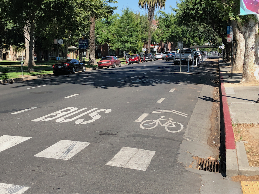
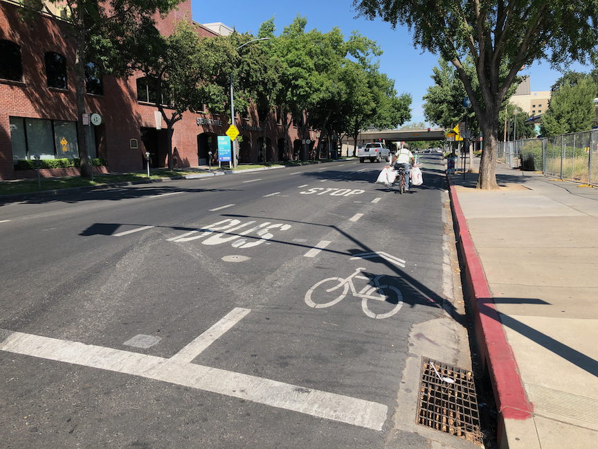
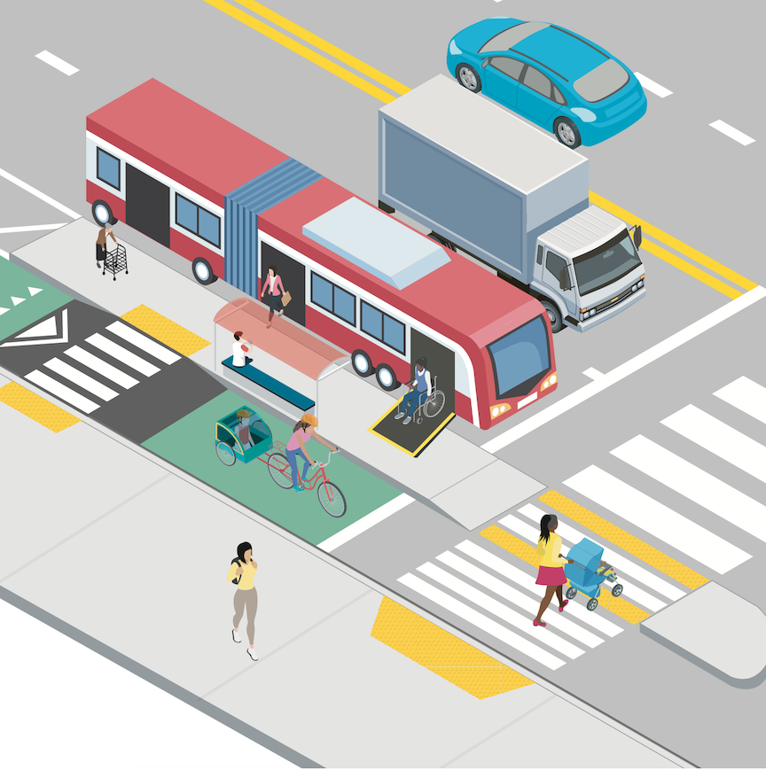
I recently attended a meeting of SacTRU (Sacramento Transit Riders Union) and heard complaints about the bus stops along J Street between 19th Street and 29th Street, in the section where a separated bikeway (cycletrack, protected bike lane) was installed. I have heard these concerns before, so let me talk about them. Two SacRT routes run along this section of J Street, Bus 30 and Bus 38.
The concerns are two:
The bus stops are too widely spaced.
The bus stops are very difficult for disabled people (and bus operators) to use because the bus no longer stops at the curb, but rather in the street.
Actually, there are TOO MANY bus stops in this section of 10-1/2 blocks, from 19th Street to nearly 29th Street where the separated bikeway ends. Five bus stops, two of them only one block apart. In a central city setting like midtown, bus stops should be no closer than three blocks apart (about 1/4 mile), and preferably more, like four to six blocks. Why? Because every stop slows the bus significantly, not only the deceleration to the stop and acceleration from the stop, but dwell time. Buses in some areas like this actually spend more time stopped than moving, and as a result, the speed of the route is often below 10 mph. The following five photos show the five bus stops. It is significant that there are too many stops, because solutions to issue 2 are not inexpensive.
J St near 19th StJ St near 22nd StJ St near 25th StJ St near 27th StJ St near 28th St
The second issue is real. Bus operators can have a hard time deploying ramps to the street, particularly when the street is strongly crowned as parts or J Street are. A disabled passenger needing the bus ramp, which might be a wheelchair user or someone with a disability making stepping up to and down from the bus difficult, have to wait in the bikeway to board, not appreciated by the rider or by bicyclists. After debarking, the person must travel along the bikeway to the nearest driveway or corner curb ramp, again, not appreciated by the rider or bicyclists.
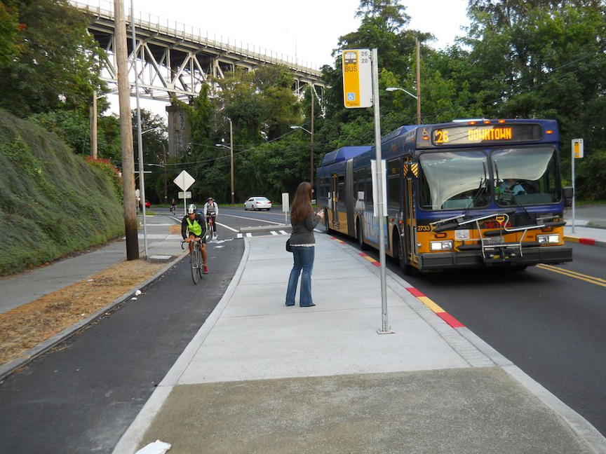
So, what is the solution? Bus boarding islands, which have been implemented in many cities. The first photo below is from Seattle. Riders have an large area to wait for the bus, the bus ramp is easy to deploy, and there is a safe crossing to the sidewalk at the end of the island. A slight disadvantage for the rider is that they must ramp down off the island and then back up to the sidewalk.
Seattle bus boarding island (from NACTO)
The diagram shows an alternative configuration, where the bikeway humps up over the crosswalk, but the route from platform to sidewalk for bus riders is level. This is probably safer for both riders and bicyclists.
diagram of bus boarding island with level crosswalk (from Vision Zero Network)
There are two significant challenges for these bus boarding islands. First is that installing them may require addressing drainage, which can greatly increase the cost of the installation. If three of the five bus stop photos, you can see drainage inlets, so this would be an issue on J Street.
The second is that by placing the bus boarding island where the bus stop now is, buses then stop in the travel lane rather than pulling out into the bus stop. The positive of this is that they don’t then have to negotiate their way back into traffic, which can be challenging and lead to significant delays to the bus schedule. The negative is that private vehicle drivers will complain about the slight delay to their drive from having to wait behind the bus. The convenience and safety for the many people on the bus outweighs the slight inconvenience for private vehicle drivers, but there will be complaints. Timed points on the route, where the bus would stop to wait if it is ahead of schedule, should not be in the travel lane, but that is not true for any of these stops.
To solve the boarding issue on J Street would take a cooperative project with SacRT and the city, and funding from both sides. The number of bus stops should be reduced, probably to three, so that fewer bus boarding islands are needed. This should be carefully planned so that they don’t need to be changed. It is possible to install temporary bus islands, as Oakland and other cities have done in a few places, so if the stop doesn’t turn out to be the best location, it can be moved without great expense.
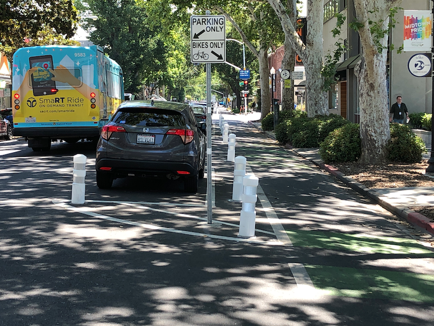
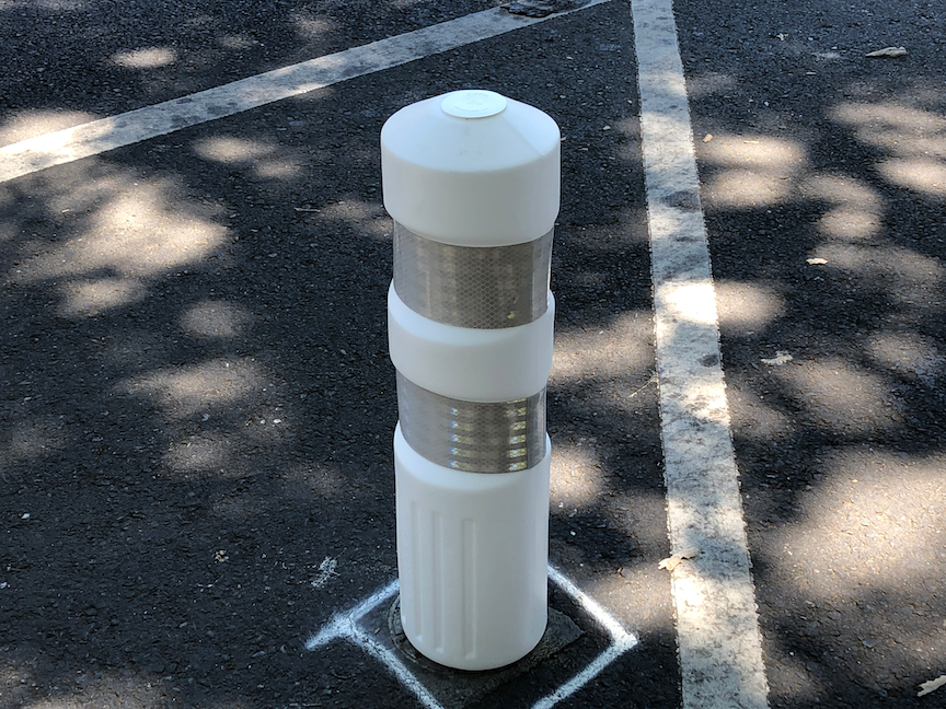
This is a followup to J St bikeway. If you are a Twitter person, you may have noticed discussions the last few days, started by Jennifer Donlon Wyant of the city, about new delineator posts being installed on the J Street separated bikeway. See also the ‘Battle of the Bollards’ page. Though as Jennifer points out, these are not bollards.
Below are photos of the three types of vertical delineators. I’m calling them, respectively, fat delineators (first two photos), rubbery delineators (second two photos), and turtle delineators (fifth photo). The bumps are often called turtles (except in Texas where they are called armadillos). As you can see, despite the fresh installation, at least one of the rubbery posts has already been hit several times and is marked with tire rubber. However, it does not seem to be damaged in the way a regular plastic post would be. The delineator is much more flexible, and perhaps more able to take being hit by reckless drivers.
J St bikeway fat vertical delineatorsupJ St bikeway fat vertical delineator close-upJ St bikeway skinny rubbery delineatorsJ St bikeway skinny rubbery delineator showing damageJ St bikeway turtles & delineators
The fat delineators are much more visible than the rubbery delineators, and probably about as visible at the turtle delineators.
Time will tell which of these works best. Of course none of these provide complete protection from errant drivers, but the theory is that parked cars provide much of the protection. Probably true during the times of day when the parking is in heavy use, but not at other times of day. In the previous post, I recommended that the block sections without driveways, about half the blocks in this stretch of J Street, be protected with concrete curbing. Jennifer points out that this is an attempt to solve or mitigate the problem with relatively minor expenditures, whereas concrete is more expensive. The bikeway itself was an attempt to improve bicyclist safety and comfort with relatively minor expenditures, as part of a repaving project.
Next post I’ll have some information about the bus stops along J Street.