SacCity design speed

Note: A reader asked how a driver would know whether they are on a street where the design speed is well above the posted speed, or whether they were on a street where the design speed was equal to the posted speed. That is a reasonable question. A safely designed street communicates through design what the intended speed is. However, our traffic engineering profession has trained drivers very well with the expectation that it is safe to exceed the posted speed. There will be a transition period as drivers learn 1) to pay attention to the street and what it signals, not just what the sign says, and 2) that new and reconstructed streets are designed for safety of all users, and therefore the design speed equals the posted speed. But in the meanwhile, drivers will need to know. So, I’ve added a sign below that could be used to signal design = posted, with a red border. The color of the sign itself can’t be changed because in our sign system (MUTCD), white is regulatory.

Part of an ongoing series of posts to support better streets in the City of Sacramento during their 2023 update of Street Design Standards. New standards must be innovative, safe, and equitable, and it will take strong citizen involvement and advocacy to make them so.

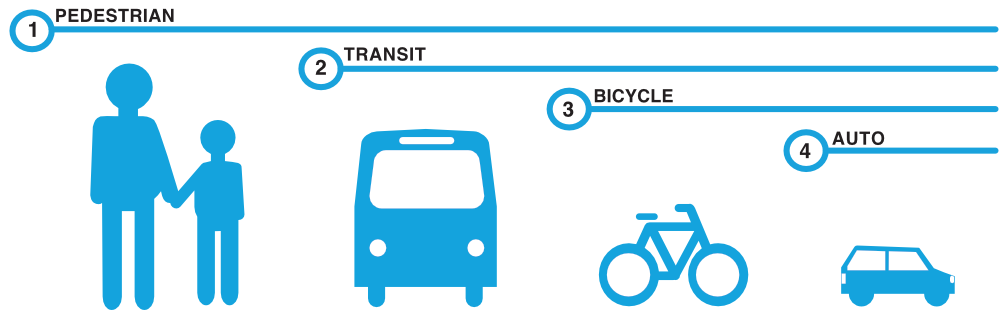
Streets are designed for a specific speed limit, which is almost always well above the posted speed limit. The original theory was that designing for higher speeds would protect drivers who drive over the posted speed limit. This is outmoded thinking, for two reasons. One is risk compensation, that most drivers will drive at a speed that feels slightly unsafe, so they are driving just over the design speed. Two is that even if the design speed is safe for drivers, it is not safe for walkers and bicyclists.

The points below are policy, not specifically designs. I have realized that it is not just the design standards that need to be updated, but the policies that determine what design will be used in various context. A lot of city policies are not documented, but reside in the minds of the planners and engineers. Because they are not documented, the public can’t evaluate them and ask for changes.

  • Design speed = posted speed; a street will never be designed or reconstructed for a higher design speed than the posted speed limit
  • Design and posted speed limits will be set at a level that ensures safety for all street users including walkers along and crossing the street, and bicyclists
  • All projects that reconstruct or reallocate a street must consider a reduction in the design and posted speed
  • Lane widths must match design speeds; lane widths will be limited to 9 or 10 feet except that one lane on truck routes, bus routes with 15 minute or better frequency, or dedicated bus lanes may be 11 feet
  • Local streets will have a design and posted speed of no more than 20 mph
  • Streets intended for both local and through traffic may have a design and posted speed of up to 30 mph
  • Streets will not be designed or posted for 40 mph unless the design reduces intersections, and reduces or eliminates driveways and turning movements
  • No street in an urbanized area will be designed or posted over 40 mph

bicycling on sidewalks

The release yesterday of the report Arrested Mobility: Barriers to Walking, Biking, and E-Scooter Use in Black Communities in the United States demonstrating that tickets for riding on the sidewalk are one of the ways in which laws and law enforcement discriminate against black bicyclists, and Latinx bicyclists as well.

Let me say that I am not in favor of bicyclists on sidewalks, but the conflict between bicyclists and walkers is often exaggerated, and bicyclists are making the best decision they perceive to keep themselves safe from traffic violence. I don’t do it, but I understand why other people do.

So what is the situation in the Sacramento region?

City of Sacramento code 10.76.010 Riding bicycles on sidewalks prohibits bicycling on sidewalks only where signed and where in-street facilities are provided. The code says:

  •  A. No person shall ride a bicycle on a sidewalk where a sign is posted indicating that bicycling is prohibited. The city manager shall designate sidewalks where such signs are posted upon a finding that:
    • 1. The sidewalk abuts a road that is designated a “Low Stress Bikeway” using the criteria for the Facility Selection Guidelines in the City of Sacramento Bicycle Master Plan; and
    • 2. There is either a demonstrated or probable conflict between pedestrians and bicycles. This may be shown by information including, but not limited to: 311 reports, incident data, or estimated high pedestrian activity determined by counts or adjacent land uses and densities.
  • B. Subsection A of this section does not apply to the following persons:
    • 1. City employees acting within the course and scope of employment, including but not limited to:
      • a. Peace officers, as defined in California Penal Code section 830.
      • b. Emergency medical personnel as designated by the fire chief of the city.
      • c. Parking enforcement officers.
    • 2. Children under the age of 18 years old and an accompanying adult.
  • C. Where bicycling on a sidewalk is permitted, the following apply:
    • 1. Bicyclists must yield the right-of-way to pedestrians by slowing down, stopping, or dismounting, as needed.
    • 2. Before passing a pedestrian traveling in the same direction, bicyclists must give the pedestrian an audible warning.
  • D. The city manager or designee shall report to the city council annually regarding the impacts of sections 10.76.010 and 10.76.030. (Ord. 2019-007 § 2; Ord. 2017-0033 § 1; Ord. 2016-0024 § 1; prior code § 25.05.070)

There are some designated bike routes on sidewalks in the City of Sacramento, which were designated before this code came into effect and are still valid. N Street between 8th Street and 15th Street, and the area through the convention center/performance center between 13th Street and 14th Street.


SABA has a summary of sidewalk riding rules, on Sharing the Road page, scroll down to ‘Is it legal to ride on the sidewalk? This page may be out of date.

Note that the County of Sacramento, Elk Grove, and Rancho Cordova code sections are identical, and the Folsom and Galt code sections are identical, examples of mindless copying of code from other locales.

I do not have any information on whether these codes are being enforced in a discriminatory way, but given the almost universal pattern of law enforcement oppression of people of color, I’d not be the least surprised.


On the positive side, AB-825 Vehicles: bicycling on sidewalks (Bryan) has been introduced which would prohibit sidewalk prohibitions except where there are high quality bicycle facilities available on the street,  invalidating all of these code sections except, perhaps, the City of Sacramento. The relevant paragraph is: Notwithstanding paragraph (1), a local authority shall not prohibit the operation of a bicycle on a sidewalk adjacent to a highway or corridor that does not include a Class I, Class II, or Class IV bikeway, as defined in Section 890.4 of the Streets and Highway Code.

I hope readers will support this legislation. The bill passed the Assembly Committee on Transportation on March 20, 2023, and was referred to Assembly Committee on Appropriations, but not yet scheduled. See also Streetsblog CA Traffic Safety Bills Pass First Committee.

If passed, the legislation might well cause cities and counties to accelerate projects to add safe bicycling facilities to streets, in order to reduce sidewalk riding. One can hope.

street design contexts

People have commented on my series of street design posts, online and Twitter and in person, with many questions about how to fix existing streets. My focus so far has been on new and reconstructed streets. Obviously fixing existing streets is a critical issue, and I’m not wanting to neglect it, but part of my approach is summed up as “don’t build stupid”, in other words, don’t ever again design or construct a single transportation infrastructure that prioritizes motor vehicle traffic over access and safety for walkers and bicyclists. The best time for better design was 50 years ago, the second best time is today. But the City of Sacramento, and most cities and counties and state agencies, are continuing to build things that are hostile to people walking and bicycling. Traffic engineering is a remarkably regressive profession, sticking with what was once thought to work, even though it never did, and even though it is absolutely clear that it does not meet our needs today. Transportation infrastructure is meant to last 30 to 50 years, and may be in place longer than that, so everything we do wrong today will be around for a long time. We won’t ever have the money to fix everything (a lot of our transportation investment is basically money we’ve flushed down the toilet), and the Vision Zero or Safe Systems approach of identifying and fixing the locations with the highest fatality and severe injury crashes is right.

My thinking about street design has four contexts:

Read More »

street trees in the parking lane

Note: Added two photos to the bottom, or integrated parking and trees.

In situations where there isn’t any space for trees along the street, usually where a sidewalk buffer (planting strip) was never provided and where a reconstruction of the street to add sidewalk buffers is not in the budget or possible in the right-of-way, trees can be placed in the parking lane. I am not suggesting here that the entire parking area be replaced with trees, but there some trees and their associated shade for walkers and traffic calming effects could be provided on any street with existing parking.

Portland (PBOT) has a sheet about street tree enhancements, which includes Tree Planting in the Curb Zone:

Tree planting in the curb zone allows for encroaching into the on-street parking zone to increase planting widths. This offers an alternative method for increasing tree well size without negatively impacting people walking.

This new tool provides an opportunity to plant trees along curb tight sidewalks or where the furnishing zone is too narrow for large street trees, locations where tree planting would not be possible under current guidance.

PBOT Pedestrian Design Guide
PBOT Pedestrian Design Guide trees in the parking lane diagram
PBOT Pedestrian Design Guide trees in the parking lane

San Francisco has a Parking Lane Planter page:


Parking lane planters are landscaped sidewalk extensions placed between parking spaces at regular intervals or at specific locations. They provide space for street trees and landscaping on streets with narrow sidewalks, where tree planting is limited by conflicts with utilities or driveways, or where there is a desire to visually narrow the roadway.

SF Better Streets

It does not seem as though most cities have policies about placing trees in the street, and those that do, do not seem of long standing, but certainly the practice exists. Street trees in general, though, are of long standing, with every city having policy and design guidance. Sometimes urban forestry and transportation policies and transportation are well integrated, but as often, not.

The City of Sacramento does have an inventory of trees on city property, which includes planting strips (sidewalk buffers). I don’t know of any trees in the parking lane in Sacramento.


Two readers pointed out locations in Sacramento where parking and street trees are mixed in. Both of these were designed this way; the trees were not added later. Both are on R St, the first with a housing development, with parallel parking, the second with housing and commercial development, with perpendicular parking.

R St between 25th & 26th, south side, parallel parking and trees
R St between 16th & 18th, south side, perpendicular parking and trees

What’s Next? – SacMoves Coalition

An earlier post covered the Mayor’s Environmental Advocates Roundtable.

SacMoves is a coalition of transportation advocacy organizations and environmental and climate advocacy organizations, primarily, though it does include some other interests such as housing. There are also a number of interested individuals who participate in the meetings. I am not speaking for the coalition. I represent one organizational member of the coalition, Sacramento Transit Advocates and Riders (STAR), and serve on the Process Committee of the coalition, but otherwise don’t have position or authorization to speak for the coalition. I am relaying information that I think will be of interest to others.

SacMoves decided not take a position on the Measure A transportation sales tax. Most organizational members were opposed to the measure, some very strongly, and there were a few members that did not want the coalition to take a position. As a result, several individuals and some organizations formed the MeasureANotOK group, assisted by Climate Plan, and were primarily responsible for defeat of the measure (though there is of course always an anti-tax contingent). And it was a resounding defeat!

SacMoves Coalition held a special meeting on March 9 to discuss What’s Next?, and more specifically whether SacMoves would take a key role in formulating future transportation funding, or would wait and respond to what others proposed. The group meeting that day confirmed that the coalition would take a key role, and the next regular meeting confirmed that. A one-page summary of the special meeting is here: https://gettingaroundsac.blog/wp-content/uploads/2023/03/sacmoves_2023-03-16_planning-summary.pdf.

The regular meeting on March 17 formed three working groups to start developing background information towards providing a model for transportation goals and funding, which are policy, funding, and communications. The coalition also decided to work more closely with housing and particularly affordable housing interests to see how each can contribute to the best solutions. Transportation and housing cannot stand in siloes, or they both fail.

The coalition does not see itself as the only group working on transportation funding. Organizational members and individuals are following and participating the other efforts, including the Mayor’s roundtable. Perhaps eventually the efforts will coalesce behind a single proposal which will move forward through the efforts of all the interested organizations and individuals.

Unfortunately, SacMoves does not have a website, so I can’t direct you there for more information or contacts, but if you contact me, I will pass you along to the right people.

separated bikeways and bus routes

The City of Sacramento started a design with protected bikeways on streets with significant bus traffic on P Street and Q Street in downtown Sacramento. I live on P Street, so see use of the bikeway on a daily basis. It works OK. P and Q are not heavily biked streets, and the separated bikeways are not heavily used, but they are OK. And actually, P Street doesn’t work well for buses. Since much of the bus traffic is commuter buses, a lot of them over a short period of time, there is often a stack-up of buses blocking traffic and interfering with each other at a stop opposite me on P Street at 13th Street.

Note: I’m using the term separated bikeway here because it is the term in state law, and therefore planning and engineering documents. Most people call these protected bike lanes, or sometimes cycletracks, though the term cycletrack is more commonly used for two-way bike facilities. Use whatever term you’d like!

On Q Street eastbound, the separated bikeway transitions to a bike lane at 14th Street. Since there are bike lanes on both sides of Q Street to the east, a bicyclist a decide where to transition to the right side of the street. This works OK.

On P Street westbound, however, it is a completely different story. The separated bikeway ends at 9th Street. To the west there are no bicycle facilities of any sort. It is a three lane traffic sewer (what I can three or more lane roadways, the purpose of which is solely to flush traffic in and out of downtown). With the construction going on all through downtown, P Street is and has been reduced to two lanes is several places, and with state workers mostly working from home, there is much less traffic in downtown. Nevertheless, the design is fatally flawed. I use the term ‘fatally’ on purpose – it is a design likely to result in bicyclist fatalities.

Read More »

What’s next? – Mayor’s Environmental Roundtable

After the failure of Measure A transportation sales tax measure, everyone who was for it, and everyone who was against it, asked ‘What’s next?’ It is clear there is a need to fund at least some types of transportation infrastructure, including transit, active transportation, and repairing the potholes. It is also clear to me, at least, there there is absolutely no need to fund roadway capacity expansion. We have all of the roadways we will ever need – we need less capacity, not more. But that is not clear to everyone. A lot of people initially were saying things like “we just need to improve the measure a bit, perhaps by removing the Capital Southeast Connector, and then it will pass in 2024. Fortunately, that view has faded. We need something much better than the failed Measure A, and it is not obvious that more transportation sales tax is the right solution. So, What’s next?

One of the groups working on that question is the Mayor’s Environmental Advocacy Roundtable (the mayor being Mayor Darrell Steinberg). A premise of the group is that there might be a role for the city in defining how to fund transportation, and perhaps creating a sales tax or other measure focused on the city. This group has met four times. I was able to attend the last meeting on March 22, and have a brief report. Please keep in mind that these are my notes about what I found interesting, not minutes of the meeting. First, two documents were available, shared here, the agenda, and the overview. Jennifer Donlon Wyant gave a presentation on the city’s transportation planning and funding, which I do not have available. The remainder of the meeting was discussion. So, my notes:

Read More »

SacCity intersections of local streets

Part of an ongoing series of posts to support better streets in the City of Sacramento during their 2023 update of Street Design Standards. New standards must be innovative, safe, and equitable, and it will take strong citizen involvement and advocacy to make them so.

When two local streets intersect, the priority should be for people walking. I’ve created a diagram of what such an intersection might look like, and measure. Notice that the travelway, the area used by moving motor vehicles, is much narrower than is true on most existing streets. This is intentional. Drivers are slowed by their perception that there is a limited space to pass other motor vehicles, or bicyclists for that matter, and limited shy distance from parked cars. Not only does this make the street safer, it also makes it more pleasant for everyone. Drivers traveling any distance will leave these streets in favor of wider/faster streets. Bicyclists can mix with other traffic due to the slow speeds, and do not need a dedicated area. Design and posted speed (if posting is even needed) would be a maximum of 20 mph, and might be less.

Parking is present and welcome, both because it is probably needed, and because it slows motor vehicle traffic. Every corner has a curb extension to shorten the crossing distance for people walking, to increase visibility between walkers and drivers, and to further calm traffic.

Sidewalks of at least six feet, and sidewalk buffers of at least eight feet are included.

Most significantly, sidewalks are raised and extended, with concrete, across the intersection. This enforces the perception that this is a place for walkers, where drivers and motor vehicles are guests. And it is a place where kids could play in the street, as used to be the right of every kid before we let cars dominate our streets. There is still significant pavement for motor vehicles (and bicyclists), but it no longer dominates the neighborhood.

I will address what kinds of streets these are in the future, but what I envision for now is a street with about 80% or more residential, multi-family and single-family. Small businesses on single parcels would be allowed, particularly on corners, but there would be no large commercial or retail, and there would be no surface parking lots.

diagram of intersection of two local streets
Read More »

sidewalk buffer widths

One of the elements of street design is the width of sidewalk buffers, and how these are presented in design standards. The sidewalk buffer is the area between the curb and the sidewalk. The city calls sidewalk buffers ‘planting strips’, and this is often how they are used, but it is not the only use, and in more urban areas, there are often multiple uses of the sidewalk buffer.

I did a sampling of sidewalk buffer widths in the central city, and a few other parts of Sacramento. I am not claiming any insight into the overall pattern. The city does not have a publicly available database or GIS layer of sidewalk locations and widths, let alone locations and widths of the buffers. I have heard rumors that they are developing one, but I have been hearing that rumor for the last ten years, so I’ve become doubtful.

Typical buffer widths in the central city range from six feet to nine feet, with seven feet being the most common. With huge mature trees, the narrower buffers are too narrow of the trees, and the sidewalks have had to be modified. The photo below shows an example, and these situations are everywhere.

sidewalk narrowed for tree roots, Q St near 14th St
Read More »

a graphic for transportation mode share

As I am working on ideas about the City of Sacramento update of Street Design Standards, I am realizing that though details are important, the most important of all, and what should be completed before getting back down to the details, is a statement of values about our transportation system, which we do not have. And there should be a clear, concise graphic that the public can easily grasp, to go with that. So, some ideas.

I’ll start with my favorite of all time, from Complete Streets Chicago. Finding this graphic a number of years ago gave me a framing for what I want to see in our transportation system, and really changed how I think about and communicate about transportation.

Chicago Complete Streets mode share graphic

I just modified this for Sacramento. Why the switch between transit and bicycling? Until the county and region fund transit at a level that allows it to be effective, it is not going to be number 2. I wish it were, but meanwhile, I think bicycling takes number 2.

Chicago Complete Streets mode share graphic modified for Sacramento
Read More »