SacTA Board 2024-10-10

I realize that posting meetings so close to the meeting makes it impossible to schedule your possible attendance, and sometimes even to submit comments through email. But it is still useful, I think, to keep up on transportation issues and government agencies. Discussion and even decisions on the agenda are often not the final word.

The Sacramento Transportation Authority (SacTA – I label it SacTA rather than STA, to distinguish from the California State Transportation Agency which goes by STA or CalSTA) Board of Directors will meet today, Thursday, October 10, at 1:30 PM in the Sacramento County Board of Supervisors chambers, 700 H Street in downtown Sacramento. The agenda can be viewed on the SacTA Board Meetings page, or here. The entire meeting packet is available on SacTA, but it is quite a large document, and you may find looking at individual agenda items to be more efficient. I’ve commented on a linked to three items of greatest interest to me.

Agenda 08: SB 1 Cycle 4 Local Partnership Program (competitive) Project Prioritization

There are two projects to be prioritized for application to the state SB 1 Local Partnership Program, one related to the I Street Bridge Replacement project, and the other for a transit bus yard, hydrogen buses, and hydrogen refueling in north Sacramento, and other transit and transportation projects. Generally only one submitted project is funded, so the prioritization is important.

I don’t have any strong feelings about the two projects, though I will caution that the rush to hydrogen, which is fueled (pun intended) by strong federal, state and local subsidies, is risky. Though hydrogen fuel cells may turn out to be the best solution for some transit routes, the paucity of green hydrogen (that does not rely on fossil fuels or biomass conversion), and the lack of really addressing this issue, is concerning. Much of hydrogen boosterism comes from the fossil fuel industry, trying to maintain its grip on our energy system.

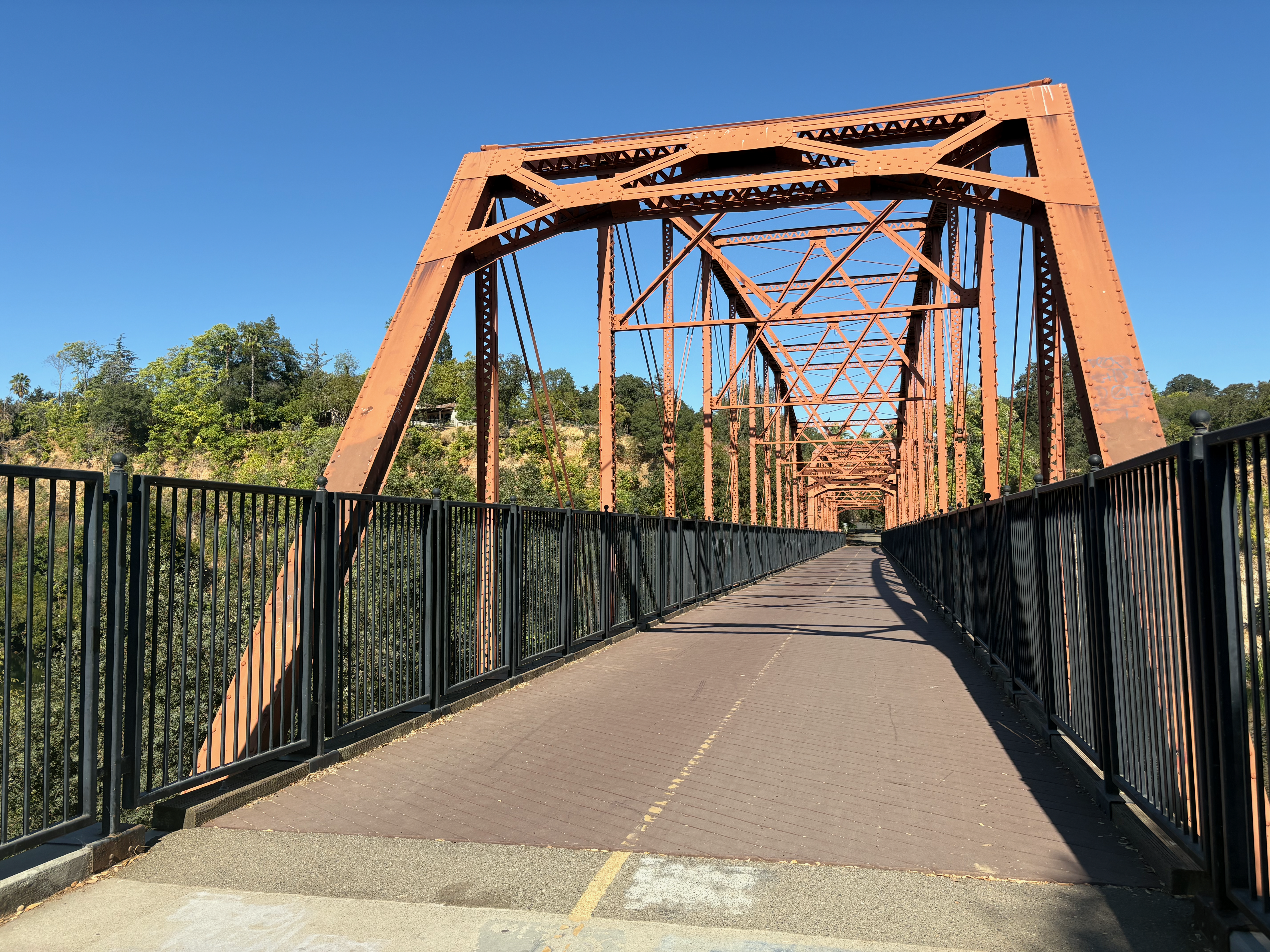
I think everyone would agree that the I Street Bridge replacement is critical, but the city has made sure that it is an expensive trophy bridge rather than a utilitarian bridge.

Agenda 11: Potential Legislative Changes (I’ll let you read the full agenda item title)

The charter for SacTA, established with the passage of the existing Measure A (not the failed Measure As) limits the agency to pass-through of transportation funds to local transportation agencies, with limited influence over the projects implemented. The ‘Measure C’ proposal by SMART (Sacramento Metro Advocates for Rail and Transit) and Mayor Steinberg, places an emphasis on transit, housing, and safe streets. And no roadway capacity expansion. The measure being considered by SacRT, for the City of Sacramento and Elk Grove portion of its service area, would provide some support for infill transit oriented development and first mile/last mile active transportation, but would be primarily for transit. SacTA does not have the authority to fund anything other than direct transportation projects. This agenda item would allow SacTA to consider legislation to broaden it mandate to include housing or housing-supportive infrastructure related to transportation.

It is not clear whether any measure proposed by SacTA would approach the model proposed by active transportation and transit advocates, but this idea is worth pursuing.

I support this agenda item.

Agenda 12: Consider the Creation of a Temporary New Transportation Funding Subcommittee

This agenda item would form a subcommittee to explore the possibility of, and chances for success, of a 2026 transportation sales tax measure sponsored by SacTA.

We know that a transportation measure heavily weighted towards roadway capacity expansion has failed and will fail, but with a possible shift in priorities to roadway maintenance (fix-it-first), transit and active transportation, there is some chance of success. If Proposition 5 passes this November, it is possible that a ballot measure in 2026 would require only a 55% yes vote, rather than a 67% yes vote, which is difficult to pass in Sacramento County with its strong suburban and semi-rural opposition to all taxes.

Several transportation advocacy organizations are opposed to any additional sales taxes since they are regressive, having a much greater impact on low-income people than other taxes. However, at this time, it does not looks as though any of the potential proposals uses alternative taxes.

I support this agenda item.

more on Broadway-Land Park bike signal

I have written before about the problematic bike signal for Broadway eastbound at Land Park Drive (dangerous bike signal on Broadway, Broadway bicyclist press the button). Now some more detail, from a full hour of observation on the signal and driver behavior.

I had hoped to observe bicyclists reacting to the signal, but unfortunately there were no bicyclists. Despite the city devoting much of the street right-of-way to bike lanes (not protected, on only sometimes buffered), it appears that no one is riding their bicycle on Broadway. I’m not surprised. Broadway continue to be an unpleasant place for bicyclists and walkers, and regular bike lanes are unlikely to change that.

The last post I had noted that there was a required beg button for bicyclists to trigger the bike signal, but had failed to look up and notice that there was a complete set of regular signal, bike signal, and blank-out no-right-turn sign on the same post. It looks like:

photo of Broadway eastbound at Land Park Dr, signal, bike signal, blank-out no right turn
Broadway eastbound at Land Park Dr, signal, bike signal, blank-out no right turn

For those unfamiliar with the blank-out signs, which are relatively uncommon in the city, it illuminates when turns are prohibited, and is blank when not prohibited. See photo below for the blank-out phase.

This signal array is definitely mis-communicating to drivers. When the bicycle signal is on, the no-right-turn sign should be on, and the regular signal red. This is mounted close to the right hand turn lane, and drivers see it as applying to that lane.

Most of the time, it is necessary to press the pedestrian beg button to trigger the bike signal. But then sometimes it is triggered without any press, and not due to the presence of bicyclists, as there were no bicyclists. Most signal cycles the bike signal remains red.

When the bike signal is on, there is a period of time when the no-right-turn sign is not on (blanked out), as below.

photo of Broadway eastbound at Land Park Dr, signal, bike signal, blanked-out no-right-turn
Broadway eastbound at Land Park Dr, signal, bike signal, blanked-out no-right-turn

Do drivers follow the no-right-turn sign? In an hour of observation, I did not see one driver follow the sign. Every driver turned across the no-right-turn sign and across the green bike signal. Every. Though I did not observe it at this time, I have experienced drivers yelling at me, and other bicyclists have reported being yelled at, by drivers who think they have the right of way and wonder why bicyclists are proceeding and interfering with cars. The photo below shows just one of about 70 drivers who turned against the no-right-turn sign.

photo of Broadway eastbound at Land Park Dr, driver turning against no-right-turn sign
Broadway eastbound at Land Park Dr, driver turning against no-right-turn sign

Solutions

  1. The regular signal should remain red while the bike signal is green. The placement of this signal is interpreted by drivers as applying to the right hand turn lane, so it must be red.
  2. The bike signal must have an exclusive phase where all other vehicle movements are prohibited. A properly designed intersection with a properly designed signal system probably would not need an exclusive phase, but this is NOT a properly designed intersection and NOT a properly designed signal system.
  3. The pedestrian beg button should be removed from the bike lane, and automatic detection of bicyclists installed. The city knows how to do this, and has done it at a few other intersections, but chose not to here.

Bicyclists will be fatally or severely injured here, and the cause of the crash will be mis-designed roadways, for which city engineers are directly responsible. Drivers are just responding to a mis-designed roadway, the guilty party is the traffic engineers.

The design document for Broadway Complete Streets, and as built, has a through lane, a dedicated left hand turn lane, and a dedicated right hand turn lane. This right hand turn lane is the source of the conflict, the source of the danger. The roadway as built prioritizes motor vehicle throughput over safety.

a trip to San Francisco

My last major trip for the Week Without Driving was a trip to San Francisco.

Friday, I walked from a transportation safety meeting to Sacramento Valley Station, and caught Capitol Corridor train to Richmond, then transferred to BART into San Francisco Embarcadero Station, and walked to Trader Joe’s and then to the Hostelling International hostel near Union Square. That evening I walked to San Francisco Playhouse to see The Play that Goes Wrong, only two blocks away, which is why I stay at that hostel when I’m seeing a play.

Saturday morning I walked to the Ferry Building farmers market to grab a few picnic items, then took Muni Metro N Judah light rail to 9th & Irving. From there I walked into Golden Gate Park and to Hardly Strictly Bluegrass (HSB), a three day free festival (I missed the first day due to the transportation meeting) that I’ve attended seven times since 2010 (the festival is 24 years old). I realized sitting on the grass that I really wanted a lightweight folding chair to Sunday, and other uses, so I took two Muni buses to Sports Basement in the Presidio, bought the chair, and then one bus back to Union Square area and the hostel.

Evening, I went to a contra dance in Oakland, Circle Left. Short walk to BART, BART from Powell Station to 19th St Oakland, walk to the dance center. I didn’t last the entire dance, because a hot day in the sun and dancing at the festival left me drained. Walk and BART and short walk back to the hostel.

Sunday I again took Muni Metro N Judah to 9th & Irving, and walked to the Japanese Tea Garden, my favorite part of Golden Gate Park (among many), spent some while just being, and then had Hojicha tea. From there, a walk along JFK Promenade to HSB. The promenade is a long now car-fee route in the park, one of the best outdoor spaces in the city. The day was slightly less hot, but no less sunny, so in between main stage performances, I wandered to shadier stages (six stages total). The closing act by Emmylou Harris draws the biggest crowd of the festival, and of course I joined the many dancers on the grass to the left of the stage. Everything over, I walked out of the park and caught N Judah back to Union Square to pick up my travel pack left at the hostel, then BART to Richmond.

I missed the Capitol Corridor train that I intended to catch, so had to wait for the last. For an unknown reason, this last train was scheduled for an hour later than normal. The last train is often delayed to accommodate people attending the 49er’s game, or other major sports events, but the game on Sunday was an afternoon game, so the delay made no sense. And then the train was late. The plus was that I met and talked with several people on the platform who had also attended HSB. The train got me home after midnight, and I walked back home (there is no light rail service after 11:00 PM).

I do tend to cram in as many activities as possible when I take trips to San Francisco and the Bay Area, and this weekend was no exception. A big part of what enables this is the great transit system in the Bay Area. Not perfect, but great. Could I have done all this with a car? No, because I’d have spent so much of my time looking for parking that I’d have missed other activities, and paid more for parking than I spent on the entire trip travel.

I plan almost all of the travel with the Transit App, and pay for all of my transit in the Bay Area with a Clipper Card (on my watch). Capitol Corridor travel I buy in the Amtrak app, which is now easier to use than the website.

These are my three big trips during the Week Without Driving (a trip to San Rafael, a trip to Fair Oaks). I did a lot of bicycling and walking as well. I am not a person who has to walk, bicycle and transit. I do it by choice. Though having a car would probably eat up so much of my income that I’d likely end up living in my car. That is not a joke. If you look at areas in Sacramento where unhoused people are living, you will often see high value cars. I suspect paying for those very expensive cars is what pushed many people over the edge into homelessness.

Stockton Blvd Plan to Planning and Design

The City of Sacramento Planning and Design Commission is holding a hearing on the Stockton Blvd Plan this Thursday, October 10, 5:30 PM. It is item 3 on the overall agenda.

The Stockton Blvd Plan is largely about development and necessary utility infrastructure along the corridor between Alhambra Blvd and 65th Street. I am making documents available here. Note that two of these are huge. I’ve downsampled them a bit, but if something you wish to see is fuzzy, you will have to go back to the original documents on the city website, Upcoming Meeting Materials.

I do not have time to look at these documents, but I’m posting them in the hopes that someone will. Though I use Stockton Blvd a few times a year, I don’t spend enough time there to have useful comments from a community perspective.

The Stockton Blvd Plan is NOT about transportation, which is addressed by a separate Stockton Blvd Corridor Plan. In fact, the Stockton Blvd Plan EIR refers all transportation related comments to this document. This plan was a draft in 2021 (Stockton Blvd Corridor Study, Stockton Blvd needs trees, Stockton Blvd draft available). The related project page has disappeared from the city’s website, and the draft plan is quite hard to find (which is why I’ve linked to my copy). The city and SacRT came to an agreement to consider Stockton Blvd for bus rapid transit (BRT), or something approaching that, rather than the weak tea attention to transit in this draft plan. However, there doesn’t seem to be any trace of that project on the city website. SacRT has a webpage about the project: Ride the Future: Sacramento’s Bus Rapid Transit Solution, but there are few details and no timeline.

cover of Stockton Blvd Plan

Broadway bicyclist press the button

Additional posts on Broadway Complete Streets are available at category ‘Broadway Complete Streets‘.

The bicycle signal face for Broadway eastbound at Land Park Drive/16th Street did not work for several weeks after it was turned on. Then it was ‘fixed’ so that it was part of every signal cycle. Now it has been further ‘fixed’ by the installation of a beg button which the bicyclist must press to trigger the bicycle signal. The beg button is the standard pedestrian button, it says nothing about bicyclists.

This signal should detect bicyclists and trigger the bicycle phase, without requiring any action by the bicyclist.

This is yet another example of the incompetence of city traffic engineers, who not only cannot design a signal that works properly, but will actively make things worse for bicyclists. Their concern is foremost, and only, with the free flow of motor vehicle traffic.

Bike signal for Broadway eastbound requires button push

SacCity pedestrian safety emergency: enforcement

The draft City of Sacramento emergency declaration on pedestrian safety: ‘Declaring a state of emergency regarding pedestrian safety in the City of Sacramento and calling for immediate action to address pedestrian injuries and fatalities’ is available (pdf of text, 2 pages, 68KB) (pdf of attachments, 28 pages, 26MB).

This post focuses on the enforcement item.

3. “The City Manager is further directed to work with the Sacramento Police Department to ramp up enforcement of traffic laws that protect pedestrians, including speed limit enforcement, crosswalk violations, and distracted driving. The City shall prioritize enforcement in high-injury corridors and areas with frequent pedestrian activity.”

Three advocacy organizations specifically commented about the draft that it must focus on ‘equity and mobility justice’, as did most of the people who spoke at the city council meeting.

I’ll be blunt. There is a deep and well justified mistrust of Sacramento Police Department (SacPD) among people of color and low-income, particularly among, but not limited to, blacks. SacPD has a history of oppressing black people, and has often used traffic stops as a pretext to harass people. Many of these have escalated into arrest, beatings, and even death. I have seen no real evidence that SacPD has changed their stripes. They are not people that I want interacting with the public about traffic law. And, apparently, they don’t want to either. SacPD has reduced its traffic officer group to almost nothing, and does little traffic enforcement by traffic officers or any officers. It is time to move past the idea that law enforcement has much to contribute to reducing traffic violence.

At the same time, no enforcement of any sort is not the answer. People are dying when drivers violate traffic law, and these deaths are unacceptable. Speed is a contributing factor to all traffic crashes, and is sometimes the primary factor. Driving too fast for conditions, and these conditions include walkers and bicyclists on and close to the roadway, is always wrong, even though road design encourages it.

Automated enforcement is a partial answer. It avoids the pretextual stops, avoids harassment of people of color and low-income by police, at least over traffic law, avoid the escalation that police engage in, and is much less expensive than police officers.

The three main traffic violence issues to be addressed, at least at this time, are:

red light running: Red light cameras and automatic ticket issue to the owner of the vehicle are a partial solution to red light running. Of course some drivers will always run red lights, will always endanger others, and will not be deterred by tickets. But most drivers will notice that tickets are being issued, and will change their behavior. Red light running does have infrastructure solutions, including changing from far-side signals to near-side signals, and raised crosswalks and raised intersections. But there are not easy or inexpensive fixes, so automated enforcement is a good interim solution. When the county ended its red light program, which operated the red light camera in the City of Sacramento, the city made no effort to replace that program, and at least some city staff celebrated it (the red light runners?). The city should create a red light camera program of its own. It should be administered by Public Works, not by SacPD. There are equity issues, since the wide, high speed arterials that most encourage red light running are in low-income communities. Two solutions are to distribute cameras across the city in locations where red light running might occur, and not just those locations with a history. The egregious violators, which are who we really want to target, will be receive tickets eventually. The second is to adjust violation fees (and court costs) to a factor related to income. It would be awkward and perhaps invasive to base it on income, but it could easily be based on vehicle value.

failure to yield to walkers: Drivers have been trained by roadway mis-design to not yield to people in crosswalks. The recent SacPD, OTS funded, sting on J Street demonstrated how common this is. But again, as drivers have been trained to do this, they can be untrained. There are options for automated enforcement of failure to yield, but it requires more complicated and less widely used technology. The city should be experimenting with this technology (they are not), but in the meanwhile, this may be one situation in which in-person enforcement, on a limit basis and with close attention to equity concerns, may be justified. Any in-person enforcement by SacPD raises issues of police violence and over-reaction, including high-speed chases of violators. One solution is to ban high-speed chases. With technology such as helicopters (which the police love) and drones, there is no reason to endanger the lives of violations, bystanders, or officers themselves with high speed chases. Too many cops have watched too many movies with the thrill of high-speed chases. The practice must end.

speeding: There is available and highly reliable technology for automated enforcement of speeding. There is a state-authorized pilot program of speed camera enforcement in six cities and part of Pacific Coast Highway. Sacramento is not among them. To its credit, City of Sacramento asked to be part of this pilot but was not included. The city should strongly lobby the next legislative session for inclusion, and should have a program designed and ready to go when authorized. Speeding is the most common concern of the public, and it is true that speed is a factor in every crash, I’m doubtful that it is the biggest concern. I’d rather see a focus on red light running and failure to yield.

I believe that item 3 should be deleted for its likely failure on equity and mobility justice.

I have not yet written about the other six items, and don’t know when I’ll be able to get to it. However, I will say now, in case you were wondering, that by far the most effective city response is temporary (quick build or tactical urbanism) and permanent changes to roadway design. And what it will take to accomplish those changes is funding, from the city general fund. The seeking of grants, and waiting years or decades for the funding to address traffic violence, is only part of the solution. If this is truly an emergency, and it is, the city must spend significant funding to act on it, and act now.

SacCity pedestrian safety emergency: education

The draft City of Sacramento emergency declaration on pedestrian safety: ‘Declaring a state of emergency regarding pedestrian safety in the City of Sacramento and calling for immediate action to address pedestrian injuries and fatalities’ is available (pdf of text, 2 pages, 68KB) (pdf of attachments, 28 pages, 26MB).

This post focuses on the education item, a public awareness campaign.

2. “The City Manager is directed to identify funds for a public awareness campaign, to educate drivers, cyclists, and pedestrians about traffic safety, with a focus on reducing speeding, improving crosswalk use, and ensuring safer interactions at intersections.”

Public awareness campaigns, or education campaigns, are not an effective response. Despite spending hundreds of millions of dollars on these campaigns, the National Highway Transportation Safety Administration (NHTSA) and the California Office of Traffic Safety (OTS) do not seem to have any research documenting the effectiveness of such programs. But the basic concept of such campaigns is that most crashes are caused by driver, or walker, or bicyclist error, continuing the implication of the rescinded and widely ridiculed ‘94% of all crashes are caused by human error’ (‘It Ain’t 94 Percent’: NTSB Chair Jennifer Homendy Discusses the Role of Human Error in Car Crashes). We just need to educate roadway users, and these crashes won’t happen anymore. Ha!

Many of the public awareness campaigns from NHTSA and OTS are actually victim-blaming campaigns. If only you had been wearing a reflective vest and carrying a light, if only you didn’t cross the street or ride your bike on the street (but don’t ride it on the sidewalk!), if only you hadn’t assumed that our roadways were safe to use, if only you ran faster, if only you weren’t in a wheelchair, if only you’d been willing to walk the half mile to a safe crossing, you’d still be alive. The classic pedestrian safety campaign that shows tire tracks across the face of walkers serves as an example. Do I trust the city to come up with more constructive ‘education’. No, I don’t. I’m afraid that they would just copy and perpetuate existing programs, spending a lot of money and not changing behavior.

Almost drivers know the law, California Vehicle Code, at least the major and not recently changed parts. They know they are supposed to stop at stop signs. They know they are not supposed to run red lights. They know they are supposed to drive the speed limit. They know they are supposed to yield to walkers in the crosswalk (painted or not). They know they are not supposed to enter the intersection unless they can clear it. They know there are clear rules about taking turns at stop sign controlled intersections. So why do they so often do the wrong thing? Why do they kill and severely injure people walking and bicycling, not to mention people in other motor vehicles, their own passengers, and themselves? Because the mis-design of our roadways encourages them to do so. The design says drive fast, consider yourself to be the privileged user of the roadway, and that people walking and bicycling should get out of the way. That kind of education is actually quite effective. It is true that most drivers do not know about recent changes in traffic law, because the state agency responsible for educating them about changes, the Department of Motor Vehicles, does not do so, and is not interested in doing so.

What would be the point of an education program telling people what they already know? None.

I have been involved professionally in walker (pedestrian) and bicyclist education for 22 years. Every program that I have worked in, and designed, included information about the law and how to stay safe, and then, most importantly, practice of that knowledge and those skills. Without practice, education is of very little value. Would the city somehow implement supervised practice for drivers, walkers, bicyclists? I can’t imagine that. The one thing that the city might productively do is educate about traffic laws that have changed during the last legislative session. But I’ve never seen a government agency do that. Walking and bicycling advocacy organizations (CalBike and Walk San Francisco among them) do, but not cities, not counties, not the state.

I believe that item 2 should be deleted as being ineffective.

a trip to Fair Oaks

A shorter and less ambitious car-free trip, this time to Fair Oaks on Wednesday.

I rode my bike from home, along the American River Parkway, across the old Fair Oaks truss bridge, and up to Badfish Coffee in Fair Oaks Village. There are drinking fountains, bathrooms and picnic tables at a number of locations along the parkway, though not until Watt Avenue and east. Some reading and writing along with my tea, mostly transit back home.

I caught SacRT bus 21 from Fair Oaks to Mather Field/Mills light rail station, the SacRT Gold Line to 48th Street Station. A short bike ride to Trader Joe’s for a little grocery shopping. I do a number of trips to grocery stores and farmers markets each week, buying small amounts that fit in my bicycle bag, rather than doing a big trip that might require driving. Give it a try!

I then rode the rest of the way back home along Folsom Blvd and central city streets.

Today was California Clean Air Day, with SacRT offering free rides on transit for the day. I overheard a number of regular and low income riders talking about how excited they were to have a free fare day. The bus was crowded with riders, more than usual, though light rail was not.

I have a folding bike, so carry it on the bus (it does not fit securely on the front bike rack), but each bus has a front rack that can accommodate three bikes. Two riders traveled most of the way on the bus with their bikes on front. Light rail can accommodate several bikes, though it is hard to get them up and down the steep stairs. Unfortunately, SacRT seems to be running mostly old rail cars on the Gold Line, not the new low-floor cars that were promised.

a trip to San Rafael

Dan Allison, author of this blog, took a trip to San Rafael, California, in north bay Marin County, on Monday of Week Without Driving. To be transparent, I have been car-free for over 13 years, and car-light for about 7 years before that, so a trip on bicycle and public transportation is just the way I live life, not an exploration of the challenge that people who can’t drive face. My income is lower middle income, so I have enough money to travel, at least locally. I went to San Rafael to retrieve my phone charger and battery pack that I’d left on a Marin Transit bus last Wednesday. It took three days for Marin Transit to find the item and get it to lost and found. It was entertaining, and sad, to watch the included AirTag travel around on multiple bus routes. AirTags are bluetooth, so only report when they are close to a modern iPhone, but they do keep showing up in new locations.

So, the Monday trip:

  • bicycle from home to Sacramento Valley Station
  • Capitol Corridor train from Sacramento Valley Station to Richmond Station, $22.95
  • BART from Richmond to El Cerrito del Norte, $0.85
  • Golden Gate Transit bus 580 from El Cerrito del Norte to San Rafael Transit Center, $3.50
  • bicycle to a local coffee shop, where I worked on Week Without Driving communication
  • bicycle to Sprouts Farmers Market for lunch supplies
  • bicycle to Larkspur Ferry
  • Golden Gate Larkspur Ferry to San Francisco, $7
  • bicycle to San Francisco Bay Ferry gate G1
  • San Francisco Bay Ferry to Oakland Ferry, $2.30
  • bicycle to Oakland Jack London Station
  • Capitol Corridor from Oakland to Sacramento, $24.65
  • bicycle from Sacramento Valley Station to home

All of the public transportation was using my senior Clipper Card, on my watch. Capitol Corridor train travel was pre-purchased tickets through the app. The total was $61.25, which is rather expensive for a none day trip, but is quite a bit less than I would have spent driving. At about 83 miles there, and about 105 miles back, using the IRS rate of $0.67 per mile, driving would have cost $126. Plus $17.25 for Golden Gate Bridge and Carquinez Bridge tolls. Most people think only about gas costs, or charging costs, and forget about depreciation, insurance, maintenance, parking, and tolls.

Travel time is hard to compare, since I made so many stops along the way, and did not travel by the most direct route. Looking at the simpler Sacramento to San Rafael trip, driving would be 1 hour 20 minutes, whereas I spent about 2 hours 20 minutes on public transportation.

This is a trip that I’ve taken many times, so there was very little planning involved, and in fact I changed my plans for the leg back home several times on the fly, without problems. Less familiar trips would take more planning.

A few photos from my trip are below, but many parts are missing. I’m not used to documenting my public transportation travels, and even less for selfies.

SB 960 complete streets signed

Governor Newsom has signed SB 960, the complete streets bill (SB-960 Transportation: planning: complete streets facilities: transit priority facilities.), authored by Scott Wiener. That’s the good news. It is certain that the Caltrans districts will resist this law, but with oversight by CalBike and the public, things will gradually shift.