The City of West Sacramento is developing a Vision Zero Action Plan. If you live in, work in, or travel in West Sacramento, I encourage you to take a look at the VZ page. The map showing crash locations, nearly all at intersections, indicate that West Capitol Ave is the epicenter for traffic violence, with Sacramento Ave coming in second. That is my own experience in riding and walking on these arterial streets. West Capitol Ave is the route for Yolobus 42A/42B, and several other routes.
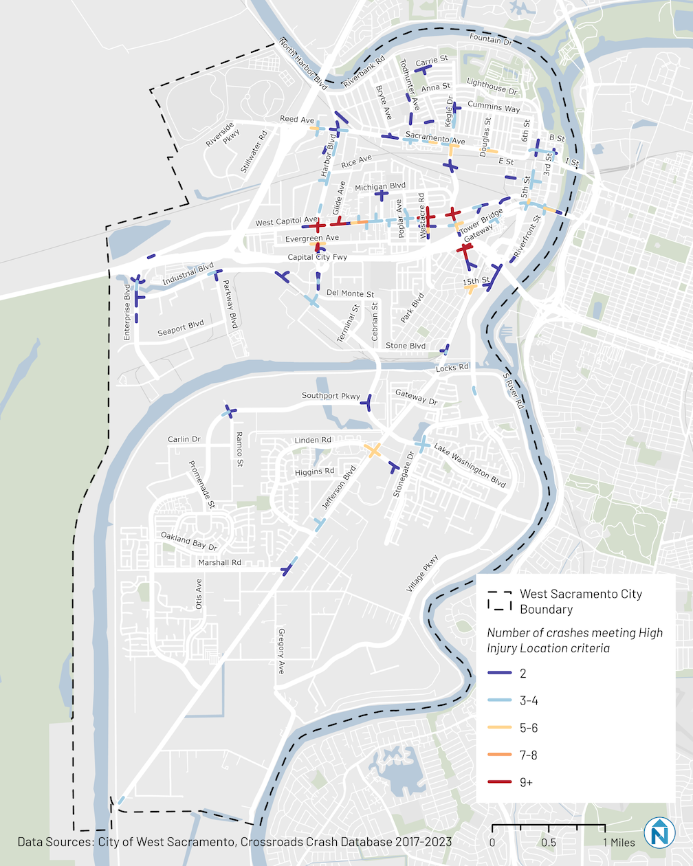

The data is from 2017-2023, mostly before they painted the green, buffered bike-lane down West Capitol Ave. It _feels_ like a comfortable route now; I am interested to see how the crash data has changed.
LikeLike