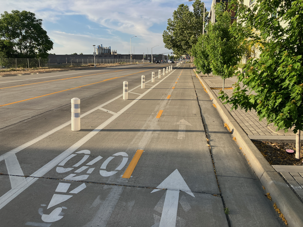
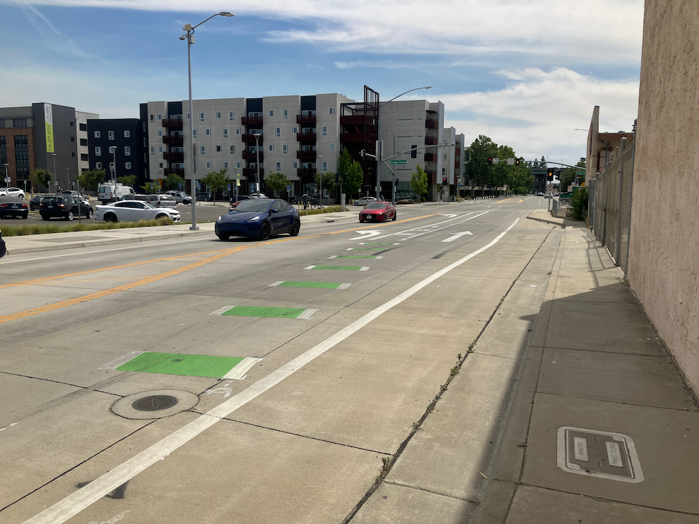
WestSac: traffic calming around Sutter Health Park

In response to a comment from a reader, I went to look at the area around Sutter Health Park, primarily the intersections of 5th Street and Cabaldon Parkway, and 3rd Street and Cabaldon Parkway. Note that Google Maps and Google Earth photos from July 2024 do not show the current configuration of these intersections with various traffic calming features, and vertical delineators often do not show up. If you want to see or experience it, you’ll need to go out there for yourself.

The city has kept adding vertical delineators to this entire area in an effort to regulate driver behavior around the ballpark. Things have improved but are still not safe. It is a comment on the drivers that pass though this area, and attend games, that so much has needed to be added, but is still insufficient. I can imagine the city saying “Well that didn’t work, lets add more of that”.

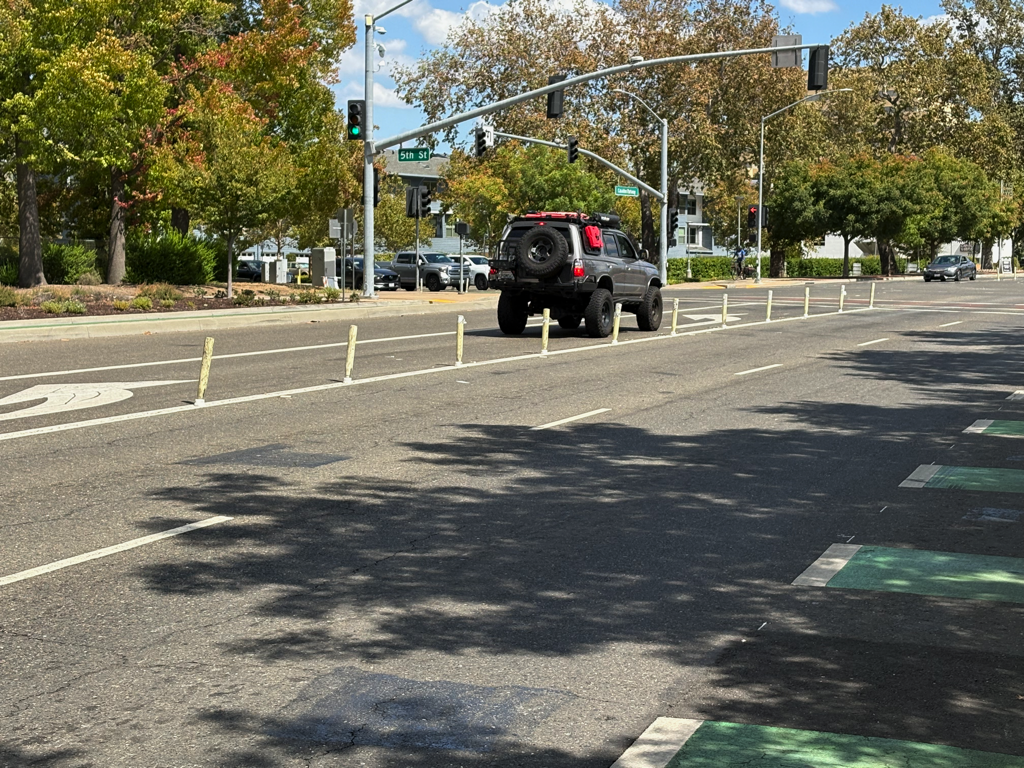
The photo below shows 5th Street southbound approaching Cabaldon Parkway. It is the only one that shows both lane delineators (white) and centerline hardening (yellow). The traffic lane adjacent to the bike lane is very narrow, and the bike lane is not protected in any way from this traffic lane. Much of the lane is in the gutter with a linear seam between the two. Which means it is not actually a legal bike lane, despite the message of green paint. This roadway need to be reconfigured to create a safe bikeway with at least a buffered separation, or ‘protected’ by vertical delineators, or best of all, a hard concrete curb. While riding this bike lane, I was passed by a large truck that drifted into the bike lane, forcing me to the curb.

This roadway design is completely UNSAFE for bicyclists, and must be corrected immediately by the City of West Sacramento.
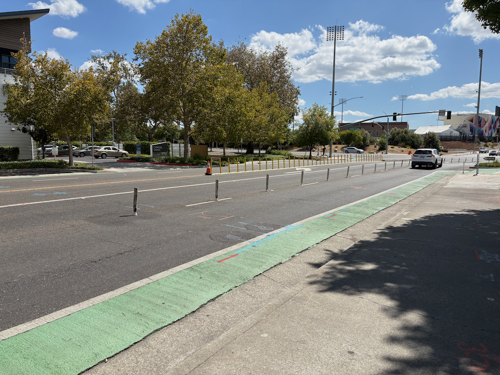
photo of 5th St at Cabaldon Pkwy lane delineators & centerline hardening
5th St at Cabaldon Pkwy lane delineators & centerline hardening

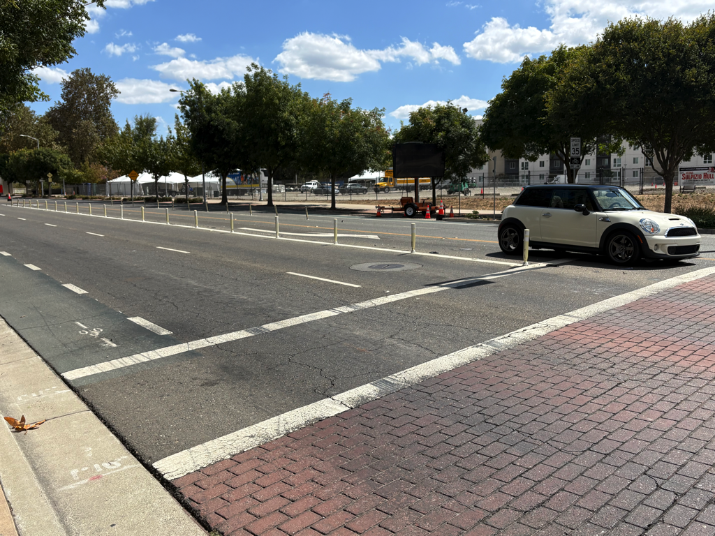
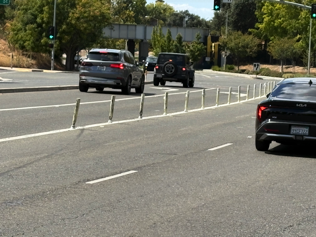
The next set shows lane channelization delineators (white). Note that they are no longer white and unbent, they have been run over by drivers multiple times. But they do have a traffic calming effect by discouraging drivers from changing lanes in unsafe locations or at intersections.

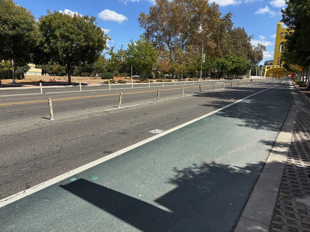
The reader commented that motor vehicles in lanes to the right of the delineators, westbound and eastbound on Cabaldon Parkway, drift to the right and into the bike lane. I did not observe this in my time there, and I did not feel unsafe, but I am not discounting the reader’s concern. I may have felt OK because these bike lanes are wider, not the barely legal lanes found many places, including the one above.

The longer stretches of bike lanes, particularly on Cabaldon Pkwy eastbound under the bridge, should be curb protected. Except for the bus stop at West Gateway Apartments, there are no driveways in this section.

A side note: the car in the left hand turn lane in Cabaldon at 3rd photo below sat through two signal cycles because it was not detected, and finally went on the red.
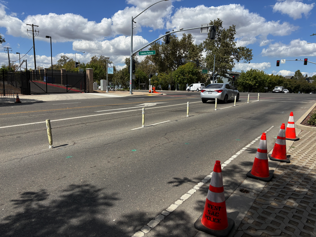
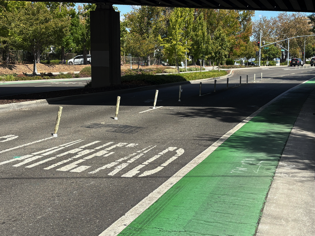
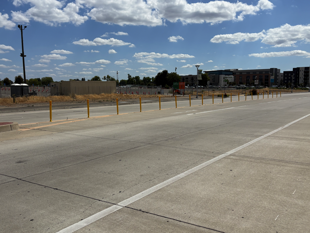
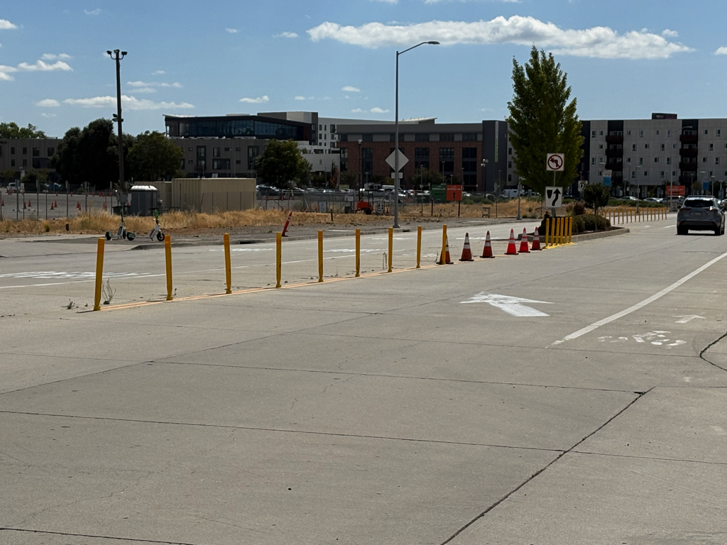
The next set shows centerline hardening (yellow). Most of these are more recent installations, so are mostly still yellow. These appear to be installed to keep drivers from turning into and out of the parking lot areas where they are not supposed to.
And lastly, the transition point on 5th Street southbound from the right-side traditional bike lane to the left-side two-way separated bikeway, often called a cycletrack. Note the very narrow bike lane between two lanes of motor vehicle traffic, ‘protected’ (not protected) by a line of lane channelizers on the left side of the bike lane. This is a horrible design. The bike lane should have been continued to the intersection, two-stage turn box, and an exclusive bicycle phase light.
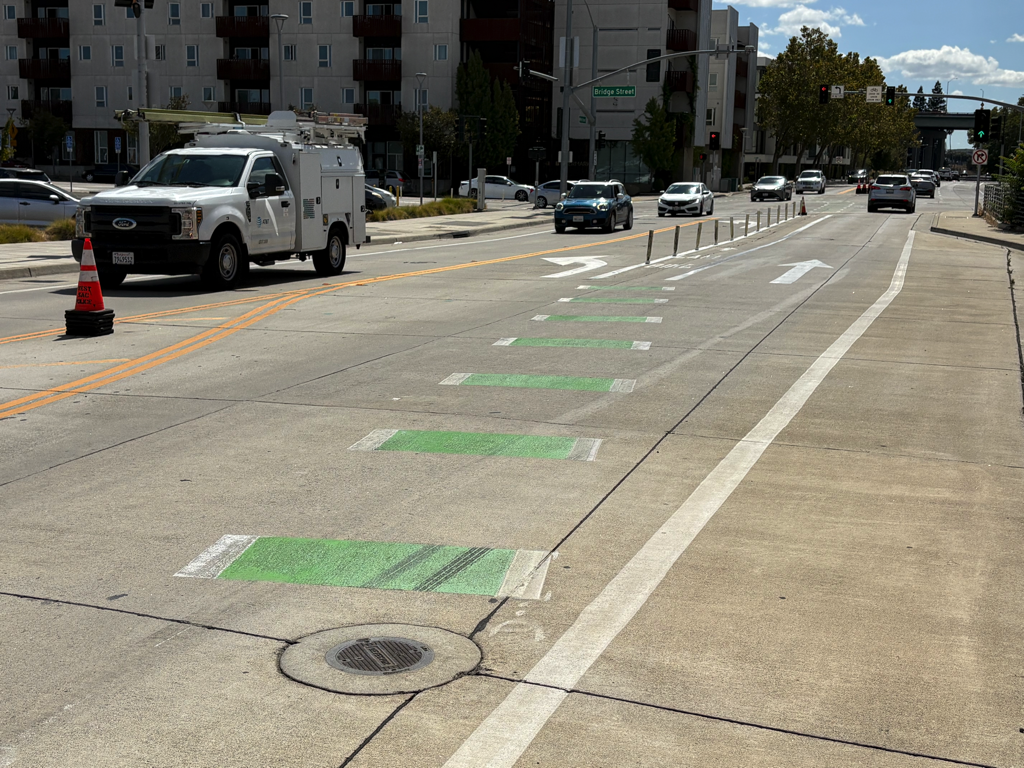
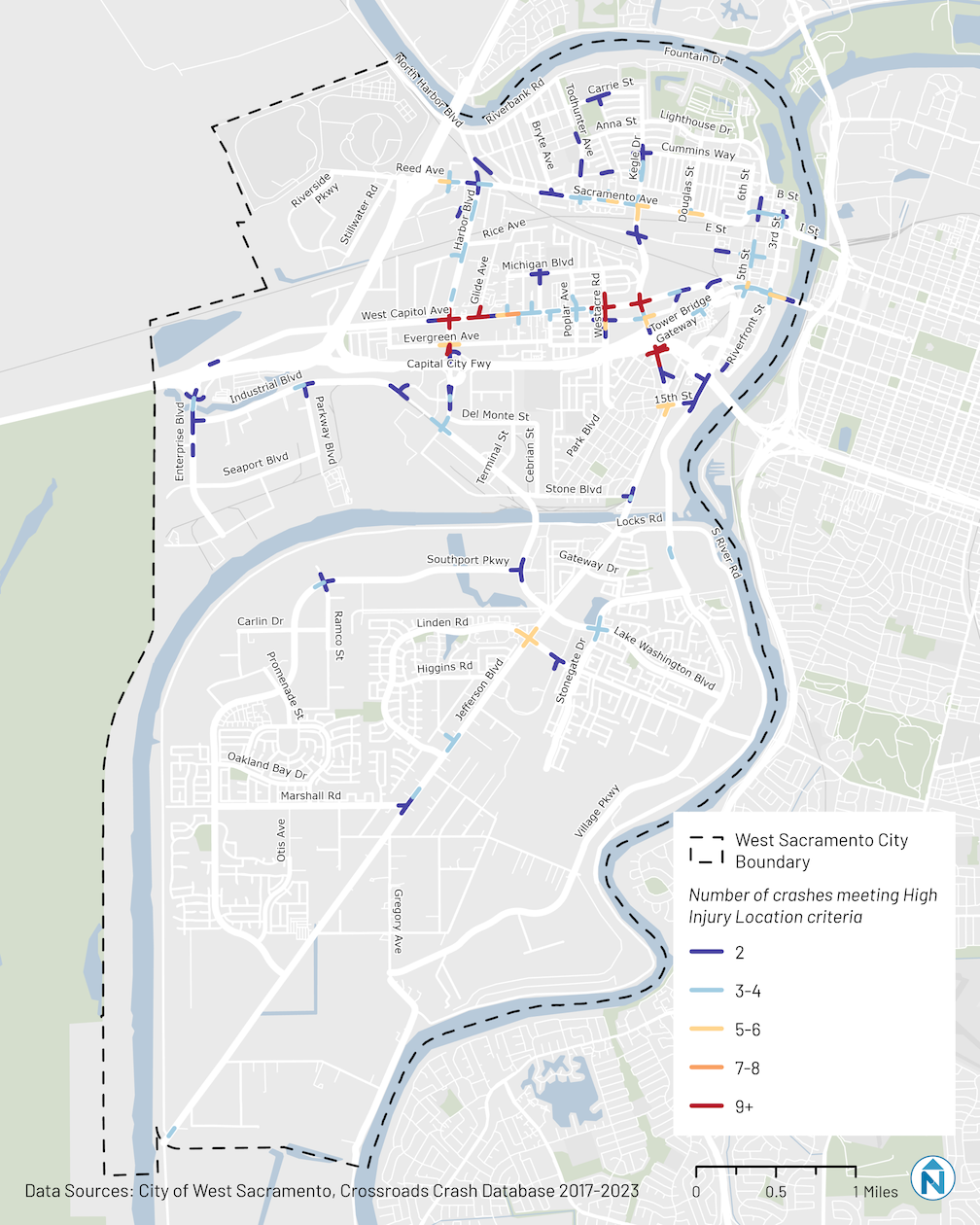
photo of 5th St SB transition to cycletrack
5th St SB transition to cycletrack

sustainable transportation planning grants

The Caltrans Sustainable Transportation Planning Grants for 2025-2026 have been awarded.

Davis received a grant to develop an Active Transportation Plan, described as:

“The City of Davis proposes to develop a city-wide Active Transportation Plan (Plan) with the goal to increase the active mode share trips by 5% by 2040 with the development of innovative and data-proven successful projects, programs and policies that will reduce vehicle miles traveled and greenhouse gas (GHG) emissions (transportation accounts for 74% of GHG emissions in the City of Davis), improve access to transit stops, and enhance safety for all. The Plan will be informed by robust community outreach and the City will work with both our vocal and underrepresented community members and advocacy groups such as Cool Davis, Bike Davis, Strong Towns Davis, Davis Downtown Business Association, Davis Chamber of Commerce, Yolo Cares, Yolo County, the school district, church-based groups, SACOG, identity-based organizations, aging community organization and homelessness service providers to inventory the existing conditions, identify resident’s needs and desires, and identify projects, programs and policies and prioritize the outcomes. Major deliverables include an executive summary designed for decisionmakers and community members filled with graphics and easy to read maps and a technical document which includes recommended prioritized short- and long-term projects, programs and policies to increase active transportation mode share. The Plan will have a strong nexus with existing plans such as the City of Davis’ 2023 Climate Action and Adaptation Plan and 2023 Local Road Safety Plan; SACOG’s Metropolitan Transportation Plan/Sustainable Communities Strategy; and the California Transportation Plan 2050, thereby furthering California’s goal of creating a transportation system that is equitable, safe, sustainable, integrated, and efficient for all.”

SACOG received a grant for CARTA Regional Toll Equity Study, described as:

“Consistent with local and statewide plans, the Sacramento Region (Sacramento, Yolo, Placer, El Dorado, Yuba, and Sutter counties) is developing our first toll lanes to reduce greenhouse gas emissions, improve transit reliability, and manage freeway congestion in our growing region. To deliver an equitable toll lane system, the Sacramento Region needs to evaluate the impact of toll lanes on low-income, disadvantaged, and other equity-priority communities; reduce disparities in benefits and burdens for those communities; and enhance transportation access for all users. The CARTA Regional Toll Equity Study (Study) will fill this gap by reviewing toll equity best-practices, analyzing how toll lanes will impact travel for equity-priority communities, and providing a clear and actionable roadmap to deliver an equitable toll lane network in the Sacramento Region. The Study will be led by the Capital Area Regional Tolling Authority (CARTA), a joint power authority between SACOG, Caltrans District 3, and Yolo Transportation District (YoloTD) that is the new designated tolling authority for the Sacramento Region.”

City of West Sacramento received a grant for West Sac Forward Transit Priority Plan, described as:

“With West Sacramento experiencing some of the strongest growth in the region this century; planned Sacramento Regional Transit (SacRT) light rail transit construction into West Sacramento starting in 2026; public On-Demand Rideshare services growing in popularity; and existing Yolo County Transit District (YoloTD) bus and paratransit service changes anticipated – the City of West Sacramento in partnership with SacRT, YoloTD, and Via, with support from Sacramento Area Council of Governments (SACOG) proposes to develop the “West Sac Forward Transit Priority Plan”: an innovative sustainable public transit plan rooted in community feedback and collaborative public participation.

Using Sustainable Communities funding, our agencies will team-up to analyze existing systems targeting efficiency, effectiveness, and seamless integration of public bus, rail, rideshare, and planned rapid transit systems to better serve residents and local workforce through new policies, strategies, and recommended infrastructure improvements. Objectives include reducing transit delay, increasing reliability and resiliency, increasing ridership, improving access and mobility for equity priority communities and transit-dependent populations, reducing Greenhouse Gas (GHG) emissions, reducing congestion and Vehicle Miles Traveled (VMT), and improving traffic safety while balancing service cost and system performance.

The final deliverable: a transformative plan with recommended improvements that support healthy, diverse communities and strengthen the economy by implementing the City’s Strategic Plan and Mobility Action Plan, YoloTD’s Short Range Transit Plan, and the SACOG 2025 Blueprint Triple Bottom Line strategic goals of Equity, Economy, and Environment – which complement Caltrans’ six Strategic Plan Goals, meet grant objectives, and achieve CTP 2050 vision and Statewide Transit Strategic Plan objectives prioritizing cost-effective public transit services with improved mobility, social equity, and reduced GHG emissions.”

There are other grants in the region, which can be viewed on the Caltrans Sustainable Transportation Planning Grants page.

West Sacramento Vision Zero Action Plan

The City of West Sacramento is developing a Vision Zero Action Plan. If you live in, work in, or travel in West Sacramento, I encourage you to take a look at the VZ page. The map showing crash locations, nearly all at intersections, indicate that West Capitol Ave is the epicenter for traffic violence, with Sacramento Ave coming in second. That is my own experience in riding and walking on these arterial streets. West Capitol Ave is the route for Yolobus 42A/42B, and several other routes.

Vision Zero high-injury map for West Sacramento

cycletrack in West Sacramento Bridge District

Note: I’ve added text and a photo of the approach from the north.

The City of West Sacramento has installed a section of cycletrack (a two-way Class 4 separated bikeway) on South River Road and 5th Street in the Bridge District. Apparently completed late 2023 (shows how long since I’ve ridden that way), it is part of the Riverfront Street Extension and 5th Street Widening Project.

From 15th Street (the connection to Jefferson Blvd) north to almost Mill Street, the bikeway is separated from motor vehicles by a hard curb divider. The on-street bike lane southbound still exists, but this bikeway provides a much safer alternative. The onramp to Hwy 50 east (or Business 80 as it is designated), was an extreme hazard for bicyclists due to drivers turning at high speeds. See two photos below.

South River Rd cycletrack / separated bikeway at 15th St
South River Rd cycletrack / separated bikeway

From Mill Street north to Bridge Street, the cycletrack is separated by a buffer and vertical delineators (K-71). At Bridge Street and north, the roadways returns to traditional Class 2 unprotected bike lanes. Though it would have been great to extend the curb-protected cycletrack all the way north to West Capitol Avenue, at least the truly dangerous section at the freeway onramp was fixed.

To the south of 15th Street, South River Road has more traditional bike lanes, with buffers in a few locations, as it crosses the ship channel and goes through two roundabouts.

The transitions to and from the bikeway seem a little awkward as they swoop through the intersection, but are probably not unsafe. I observed several bicyclists heading westbound to 15th Street who were not following the skip green bicycle markings, but the maneuver was not unsafe. I did not observe any bicyclists at the Bridge Street intersection.

Approaching the cycletrack from the north, the southbound traditional bike lane on the west side of 5th Street transitions to the cycletrack on the east side of 5th Street at Bridge St. Though the transition does not feel safe, I think it actually is, with signals preventing inappropriate motor vehicle movements.

5th St bike lane transitioning to cycletrack approaching Bridge St
signs and signals for bicyclist on 5th St at Bridge St