The SacBee published an article yesterday: After a deadly crash, Sacramento fixed a dangerous road. Why isn’t this the norm? Apologies for linking to a firewalled article; if you have a subscription or access to a printed newspaper, it is well worth reading.The article is quite in-depth, more like the investigative reporting that the SacBee used to do, but rarely does any more. The author is Ariane Lange.
The article highlights changes made to the intersection of Broadway and Martin Luther King, Jr. Blvd (MLK) after a fatal crash single-vehicle crash in 2021. Though the article did not make clear, the driver was likely eastbound on Broadway and continued straight into the building. Google maps, below, does not show the changes, but a photo from the article does (second).

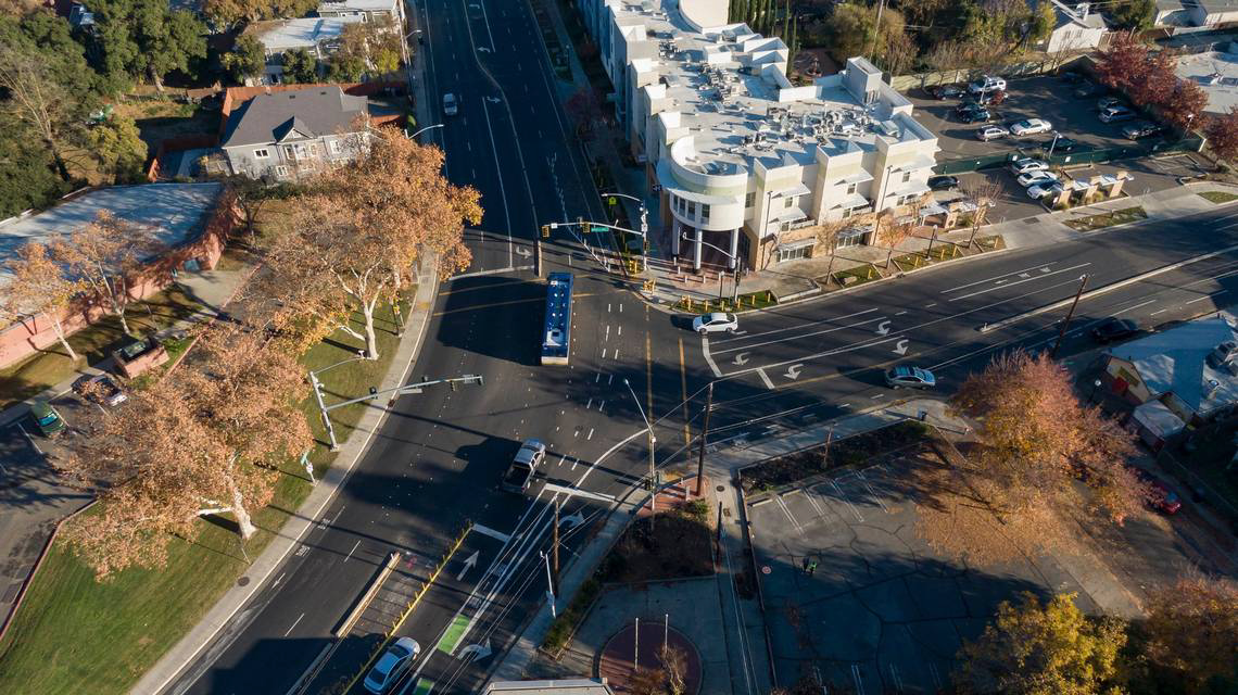
Broadway eastbound was narrowed to one through lane, both approaching and leaving the intersection. Broadway westbound and MLK were not changed. The article said these fixes, paint and vertical delineators (soft hit posts) cost $60,000. The intersection is still a vast area of pavement, with multiple lanes approaching and leaving, which encourages higher speed driving and less attention. Though not a cause of this particular crash, the double left turn lane from MLK to Broadway westbound is a clear hazard, particularly with the wide open intersection that doesn’t mark lanes for turning drivers. Less dangerous than before, but still clearly dangerous.
The article then covers a May 2023 crash on San Juan Road in Natomas. Though other articles don’t make it clear exactly where the crash happened, it is likely that it was an eastbound vehicle on San Juan Road, in the curve to the east of Bridgeford Drive, shown below. Again, a single-vehicle crash. San Juan Road is very wide, two general purpose lanes in each direction, a center turn lane which is superfluous because there few driveways in the area, and narrow bike lanes. It is about 74 feet wide. The city has not updated its traffic counts database since 2018, and the date of the last count for the nearest intersection of San Juan at Bridgeford in 1998 was 12,165. It is doubtful that a four lane road is appropriate here.
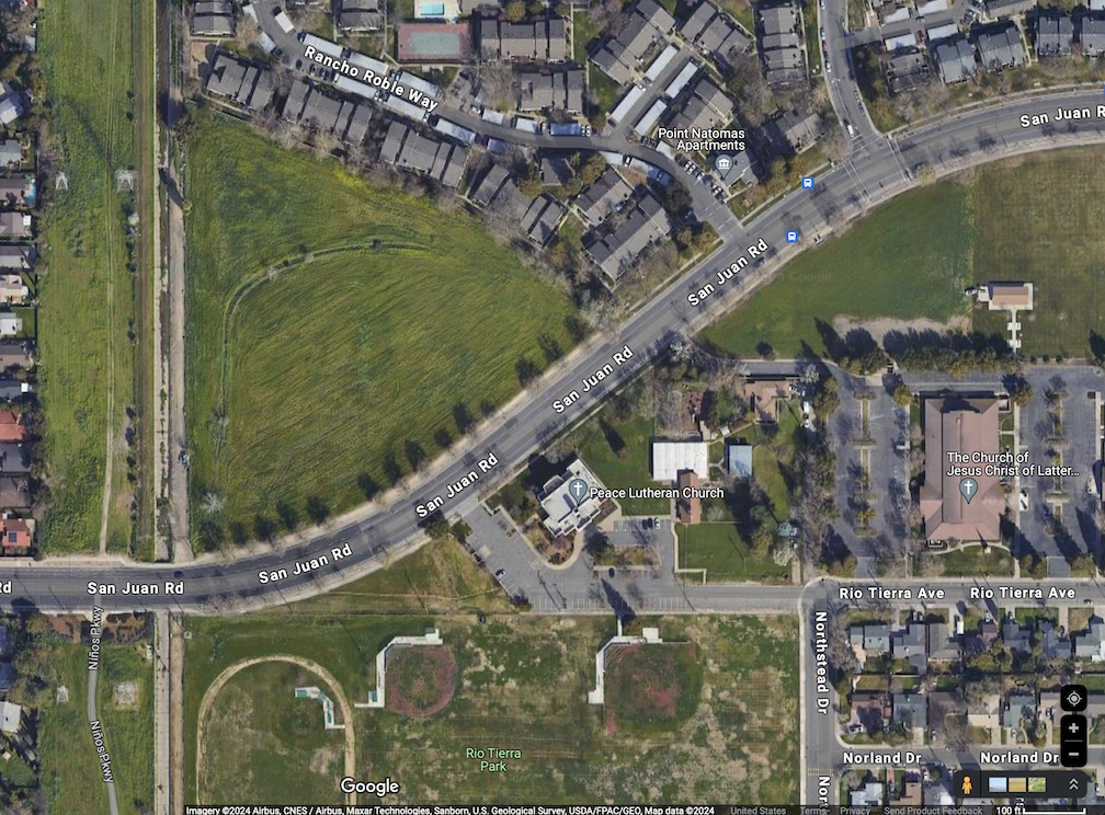
Ninos Parkway, mentioned in the article, is at the left edge of the Google Map above, completed south of San Juan but not north, and with no safe crossing of San Juan. It is not clear whether a safe crossing of San Juan for the Ninos Parkway would have an effect on speeds on San Juan.
Questions raised by the article:
- When we blame crashes entirely on the driver, though they are at fault, we ignore road design solutions that can prevent or reduce crashes and the severity of crashes that do occur. All reporting on crashes should include information about the road design.
- The city does not set aside funding for fixing road design issues, apart from required grant funding matches.
- The city does not have a quick response program to implement temporary and low cost fixes to crash locations.
- The city has prioritized major road safety projects in the Transportation Priorities Plan, but the top and moderate projects would require $5B, far beyond any possible funding. The city, along with every other city and county, has built unsafe roadways with the encouragement of the federal and state governments, so there are thousands of roadway locations that need to be fixed. Dangerous roads are concentrated in lower income neighborhoods.

If you use the Duck Duck Go browser, you can read almost every online Bee story.
LikeLike
I confirmed that Duck Duck Go seems to work for SacBee articles. Thank you for the heads up! macOS broswer: https://duckduckgo.com/mac?source=gl, and in App Store. Also Windows beta, iOS, and Android.
LikeLike