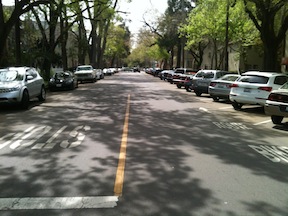
business on a two-way, two-lane street (Capitol at 18th)
I walk a lot in midtown, going to and from various destinations such as the train station, nonprofits and agencies I work with, grocery stores, theatres, farmers markets, breweries, etc. I was thinking last night as I walked to and from Capital Stage about what streets I choose to walk on.
Almost all the time I choose to walk on two-way, two-lane streets. I rarely choose to walk on the multi-lane streets and the one-way streets, except for short distances as I zigzag to my destination. The two-way, two-lane streets are usually quieter, less traffic and traffic moving more slowly. I can relax more with the quiet, and I can look around more, paying more attention to everything around me and not just traffic.
Protected bikeways, also called separated bike lanes or cycle tracks, are all the rage these days. The NACTO Urban Bikeway Design Guide codified cycle tracks, but they were already showing up in several cities, and are now being implementing in a great number more. I’ve ridden on cycle tracks in Long Beach, San Francisco (just yesterday, in fact) and other cities, and yes, they are a pleasure to ride on compared to riding in traffic or traditional bike lanes. Many people have declared the era of vehicular cycling dead, and the era of protected bikeways upon us.
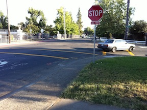
In the month of May I bike commuted to work in Carmichael and Citrus Heights most of the days. I had plenty of time to think about stop signs, as there are a lot of them on my regular routes. A few less, now that the county has removed some from the parkway path, but still, a lot. At most of these stop signs, there are no cars anywhere in sight, particularly at the beginning of AM and PM commute hours when I’m riding, but even at other times of day. So I started thinking, why are these stop signs here, and what are stop signs for?
Stop signs get used for these purposes:
When there is a busy intersection with a more or less equal flow of vehicles on both streets. The four-way stop signs assist people in taking turns.
When one street is so busy that gaps long enough to cross that street are rare.
When there are visibility issues that prevent vehicle drivers to see each other.
When motor vehicles are going too fast, and they need to be slowed down.
I have noticed a lot of confusion in Sacramento amongst both transportation professionals and citizens interested in traffic calming about roundabouts. If you live, work or play in downtown and midtown Sacramento, you’ve seen a lot of structures in the intersections which people call roundabouts, but which are not, they are traffic circles. So what is a roundabout?
intersection conflict points
A modern roundabout is a structure that allows a free flow of traffic without stop signs. Instead, they use yield signs and markings. They are most appropriately used at street intersections where both streets are fairly busy. The biggest advantage of a roundabout, for all users, is the reduction of conflict points in the intersection from thirty-two to four, as illustrated in the diagram at right!
When 3-lane streets are narrowed to 2-lane streets, street width is recovered for other uses. Traffic lanes are commonly 12 feet wide, though they can be as narrow as 9 feet and as wide as 14 feet or more. Most streets in the downtown/midtown area that I’ve recommended for narrowing are really five lanes wide, three traffic lanes plus two parking lanes. Eight ways in which this recovered right-of-way width can be used:
Widen sidewalks: In some areas, sidewalks are too narrow to carry the number of walkers using them. For example, on 16th Street between P Street and O Street, the sidewalk is much too narrow to handle the foot traffic. There are six businesses on the east side of the street: Pronto by Paesano’s and the associated Uncle Vito’s Pizza, Super Cuts, Nishki Sushi, and Starbucks, plus a storefront that is being refurbished to be Thai Canteen. These generate a lot of customers on foot and on bike, and the narrow sidewalk is frequently crowded.
Add sidewalk buffers: In cases where the sidewalk is immediately adjacent to the street, or a there is a buffer but it is too narrow, width can be devoted to these buffers. Sidewalks with buffers are called detached sidewalks. These may not appropriate in commercial areas because the isolated high-turnover parking from the sidewalk, but are completely appropriate in residential areas and may be in mixed areas.
Add bicycle lanes: Bicycle lanes take up five feet of width if adjacent to the curb, and six feet if adjacent to parking. (AASHTO standards are a minimum of four and five, but these widths are unsafe.) Normally a street will have bike lanes on both side, so two bike lanes will take about the same space as one traffic lane. If we were to otherwise leave the street system as it is, with high speed one-way streets, the protection of bike lanes is critical to making downtown/midtown more bikeable. However, if the recommendations I have made were implemented, streets would move more slowly with lower volumes of traffic, and bike lanes would be less necessary.
Add protected bike lanes: A protected bike lane (cycle track) is a protected bike way, with some sort of physical protection from motor vehicle traffic. The protection can be a painted no-vehicle area, hit posts, curbs, parked cars, or a surface raised to a level between the roadway and the sidewalk. Because the protection takes up space, in many situations only a single protected bike lane can be gained from the removal on one traffic lane.
Add dedicated transit lanes: Bus routes on streets with heavy traffic are often slowed by congestion and by turning vehicles. Both bus and light rail can be sped up by removing some of the conflict with dedicated transit lanes. Long distance dedicated lanes can be used to create bus rapid transit routes, but short segments of lanes can be useful for solving spot congestion problems. If light rail and buses run more freely, transit times are reduced and people will be more likely to choose transit over privately owned vehicles. It is not clear to me at the moment whether any of the 3-lane streets are logical locations for dedicated transit lanes, but I will look at this in the future.
Create wide medians: Medians can be created along the middle of the street, separating the two travel directions. These medians can have plantings, artwork, rainwater basins, sitting areas, and a number of other amenities that may be absent along the street. These parkways or boulevards are probably not appropriate in commercial areas, but would be in residential or mixed areas.
Convert from parallel to diagonal parking: Conversion from parallel parking to diagonal parking (60 degree reverse angled parking) uses up about 8 feet of street width, and roughly doubles the amount of parking. Because parking takes more of the street width, it is even more important to consider curb extensions (bulbouts) to increase pedestrian – driver visibility at intersections and mid-block crossings.
Create center turn lanes: If the street is also being converted from one-way to two-way, the center lane can become a turn lane. I think that this is the least useful of the solutions because it serves a single and not very common need, left turns, with an entire dedicated lane. If the traffic on a street is so heavy that it is difficult to make left turns, a left turn pocket or a block-long center turn lane can be provided every four to eight blocks, but having a continuous lane is just a waste of precious right-of-way.
Certainly not every solution is right for every situation, and each roadway segment should be analyzed to determine the best overall use of the width recovered from 3-lane to 2-lane conversion.
I’ve suggested using up excess street width with diagonal parking. Below are two photos of 17th Street in midtown, one of the section between N and O, which has parallel parking, and a much-too-wide street width. The second is between O and P, which has diagonal parking on the west side. Since these are right next to where I live, I get a regular chance to observe the behavior of drivers on these two sections. On the parallel parking section, drivers are almost always moving above the speed limit, about 30 mph, particularly since most of them have come from an overly-wide section of 17th north of N Street. On the diagonal parking section, drivers are almost always moving at less that the speed limit, about 20 mph. A more subtle difference is that northbound drivers, from the diagonal parking section, seems more willing to yield to pedestrians at the unmarked crosswalks at the intersection of 17th and O streets, whereas southbound drivers, from the parallel parking section, seems to be less willing to yield. Narrowing streets with diagonal parking really does make a difference!
17th Street parallel parking17th Street diagonal parking
A friend suggested that my streets change ideas were hardly new, and that is quite true. Some streets were converted in the past, some were identified for conversion but not completed, and many more have been suggested but not adopted by the city. Here are some additional references.
Some news articles about past and planned conversions in Sacramento:
Note: There are a number of contrarian views available from the cars-first crowd. You can search for the Internet for “two-way conversion” if you want to find them.
Note: I’ve updated this post to add some detail to the descriptions and photos to illustrate the treatments. I will be adding separate detailed posts on some of these treatments.
Following on my earlier posts about changing streets in downtown/midtown Sacramento, here are additional street changes that might be used in some places:
Reduce speed limit: Reduce speed limits throughout downtown/midtown to 20 mph. Of course simply reducing speed limits does not ensure that actual speeds go down, unless other measures are taken. The removal of three-lane and one-way streets will help a great deal, since these are the streets that most encourage speeding. Other changes suggested below will also slow traffic. I think, however, that the primary change will be a change in attitude, in cultural values. Once a place becomes more livable, people will focus more on being there instead of going through there to somewhere else. I see the whole pace of life in downtown/midtown as being slower, living at the pace of a walker, or even the pace of a casual conversation, rather than at the unnatural pace of a motor vehicle.
The maps I posted the last two days were preliminary to this post. I would like to see two significant changes to the streets in downtown/midtown Sacramento that will make these areas more livable, more walkable, more bikeable, and safer. I am proposing the complete elimination of traffic sewers from downtown/midtown Sacramento. What is a traffic sewer? It is a street designed to move large volumes of vehicles at high speed in and out of work areas during morning and afternoon commute times. In Sacramento, the main work area is the state buildings downtown, though there are certainly other employers and other areas, including midtown.
3 to 2 conversion, 10th Street northbound
1. Convert all three-lane streets into two-lane streets. The map showing these streets in the downtown/midtown area is linked from my Sac 3-lane Streets post.
These three-lane streets are, of course, also one-way streets. In many cases the lane removed would be used to provide bike lanes or protected bikeways, but in some cases the space might be best used to create wider sidewalks or diagonal parking where additional parking is needed. Though in some cities the three-lane to two-lane conversion is used to create a turning lane, I don’t believe that these are necessary in downtown/midtown, nor do I feel that this is a good investment of right-of-way.
This conversion would remove some traffic capacity, though unfortunately, not as much as one might wish. Studies show only a slight reduction in capacity from this treatment, which is sometimes referred to as a road diet, though I like the term rightsizing.Read More »
Tomorrow night (Nov. 8) at 6 PM the Sacramento City Council meets to vote to adopt a plan for the Freeport Blvd. Bike Lane project.
City staff propose replacing 4 substandard-width traffic lanes on Freeport Blvd. between 4th Ave and Sutterville Rd with 5 lanes: 2 standard-width traffic lanes and a center turn lane for motor vehicles and bike lanes in both directions (Segment Design Concept 2 on the website below). Staff also proposes bike-friendly modifications to the intersection at Freeport and 4th Ave, in front of Taylor’s Market (Intersection Design Concept 2).
The segment improvements are exactly what bicyclists need for safety, and while the intersection improvement isn’t the best one (see #4), it’s affordable and workable.This is a good plan and it looks likely a council majority is prepared to approve it.We need **100** bicyclists to attend this meeting to show the council that our community supports these kinds of essential safety improvements. If you ride on Freeport or care about the safety of someone who does, please join us and please share this invitation with others!
Questions? Contact SABA at jim@sacbike.org or 916-444-6600.


 Reduce speed limit: Reduce speed limits throughout downtown/midtown to 20 mph. Of course simply reducing speed limits does not ensure that actual speeds go down, unless other measures are taken. The removal of three-lane and one-way streets will help a great deal, since these are the streets that most encourage speeding. Other changes suggested below will also slow traffic. I think, however, that the primary change will be a change in attitude, in cultural values. Once a place becomes more livable, people will focus more on being there instead of going through there to somewhere else. I see the whole pace of life in downtown/midtown as being slower, living at the pace of a walker, or even the pace of a casual conversation, rather than at the unnatural pace of a motor vehicle.

