Caltrans gives the middle finger to walkers on 15th St

As part of the Fix 50 project, which has been going on for an indeterminate period of time, and may be complete sometime in this century, Caltrans tore up sidewalks and curbs under the freeway overpasses so that they could use the area under the freeways to store construction material and equipment. One locations was 15th Street under Highway 50. The sidewalk was replaced by uneven asphalt pavement, accessible for some people walking, but certainly not people with mobility devices.

15th Street under the freeway has never had sidewalks on the west side. As with almost all Hwy 50 underpasses, the design was for high-speed on-ramps and off-ramps which would have made walking there suicide. And bicycling as well. Cars first, cars only, the Caltrans motto.

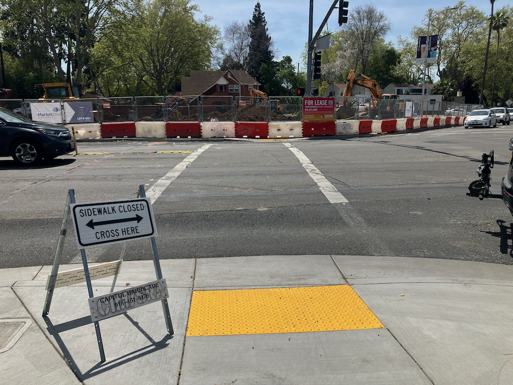
Caltrans started to repair the damage to sidewalk and curb on the east side of 15th. Sometime before June 3, a fence was put up blocking the sidewalk. The result is that there is no path for people walking to follow 15th Street under the freeway. This is a violation of PROWAG, which Caltrans, along with every transportation agency, is legally mandated to follow. Though the regulations provide more detail, the summary says it well: “When an entity closes a pedestrian access route for construction, it must provide a temporary alternate pedestrian access route with basic accessible features. Alternate pedestrian access routes ensure that construction in the public right-of-way does not prevent pedestrians with disabilities from reaching their destinations.” Caltrans did not do so. It could have done so by closing one of the motor vehicle lanes and providing a protected pedestrian access route (and a bicyclist route as well, which is not required by PROWAG but is required by the California MUTCD).

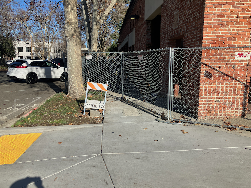
So far as I can determine (remember, Caltrans has fenced off this area), the work remaining to be done is to patch the pavement between the curb and the existing roadway. This is something that would take one day, at most. But as of today, June 16, nothing had changed, nothing had been done. Two weeks. This is the middle finger that Caltrans is giving to people walking. Thirteen days, or more, of no access for people walking, for no good reason, just because Caltrans can’t get its act together to fix something it broke.

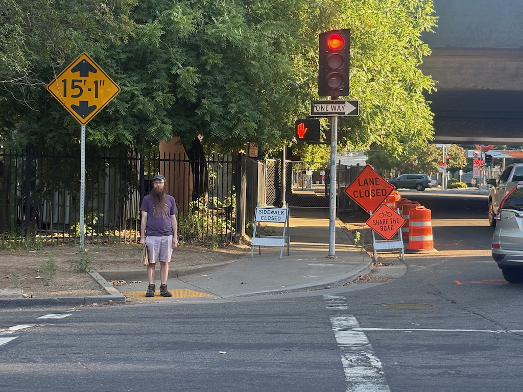
First, what it looks like going south to north on 15th Street. The detour is to… 16th Street, a full block away. That intersection is even more hazardous than this one, with two lanes with high volumes of high speed drivers turning left from 16th Street northbound to W Street westbound. You take your life in your hands there. Actually, you take your life in your hands whenever and wherever you use a facility designed by Caltrans, but 16th Street is one of the worst.

photo of 15th St at X St, pedestrian detour sign
15th St at X St, pedestrian detour sign

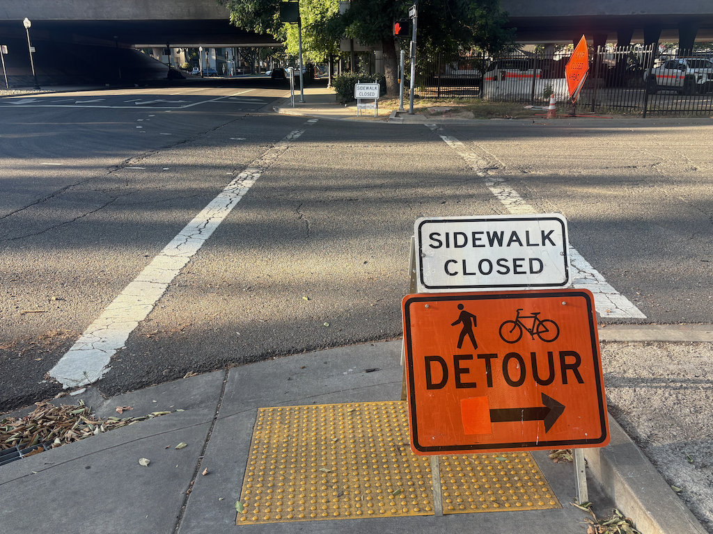
Second, what it looks like going south on 15th Street. You can see the fence that blocks access, but you can’t see, from here, the minor fix that would remove this problem. Apparently the person walking had gone around the fence, unwilling to go two blocks out of their way, to and from 16th Street. This is the target audience for Caltrans, and by ‘target’, I mean a person at risk of bodily injury or death at the hands of Caltrans. At least Caltrans put up a small ‘bicycles share the road’ at a locations where drivers are sure not to see it. This should be an illegal sign in any case, as drivers take it to mean, bicyclists should get out of the way and ‘share’ the road with cars. California MUTCD also required bicyclist accommodation in this situation.

photo of 15th St at W St, pedestrian access blocked
15th St at W St, pedestrian access blocked

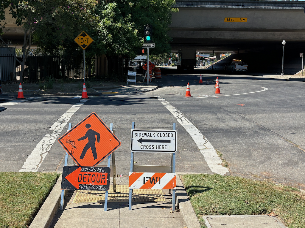
And this is what it looked like today, June 16. No change, except that the ‘bicyclists share the road’ sign is gone. Again, the suggested detour is to the even more hazardous intersection of 16th Street and the freeway.

photo of 15th St at W St, pedestrian detour, sidewalk blockage
15th St at W St, pedestrian detour, sidewalk blockage

I have said before, but it bears repeating, that Caltrans District 3, which includes Sacramento county, is a rogue agency, funded by taxpayers (your tax money) but accountable to no one. Not Caltrans headquarters, not California Transportation Commission, not the governor, not the federal government. And most particularly, not the citizens of Sacramento. They do what they want, when they want. They want you to just accept that they are killing you, using your own money for the crime.

I sometimes wonder if the felon Trump got his ideas for grift, criminality and incompetence from observing Caltrans District 3.

Am I pissed? You bet.

Land Park & Broadway construction zone issues

A new development is under construction on the southeast corner of Land Park Drive and Broadway, the historical site of Tower Records and Tower Books. I am glad to see development, particularly housing, happening here after the lot sitting empty for a bit more than a year. The project name is either Land Park & Broadway, or Tower Broadway. The project description from the City of Sacramento Agency Counter site is:

“MULTI-FAMILY HOUSING/MIX USE – New Five (5) story mixed use development consisting of ground floor retail within a concrete podium and (4) floors of for-rent apartments above. Studios: 39; 1 Bedrooms: 19; 2 Bedrooms: 10”

However, the construction site has several violations of ADA and PROWAG.

The crosswalk over Broadway at 16th Street is closed by a construction fence on the south side. However, there is no detectable warning barrier on the north side, only a sidewalk closed sign with, being on a folding barricade, is a trip hazard, and the pedestrians signal is not covered so that someone with limited vision would know the crosswalk is closed.

photo of Broadway at 16th St closed crosswalk not ADA compliant
Broadway at 16th St closed crosswalk not. ADA compliant

The same problem exists for the crosswalk over Land Park Drive, inappropriate signing posing a tripping hazard, lack of detectable barrier, and pedestrian signal face not covered.

photo of Land Park Dr at Broadway closed crosswalk, not ADA compliant
Land Park Dr at Broadway closed crosswalk, not ADA compliant

On the east side of Land Park Drive approaching the construction site, there is no detectable barrier, signing is placed so that it blocks access to the bus stop, and the construction fence intrudes into the sidewalk. Note that the pedestrian detour sign is not required and probably does nothing to help people walking.

photo of Land Park Dr closed sidewalk, not ADA compliant
Land Park Dr closed sidewalk, not ADA compliant

Getting a little closer, you can see that there is a bus stop for which access has been blocked by the construction signing. The bus stop is no longer accessible to anyone with mobility issues. I just talked to a SacRT employee, who said they had received no communication from either the city or the construction company about this blockage. SacRT will consider temporarily moving the bus stop. The construction company could have placed fencing and signing to maintain access to the stop, with a detectable barrier beyond the stop, but they did not. I suspect the city didn’t even notice this in their Traffic Control Plan. The city generally accepts whatever the construction company writes, without field checking it. It is well known that the city and most construction companies consider walkers and transit users as unimportant.

photo of Land Park Dr no bus stop access
Land Park Dr no bus stop access
Land Park Dr bus stop 1058

I did not check ADA compliance on the Broadway sidewalk approaching this construction site from the east, but would expect to see similar problems there.

While walking Broadway today, I noticed that two construction projects which were reported to the city (311) months ago have not been corrected. So far as I can tell, the city stopped inspecting or enforcing construction sites and Traffic Control Plans months ago.

Broadway too-narrow sidewalks

This is a follow-up to my serious concerns about Broadway post. There will be additional posts about the Broadway Complete Streets project. The Broadway Complete Streets project is underway, with several locations of corners, midblock crossings, curbs, and sidewalks already reconstructed.

It is clear that throughout the planning and construction of this project, sidewalks were ignored or discounted. The project is all about the roadway, reducing motor vehicle lanes to 2 plus a turn lane (from 4), and adding buffered bikeways. It is common in project planning to assume that sidewalks will not be disturbed, and therefore do not need to be brought up to current ADA/PROWAG requirements. However, sidewalks are being replaced, newly constructed, in several locations along Broadway. That means they do have to meet current requirements, and that requirement is a clear width of 48 inches.

The Broadway Complete Streets Final Recommendations (2016) document identifies ‘Sidewalk obstructions or narrow sidewalks’ as a critical issue. It also says “The proposed road diet allows for a buffered bike lane through the entire corridor, and presents opportunities for pedestrian crossing improvements, new pedestrian crossings, and sidewalk enhancements.” However, other than curb extensions at intersections and mid-block crossings, nothing in the design actually enhances sidewalks. The ‘typical cross section proposed’ is below. Though the diagram shows 8 foot sidewalks, the actual sidewalk width varies greatly along the corridor.

diagram of Broadway Complete Streets typical cross-section proposed
Broadway Complete Streets typical cross-section proposed
Read More »

SacCity work zone problems on Broadway

Posts related to the work zone guidelines are linked via category ‘Work Zones‘ within City of Sacramento category. Posts about construction project issues, previous to and after the release of the draft guidelines, of which there are a huge number, are linked via tag ‘construction zone‘ within Active Transportation category.

I walked a long section of Broadway today, and came across two construction projects that close sidewalks without proper and safe signing and barricades.

‘Dental Clinic Remodel’

I put this one in quotes because it is a building that has been abandoned for years, but is apparently now under construction. Construction for this half-block building on the north side of Broadway between 23rd and 22nd Streets has closed sidewalks on both 23rd and 22nd. For 23rd, there is some signing, but also a non-detectable chainlink fence and trips hazard folding barricade. As with many other construction projects, a sign on hand, the bicycle/pedestrian detour sign (MUTCD M4-9a), was used though it is not required or appropriate. The sidewalk closed ahead cross here (MUTCD R9-11) is a valid sign, but the wrong location. The sidewalk is closed HERE, not ahead, so the correct sign is sidewalk closed cross here (MUTCD R9-11a).

photo of work zone violation at Broadway and 23rd St, wrong sign, non-detectable barricade
work zone violation at Broadway and 23rd St, wrong sign, non-detectable barricade

At the corner of Broadway and 22nd Street, there is no sign at all, and the same non-detectable chainlink fence used as a barricade.

photo of work zone violation at Broadway and 22nd St, no sign and non-detectable barricade
work zone violation at Broadway and 22nd St, no sign, non-detectable barricade

I did not check on the north side of these sidewalk closures, but I would assume the signing and detectability is the same or worse.

Read More »

SacCity work zone comments

I developed comments on the Draft Criteria and Guidance to Accommodate Active Transportation in Work Zones and at Events, and submitted them to the city, attached if you wish to take a look. There is a roundtable meeting for stakeholders on January 9, and a community meeting later in the month, possibly January 24.

PROWAG (Public Right of Way Accessibility Guidelines), released in August 2023, has the force of law, whereas MUTCD and CA-MUTCD are advisory, so relevant sections of PROWAG must be referenced in the work zone guidance.

Signing

PROWAG Chapter 3 says: [R303.2 Signs: Signs identifying alternate pedestrian access routes shall be provided in advance of decision points and shall comply with R410. Proximity actuated audible signs or other non-visual means within the public right-of-way of conveying the information that identifies the alternate pedestrian access route shall also be provided.]

The draft guideline says: ‘Proposed design and placement of the temporary traffic control signs, devices, and roadway markings must follow the most recent edition of the CA MUTCD.’

The draft guidelines must make clear that CA-MUTCD/MUTCD signs as shown on the diagrams must be used. This is a common failing of construction zone signing. Companies, and the city, use whatever similar signs happen to be on hand. They use roadway construction signs, and paper signs that melt in the rain and blow away in the wind. Note: I submitted a comment to FHWA for the MUTCD revision that these signs should be construction orange, as they are temporary construction closures, not permanent. They didn’t listen.

Barriers

MUTCD text and figures show barriers in crosshatched orange. Unfortunately, neither MUTCD nor PROWAG show details of what that barrier should look like. It is common in construction projects to use chain link fence or roadway construction barriers on sidewalks, but these do not meet the requirements for detectability by persons using canes. Though PROWAG does not specifically address barriers (unfortunately), it does have the text: R303.6.1 Top: The top of the top detectable edging shall be no lower than 32 inches (815 mm) above the walking surface and be free of sharp or abrasive surfaces, and R303.6.2 Bottom: The bottom of the bottom detectable edging shall be 2 inches (51 mm) maximum above the walking surface.

There are two diagrams that I’ve used before, left and center. Right is a commercial product (though note is is only compliant if the props are away from the walker, otherwise they are a trip hazard). This model has been used in several places in Sacramento, but they tend to fall down in wind, so may not be the best. The channelizer in center is often used as a barricade at crosswalks, and I believe this use is compliant, and they don’t fall down in wind. The draft guidelines must include some sort of diagram, otherwise, companies will use whatever is on hand, and whatever a sighted person thinks is sufficient.

The left diagram is from Applying the Americans with Disabilities Act in Work Zones: A Practitioner’s Guide (https://workzonesafety.org/publication/applying-the-americans-with-disabilities-act-in-work-zones-a-practitioner-guide/), and the center diagram is from Work Zone Pedestrian and Bicycle Guidance (https://www.vdot.virginia.gov/media/vdotvirginiagov/doing-business/technical-guidance-and-support/technical-guidance-documents/traffic-engineering/WZ_Ped_Bike_Guide.pdf).

Diagrams

The sidewalk diagram in the new 2023 MUTCD Figure 6P-28 is better than the 2014 CA-MUTCD Figure 6P-28 because it makes clear that ramps from sidewalk level street level are necessary for a diversion. That diagram is below, and should replace the one in the draft guidelines. Figure 6P-29 is the same in both.

diagonal ramp corners are now illegal

PROWAG (Public Right-of-Way Accessibility Guidelines) from the US Access Board have now been officially adopted. I’ve only begun to review them, but a few things grabbed my attention right off the bat. From PROWAG:

“At an intersection corner, one curb ramp or blended transition shall be provided for each crosswalk, or a single blended transition that spans all crosswalks at the intersection corner may be provided. Where pedestrian crossing is prohibited, curb ramps or blended transitions shall not be provided, and the pedestrian circulation path shall be either (a) separated from the roadway with landscaping or other non-prepared surface or (b) separated from the roadway by a detectable vertical edge treatment with a bottom edge 15 inches maximum above the pedestrian circulation path.”

This means that the diagonal access ramps at corners, which are common in suburban areas and even a few urban areas, are no longer legal for installation. For any alterations of curbs, sidewalk, or corner, new ramps must be two to a corner, perpendicular, or the ramp must cover the area of both sidewalks. See photo below.

photo of diagonal curb ramp, now illegal under PROWAG, installed May 2023
diagonal curb ramp, now illegal under PROWAG, installed May 2023 by Sac City

Secondly, the pedestrian prohibition signing in common use in the City of Sacramento and many other places is now illegal, because it does not meet the criteria of the bottom edge no more than 15 inches above the sidewalk. See photo below, showing a newly installed curb ramp where the ramp does not extend the full width of both crosswalks. Again, any alteration of the curb, sidewalk, or corner requires compliant design. Of course the majority of these pedestrian crossing prohibitions are unnecessary, and were installed to ease motor vehicle traffic and not to protect walkers, so most should simply be removed, and legal curb ramps installed. The one exception would be freeway on and off ramps that have not been modified to be safe under any conditions.

photo of pedestrian crossing prohibition, now illegal under PROWAG
pedestrian crossing prohibition, now illegal under PROWAG