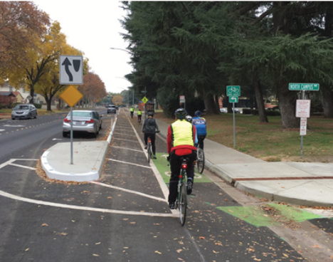
I recently attended a meeting of SacTRU (Sacramento Transit Riders Union) and heard complaints about the bus stops along J Street between 19th Street and 29th Street, in the section where a separated bikeway (cycletrack, protected bike lane) was installed. I have heard these concerns before, so let me talk about them. Two SacRT routes run along this section of J Street, Bus 30 and Bus 38.
The concerns are two:
The bus stops are too widely spaced.
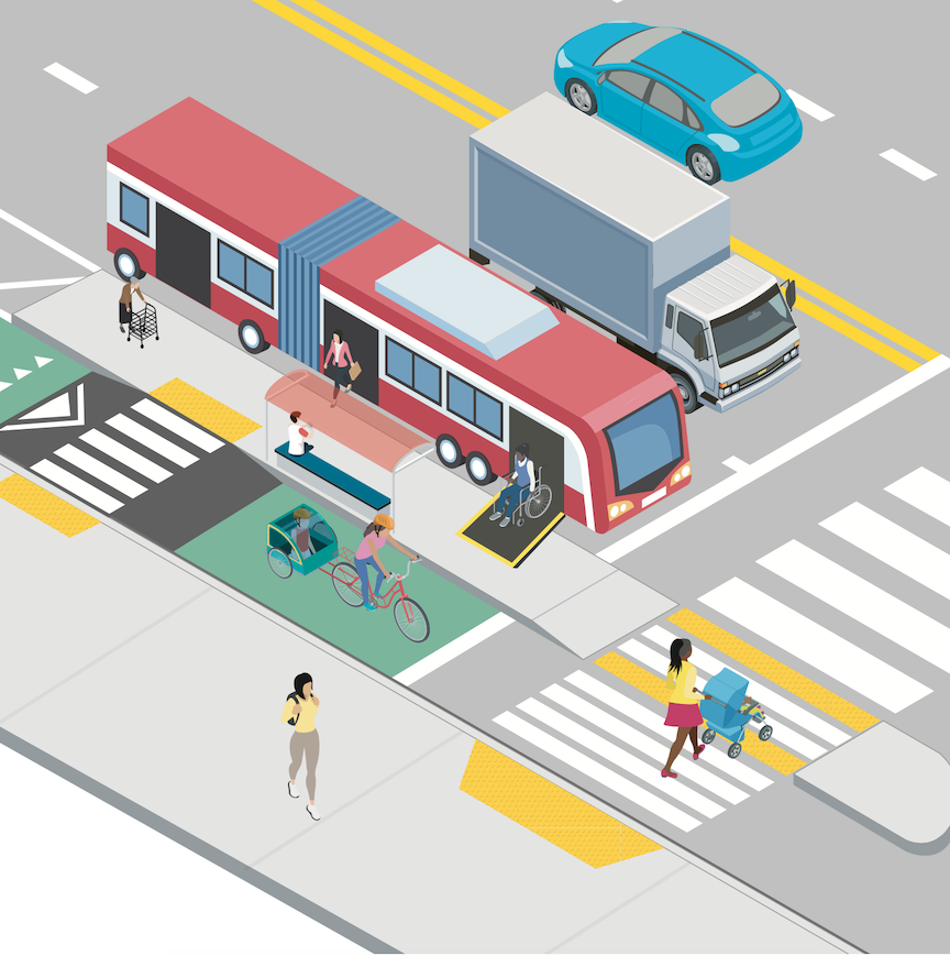
The bus stops are very difficult for disabled people (and bus operators) to use because the bus no longer stops at the curb, but rather in the street.
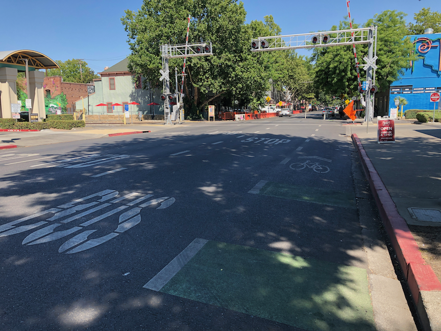
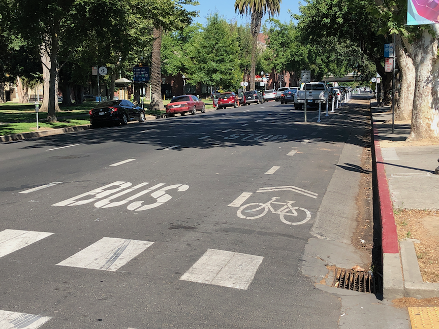
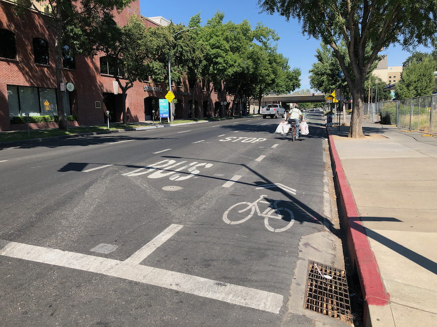
Actually, there are TOO MANY bus stops in this section of 10-1/2 blocks, from 19th Street to nearly 29th Street where the separated bikeway ends. Five bus stops, two of them only one block apart. In a central city setting like midtown, bus stops should be no closer than three blocks apart (about 1/4 mile), and preferably more, like four to six blocks. Why? Because every stop slows the bus significantly, not only the deceleration to the stop and acceleration from the stop, but dwell time. Buses in some areas like this actually spend more time stopped than moving, and as a result, the speed of the route is often below 10 mph. The following five photos show the five bus stops. It is significant that there are too many stops, because solutions to issue 2 are not inexpensive.
J St near 19th StJ St near 22nd StJ St near 25th StJ St near 27th StJ St near 28th St
The second issue is real. Bus operators can have a hard time deploying ramps to the street, particularly when the street is strongly crowned as parts or J Street are. A disabled passenger needing the bus ramp, which might be a wheelchair user or someone with a disability making stepping up to and down from the bus difficult, have to wait in the bikeway to board, not appreciated by the rider or by bicyclists. After debarking, the person must travel along the bikeway to the nearest driveway or corner curb ramp, again, not appreciated by the rider or bicyclists.
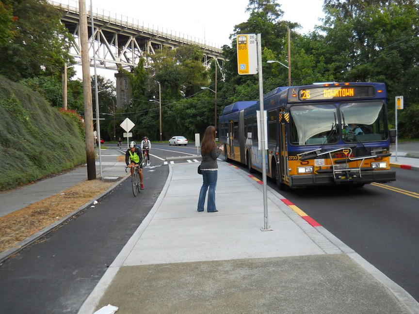
So, what is the solution? Bus boarding islands, which have been implemented in many cities. The first photo below is from Seattle. Riders have an large area to wait for the bus, the bus ramp is easy to deploy, and there is a safe crossing to the sidewalk at the end of the island. A slight disadvantage for the rider is that they must ramp down off the island and then back up to the sidewalk.
Seattle bus boarding island (from NACTO)
The diagram shows an alternative configuration, where the bikeway humps up over the crosswalk, but the route from platform to sidewalk for bus riders is level. This is probably safer for both riders and bicyclists.
diagram of bus boarding island with level crosswalk (from Vision Zero Network)
There are two significant challenges for these bus boarding islands. First is that installing them may require addressing drainage, which can greatly increase the cost of the installation. If three of the five bus stop photos, you can see drainage inlets, so this would be an issue on J Street.
The second is that by placing the bus boarding island where the bus stop now is, buses then stop in the travel lane rather than pulling out into the bus stop. The positive of this is that they don’t then have to negotiate their way back into traffic, which can be challenging and lead to significant delays to the bus schedule. The negative is that private vehicle drivers will complain about the slight delay to their drive from having to wait behind the bus. The convenience and safety for the many people on the bus outweighs the slight inconvenience for private vehicle drivers, but there will be complaints. Timed points on the route, where the bus would stop to wait if it is ahead of schedule, should not be in the travel lane, but that is not true for any of these stops.
To solve the boarding issue on J Street would take a cooperative project with SacRT and the city, and funding from both sides. The number of bus stops should be reduced, probably to three, so that fewer bus boarding islands are needed. This should be carefully planned so that they don’t need to be changed. It is possible to install temporary bus islands, as Oakland and other cities have done in a few places, so if the stop doesn’t turn out to be the best location, it can be moved without great expense.
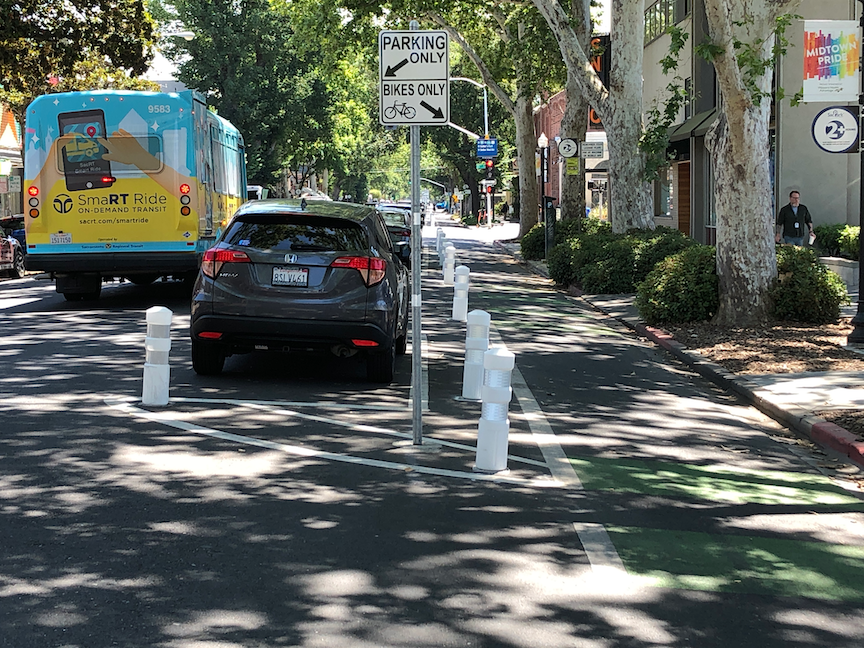
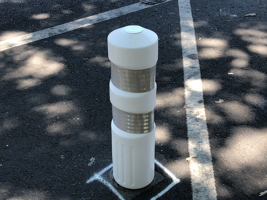
This is a followup to J St bikeway. If you are a Twitter person, you may have noticed discussions the last few days, started by Jennifer Donlon Wyant of the city, about new delineator posts being installed on the J Street separated bikeway. See also the ‘Battle of the Bollards’ page. Though as Jennifer points out, these are not bollards.
Below are photos of the three types of vertical delineators. I’m calling them, respectively, fat delineators (first two photos), rubbery delineators (second two photos), and turtle delineators (fifth photo). The bumps are often called turtles (except in Texas where they are called armadillos). As you can see, despite the fresh installation, at least one of the rubbery posts has already been hit several times and is marked with tire rubber. However, it does not seem to be damaged in the way a regular plastic post would be. The delineator is much more flexible, and perhaps more able to take being hit by reckless drivers.
J St bikeway fat vertical delineatorsupJ St bikeway fat vertical delineator close-upJ St bikeway skinny rubbery delineatorsJ St bikeway skinny rubbery delineator showing damageJ St bikeway turtles & delineators
The fat delineators are much more visible than the rubbery delineators, and probably about as visible at the turtle delineators.
Time will tell which of these works best. Of course none of these provide complete protection from errant drivers, but the theory is that parked cars provide much of the protection. Probably true during the times of day when the parking is in heavy use, but not at other times of day. In the previous post, I recommended that the block sections without driveways, about half the blocks in this stretch of J Street, be protected with concrete curbing. Jennifer points out that this is an attempt to solve or mitigate the problem with relatively minor expenditures, whereas concrete is more expensive. The bikeway itself was an attempt to improve bicyclist safety and comfort with relatively minor expenditures, as part of a repaving project.
Next post I’ll have some information about the bus stops along J Street.
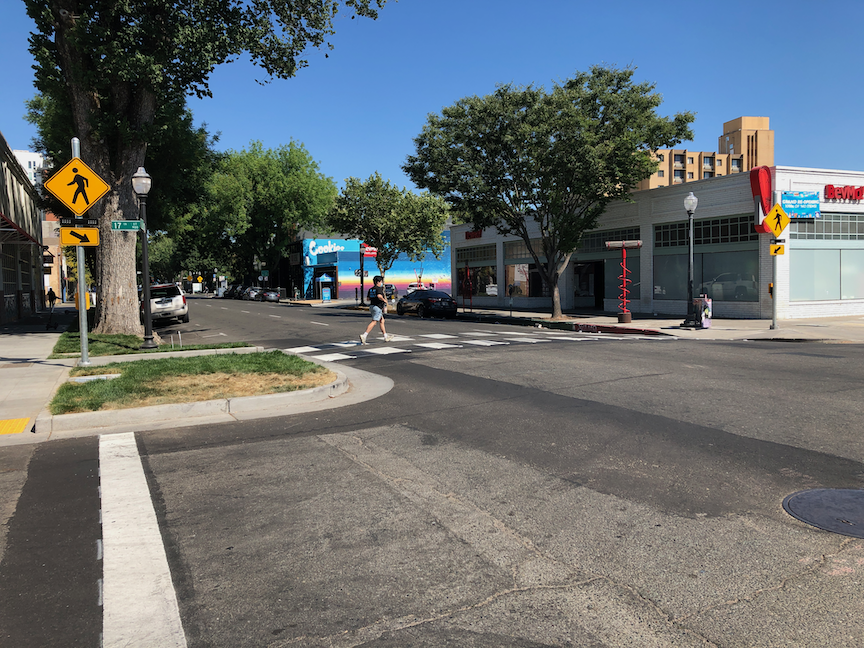
Last week I walked over to the new Target store at J Street & 17th Street in midtown Sacramento. On my way there, I was thinking to myself that with the additional people walking to the store, the crosswalk over J Street was going to need some sort of additional protection, since I knew from experience that most car drivers don’t yield to people walking at that location.
Lo and behold, a RRFB (rectangular rapid flashing beacon) was installed!
RRFB on J St at 17th St
The person walking presses a button which triggers flashing lights mounted on the pedestrian crossing signs. A curb extension on the north side of the crosswalk was installed when the sidewalks around the Target store were installed, so the crossing distance has been shortened somewhat, which also helps.
There are signs with the buttons, below. These are not MUTCD compliant signs, which is ironic, because the city had refused at the beginning of the pandemic to install pedestrian crossing signs that indicated the actual effect of the button, whether it was necessary to press it, because there is no MUTCD sign that does that. Maybe the city is reconsidering it’s signing – unlikely.
RRFB button
A word of warning to anyone who thinks signs and flashing light make it safe to cross. What they do is make is safer than it would be without, but not safe. J Street is a three-lane traffic sewer, on which drivers seldom yield to people walking, whether there is a marked crosswalk or not. Anytime a roadway has multiple lanes in a direction, the multi-lane threat exists, that one driver will stop and others will not. I see this routinely on all the streets in Sacramento that are multi-lane. So, cross with caution no matter what. What I do is step into the street to remind drivers that I have the right-of-way, but walk very slowly until the drivers in all lanes have come to a complete stop. Of course that frustrates the driver who originally stopped, that I am crossing so slowly, but my job is to keep myself safe, not to please drivers.
The J Street separated bikeway has problems, as has been highlighted by Streets are Better and many others. Separated bikeways are also called protected bike lanes and cycle-tracks, but in California the official term is separate bikeways.
The City of Sacramento placed a separated bikeway on J Street from 19th Street to 29th Street as part of a repaving and roadway reallocation project called the J Street Safety Project in 2018. This was the second such project in Sacramento, the first being portions of P and Q Street downtown, but it was the first in the heavy retail, parking, and traffic environment of J Street.
The theory of these parking-protected bikeways is that the row of parked cars protects bicyclists from moving cars, and this is true in the length of the block (but not at intersections, which are a separate issue), when there are parked cars. But some times of day there are not parked cars, and throughout the day as cars come and go (particularly on a retail corridor), protection is lacking.
It is true that bikeways don’t need strong protection from PARKed cars, but they do need protection from PARKing cars and delivery vehicles, and bikeway intrusion.
Vertical delineators and pavement markings were used to set off the bikeway, with a sign at the beginning of each block segment showing the new allocation. These vertical delineators are also called bollards and soft-hit posts, with soft-hit meaning that they won’t damage cars when drivers hit them. The first photo below shows the 27th to 28th section. It initially had 14 delineators place, but only three are remaining. The other blocks have fared a little bit better, but overall about half the delineators are gone. The second photo shows the 25th to 26th section sign that has been run over by a driver.
J Street bikeway, 27th to 28th section, missing delineatorsJ Street bikeway, damaged sign
Some of the vertical delineators are being run over by people parking, some by delivery vehicles parking on top of them, and some by drivers going down the bikeway itself. And probably some just for sport. I don’t know which of these causes are most common.
There are several solutions:
One: Put the delineators closer together so as to make it more obvious that vehicles are not supposed to cross them.
Two: Add bollards which either are, or at least look to be, more substantial. The photo below is from a somewhat different setting in Oakland, with more substantial bollards. Reading blogs and Twitter, these seem to be successful in some cities and some settings, but not in others.
bollards in Oakland
Three: More substantial separators such as planter boxes.
planter separated diagram from C40
Four: Partial hard curbs or medians. The photo shows a median at the start of a bikeway section. It reduces the number of signs flattened by drivers and signals to drivers that there is something different about this block.
bikeway with hard median start, FresnoCOG
Five: Continuous hard physical curb or median. It is hard to find good photos of these, probably because in the past they haven’t been seen as necessary. There are a lot of photos of hard medians adjacent to moving traffic, and adjacent to two-way cycle-tracks, and alongside raised bike lanes that are at or close to sidewalk level. But the graphic below gives the general idea.
Of course hard curbs or medians are more expensive, but last 20-30 years whereas delineators or bollards may need to be replaced every year, so I think they are a good investment.
A major issue with all separate bikeways is the presence of driveways. In fact streets with a high density of driveways should not have this design. Below at the blocks of the bikeway, with information about driveways.
19th
3 driveways
partially separated; driveways not changeable
20th
3 driveways
2 changeable driveways
21st
1 driveway
driveway not changeable
22nd
2 driveways
2 changeable driveways
23rd
no driveways
24th
2 driveways
1 maybe changeable
25th
no driveways
26th
no driveways
27th
no driveways
28th
2 driveways
partially separated; 1 driveway changeable
The changeable driveways will be the topic of a separate post, but the basic idea is that parking lots that have access to the alleyway do not need access to the main street, so in this case, parking lots with access to Jazz Alley do not need access to J Street.
My recommendations
Place hard medians at the beginning of each block, to protect the signs, and better signify to drivers this is a different place. For the locations where there are bus stops (19th, 22nd, 25th, 27th, 28th), the median would be moved down the block a bit. Note that this is too high a frequency of bus stops, but that is an issue for another post.
Place more substantial bollards, and at a closer spacing.
Place a continuous hard median on one of the four blocks without driveways, the same width at the painted buffers present now. This would be a pilot to test the installation, determine costs, and document benefits. If the pilot is successful, the other three blocks with no driveways should receive the same treatment.
Start negotiation between the city and the owners of parcels that are used solely as parking lots, to close J Street driveways and use Jazz Alley access. Some of these parcels will be redeveloped into more productive uses anyway, but that may take longer than desired.
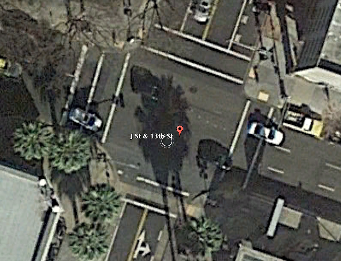
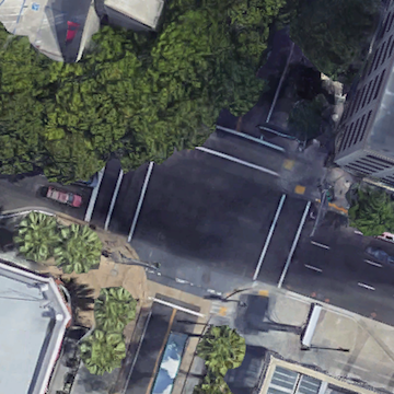
The intersection of 13th Street and J Street in downtown Sacramento is a mess for walkers and bicyclists, largely due to poor decisions that the city has made. The setting is below, with a historical view selected for no leaves on the deciduous trees. On the southeast corner is the convention center, which is under construction now, and the southeast corner is fenced off. On the southwest corner is the Sheraton Grand Hotel. On the northwest corner is a major downtown parking garage, managed by Ace Parking. On the northeast corner is another parking garage managed by Parking.com.
intersection of 13th Street & J Street, downtown Sacramento
In the days before construction on the convention center started and the Sheraton shut down due to the pandemic, this was one of the busiest pedestrian intersections in the central city. The crossing of 7th Street at K Street/DOCO Center, L Street at 11th Street and 10th Street when the legislature is in session, Capitol Mall at Tower Bridge, and a few others are up there, but this one is certainly in the top 10. The city rarely collects pedestrian data, so I do not know what the ranking or volume is.
When the convention center is completed and open, and the Sheraton opens at full scale, this will again become a very busy pedestrian intersection. So you would think that the city would design this intersection and signals to prioritize people walking, but you’d be wrong.
The crossing of J Street on the west leg of the intersection requires pushing the ped button. There are a number of pedestrian signals in the central city that do not require pushing the button, and these are called auto-recall, meaning they automatically change on a cycle. Not this one! I just observed a number of walkers crossing here, and only about 5% of them initially realized they had to push the button. When I mentioned that the signal would never change unless they pushed it, they were surprised, and not happy. When the ped head signal does come on, it has a white hand of 5 seconds, and a countdown of 9 seconds for a total of 14 seconds. There are three lanes of motor vehicle traffic here, lanes about 12 feet wide, for 36 feet. The MUTCD recommended crossing speed is 3.5 feet/second, so 36 feet should be a minimum of 10 seconds, but this assumes that people can leave the curb immediately, not true when the activation button is set well back, and there is pedestrian congestion. In that case, the crossing speed should be 3.0 feet/second. If you want to read about the contortions traffic engineers go through to make walk cycles as short as possible, read pedestrian crossing questions and answers.
The traffic signal for J Street will remain green unless there is a vehicle waiting on 13th Street or someone pushes the ped button to cross. The ped signal to cross 13th Street goes through a white hand, countdown, brief pause, and then back to the next cycle. Without a cross-traffic vehicle or button push, the traffic signal will never cycle. Ever.
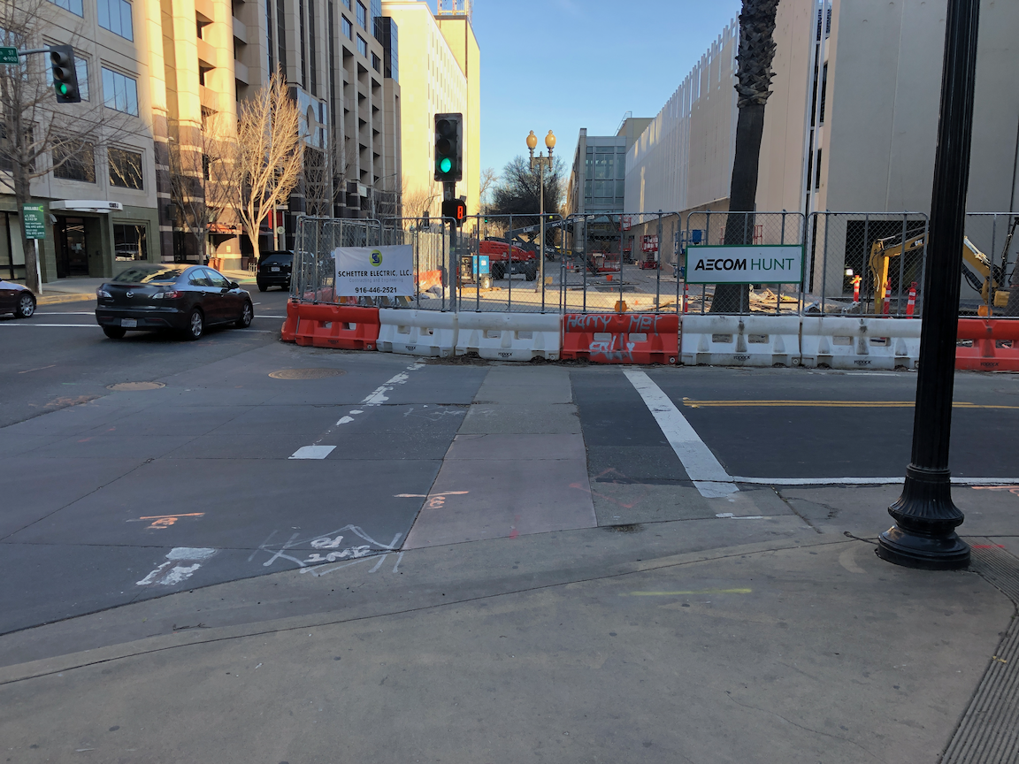
crosswalk over J Street at 13th Street
An additional problem is that sometimes the signal controller will just skip the crossing J Street part of the cycle, even when the button is pushed. Since I’m mostly on my bicycle rather than on foot here, I haven’t quite pinned down the behavior. I don’t know if it depends on time of day, or traffic volume, or is just random, but I can affirm that it happens, and not infrequently. So even after the walker presses the button, they may have to wait through another full cycle before they get the walk.
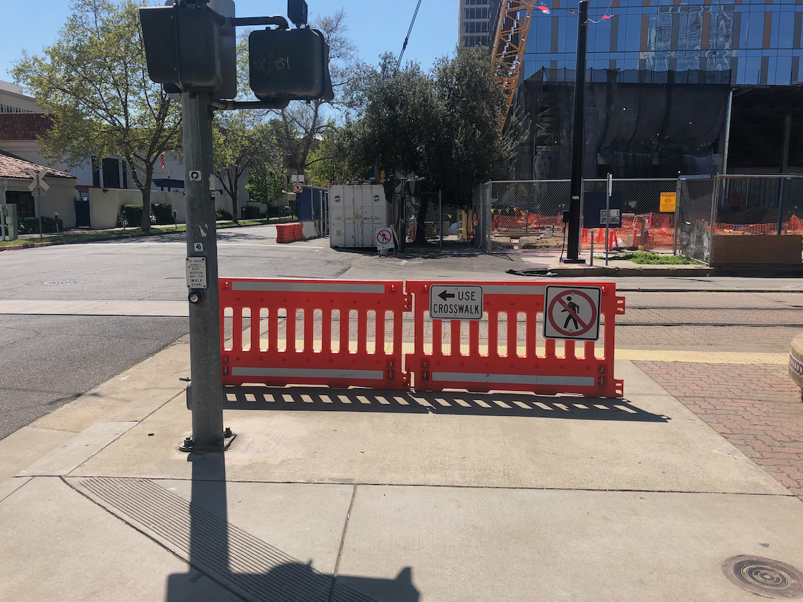
On the southeast corner, the convention center construction has closed the corner and sidewalks. In this situation, there should be a barricade and warning signs on the opposite corner, so J Street south side eastbound and 13th Street east side southbound. A fully sighted person can of course see the barrier and fence across the street, but the point of ADA requirements is to communicate to everyone, not just the sighted. Below is what is looks like, followed by what it should look like. Remember, this is a city project, not a private development, but the city apparently holds itself to lower standards than it holds private developers.
closed crosswalk over 13th Street at J Streetproper barricade and signing for a closed crosswalk, O Street at 8th Street
The east leg crosswalk also suffers from traffic flow design. The walk sign for this crosswalk comes on at the same time as the southbound green signal comes on, bringing drivers into immediate conflict with walkers in the crosswalk. There is no leading pedestrian interval (LPI) to let the walkers get a head start. At this time the crosswalk is closed, but as soon as it is reopened, the conflicts will be immediate, as they have been for years.
Solutions?
Immediately institute auto-recall on the crossing of J Street, and remove the buttons. These are not modern audible buttons, they are antiques.
Immediately institute a leading pedestrian interval on the crossing of J Street, to increase protection from left and right turning drivers.
Immediately lengthen the pedestrian phase for the crossing of J Street to a minimum of 20 seconds.
When then southeast corner of the intersection is re-opened, with completion of the convention center construction, implement an exclusive pedestrian phase for this intersection, in which there is no movement by motor vehicles during the walk cycle, and walkers can cross in any direction including diagonally. If any intersection in Sacramento deserves this treatment, this is it.
Traffic calm J Street to reduce speeds. The most important step is to reduce general purpose lanes to two, and create some sort of bicycle facility. I’m not sure of the best design, as the valet/unloading/loading are for Sheraton Grand may make this challenging.
Get rid of any City of Sacramento Public Works employee who believes the purpose of central city streets is to favor suburban commuters (the J Street traffic) over walkers, bicyclist, and local residents.
I have made at least seven 311 reports on the signal problems at this intersection, asking that it be changed. The only change that I’ve been able to notice is that they lengthened the pedestrian phase for crossing 13th Street, and shortened it for crossing J Street. I just gave up after a while.
Bicyclists
That covers most of the pedestrian problems at this intersection. How about bicyclists? 13th Street is a major bicycle route in downtown, being the only north-south street that crosses through Capitol Park and is not an arterial street, often with heavy traffic and higher speeds. There are bike lanes on much though not all of 13th Street to the south J Street, and there are bike lanes on most blocks to the north, except the half block approaching this intersection. Here, the bike lane has been sacrificed to create a turn lane. There is a required left turn lane and an optional turn lane, but no bike lane. So at this busiest of all intersections on the route, there is no bike lane. There is a clear message here from the city: we will accommodate bicyclists only if it does not reduce motor vehicle capacity. Otherwise, tough luck.
The loop detectors on 13th Street only sometimes detect bicycles. I often see bicyclists during off-times, when there are fewer motor vehicles to trigger the cycle, proceeding through the intersection on red, when it is safe to do so (and occasionally when it is not). They have the right to do so, since by definition a signal that does not detect vehicles (devices) is a non-functional signal, but it is not the best solution.
When the pedestrian button is pushed to cross J Street on the west leg, but no southbound motor vehicles are present, the vehicle signal remains red, so doesn’t allow for undetected bicyclists. This doesn’t protect any walkers, so it makes not sense.
Solutions?
Continue the bike lane on southbound 13th Street to and through (with green skip paint) the intersection with J Street, and remove the left turn lane which prevents the bike lane from continuing. That might mean lengthening the green light for motor vehicles in order to clear the queue.
Install video detection on this intersection that will detect bicyclists on 13th Street so that they don’t have to wait for motor vehicle traffic to arrive and trigger the signal cycle.
Change the traffic signal for southbound to go green at the same time as the pedestrian walk sign. This allows bicyclists to proceed without confusion.
4. Sacramento, California The J Street Safety Project was designed to calm traffic, improve pedestrian crossings, provide parking-protected bikeways, and make the street more inviting for travel. They chose to add a parking-protected lane to allow people of all ages and levels to bike the grid, separated from moving traffic. Travel lanes were reduced from 3 to 2, encouraging slower vehicle speeds, decreasing pedestrian crossing lengths, and improving corridor safety. The project came out of the Central City Transportation Plan (Grid 3.0) in 2016, and is a marriage of street maintenance funding and transportation planning. They found that there was a need to calm traffic and improve pedestrian crossings, which was identified by the local businesses and residential community. The project improves pedestrian visibility by moving parking back from the intersection. It also benefits local businesses along the corridor by slowing traffic and increasing ease of crossing the corridor. So far they’ve built over 25 blocks of parking-protected bikeways this year, and have funding for another 22 blocks.
The signal at J Street and 13th Street in downtown Sacramento (shown at right) does not work well for pedestrians. The signal cycle is long, even compared to other signals on J Street, so the wait for pedestrians is quite long. I have seen the signal cycle skip both pedestrian crossings and vehicle crossings a number of times, which means that the wait is doubly long. Most walkers respond to this long wait by simply crossing the street against the pedestrian signal, and I don’t blame them at all.
A second issue is that the signal is set so that the east crosswalk walk mode occurs at the same time as the left turn from 13th Street southbound to J Street eastbound, meaning there is always a conflict between pedestrians and drivers at this point, and this conflict has been created by the signal setup. Many drivers cut directly behind or in front of people walking, as they know if they wait until the crosswalk is clear, as the law requires, they won’t make the signal.
This signal should be reconfigured so that it gives priority to pedestrians, without making them wait an unreasonable period of time, and does not create unnecessary conflict between turning drivers and people walking. The east crosswalk at a minimum needs a longer leading pedestrian interval (LPI).
Even better would be to make this a pedestrian scramble intersection, with an all-direction crossing phase during which all vehicle turning movement are prohibited. The intersection can be marked with diagonal crosswalks, and additional diagonal pedestrian signal head added, however, simply changing the signal timing is sufficient as an initial step. This is a busy crosswalk intersection, with the convention center on one corner, the Sheraton Grand on another, and the parking garage for the Sheraton and others on the third corner. It is alway busy, and the people crossing here are commonly tourists, who are likely used to more advanced ‘world class’ cities where pedestrians are not second class citizens after car drivers.
Note: There are a number of busy pedestrian crossing intersection in the Sacramento central city that deserve an upgrade, but this is the one that most irritates me, whether walking or bicycling.