Note: This is only one of 20 intersections. It is unlikely that I will be able to map and analyze all, but this post will provide an indication of the information available. General information on the Top 20 intersections, with criteria, list, and map, follows the information about this intersection.
I am looking more closely at the Top 20 intersections identified in the City of Sacramento Vision Zero Action Plan Update. The intersection at the top of the list is Elder Creek Road/47th Avenue and Stockton Blvd. This is mis-labeled in the document, as Elder Creek Rd and 47th Ave, but the east-west roadway changes names at Stockton Blvd, so the intersection is with both roads and Stockton Blvd.
This intersection, in southeast Sacramento, is very close to the unincorporated county. Stockton Blvd at this intersection is 7 lanes wide (two northbound, two southbound left turn, two southbound through, and one southbound right turn). 47th Avenue is 6 lanes wide (two westbound, two eastbound through, and two eastbound left).
Elder Creek Road is 6 lanes wide (two eastbound, two westbound left turn, two westbound through), but also has a 6.5 foot wide ‘lane’ on the right that appears to be used as a right turn lane by some drivers. This indeterminate lane seems to be the locale of four of the five crashes at this intersection.
The intersection has two uncontrolled slip lanes, which are a known safety hazard, from Stockton Blvd southbound to 47th Avenue westbound, and Stockton Blvd northbound to Elder Creek Road eastbound. However, these were not the location of the crashes shown.
The intersection has double left turn lanes on all legs, which are a known safety hazard. However, these were not the location of the crashes shown.
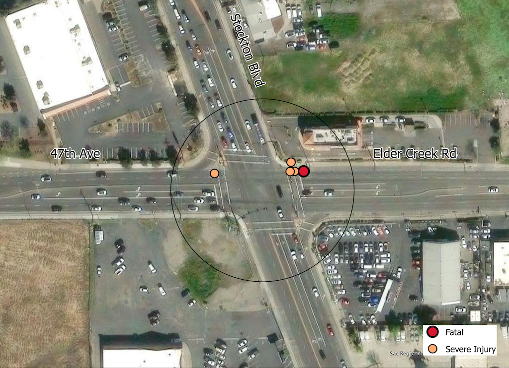
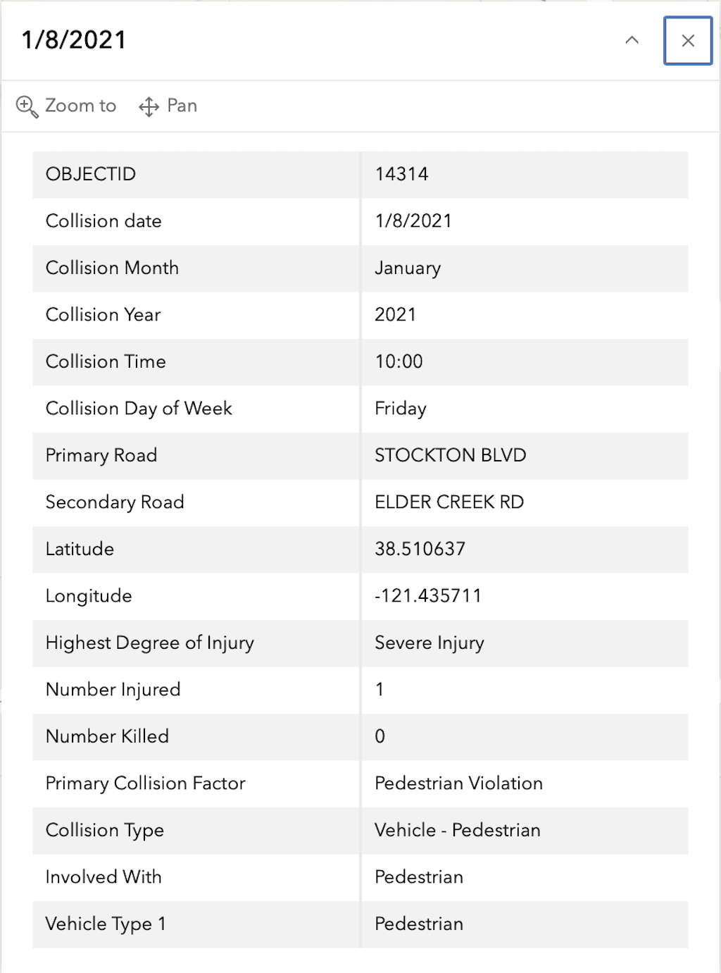
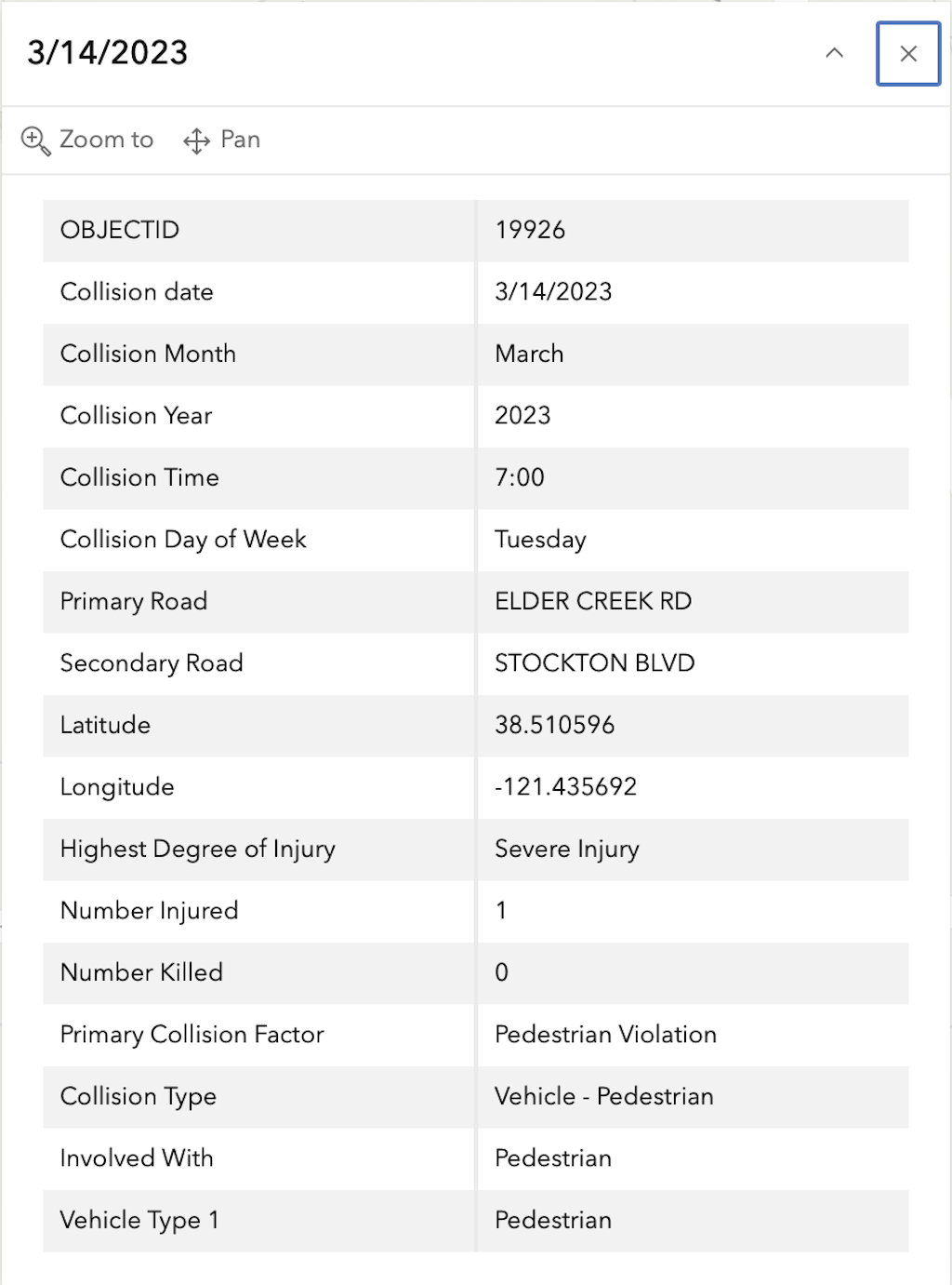
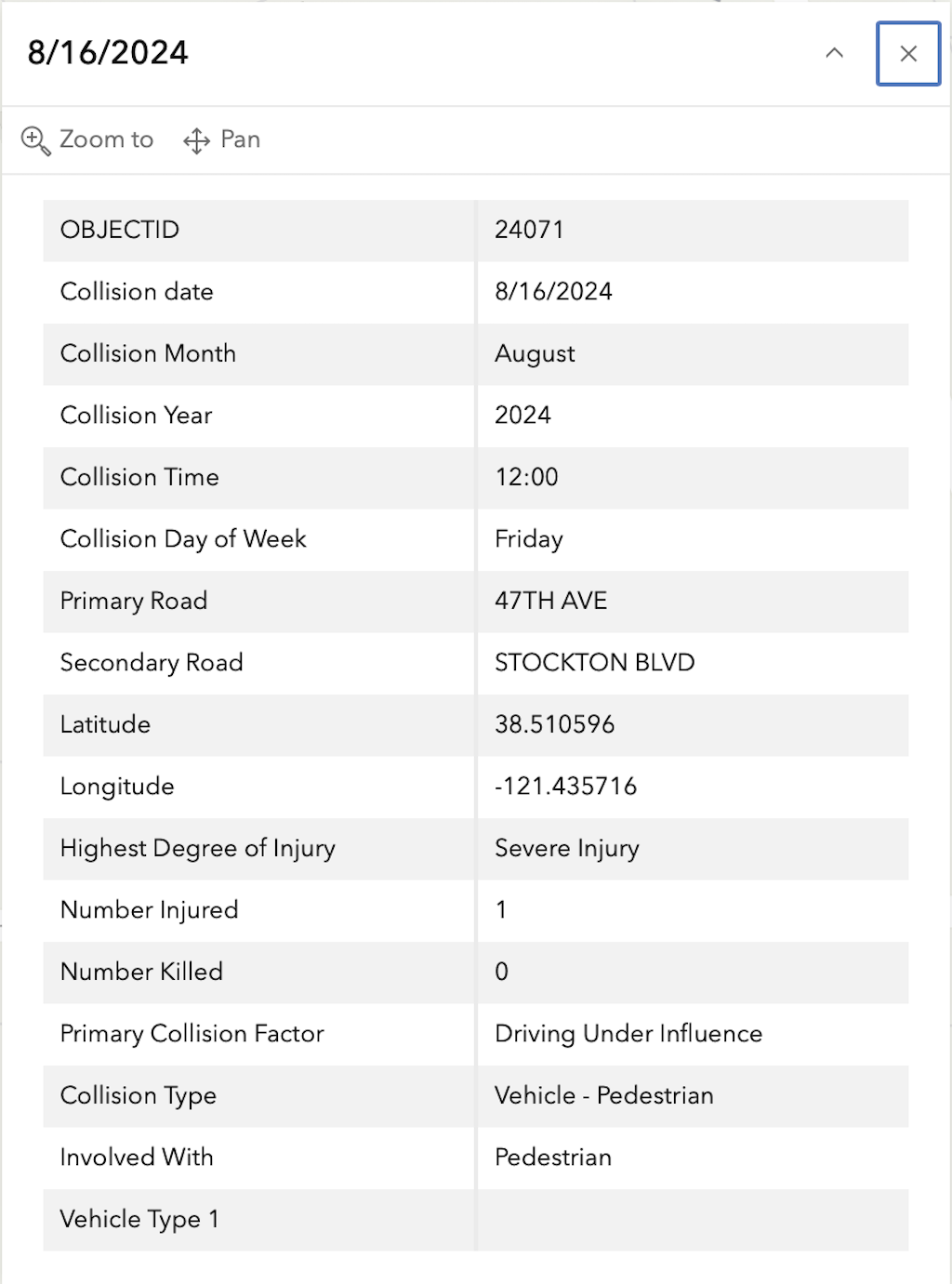
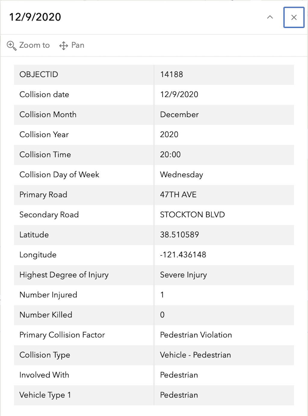
In the 2015 to 2024 period (which is used in the Vision Zero Action Plan Update), there was one fatality and four severe injuries at this intersection, all of pedestrians, mapped below (pdf). Please note that the exact crash locations may not be accurate, as police reports often do not correctly locate crashes. Also note that ‘pedestrian violation’ entry may be false, as police often blame crashes on the person walking when actual responsibility is not clear, or the pedestrian is dead and can’t counter the driver story.
The red dot is the fatal, and the orange dots (one is covered by another) are severe injuries. Together, these are know as KSI = killed or severe injury. The other categories of crashes, ‘other visible injury’ and ‘complaint of pain’ are not shown on my map, since these are not the focus of Vision Zero, however, there are quite a number of these at this intersection, concentrated on the crosswalk over Elder Creek Road on the east side of the intersection, which you may view in the Crash Dashboard Interactive Map.
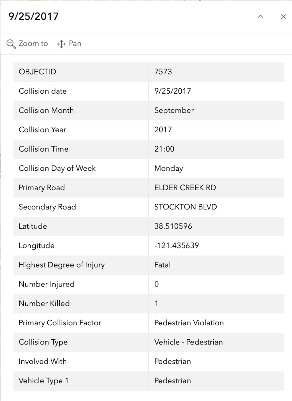
The crash details, available in the Vision Zero Crash Dashboard Interactive Map, are below.
General Information on Top 20 Intersections
The selection criteria for the Top 20 Intersections is: “These intersections scored within the top 0.5 percentile of all intersections on the updated High-Injury Network. They are sorted by KSI crashes within a 150 foot radius.”
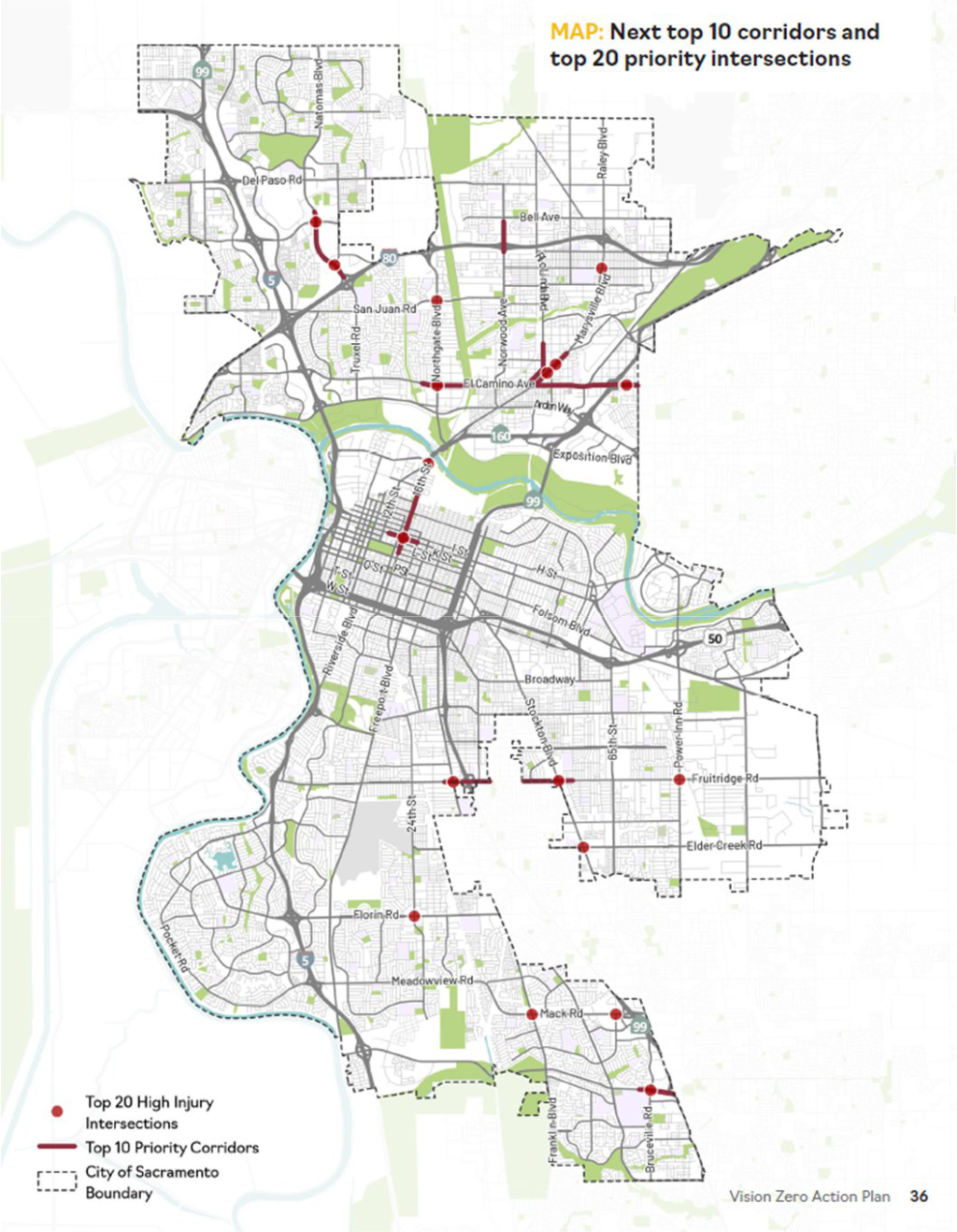
The list (pdf) of Top 10 corridors and Top 20 intersections is shown below, followed by the map (pdf) of these.