The oldest parts of the City of Sacramento have a grid street pattern, meaning streets and cross-streets at regular intervals. Nearly all of the central city and much of east Sacramento have a grid. Outside that, there is a broken grid, or no grid. There are certainly constraints to a grid, such as the Sacramento River and American River, railroad tracks, and old highways that are now arterial streets, such as Stockton Blvd. And of course there are the freeways that have destroyed what grid did exist: Interstate 5, Interstate 80, Highway 99, Highway 50, cutting most local streets into two inaccessible sections.
I acknowledge that the other cities of Sacramento County, and unincorporated county, are as bad or worse than anything in the city, but I’m using the City of Sacramento as a example of a universal problem in the region. In the eastern suburbs, unincorporated Arden-Arcade, Carmichael, Fair Oaks and Orangevale, streets intentionally change directions, for example, a street that starts out north-south will end up exiting east-west to an arterial. Other streets loop back on themselves, but change names somewhere along the way. Streets that were designed wide, as through streets, suddenly end. Yes, things can be much worse.
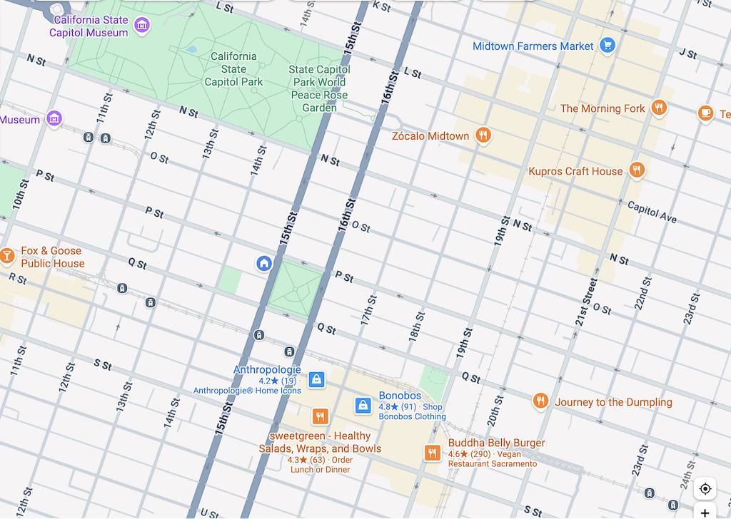
Here is the central city grid. Not perfect, but close.
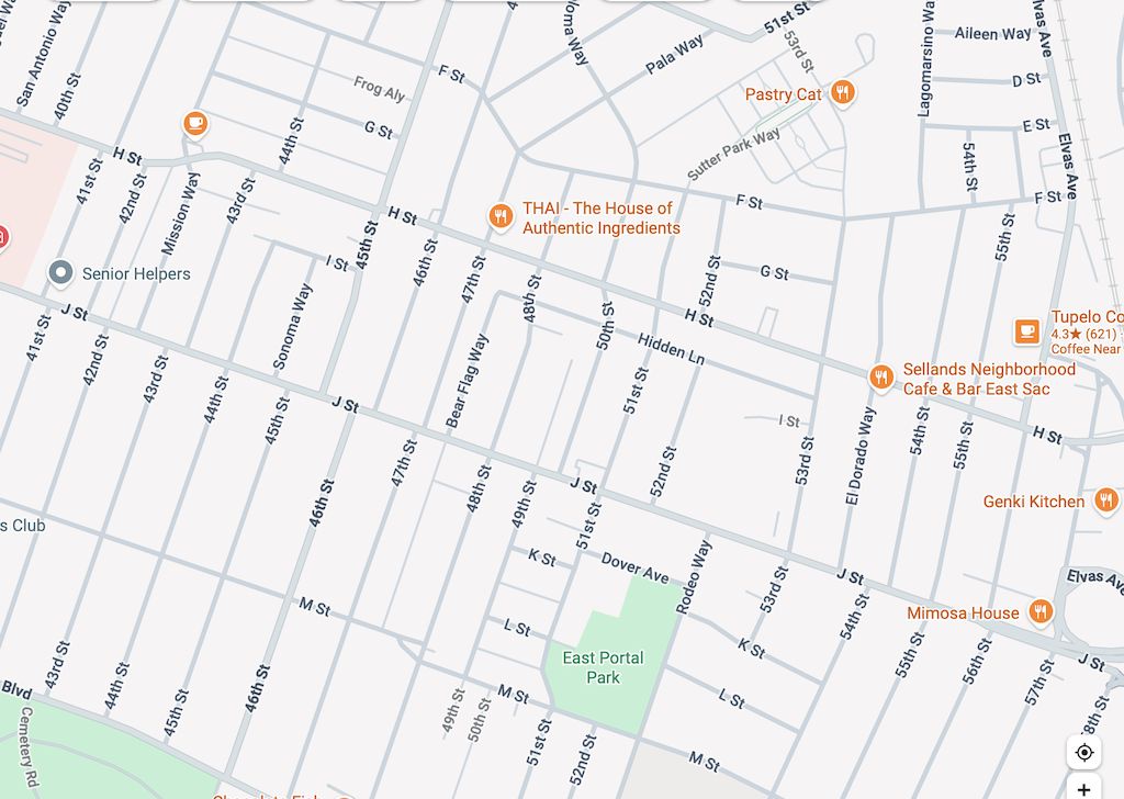
Here is East Sacramento. Less regular, but not bad.
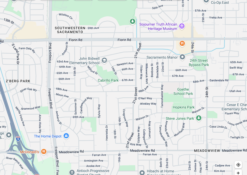
Here is a section in south Sacramento. There are grid streets, Florin Road, Meadowview Road, Freeport Blvd, and 24th Street. There are even a through street within this section, 21st Street. But none of the other streets are through streets. Some are straight, and some wind around.
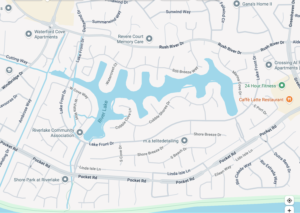
And finally, here is the River Lake area of The Pocket. Few through streets, cul-de-sacs everywhere. No way to get from one area to the next.
So why is this important? Grids allow travel by many different routes. They allow travel on parallel streets so that some streets can emphasize car travel (well, actually, all of them do, currently), while others are or could be for slower travel by foot and bicycle. Grids allow efficient bus routes that get people to destinations with no transfers or one transfer. Our bus system that exists is a maze of zig-zags, largely trying to make the best of a no-grid street system.
Why did this happen? In the Sacramento area, developers of high income neighborhoods (see River Lake above) wanted windy streets so that only people who live there can figure out how to get places. Cul-de-sacs galore, making sure that people from outside (‘those people’) cannot get into the neighborhood, and guaranteeing low traffic on that street, while increasing traffic on all other streets as people try to get somewhere. In middle income neighborhoods (see South Sacramento above), windy streets were designed to give the feel of a high income neighborhood. If you can’t figure out where to go, isn’t that a sign of income?
Broken grid and no-grid neighborhoods make sure that amenities such as groceries, coffee shops, and medical services, are further away. Everyone must drive. All traffic must be funneled onto larger and larger, and more dangerous streets. And isn’t that the point of these neighborhoods, a sign of wealth when you can have the fancy car that exceeds the cost of some homes, and a deep bank account for gas, or charging?
Downtown Sacramento had most of its buildings removed, replaced by state buildings and massive buildings, which is why downtown is largely dead. But the street grid is mostly still there, the bones of what could someday become a livable, functional place again. As I have said many times, midtown Sacramento is the model of what a place can be, a vibrant neighborhood with a mix of uses. The grid is in large part what allowed it to develop, and to continue to exist. I doubt that most of Sacramento will ever evolve to a more economically vibrant and livable place. Without a grid street network, it can’t.
Many people have argued that single family homes, exclusionary zoning and redlining, and suburban sprawl are the original sin. They are a sin, but not the original sin. The original sin is the lack of a grid street system.
The city allowed this, by allowing developers to design any sort of street pattern they wanted. The city could have developed a grid street system, and allowed developers to design streets within this, but they did not. They also did not require that streets in one development connect to streets in an adjacent development. The lack of a grid is a problem that will haunt us forever. But for any new development areas, the city must design and enforce a street grid. Regular north-south and east-west streets should be on a grid of one-quarter mile. Within that grid, developers can do what they want, but they can’t break the grid.
The street grid is a topic that crosses boundaries (ha ha) between street design standards (Public Works, Street Design Standards Amendment) and development standards (Community Development, Planning Division). I am not sure where it best belongs, but I do know that it must exist, and must be enforced, no matter what bribes (mostly in the past) or campaign contributions (modern bribes) are made.
The lack of a grid has long bothered me, but I’m posting about it now because the recent How to design for cars in people-centred places suggests that not every street needs to be multi-modal, that a ‘complete network’ of parallel routes, rather than a ‘complete street’ is a better solution, hence “Complete networks, not complete streets”. I have just started to look at the design guide, but this is something that jumped out at me in the Strong Town podcast and Streetsblog post – how do you have parallel routes when there are no parallel streets, because there is no street grid?
More to come.

